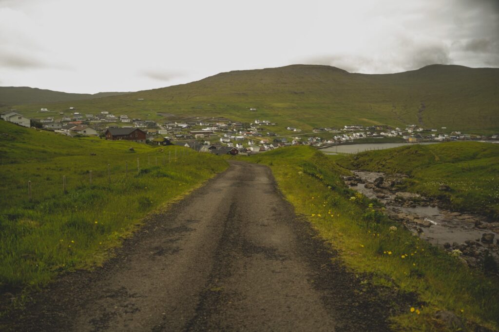
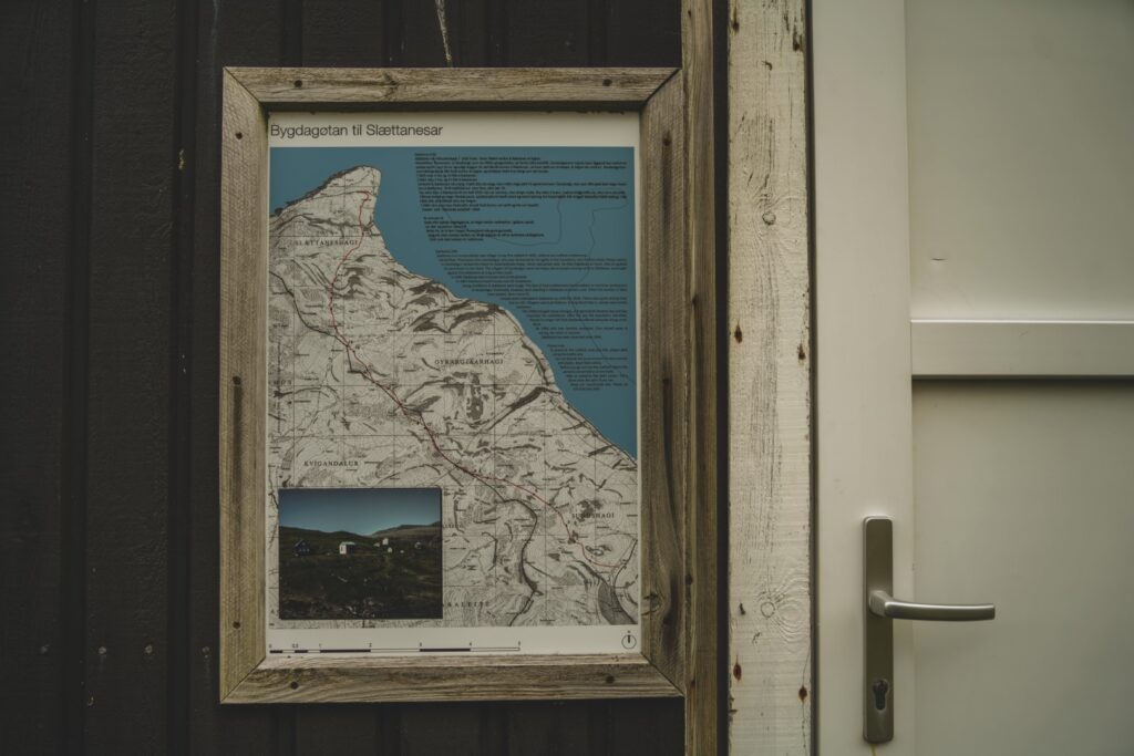
Vágar is undoubtedly the most interesting island of the Faroe Islands. Not only is it full of hotspots such as Trælanípa, Trøllkonufingur and Múlafossur, the island is also home to several cute villages, two abandoned villages, challenging and easy mountain peaks to climb and many old cairn trails that were once the only connection between the villages (besides boats to those with a harbour). Miðvágur is connected to Vatnsoyrar with a short, scenic trail along the edge of a mountain. Sørvágur is connected to Oyrargjógv, Vágar’s abandoned harbour, via a trail through the islands’ interior. Bøur is famously connected to Gásadalur via a short but steep mountain trail. And even the abandoned villages of Slættanes and Víkar can be reached via cairn trails; Víkar from Gásadalur and Slættanes from both Gásadalur, Sandavágur and Sørvágur. I’ve spent many weeks exploring Vágar over the years, and in the summer of 2021, it was finally time to hike the last cairn trail on the island; from Sørvagúr to Slættanes and then finally along the coast to Oyrargjógv. 23 kilometres in total!
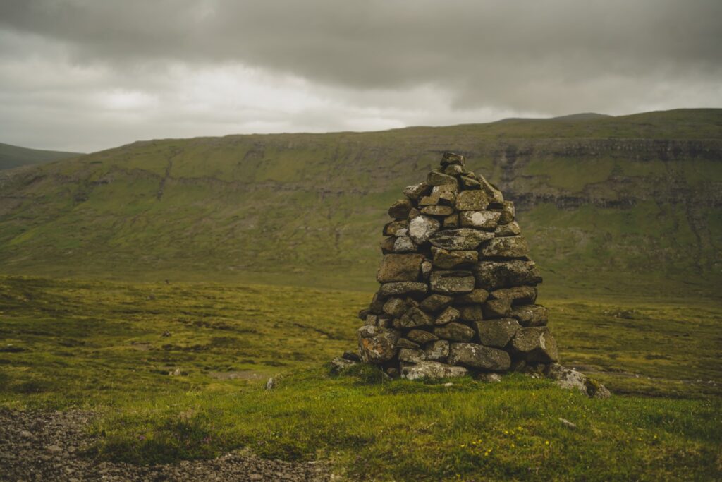
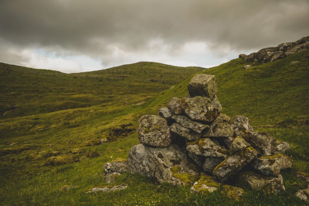
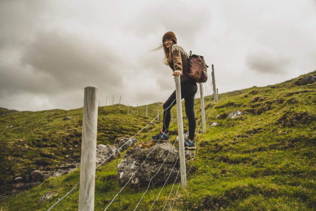
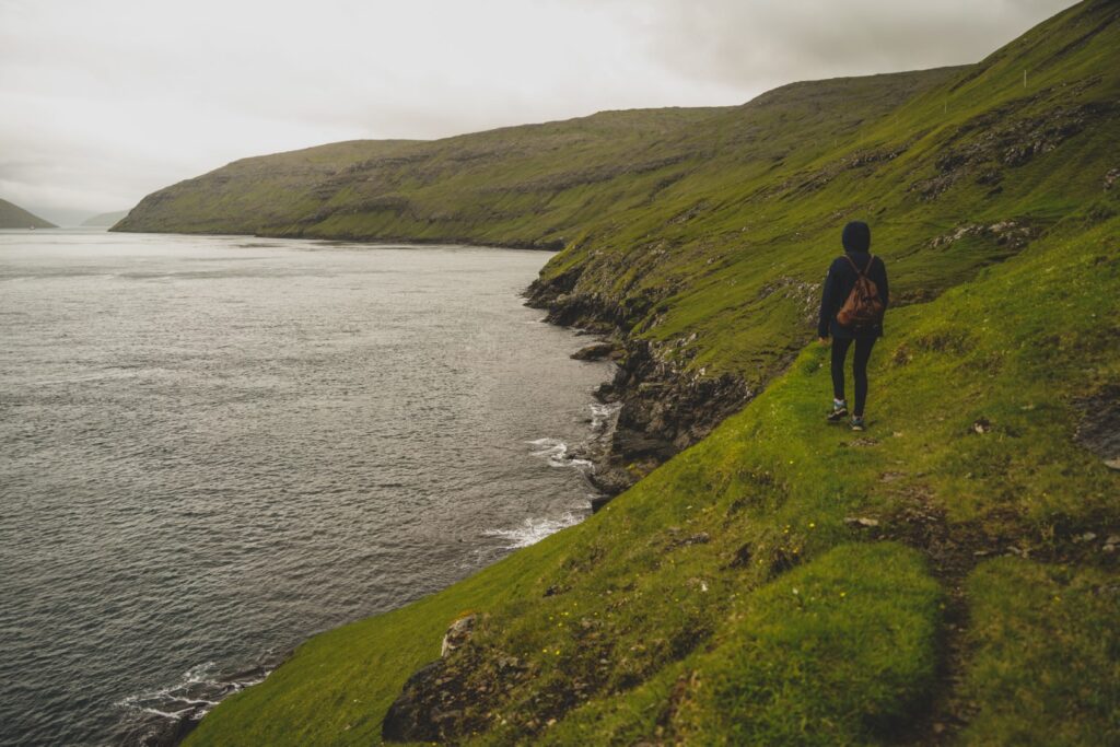
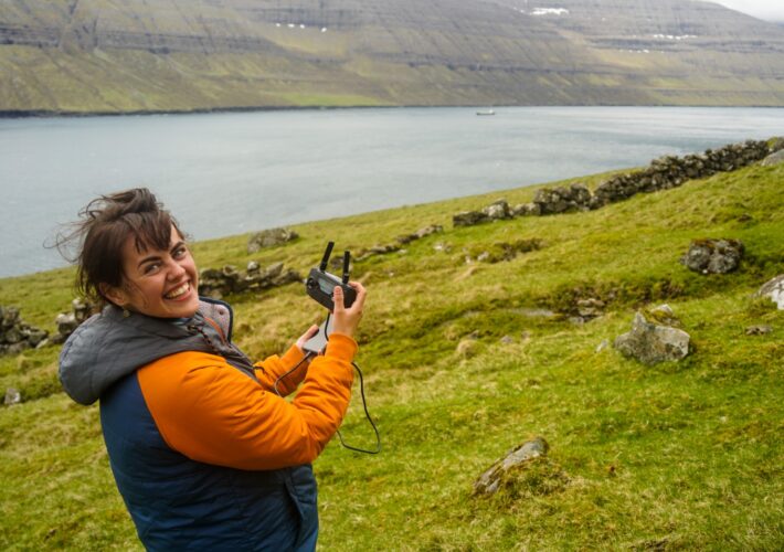
My friend Lucie came along for the hike which at first offered a mix of sunshine and cloud coverage as we made our way from the highest street of Sørvágur and into the meadows of Vágar’s interior. Just like the other cairn trails on the island, this one is well-marked with cairns throughout so hikers can find their way easily, even in thick fog. Thankfully, we didn’t have to worry about fog, but it was nice to have these wayfinders so we didn’t have to rely on a map!
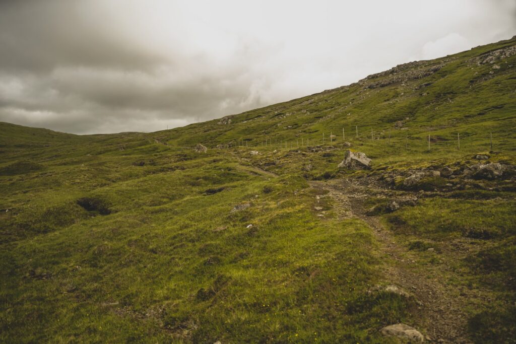
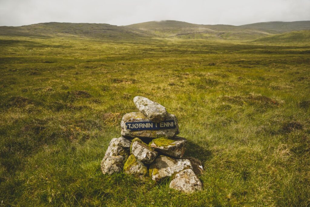
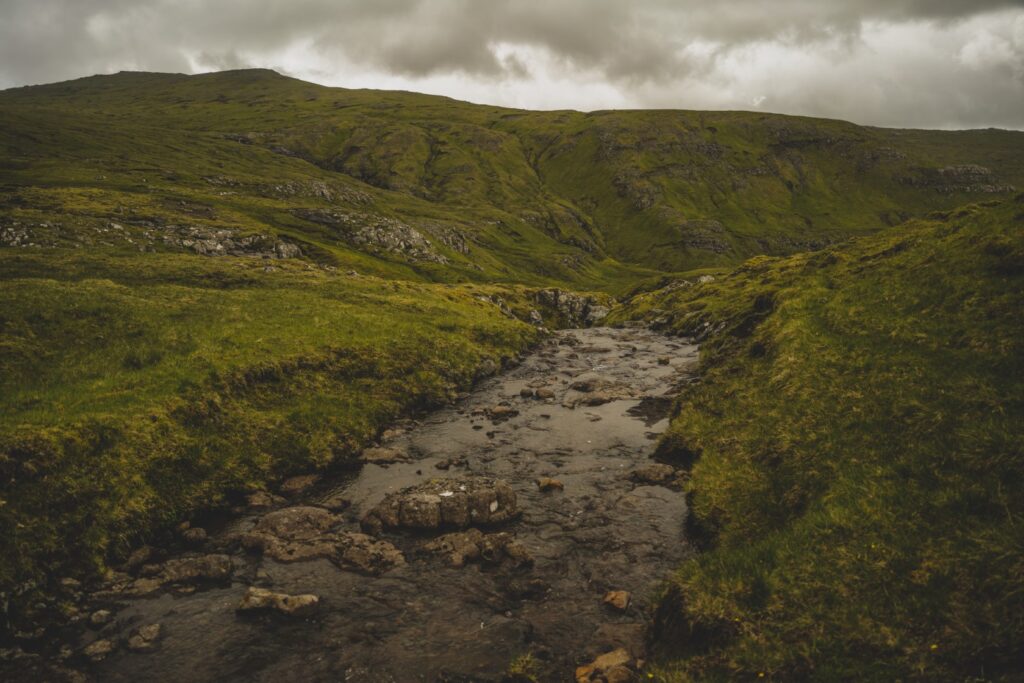
The first section of the route involved some steady uphill hiking. We met the cairn trail that leads to Oyrargjógv before hiking downhill for a little while past the small lake of Tjørnin í Enni.
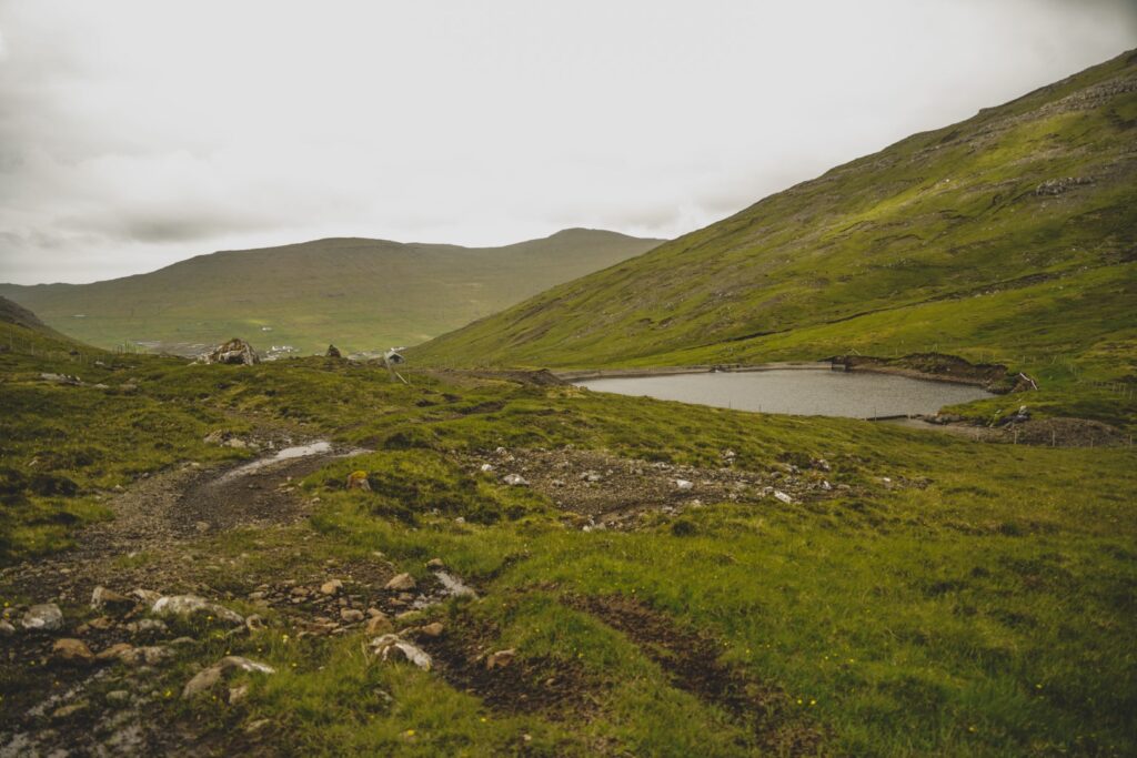
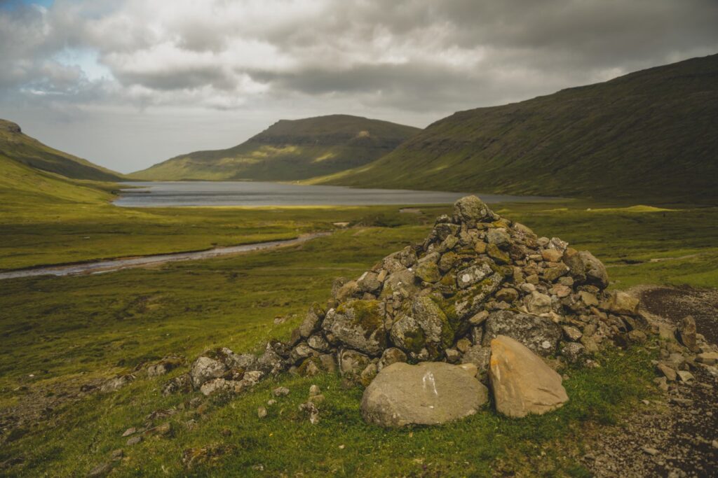
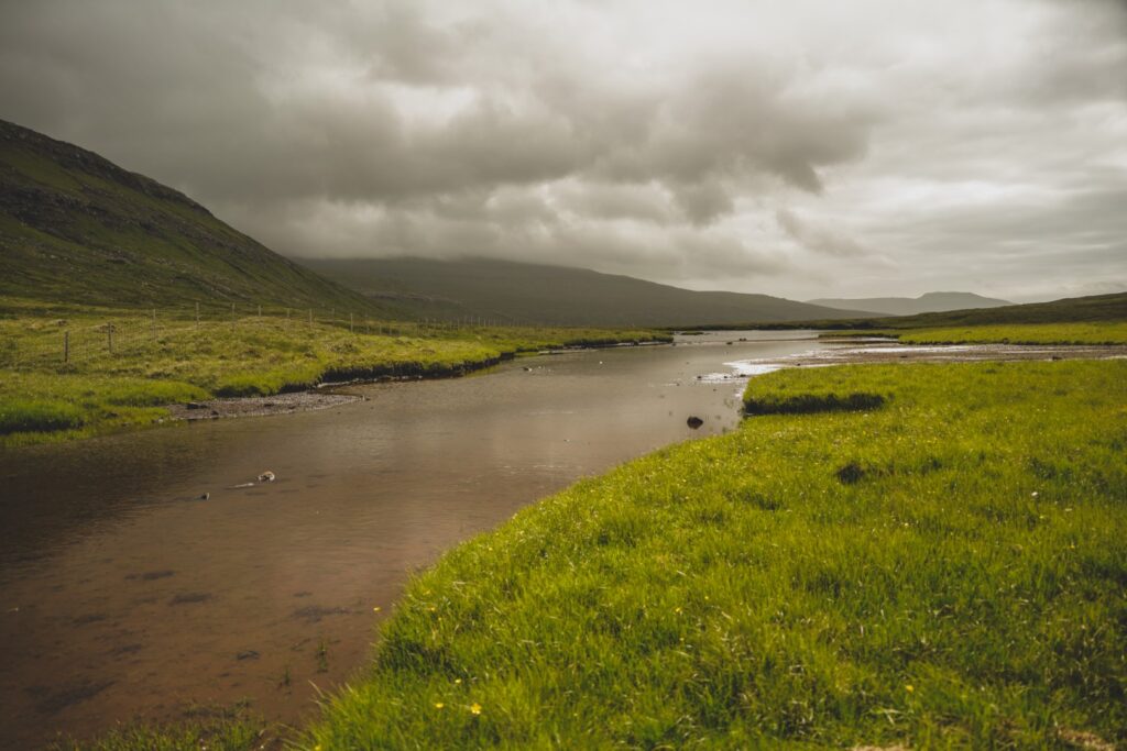
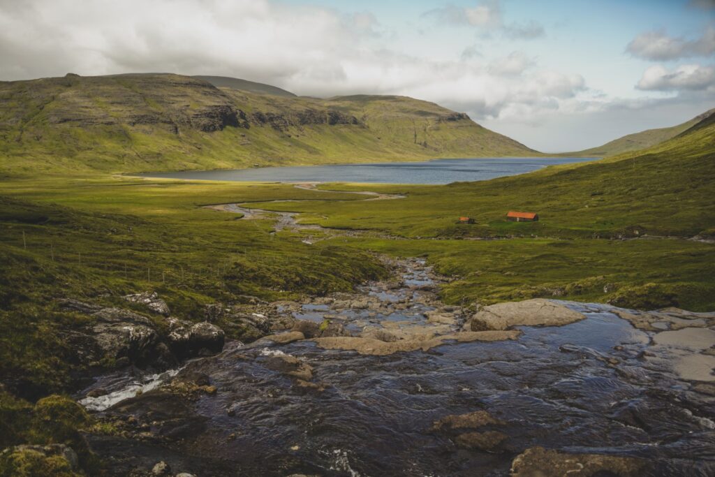
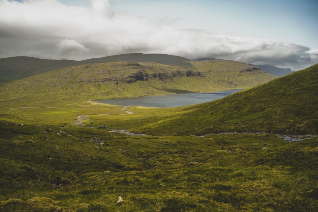
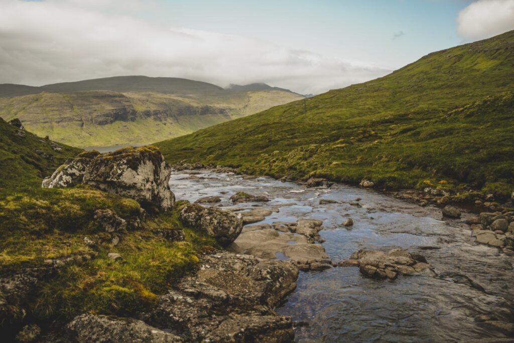
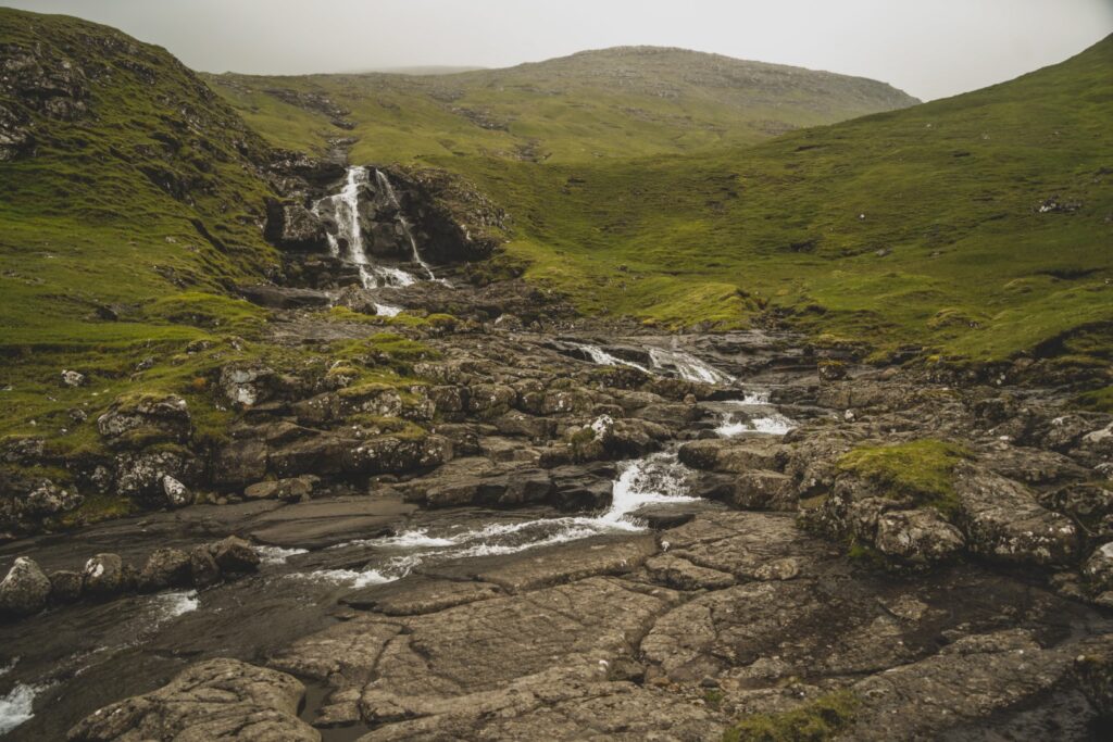
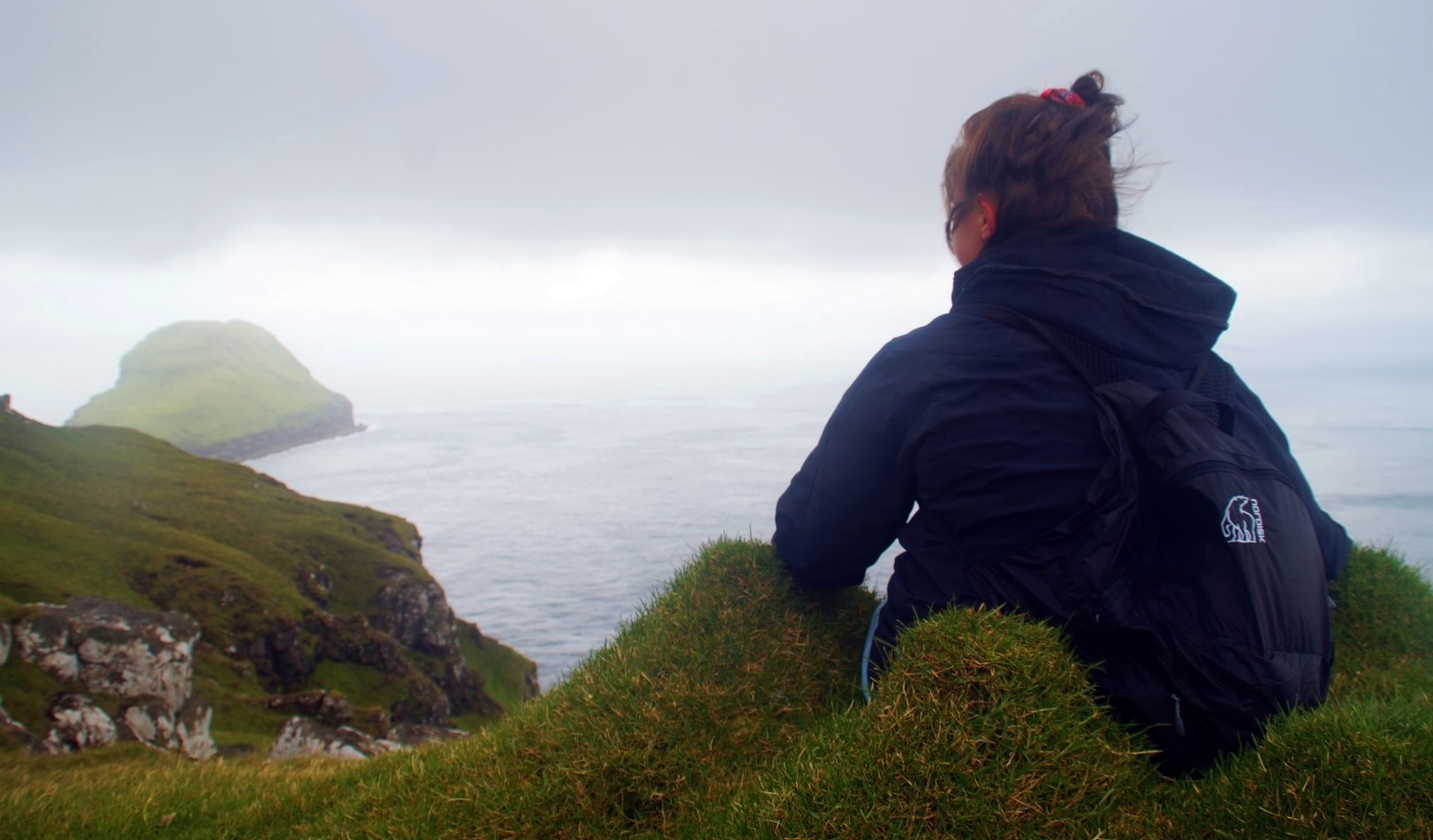
The hike took us by Fjallavatn, the second-largest lake in the Faroe Islands, which is one of my favourite places in the country. We had to cross several rivers and waterfalls but non too difficult as there were enough dry rocks to step on. Crossing rivers is my least favourite part about hiking, as I don’t trust my own balance!
The next section took us up to a mountain pass between Tungufelli (591 m.) and Tungufellið Lítla (443 m.), both mountains that Lucie and I climbed back in October 2020. This part was quite steep with another few rivers to cross, and then we reached the spot where the trail meets and merges into the trail from Sandavágur to Slættanes. Vestmanna over on Streymoy soon came into view, and not long after, Slættanes finally revealed itself!
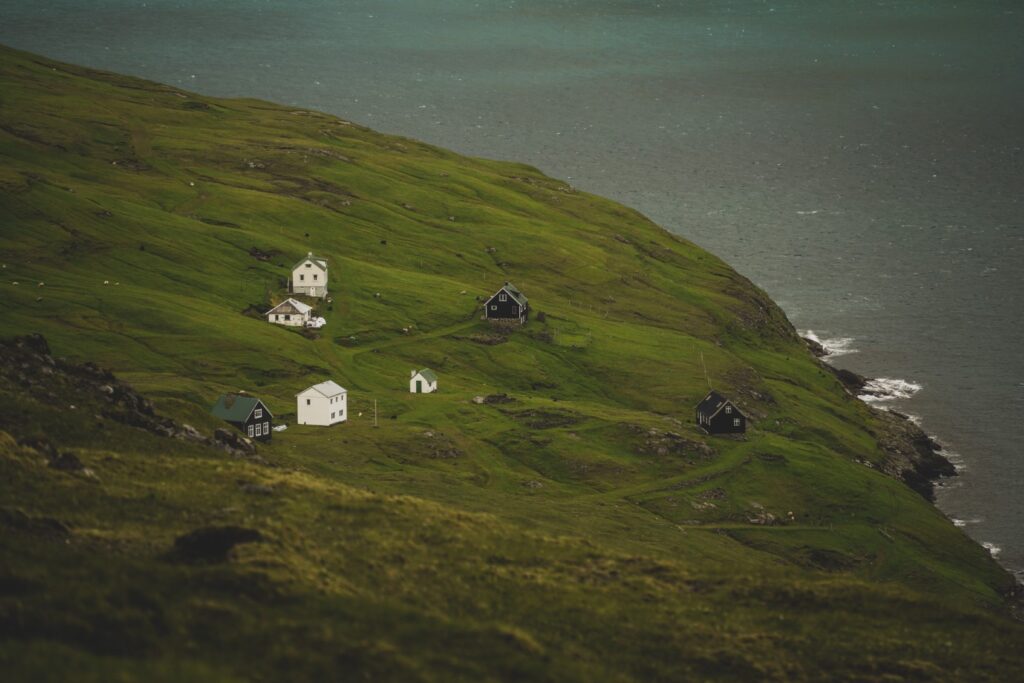
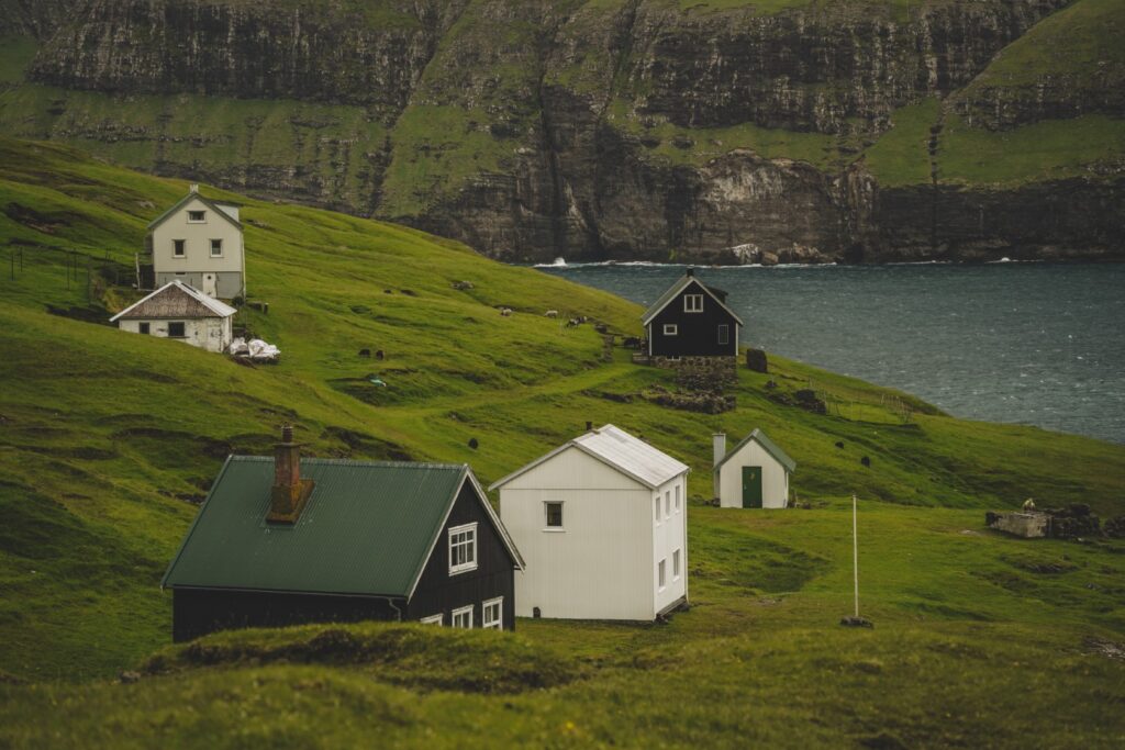
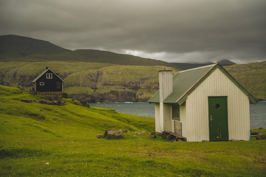
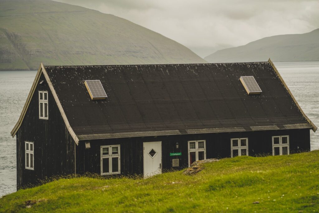
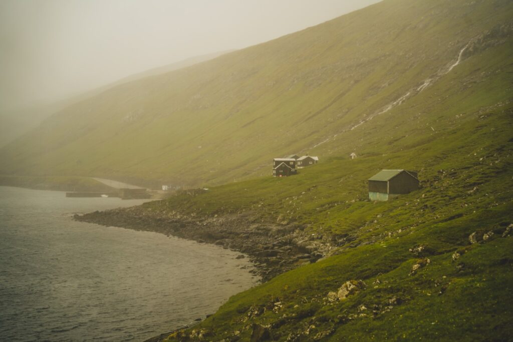
After four hours of relatively easy hiking, we reached Slættanes.
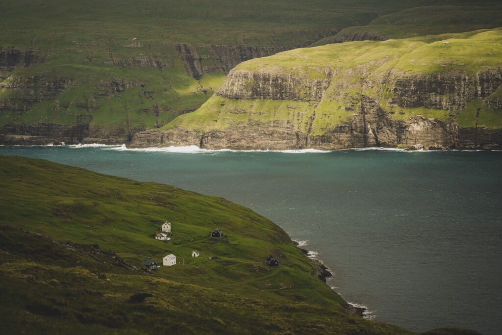
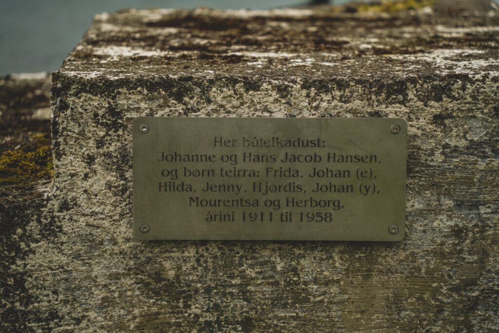
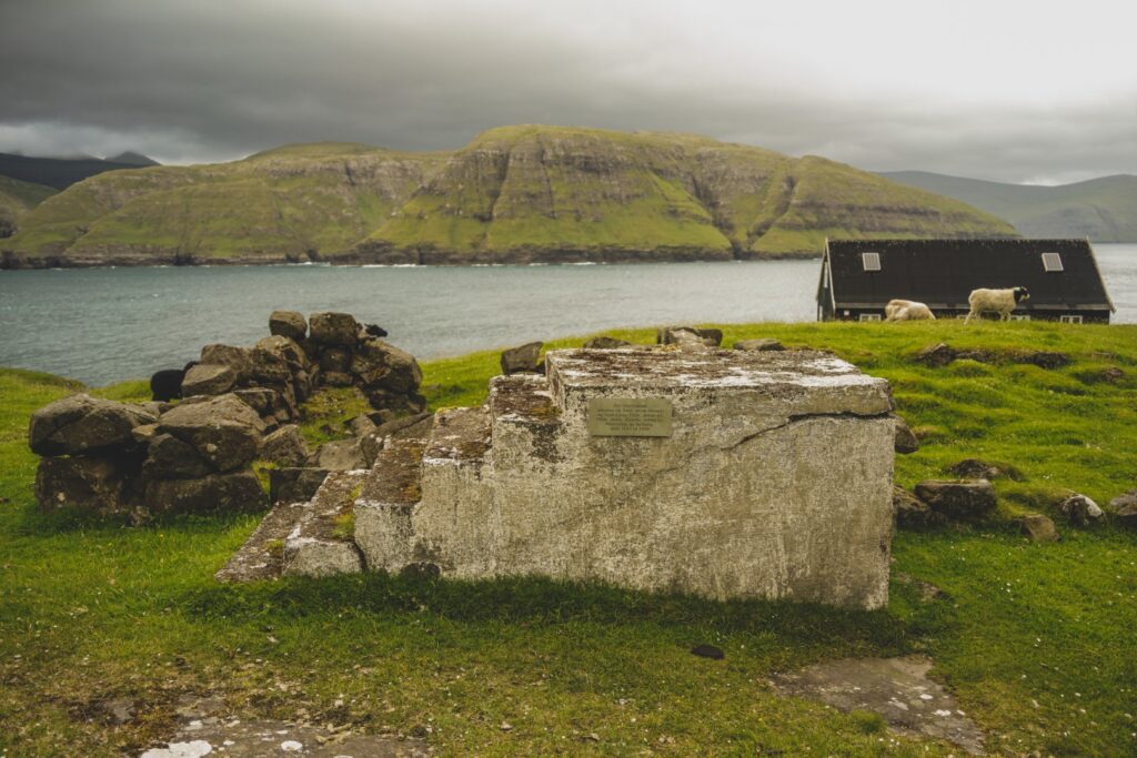
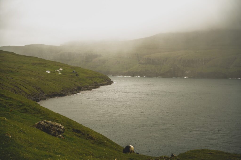
The village was founded in 1835 and was once home to a thriving community of around 130 people. But life in Slættanes was tough, and the village was already abandoned in 1965. Despite the close location to the large village of Vestmanna on the other side of the sound, life in Slættanes was very isolated as the only way in and out was by boat or foot.
Today, the houses are used as summer homes for the families of the former villagers, and Slættanes is becoming an increasingly popular place for intrepid hikers and boat trippers alike.
After a delicious lunch with homemade vegan carrot cake (an annual tradition for Lucie and I!), we set off for the last part of our hike, a non-official route to Oyrargjógv following sheep trails along the east coast of Vágar.
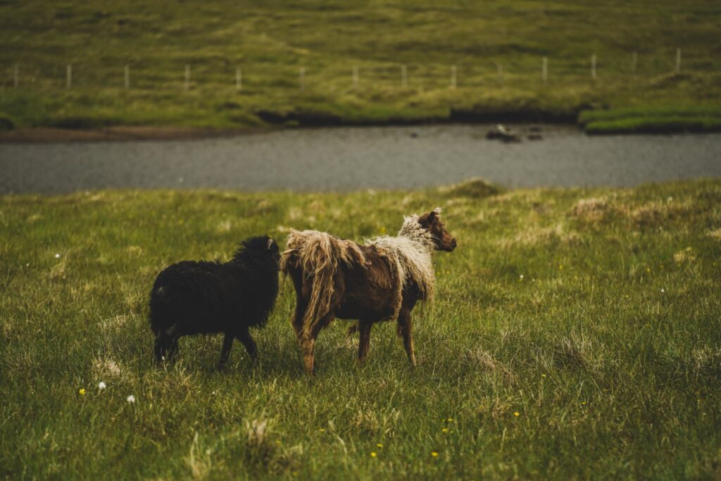
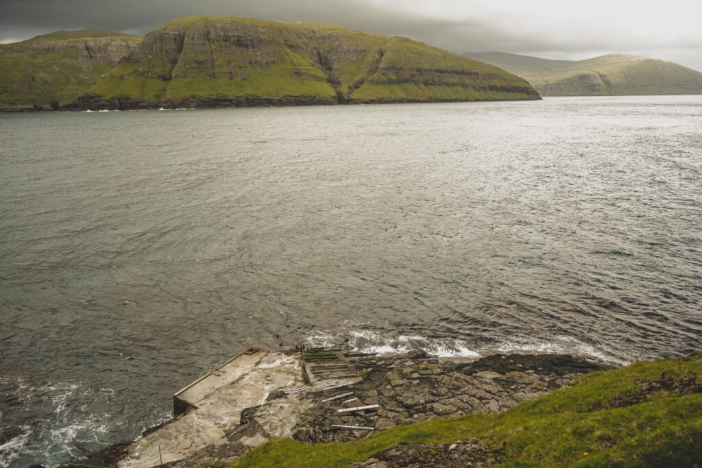
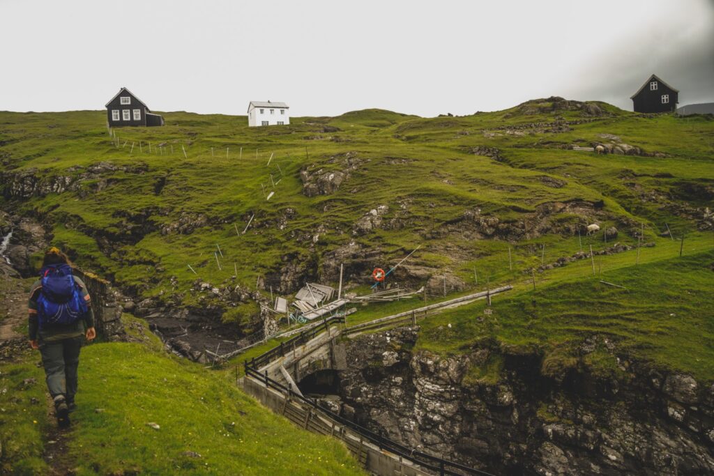
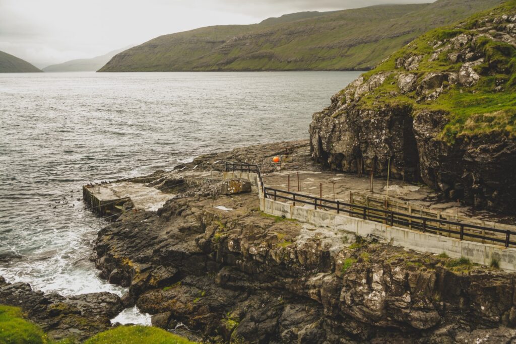
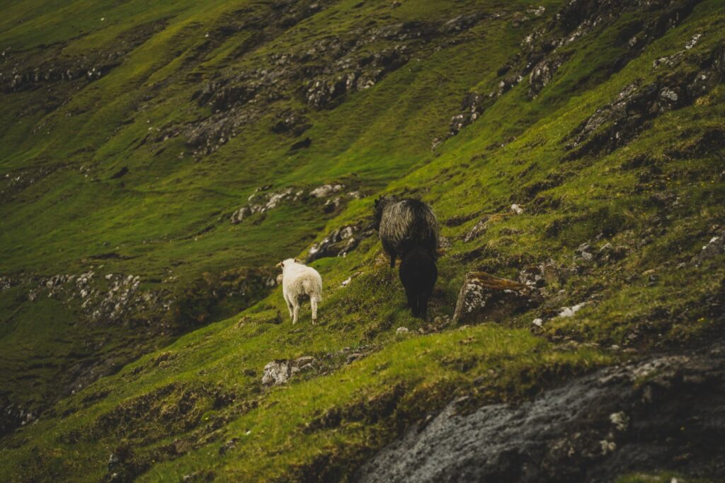
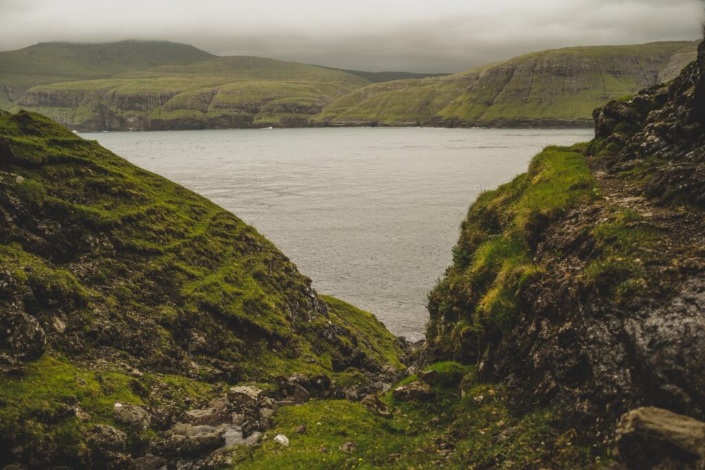
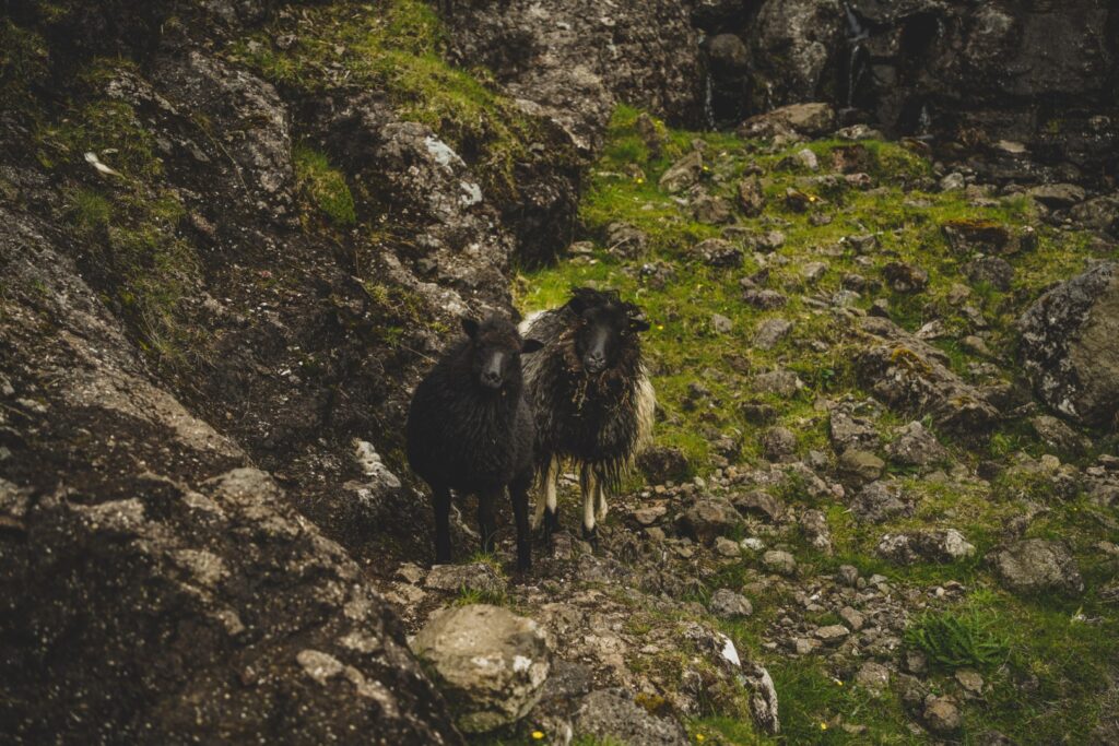
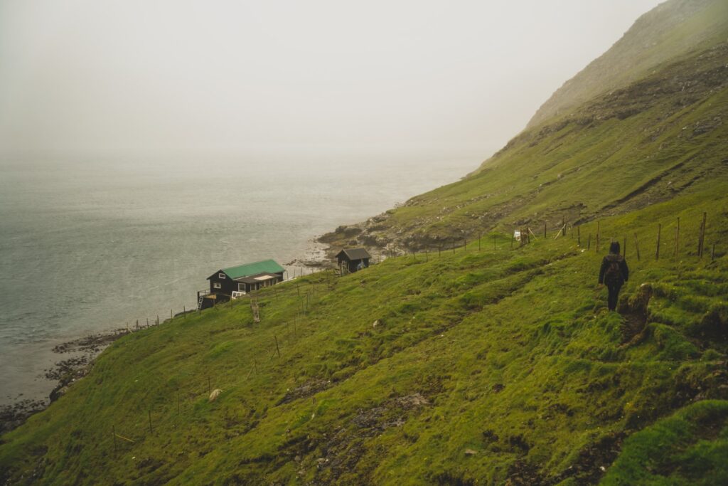
Oyrargjógv is the old ferry port that was once the only connection Vágar had to the rest of the country, up until 2002 when the subsea tunnel between Vágar and Streymoy was built. We only had an old map with a trail to go by, so we didn’t even know if it would be possible to hike this way, but there were actually sheep trails to follow the entire way. In the beginning, a flock of sheep walked in front of us as if to show us the way, then got scared and ran off when they realized we weren’t sheep too.
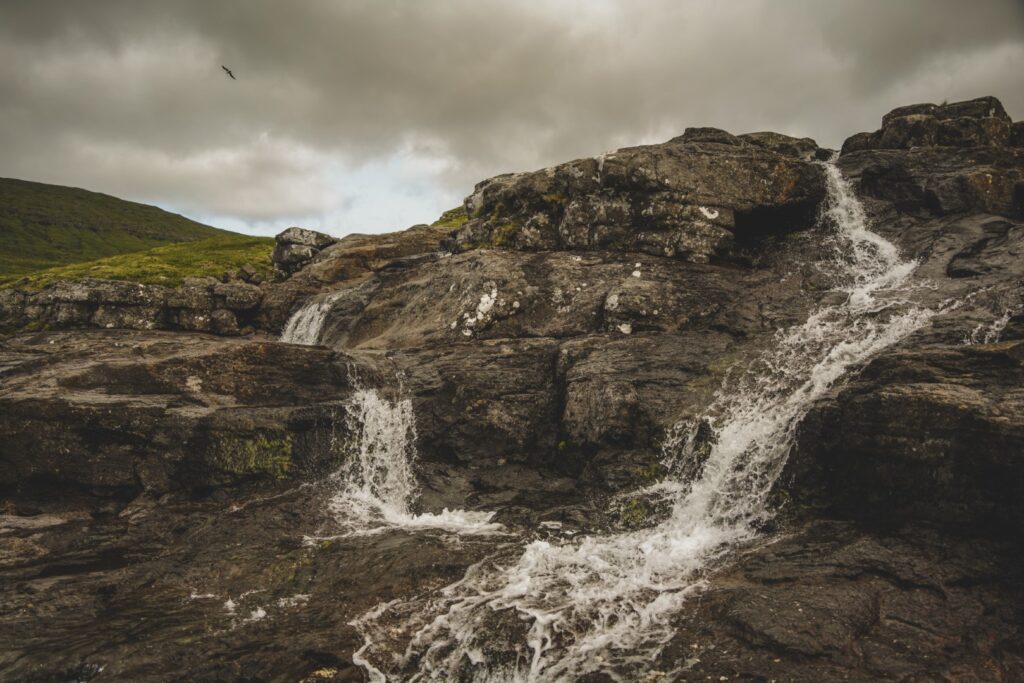
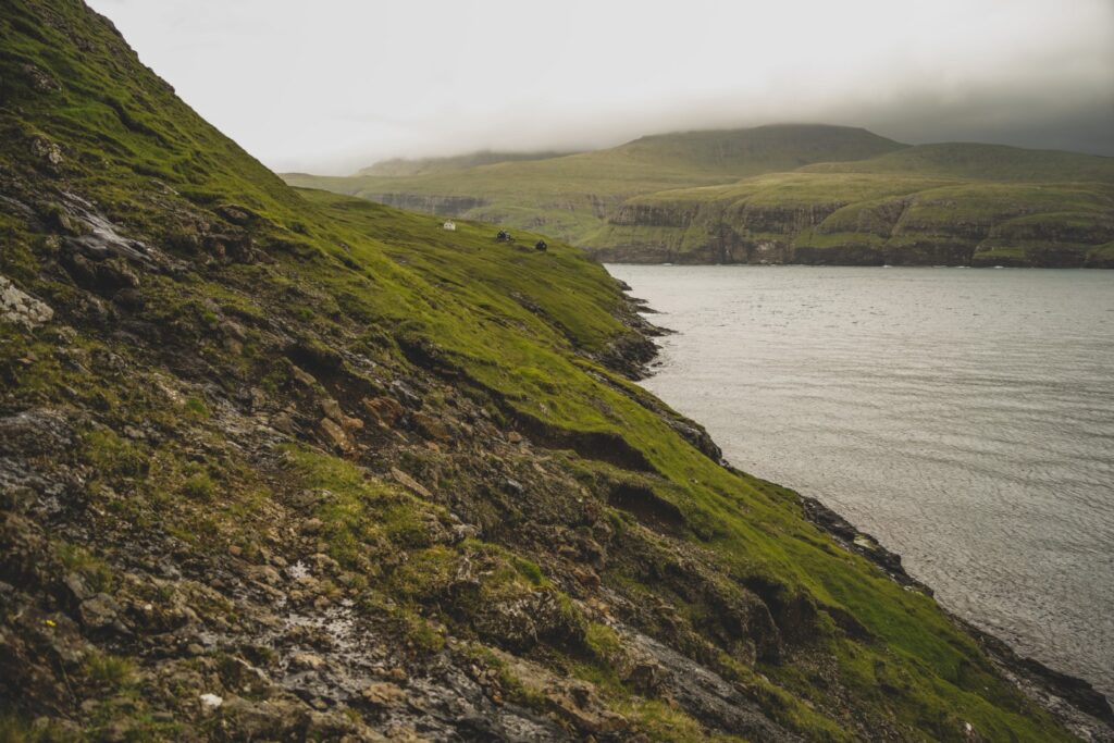
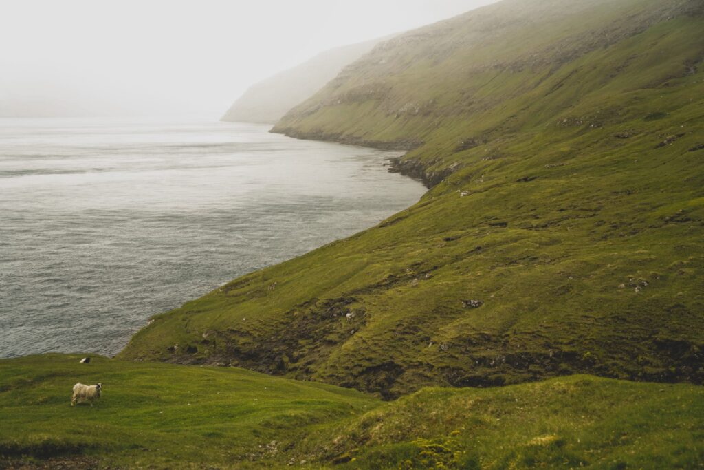
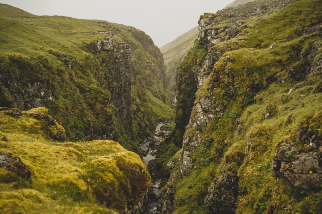
This is for sure the quickest way to reach Slættanes on foot, but also the most dangerous as you’re hiking on steep cliff edges by the ocean instead of inland. We had to cross several waterfalls and gorges; one gorge was full of aggressive birds that definitely did not appreciate our presence; another was impossible to cross so we had to hike up a long way to pass it – and it was so slippery that I fell on my butt! The hike was steep in parts, but not impossible, even in the worst weather I’ve experienced on any hike on the Faroe Islands. The rain came shortly after we’d set off and stayed for the remainder of our hike, drenching us completely. But that’s the Faroe Islands for you. Beautiful and wild, and very unpredictable.
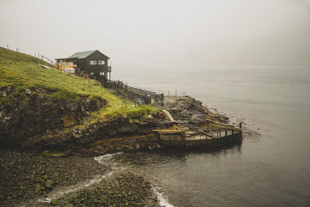
We came past the most isolated summer cottage on Vágar and we both desperately wanted to get inside to dry our sorry selves. But we pushed on, passing another huge gorge that was thankfully easy to cross, and then onto a very steep section. But finally, after 3,5 hours of hiking in the rain, we reached Oyrargjógv! And then we just had to walk 2,5 kilometres to the main road to stick our thumbs in the air. It didn’t take long before a local guy felt sorry for us, picked us up and drove us back to our hostel.
This hike was the last hike I did in the summer of 2021 on the Faroe Islands. It was also the last trail I had yet to undertake on Vágar. Now I’ve hiked every possible trail, and climbed every mountain on the island. I feel like I know Vágar to its core now but that doesn’t mean I’ll stop exploring the island. I love it too much to stay away, and many of these places deserve plenty of revisits!
Hiking route description: Sørvágur to Oyrargjógv via Slættanes
The hike begins at the end of Húsadalsvegur in Sørvágur. Follow the gravel road to its end by a small lake, then go right of the fence. You’ll soon spot the first stone cairn, and they’ll be with you for the remainder of the hike so you really can’t get lost on this hike! After approximately 500 metres, you’ll see a cairn to your right; ignore this as this cairn is for the route directly to Oyrargjógv. Follow the cairns to the left heading north instead.
The beginning of the hike goes steadily uphill, but after a few kilometres the trail starts going steadily downhill instead. You’ll soon reach the small lake of Tjørnin í Enni where you’ll have to cross a fence before going uphill again to the Fjallavatn trail. When you are almost at the lake, leave the trail and go north towards the next cairn behind the waterfall. This is another uphill push and you’ll have to cross a fence and the waterfall. Continue north to the next river which can be quite difficult to cross but there are several rocks to step on.
The next section goes up to a mountain pass between Tungufelli (591 m.) and Tungufellið Lítla (443 m.). This section is quite steep and there are another few small rivers to cross. Soon, you’ll reach the spot where the trail meets and merges into the trail from Sandavágur to Slættanes, and it won’t be long until you can see Slættanes. There are no more cairns now, just head towards the houses.
Enjoy a break at the abandoned village, and perhaps walk to the lighthouse to the north of the village before heading on towards Oyrargjógv. There are no offical trail or cairns to follow, but you just have to stick to the coast as much as possible. First, go down to Slættanes’ tiny harbour and then just follow the coast south. There are some sheep trails to follow which makes it a bit easier but it is a steep hike. You have to cross several waterfalls along the way and hike above several small gorges. Unfortunately, you’ll have to hike up quite a bit to cross one large gorge, but the rest are easy to cross. You’ll come by an isolated summer house with another gorge which you’ll have to climb down and then follow a sheep trail up on the other side. Soon after, you’ll reach Oyrargjógv! If you’re hitchhiking, you’ll most likely have to walk another 2,5 kilometres to the main road as cars rarely come down to Oyrargjógv.
The hike is 23 km, takes 7-8 hours and is of moderate difficulty. The most difficult part is between Slættanes and Oyrargjógv, so you could also choose to return back to Sørvágur instead, adding another hour to the hike.
Leave a Comment
Pingback: Hiking to an active volcano: My story from Geldingadalur, Iceland – Northtrotter on 21/01/2023
Pingback: Popular hikes restricted: Examining overtourism on the Faroe Islands – Northtrotter on 21/01/2023

2 COMMENTS