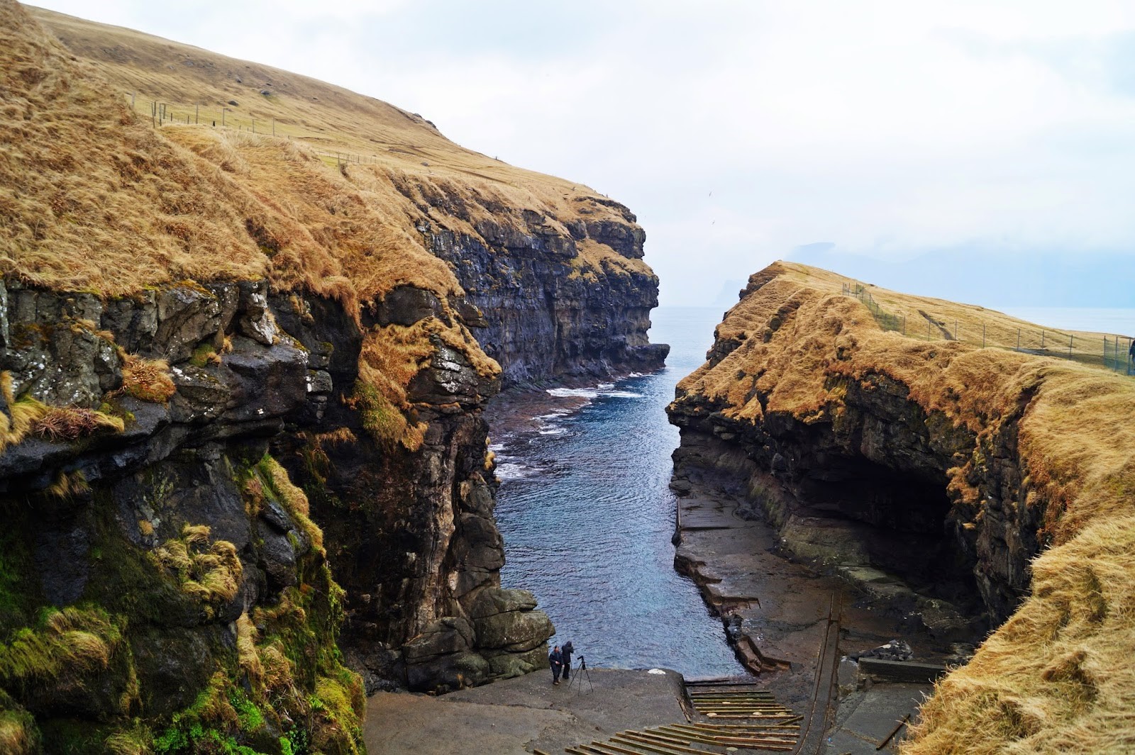
It was yet another sunny day in October on the Faroe Islands. Once again, the weather gods were smiling at me, beckoning me to get outside and get closer to achieving my goal of climbing all mountains on the island of Vágar.
That day, I had near perfect conditions for mountain climbing, if only it hadn’t been for the snow and ice that had recently settled on some of the mountain tops. But it didn’t stop me.
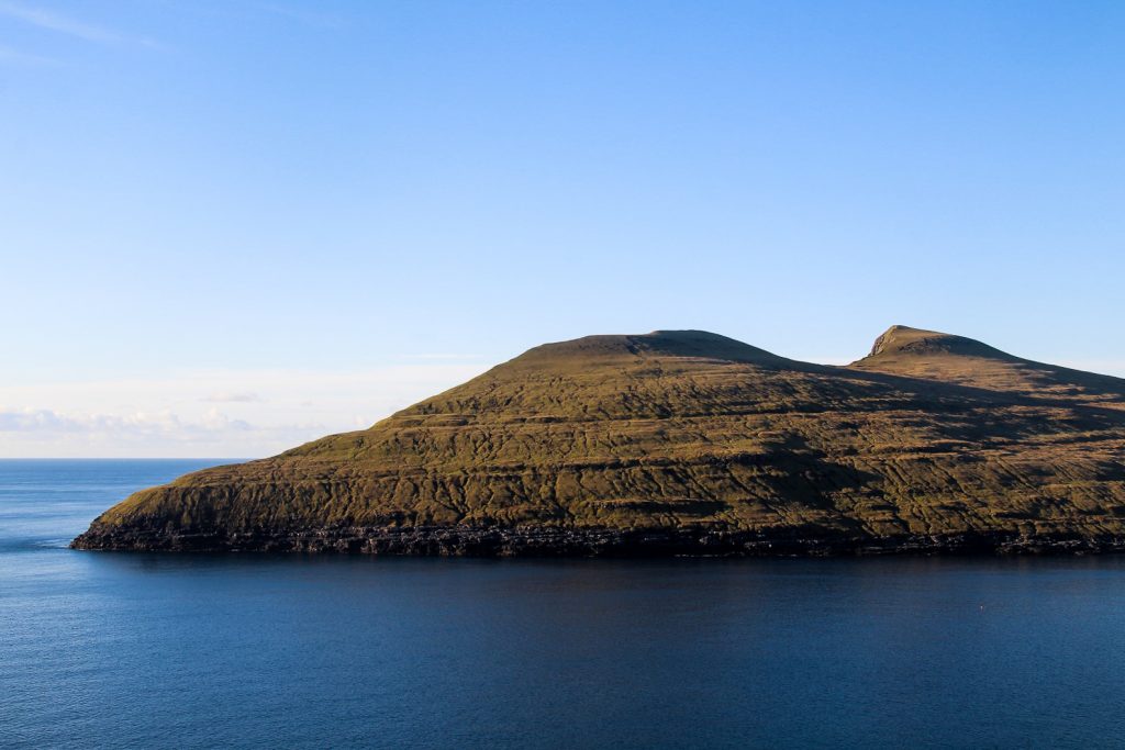
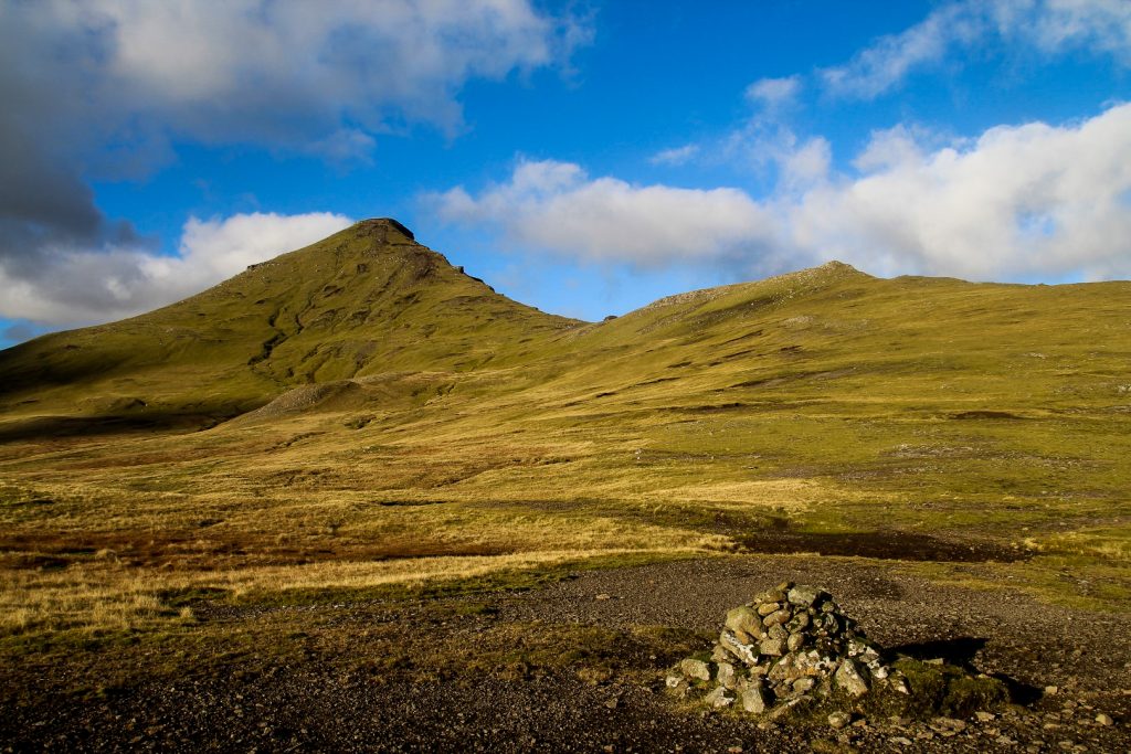
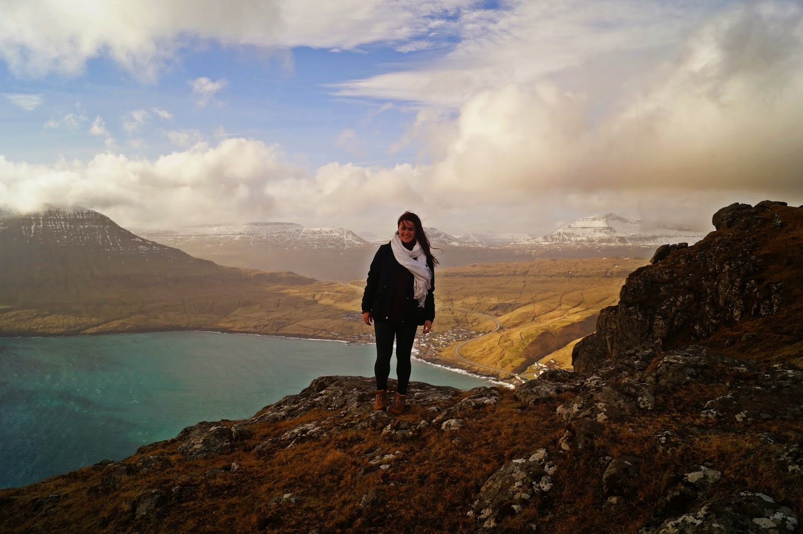
I decided to climb the mountains that I’d been staring at from my hostel window for three weeks, the mountains above the famous rock formation, Trøllkonufingur; Krosstindur at 574 m., Húsafelli at 591 m., Malinstindur at 683 m., Breiðistíggjur at 594 m. and Heldarstindur at 572 m.
Since the mountains are all quite close together and the trailhead only a short distance from my hostel, I decided that I had time to sleep in a little and then leave for the hike at 10 AM. But as it turned out, eight hours of daylight wasn’t quite enough.
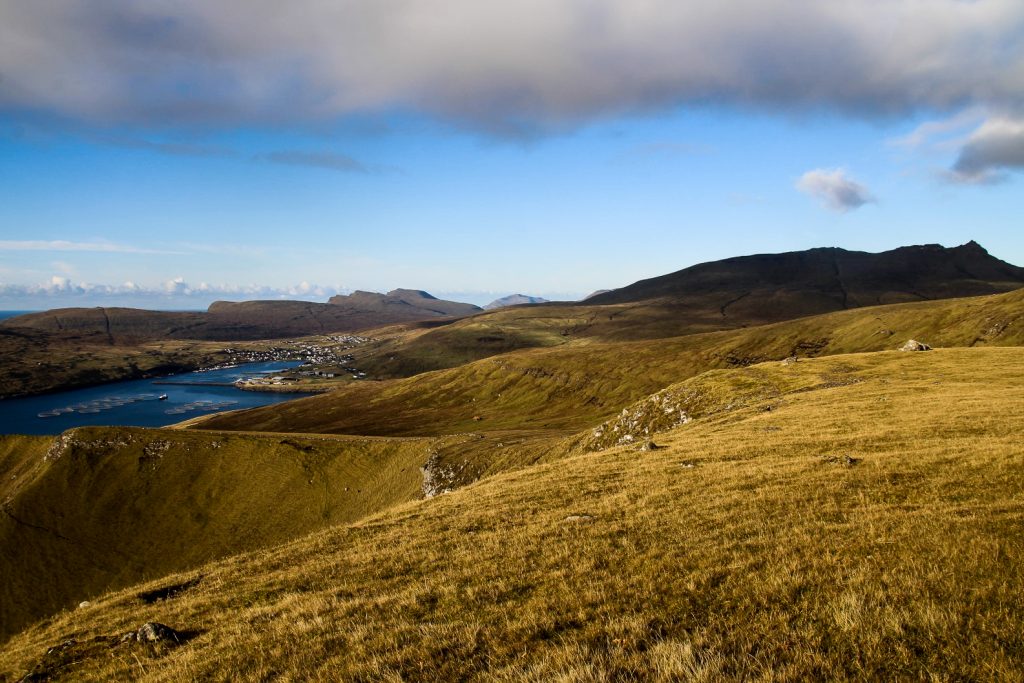
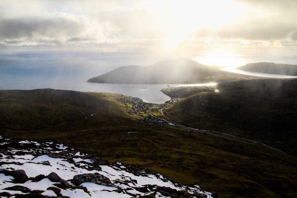
I started the hike in the southern end of Sandavágur, following the short trail to the popular viewpoint for Trøllkonufingur. Usually, this is where visitors stop and turn around, but I continued upwards towards the first mountain peak, Krosstindur.

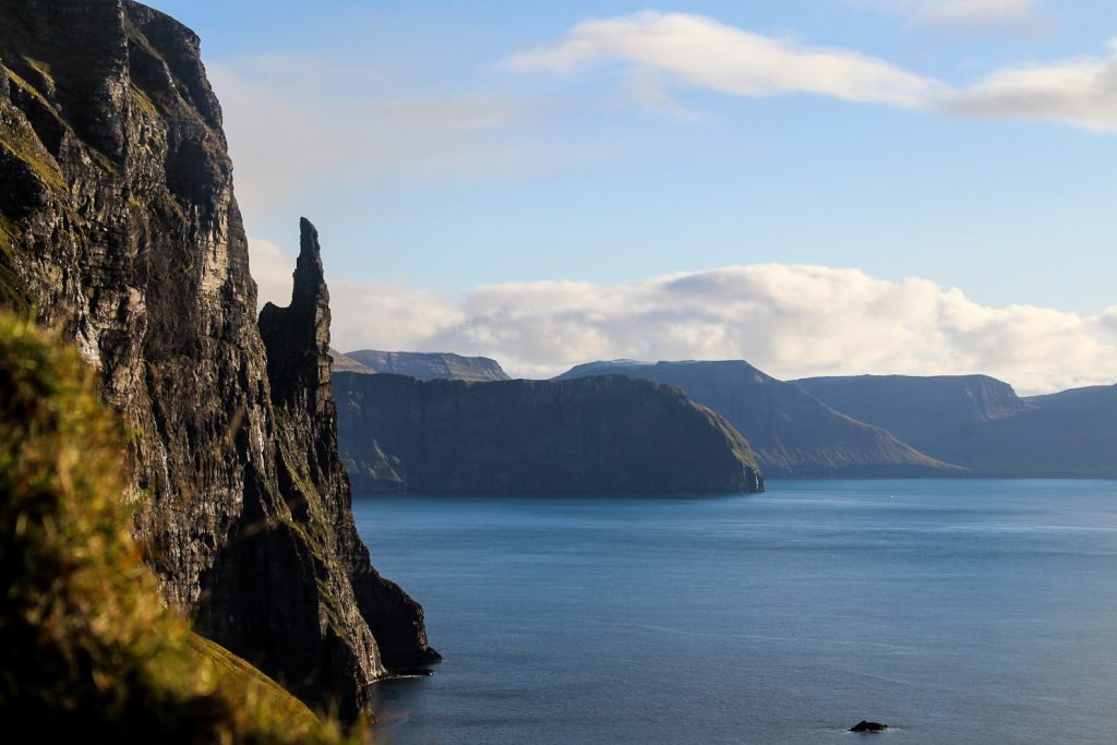
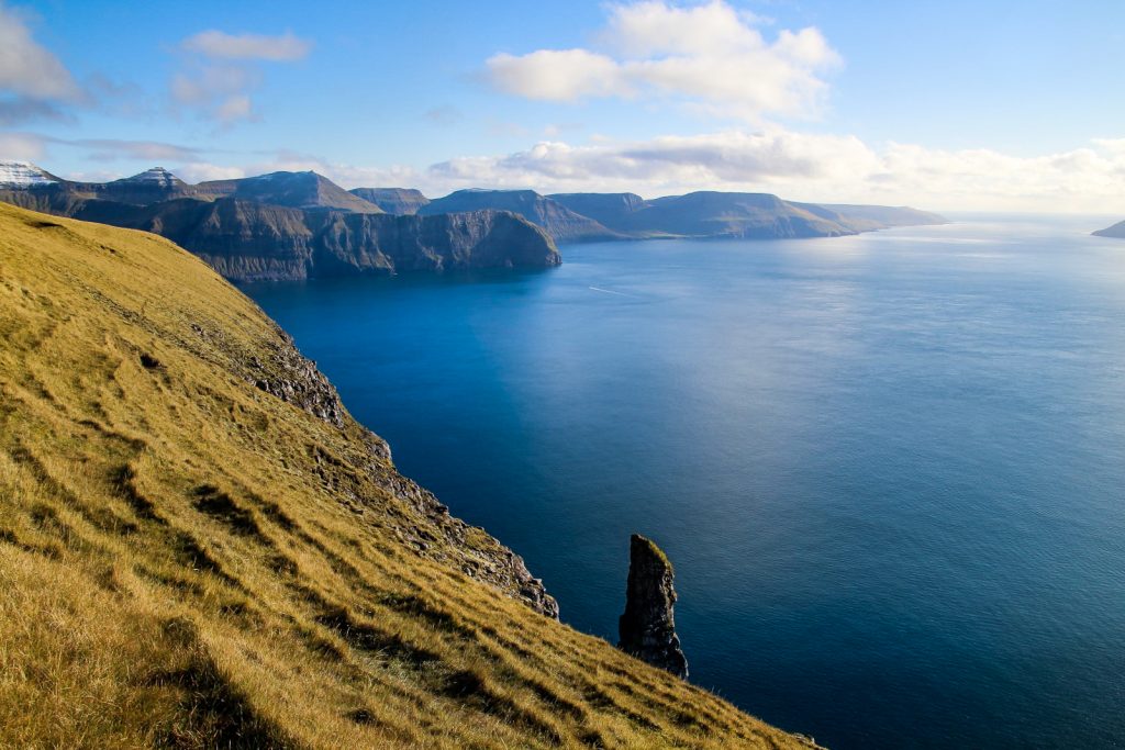
I had been close to falling quite a few times while walking through the icy streets of Sandavágur that morning, but thankfully, the ice hadn’t settled on the frosty grass of the mountain. I walked as close as possible to the edge without compromising on safety, just so I could continue having Trøllkonufingur in my view. I really wanted to find a close-up view of the rock formation, something I’ve never seen before anywhere on social media. I wasn’t sure if it would even be possible, but I for sure was going to try!
I continued hiking up the mountain, a nice and easy ascend that was especially enjoyable with the heat of the sun and the beautiful blue sky above me. Before turning off for the summit, I took a little detour further towards the coast, descending quite a bit. Keeping a lookout for a possible view of Trøllkonufingur from above, I continued down the steep slope, minding my steps so I wouldn’t fall and slide right off the mountain. I was still thanking the weather gods that they hadn’t let the ice settle on the grass!
And then suddenly, there it was. The peak of the famous rock formation came into sight, and I felt so lucky to be able to get so close to it. That was definitely worth all the descending that I would then have to ascend again afterwards!


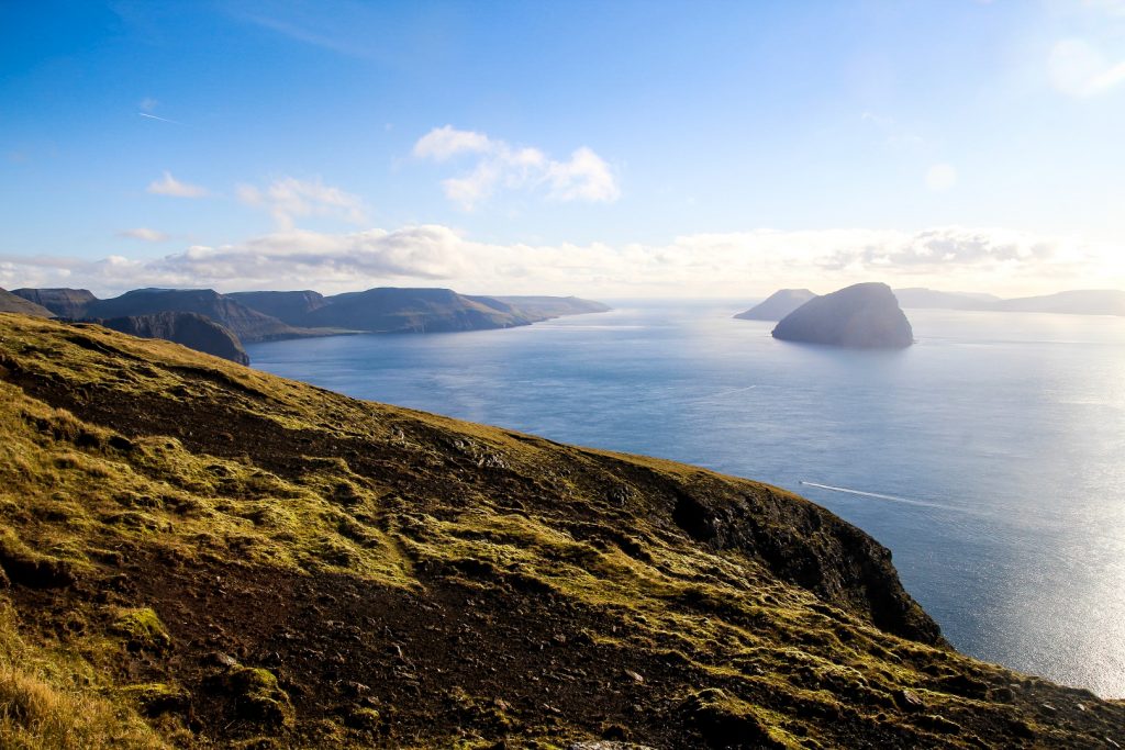


I continued for a bit around the coast and found a nice view of Streymoy and the backside of Krosstindur, before I ascended and started climbing towards the summit. But I didn’t get very far as the beaming sun and calm wind distracted me. I sat down on the grass and enjoyed my lunch, having a wonderful moment of solitude and rare October heat on my cheeks as I scouted for whales in the ocean.
After a while, I started to get cold so I headed up to the summit of Krosstindur. The last part of the ascend was along a steep ridge, but there was a sheep trail to follow and I took it easy so I wouldn’t fall. I reached the summit and climbed up the rocks that make up the cross that gave the mountain its name. It was a bit difficult to get right up to the top, but I managed with some bouldering.
As soon as I got up there, I noticed three sheep peeping up at me from a ridge below. They must’ve wondered what on earth I was doing, pulling myself up those rocks!


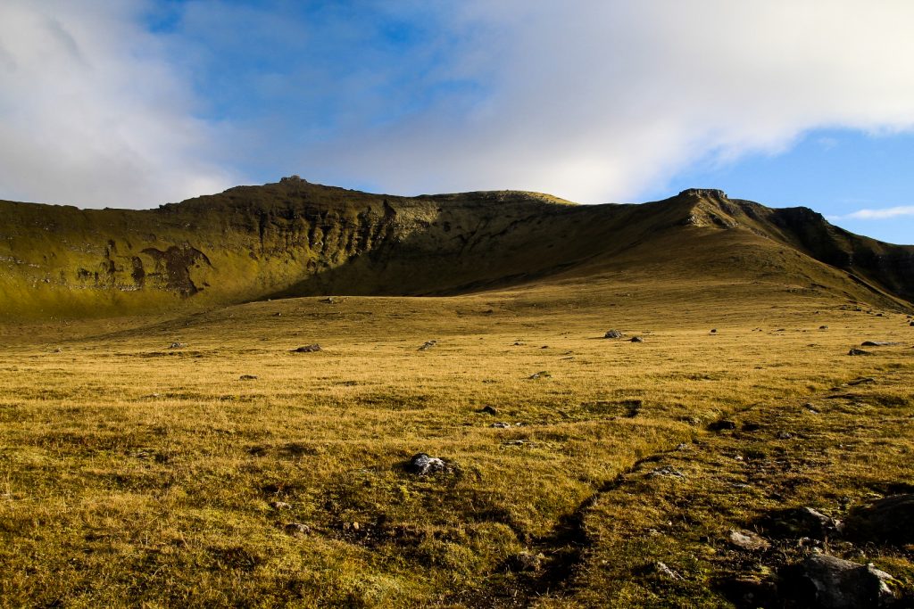
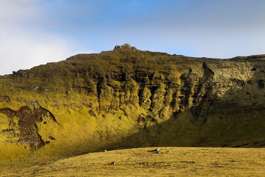
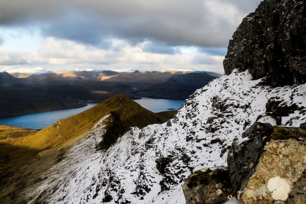
Looking down from Krosstindur, the valley I’d just hiked up from almost resembled a giant crater. This side of the mountain is steep, but it’s nothing compared to the other side which is rocky and with a huge drop. So I descended slowly and followed another sheep path along the next ridge to Húsafelli, the second mountain.
It started raining lightly and the wind picked up, but it didn’t matter as this part of the hike that looked the most treacherous from below was actually one of the easiest sections. The sheep trail was wide enough for me to feel comfortable hiking my usual speed!
Only the last few meters required some climbing and then I reached my second peak that day!


The next mountain, Malinstindur, the highest of the day, is quite far from Húsafelli, about three kilometers. It looked like less, but it took quite a while as I first had to descend from Húsafelli, cross a fence and then hike up the steep slope of Malinstindur.
On my way down Húsafelli, I looked back and noticed a man on his way to the summit. I waved, but I don’t think he saw me. A few moments later, I saw him reach the summit and put his arms in the air. Victory!
As I headed towards the summit, I spotted another guy, this one on top of Malinstindur. I hoped that he would stay until I got up there, but he was gone when I finally reached the summit. Probably because I took so very long doing it. I was tired and feeling lazy, so I basically dragged myself up in between snack breaks and photo breaks.
But once I got up there, all of my energy came back as the summit was covered in a beautiful blanket of snow! And I loooove snow!


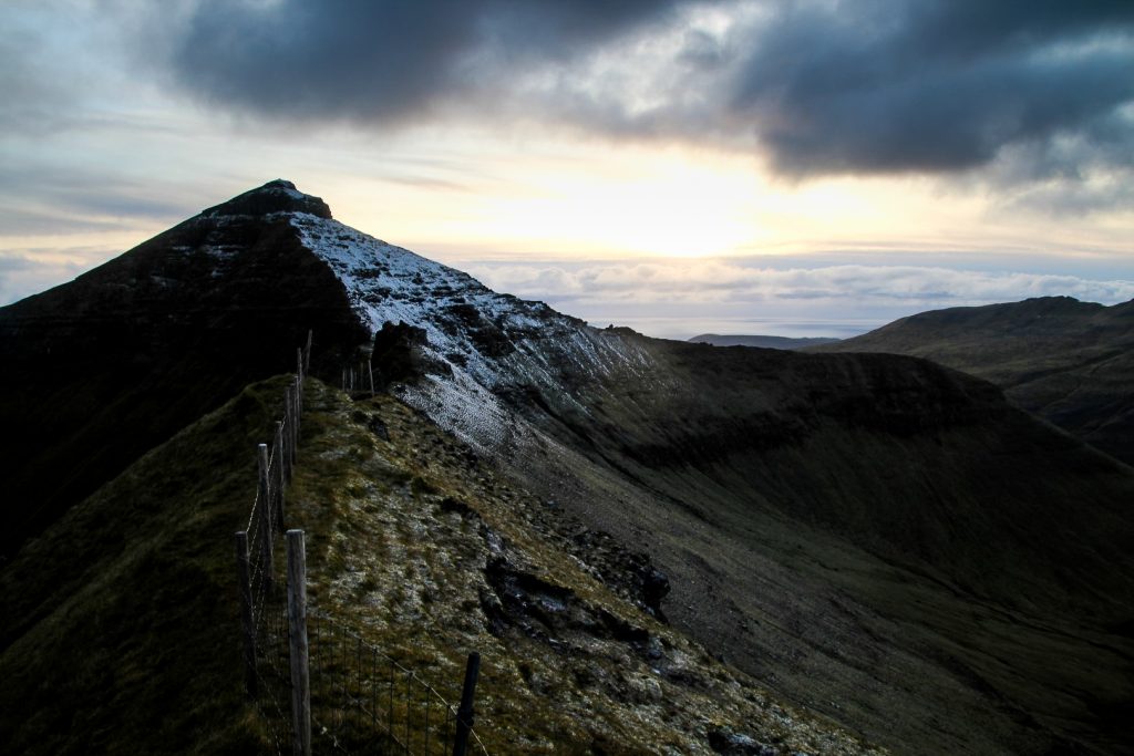
Getting from Malinstindur to the next mountain, Breiðistíggjur, proved a lot more difficult than I’d ever imagined. The summits are only about 500 meters from each other, but going the direct route along a ridge wasn’t possible. I tried, climbing down icy rocks along the ridge, until I came to a point with a huge drop that I couldn’t possibly go down without injuring myself.
So back up I went.
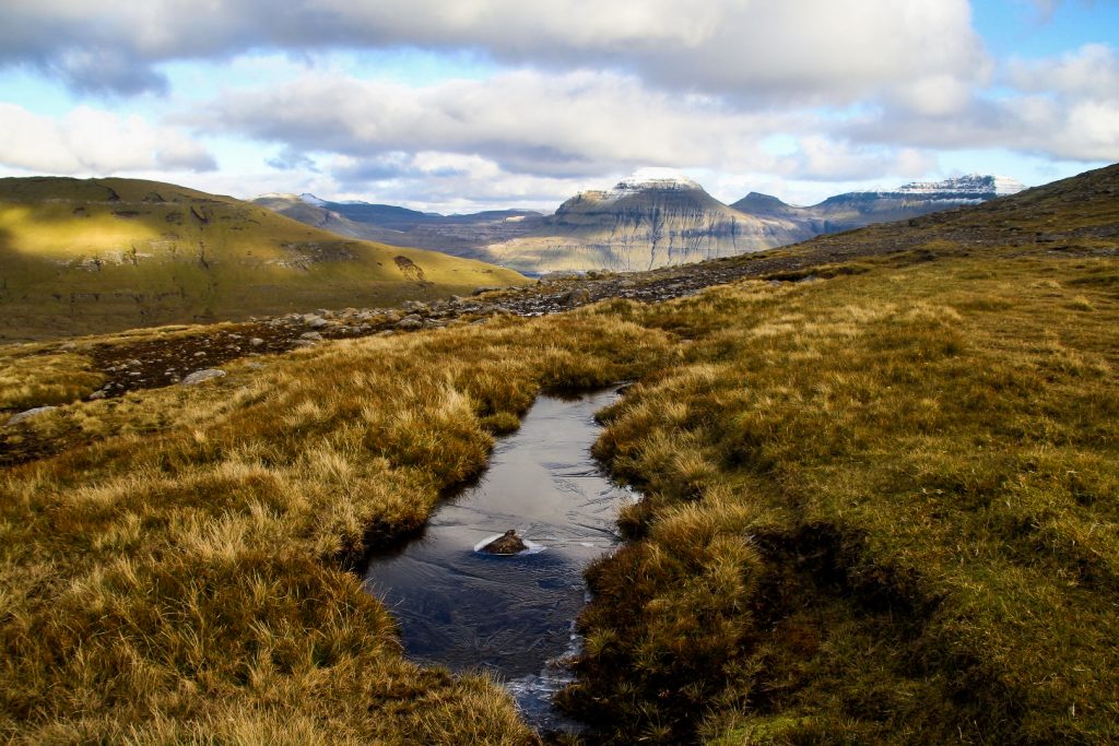
I needed to figure out a different way, but the only other way without too much of a detour was down an icy valley that obviously never sees the sun in autumn/winter. It was getting late, in fact I only had 1,5 hour left before sunset with two peaks to go. And fog had started coming in too. I considered giving up, but I figured I would be able to make it if I pulled myself together and stopped taking breaks all the time.
So I found a good spot and sat on my butt, and slid all the way down to the valley. It was incredibly cold for my butt and hands and it took much longer than I hoped as it was further than it looked. But I got there in the end, and then I just had to find my way up Breiðistíggjur…
It started snowing as I ascended towards the peak. It was a steep and tough climb, but with my forced energy, I managed to get up there without too many breaks!
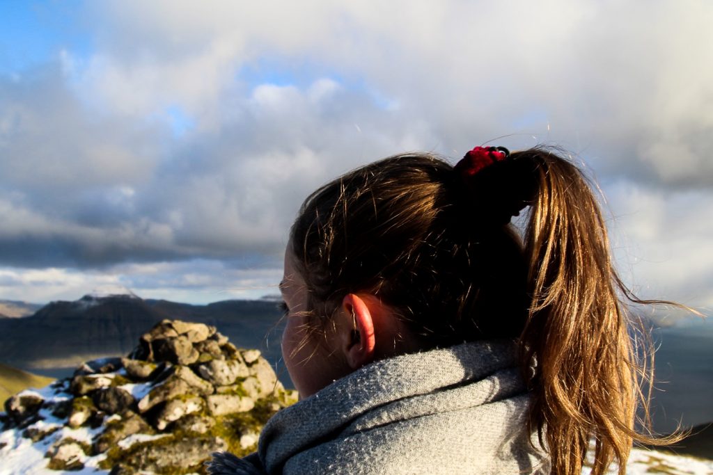
I had 25 minutes left until sunset, one peak to go. Thankfully, Heldarstindur is only about 700 meters from Breiðistíggjur and it looked like an easy hike to get there. I had to descend a bit, but not much and then I just followed a ridge before ascending towards the rocky summit. I found a grassy spot to climb up to the summit amongst the icy rocks, and just as the sun said goodnight, I reached my fifth and last summit of the day!
I was so glad I hadn’t given up! Even though I still had about two kilometers left to hike in the dark.


I considered my options for hiking back down to the road, and I really wanted to get as close to Sandavágur as possible so I wouldn’t have to hitchhike. But the shortest distance was to the sub-sea tunnel that connects Vágar with Streymoy, and due to the incoming darkness, that was the route I chose. I just had to hope that I would have luck hitchhiking from there.
The descend was quite easy and there was just enough light for me to see without using a flashlight. Thankfully, my night vision is quite good, so I could navigate my way over streams and back down to the road that finally came into view after an hour of descending!
I stood in the light from the street lamps so the cars would see me. A few cars passed, and then a lovely Polish lady stopped for me. She was on the way to the airport and didn’t mind dropping an exhausted me off at the hostel on the way!
Hiking route description: Krosstindur, Húsafelli, Malinstindur, Breiðistíggjur and Heldarstindur
The hike starts on the highest road in Sandavágur, Traðarvegur, which later meets the footpath Úti á Trøð. Follow the path to its end where you’ll see the famous view of Trøllkonufingur. Walk 20-30 meters back along the fence to where it ends and head up the mountain Krosstindur, following the edge as closely as possible for nice views of Trøllkonufingur.
Before climbing the last meters up to the summit, descend towards the coast to get a close-up view of Trøllkonufingur. Be careful as the slope is quite steep. The best view is found at 62.047163, -7.093256.
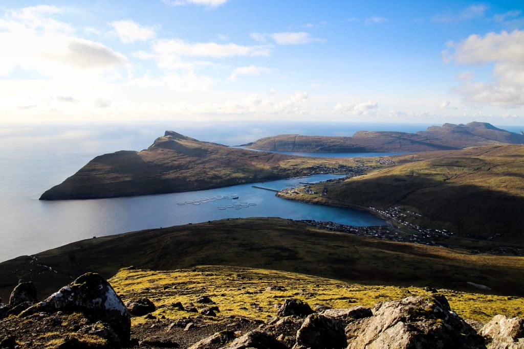
Then head back and climb to the summit of Krosstindur. To get to the very top, you’ll have to hike along a steep ridge and do a bit of bouldering, but it’s not the most challenging climb. Climb down the summit carefully and follow the sheep trail along the ridge to the next mountain, Húsafelli (the one on your right when looking towards Miðvágur). When you see the summit to your right, leave the sheep trail and start climbing up. A few moments later, you will reach the summit.
Looking to the right, you will see the next mountain, Malinstindur. It’s quite far from Húsafelli and requires some descending and lots of ascending. There’s one fence to cross before the ascend begins, but it’s easy to step over. The descend is easy, but the ascend is long, although not steep. Climb up the right side of the mountain, but be careful to not go too near the edge. The last stretch to the summit is quite steep, so take extra care here.
Behind the summit cairn, you will see a steep rocky ridge towards the next mountain, Breiðistíggjur. Even though it looks close, I don’t recommend going down this way as it’s very steep with huge drops and it gets icy in winter. Instead, cross the fence on the summit, hike down a ridge towards the road until you find a good spot to descend to the valley below.
Once you’re below the summit of Malinstindur, hike towards Breiðistíggjur and start climbing up. It’s a steep climb, so take care. The summit is quite rocky, but there’s a fence to hold onto. The next mountain, Heldarstindur, is to your right. It requires a bit of descending and ascending, but it’s an easy hike. The summit is quite rocky, but there are plenty of grassy parts in between to safely climb up.
To get back to civilisation, you can either choose to hike back to Breiðistíggjur and down to the road from there, ending the hike a few kilometers outside of Sandavágur, or you can choose to go to the road straight from Heldarstindur, ending the hike near the sub-sea tunnel. Both are easy descends of 2-3 km.
The hike is 12 km, takes 7-8 hours and is of moderate to hard difficulty.
Leave a Comment
Pingback: Sørvágur to Oyrargjógv via Slættanes: A long hike across the middle of Vágar – Northtrotter on 22/12/2020

1 COMMENT