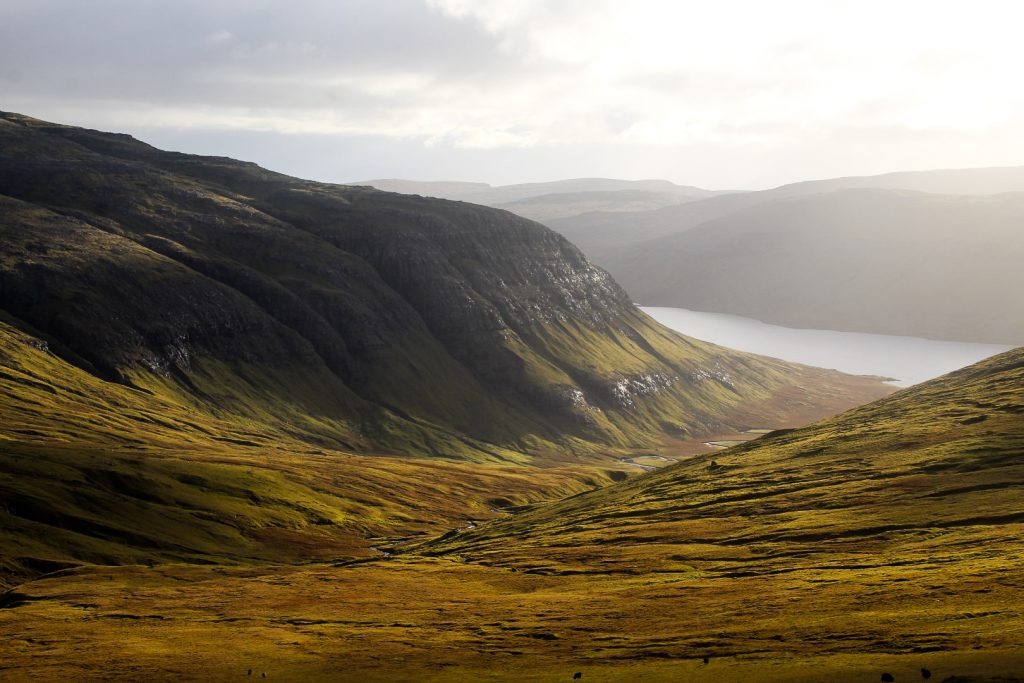
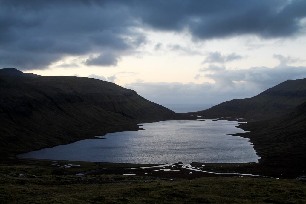
For years, I had been mesmerized by the thought of the isolated Fjallavatn, the second-largest lake in the Faroe Islands, nestled beneath high mountain peaks.
For some reason, Fjallavatn has always escaped the attention of most visitors to the Faroe Islands, myself included, which probably has something to do with it being overshadowed by its much more famous older brother, Leitisvatn. Fjallavatn doesn’t come with an insane optical illusion like Leitisvatn, but it does offer solitude and proximity to an incredible view of an isolated black sand beach with a backdrop of Víkar, one of Vágar’s two abandoned villages.
With my goal of seeing just about every corner of Vágar in October, my dream of hiking along Fjallavatn finally became a reality. I’d passed swiftly by the lake and actually seen the view of the black sand beach on a hike from Gásadalur to Slættanes a week or so earlier, but I was incredibly excited to see the lake up close and to revisit the black sand beach, my absolute favourite viewpoint on the Faroe Islands!
My friend Lucy decided to come along on the hike, which was perfect as I had planned a long and challenging hike of 26 km. It would be great with some company! You see, we weren’t “just” hiking to the beach viewpoint and back, we were also going to climb six mountains on our way back to the car. Now THAT would be an adventure! I just hoped time would be on our side since the sun was going to set already at 04.30 PM.
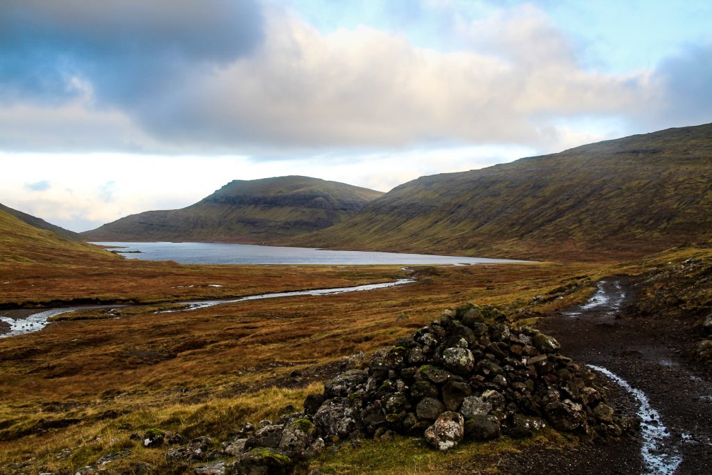
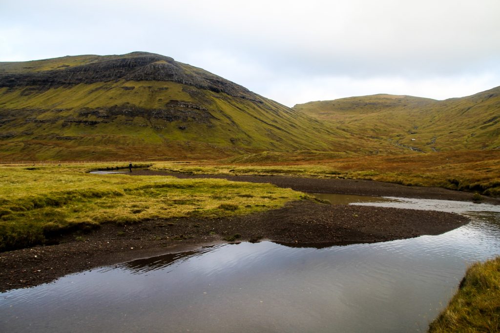
We followed a rough road into the middle of nowhere from Vatnsoyrar and parked our car at the trailhead at 08.45 AM, giving us almost eight hours of daylight for our hike. The first long section went smoothly. We followed a trail that took us through the flat landscapes beyond Vatnsoyrar to the edge of Fjallavatn. We had to cross a few streams, but small wooden bridges had been laid out, making the crossings easy. But there were two major challenges coming up that we hadn’t been aware of beforehand… river crossings!

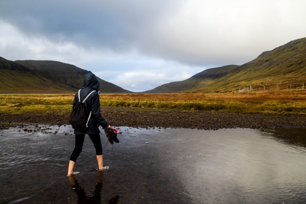
We encountered the first river just before reaching Fjallavatn. I recalled having to take my boots and socks off to cross Reipsá during the hike to Slættanes, and I really didn’t want to do it again. Rivers on the Faroe Islands – in October – are icy cold, and my hiking boots are a pain to take on and off. But we didn’t have much choice. Where are the bridges when you truly need them?
We tried our hardest to find a good spot to cross, but there was always too far of a distance between the rocks. So with our boots in our hands, we waded through the icy cold water to the edge of the lake. Ouch!

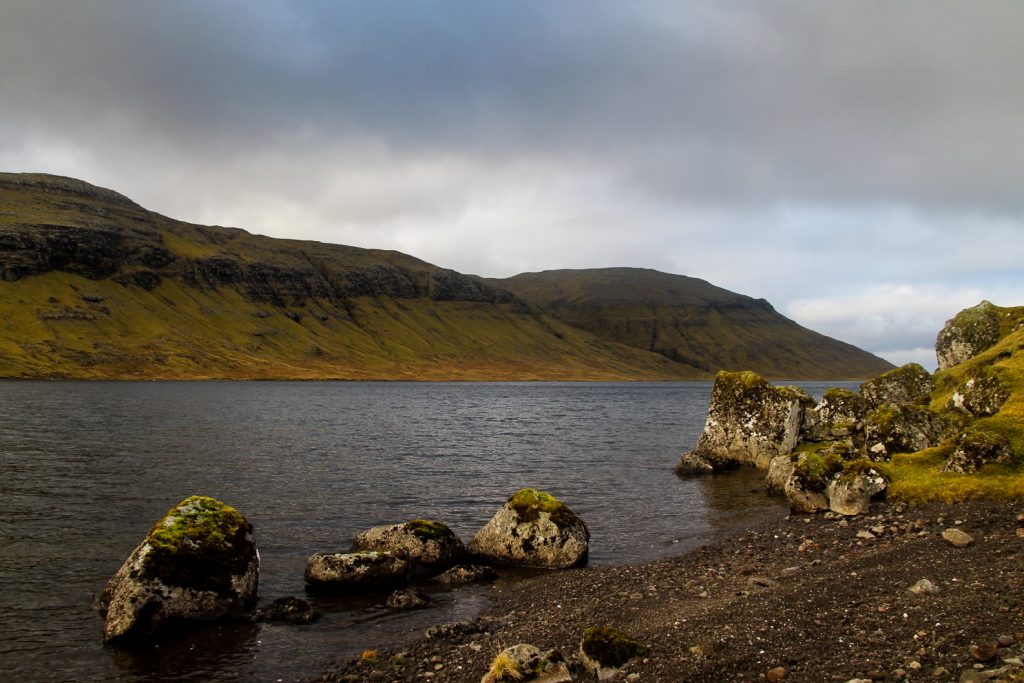
Finally I was at Fjallavatn. The mysterious lake full of wild trout that I’d wanted to visit for years. I was finally there and it was a treat for my eyes. Since the lake is so rarely visited, I’d always imagined it would be really tough to reach. But it wasn’t – at least not until we encountered that river!
But of course, it wasn’t the only river we had to cross that day…
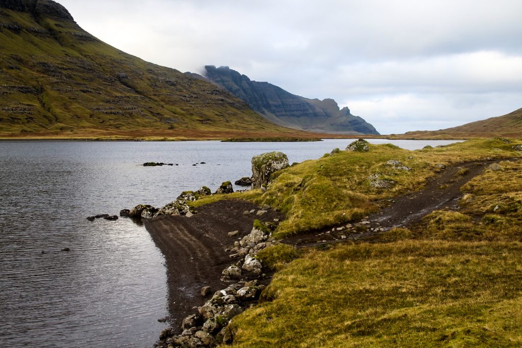
We continued along the trail that runs alongside the lake, mostly along stony beaches. When we were almost at the end of the lake and had gladly forgotten all about our little river adventure, the river Botnáin turned up. And guess what, it wasn’t any easier to cross.
Lucy did the sensible thing. She took off her boots and socks and waded through the river. I, on the other hand, was just too lazy to deal with cold feet and difficult hiking boots, so I found the most shallow spot and walked over. Of course, I got soaked. But maybe it was worth it…
The trail ended, and after the river followed the wetland area known as Norð á Munna that would’ve made my feet wet if they weren’t already. We waded through the wet landscape towards the ocean, following the wide river Reipsá which we – thankfully – didn’t have to cross.
At one point, I recognized the landscape from the hike to Slættanes and realized we’d crossed the trail. It was so funny to be back there, and I started to feel nostalgic even if it was only a week ago that I’d hiked that trail!
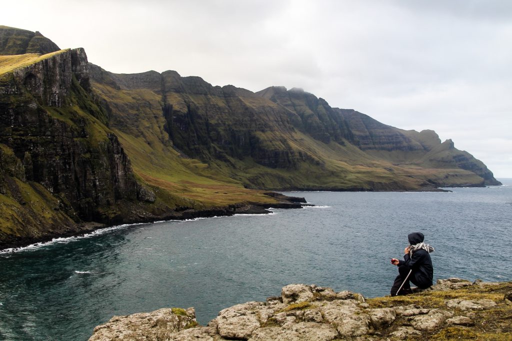
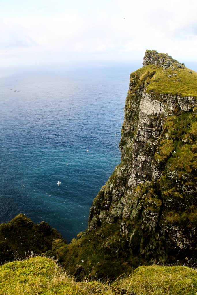
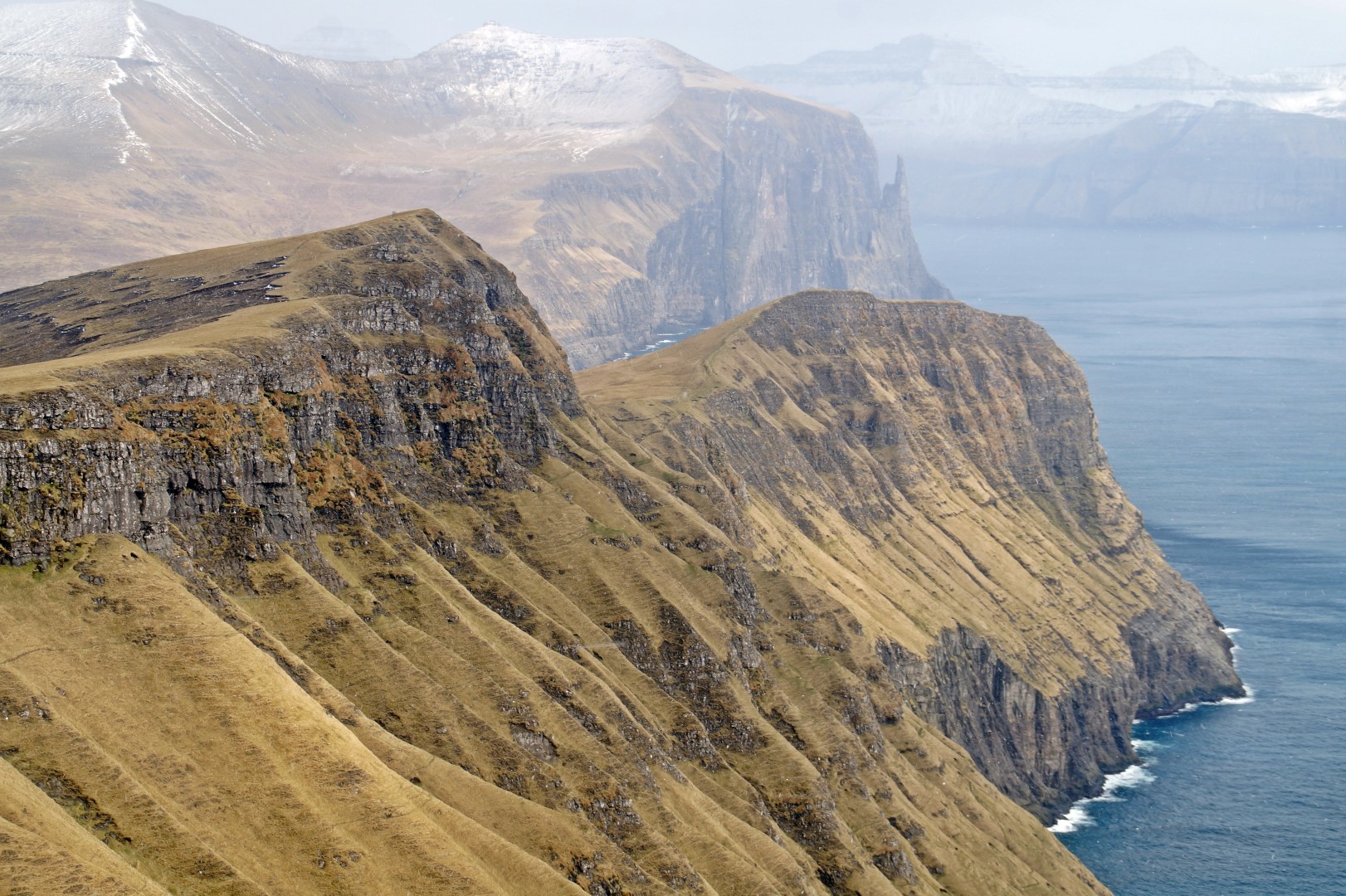
Two hours after we’d started our hike, we stood by the coast, 80 meters above sea level, and looked out at my favourite view in the country. The waves crashed in over the tiny black sand beach, isolated and forgotten after the last inhabitants of nearby Víkar left in 1910. The beach is still full of driftwood, reminding us of the importance it once had as a collection point for the villagers. I couldn’t help but wonder where in the world the wood originated from.

Our first two hours of relatively easy hiking hadn’t prepared us for what came next. We were about to start our attempt to climb six mountains in a day, something that would be a personal record for both of us if we could complete it.
But the first mountain was tough, very tough. It was as steep as anything, first up a grassy section and then came the wet rocks where we had to scramble our way up. Thankfully, once we got over those rocks, the worst section was over and it went gradually uphill from then on.
Looking back, we were rewarded with a lovely view of the tiny black sand beach and the few buildings in Víkar, beckoning me to visit them soon.
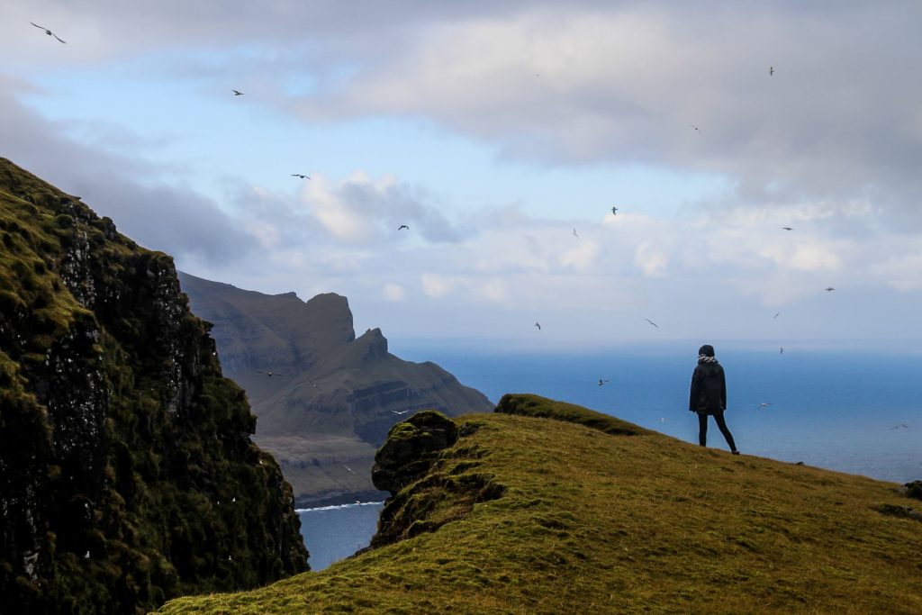
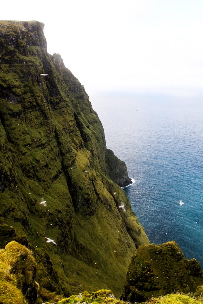
We came past deep gorges packed with birds that lead us up to the summit of the first mountain, Høvdin uttanfyri Eyrgjógv at 502 m. The views were incredible everywhere we looked, and I exclaimed to Lucy that we had just reached one of my favourite mountains on the Faroe Islands! I just love discovering new places in that gorgeous country. We could’ve spent all day just exploring this mountain and its many gorges but we had to move on as fog was rolling in faster than we could hike.


We wanted to take a snack break at the summit, but the incoming fog forced us to start descending. Luckily, the next peak, Antinisfjall, is over 100 meters lower than Høvdin uttanfyri Eyrgjógv, in fact it doesn’t even really look like a mountain, especially with Grímstaðfjall towering above with its 523 metes on the other side.
We reached two more gorges and enjoyed the sound of the screeching birds as we hiked towards Antinisfjall. The fog went by quickly, revealing the summit of the mountain. It was a long descend and only a very short ascend before we reached our second summit, the steep peak of Antinisfjall. One careless moment and we’d be in the ocean!
Although we were really quick at climbing Antinisfjall, we had been so slow at climbing up the first mountain so it was already past 1 PM. Just four hours left till dusk and still four peaks to go!


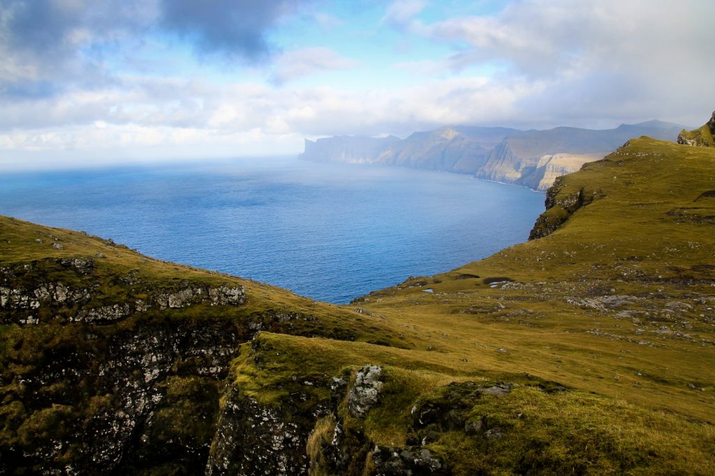
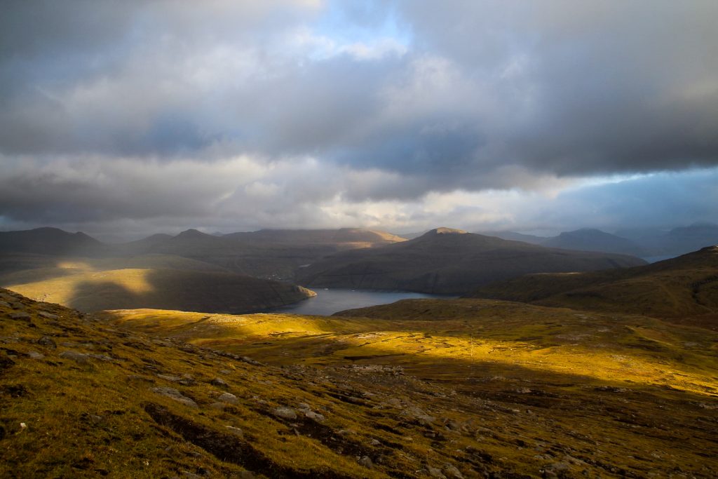
The long descend to Antinisfjall meant an even longer ascend up to our next mountain, Grímstaðfjall at 523 m. The energy that I’d found when hiking up Antinisfjall was gone, making it a long and tough ascend. But we got up there in record time, somehow! The summit awarded us with incredible cliff views towards the gorges of Høvdin uttanfyri Eyrgjógv, and with a view of a few of the buildings in the abandoned village of Slættanes, far away in the distance towards Streymoy.
Better yet, as we turned around and looked towards Fjallavatn, the sun won its battle with the dark clouds, beaming on our cold faces.


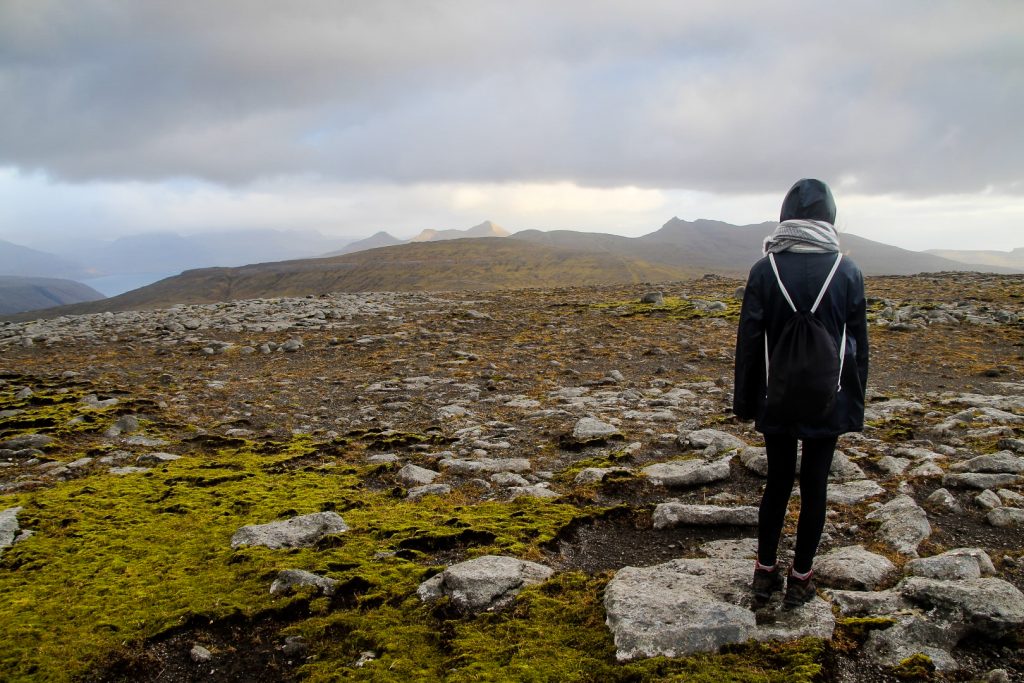
A blue sky suddenly emerged, but with it came strong winds that blew us towards our next mountain, Jatnagarðar at 563 m. The summit looked so far away from where we stood, and it was obvious that we’d have to do quite a bit of descending and ascending to reach it. We were expecting a tough climb.
But we were pleasantly surprised. The descend was shorter than we’d feared and the ascend was nice and gradual. We could even walk our normal speed without huffing and puffing. While Høvdin uttanfyri Eyrgjógv was my favourite mountain on this trip for its views, Jatnagarðar was Lucy’s favourite for its unexpected lack of challenge!
Passing the cairns that make up the trail between Gásadalur and Slættanes once again, we suddenly spotted four white hares running towards the summit. We followed them until we couldn’t see them any more (if only we’d had the speed of a couple of hares!) and we found our way to the summit, reaching it 50 minutes after leaving the last summit. Not bad considering they are two kilometers apart!


The easy ascend up Jatnagarðar gave us renewed energy and a belief that we could complete our six peaks before sunset!
And with the next peak, Tungufelli at 591 m., only being about 700 meters away, we were closer than ever to our goal. Climbing this peak required almost no descending and only very little ascending, so Tungufelli has to be the easiest mountain of the day despite it being the highest!
Looking down the valley in front of us, we spotted the next mountain which looked even more like a hill than Antinisfjall. But it actually felt more like a mountain climb than the two previous peaks since we had to descend for over a kilometer before finally starting the ascend.
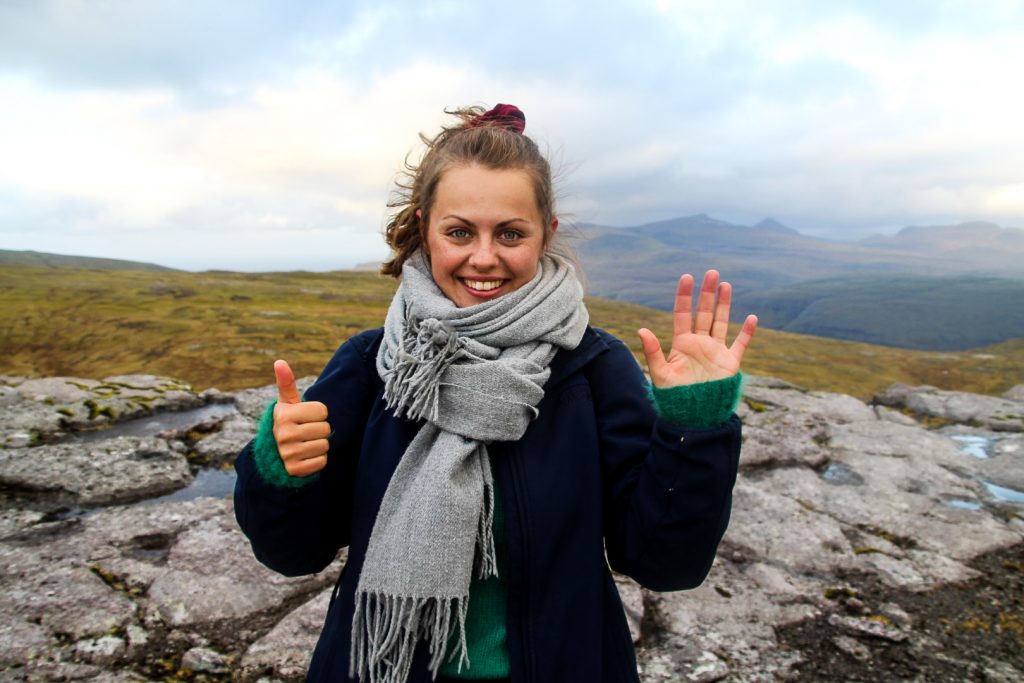
We met the trail between Slættanes and Sandavágur which continues up Krossafelli and beyond. By now, our legs were tired so we were basically dragging them up the mountain. But we made it in the end. We reached the summit of Tungufellið Lítla at 443 m., the sixth mountain of the day, beating our personal records! It will be a long time until I can attempt to beat the new record!
We reached our sixth and last summit at 3.30 PM, just an hour before sunset. It was in much better time than we’d feared, as we’d imagined descending back to the car in the dark.
We did end up hiking some of the last section in the dark though as it was long and quite challenging with steep descends, taking us almost two hours to complete. Thankfully, we didn’t have to cross any rivers as we made sure to hike above them and first descend back to the trail to Vatnsoyrar when they were safely behind us!
We were exhausted when we finally reached the car, with 26 km and very sore legs in the baggage, but it had been an incredible day full of gorgeous views, typical Faroese weather and lots of girl talk!

Hiking route description: Høvdin uttanfyri Eyrgjógv, Antinisfjall, Grímstaðfjall, Jatnagarðar, Tungufelli and Tungufellið Lítla
The hike begins and ends 2 km beyond the village of Vatnsoyrar. Follow the main road through the village and continue out of the village for as far as possible until the road begins to deteriorate. You’ll find a small parking area to your right.
The trail is straight ahead. Follow it to the edge of the lake where you’ll have to cross the first of two rivers. Both are quite tricky to cross so it might be a good idea to remove your boots and socks and just wade over. As you approach the lake, the trail runs along the right side of it, mostly along stony beaches. At the end of the lake, you will have to cross the second river.
The trail ends just beyond the river. Cross two fences and continue for two kilometers through the wetland area Norð á Munna towards the ocean. Follow the river Reipsá out to the ocean where you’ll find the view of the black sand beach to your left.
To your right is the first of six mountains, Høvdin uttanfyri Eyrgjógv. The ascend is steep, but just find a good spot and start climbing up. The first part is grassy, but afterwards it requires some scrambling. Once you’re over the worst part with rocks, it’s a gradual ascend past some beautiful gorges to the summit.
The next mountain, Antinisfjall, is the tiny peak below you, about one kilometer to the right. It takes quite a bit of descending and just a little bit of ascending to get to. The third mountain is Grímstaðfjall, a kilometer to your right, which is quite a tough ascend as you have to climb up the 100 meters you just descended plus 120 meters more. When you get to the summit, look to your right and you should be able to spot some of the houses that make up the abandoned village of Slættanes.
For the next mountain summit, leave the coast and head inland. Jatnagarðar is about two kilometers away and is an easy hike with some descending and gradual ascending. You will pass by cairns from the Gásadalur-Slættanes trail, ignore these and continue upwards to the summit. The next peak, Tungufelli, is straight ahead, about 700 metes away. It only takes a bit of descending and ascending to reach the summit.
The sixth and last mountain of the day can be a little tricky to find as it’s a lot lower than the surrounding mountains. Tungufellið Lítla looks more like a hill, but can be spotted in the valley below Krossafelli. You will have to descend quite a bit down to the valley, meeting the trail from Slættanes to Sandavágur on the way, before ascending up the small mountain. This section isn’t tough as there are no steep parts, but it is quite long.
For the descend, aim for the edge of Fjallavatn or further along towards the trailhead. Make sure to hike above the rivers so you won’t have to cross them again. Rejoin the trail when you can and hike back to the car.
The hike is ca. 20-26 km (depending on river detours), takes 8-9 hours and is of moderate difficulty.
Leave a Comment
Pingback: To Eysturtindur and beyond: Scaling four peaks on northwestern Vágar – Northtrotter on 08/01/2021

3 COMMENTS
Mansour Bozorgmehr
3 years agoHi Melis. Sometime one of my friends told me that the nation of Denmark is a nation of hiking. I did not understand what he meant then, but since I knew you, I have understood what my friend meant. 😀👍
Melissa Cherry Villumsen
3 years agoHehe, I think that’s very true! Many Danish people love hiking even though we don’t have mountains 😀