It has long been a goal of mine to climb all 340 mountains in the Faroe Islands. In October 2020, I spent a month on the island of Vágar trying to summit all of its 41 peaks. I “only” managed to climb 35 of them, so for my 2021 visit to the Faroes, I based myself on Vágar again to finish the mission. Four of the peaks were easily reached within one glorious day of hiking, but the last two remaining had proven to be a real challenge. I had, in fact, already attempted to climb them and had failed miserably. But this time, I teamed up with Lucie who has a much better sense of what is possible and what isn’t than me, and I had a feeling we’d make it this time!
The last two remaining mountains were Heinanøva at 612 m. and Árnafjall at 722 m., the latter of which is the highest on the island. It was eating me up inside that I’d climbed so many of Vágar’s mountains – and they aren’t all easy, either – but had given up on reaching the summit of the highest mountain. That had to change. I was determined to finally cross Heinanøva and Árnafjall off the list, and move onto a new island with fresh mountains to conquer!
I was quite exhausted after some long days of hiking, but it’s difficult for me to have a rest day on the Faroe Islands when there’s so much I want to see – unless it’s raining cats and dogs of course! When Lucie suggested we try to climb these last two mountains on a cloudy yet dry afternoon, I couldn’t resist. Hiking with her is so much fun, and I was starting to fear I’d have to leave the Faroe Islands once again without conquering Heinanøva and Árnafjall.
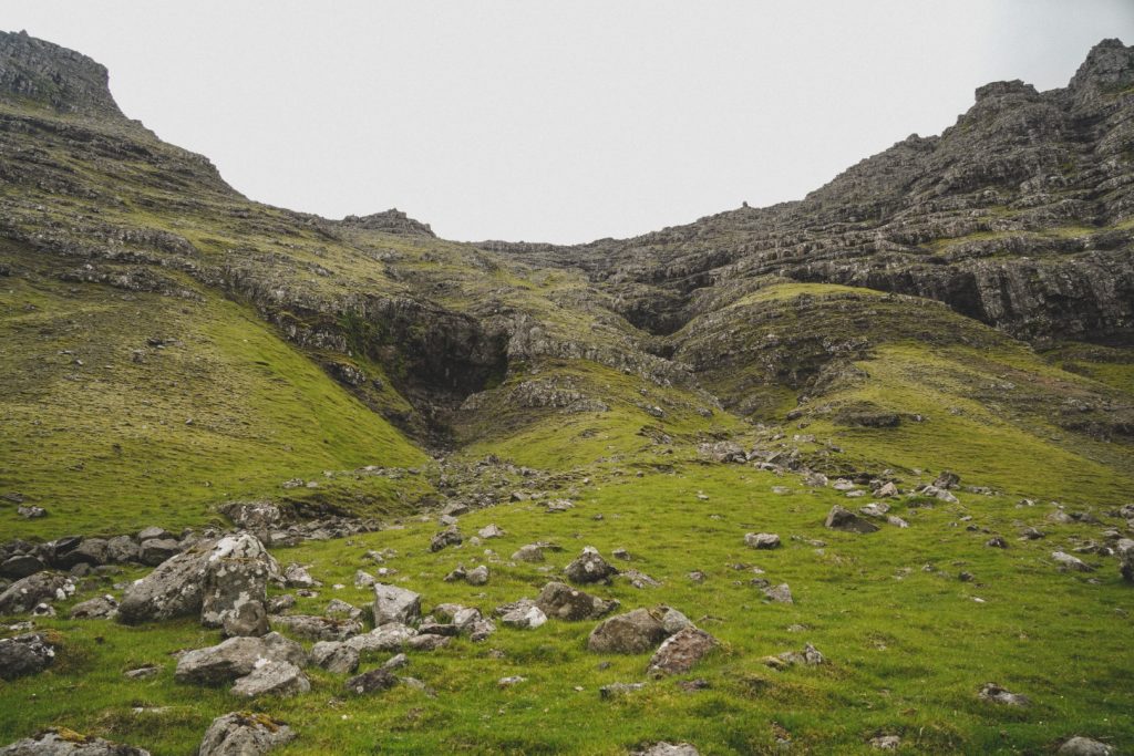
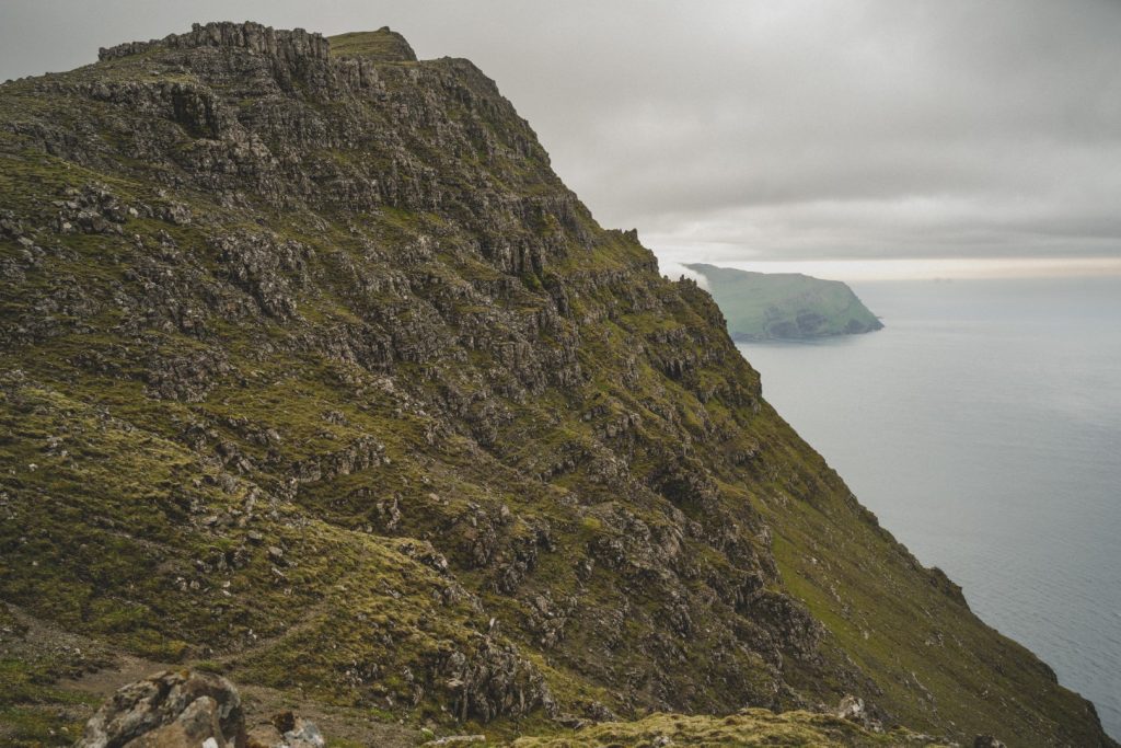
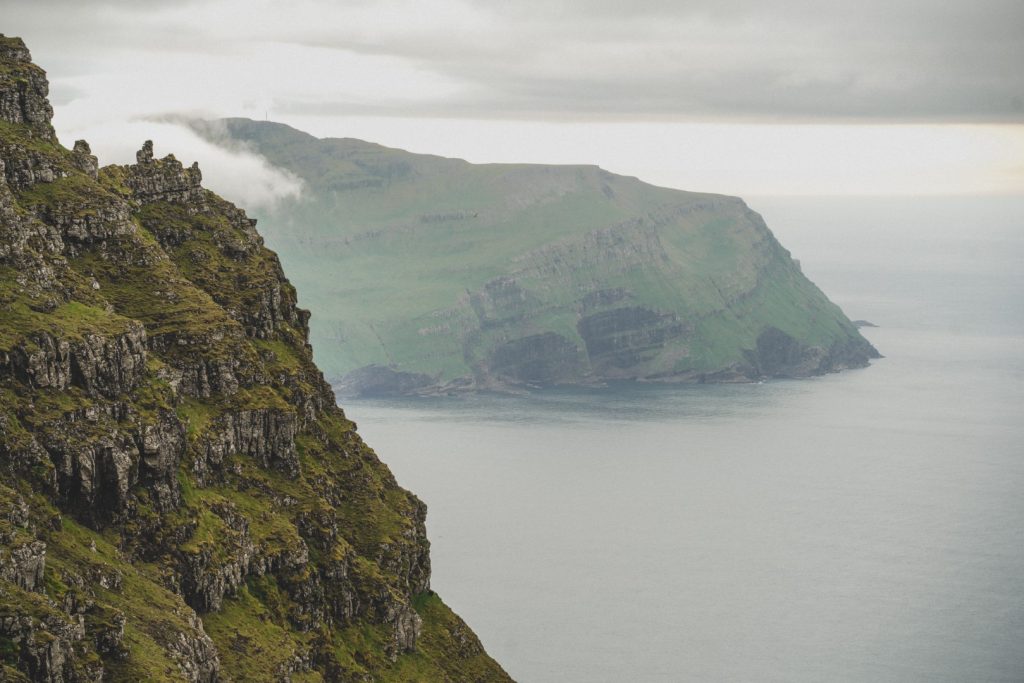
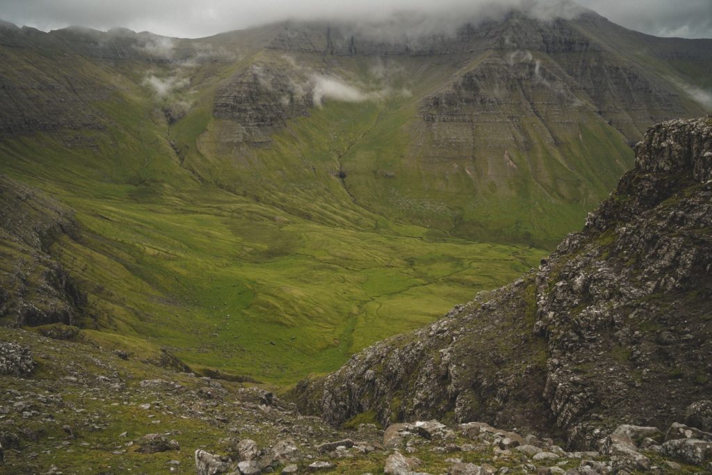
We hitchhiked from Tórshavn and spent the next four hours scrambling our way up the mountains. The first section of the hike out to the mountains is nice and easy, through the valley behind Gásadalur with beautiful views of the village and islets in the distance. But as soon as we reached the base of the mountains, the scrambling began. I recognized the route I’d mistakenly taken nine months earlier straight away, but couldn’t see where else it would be possible to go up. Lucie suggested going up just left of my previous route, so we tried it although I was sceptical as it was steep and there were many loose rocks. It wasn’t long until we met a local family coming down from the mountain the same way we were going up, and that’s when we knew for sure that we were going the right way! A few of them were in sneakers which just proves to me that Faroese people are a lot tougher than the rest of us!
The route Lucie had chosen turned out to be much easier than the one I’d mistakenly thought was the correct way. It did involve quite a bit of scrambling, but it was less steep and much safer. It just didn’t look like it from below!
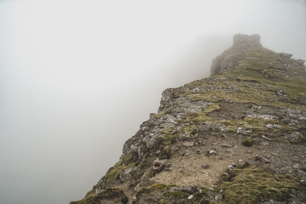
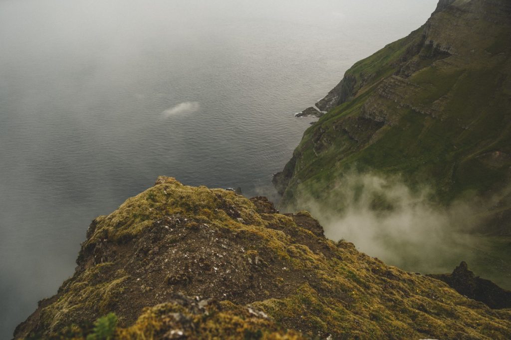
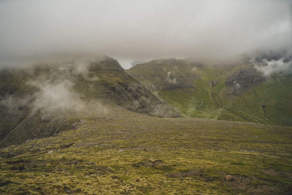
Once we got past the steep part of the mountain slope, we reached the pass between the two peaks and the rest of the hike was a piece of cake. Fog had swallowed up Heinanøva so we started with Árnafjall, hoping to make it to the summit before it too was engulfed in fog. It was a gradual ascent towards the peak, but despite hiking quite fast, the fog made it up there before us.
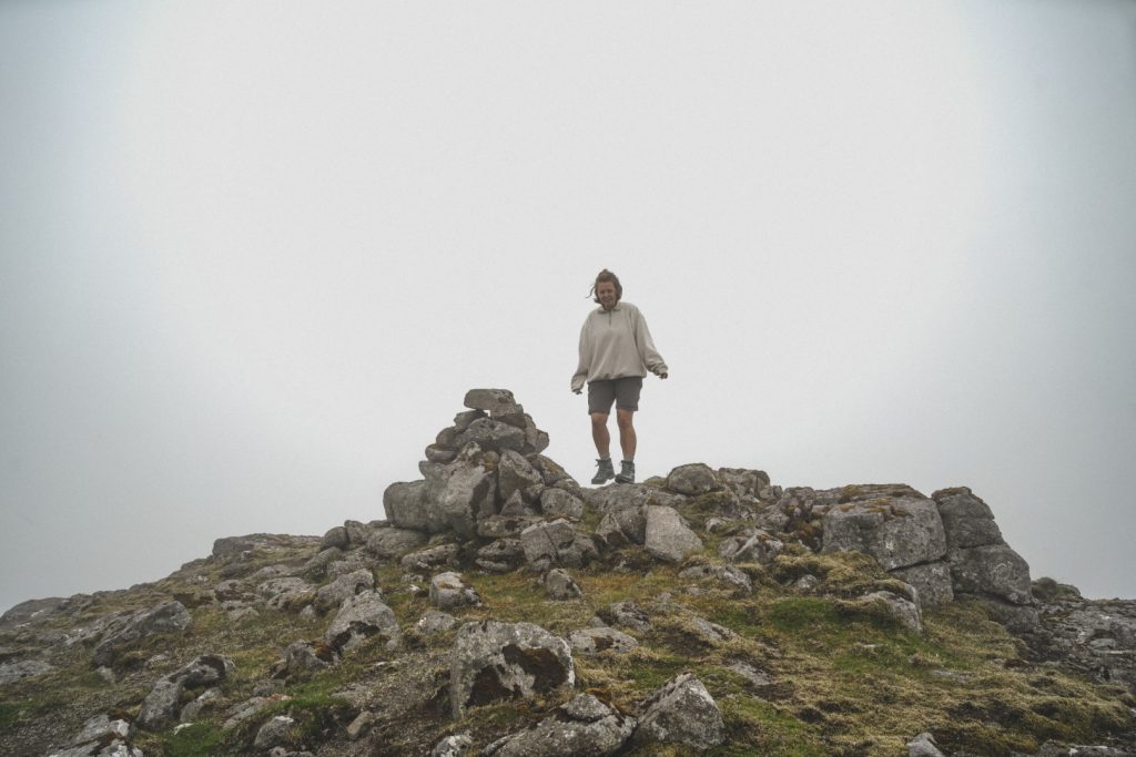
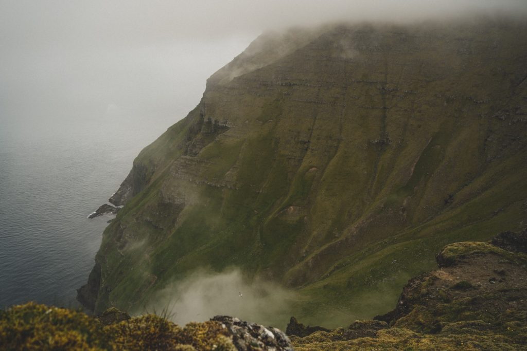
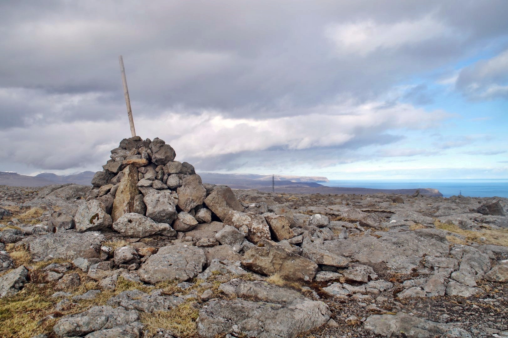
Two hours after we’d set off from Gásadalur, we were standing at the very top of Vágar after a much easier climb than we’d feared. Unfortunately, we couldn’t see anything except the summit cairn assuring us that we had, in fact, reached the summit, but I know the view would’ve been amazing had the fog lifted. I’d seen the mountain from the other side on my hike to Víkar, and it’s all vertical cliffs with a dramatically long drop! With this knowledge, I knew exactly when to stop even though I could see hardly anything in the thick fog.
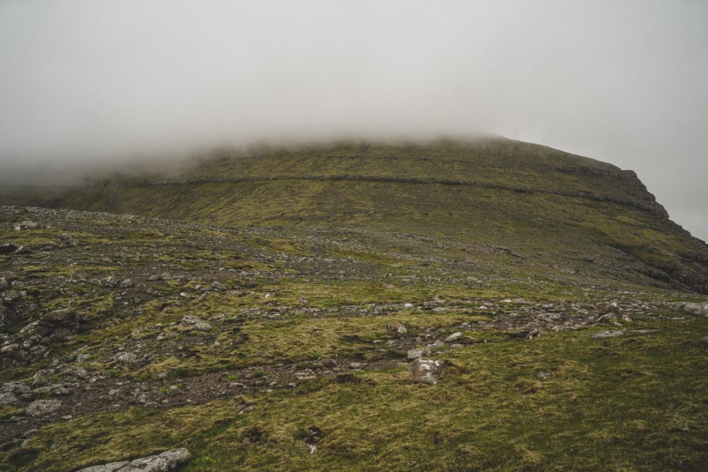
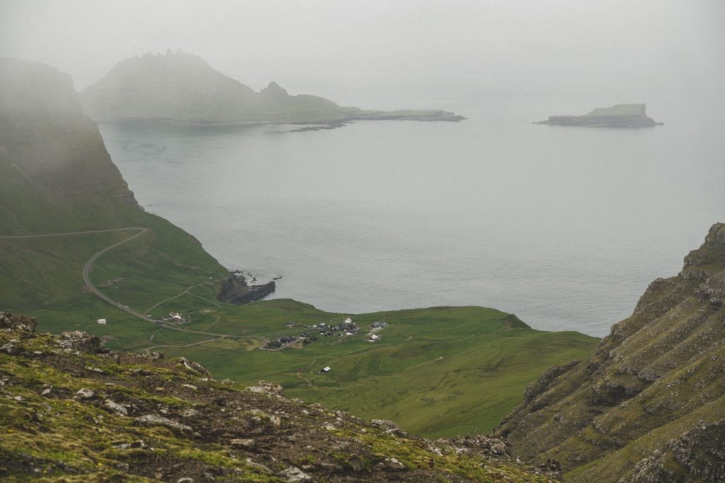
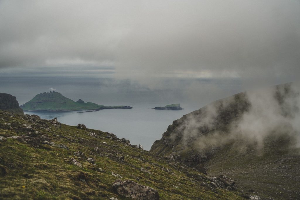
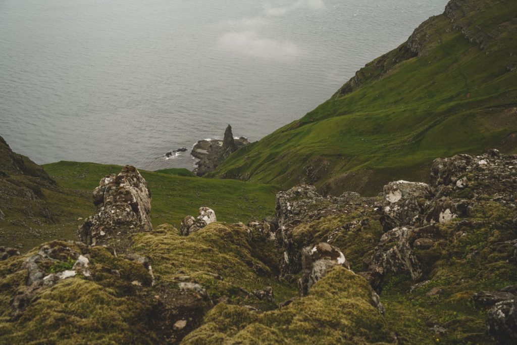
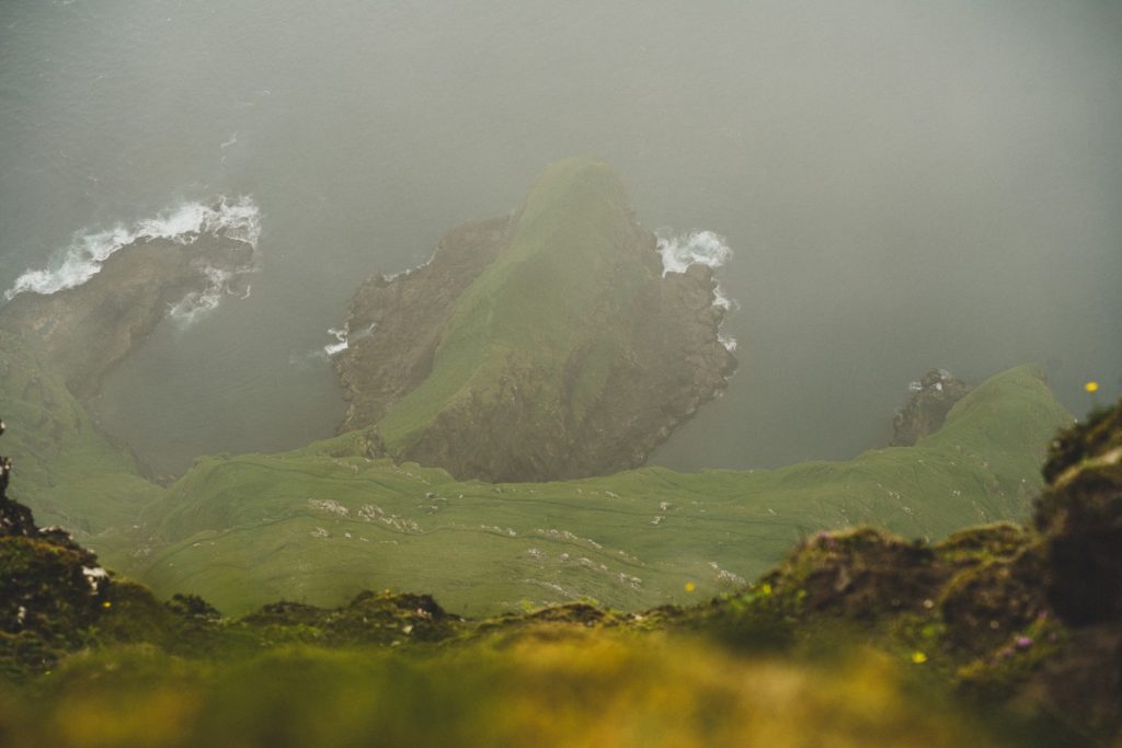
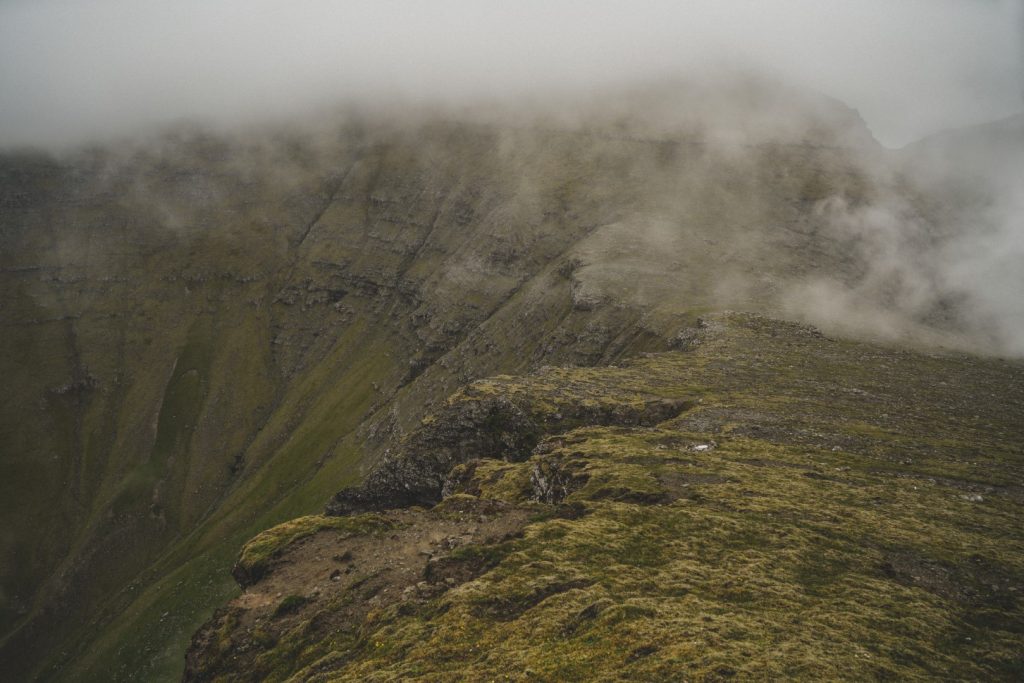
Leaving the fog behind, we started the easy descent down Árnafjall and the subsequent easy ascent up Heinanøva which was now almost free from fog. We enjoyed the incredible views of Heinanøva’s slopes and the Sæurðardrangur headland below. Looking back at Árnafjall, the entire mountain had now been covered in thick fog and it looked impossible to climb. Our timing had been impeccable!
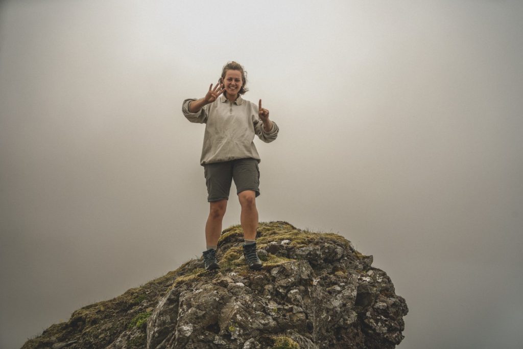
Just fifty minutes after leaving Árnafjall’s summit behind, we reached the peak of Heinanøva, completing my mission of climbing all 41 mountains on Vágar! I can’t describe how incredible it felt to reach the last peak – and how motivated I now feel to take on the next Faroese island!
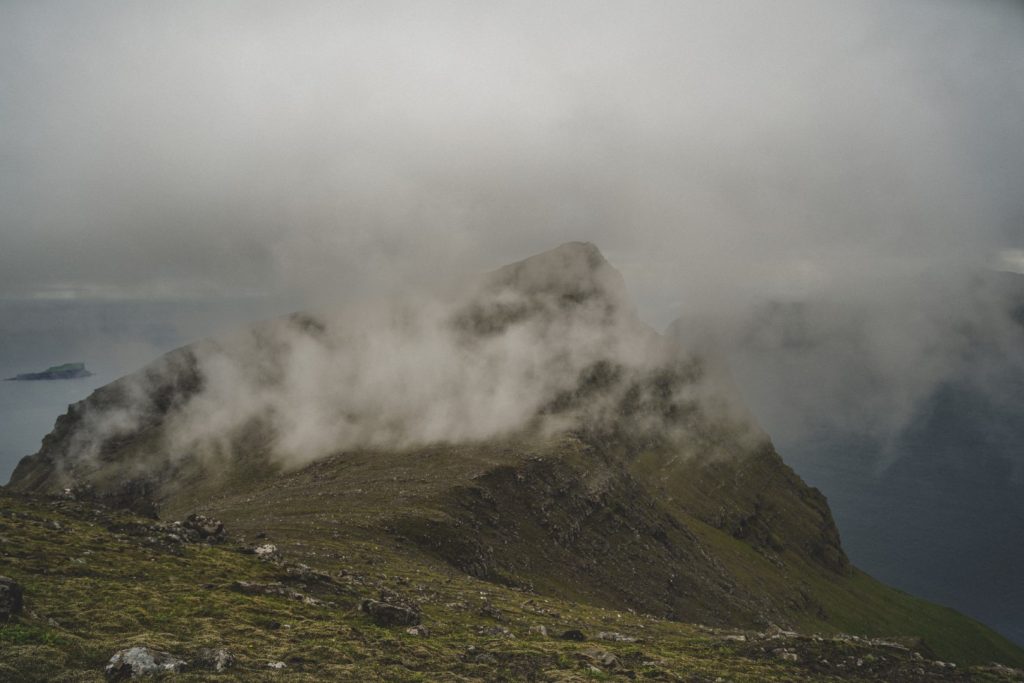
Fog was starting to roll in again, so after a few quick summit shots, it was time to head back down. We followed the same route and took it easy so we wouldn’t slip on the loose rocks. It only took us another 1,5 hours to get back down and reach our starting point in Gásadalur.
What we’d imagined would take all evening, turned out to be merely a four-hour hike that secured my goal! I finally climbed the last two of Vágar’s mountains and can now say that I truly know this island inside out! Mission complete!
Hiking route description: Climbing Árnafjall and Heinanøva
The hike begins in the village of Gásadalur at the end of Gerðisvegur. Follow the dirt track to two gates that you have to open to enter the valley where the dirt track begins. Follow the dirt track which is marked with cairns for a few hundred metres and then turn left towards the mountains.
Go to the base of the mountains, in between the two summits. Do not hike up in the middle where the grassy part is as this gets very steep and dangerous later on, instead go up just to the left of that. It’s a bit of a scramble and there are many loose rocks, so do take care. The climb to the mountain pass isn’t long and once you reach it, the rest of the hike is easy.
You’ll have the summit of Árnafjall to your right and Heinanøva to your left. Choose which one to begin with depending on the current weather conditions, and then just start hiking up. The ascents up both peaks are very easy, and both summits are marked by cairns so you really can’t go wrong. Take extra care at the summit of Árnafjall as the other side of the mountain is treacherously steep and one wrong step can be fatal!
Follow the same route to get back down, but be careful when you get to the steep part. Take it slow and don’t take any chances.
The hike is 6 km long, takes 4-5 hours and is moderate to hard. It involves some scrambling, but it’s really only the first part that’s a challenge.
DO NOT attempt this hike in fog or bad weather. Fog is the greatest danger when hiking in the Faroe Islands, and if you don’t know your way around the mountains and are without a local guide, you could get injured badly. Árnafjall is no joke in fog! Click here to book a hike with a local guide.
Leave a Comment
Pingback: My 10-year Faroeversary: Turning my passion for the Faroes into a research journey – Northtrotter on 21/07/2022

1 COMMENT