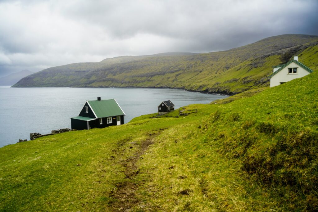
Back in January, less than a week into my postgraduate studies at the University of Aberdeen, a great idea for my dissertation popped into my head. Granted, it wasn’t actually new, I’d been toying with this idea for a few years now after a special hike in Norway with my bestie back in 2021, but now I’d decided to go for it. I set up a meeting with my potential supervisor, and she was all for it! So, for my Master’s dissertation, I’m writing about eight villages on the Faroe Islands that were abandoned between the 18th and 20th centuries – a subject that has been overlooked for too long. I’ve been interested in these villages for a very long time, which this blog bears witness to (I first wrote about a hike to one of the abandoned villages back in 2015). To be able to combine my interests in archaeology, abandoned places and the Faroe Islands for my dissertation felt unreal! This would also be my first ever independent research project, which was really really exciting and a little nervewracking!
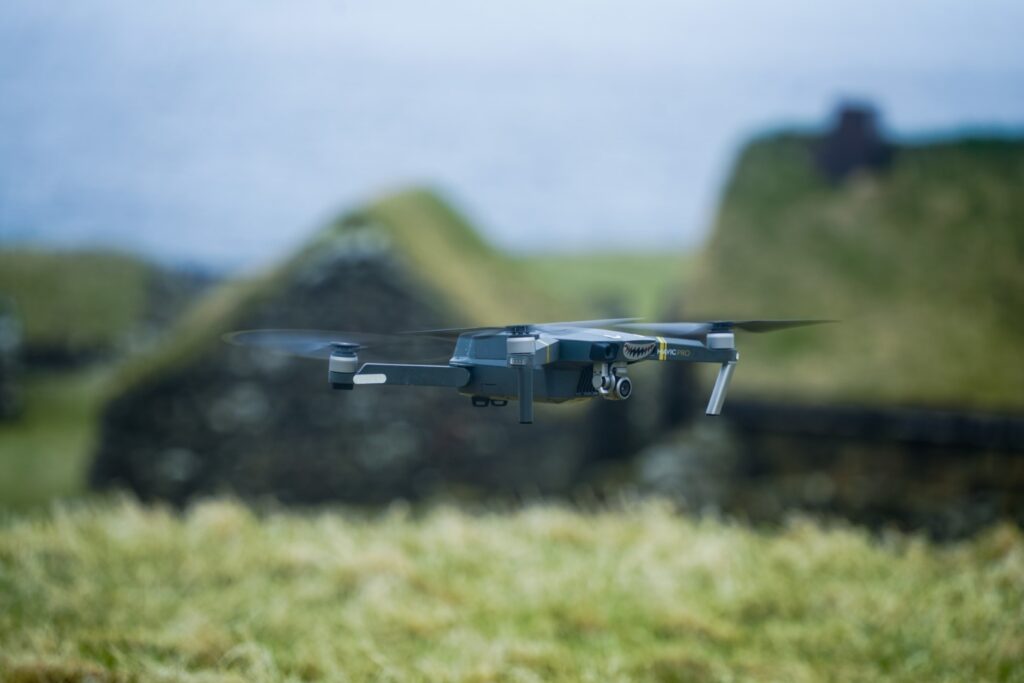
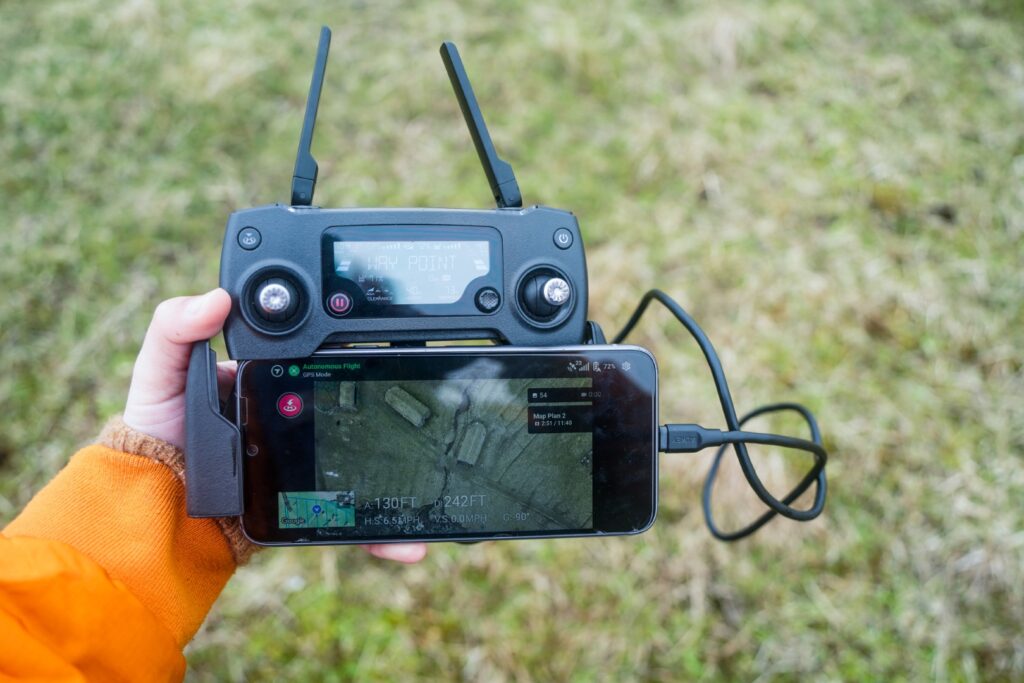
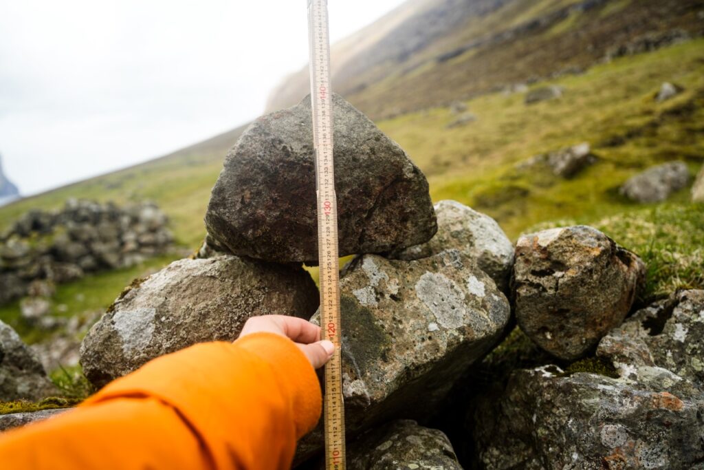
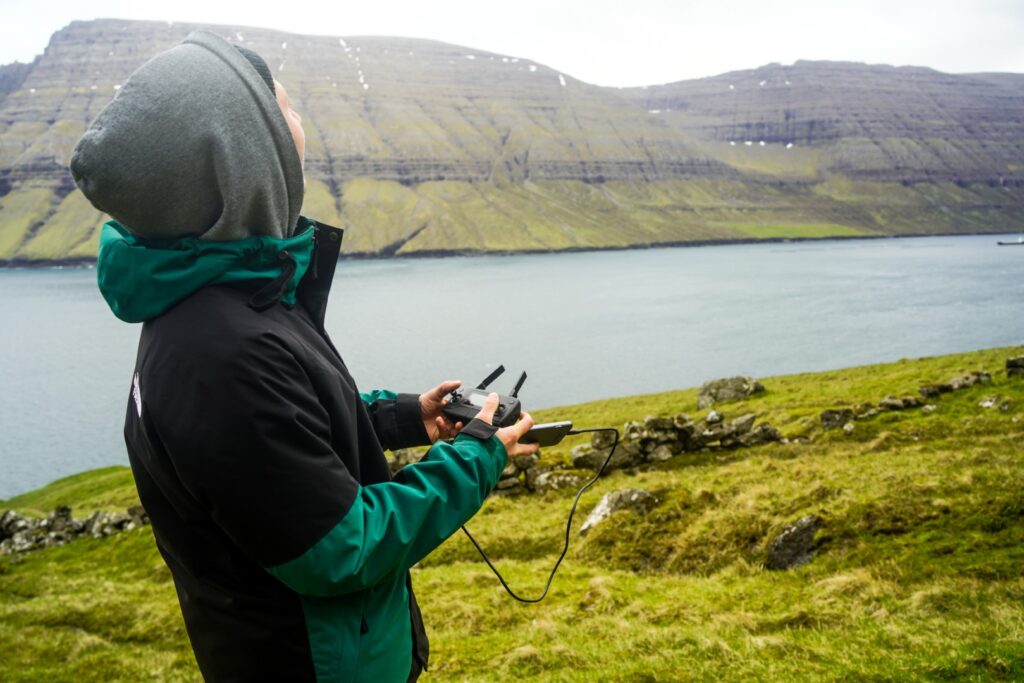
I quickly decided I’d spend the entire month of May conducting my research. I’d hike to each village, do surveys and measurements, photograph each structure and create 3D models with a drone I borrowed from the university. I had lots of planning to do before my trip, such as learning how to fly the drone, getting permission from the National Museum of the Faroe Islands, contacting landowners to get permission to work and camp on their land, writing posts on local Facebook groups to get information about the villages, planning my research, etc.
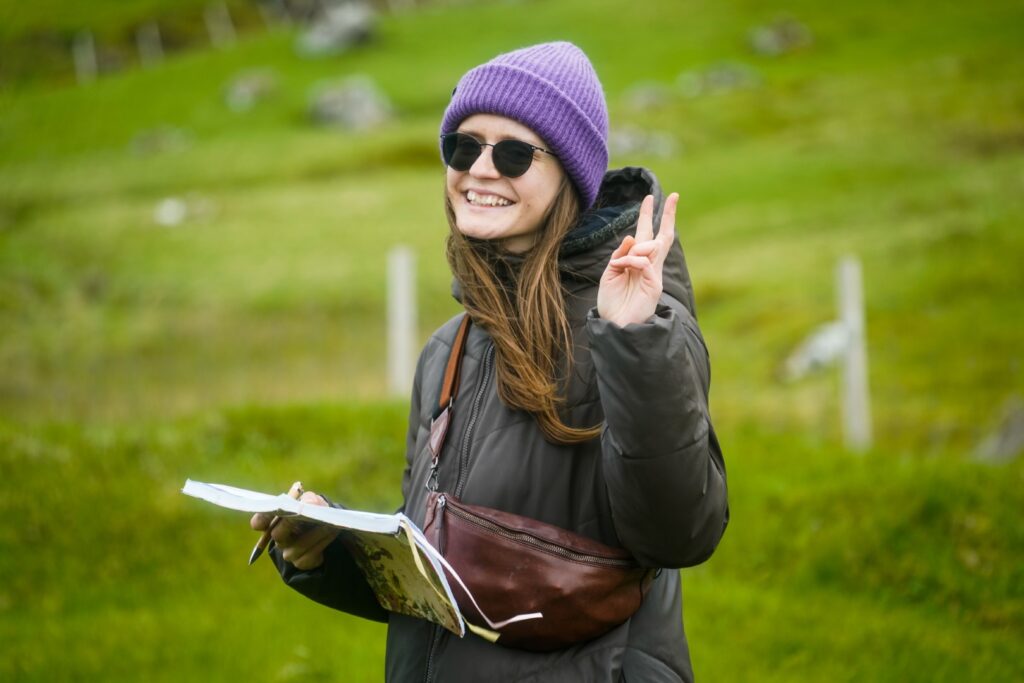
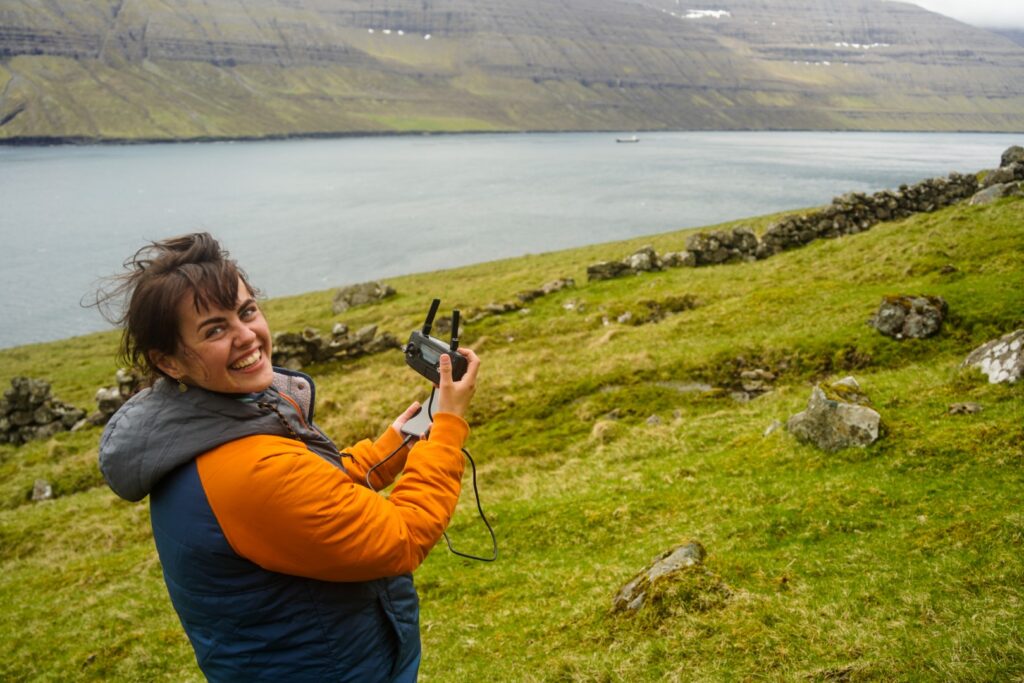
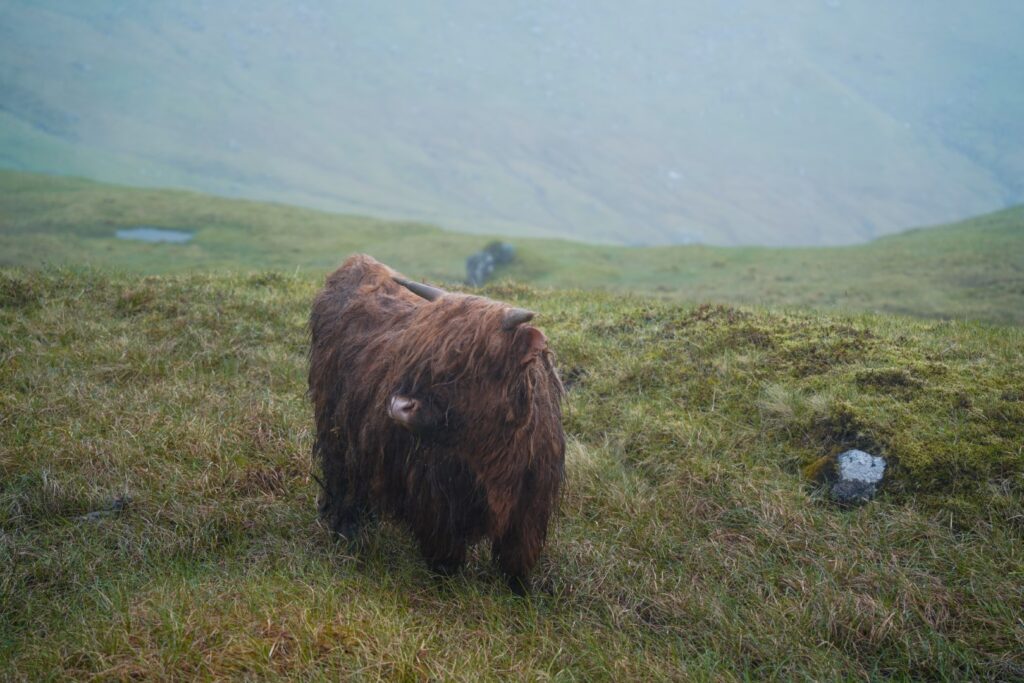
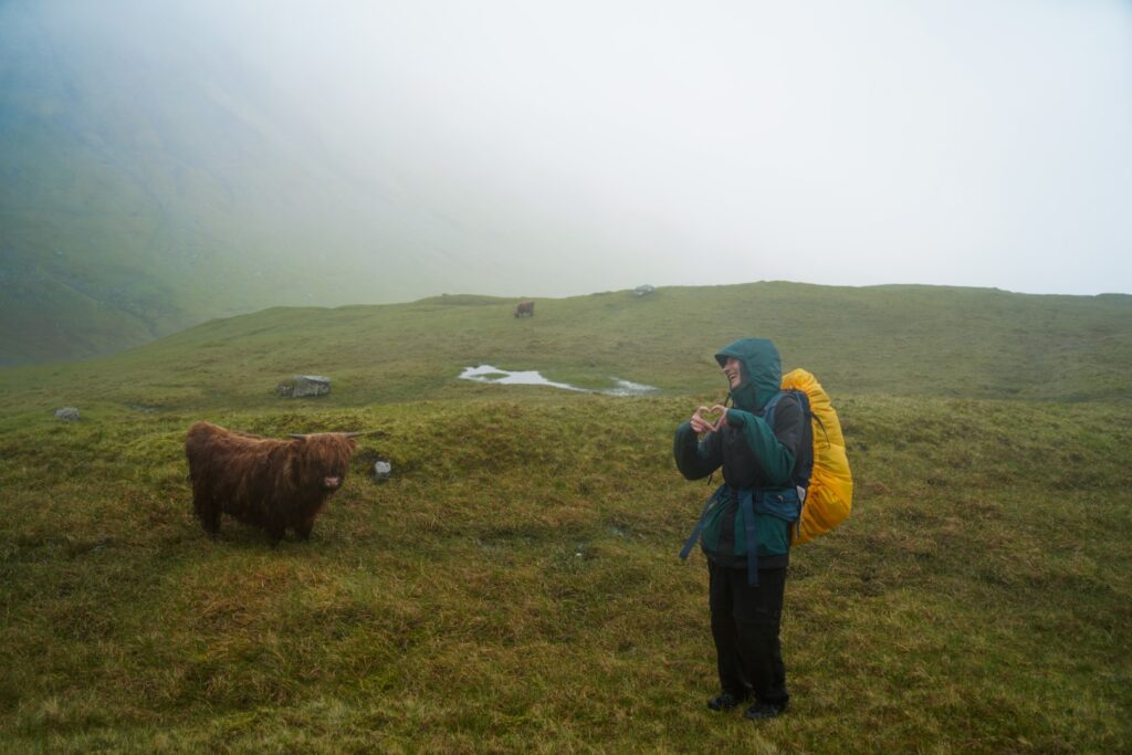
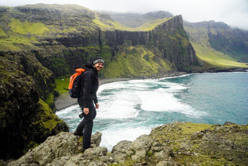
Because I’m a student and had to cover all costs myself, I decided to try to do it as cheaply as possible. I mainly hitchhiked around, ate from supermarkets and I actually managed to not pay a single dime for accommodation for the whole month by staying with friends, camping and helping out at my favourite hostel in return for free stays. It was a fun time, and I was lucky to meet some great people who joined me for some of the hikes. Below is a run-through of my month of research on the Faroe Islands and all the adventures and challenges I went through!
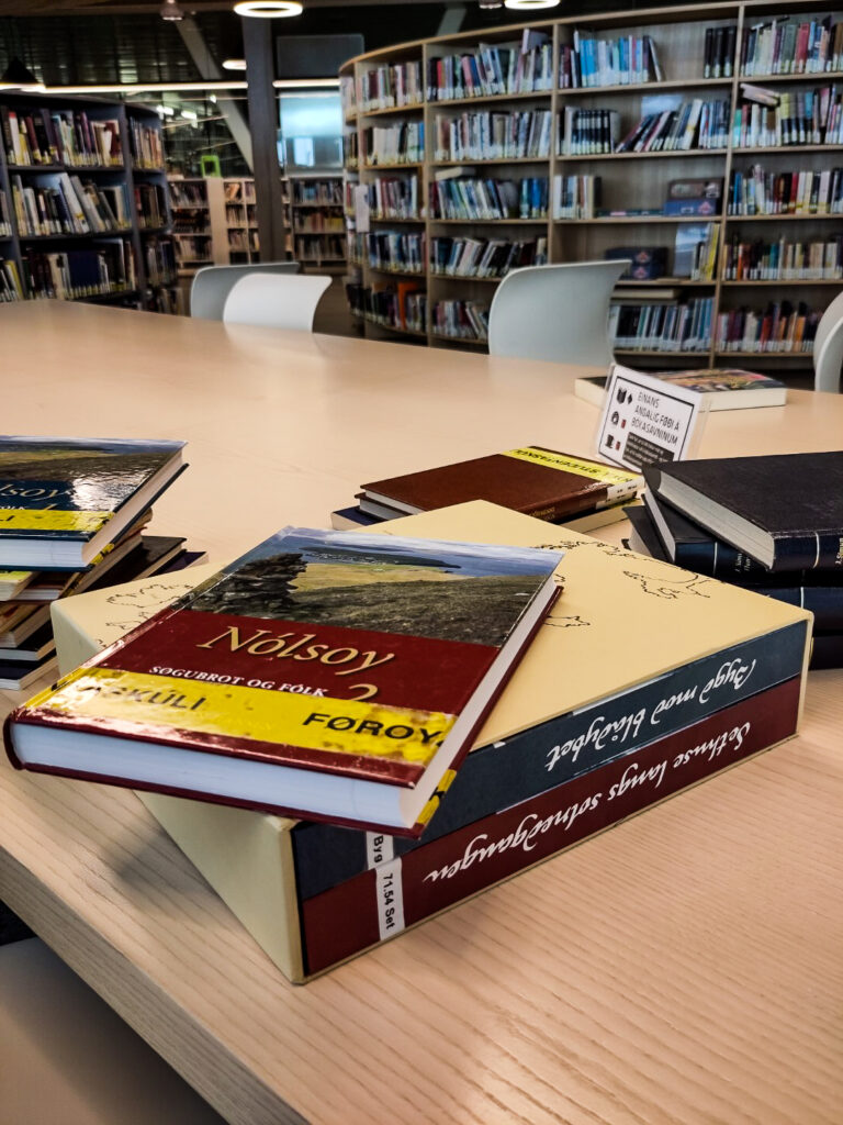
Searching up literature in Tórshavn
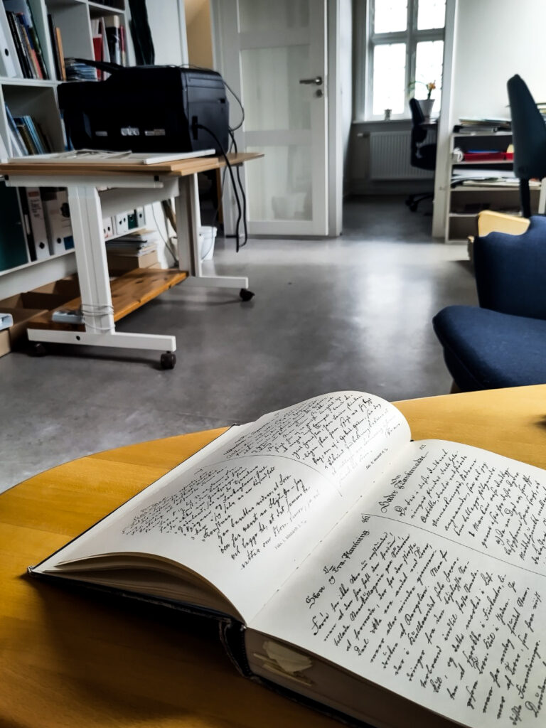
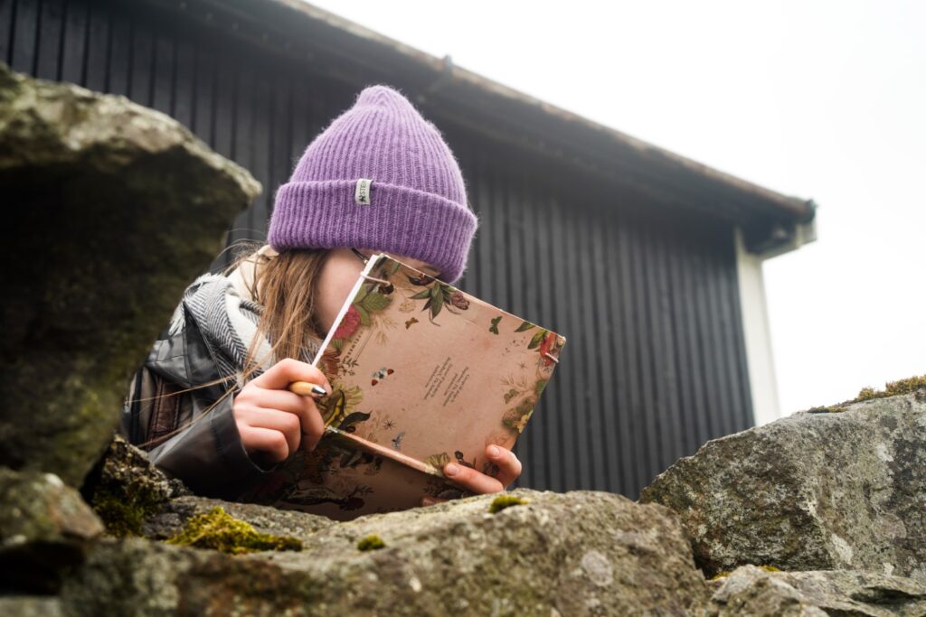
In order to answer my research questions, it will be necessary to go through all available literature on the eight sites, most of which is in Faroese and only available on the Faroe Islands. Therefore, I spent the first three days of my trip in Tórshavn going through books in two libraries and at the National Museum. I took pictures of all relevant pages so I can read them at a later time as there was not enough time while I was there, especially since Faroese is not a language that I master. I am able to read Faroese, albeit slowly and with the help of a dictionary!
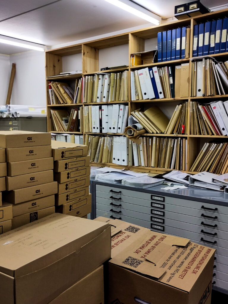
Unfortunately, I was not allowed to go through the archives at the National Museum, but I did get a little tour and I was sent all the documents they have on the eight sites.
I also spent a few hours with a local whose grandfather was born in Skarð, one of the abandoned villages. He had lots of material to share with me and has since sent me several pictures of artefacts and furniture from the village! This was exactly what I hoped to get out of the Facebook posts, but unfortunately, I was only contacted by people with ancestors from Skarð, so the other villages remain somewhat a mystery (but that’s where the literature will hopefully help!).
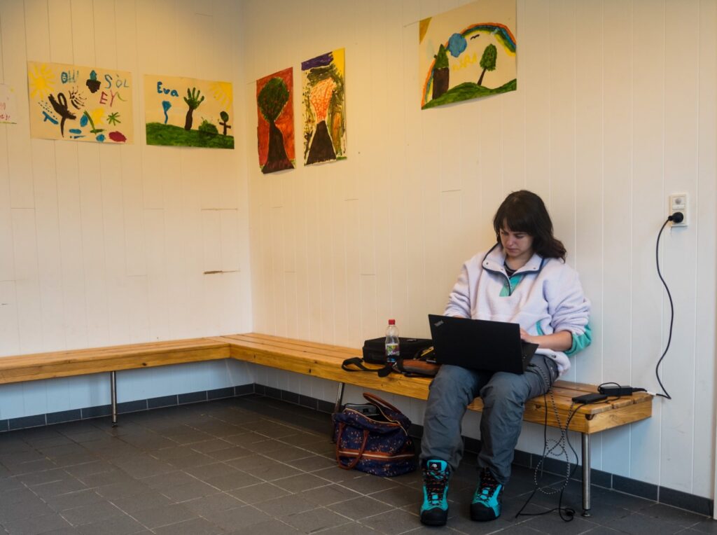
In Tórshavn, I stayed with my friend Lucie and spent the evenings hanging out with her and working on my laptop at the cozy café where she works!
Koltur
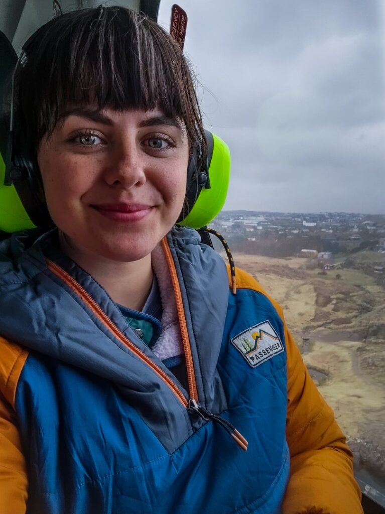
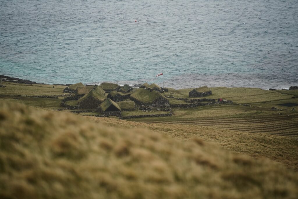
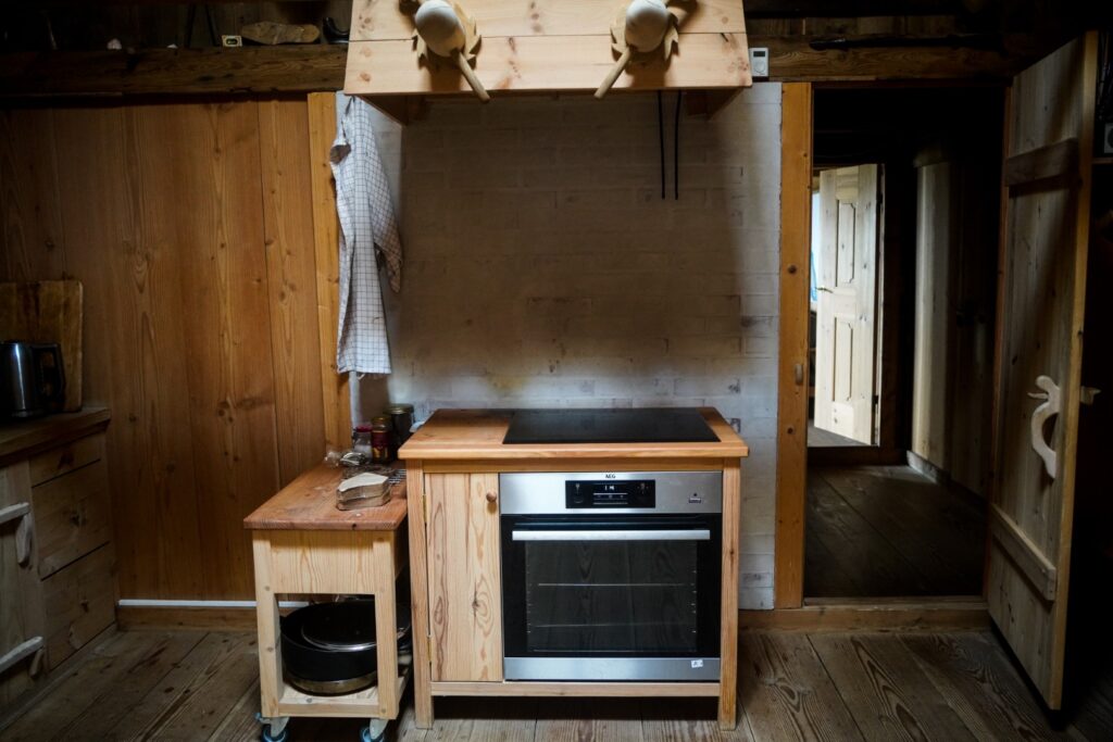
The first abandoned village that I visited was that on Koltur, a small island with just two semi-permanent inhabitants left. I arrived by helicopter and planned to spend two nights camping on the island, but instead, I was offered to stay in “the scientists’ house” right in the middle of the restored part of the abandoned village, which was really cozy!
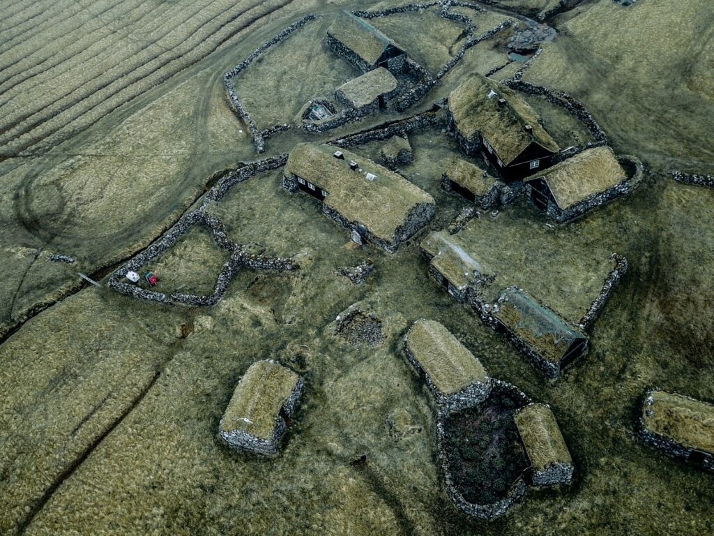
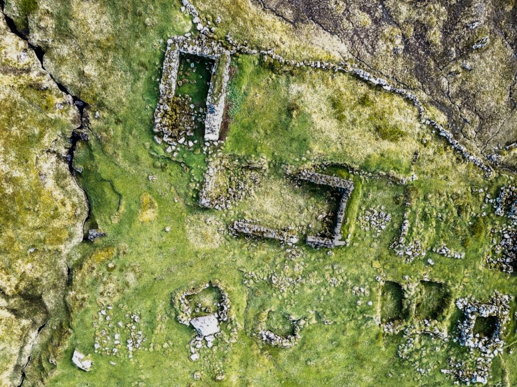
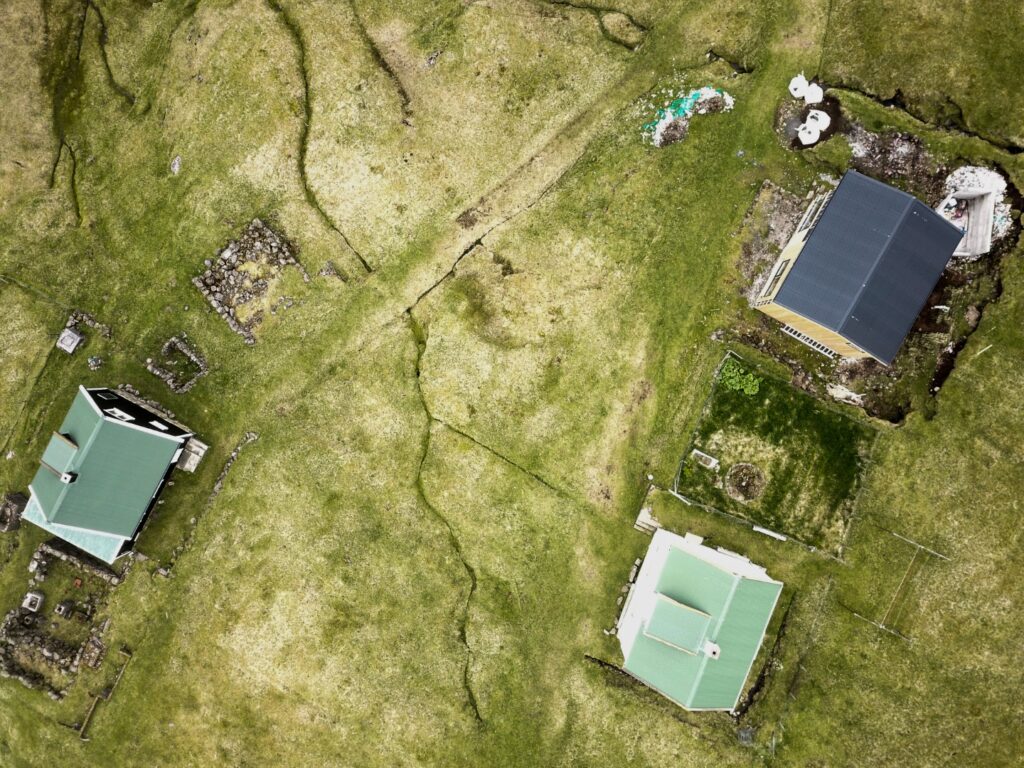
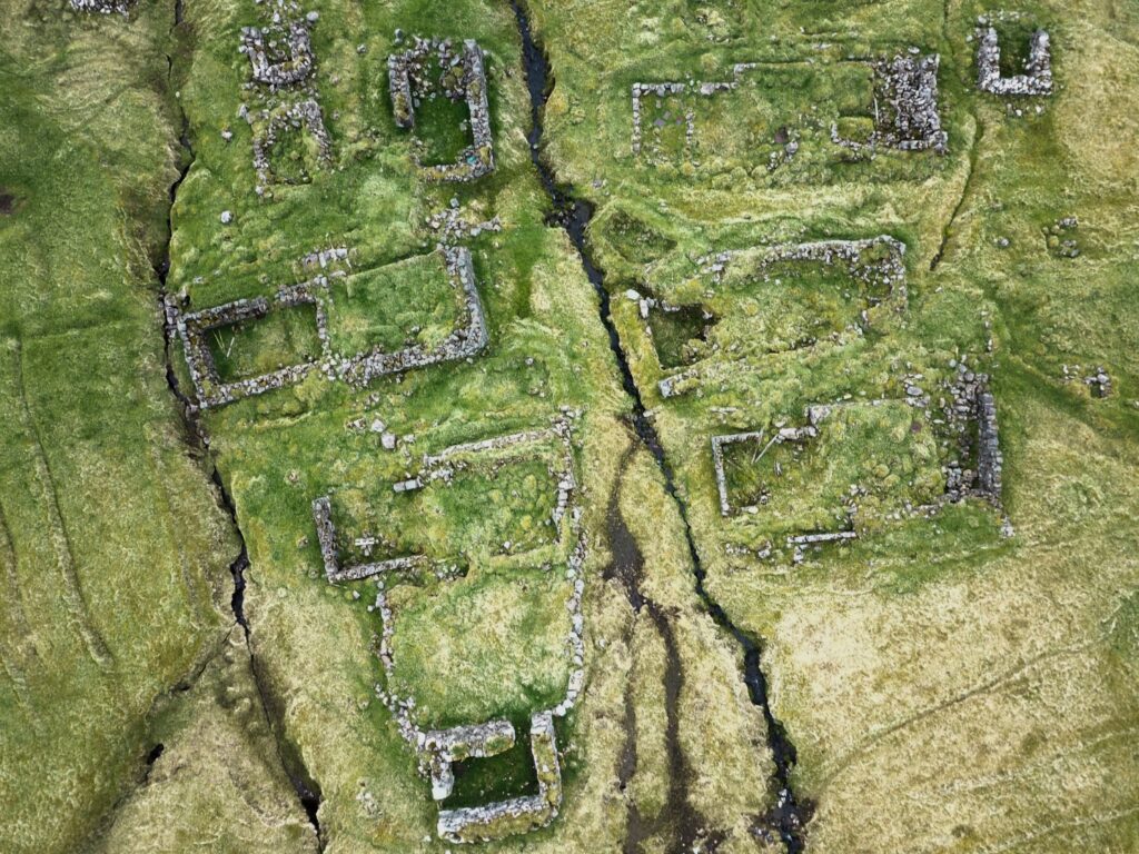
Koltur consists of two bylingur (‘neighbourhoods’) that were abandoned in the beginning of the 20th century. The northern bylingur, Norðuri í Gerðum, consists mostly of ruins, whereas the southern bylingur, Heimi í Húsi has been restored to its former glory. At Á Gróthustangi in the north, there is a collection of outhouses.
During my two days on the island, I surveyed the two bylingur and the outhouses. Since Heimi í Húsi is restored and is today a museum, I did not look for artefacts, but I did take pictures of each structure. I had a long talk with Bjørn who lives on the island and takes care of the old structures, and he told me all about the restoration process and the many plans for Koltur’s (bright) future. The plan is to turn the island into a national park focusing on both nature and cultural history, which I think is really exciting! At Norðuri í Gerðum, I found several artefacts (including broken glass and a nail), but there was nothing to be found at Á Gróthustangi.
I was really nervous about flying the drone alone for the first time, and unfortunately, it wasn’t smooth sailing. First of all, it was too windy to fly when I got there as well as the following morning, so I had to wait until the late afternoon to fly. Then the drone wouldn’t connect at first, and then once I got it flying, it disconnected mid-flight over Heimi í Húsi. I eventually managed to complete the flights over both bylingur and the outhouses, but when I attempted to fly over a single structure (a sheep shelter) on the southern part of the island, some grass got stuck in a propeller, and the drone would not start again. The drone was also frequently attacked by birds but thankfully, they never got it!
I woke up early on my last morning on Koltur as I still had a few structures to survey and photograph, and I wanted to fly the drone over Heimi í Húsi and Norðuri í Gerðum again to get some closer shots, plus get those shots of the single structure that I hadn’t been able to get the day before. Thankfully, the drone cooperated and seemed to have forgotten about the grass that got stuck the day before!
My helicopter was scheduled for 1 PM so I was in a bit of a rush to get it all done plus packing and cleaning up the house, but I managed to do it all with half an hour to spare. However, I needn’t have rushed as the helicopter was cancelled due to thick fog. Luckily, Bjørn’s wife had to return to the mainland so she called for a friend to pick us up on a boat which came some hours later. If not, I would’ve been stuck on Koltur until the next helicopter three days later (not that I would’ve minded much, and if I didn’t have other sites to visit, I definitely would’ve stayed there!).
Nólsoy
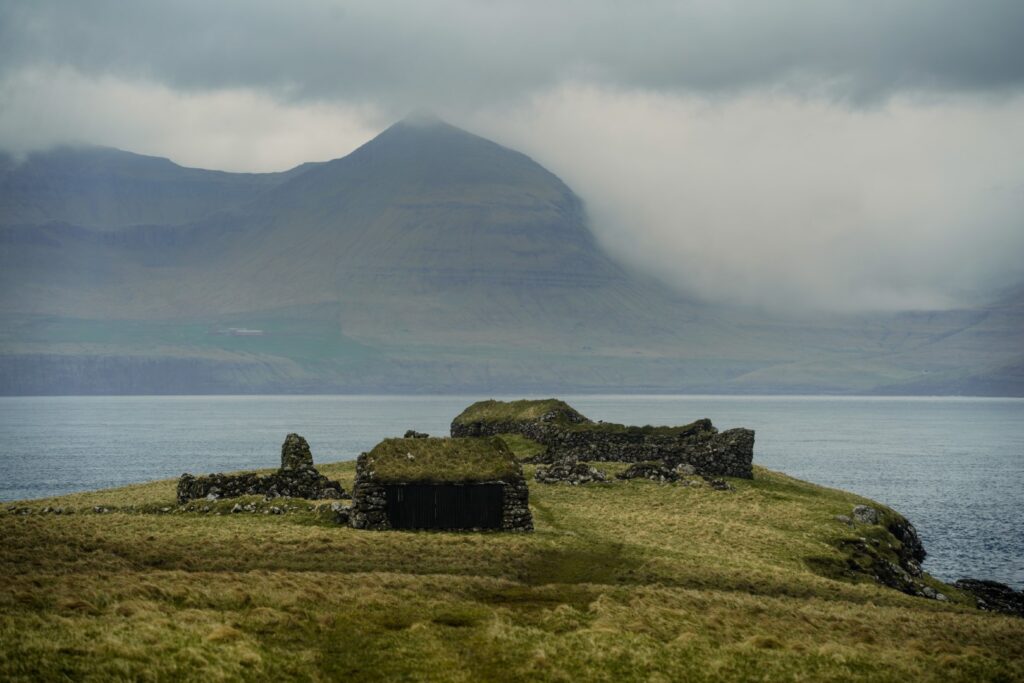
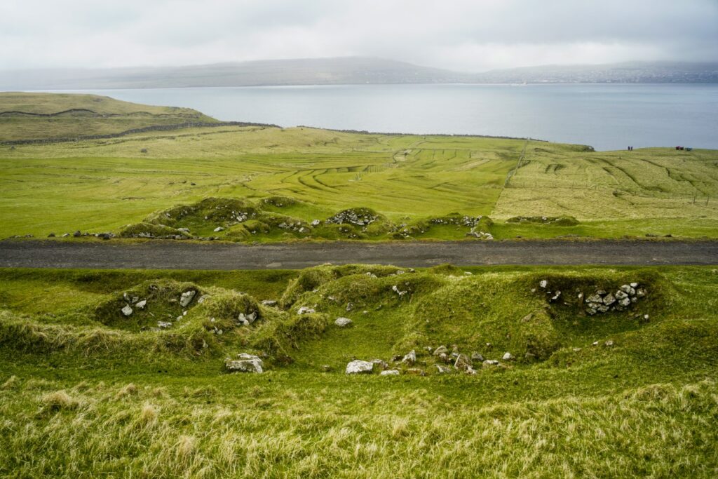
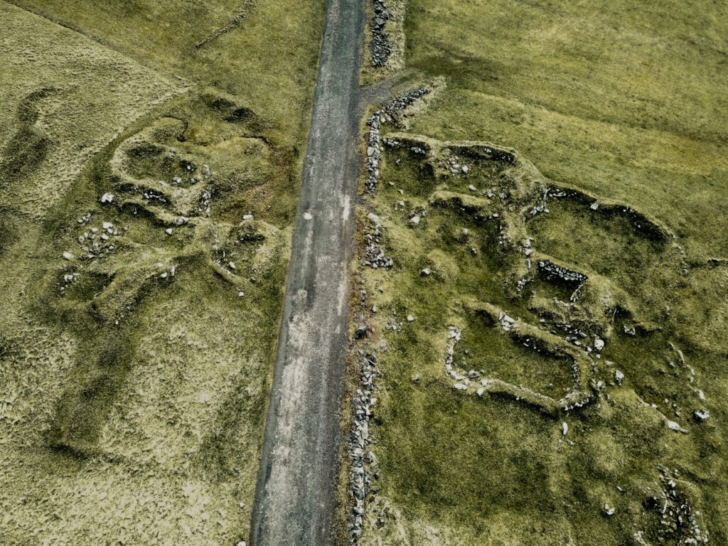
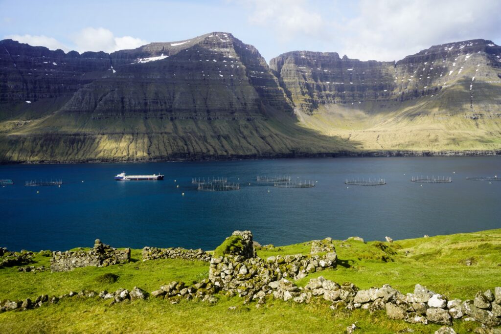
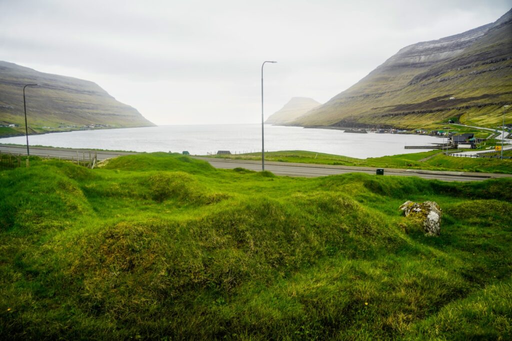
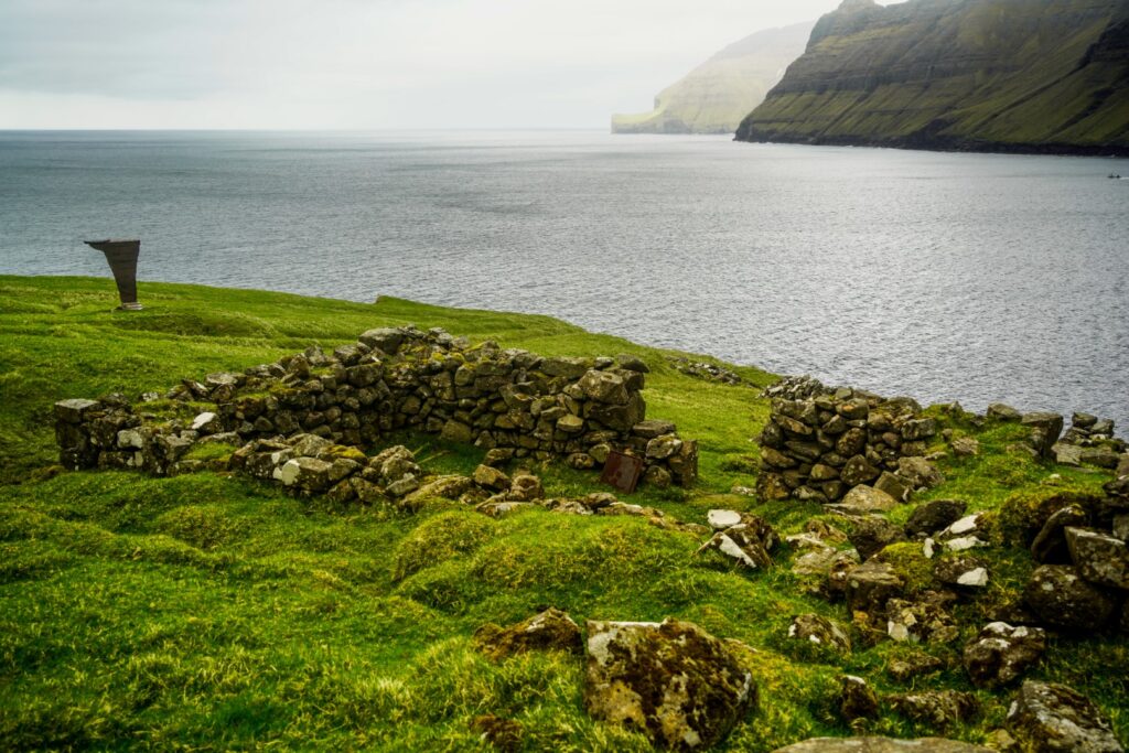
On Nólsoy lies the ruins of Korndalur, a settlement that was abandoned in the mid-18th century. Sadly, a road cuts right through the settlement but the ruins on both sides are still clearly visible. No archaeological excavations have been done there and little is known about life in the settlement, but there is a well-known local legend about a Scottish princess who once settled there after falling in love with a local!
After Koltur, I had originally planned to go to Toftir to visit some friends of mine, but since I was back on the mainland later than expected, I rescheduled with themf and instead caught an evening ferry to Nólsoy which leaves from the harbour in Tórshavn. I met up with Lucie at her café as I had an hour and a half to wait, a nice time to relax a little and get some work done.
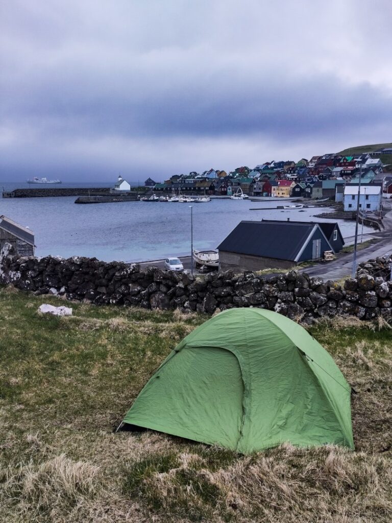
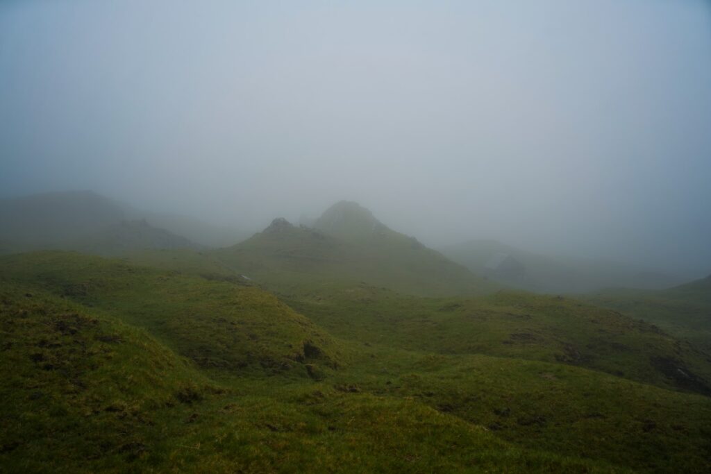
When I arrived on Nólsoy, it was foggy and raining lightly. I got my tent up in a flash, and then headed to Maggie’s (a very cozy bar/café!) for some fries and a coke. I slept in the next day as the forecast had promised rain. Thankfully, it wasn’t much, but enough for me to not be able to fly the drone. It stayed very foggy the whole day with just a few moments of sun here and there as well as a few moments of rain (very typical Faroese weather!), so I didn’t do any fieldwork that day. Instead, I spent most of the day in the ferry terminal where there’s heating and charging outlets, and was able to catch up on transferring and organizing all of my pictures from Koltur.
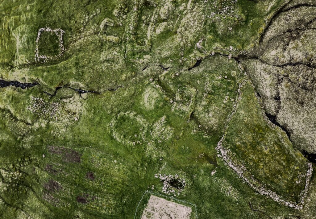
The following day was my research day. I spent the entire day out at Korndalur and some sites nearby that may be connected to the old settlement (two mills and seven outhouses!). The drone behaved and let me do several surveys over the sites so I could get some good images for my 3D models. The mills and outhouses took a while to locate as all I had to go by were two dots on a map in a book I’d found at the library, but I did manage to locate both sites. The outhouses were particularly difficult to find as the book mentioned seven and they were all very spread out. In the end, I did manage to find them all, but only after checking through the drone pictures thoroughly!
The following day, I visited the local tourist information to ask if they had any books or documents about Korndalur. They didn’t except the book I’d already been using, but they introduced me to a local who showed me around the present village and pointed out the houses that had been moved from Korndalur back when it was abandoned. He took me to a house where a family keeps an old stool from Korndalur, and then took me to meet a guy who’d found an old casting mould halfway between Korndalur and the present village. He was very excited to show not only the artefact but also the very spot where he’d found it! It always amazes me when people show interest in my projects and actually take time to help me, and it happened a lot during my month on the Faroe Islands!
In the afternoon, in the most beautiful weather, I walked along the west coast out to Í Kassunum, an abandoned settlement thought to date to the Viking Age (and therefore not included in my research). I hadn’t heard about this site before reading the book and I thought I’d been everywhere on Nólsoy, so of course, I had to pay it a visit while I was there! On the way out, I found another mill by the river Storá, which might be related to either of the abandoned settlements, so I decided to do some measurements there just in case. The ruins of Í Kassunum were a struggle to find as I only had a spot on the map in the book and a picture to go by, the latter of which was the most helpful as I was able to locate it by looking at the landscape! I counted four ruined structures. A truly fascinating site that I’d love to revisit academically in the future!
Skálatoftir, Borðoy
After Nólsoy, I took a few days off from my fieldwork to visit friends in Toftir and hang out with Lucie in Tórshavn. When it was time to head out again, I went north to the Northern Isles and planned to work on all four sites there before ending in Vágar at the end of the month. Well, that plan didn’t quite work out…
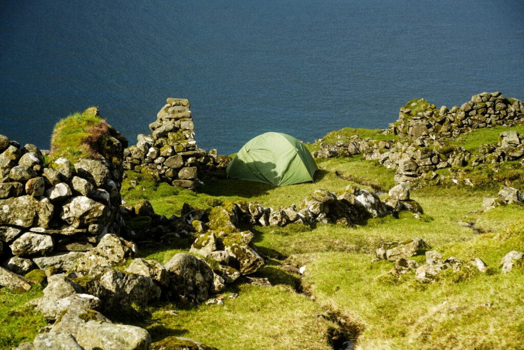
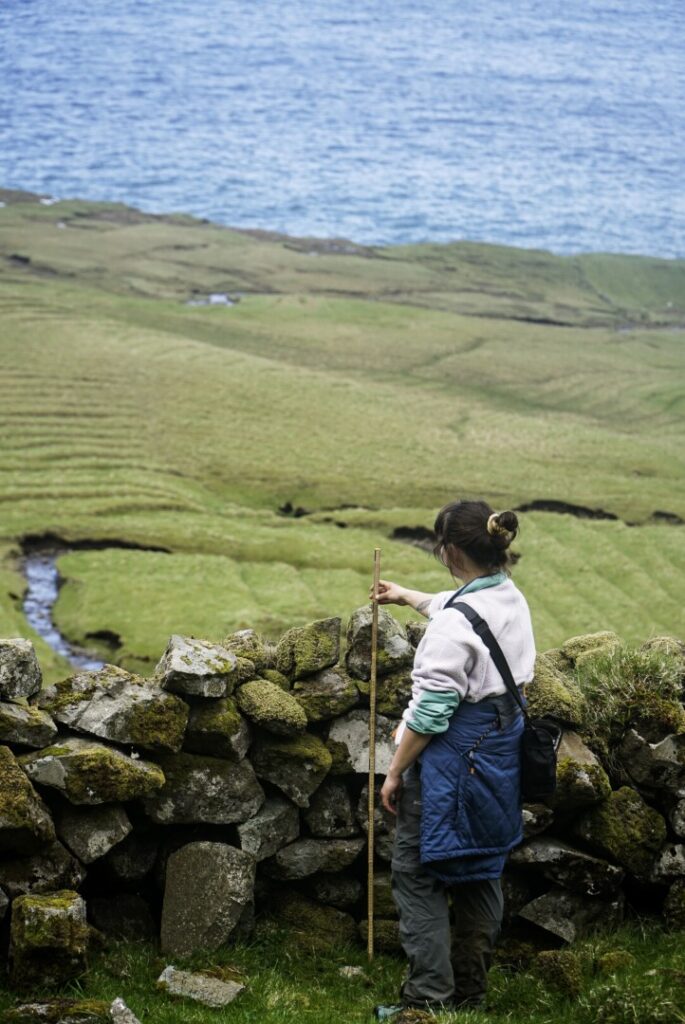
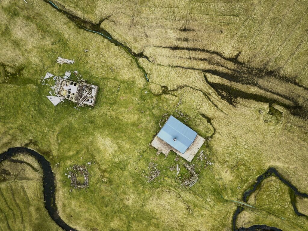
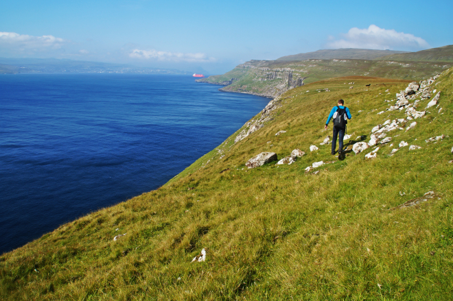
The first site that I visited in the north was Skálatoftir, which was abandoned in the early 20th century. I’d decided to hike from Múli, a village that was abandoned in 2002 (and thus, not part of my research). The hike is 6 km and should take 2-3 hours, but with two backpacks carrying my camping gear and research gear, I was slowed down significantly. I also didn’t realize that the hike would be as steep as it was – I was literally right on the edge above the ocean and the drop was steep. One wrong step and I’d be in the ocean. So, I took my time and was very careful with every step. After six tedious hours, and way past sunset, I finally arrived in Skálatoftir and pitched my tent right in the middle of the ruined village.
I spent the whole next day working at the site. I’d checked the weather forecast the day before and knew it was going to rain in the afternoon, so I got the drone shots done in the morning. It started raining as I began my survey of the structures. It stopped after a little while, but soon came back, and that was what it was like the whole day. It was quite miserable and I had a difficult time keeping my notebook dry. The one light in the dark were two seals that kept popping their heads up to say hello.
It was evening when I finally finished my survey, as I had also included the many outhouses in the surrounding area. It took a while to locate them, but I would rather be thorough than regret missing something later!
At around 7 PM, I started my walk back to civilization, this time to Strond where I planned to pitch my tent and then meet up with Lucie the following morning to go to Skarð with her. My ankles were killing me after the hike the day before because of the rough terrain, and my back was also in agony. So it was another slow and tedious hike, and I decided to stop 1,5 kilometres from Strond to pitch my tent as I was exhausted and it was getting dark (this was close to 11 PM!). The wind was very strong, so I decided to pitch the tent inside a sheep shelter – I thought it was a genius idea, but unfortunately, it didn’t stop the wind from attempting to tear my tent apart. The rain didn’t help and it did get inside the tent in one part as I couldn’t stretch it out properly because of the shape of the sheep shelter. It was shivering cold the whole night and I was not surprised when I woke up to snow on the mountains the next morning.
Gerðar, Klaksvík, Borðoy
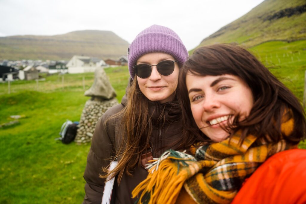
Lucie and I had planned to hike to Skarð over the mountains from Kunoy bygd – a notoriously difficult hike, but I really wanted to understand the hardships that the villagers went through, so I wanted to do it regardless. However, with the fresh snow in the mountains, it was no longer safe to go, so instead, we met up in Klaksvík and enjoyed a slow day of café visits and work at the easiest reachable of my sites, Gerðar.
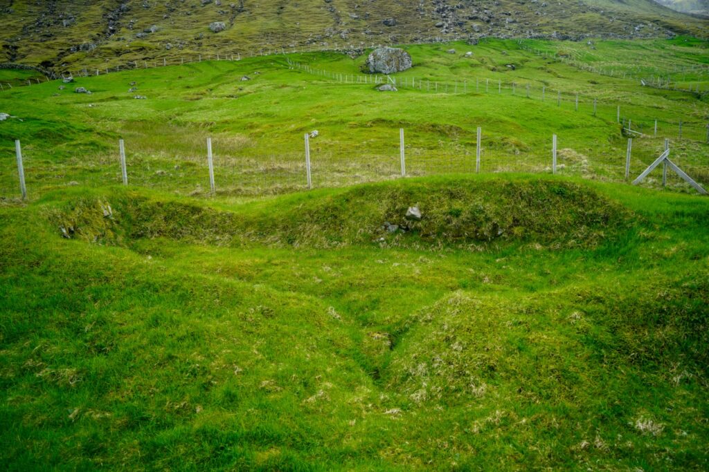
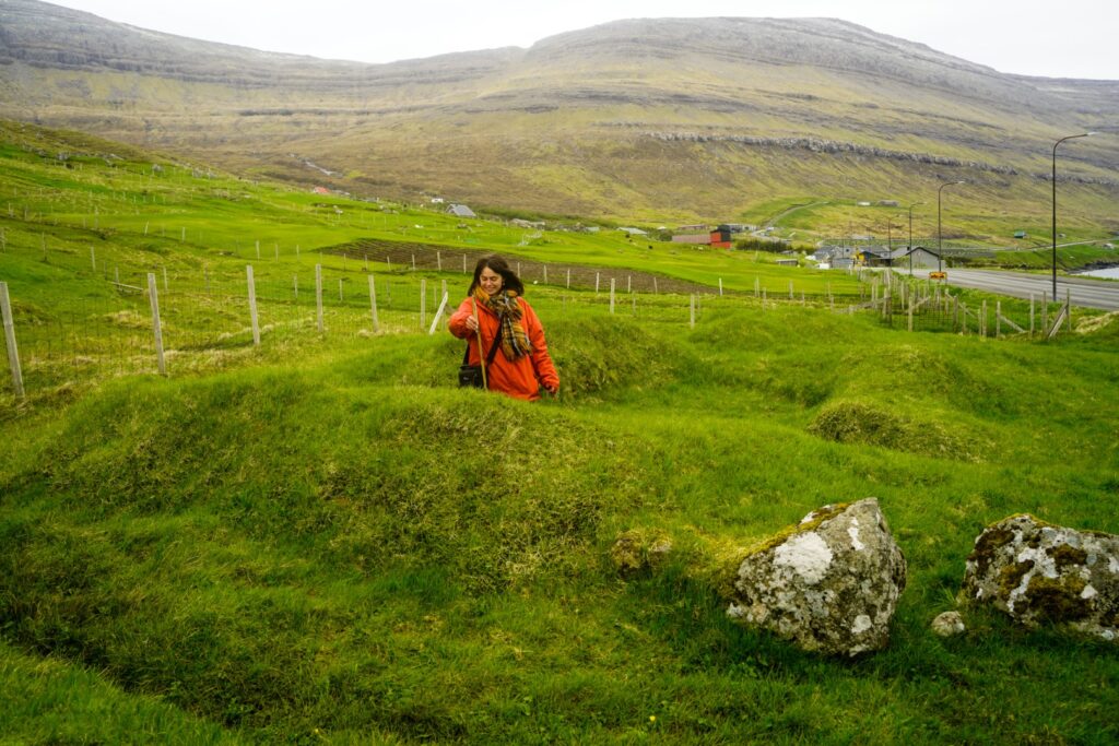
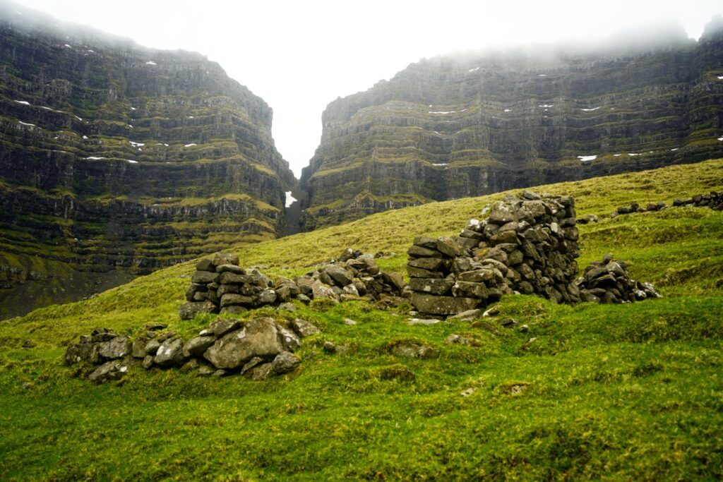
Gerðar is a neighbourhood in Klaksvík which was abandoned in the mid-18th century after two avalanches devastated the houses and killed almost all the inhabitants. I enjoyed showing Lucie my fieldwork, although I couldn’t fly the drone over Gerðar due to its location right at the edge of Klaksvík (drone-flying is not allowed in villages). But thankfully, I have been given permission to use 3D models of Gerðar that the National Museum have produced.
With Lucie’s help, it didn’t take long to finish my work at Gerðar, so we spent the rest of the day in Klaksvík relaxing and eating delicious cake at Fríða Kaffihús. Instead of camping another night, I decided to go to Giljanes Hostel (my favourite!) on Vágar for a few days to relax, let my feet and back recover, and dry all of my stuff. It was a great decision as I met several fun travellers, enjoyed cozy slow days with Felix the Cat, caught up with my work and had stable WiFi for a presentation of my dissertation that I had to do for uni!
Blankskáli, Kalsoy
After some lovely days of resting, it was time to return to the north and head to my next site, located on the island of Kalsoy. But first, I joined my new hostel friends for a day of hiking on the island, to the famous Kallur Lighthouse in the north. I had planned to stay in my tent at the campsite in Mikladalur for two nights, but when I tried to set it up, I found out that one of the poles had broken during the storm. Luckily, some of the guys I’d been hiking with had an airbnb in Klaksvík and offered me the sofa. A comfy and warm alternative!
I sailed back to Kalsoy early the next morning and met up with the landowner and his dog who wanted to join me on the hike to Blankskáli, a village that was abandoned in 1816 following an avalanche. He was very interested in my project, and it was a big help that he was there. He told me a lot about the village and could even tell me about the history of some of the houses!
There are two ways to get to Blankskáli from Syðradalur; over the mountain pass behind the village or along the coast. We chose to hike both ways so I could get an understanding of the hardships the people of Blankskáli had to deal with back in the days. We hiked over the mountain pass on the way out there, which took a little under three hours. I spent the next four hours doing my fieldwork; flying the drone over the whole infield and measuring and photographing every structure. The landowner went to look for his sheep and watched two sheep giving birth, and then watched as I finished my work. At the end of the day, we walked along the coast, a steep and very narrow trail that wasn’t great for my feet, especially because we were in a hurry to catch the ferry back to Klaksvík. We made it in good time, though, after a wonderful and very smooth day of work!
Skarð, Kunoy
After another night at Giljanes Hostel, I returned to the north in the afternoon, this time with Max who I had met at the hostel. He wanted to join me for the hike to Skarð, the most well-known of the eight abandoned villages due to its sad fate; it was deserted in the early 20th century after a boat accident that killed all able-bodied men of the village.
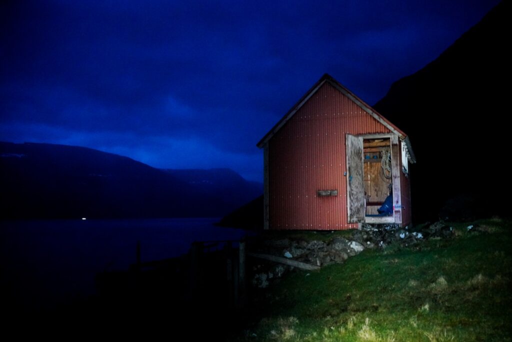
There are two ways of getting to Skarð; over the mountains from Kunoy bygd or along the coast from Haraldssund. We chose the latter for our trip out and hoped the weather would be good enough for the hike over the mountains on the way back. We didn’t start walking until 6 PM as I had a meeting in Klaksvík beforehand with one of the descendants from the village. She was a great resource and even offered to drive us to the trailhead! The hike out took us three hours along a well-trodden trail that I first hiked back in 2015. We arrived shortly before sunset and were relieved to find the little red shelter open and empty for us to crash in. Max built a fire on some rocks beneath the elevated shelter, and we then spent the next many hours cozying up to the heat and enjoying our well-deserved dinner (of crisp bread, hummus and fried onions!).
The next day, we woke up quite late and spent the next four hours doing my fieldwork. Max was a great help as he did all the measurements and GPS points while I wrote everything down in my little notebook. Unfortunately, I experienced a very serious problem with the drone as it crashed and the tips of one of the propellers broke off… Combined with quite strong winds, the drone struggled to complete the route. So in the end, I gave up and decided I’d have to come back to the site on a less windy day… If the drone would still fly with a broken propeller, that is!
At 7 PM, we started our walk back to Haraldssund as the fog was too low to go over the mountains. We were lucky to find a nice local couple in Haraldssund to hitch a ride with back to Klaksvík, and from there, it was easy to hitchhike to Tórshavn where we spent the night!
A failed attempt to reach Víkar, Vágar
I spent the morning in Tórshavn trying to find a way to fix the drone propeller, but it was to no use as none of the shops had propellers for my drone model. So I decided to just try to use it despite the broken propeller. I went back to Giljanes Hostel and spent the next two days there cuddling with Felix and catching up on my work.
On a sunny Friday, I met up with Max again to hike out to Víkar, a village on Vágar that was abandoned in the early 20th century. We hitchhiked to Gásadalur just as the fog started coming in, and it was already thick in the valley when we arrived. We decided to try regardless as I’d hiked that way before and felt I knew which way to go, plus it wasn’t very windy. The first part of the hike up to the mountain pass went well; although it was foggy, we could easily see where we were going. But as soon as we got to the top, the wind picked up, it started raining heavily and the fog got even denser. We tried going down a short way but then saw that an edge was coming and I couldn’t see the cairns that mark the trail.
It was just too dangerous to continue, so we gave up on our attempt to reach Víkar and went back up to the mountain pass to try to find the trail back to Gásadalur. That didn’t exactly go well either as the wind and rain only got worse and we often had to stop up to stabilize ourselves. But once we were back on the other side of the mountain pass, I knew that we wouldn’t be in danger as this side is much less steep. Eventually, Max spotted the trail and then it was easy for us to find our way back to the village. We were completely soaked and really cold when we got back, and we had literal puddles in our boots! Thankfully, we were picked up by two lovely tourists as soon as we got to the road and arrived back to the warm hostel in record time!
This was when I started getting a little stressed that I wouldn’t be able to finish my fieldwork in time… The weather forecast wasn’t looking great for my last week and I still had three sites left to finish…
Slættanes, Vágar
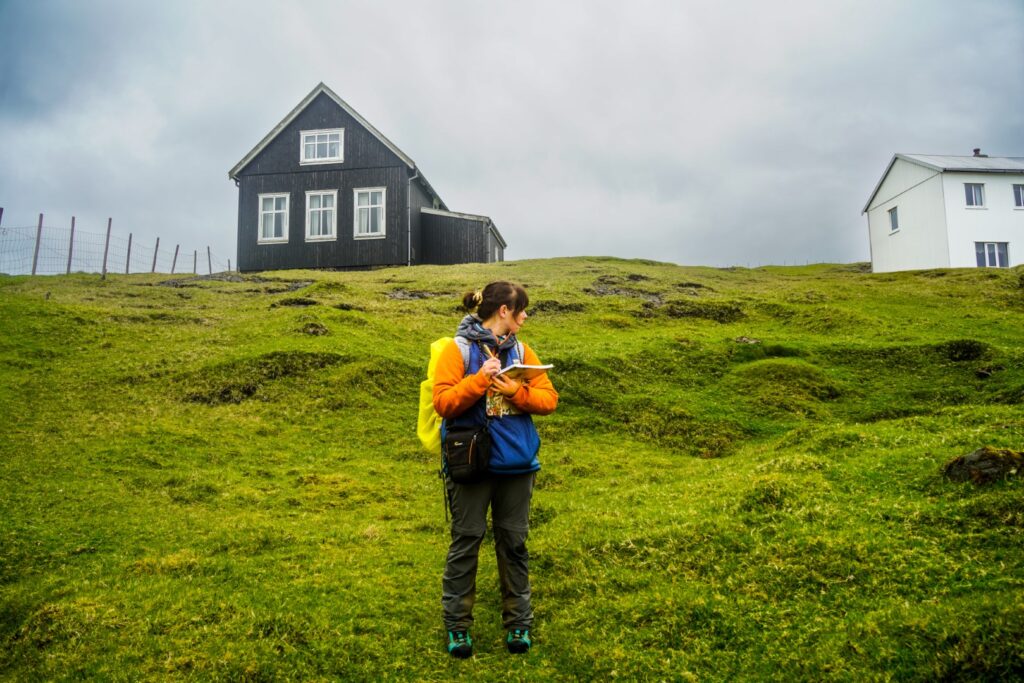
Two days after the failed attempt to reach Víkar, Lucie joined me on a hike from Sørvágur to Slættanes and back to Oyrargjógv, a hike we’d already done together two years earlier. Slættanes was abandoned in 1964, and is the latest abandoned of the villages I’m writing about – although some of the houses are still maintained and used as summer residences. The weather forecast did not look great, but we were surprised to have mostly dry weather and not much wind throughout the day!
The hike out felt really long, which was also due to us getting a little lost (despite having hiked the exact same route before…). With the help of Lucie, I finished the fieldwork in just three hours and found many more ruins than I remembered being there. I was really worried about whether the drone would be able to fly or not with the broken propeller, but it cooperated and I got my shots without any issues!
The hike back to Oyrargjógv was just as long, and our feet were absolutely killing us by the end of the day! It was the biggest hiking day by far, with 28 kilometres and over 43,000 steps – but the next day would be even longer.
Back to Víkar
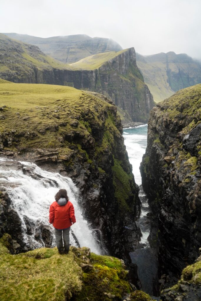
The next day, it was time to try to reach Víkar again, this time with Oscar who I’d also met at the hostel. The weather forecast looked good, but it was raining when we set off. Because of this, I decided to hike to Víkar via Fjallavatn instead of going over the mountain pass from Gásadalur, a longer route but much easier and safer than the route from Gásadalur. The weather was miserable for the first two hours, but then it finally cleared up and stayed nice for the rest of the day! The hike was beautiful and fun; we got invited into a little hut for some tea, and found a gorgeous view of the Reipsáfossur waterfall above the black sand beach near Víkar.
Once we were down in the abandoned village, I spent a few hours doing my fieldwork. The drone cooperated and flew over the infield with no problems, and Oscar helped me do the survey and measurements. It was great to have him there as he spotted some ruins I hadn’t seen, and it was just nice to have some good company!
For the route back, we decided to hike over the mountain pass to Gásadalur as the weather was nice and we didn’t fancy the long walk back along Fjallavatn. We easily found the cairns that mark the trail, but then suddently fog came rolling in and it quickly got very dense just as we were on the steepest part of the trail. We got a little lost, but with the help of a GPS and Oscar’s sense of direction, he got us to the right spot and we found the trail leading down to Gásadalur. It was past 10 PM when we finally got down and we were afraid there’d be no cars to hitch a ride with. But we got lucky and hitched a ride with two locals who took us to a gas station as we were starving. We decided to walk back to our accommodation from there, a half an hour walk which isn’t much but felt like a lot after 29 km in rough terrain. But to our astonishment, the lady who had invited us in for tea earlier that day came by and offered to drive us. Talk about a small world!
The return to Skarð
On my second-to-last day on the Faroes, I returned to Skarð via Haraldssund, a 14 km round-trip hike that I really could’ve done without since I was still exhausted from the hikes to Slættanes and Víkar, and this was my third big hiking day in a row. Also, the wind was too strong to comfortably fly the drone, but since it was my last available day to do fieldwork (I had plans in Tórshavn for my last day on the Faroes…), I just had to do it. I was lucky enough to borrow a car from a friend, which really helped as I didn’t even have the energy to hitchhike. It also made it easier to run a few other errands such as visiting the local museum in Klaksvík to find some more literature and stopping in a few spots to take pictures of Gerðar and Blankskáli from afar.
Once I got out on the trail, it wasn’t actually too bad. My feet and legs were tired, but the weather was nice and the trail is easy to follow. I got there in record time – just two hours each way instead of the usual three! It sure helps not lugging around camping gear!
Since the wind wasn’t going to drop until the late evening, I decided to fly the drone and hope and pray that it wouldn’t have any issues with the wind. My eyes were glued to it for the entire 40-minute flight, and there was a gruelling moment when the drone lost connection. Thankfully, it reconnected quickly again, and managed to finish the entire route without any more trouble. I was so relieved when it finally came back down to me, and sooo glad that I’d managed to get all of my fieldwork done in time – with literally no time to spare!
What’s next?
I’ve spent the past ten days in Denmark recovering from my busy month on the Faroe Islands, but now it’s time to get stuck into the writing process! I have a busy summer ahead of me with a roadtrip in Canada and an excavation and solo travels in Alaska, but I am going to try to get as much done as possible so I won’t have to work too much on my dissertation next term. My dissertation is due on January 8th, so while it seems like I have plenty of time to write, I know that I’ll be extremely busy with classes and assignments from September, so it’s important to get most of it done before then to avoid stressing myself out! But it’s a good thing that this subject is something I’m really passionate about! I’m actually excited to start writing, reading and gaining more knowledge about the abandoned villages!

Leave a Comment