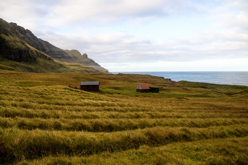
The year is 1833. The first settlers have just arrived in the newly founded village of Víkar. The soil is fertile, landscape favourable, but the villagers are very isolated. The nearest village is Gásadalur, 5 km to the west. It doesn’t sound like much, but getting there involves traversing a high mountain pass. There are no roads, no harbour. The only way in and out is by foot. Fast forward 77 years, and the village is abandoned. The last villagers leave the place behind and soon all that is left are the ruins and memories of a once thriving community. Today, these ruins are still present. But among them are also three modern buildings; a summer house, a private shelter and a shed.
I had always wanted to visit Víkar and that dream only became bigger after trekking to the similarly abandoned village of Slættanes on the northeastern coast of Vágar, a route that took my hiking buddy and I along the mountains above Víkar. A week later, it was finally time to explore Víkar itself. My plan was to walk amongst the old fields, explore the few buildings and get an understanding of what the villagers had to go through every time they wanted to leave their village. As I discovered, it was a lot. There is no simple route to Víkar.
Back in the days, Víkar belonged to the village of Gásadalur, which is still inhabited today. An old trail connected the two with each other, and parts of the trail is still visible today. I didn’t know what I was going to discover. There is no information about this trail anywhere online, all I had to go by was a marked trail on maps.me. But it turns out that the route isn’t based on cairns like most other village to village trails on the Faroe Islands. Maybe the cairns have eroded and nobody has cared to build them up again, because unlike Slættanes which is connected by three well-marked cairn trails, Víkar is rarely mentioned and rarely visited.
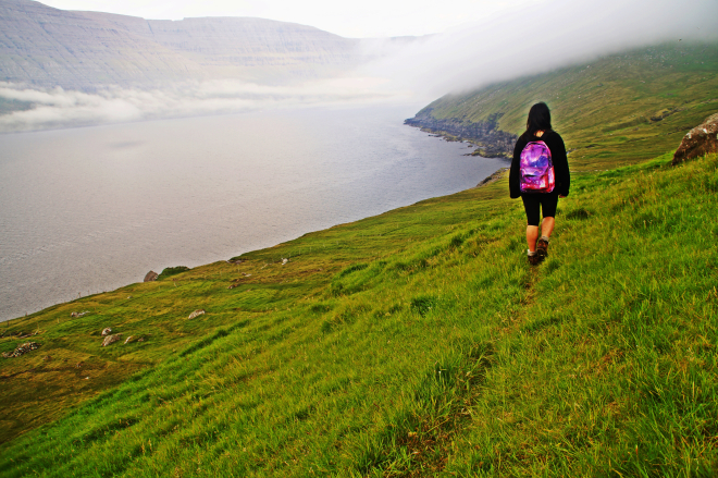
I drove to Gásadalur just after sunrise, wanting to make the most of the few daylight hours that late October offered. I parked my car in the village centre and at 08.30 AM, I was on my way. I knew the first part of the route well as it’s the same as the beginning of the hike to Slættanes – along a dirt track deep into the valley beyond Gásadalur. But one thing was different this time around. I wasn’t carrying a heavy backpack with camping gear! So it took a lot less time and effort to climb up the steep mountain pass, although it was still tough. The ground was frozen and the sun was behind the mountains, so I had to watch my steps so I wouldn’t slip and fall.

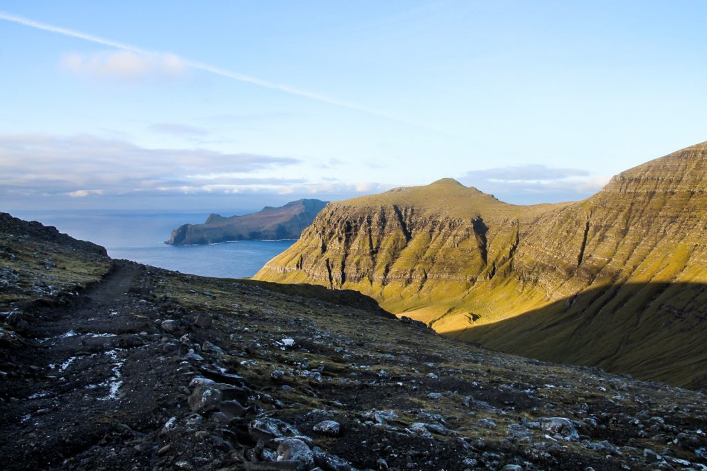
I crossed over the mountain pass and found the cairns that I remember from the hike to Slættanes. This is where the two trails separate, the one to Slættanes going south and the one to Víkar going north down an incredibly steep cliffside. I considered my options. Either I spend all day treading carefully down the slippery rocks, or I sit on my butt the entire way with the risk of ruining my trousers. I chose the latter. I didn’t have time not to!
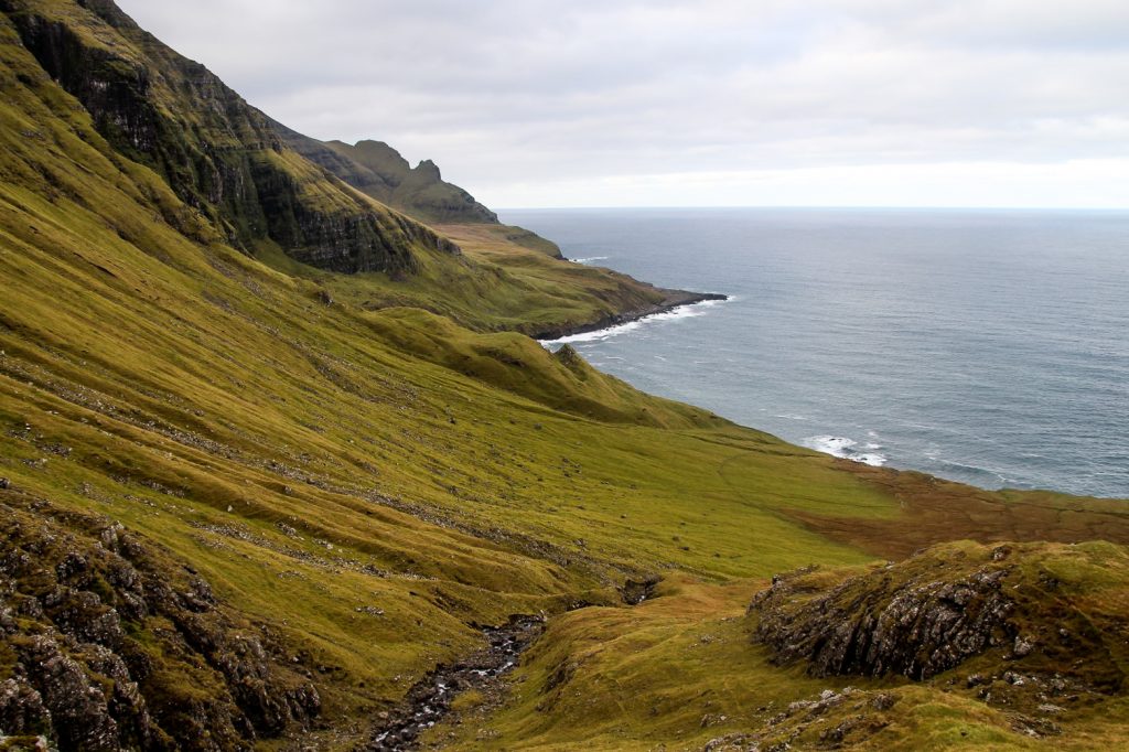
The rocks were slippery, treacherous even. Despite the marked trail on maps.me, there was no path or cairns, so I just had to choose a way and aim for the village below me. At one point, I spotted grass below me, so I decided to aim for that, giving my trousers a break from the sharp rocks. But it didn’t last long. The route got steeper and the only possible way was down a rocky gorge. I had to scramble some, and put my faith to my climbing skills. All I could think about was how happy I was that I didn’t have to go up the same way, because there are actually two trails to and from Víkar, and I for sure was taking the other one out of the village! But thankfully, I soon reached another grassy section which I could almost run down. I survived and so did my trousers, because soon, I was at the bottom of the cliff, the village just 700 meters away on flat ground!
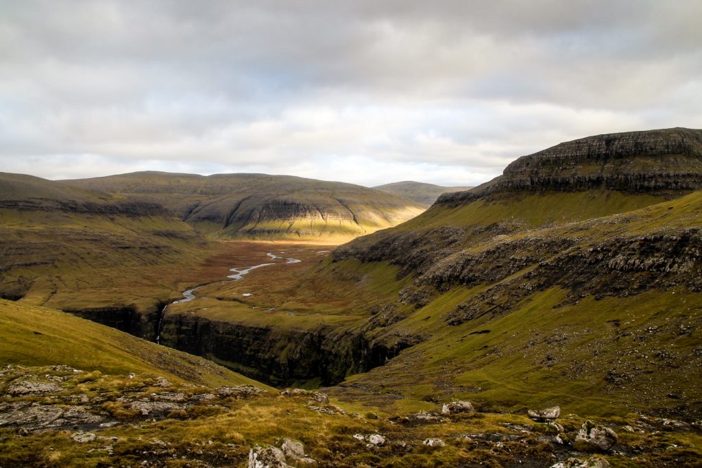
I was a few hundred meters from the village when I decided to take a little detour. When climbing the ridge between Vágar’s two highest mountains, Árnafjall and Eysturtindur, earlier that month, I’d noticed a large lowland below Árnafjall with a building on a peninsula called Tjørnunes. I was so eager to explore this isolated area especially now that I was so close and seeing that it would actually be possible to reach from Víkar. But it was already 11.30 AM and sun was going to set five hours later, and I still had a long way to go back to Gásadalur. It would’ve added one or two hours to my hike, and left me without any time to explore Víkar, so I decided to save this area for another time. At least it gave me an excuse to return to Víkar, an area I would soon claim to be my favourite in the country!
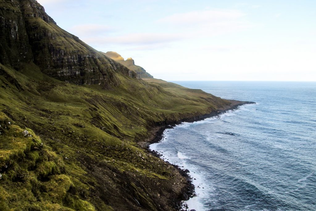

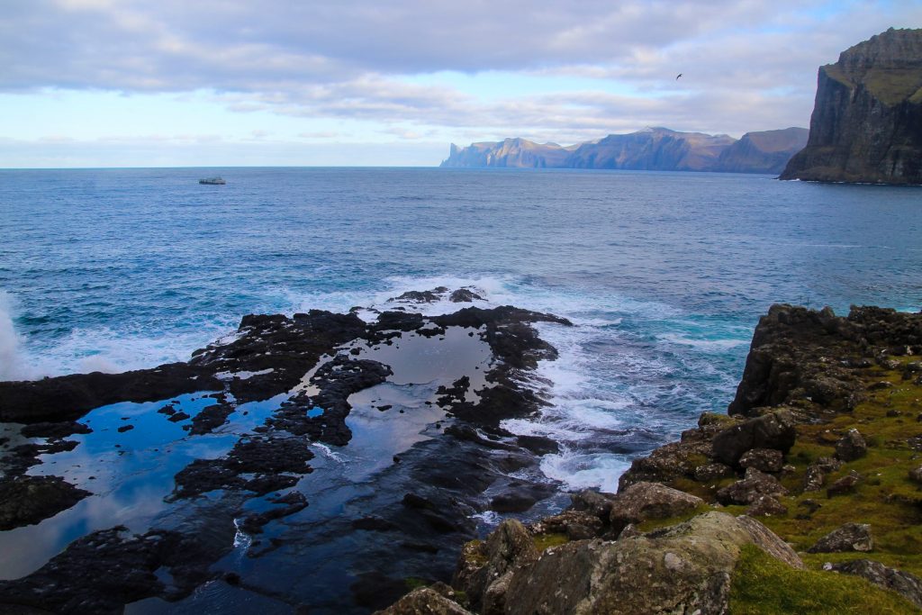
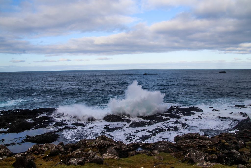
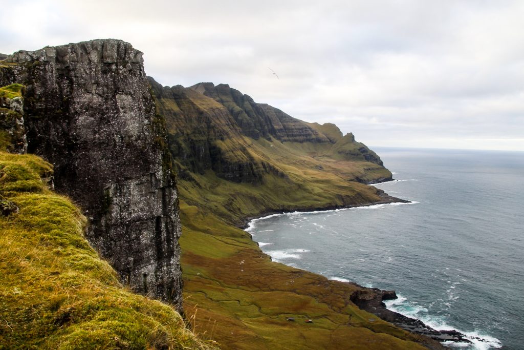
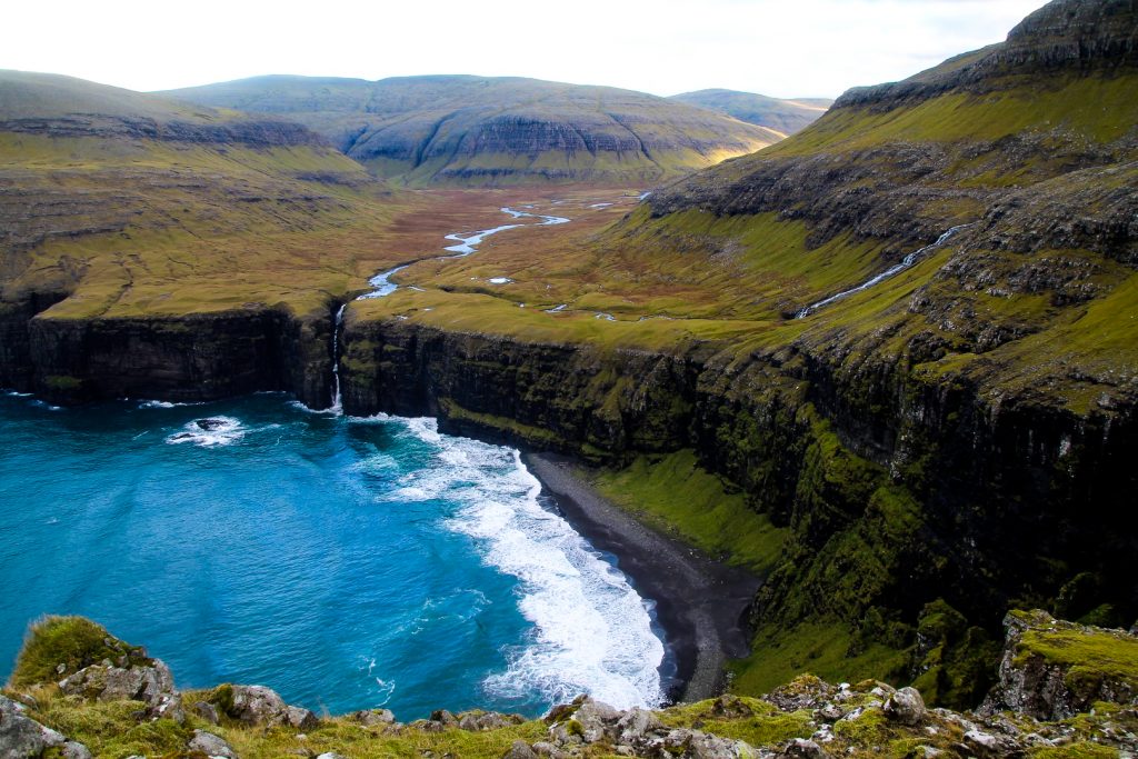
Eager to explore Víkar, a place I’ve dreamt of visiting for many many years, I ran along the coast towards the buildings, in search of a harbour. It was hard for me to believe that the village survived for 77 years without a harbour, but they must have done, because I didn’t find any. But I did discover a large rocky plateau with waves crashing against it, creating a gorgeous and forceful scene.
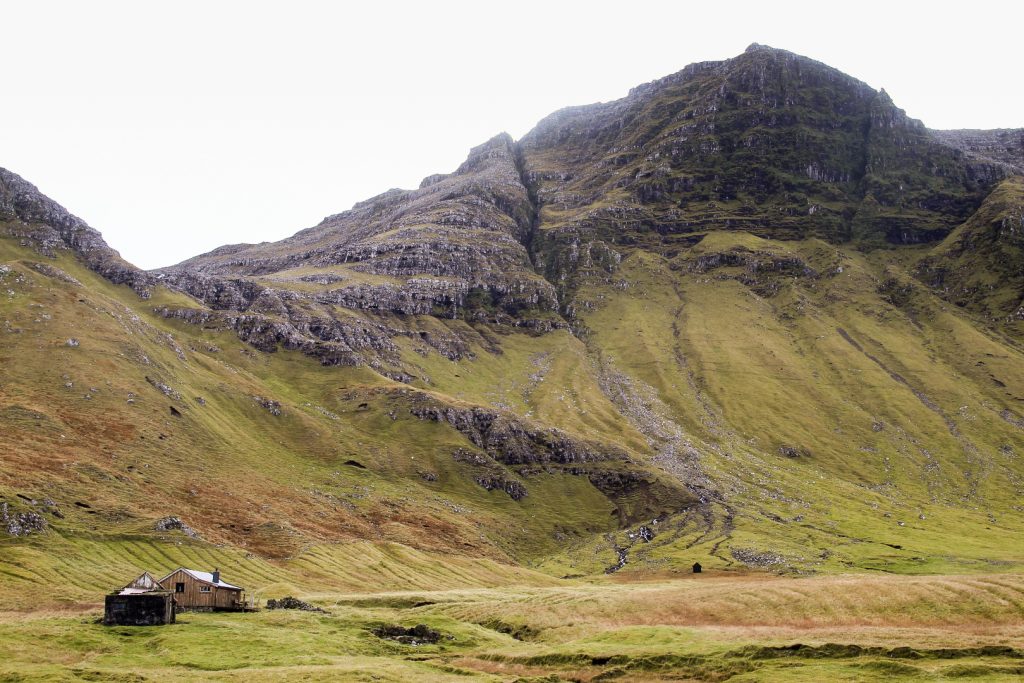
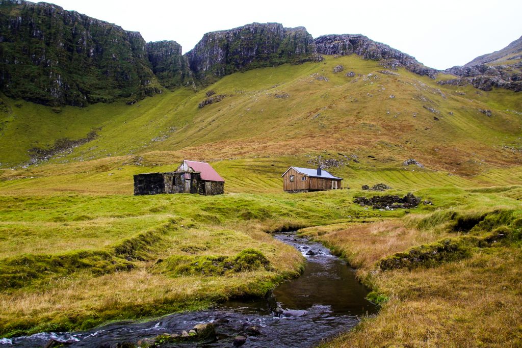
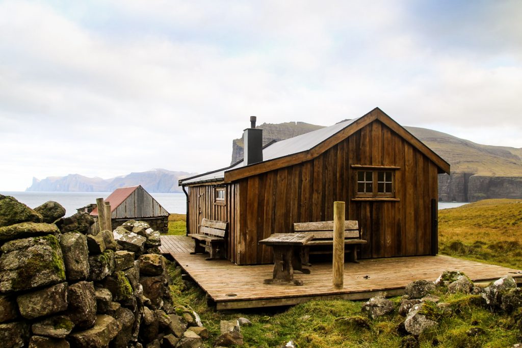
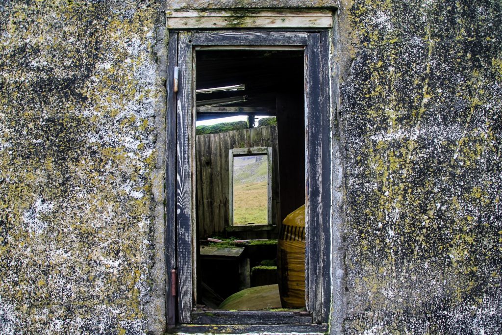
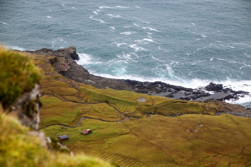
As I walked towards the only buildings still standing in the village, I came past many foundations of house ruins. It’s also still possible to see the cultivated lands, so it’s obvious that this place was once home to a thriving community. The three buildings that stand today do not date back to when the village was alive, but were built afterwards as summer houses. One of them, a gorgeous wooden house, looks like it’s still being used as a summer house. The building next to it looks more like a shed or storage house as it’s dilapidated and full of junk.
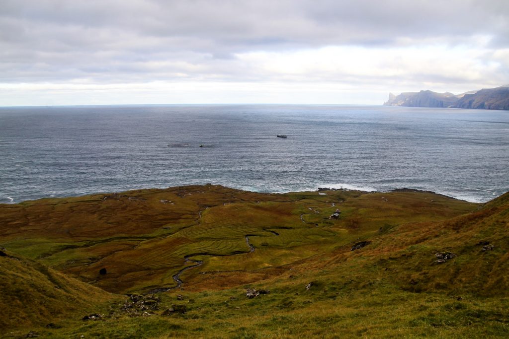
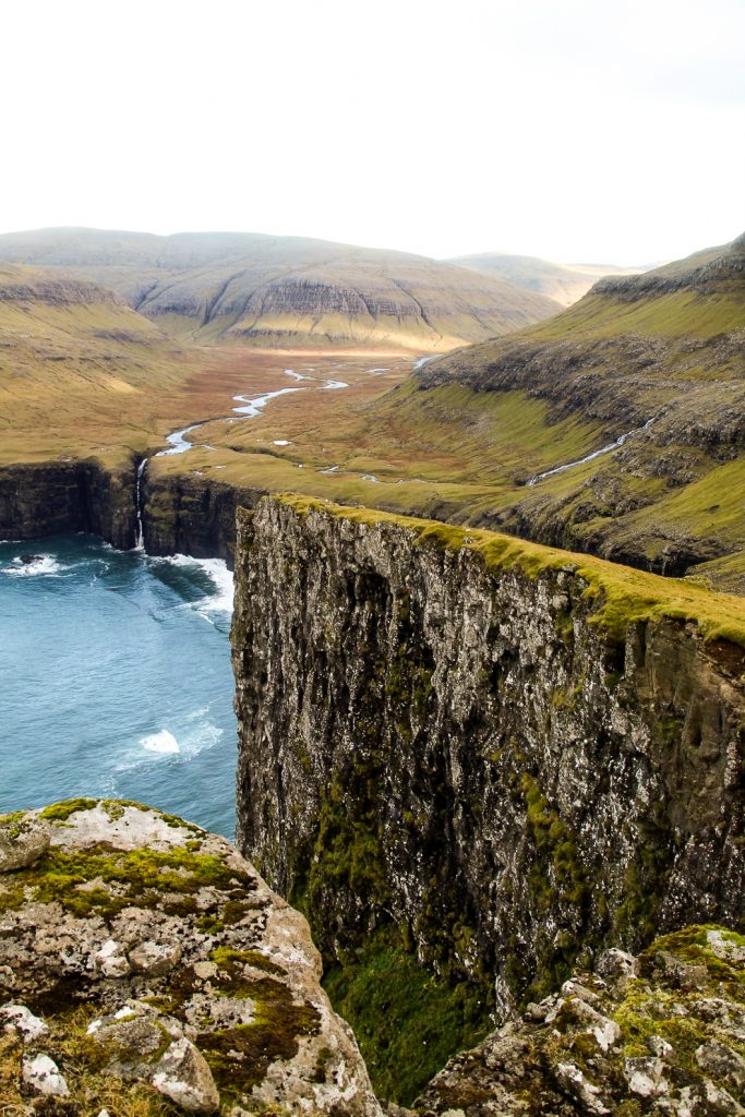
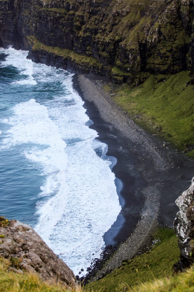
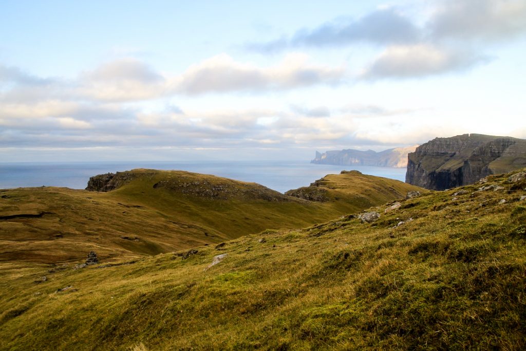
I felt like a child running around the abandoned village, in awe of the views I was seeing and the history before my eyes. I can’t believe this place isn’t more popular. But it could change in the years to come. The nearby black sand beach of Viðvík has gained quite a bit of fame from Instagram in recent years, and Víkar is visible behind this beach. I’d seen the beach twice before from above, but I also wanted to see it from below. So I hiked along the cultivated lands out to the edge of the lowland where a cliff separates the village from the beach. The view was nice, but the view of the beach from above is unbeatable.
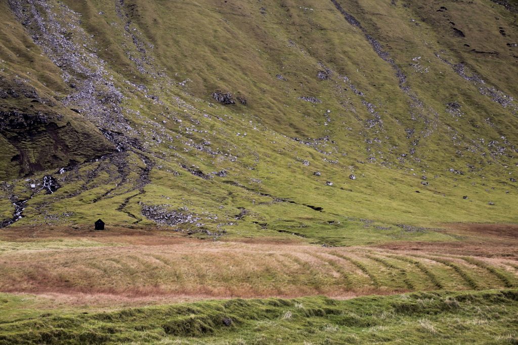
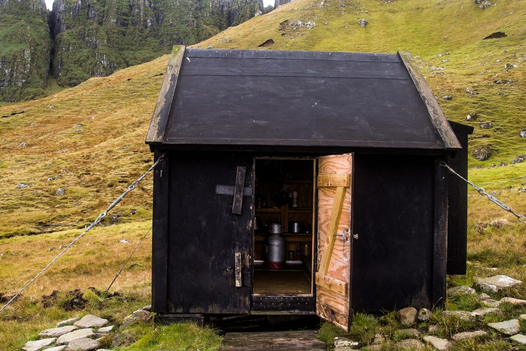
As I headed back towards the village and looked further upstream, I set out for the third building in Víkar, a small black building which I hoped would be the shelter I’d heard about a few days earlier. A local had told me about it but I didn’t truly believe him as I couldn’t imagine a shelter in such an isolated location – but he was right! The door was closed but I figured out how to open it, and inside was the cutest little shelter I’ve ever seen, complete with two bunk beds! I’ve since been in contact with Visit Vágar about this shelter, and it turns out it’s private and not available for rent.
I still can’t get over how incredible Víkar is. It’s truly amazing. The views, the history, the isolation. It has everything; ruins, a shelter, many possible hiking routes and a nearby black sand beach. Slættanes may be the more famous of the two abandoned villages on Vágar, but Víkar is certainly the star of the show!


I’d spent two hours exploring the abandoned village, so it was about time I started my return to Gásadalur. Thankfully, I didn’t have to climb up the same way as I came down. Instead, I hiked upstream from the shelter, up a rocky cliff along a route that is also marked on maps.me. There aren’t any cairns or trail, however, so I’m in doubt whether or not this is an official route, but it was definitely a lot easier than the other route.
I had to do a bit of scrambling, but there were plenty of safe rocks to grab so it wasn’t an issue at all. Before I knew it, just 50 minutes after leaving the village behind, I was on top of the ridge near the trail to Slættanes which I would follow back to Gásadalur.
But first, I wanted to take a little detour to the steep cliff that towers above the black sand beach. I was hoping to find a unique view of the beach from up there! I found so much more. I hiked past gorges where I could see the buildings of Víkar far below and then the beach came into view, much closer than the Insta-famous view from the other side. I descended a bit to get as close as possible to the beach and wow, I couldn’t believe the view I saw!

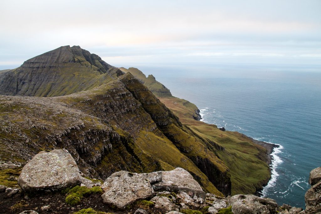
I was under a bit of time pressure by now as I’d spent way too long taking pictures and enjoying the views, but I just didn’t want to miss out on anything. There was one more place that I wanted to see in the area before returning to Gásadalur, and that was the summit of Mølin, one of few mountains I was missing on the island.
I headed back towards the area that I’d come up, joining onto the cairn trail to Slættanes. Thankfully, the mountain wasn’t difficult to climb as it’s quite low at just 423 m., but my legs were getting really tired by this point. As soon as I reached the summit, I looked back at the nearby mountain of Klubbin and noticed two guys climbing up the summit. I was surprised to see anyone else in such an isolated place just an hour before sunrise, but I figured I would meet them later on on the way to Gásadalur. But I didn’t. My guess is that they either own a summer house near Fjallavatn or even the one in Víkar. Either way, they are lucky if that’s the case!
At 3.30 PM with an hour left until sunrise, I started making my way back to Gásadalur. It was a lot later than I’d hoped, but I figured that if I could make it to the mountain pass before sunset, I would be fine as the trail back down to Gásadalur is easy to follow.
Since I was under a bit of time pressure, I decided not to descend back down to the cairn trail and instead make my way over a ridge to a higher section of the trail so I wouldn’t have to descend too much unnecessarily. I did eventually rejoin the trail at a section I remember being so nervous coming down on the way to Slættanes. But this time, going up, it was a lot easier. I had to do a bit of rock climbing, but it was a good feeling as I noticed myself being more confident about it than before.
At one point, I lost sight of the cairns that I was following, but then I spotted the mountain pass in front of me. I was almost there! And just as the sun set at 4.30 PM, I reached the mountain pass with the trail to Gásadalur below me. I made it just in time!
The rest of the hike was easy despite the incoming darkness as I just followed the well-trodden path back to the village. I was absolutely exhausted when I finally got back to the car an hour later, but so happy that I’d managed to complete the hike of 21 km across some of the toughest terrain the Faroe Islands has to offer! I have to admit that I was doubtful of whether or not I would manage when I left for the hike in the morning, so it felt so good to complete it!
After this incredible hike, I can truly say that I’ve found my new favourite area in the Faroe Islands (I’m sorry, Nólsoy!). There’s just something about Víkar and its backcountry that is truly magical. I love the mystery, the isolation and the exceptional views that are found just about everywhere in this area. And then there’s the beach. Just imagine it, an isolated black sand beach with an abandoned village behind it. It can’t get any better than that!
Hiking route description: Gásadalur to Víkar round-trip
The hike begins in the village of Gásadalur at the end of Gerðisvegur. Follow the dirt track to two gates that you have to open to enter the valley where the dirt track begins. Follow the dirt track which is marked with cairns to the end of the valley and head up the well-trodden footpath that goes up into the mountains to your right.
Once you reach the highest point on the trail, you will see a tower to your left and cairns to the right of the tower, leading down to a valley with a few houses at the bottom. This is Víkar. Follow the cairns until they end and then find the easiest way down while aiming for the buildings below you. This section is very steep, so take care. As soon as you can, leave the rocks and hike down a grassy section. When the cliff starts getting very steep, head down a gorge, taking care not to fall. Soon, you’ll come to another grassy section which is easy to hike down and then you’ll be at the bottom of the cliff and can hike towards the village on flat ground.
Take your time exploring the village. It’s worth going down to the coast to see the large rock plateau and 500 meters to the east to see a view of the black sand beach. And don’t forget to take a look at the shelter too!
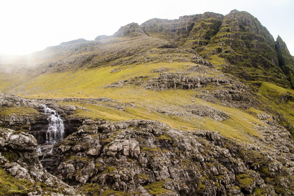
Getting out of Víkar is on a different route. At the shelter, cross the stream to your left and start hiking upwards towards the lowest part of the ridge above. There are no cairns or trail, so just take the route that looks the easiest, keeping the waterfall to your right. When you are level with the waterfall, ignore the sheep trail to your right and climb up between the huge rocks to your left. You’ll have to do a bit of scrambling, but there are plenty of safe rocks to grab.
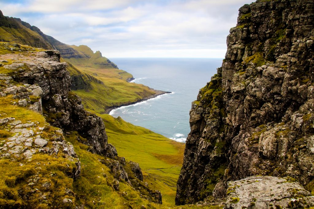
Once you reach the top of the ridge, head up the cliff to your left and follow it out to the edge for a wonderful view of the black sand beach. Turn around and hike back towards the cairn trail that connects Gásadalur with Slættanes. Just before the cairns start going upwards, climb up the mountain that looks like a hill to your left, Mølin. It’s an easy and quick climb and a fun little detour!
From the summit, walk left to a small ridge to stay up in the height instead of descending back down to the cairn trail. Head towards the mountain pass in front of you, slightly to your right, where you’ll see the cairns from the Slættanes trail on a ridge going up to your right. Follow a sheep trail to this ridge and head towards the cairns while still gaining height. Rejoin the cairn trail when you can and follow the cairns over the ridge to the top of the mountain pass. It takes a bit of scrambling, but there are plenty of rocks to told onto. From the mountain pass, follow the same trail that you came up on back down to Gásadalur.
The route is 15-21 km (depending on how much you explore Víkar etc.), takes 8-10 hours and is difficult.
Leave a Comment
Pingback: A short hike to Vágar’s unknown lake, tucked away below the misty mountain peaks – Northtrotter on 16/01/2021
Pingback: My January-March 2021: Digging away on Lolland – Northtrotter on 16/01/2021
Pingback: Misty Vágar: A spontaneous afternoon hike to Vatnsdalsvatn and Snældansfjall – Northtrotter on 16/01/2021
Pingback: On the road to ruin: A month of dissertation research on the Faroe Islands – Northtrotter on 16/01/2021
Pingback: My 10-year Faroeversary: Turning My Passion for the Faroes into a Research Journey – Northtrotter on 16/01/2021

11 COMMENTS
Nathan
1 year agoMy girlfriend and i completed this hike today and it is safe to say that your blog post is an essential read before embarking on this walk. Without your valuable and detailed information we still would be wandering between the mountaintops of northern Vagar. Thank you so much! One question: at what time of the year did you go? Because today it didn’t stop raining (read: extremely slippery rocks) and was extremely windy, two things that, judging by your sunny photos, were absent the day you walked the route. On the other hand, the color of the grass on your pictures is almost the same as today and looks very “autumny”. Sheer luck or did you walk in another season? Also: what camera do you use? Those photos are absolutely magnificent!
P.S.: How come that Vagar is so underrated? Apart from Mulafossur and the view from Bour there seems to be little interest in the unspoiled north coast of Vagar, while (in my opinion) this is easily my favorite and the most “remote-feeling” place of the islands. Even the guy from our Airbnb suggested the other islands were more scenic and worthy of putting effort into.
Mel
1 year ago AUTHORHi Nathan, thank you so much for your comment! Stories like yours are why I keep blogging and sharing tips for the Faroe Islands!
I wrote in the top of the post that I hiked this route in late October, but I was extremely lucky with the weather given the time of year! I’m sorry to hear that you had rain on your hike, but I hope you enjoyed it nonetheless!
I used my Sony A7R III to snap these photos 😀
Regarding the north coast of Vágar being underrated, I can only agree! But I think it’s due to the area being so remote and challenging to reach. Most tourists stick to the more well-known trails such as the Trælanípa hike, and even many locals don’t make it out to these remote areas (except for the hardy’s). But this area is also my favourite. I love it to bits, and hope that more people like you will discover it!
Dieter
2 years agoGreat story and photos!
You also provide valuable info (thanks!) as I have thought about doing exactly the same hike in my upcoming vacation. Do you think that reversing the direction (i.e. walking down to Víkar the easier route and going back via the difficult climb) would be better? I am more comfortable using a less steep incline when walking down.
Melissa Cherry Villumsen
2 years agoThank you so much, Dieter! I’m certain the reverse direction would be easier, although it’s still going to be a steep climb back up from Víkar. Maybe it’s worth considering going both ways via the easy route. You wouldn’t miss much if you hiked back up the same way as you went down (the easy way), but taking the steep route is a good challenge if you’re up for it! Enjoy your hike!
Dieter
2 years agoThank you for the reply.
I think I will decide when I am there. 🙂
Keep up the good quality of your blog, I really appreciate reading your posts. Both photos and text are equally enjoyable and informative. I know it is much work. I have done it myself for some time but stopped because it took too much time out of my life.
Melissa Cherry Villumsen
2 years agoThank you so much! It does indeed take a lot of time and effort, but I really love doing it, and I hope I’ll have the energy to keep it up for many years! 😀