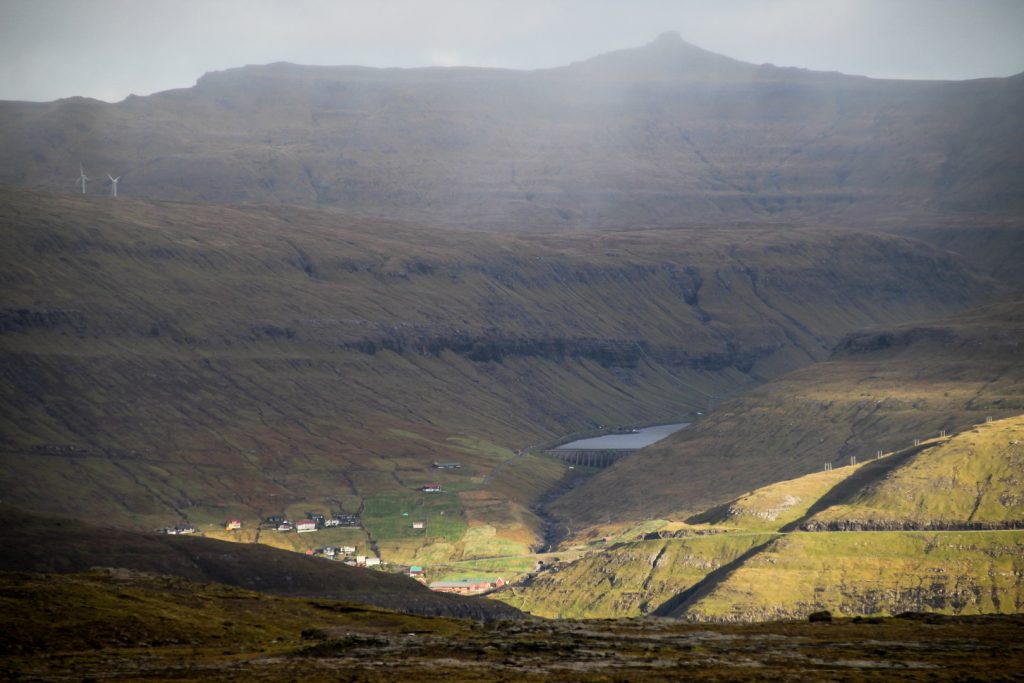
I’ve always said that I want to explore every corner of the Faroe Islands, and it isn’t a lie. But there are some places in particular that I have always dreamt of seeing, and one of them is Slættanes, an abandoned village on the northeastern coast of Vágar.
Slættanes was founded in 1835 and was once home to a thriving community of around 130 souls. But life in the village wasn’t easy and it was already abandoned in 1965. Despite the close location to the village of Vestmanna on the other side of the sound, they were isolated, as the only way in and out of the village was by boat or foot. One route which the local postman used to take connected the village with Gásadalur to the west and Sandavágur to the southeast. This route is called Slættanesgøtan, a 30 km route through most of Vágar.
On a cloudy day in mid October, my hiking buddy Lars and I set off to complete this hike ourselves and to finally accomplish that dream of mine.
We left our hostel in Sandavágur before sunrise and caught the bus to Sørvágur. There, we did a bit of grocery shopping and stuffed our goods into our backpacks that were full of camping gear and snacks. We had decided to begin our hike in Gásadalur although the official trail usually begins in Sandavágur, so we were doing it backwards. But there are no busses running to Gásadalur, so we were praying for a ride with a kind local.
Unfortunately, that ride just never turned up. We walked and walked, past the village of Bøur, and soon realized that we weren’t going to be picked up. Several cars passed us, but no one stopped. I think it might’ve been because of our backpacks. So our planned 30 km hike just became 10 km longer before it had even started. But that’s not even the worst… We had to walk through the dark tunnel to Gásadalur, which sometimes felt like walking directly into hell or a black hole. We couldn’t see anything but darkness.

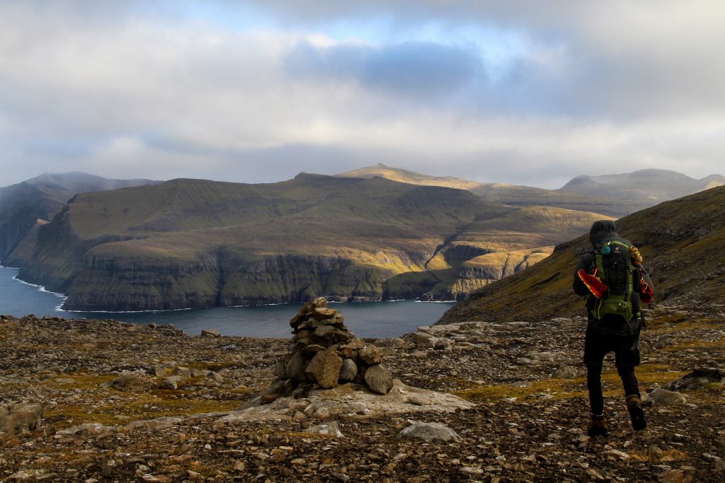
But soon after, we were in Gásadalur and found our way to the beginning of the trail that is well-marked with cairns.
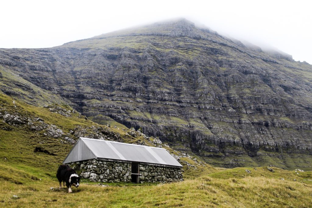
A dog followed us into the valley beyond the village, and he continued following us as we went deeper and deeper into the valley, but just before we were about to start ascending up to the first mountain pass, I shouted “heim!”, the Faroese word for “home” at him. We had no idea how to get him to stop following us, but this turned out to be the magical word. As soon as the word left my lips, he ran towards the village.
Saying goodbye to our friend, we headed up towards the mountain of Eysturtindur, which the trail runs below. This part of the trail was very steep and heavy, especially with the backpacks, but the trail itself was great. It looked like it had recently been made!
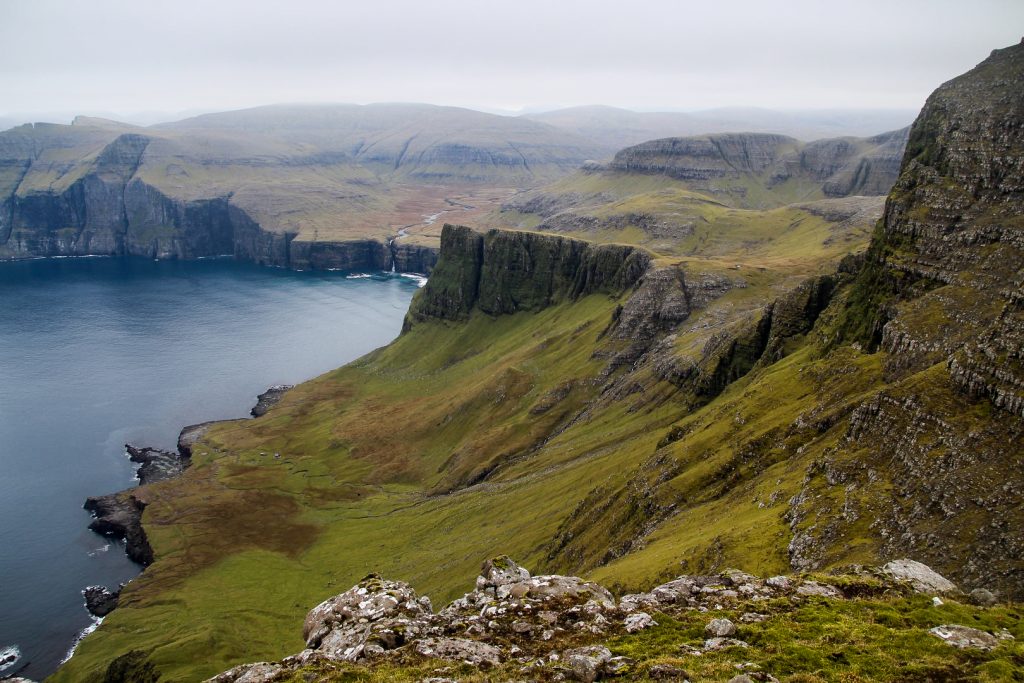
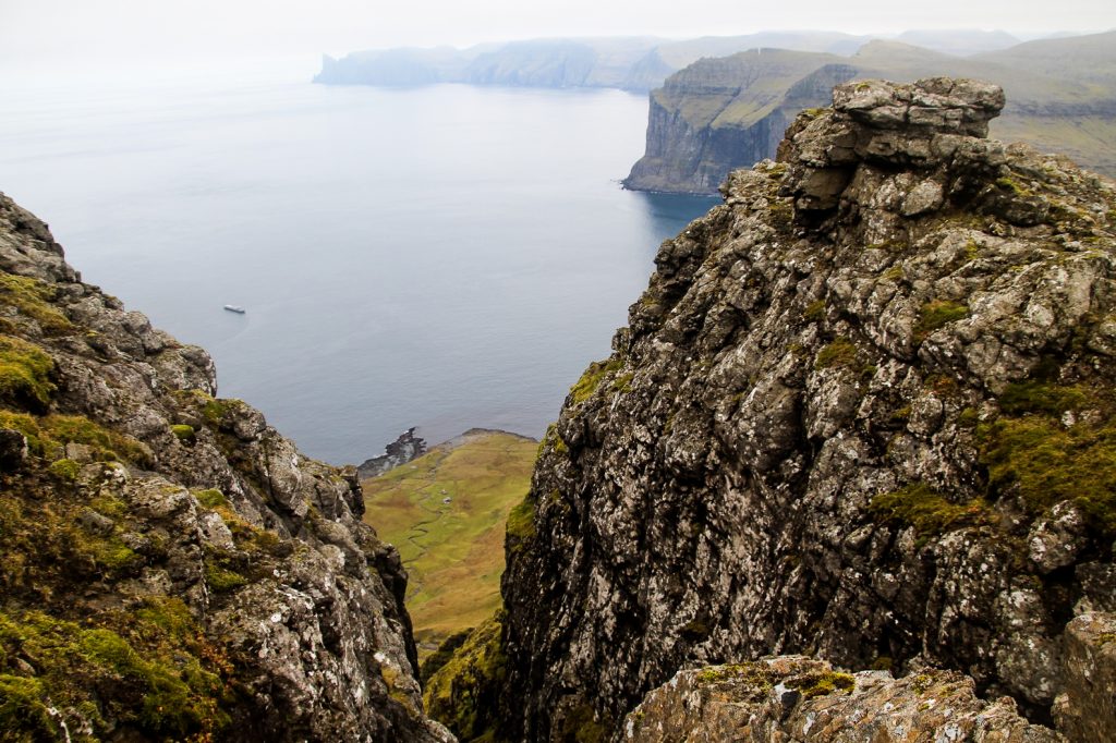
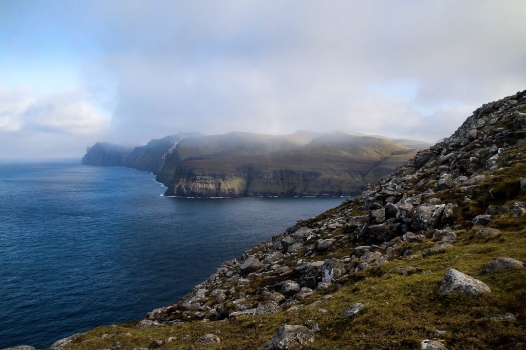
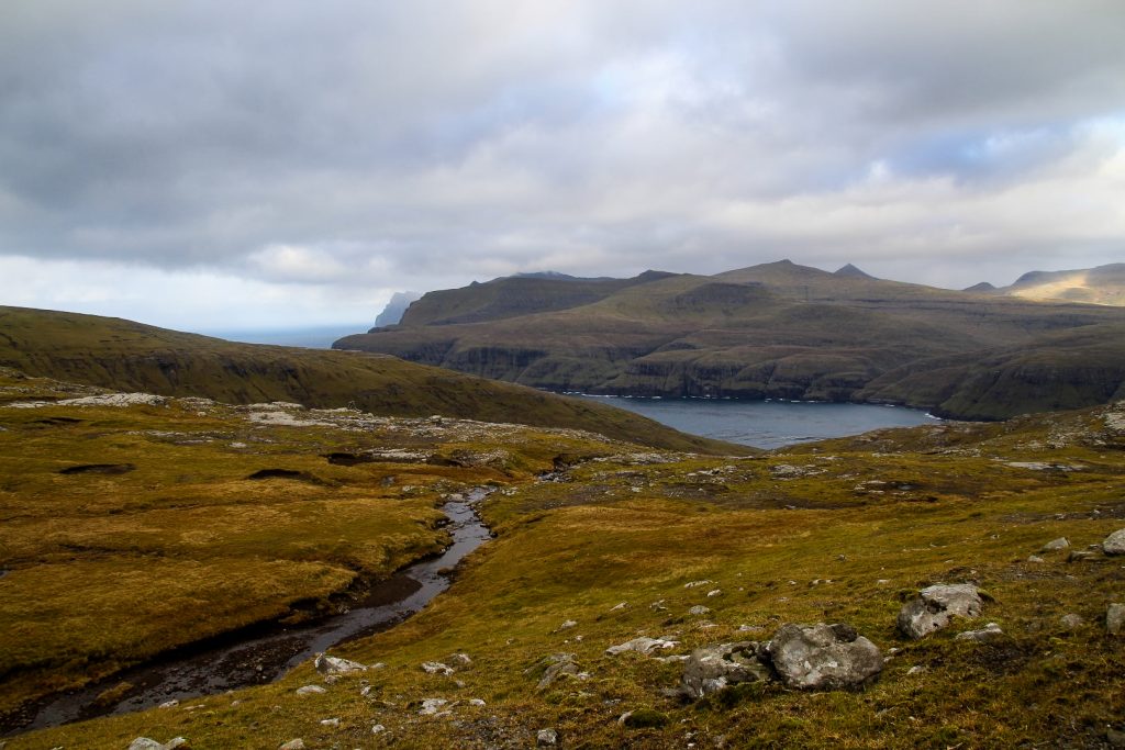
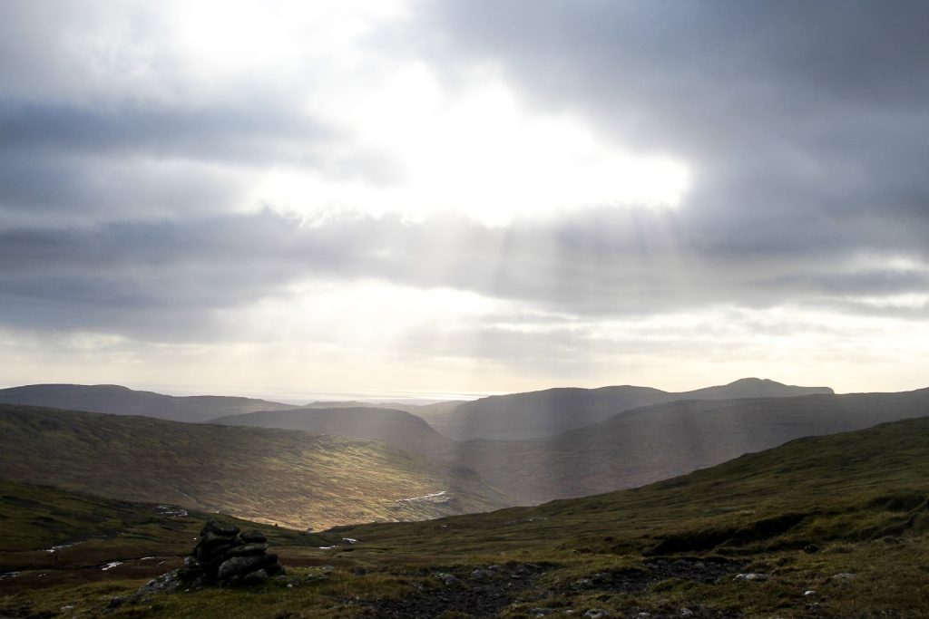
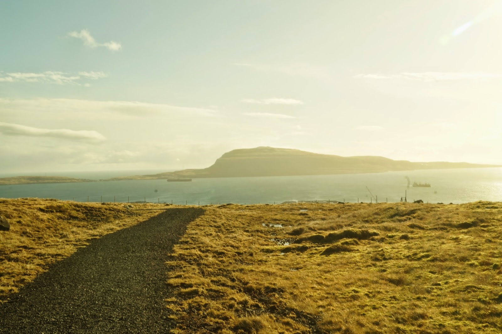
At the top of the mountain pass, a gorgeous view over the most isolated part of Vágar was revealed. We took in as much of it as we could before thick fog rolled in, making it difficult to see more than a few meters ahead.


It was time to descend from the mountain pass and hopefully get below the fog. Finding the right trail was rather confusing since a different cairn trail leads down a valley to the abandoned village of Víkar (a trail I hiked later on in October but more about that later!), and there is also a sheep trail leading down to a different valley. We started following this sheep trail before realizing that we were going in the wrong direction…
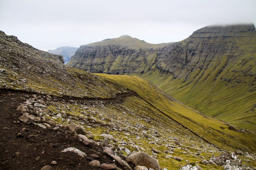
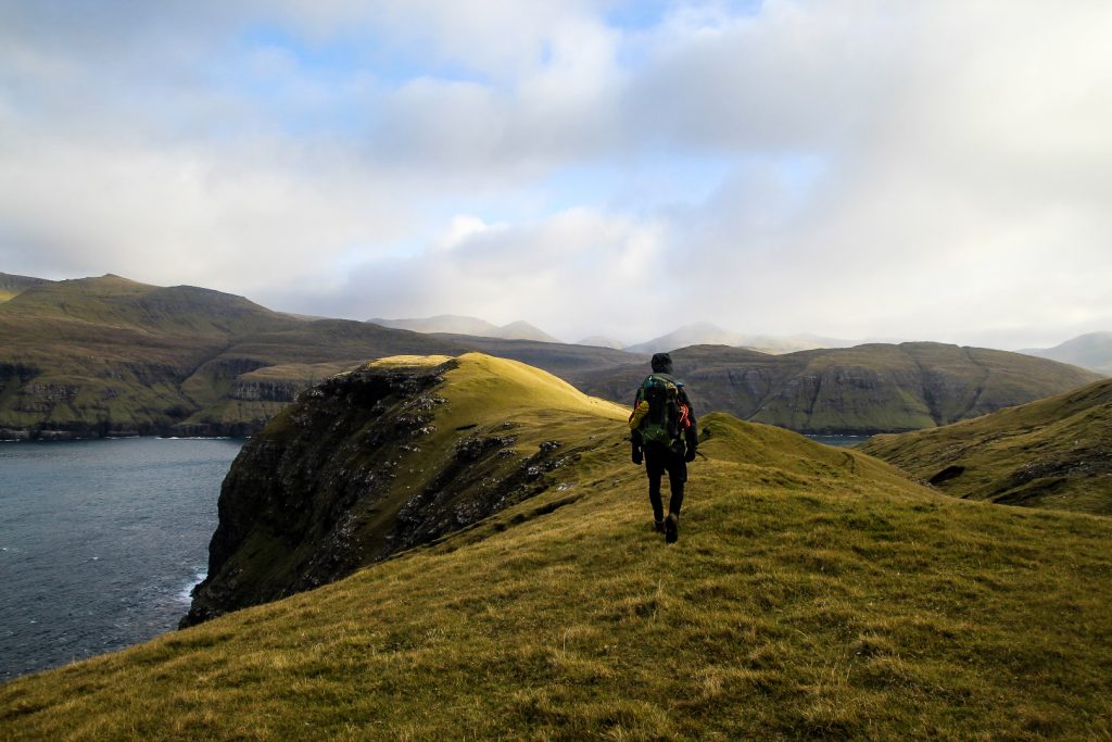
So back up we went, following the GPS. Finally, we managed to find the correct trail which goes down a steep ridge between the two valleys.
I clammed onto the slippery rocks as we made our way down the ridge. Soon, we reached a valley between the two low mountains of Mølin at 423 m. and Klubbin at 352 m. Since the trail took us just 100 meters from the summit of Klubbin, we decided to take our first detour there. We threw our heavy backpacks from us and finally felt the joy of hiking without a heavy load. We were on the summit in no time, and it offered a great view of what was to come.

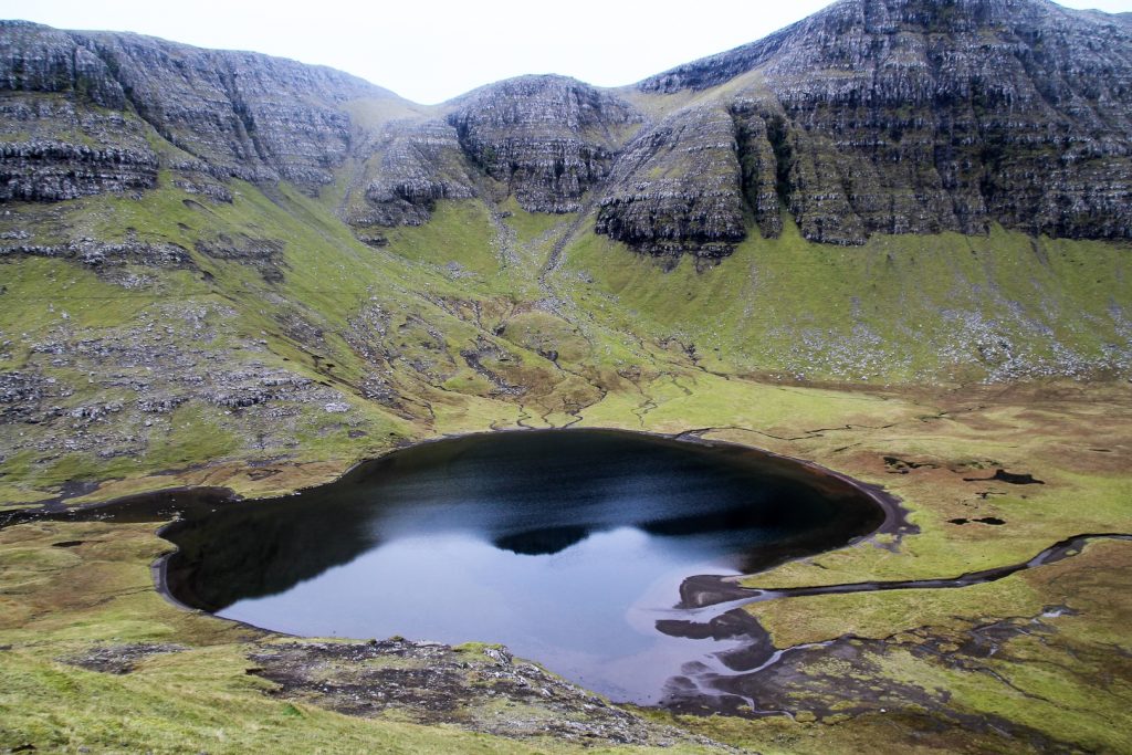
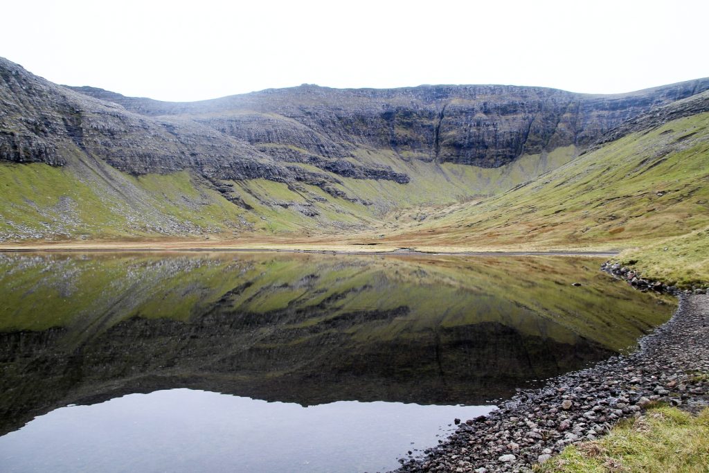
The small lake, Hvilvtkinnavatn, is located beneath Klubbin, and the trail runs alongside its northern shore although we wouldn’t have known this if it hadn’t been for maps.me as the cairns had disappeared.
We decided to enjoy the view for a moment longer and have our lunch on the slopes of Klubbin, overlooking the lake with the most perfect reflections of the mountains behind it.
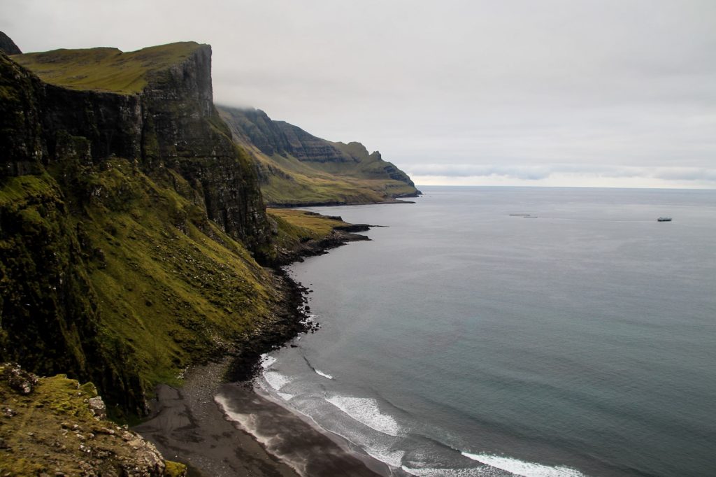
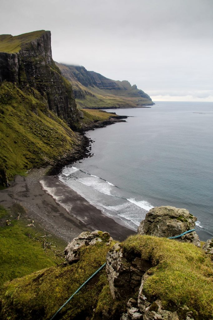
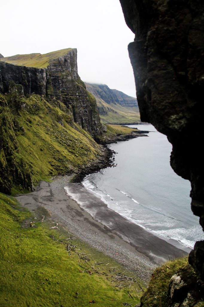
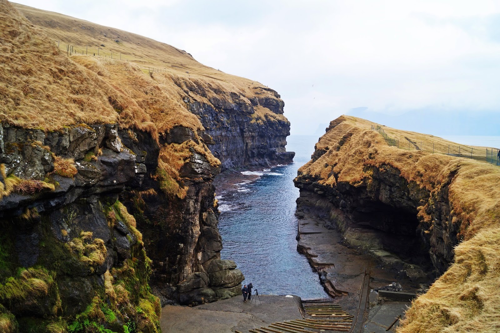
Following the river Gullringsá, we made our way down to the coast where we found the most incredible view on the journey. A steep hill rising majestically above an isolated black sand beach, complete with driftwood and a backdrop of Víkar. This beach tells a story of a time when the locals of Víkar came there to collect the driftwood that they needed to build their houses and keep warm – at the time, the only way to get wood in a barren country.
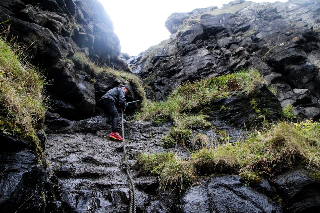
As we were walking along the coast, Lars noticed a rope leading down the steep cliffs to the otherwise inaccessible beach. Our curiosity got the better of us – we just had to give it a go. I hadn’t done any climbing since leaving Nuuk back in February 2019 where I climbed regularly, so I was rather nervous that I wouldn’t have any skills or strength to do it.
We got down the first part alright. There were enough protruding rocks to step on and I didn’t have to use the rope too much. But the next part was really difficult. Lars got down without issues, but short little me had to cling onto the rope to get down. It was difficult to trust the rope completely, but eventually my feet hit the ground. Next up was a very steep and muddy part. I slipped as I went down it, but I clung to the rope and managed to save myself although my clothes got really muddy. It felt like we had come a long way, but looking down at the beach, we could see that we were only halfway at best. It was nearing sunset and I wasn’t even sure I’d be able to pull myself up the section that we had already come down as I would have to rely solely on the “strength” of my spaghetti arms. So we (= Lars) decided to be sensible and go back up, leaving the little beach adventure for a different time. To my great surprise, I actually managed going up the rocks much better than I thought I would. It took a lot of courage and encouragement from Lars, but eventually, I pulled myself back up on safe ground, but not without slipping. Thank goodness for that rope!

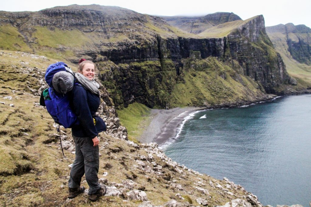
High from the hardest climb of my life and actually rather proud of myself for doing it without injury (except a few bruises, but oh well), we walked further along the coast to soak up the view of the beach and the nearby waterfall of Reipsáfossur in the last light of the day.
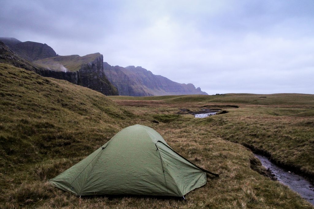
Then we started to look for our camping spot for the night. First, we had to cross the Gullringsá river, which was harder than we thought. We threw a bunch of rocks to create stepping stones for ourselves and got over just as dusk set in for good. Close by the river banks and just before it got too dark to see anything, we pitched our tent for the night and actually slept really well. It wasn’t as cold as we had feared and it was quite comfortable on the mossy ground.
We hadn’t covered as much ground as we’d hoped that day but that was mainly due to the unexpected extra 10 km in the morning. But we were sure it wouldn’t be an issue. We would just get up early to be sure that we could complete the last 23 km before sunset the following day!
We woke up before the sun after a surprisingly great night in the tent. I’m always really lazy in the mornings when camping, so it took me a while to get up and ready for the day. But I couldn’t laze about forever as we still had 23 kilometers left of our journey, and we wanted to complete it before sunset.
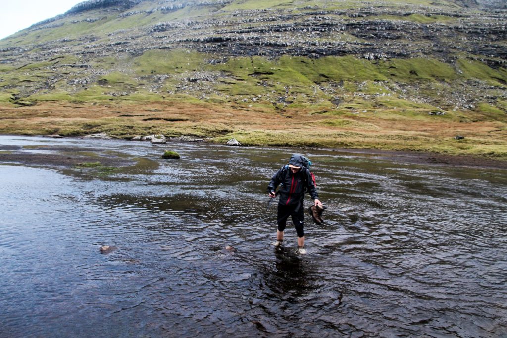
With the camping gear packed up, we threw on our backpacks and began the long day of hiking shortly after sunrise. Within a few moments, we were met with the first challenge of the day, crossing the river Reipsá. The river is quite shallow, but it’s very wide so finding a place to cross without getting our feet wet was impossible. After hiking up and down the river looking for a good spot, we decided to give up and just walk across the shallowest place after taking our trousers and shoes off. It was freezing cold, but we both got over without falling even though I was close at one point when I encountered some slippery rocks!

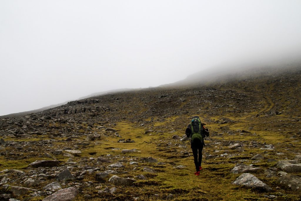
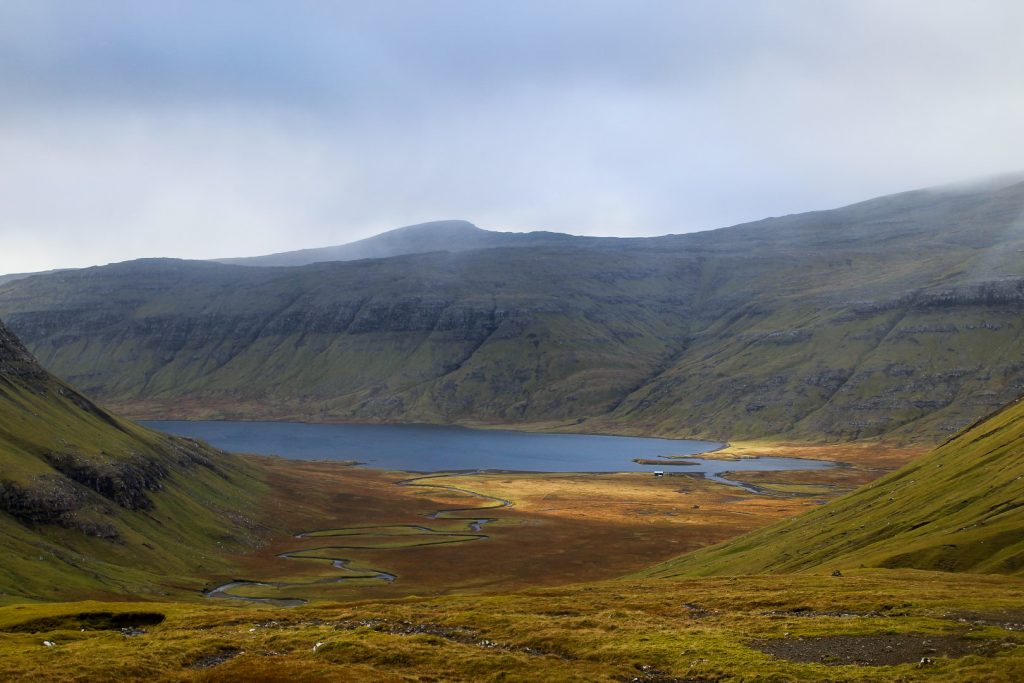
The next part of the trail took us past Lake Fjallavatn, through a swampy meadow where we had to be careful not to get our shoes soaked. And then the next challenge of the day appeared. A long and gradual ascend over several kilometers. Had it not been for our backpacks, it wouldn’t have been a problem as it wasn’t steep, but my back was starting to get really painful.
But as a little consolation, the sun tried its hardest to break through the dark clouds in between drizzles and hailstones, and it did succeed once in a while, providing us with the energy boosts we so desperately needed.
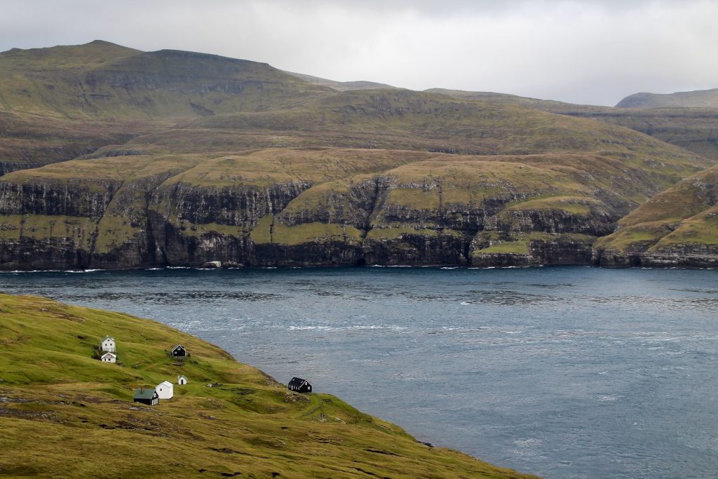
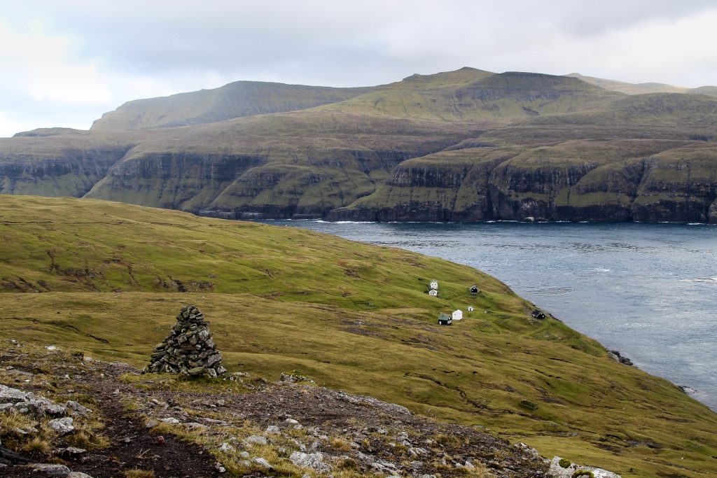
We crossed a river with stepping stones and continued up, following the old cairns to a mountain pass between Grímstaðfjall (523 m.) and Jatnagarðar (563 m.). We were hit by a gush of strong wind that stayed with us as we made our way around the coast following the trail along a mountainside. At one point, we got a bit lost from the route as the cairns disappeared, but with the help of maps.me, we were soon reunited with the trail and finally saw the tiny houses of Slættanes in the distance. We were getting close!


Vehicle tracks came to sight which made me wonder how on earth they got there in the first place. But it was fine for us as it made the trail very easy to see and follow. It wasn’t long until we reached Slættanes’ tiny lighthouse.
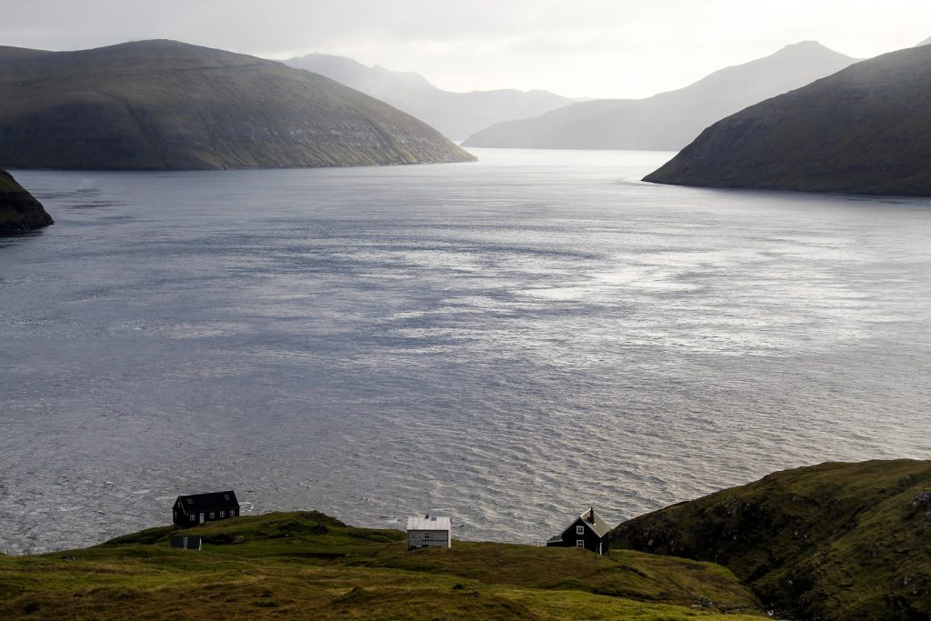
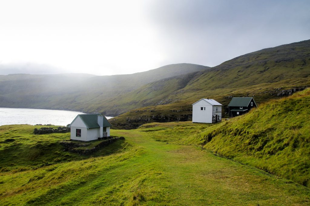
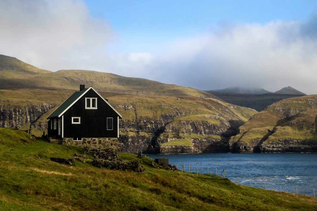
Another five hundred meters south and we arrived in the village. Finally! We got there at noon with hungry stomachs, so we took our first break of the day – and the only long one – on a bench by one of the old residential houses that has been turned into a summer house.
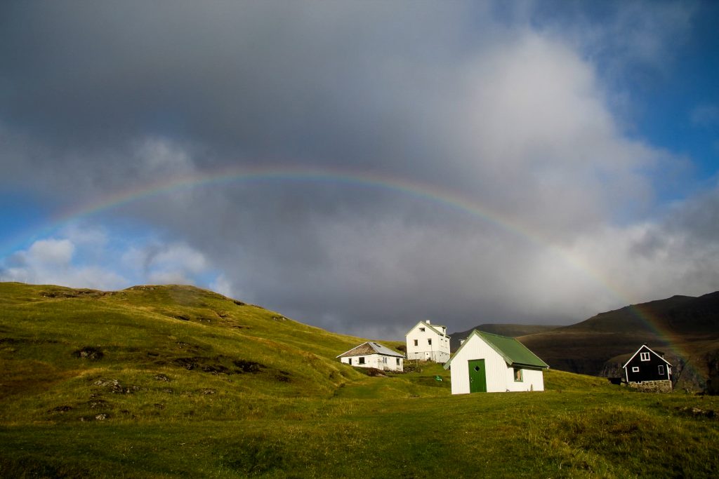
The sun won more battles with the clouds but it was still cold sitting still, so we were up and gone as soon as we’d satisfied our stomachs. Just as we were about to head out of Slættanes, a rainbow appeared, perfectly framing the houses of the village. What a perfect farewell.


Getting out of the village proved to be a real challenge. We couldn’t see any cairns in any directions, and the route beyond Slættanes isn’t marked on maps.me. So we followed our intuition and started hiking along the stream, Grøv. But we soon realized that we were heading back towards Gásadalur, just a few meters from the official trail that we’d just hiked.
So back towards Slættanes we went, until we spotted a cairn high above us to the right. We were thrilled, but bummed at the same time. Because it meant more climbing. As we went up, we noticed more cairns in the distance, reassuring us that we had finally found the correct way. I waved to the lonesome houses of Slættanes as we got further and further away, and soon they had disappeared beneath the mountains.
At one point, we lost sight of the cairns and could only see one tall cairn on a mountain pass in front of us, as well as several cairns leading up towards the mountains of Jatnagarðar and Tungufelli. Looking at a (rather useless) map of the trail that we’d found online, we could see that the trail doesn’t go up the mountains, but instead stays to the east of them, so that made up our decision of where to head next.
We were in a valley which was rather swampy and wet, something I realized a bit too late as I suddenly got my foot stuck in a hole. I managed to get it out, but not without pulling half of the holes mud and water up with me! So for the next few hours, I walked with a puddle and some extra kilos of mud on my right shoe as we headed up in the landscape to the cairn that we’d spotted far ahead.
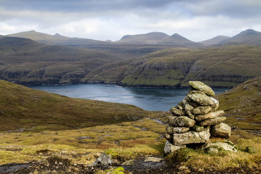
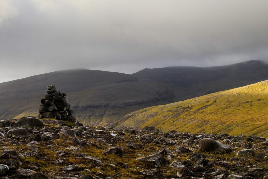
We were thrilled when we got to the cairn and saw that it was numbered. We were at cairn 24, obviously starting from Á Halsi near Sandavágur, where we were ending our hike. So now we knew that we were on the trail and we could start counting down towards the end!
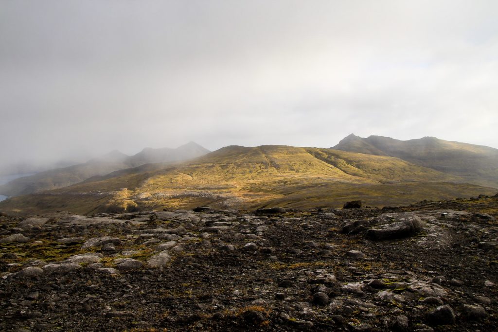
From then on, the trail was remarkably well-marked by a mix of short and tall cairns, not all numbered though. We had to overcome yet another steep ascend before the landscape finally evened out, allowing us to enjoy the last hours of our adventurous hike.
At one point, it started snowing, telling us that the almost summery conditions we’d experienced all October were over. Soon, the mountain tops would be covered in a blanket of white, making hikes like this one a lot more difficult. We definitely timed it right!
The trail took us alongside the low mountain, Tungufellið Lítla, and further up past the summit of Krossafelli. Since we were only about 200 meters from the summit, we just had to take a detour and complete the mountain climb! I was glad to give my painful back a rest as we left our backpacks behind to run up to the summit. Once up there, we were met with a wonderful view over this isolated part of Vágar, the neighbouring island of Streymoy and tiny Slættanes, which we could still spot in the far distance.

We rejoined the trail and found our backpacks, and from then on, the trail only went a bit up, but mostly even and down. But with the snow came the cold, and the wind also picked up, making us shiver as we continued hiking along the eastern slopes of Gásafelli, meeting the trail between Oyrargjógv and Sørvágur on the way.
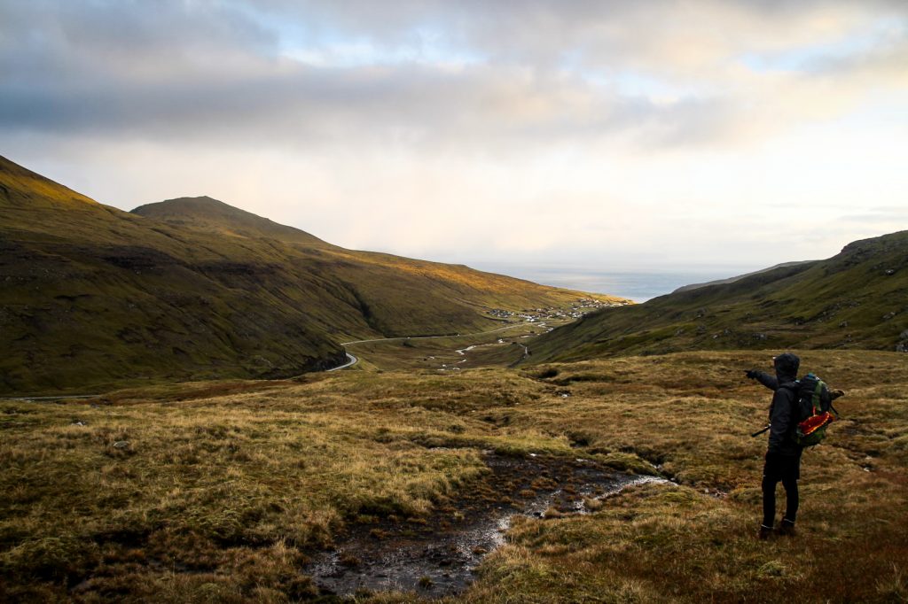
Our woes were soon forgotten when we turned a corner and spotted Sandavágur in the distance! We were finally close to the end, although these last kilometers of descending felt like an eternity.
With the road soon appearing as well, we didn’t really have to follow the cairns anymore, although we still did as we wanted to find no. 1. We found it about 600 meters from the road and then it was just a short yet steep descend before we could finally feel asphalt beneath our feet again!
We were overjoyed as we threw off our backpacks and stuck our thumbs in the air, hoping and praying that someone would have mercy on us and save us from the last 4,5 km back to the hostel. But car after car passed and Lars wanted to give up and start walking. But I was adamant (= lazy) and told him “just one more car, and then we can go”. And would you believe it, that last car was our saviour. A Kyrgyz man who is married to a Faroese woman (the best mix of nationalities I’ve ever heard of!) picked us up and drove us straight to the door, before offering us a box of liquorices from his company. Oh, the kindness of the locals on the Faroe Islands; it’s the one thing I love the most about the place! The nature is incredible, yes, but it’s the people that inhabit it that give it that extra, special beauty.
Hiking route description: Gásadalur to Slættanes to Sandavágur
The hike begins in Gásadalur at the end of Gerðisvegur. Follow the dirt track to two fences that you have to open to enter the valley where the trail begins. Follow the footpath which is marked with cairns to the end of the valley and head up the well-trodden footpath that goes up into the mountains to your right.
Once you reach the highest point on the trail, you will see cairns leading down to a valley with a few houses at the bottom. This is the abandoned village of Víkar. Don’t follow these cairns, instead follow the cairns that lead down a ridge between this valley and another to your right. This part is quite steep so take care.
Once you get down the ridge, you’ll have the two low mountains of Mølin and Klubbin on either side of you. Continue hiking between these two mountains and past the lake, Hvilvtkinnavatn. If you want, you could take a detour to the summits of these mountains before continuing. From the lake, follow the river Gullringsá out to the ocean for the most amazing view on this hike – of an isolated black sand beach.
Now it’s time to find a good spot to cross the river. It can be a bit difficult, but there are enough rocks for it to be possible without wading through. The next river crossing is only a few hundred meters away. Crossing Reipsá is difficult as the river is wide, so your best bet is to remove your trousers and shoes and walk over a shallow spot.
Continue northeast past Lake Fjallavatn and through a swampy meadow. Soon, you will start ascending again, following cairns up to a mountain pass between Grímstaðfjall and Jatnagarðar with one river crossing, which isn’t too hard as there are plenty of rocks to step on. Continue along the side of the mountain, following the coast, and you will soon see Slættanes in the distance. From here, the trail is well-trodden and easy to follow, first out to the lighthouse and then to the village.
To get out of Slættanes, walk down to the tiny harbour to cross the stream, Grøv, and start hiking up, heading southeast. There are many cairns on this section, however at one point, you will hike down to a valley and see cairns both in front of you and behind you towards the mountains Jatnagarðar and Tungufelli. Go straight, heading towards the large cairn on a mountain pass in front of you. The trail doesn’t go up the mountains, instead it runs 500-1000 meters to the east of them.
Once you reach this cairn, the trail is very easy to follow as there are cairns the entire way, many of which are numbered. Just make sure that you’re walking to the east of Tungufellið Lítla and to the west of Krossafelli. You will pass very close by the summit of Krossafelli which is worth a detour, especially since you can see Slættanes from afar from up there!
As you continue along the slopes of Gásafelli, you will at one point meet the trail from Oyrargjógv to Sørvágur going east-west. Ignore these cairns and continue straight ahead towards Sandavágur, which will soon appear to your right. Follow the cairns down to the road by Á Halsi where the hike ends.
The cairns are few and far between at the beginning of the hike, so it’s easy to get lost on this trail if you don’t have a map to follow. I recommend using the app maps.me, which has the first part of the hike, Gásadalur to Slættanes, marked. For the second half to Sandavágur, there are enough cairns so a map shouldn’t be necessary.
The hike is 26-30 km (depending on detours), takes 15-17 hours and is of moderate to hard difficulty. I recommend spending two days on this hike so you have time for detours and breaks.
Leave a Comment
Pingback: A short hike to Vágar’s unknown lake, tucked away below the misty mountain peaks – Northtrotter on 08/12/2020
Pingback: Secrets of Vágar: Finding the Skarðsáfossur waterfall near Bøur – Northtrotter on 08/12/2020
Pingback: My November-December 2020: The move to Lolland – Northtrotter on 08/12/2020
Pingback: Cairn trail to the old harbour: Hiking from Oyrargjógv to Sørvágur – Northtrotter on 08/12/2020
Pingback: An abandoned world: A challenging hike to the forgotten Faroese village of Víkar – Northtrotter on 08/12/2020
Pingback: Popular hikes restricted: Examining overtourism on the Faroe Islands – Northtrotter on 08/12/2020

8 COMMENTS
QuentinSymbolful
3 years agoWow, what a tremendous experience! I always dream about hiking the No.16 trail, guess I’ll make it soon after the pandemic ends.
Melissa Cherry Villumsen
3 years agoOh, I hope you will! It’s definitely one of my favourite trails on the Faroes! 😀