Múlafossur Waterfall flowing down a cliffside directly into the ocean with the tiny village of Gásadalur above it is an image that most visitors to the Faroe Islands want to capture. But beyond the village in those thousands of photos are the two mountains of Heinanøva at 612 m. and Árnafjall at 722 m. The latter is the highest mountain on the island of Vágar. They offer one of the toughest and most adventurous mountain climbs in the country.
Since I spent the month of October on Vágar trying to climb all mountains on the island – in addition to seeing everything else the island has to offer – I decided to get this one out of the way quickly before any potential snow came. I knew it was going to be steep and tough, but I didn’t realize just how much scrambling it would involve.
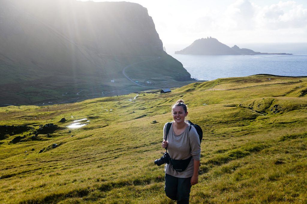
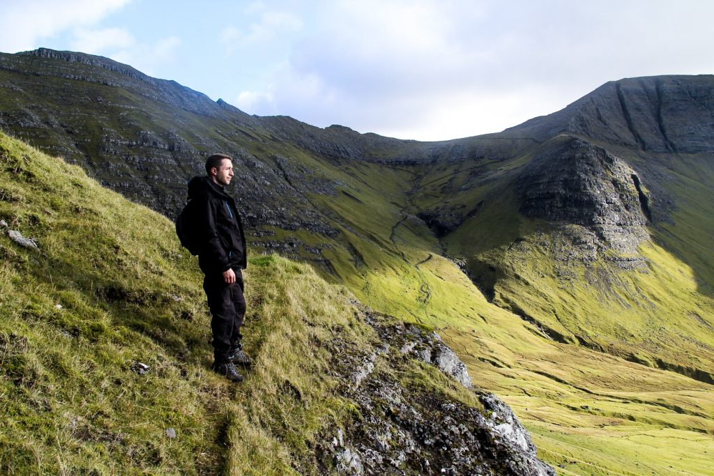
I was joined by Daniel who’d also climbed three mountains above Lake Vatnsdalsvatn with me three days earlier. We set off to Gásadalur at 10 AM, the sun shining brightly and the wind calm, promising a perfect day for a tough climb.
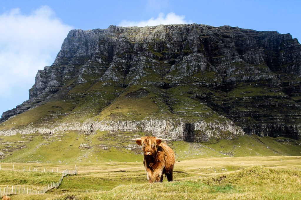
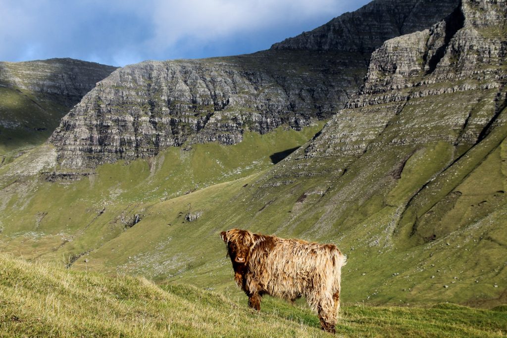
We parked the car in Gásadalur’s small parking lot and set off towards the mountains towering above the tiny village. Two gates separated us from the village and the outfield, and beyond them were highland cows that didn’t take any notice of us. It was a bit scary to walk past them as they have enormous horns and could kill us if they wanted, but they just stared a little and then kept on eating. They seem to be quite gentle creatures!

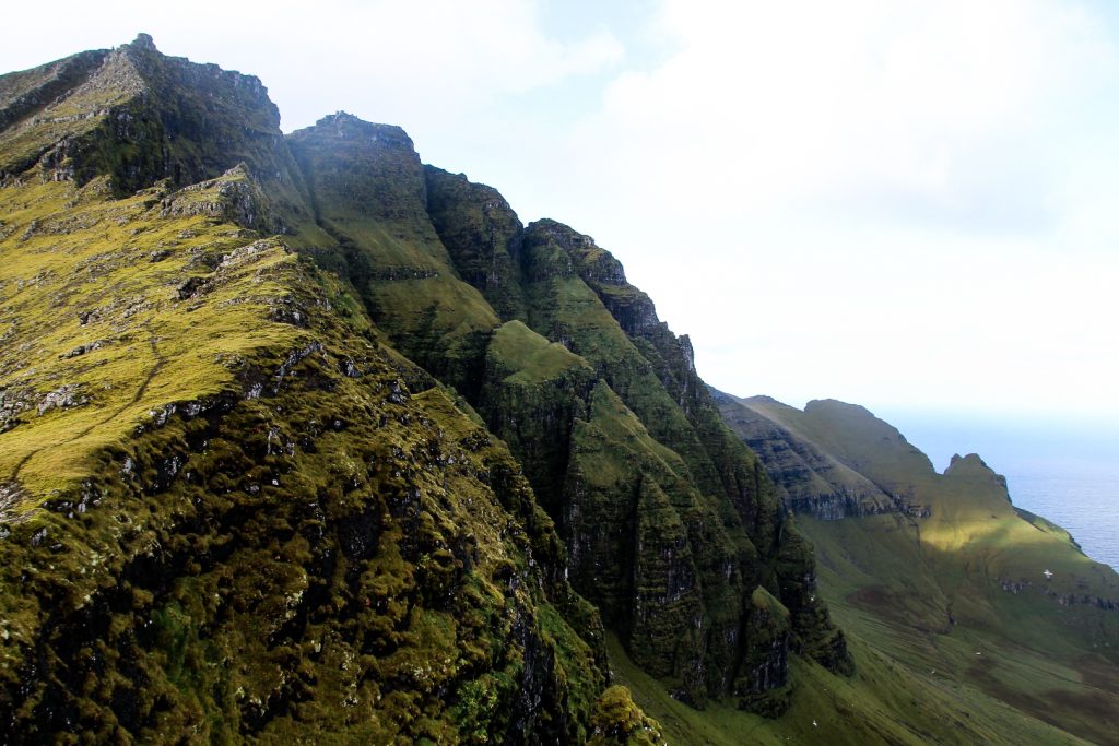
Both Heinanøva and Árnafjall are incredibly steep mountains with no obvious places to ascend, so we just hiked along the base of Heinanøva until we found a slightly less steep spot to start climbing up.
Unfortunately, we soon realized that getting to the top would require much more scrambling than we were prepared to do. Determined as I always am when I climb mountains, I hated the idea of giving up, but Daniel didn’t feel safe going any further. I went a bit further on my own to see if it would get better, but it didn’t. I was just over 400 meters above sea level, so there was still over 200 meters of scrambling to go to reach the summit of Heinanøva. I considered continuing on my own, but deep down I knew that it wouldn’t be sensible. So I climbed back down to Daniel, and we spent the next half an hour or so treading very carefully as we climbed back down the mountain. Mission failed!


But we weren’t quite ready to give up yet. Earlier on, we had spotted an area deeper in the valley that seemed like a good spot to go up to climb Árnafjall. We were certain we’d be able to get to the summit of Heinanøva from Árnafjall’s summit and vice versa, so all we really needed to do was to get ourselves to one of the summits.
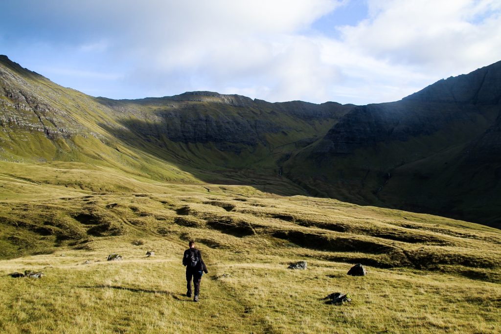
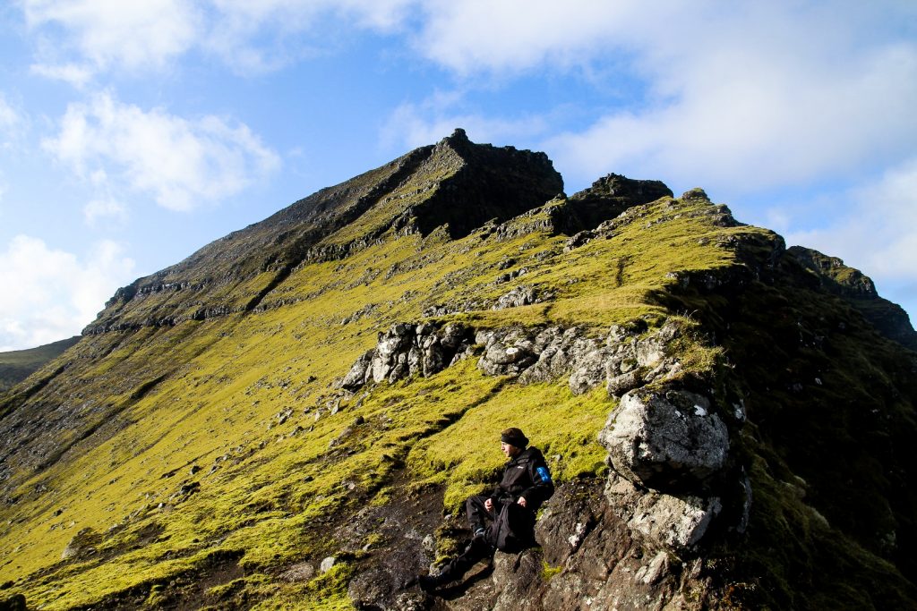
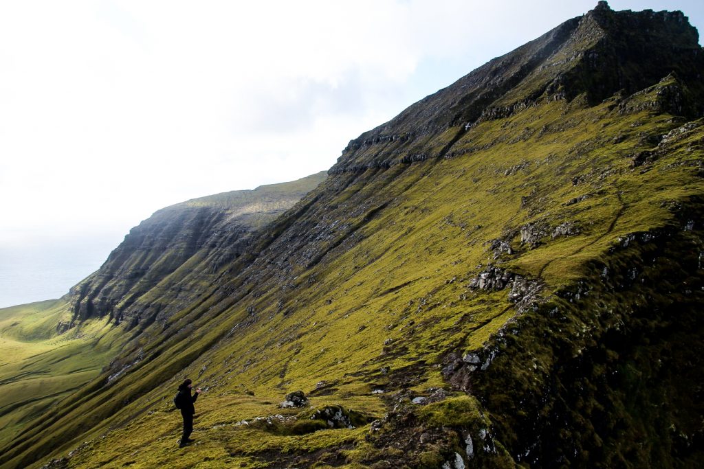
We soon found a well-trodden sheep trail to follow to our chosen spot, and we were actually able to follow it all the way up to a ridge. It wasn’t very steep, actually it was quite a nice hike and it was wonderful not having to scramble for once. It didn’t take us long to reach the ridge that we were aiming for, from where we hoped we’d be able to walk to the summit. But as we got closer, we realized that getting to the summit from there wasn’t in any way possible, because getting there would require scrambling up a steep cliffside with long drops on both sides that would mean sudden death if we fell. As eager as I always am, I decided to walk towards the summit to see if our eyes were lying to us, but they weren’t.
There was nothing to do, no way to get there, so we gave up once again. Mission #2 also failed.
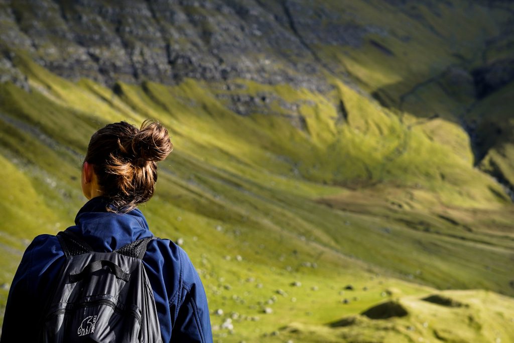
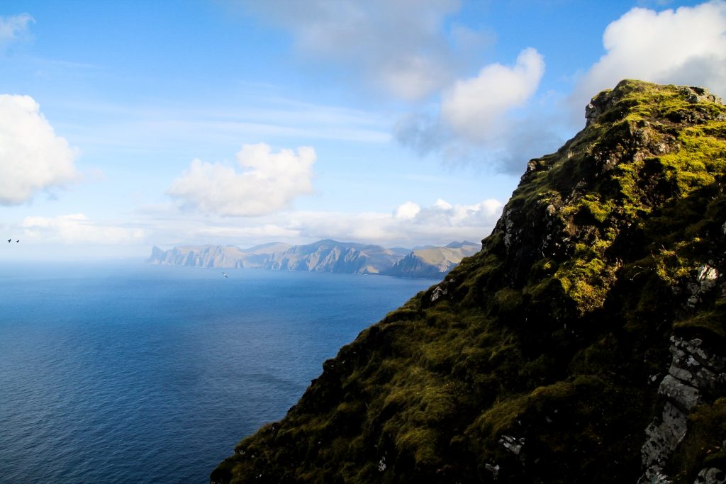
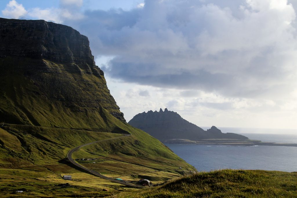
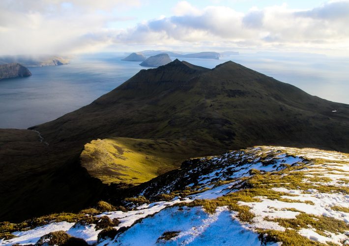
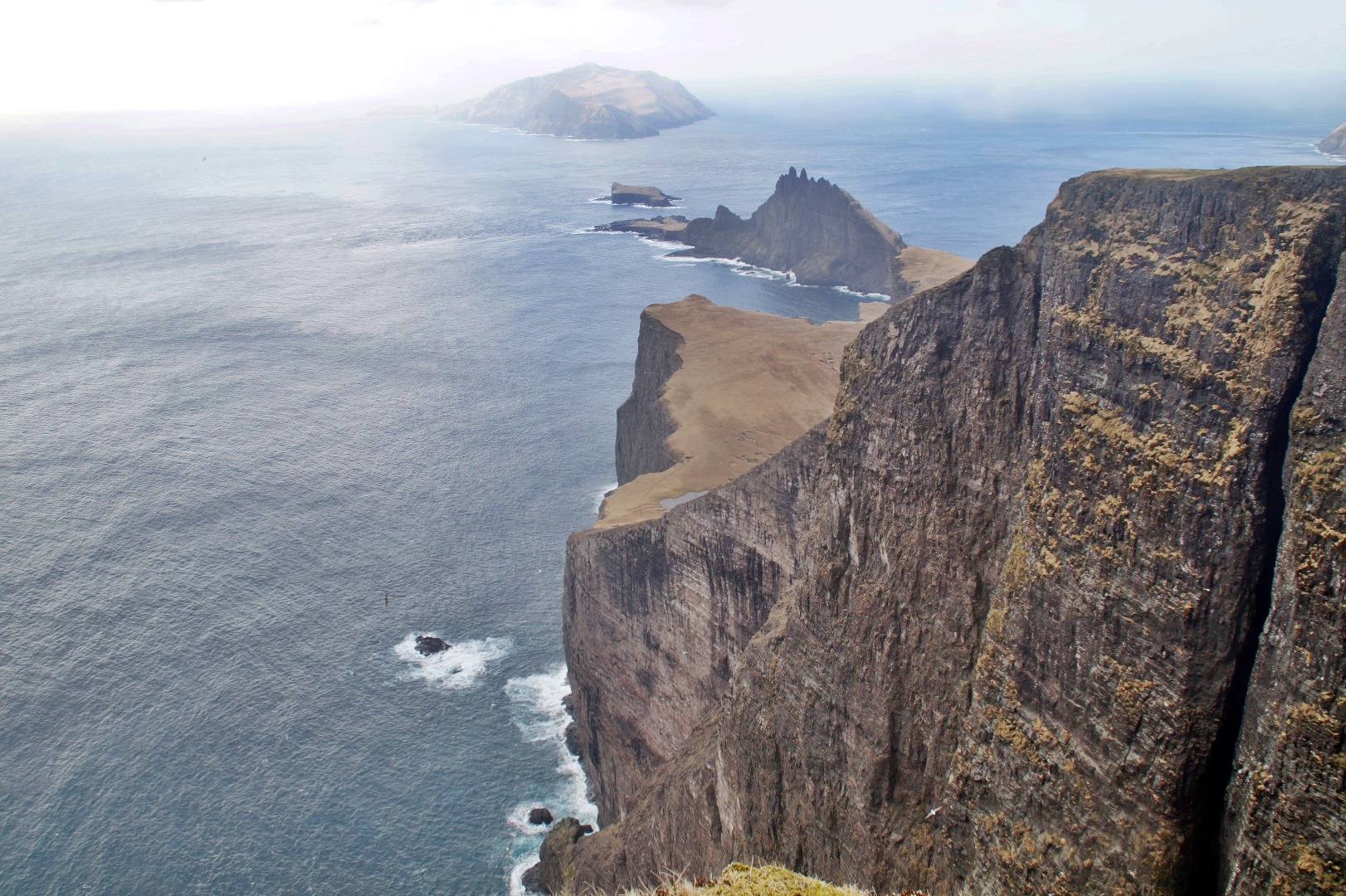
BUT, at least we got to the ridge which offered amazing views of the Tjørnunes peninsula, the sea stack of Skarvadrangur and the rocky cliffs of northwest Streymoy in the distance. Plus, we got to see the majestic summit of Árnafjall with its steep drops from a unique angle! Those views were worth the two failed attempts!
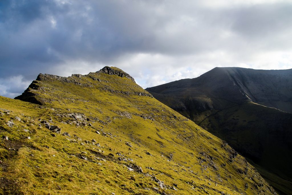


As we hiked back down, I kept looking up at the mountains to see if we’d possibly missed a good place to go up. But I didn’t see anything. I actually think the first way was the correct way. It’s the shortest distance to the summits, so the least amount of scrambling. But either way, getting to the summits is difficult.
With half an hour or so of more scrambling, we probably would’ve made it past the steep part and be able to walk to the summits. At least that’s what it looked like from below. Hopefully I will find out someday as I don’t plan on giving up. I want to conquer those mountains!

We got back to the village after a good 5,5 hours of hiking, climbing and scrambling. But miraculously, I didn’t feel tired or sore at all. I think my body must finally have gotten used to hiking almost everyday!
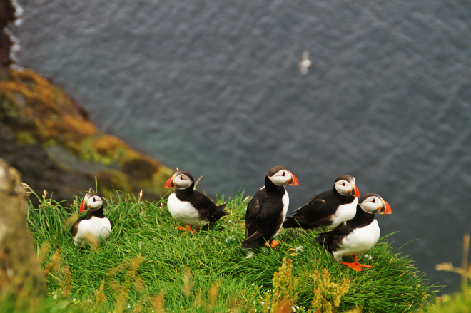
We were on our way to the car when I spotted a small shop which sells local homemade goods. A peek inside turned into an hour-long conversation with the owner who told us all about life in the village now and before a tunnel was finally built in 2004, connecting the village to the rest of the country. She also showed us a baby puffin with a broken leg which she and her family rescued and are now caring for. The chick would die in the wild with a broken leg so they are keeping him as a pet. He has already become great friends with their dog and rabbit!

Our unexpected chat was a wonderful way to end an otherwise unsuccessful day and it definitely helped to cheer me up. I don’t like being defeated by mountains, but it happens sometimes and it’s also important to remember that it’s always okay to turn back if it doesn’t feel safe. I’ll have to remind myself of that in the future!
Hiking route description: The ridge between Árnafjall and Eysturtindur
As an easier alternative to climbing the moutnains behind Múlafossur Waterfall in Gásadalur, this ridge offers similarly incredible views as well as unique views of Árnafjall’s steep and rocky summit. The ridge is found between the two highest mountains on Vágar, Árnafjall and Eysturtindur.
The hike starts in the village of Gásadalur. Walk along the road Gerðisvegur and continue when it becomes a dirt track leading into the valley. Soon, you will come to two gates. Open them and remember to close them behind you. If you see highland cows, walk past them without bothering them, then they won’t take any notice of you.
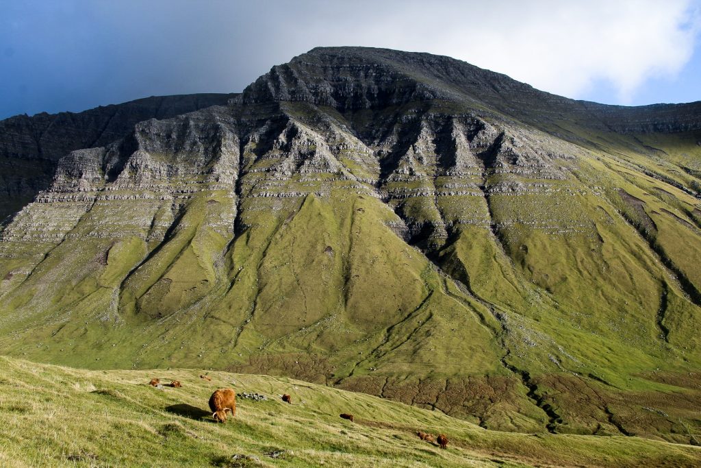
Find your way to the base of the mountains on your left and follow them until you see a narrow sheep trail leading gradually up the side of Mt. Árnafjall (there are two prominent sheep trails, but take the higher one). You will have to cross a few waterfalls, but just follow the sheep trail and you’ll find plenty of stones to step on. Continue along the sheep trail until you reach the ridge.
Be very careful here and don’t go too near the edge as the cliffs are vertical. But do enjoy the magnificent view of the Tjørnunes peninsula and the sea stack of Skarvadrangur with the ruggest coastline of northwestern Streymoy in the backdrop, and don’t forget to look to your left where you’ll find the steep, rocky summit of Árnafjall. Please don’t attempt to climb the summit from here as it’s very dangerous. To get back to Gásadalur, reverse the route.
The hike is 5 km, takes 3-4 hours and is of moderate difficulty.
Leave a Comment
Pingback: Bøur to Gásadalur: Hiking the old postman’s trail with two mountain detours – Northtrotter on 10/11/2020

1 COMMENT