This post contains affiliate links. If you make a purchase through these links, I may earn a commission at no extra cost to you. Thank you!
I was exhausted after three long days of hiking, including a 21 km hike to the abandoned village of Víkar the day before, so I wanted to give myself a break. I woke up to typical Faroese weather; some rain, some sun and some wind. I secretly wished it would start pouring down so I would have a better excuse than exhaustion to stay off the trails, but it didn’t.
I had already talked to Lucy about hiking to the heart-shaped lake of Vatnsdalsvatn that day. The hike is supposed to only take an hour each way, which would be enough to get in my 15,000 steps per day, but not too much for a rest day. But of course, once we were out there, we just had to continue…
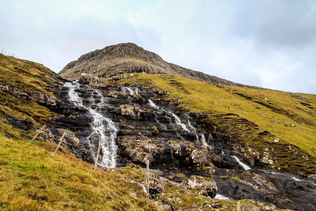
We didn’t start the hike until 2 pm, so I did have half a rest day beforehand. We parked the car in a lay-by and found the gate that leads to the “trail” up to the lake. It actually did look like a trail in the beginning, but it soon became a mixture of mud and grass, soon disappearing completely. But we knew where to go. We were following a waterfall that we knew originated from the lake!

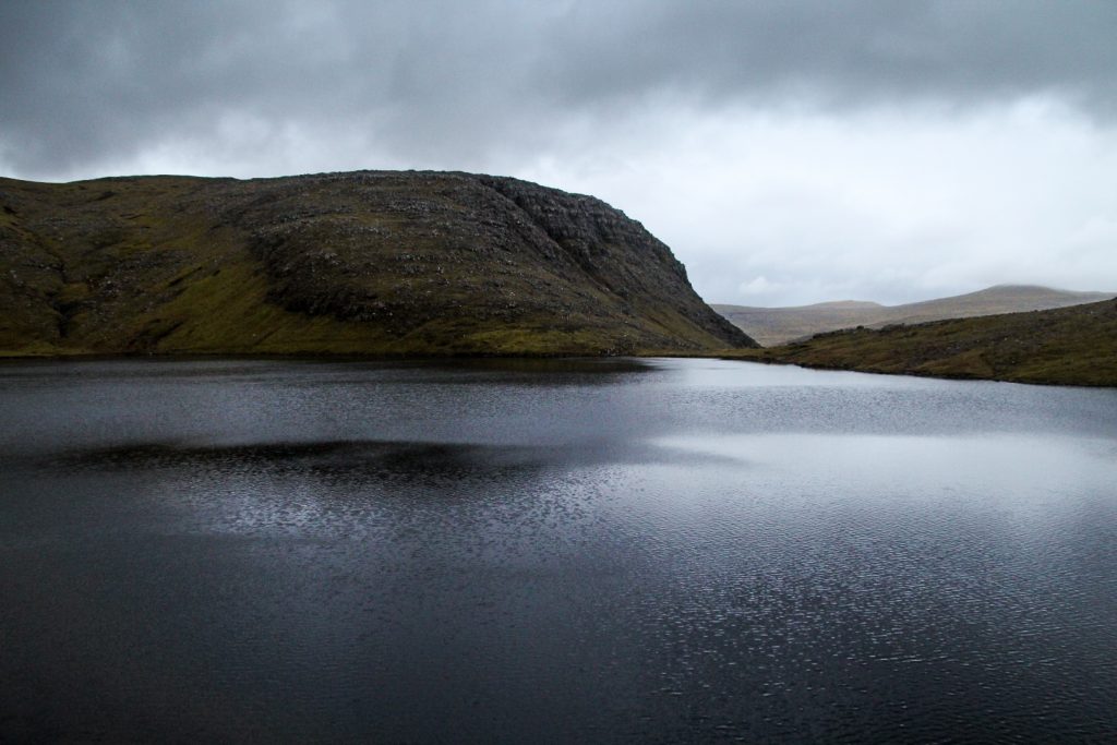
I dragged my legs up the first section. It was steep, way too steep for a “rest day”, but Lucy kept me motivated. It took us 45 minutes to reach the lake, which looked nothing like a heart at the banks. But I had seen the lake from above before where it does – kind of – look like a heart.
My initial plan of just hiking to the lake was destroyed when Lucy said she’d never seen the lake from above. Okay, we couldn’t possibly go there without seeing it from above then, right? I didn’t want her to miss out on the sight when we were so close!
So we decided to climb a mountain. So much for a rest day!
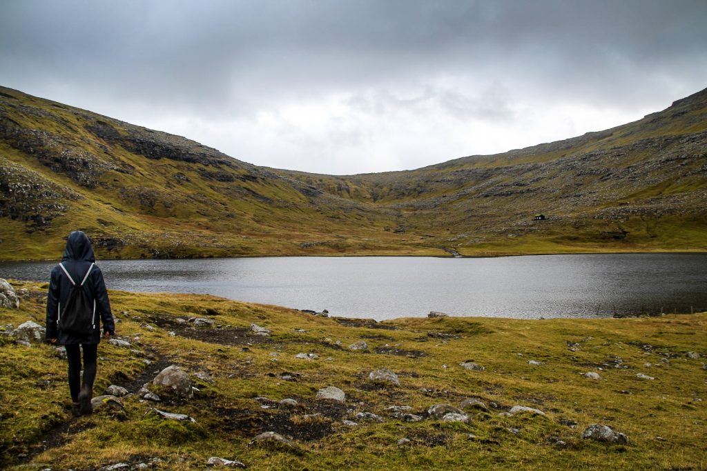
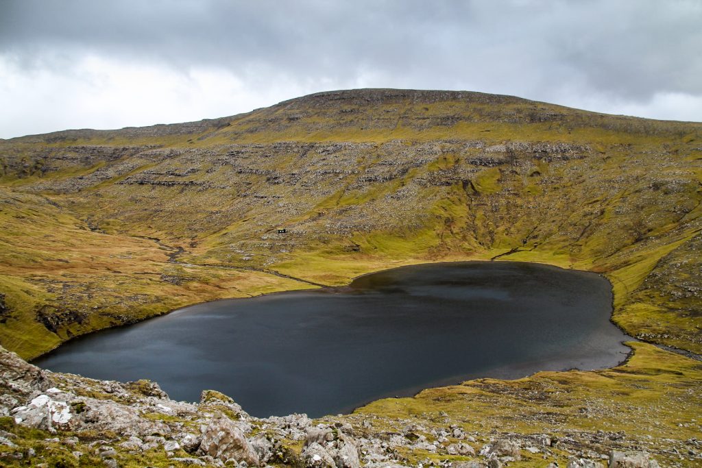
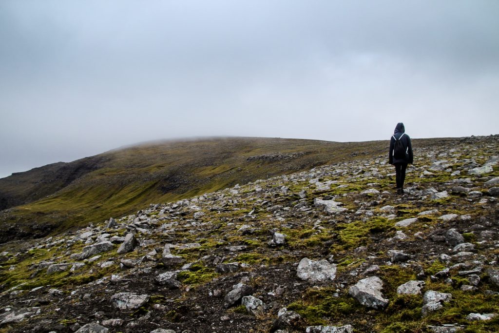
We ascended up a rocky slope at the edge of the lake, a somewhat silly decision as it turned out to be very steep. The many rocks didn’t help and we had to be careful not to slip on their wet surfaces. Looking back, Vatnsdalsvatn finally started to take its shape as an imperfect heart.
Up and up we went, and soon the summit of Snældansfjall at 617 m. came into view. Well, kind of. Because it was swallowed up by a blanket of fog.
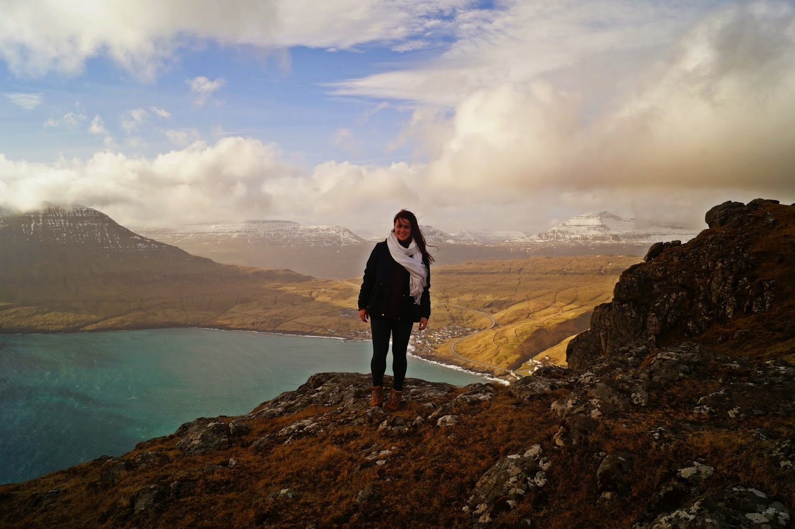
We figured the fog would soon disappear given the strong winds at this height, so we continued our gradual ascend to the summit. And to our luck, the wind did force the fog away for a moment, allowing us to see a wonderful view of the Drangarnir sea stacks and the islet of Tindhólmur.
We continued upwards and the fog started rolling in again. 100 meters from the summit cairn, we could suddenly only see 20 meters in front of us, and Lucy said it might be best to start heading down. 100 METERS FROM THE SUMMIT. Since the fog wasn’t that dense, I quickly walked to the cairn that marks the highest point of the mountain, and then ran back to Lucy to begin our descend.


We wondered if we’d be caught in this fog for the rest of the hike back to the car, but as soon as we’d said it, the fog lifted. It was literally seconds after the first mountain ridges appeared in the distance.
But unfortunately, the fog was replaced by strong winds and rain. We hurried as much as we could, cold as anything, to get back down to the lake. Somehow, we ended up taking an even steeper route than we’d come up, so it took way longer than it should’ve.
Shivering, we finally found our way to the banks of the lake as the sun said goodbye for the day. We followed a sheep trail running along the side of the lake until we found the same waterfall we’d followed on our way up. Some steep descending later – Lucy almost running and me sliding down on my butt – we were finally at the car, almost an hour after the sun had set.
If climbing that mountain wasn’t spontaneous, I don’t know what is. But I am glad we did it. It got me closer to my goal of climbing all mountains on Vágar and was actually my 35th mountain out of 41 on the island. Unfortunately, it was also my last one – for now!

Hiking route description: Vatnsdalsvatn and Snældansfjall
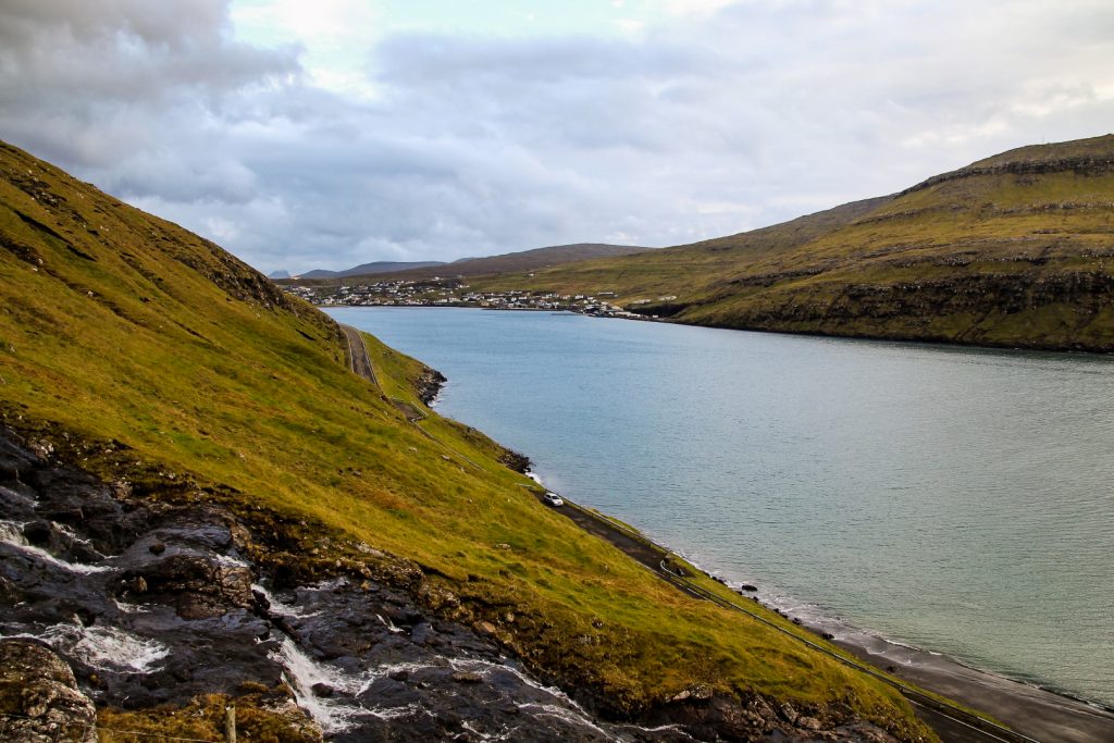
The hike begins on the right side of the road between Sørvágur and Bøur, ca. 1 km from Bøur. There is a gate a few meters from a large waterfall – this is the entrance to the hike. There’s a lay-by 200 meters back towards Sørvágur where you can park your car.
Follow the unofficial trail up alongside a fence and the waterfall. The ascend is quite steep, but it’s not difficult to find your way as you just need to have the fence and waterfall to your right at all times. There are a few streams to cross, but they are easy. At one point, you’ll have to climb up a rather steep section. There’s a grassy part to the left of the waterfall which is easy to climb up. Once you get up, continue straight ahead on flat ground until you reach the banks of the lake.
Snældansfjall is the mountain to your left. Find a good spot to climb up. The beginning is steep, but once you get up, the ascend towards the summit is gradual and easy. For a full view of the heart-shaped lake, don’t forget to hike out to the right of the mountain ridge as you climb up. A cairn marks the highest point of the mountain.
Descend from the summit the same way you came up, and return to the waterfall which is now to your left as you descend back to the road.
The hike is 6 km, takes 3-4 hours and is of moderate difficulty.
Hike to Vatnsdalsvatn with a guide
Eager to see the heart-shaped lake but not quite up for doing the hike yourself? Then take this tour with a local farmer with the added bonus of a traditional lunch after the hike!

Leave a Comment