This post contains affiliate links. If you make a purchase through these links, I may earn a commission at no extra cost to you. Thank you!
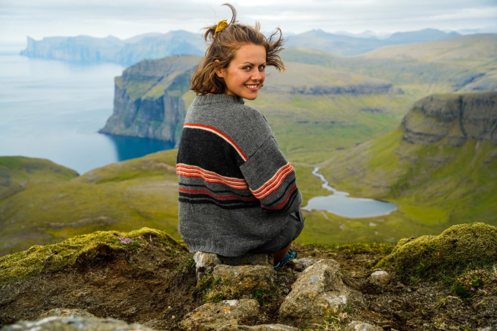
If I had a dollar for all the times I’ve been asked to create an itinerary for someone else’s trip to the Faroe Islands, I’d be rich! As much as I love helping people plan the perfect trip to my favourite country, it’s very time-consuming, so I figured it would make sense to create the perfect itinerary for every hiking lover to use.
It’s no secret that I absolutely adore the Faroe Islands. It’s the country I’ve visited the most (besides my two home countries of Denmark and England). In fact, I’ve travelled to the Faroe Islands twelve times and spent a total of six months in the country (the longest trip was six weeks and the shortest was just two days!). I’ve seen a fair share of the islands, and I feel like I know the country well enough to be able to create a good itinerary for first-timers.
This itinerary is for two weeks, which is the perfect amount of time for your first trip to the Faroe Islands. But don’t worry if you don’t have the time for two weeks. You can always use this itinerary for inspiration, and pick and choose which days suit you the best. Also remember to consider the weather, as you might want to be flexible with your days so you don’t plan the big hiking trips for rainy days. Just promise me not to cut your trip too short. Far too often, I see tourists coming to the Faroe Islands for just three days, thinking that it’s small enough to cover everything in a weekend. It’s just not going to happen. Travelling in the Faroe Islands takes time, especially if you want to experience some of the outer isles and go for scenic hikes in the mountains.
This two-week itinerary is based on my personal favourite places and hikes as well as the must-sees that every first-timer will want to experience. Do let me know if you have some suggestions to make this itinerary even better!
Seasons on the Faroe Islands
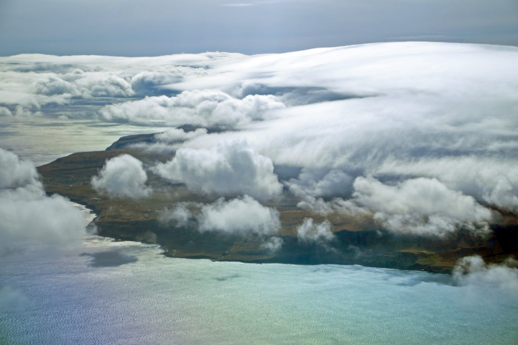
All four seasons on the Faroe Islands are special, so you really can’t go wrong with your choice. The summer days are long and mild with an average temperature of 13°C, and the grass is as green as can be, but summer is my least favourite season due to the high numbers of tourists.
Autumn brings cooler days but still long evenings, and the grass is still green, although not bright green like in the summer. Winter brings the most gorgeous light, Christmas spirit and possibilities for snow and northern lights, but the days are short and temperatures an average of 3°C. Also, be aware that November-December is hare-hunting season, so it can be dangerous to hike in the mountains during those two months (Sundays are excluded though!).
And then comes my favourite season on the islands, spring. This is when everything comes to life again. The days start getting longer, lambs, chicks and ducklings are born, and the tourism season hasn’t yet started.
Getting to the Faroe Islands
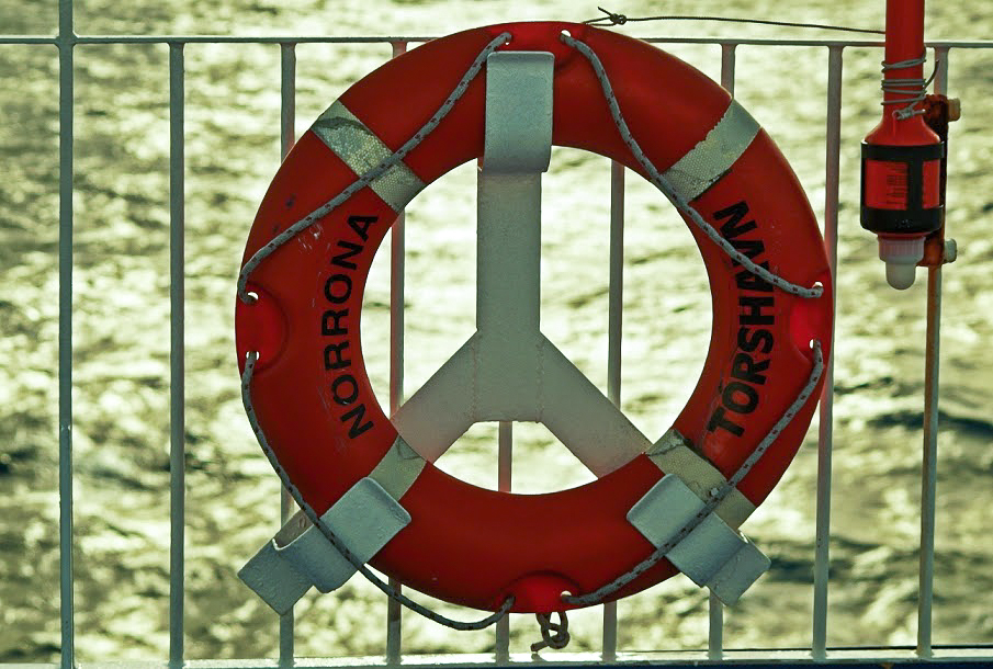
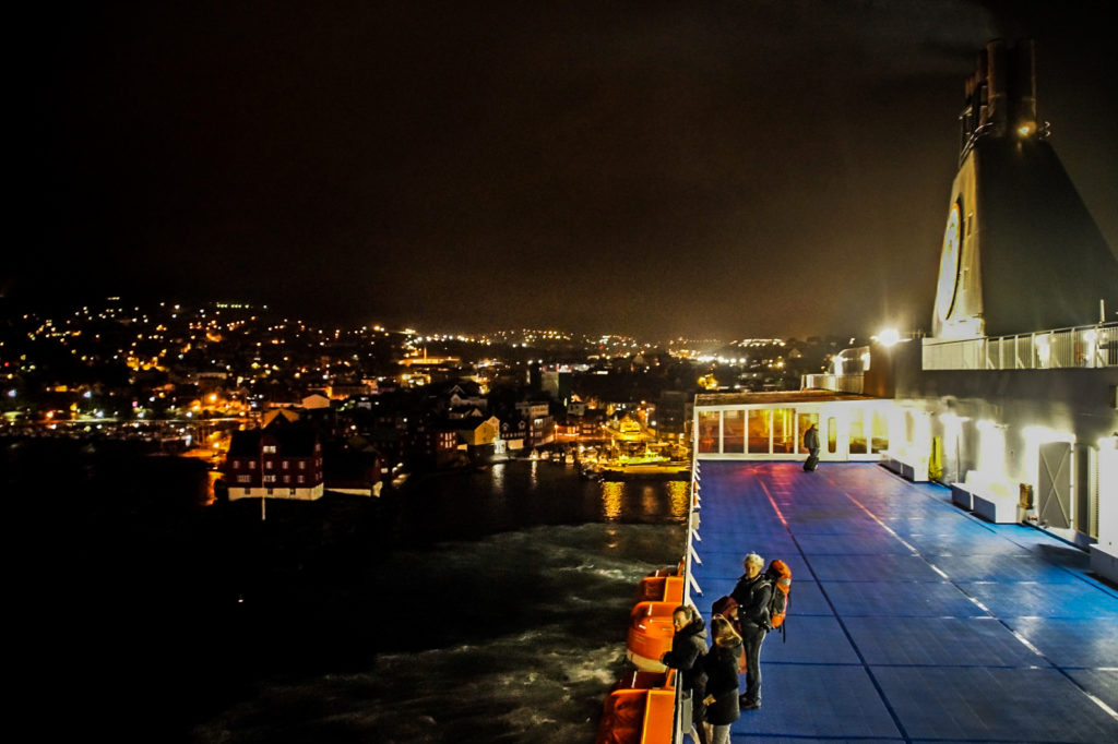
My favourite way of arriving on the Faroe Islands is on Nörrona – the ship that sails between Denmark, the Faroe Islands and Iceland. But the trip is long. It takes 33 hours from Hirtshals in Denmark and 18 hours from Seyðisfjörður in Iceland. It’s also often more expensive than flying. But if you have lots of time to spare, sailing is a wonderful way to get there, and it will give you unique views of the islands as well as the Shetland Islands en route from Denmark!
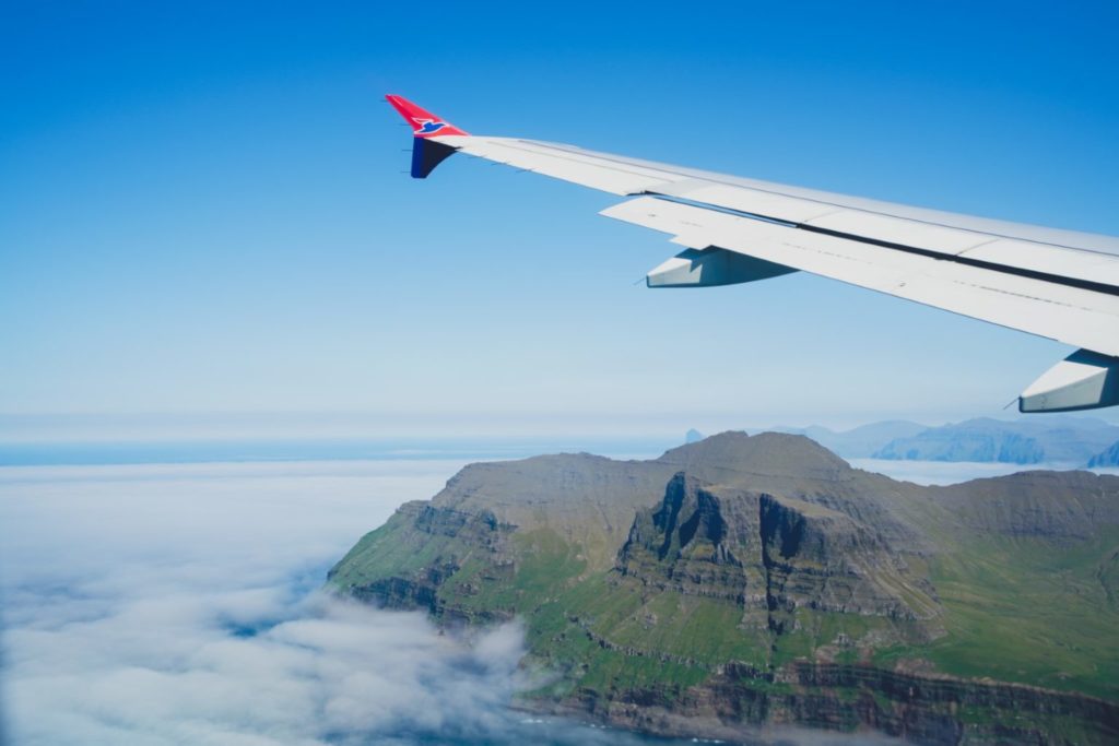
Flying to the Faroe Islands is the only other way of getting there, and by far the quickest and often cheapest way. There are direct routes from Copenhagen, Billund, Aalborg, Bergen, Reykjavík, London Gatwick, Paris, Barcelona, Mallorca and Gran Canaria. Both SAS and the Faroese company Atlantic Airways fly to the Faroe Islands, but I recommend sticking with Atlantic as I’ve had problems with SAS too many times (cancelled flights and inexperienced pilots that couldn’t land in fog when Atlantic could).
Getting around on the Faroe Islands
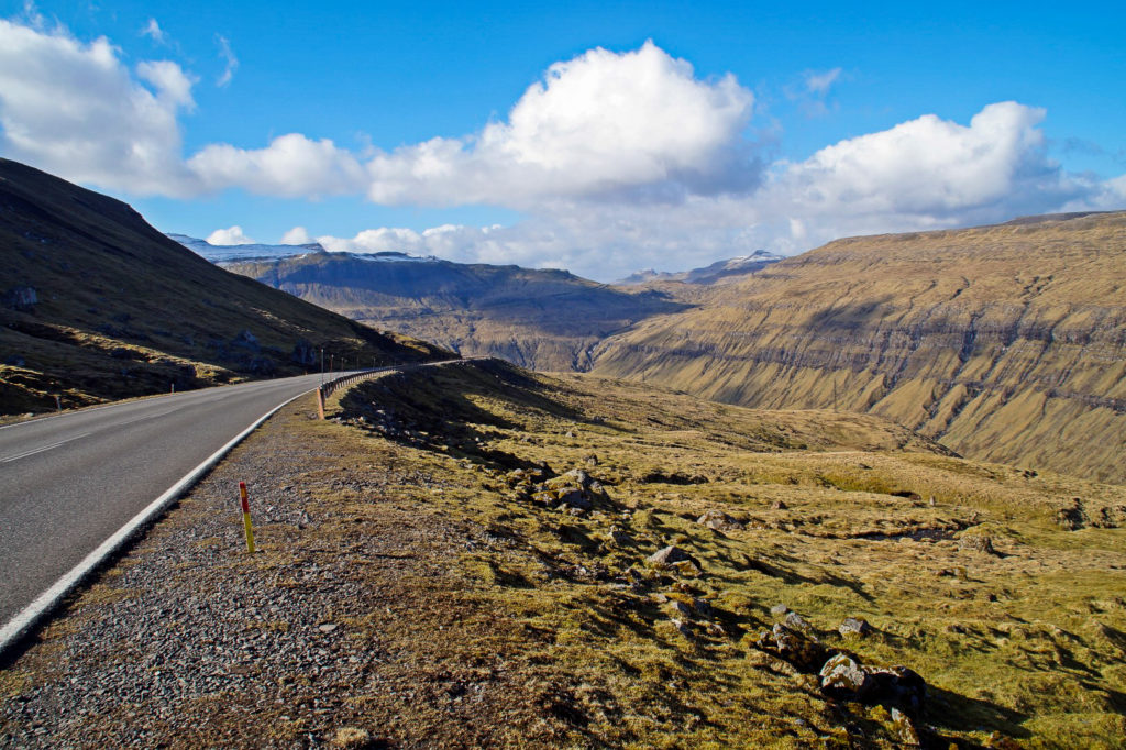
Your choice of transportation around the country is going to affect your itinerary big time. Unfortunately, busses only run between the large villages, but you could combine busses and hitchhiking or taxis to see as much as possible (if so, look into getting a travel card). Hitchhiking is surprisingly easy, especially as a solo woman (and don’t worry, it’s very safe)! Biking is possible, but it will most likely leave you miserable as the hills are STEEP and the weather unpredictable. Guided bus tours are also a thing, but I don’t recommend these as they are expensive and don’t allow much time at the destinations. Renting a car is by far the easiest way to get around, although it’s not an option for everyone and it can be rather expensive. And then there’s the ferries and helicopters. If you want to travel to the outer isles, you’ll have to catch either a ferry or a helicopter (or a combination of both!). Both are surprisingly cheap, and you can bring a car along on all ferries.
Please note that the three underwater tunnels (Vágatunnilin, Norðoyartunnilin and Eysturoyartunnilin) are toll roads that you’ll have to pay to drive through. You can either pay online or at a nearby petrol station.
This itinerary is useful to both those that drive around and those that use a combination of public transport and hitchhiking or taxis.
Want to rent a car for your trip to the Faroe Islands? See more here.
Searching for bus timetables? Look no further.
Are taxis your go-to? Contact (+298) 32 32 32
Want to see the ferry schedules? Click here.
Fancy travelling in style by helicopter? See more here.
Interested in booking tours? Find out more here!
Are vacation packages more your thing? Click here to browse!
Accommodation on the Faroe Islands
Staying overnight on the Faroe Islands is either crazy expensive or dirt cheap – depending on whether or not you enjoy camping! And if you do want a bed to sleep in, there are plenty of options to choose from, from really expensive to just slightly expensive.
However, I’m not going to recommend any in this itinerary as I’ve only ever stayed at two hostels, one in Tórshavn and one in Sandavágur. I usually do a combination of staying with friends and camping. I will recommend a town or island to stay on for each night, though – but the rest is up to you! You can see some of the options here.
The itinerary
Okay, let’s get to it – here’s the best way (according to yours truly) for hikers to spend their first two weeks on the Faroe Islands!
Day 1: Arrival
Driving distance: 0-47 km
Hiking distance: 0 km
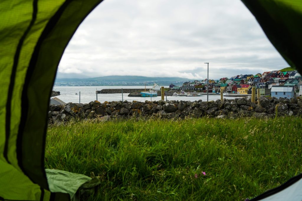
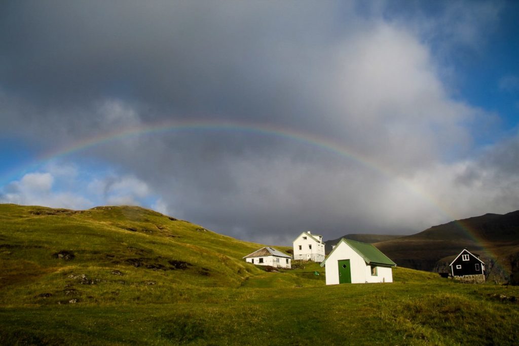
Depending on your choice of transportation, you’ll arrive either in Tórshavn or Vágar. Spend this day slowly getting your eyes adjusted to the beauty of the Faroe Islands. Maybe go for a small evening hike bathed in sunset colours or explore Tórshavn by night.
Stay overnight in Tórshavn.
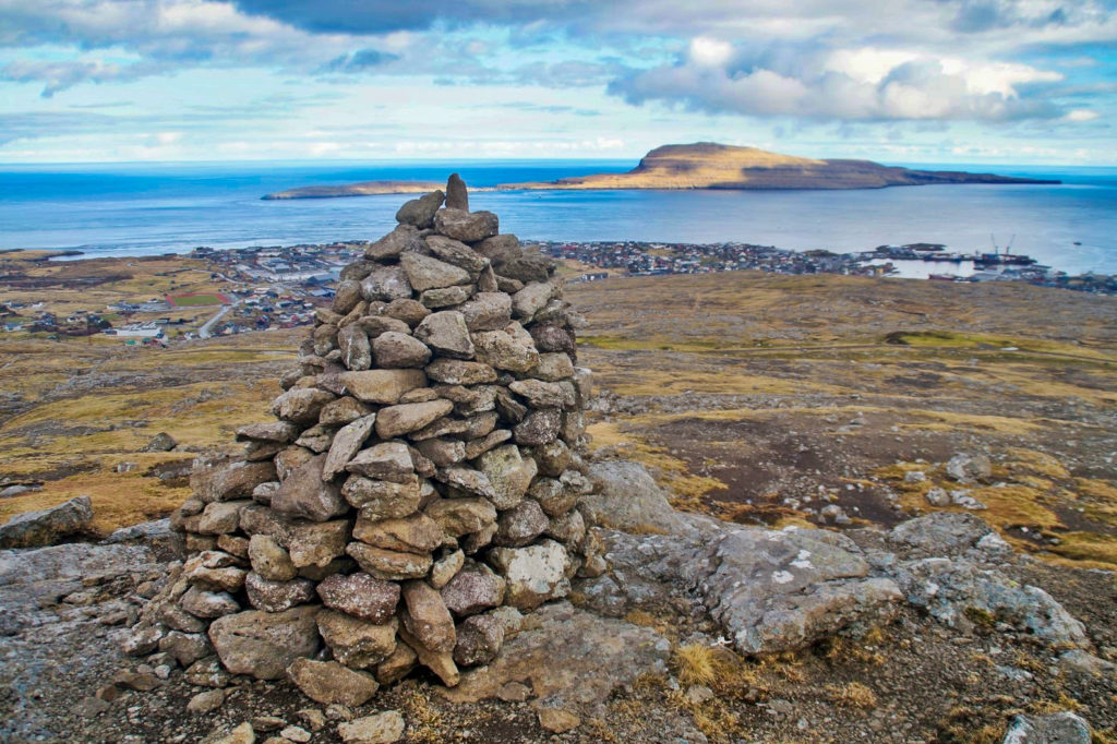
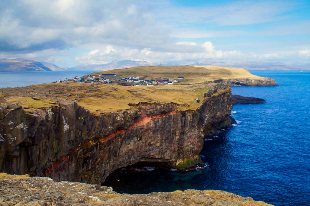
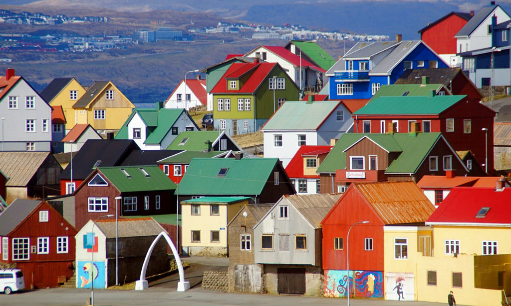
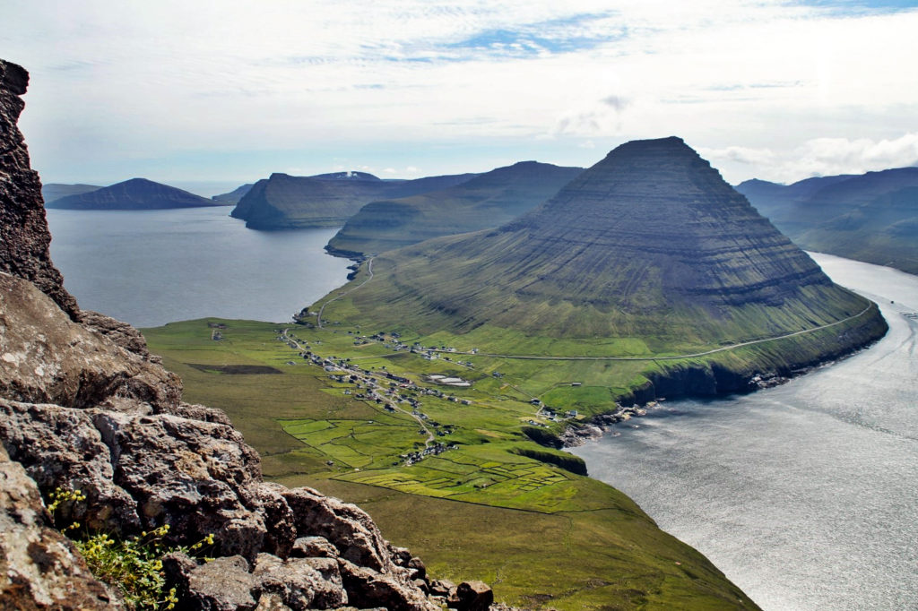
Day 2: Tórshavn and a hike to Kirkjubøur
Driving distance: 0-11 km
Hiking distance: 7-14 km
Spend the morning exploring the nation’s tiny capital and going shopping if that’s your thing (just make sure it’s not a Sunday – almost everything is closed on Sundays!).
Here are some suggestions of what to see and do in Tórshavn:
- Stroll through Á Reyni, the oldest part of town, to Tinganes, the charming home of the Faroese government that dates back to the Viking Age.
- Walk up to the lighthouse at Skansin Fortress from the 16th century for a lovely view of the capital city.
- Visit TUTL, a cozy music shop that often has free concerts.
- Explore the two harbour and grab a drink at a colourful café while enjoying the atmosphere.
- Wander through Viðarlundin, a beautiful plantation that will make you forget for a moment that you’re in a naturally treeless country.
- Shop for bargains on Faroese sweaters and other goods in the city’s charity shops. They are located at Stiðjagøta 6 (in Argir), Bryggjubakki 10 (next to the cathedral), Vágsbotnur 12 (at the harbour) and Nils Finsens Gøta 20 (at the end of the main shopping street).
- Visit the cathedral, founded in 1609.
- For the best view of Tórshavn, walk up to Hotel Føroyar or climb up to Kongavarði, ‘the King’s Cairns’.
- Learn about the history of the Faroe Islands at the National Museum in the suburb of Hoyvík – and don’t forget to explore the nearby open air museum, Hoyvíksgarður.
- While you’re in the suburb, pay a visit to the city waterfall of Svartifoss.
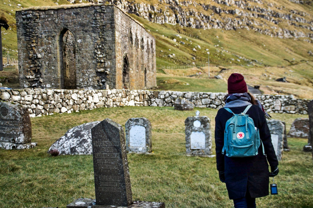
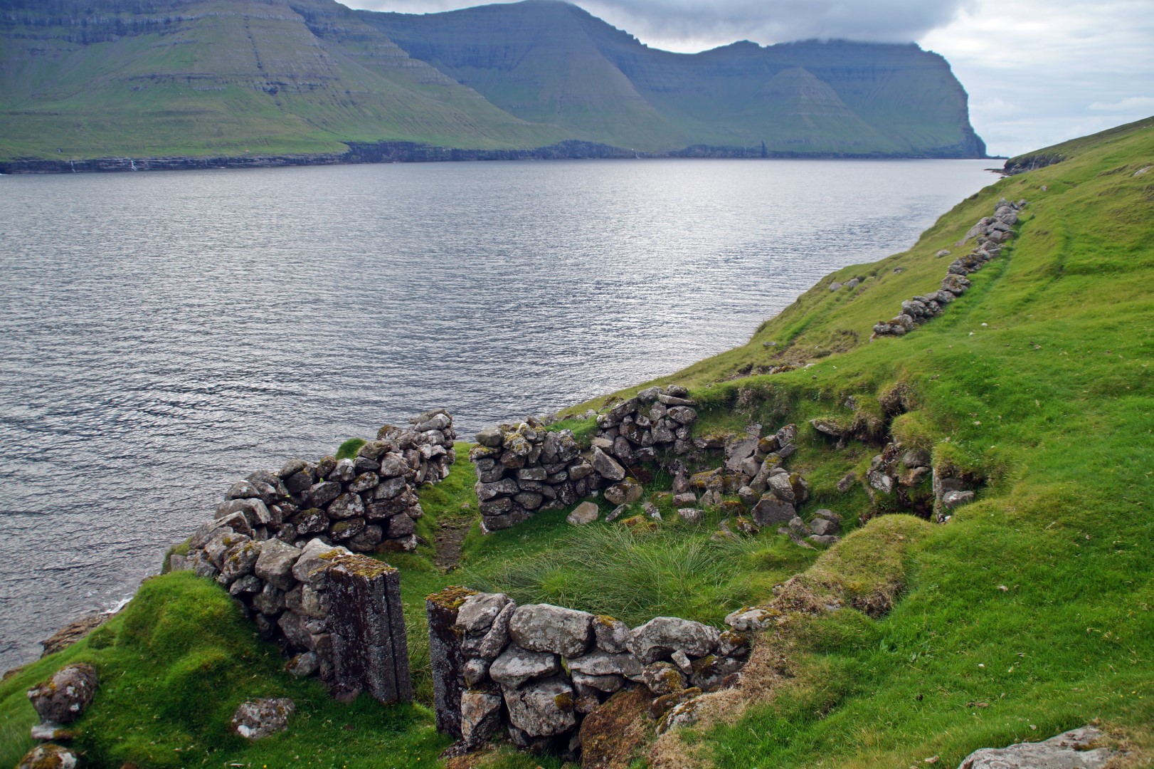
Once you’ve explored the small capital, it’s time to head to Kirkjubøur, the most important historical village in the country. The village features the oldest church in the country, Saint Olav’s Church from the 12th century, and the ruins of the Magnus Cathedral from the early 14th century, as well the farmhouse Kirkjubøargarður, which is one of the oldest still inhabited wooden houses in the world, dating back to the 11th century.
Take the adventurous route to Kirkjubøur and hike over the mountains from Tórshavn. The hike follows an easy seven-kilometre trail, which takes around two hours one way. You can either hike back the same route or take the free bus back to Tórshavn (routes 6 and 8).
Stay overnight in Tórshavn.
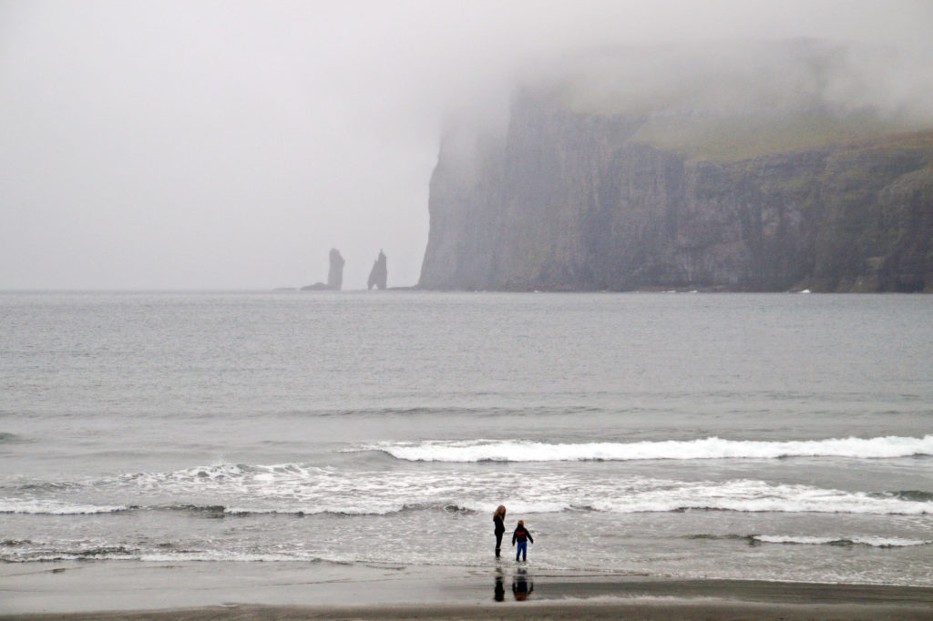
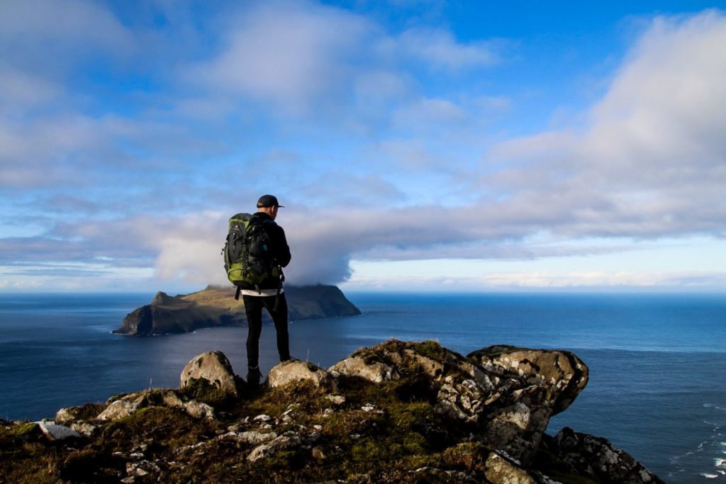
Day 3: Nólsoy and puffins
Driving distance: 0 km
Hiking distance: 5-20 km
Catch the morning ferry to Nólsoy from the harbour in Tórshavn and get ready for a beautiful day on one of my favourite islands. The ride over takes 20 minutes.
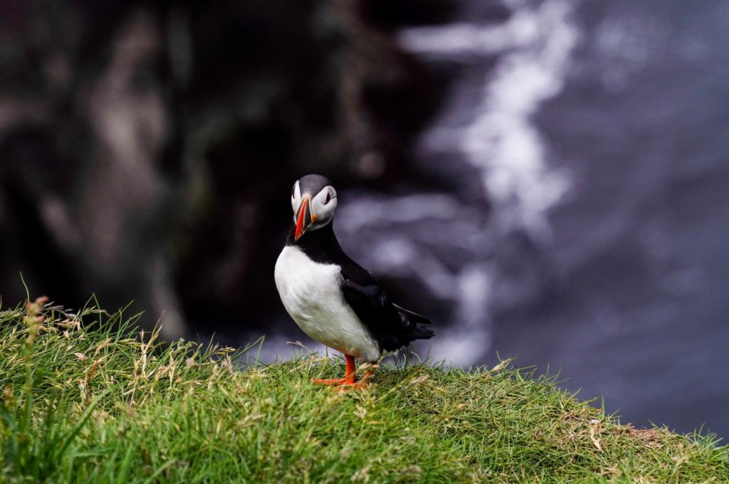
If you’re going during summer time, Nólsoy is the perfect alternative to Mykines for some puffin spotting. The puffins are usually by the cliffs on the east coast of Stongin (the area north of the village) in the mornings and late evenings, so plan your visit accordingly. A five-kilometre loop will take you around Stongin in a few hours, and you’ll have plenty of chances to spot puffins throughout.
With the whole day on Nólsoy, you’ll still have plenty of time to explore another part of the island. You could climb the highest mountain, Eggjarklettur at 372 m., hike the long way out to the two lighthouses on the southern end or head to the wild side of the island, the east coast of Eggjarklettur. Home to a huge vertical bird cliff, an insane view of the village with huge caves beneath it, and hardly any people except for bird enthusiasts and the odd adventurer, the east coast is my absolute favourite place on Nólsoy. Just make sure not to go too far if you’re not with a local. Don’t walk beyond the mossy area full of rocks as there are many hidden deep holes.
Before you leave the island, don’t forget to take a stroll through the colourful and vibrant village. Eat your dinner at Maggie’s and soak up the cozy atmosphere.
Stay overnight in Tórshavn or on Nólsoy.
Want to learn more about Nólsoy? Click here to read my guide to the island!
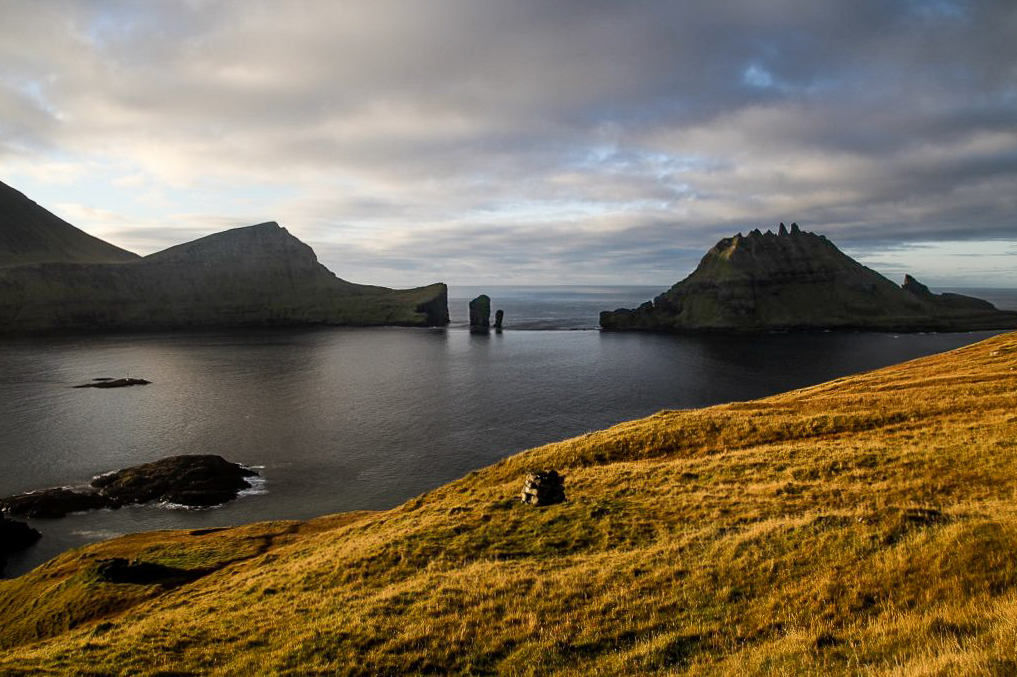
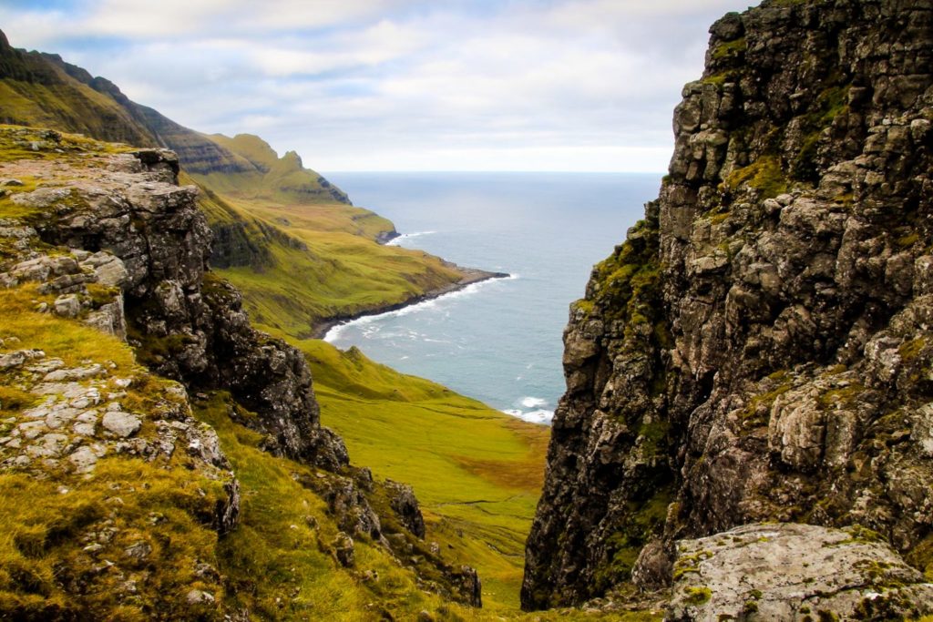
Day 4: Hestur and the best view in the country
Driving distance: 10 km
Hiking distance: Ca. 30 km
Take the free bus to Gamlarætt, the harbour where the ferries to Sandoy and Hestur dock. Catch an early ferry to Hestur, arriving just 20 minutes later, and spend your day discovering one of the best kept secrets in the Faroe Islands.
Tourists hardly ever make it out to Hestur, which is a real shame as the island is home to (possibly) the best view in the entire country. To find it, you’ll have to climb Múlin at the northwestern part of the island. There, you will have a wonderful view of Hestur’s interior as well as nine other islands in the near and far distance. But the best part is the first-class view of Koltur with its odd shape!
But before you make your way to the northwestern point, why not start from the beginning and see just about everything that Hestur has to offer? Starting from the village, follow Kvíggjarvegur to its end and continue along the footpath going south. At the southernmost end, you’ll see a tiny lighthouse, and 500 metres further along the coast going north, you’ll reach the abandoned village of Hælur. Now go east up the first mountain, Navirnar at 211 m., and continue north. Just before you reach the lakes, head west to see the spectacular Álvastakkur cliffs, and then return to the lakes and continue north. Climb the two mountains on the northwestern end, Eggjarók and Múlin, both at 421 m., and then descend and head back to the village following the coast around.
You can either stay on Hestur for the night or return to Tórshavn in the evening.
Day 5: Down south to Suðuroy
Driving distance: Ca. 70 km
Hiking distance: 0 km
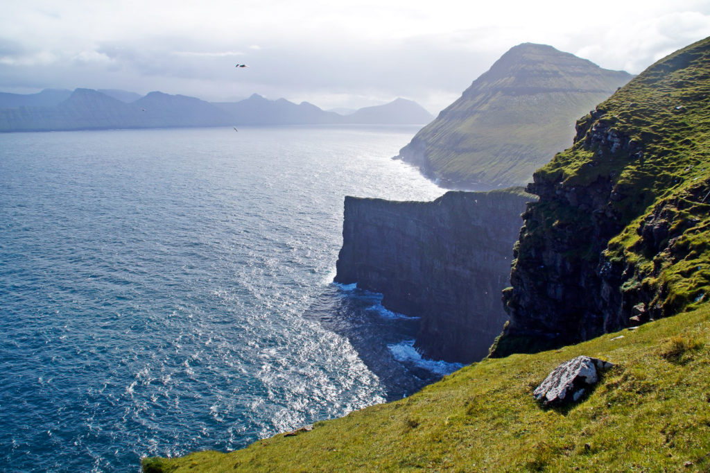
On your fifth day, head down south to the southernmost island, which is very different from the rest. Consider taking the helicopter which is incredibly scenic and fun, or catch the two-hour ferry from Tórshavn. Getting around on Suðuroy is tricky without a car, but it’s not impossible to use a combination of busses and hitchhiking.
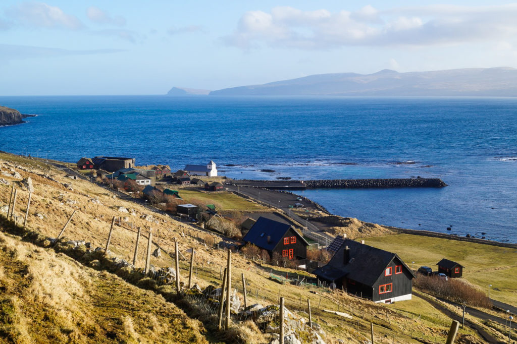
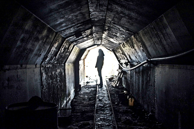
Spend this day relaxing your legs and enjoying the many sights that can be reached by car. Head down south to the lighthouse at Akraberg, located at the southernmost point of the Faroe Islands. Stop in the village of Sumba and view Beinisvørð, the second-highest bird cliff in the country. Stroll through Víkarbyrgi, an abandoned village on the southeast coast of the island. Visit the church in Fámjin where the original Faroese flag, Merkið, is displayed. Grab lunch at the atmospheric Café Mormor in Tvøroyri. Find the basalt columns in Froðba. Explore the old coal mines in Hvalba. And don’t forget to drive up to the viewpoint for the Eggjarnar cliffs, located at the end of Eggjarvegur in Vágur. It’s one of the most beautiful easy-access places in the country.
Stay overnight on Suðuroy.
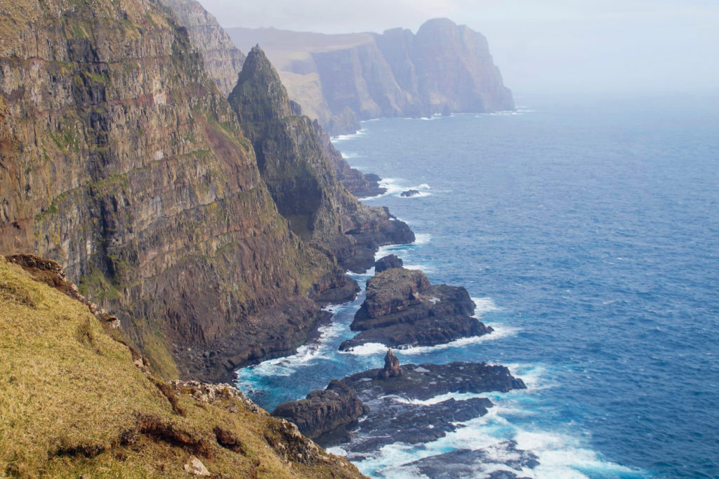
Day 6: Explore Suðuroy by foot
Driving distance: Ca. 40 km
Hiking distance: Ca. 10 km
The second day on Suðuroy is all about hiking. Head to the northernmost village, Sandvík, where the hike to the Ásmundarstakkur sea stack and the famous hanging bridge begins. Turn at Heiðavegur and follow the dirt track to the end, and you’ll see the sea stack and the magnificent cliffs behind it. Head up towards the mountain that’s behind you when facing the sea stack, and you’ll pass by a deep gorge. Keep going and you’ll soon reach a tiny wooden bridge that crosses over another gorge to Rituskor. If the wind isn’t too strong, cross the bridge and continue exploring the breathtaking scenery, or climb to the top of the mountain!
If you have more time, consider hiking the scenic Hvannhagi trail which will take you to one of the most geologically interesting places in the country. The hike is six kilometres and takes about two hours round-trip.
Return to Tórshavn in the afternoon/evening and stay overnight in the city.
Day 7: Via Oyggjarvégur to the Northern Isles
Driving distance: 103 km
Hiking distance: 7-14 km
It’s time to head up north to the Northern Isles, but not before exploring some of Streymoy’s best views on the way. Take the old road from Tórshavn, Oyggjarvégur (starts just after Hotel Føroyar), which offers magnificent views of the fjords (if it’s not foggy, that is) and passes by the country’s only prison which looks more like a five-star hotel. Make sure to stop for the iconic view of Koltur above the village of Norðradalur!
Once you’re back down on the main road, head towards the Northern Isles and make Kunoy your first destination. After exploring the quaint village of Kunoy, stop in Haraldssund just before the dam and follow the coastal trail to the abandoned village of Skarð. Skarð was abandoned after a terrible accident on the day before Christmas Eve in 1913. All men of the village except for one elderly man lost their lives when a snowstorm surprised them on a fishing trip. In January 1919, the last residents left the village and it has been abandoned ever since. Just across the fjord, the village of Skálatoftir on Borðoy, suffered a similar fate. The hike to Skarð is seven kilometres and takes three hours each way. You can either hike back or arrange for a boat to pick you up once you’ve explored the abandoned village.
Stay overnight in Klaksvík on Borðoy.
Day 8: Villingadalsfjall and Enniberg
Driving distance: 38 km
Hiking distance: 8 km
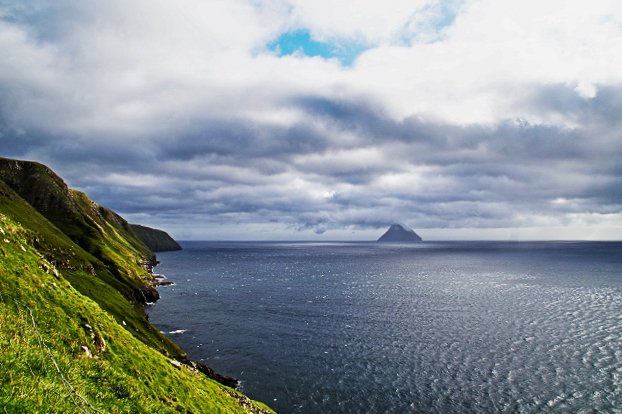
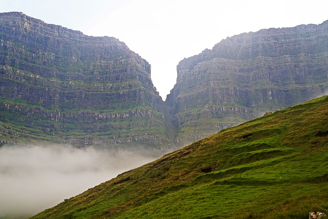
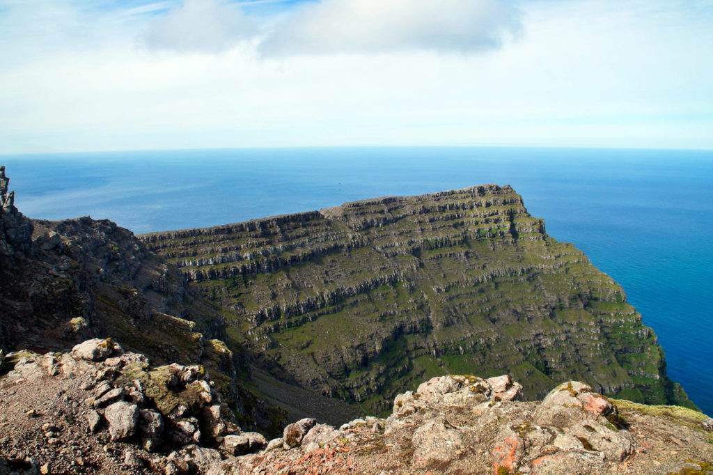
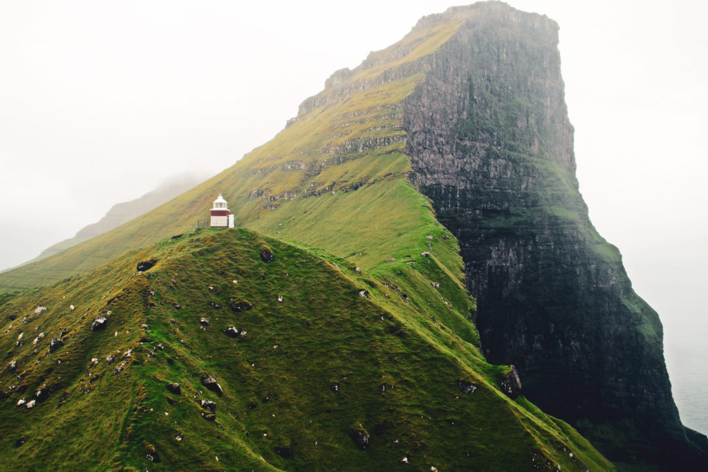
Start your day with a scenic drive to Viðoy for one of the most beautiful and well-known hikes in the Faroe Islands. The hike will take you up the third-highest mountain in the country, Villingadalsfjall at 841 m., and – if going with a guide – also to Cape Enniberg, the northernmost point in the country and also one of the highest promontories in the entire world at 754 m.
The climb up Villingadalsfjall costs 200 DKK per person without a guide, but it’s well worth the price. The hike begins at the end of Garðsvegur from where you can follow the hiking poles to the top of the mountain. It’s a steep and tough climb, but very very beautiful.
If you want to continue to Enniberg, you’ll have to go with a local guide as the landscape is steep and dangerous and the path difficult to locate (something I realized too late myself when I hiked to Enniberg!). The entire hike is eight kilometres and takes six to eight hours to complete. Alternatively, you could consider going on an exciting rib boat tour to see the famous cape from the ocean!
If you have some time to spare, stop over in Hvannasund on the way back to Klaksvík for a delicious snack and local crafts at Café Old School.
Stay overnight in Klaksvík.
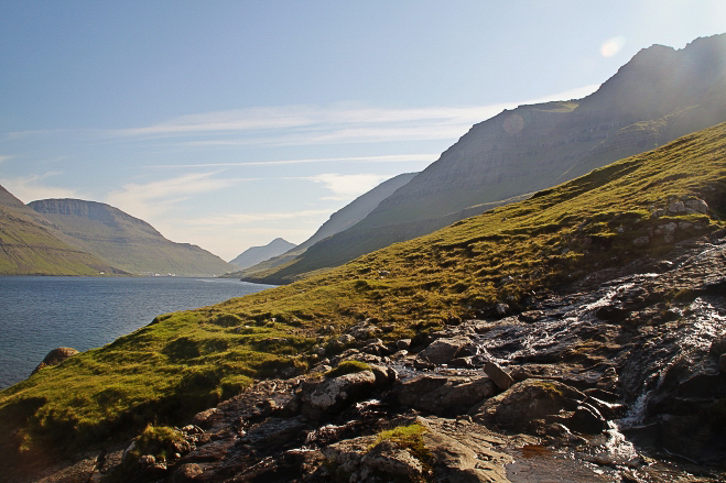
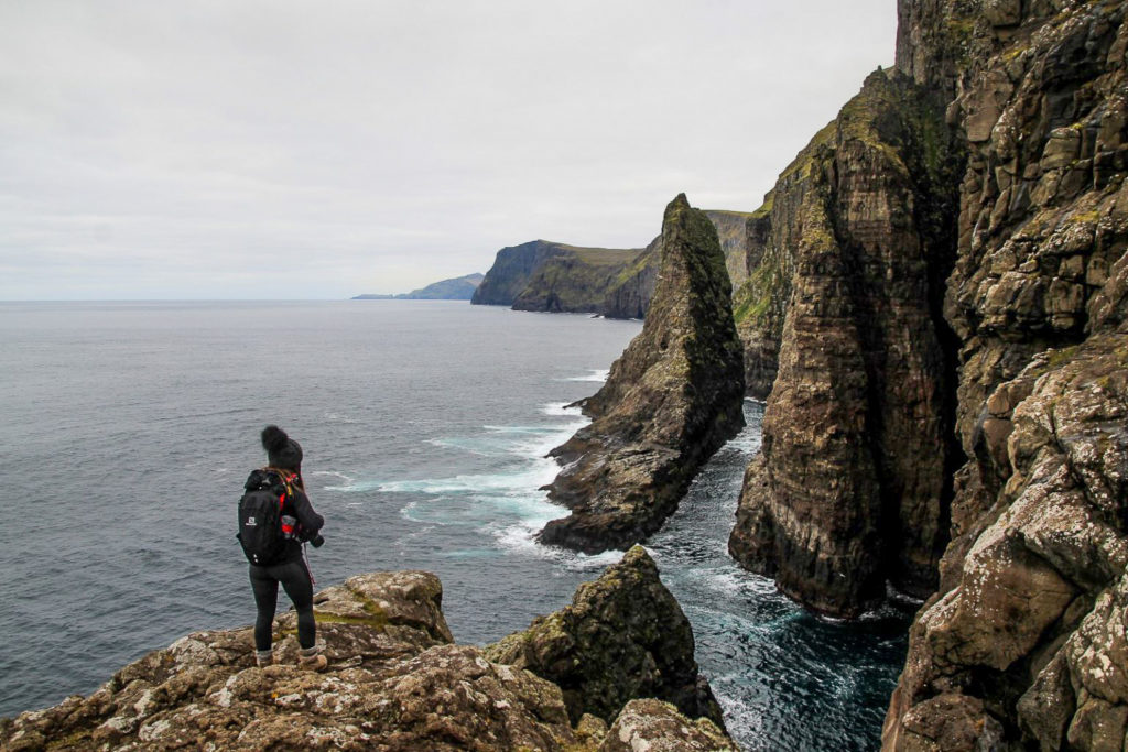
Day 9: Kalsoy and the lighthouse hike
Driving distance: 30 km
Hiking distance: 4-6 km
Spend your last day on the Northern Isles on Kalsoy, which you can reach by ferry from Klaksvík. The ride over takes just 20 minutes.
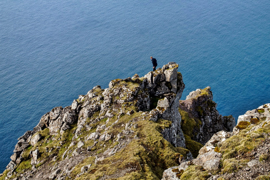
Start your day at the northern end of the island, working your way south back through the many tunnels. The famous hike to Kallur Lighthouse that everyone comes to Kalsoy for begins in Trøllanes, the northernmost village on the island. It’s a short two-kilometre hike following a well-trodden trail to the lighthouse. The trail is on maps.me. For the insta-famous view, walk onto the steep cliff behind the lighthouse, but do take care as it’s very steep and can be slippery.
Back down on safe ground, leave Trøllanes behind and head to the village of Mikladalur to see the Seal Woman statue (Kópakonan) by the harbour. Going further south, stop to explore the village of Húsar, which is the oldest on the island. Then head back to Syðradalur from where the ferry departs. If you have more time to spare, there’s another rather unknown lighthouse on Kalsoy, and it’s just a short two-kilometre round-trip hike from Syðradalur. Just walk south along the coast and you’ll reach it after fifteen minutes.
Spend your evening exploring Klaksvík, the second-largest village in the country. And if you have more time to spare, consider a trip to the abandoned village of Múli which can be reached by car.
Stay overnight in Klaksvík.
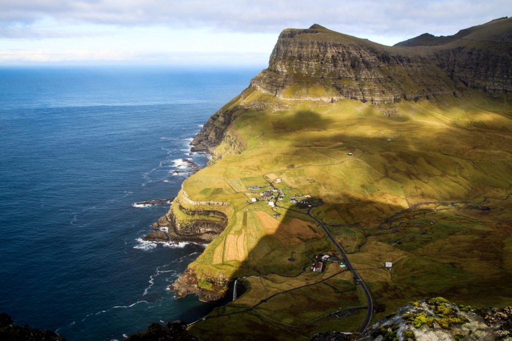
Day 10: North Eysturoy and Tjørnuvík
Driving distance: 86 km
Hiking distance: 4-17 km
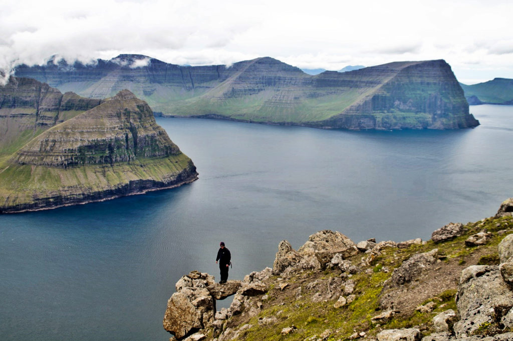
Leave Klaksvík early in the morning and head to Gjógv on the northern coast of Eysturoy. Spend some time exploring the picturesque village with the natural harbour, and consider hiking above the natural harbour for some wonderful views. If you’re up for more hiking, continue to the gorgeous Ambadalur valley northwest of the village for a view over the highest sea stack in the country, Búgvin at 188 m. The hike costs 50 DKK per person without a guide and is well worth the price. Depending on how far you go into the valley, the hike is up to ten kilometres which will take around three to four hours.
Take the mountain road Gjáarvegur to Eiði where incredible views await. Don’t miss the iconic view of the Funningsfjørður fjord, the viewpoint for the sea stacks Risin and Kellingin, and the view of the old football field in Eiði, located at the edge of the ocean.
But the main thing to do on this road is to climb Slætteratindur, the highest mountain in the country at 880 m. There’s a well-trodden trail all the way to the summit that begins at a parking lot at Eiðisskarð, the mountain pass between Eiði and Funningur. The climb up is easy and takes only around an hour to the summit. The entire hike is four kilometres round-trip. You can see all eighteen islands from the summit, and legend has it that even Iceland is visible on clear days.
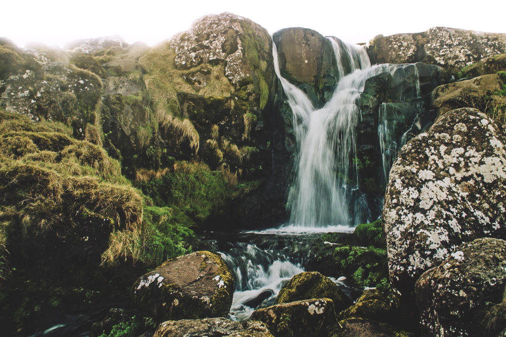
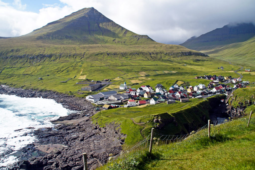
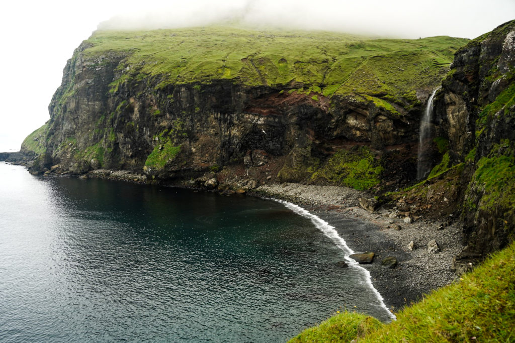
End your long day with a scenic drive to the village of Tjørnuvík on Streymoy, which is home to a black sand beach and a wonderful view of Risin and Kellingin. Don’t forget to stop at Fossá, the highest waterfall in the country, which is located on the left-hand side of the road, approximately halfway between Hvalvík and Tjørnuvík.
Stay overnight in Tjørnuvík.
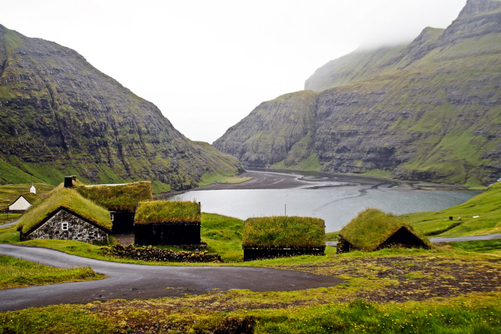
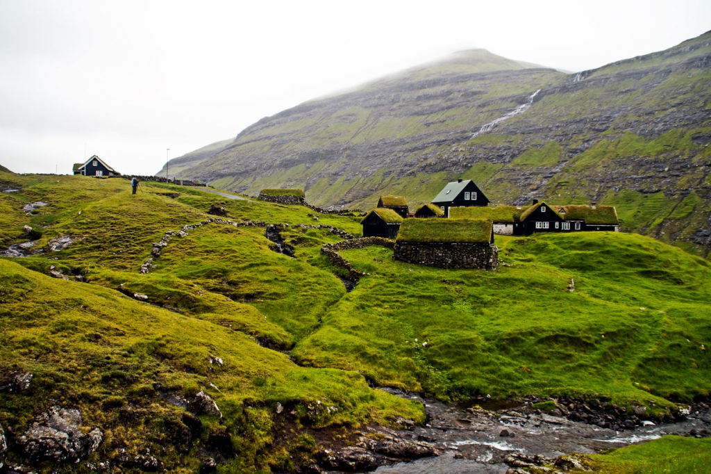
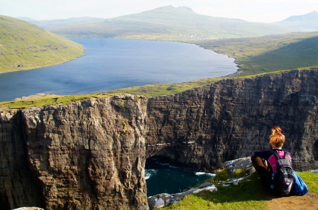
Day 11: Hike over the mountains to Saksun
Driving distance: 55-82 km
Hiking distance: 7-18 km
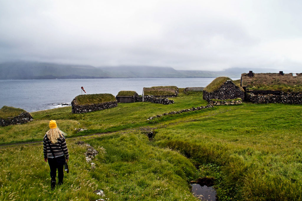
Spend your morning exploring Tjørnuvík, and then embark on a seven-kilometre hike over the mountains to Saksun, known as one of the prettiest villages in the country. With its tiny stone cottages with turf roofs above a tidal lagoon, it’s not hard to understand why. And hiking to Saksun is undoubtedly the most adventurous way to get there! The hike begins at the end of Túnið in Tjørnuvík. There are hiking poles and cairns to follow the entire way, and the trail is also on maps.me, so finding your way shouldn’t be an issue. The hike takes three to four hours each way.
Once in Saksun, take your time exploring the tiny village. Head up to the top of the village for the perfect view of the turf-roof houses with a backdrop of the tidal lagoon, visit the historic church and consider walking out to the end of the tidal lagoon. It costs 75 DKK per person and it’s a nice walk of about four kilometres and it’s not very challenging – just make sure not to get caught out there when the tide comes in!
If you’ve parked your car in Tjørnuvík, you can either return by hiking the same way over the mountains, take a taxi or hitchhike from Saksun. There are no busses to either of the two villages.
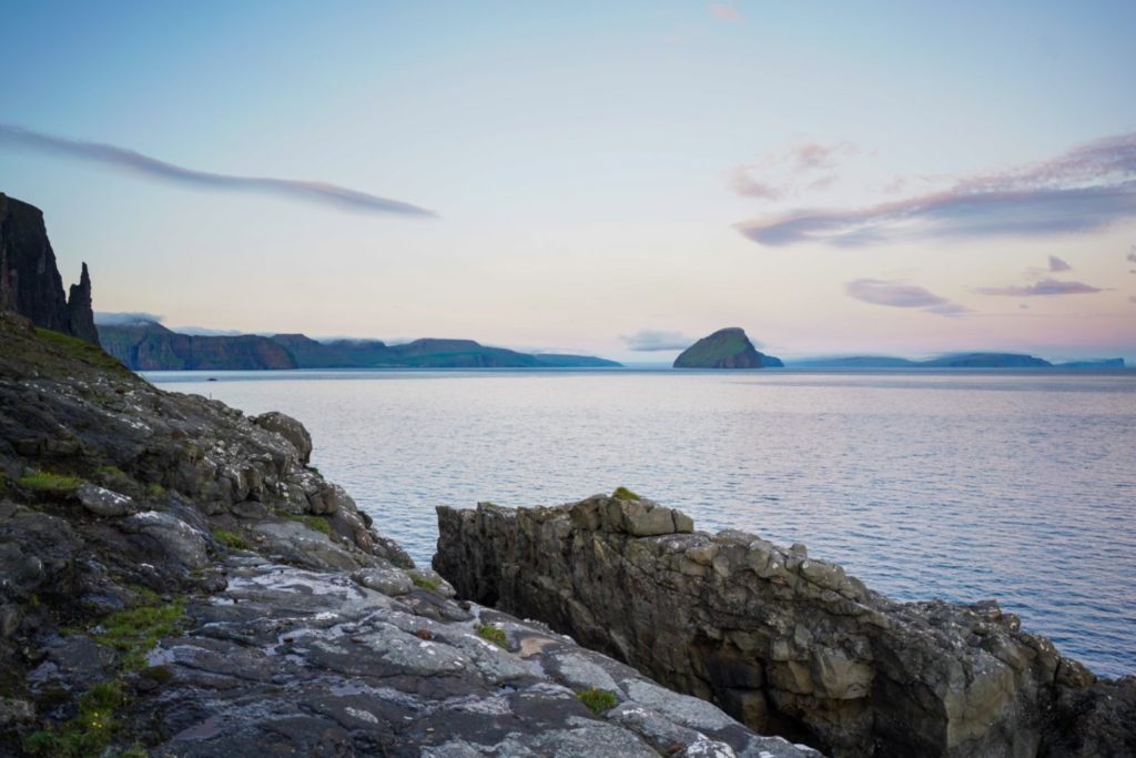
In the evening, make your way to Vágar where you’ll spend the last three nights.
Day 12: Highlights of Vágar
Driving distance: Ca. 25 km
Hiking distance: 17-25 km
There is A LOT to do on Vágar. It’s my favourite island, and that’s for a very good reason!
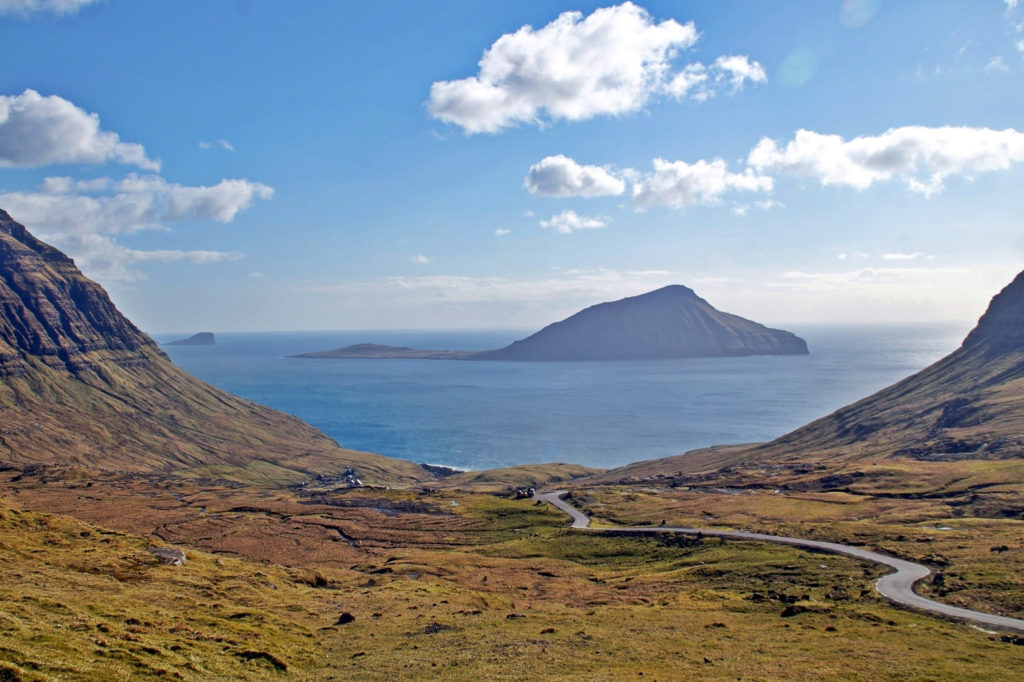
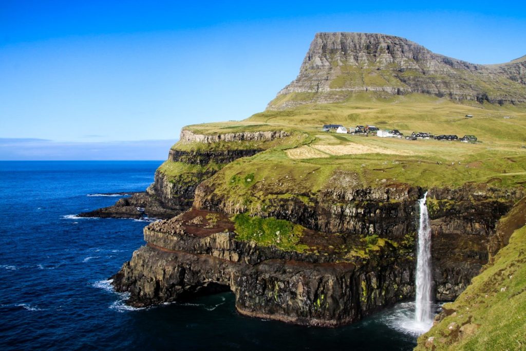
If you truly want to see the most famous spots on the Faroe Islands, head to Mulafossur waterfall in Gásadalur first. Take the adventurous route over the mountains for some of the best views in the country – and a unique view of the waterfall from above. The hike begins beyond the village of Bøur, shortly before reaching the tunnel to Gásadalur. It’s a short hike of just seven kilometres, but it’s very steep, especially the part going down to Gásadalur. Spend some time enjoying the magnificent view of the waterfall, and then take the short and easy trail around Gásadalur for more amazing views. The hike takes around three to four hours each way, but you could also choose to walk back along the road and through the tunnel or hitchhike.
Back at the trailhead, don’t miss out on seeing the unknown waterfall, Skarðsáfossur. You can find it by climbing down the hill from the trailhead, going towards the skerries of Akranessker.
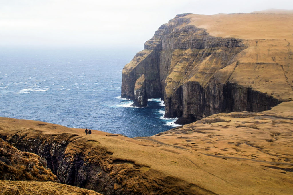
In the afternoon, it’s time to see the famous view of the ‘lake above the ocean’ from Trælanípan at the edge of Lake Leitisvatn. You can either do the easy hike to the lake, which costs 200 DKK per person without a guide, or go by kayak for just 100 DKK more. After seeing the view from Trælanípan, hike down the rocks to see the Bøsdalafossur waterfall. Don’t miss out on seeing the sea stack Geituskoradrangur up close by walking over the part where the lake turns into a waterfall and climbing up a small hill. Also, if you have time, the view from Ritubergsnøva (the mountain behind Trælanípan) is incredible!
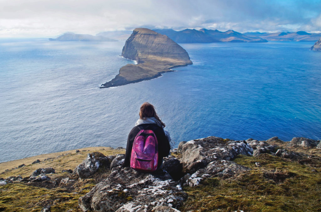
Alternatively, if you’re not into sharing nature with other tourists, consider climbing the mountain Høgafjall for unique views of Mykines and the islet of Tindhólmur, hiking above the heart-shaped lake of Vatnsdalsvatn, hiking to the hidden black sand beach beyond Fjallavatn or hiking to the Dunnesdrangar sea stacks. Sorry I can’t be more specific on what to do with a few days on Vágar – there are just too many amazing places on the island! You could literally spend the full two weeks just on Vágar and still not be done with the island!
Stay overnight on Vágar.
Day 13: Hike to the abandoned village of Víkar
Driving distance: 0-44 km
Hiking distance: 21 km
End your trip to the Faroe Islands with a bang, on one of the toughest hikes in the country – but also the most rewarding, and my personal favourite.
The 21-kilometre hike will take you above the Gásadalur valley and down a steep section to Víkar, a village that was founded in 1833 and abandoned 77 years later. Above Víkar awaits a true hiking paradise with magnificent views of Vágar’s highest mountains and a hidden black sand beach. Take your time and soak it all in. This is the best of what the Faroe Islands has to offer!
I wrote a whole post on this hike – click here to read it!
Stay overnight on Vágar.
Day 14: Time for departure
Driving distance: 0-11 km
Hiking distance: 0-3 km
Sigh, it’s your last day and it’s time to leave the Faroe Islands (but you’ll be back, right?).
If you have any time before your flight and haven’t had time to visit Mulafossur or Skarðsafossur, now’s your time to do it. Alternatively, walk to the viewpoint of Trøllkonufingur in Sandavágur and don’t miss out on hiking down the hill to see the sea stack of Klovningur. If you have extra time, climb Krosstindur, the mountain above Trøllkonufingur to see the rock from above!
Alternative destinations
… And good places to add to your itinerary if you have some extra days in the country!
The island of Mykines
You might wonder why I haven’t included this popular ‘island of the puffins’, but it’s for a number of reasons. First off, Mykines is notorious for ferry cancellations and delays, and you could get stuck on the island for several days. Secondly, it costs 250 DKK per person just to hike on the island. And thirdly, it’s hardly the only place to see puffins on the Faroe Islands. Stongin on Nólsoy (which I’ve included in the itinerary above) is a great alternative, and so is Høvdin on Skúvoy, although that’s almost as time-consuming to get to. In my opinion, Mykines is not worth the effort if you only have two weeks or less. Go with Nólsoy if your only reason for going to Mykines is to see puffins.
Two-day hike to the abandoned village of Slættanes
This hike is for the most adventurous. It takes 15-17 hours and spans 30 kilometres, which I’d recommend doing over two days. You’ll be rewarded with some of the greatest views of Vágar and the neighbouring island of Streymoy, and you’ll get to explore the abandoned village of Slættanes. Read about the hike here!
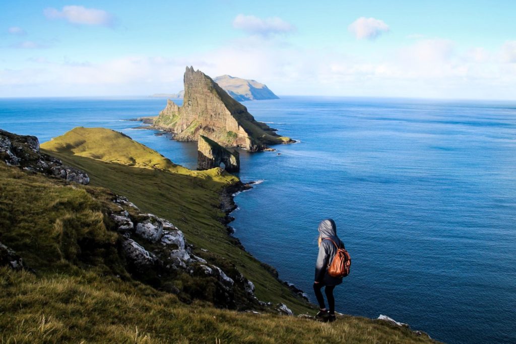
Hike to the Drangarnir sea stacks
This hike is popular for a reason, but I haven’t included it in the itinerary above due to the restrictions on this hike. It costs 550 DKK per person, which just isn’t worth it. Unless you get lucky like I did – read how here!
Alternatively, you could take a boat tour out to the cliffs including Múlafossur waterfall for unique perspectives of the two popular spots.
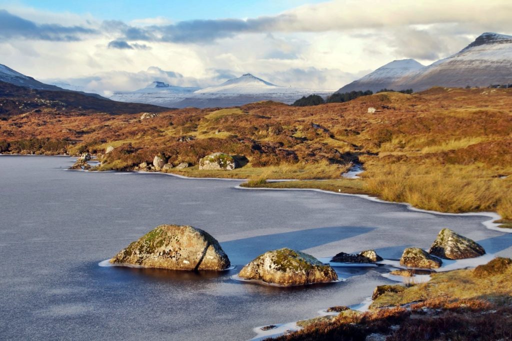
Lake Toftavatn
A gorgeous lake in South Eysturoy, surrounded by heathland which is rare in the Faroe Islands. The lake is especially beautiful when frozen in winter. See just how beautiful here.
Hike to Klakkur above Klaksvík
A short and easy hike with a gorgeous view of Klaksvík and the Northern Isles. Ideal if you have some extra time in Klaksvík. Read more here.
The island of Koltur
Visit the island with the unique shape, home to just two people. It requires an overnight stay as the helicopter doesn’t return on the same day. Read more about the island here.
The Vestmanna bird cliffs
Here’s a confession. I’ve never been to the bird cliffs of Vestmanna! Shocking, right! I’m surprised too, to be honest. But I’ve only ever heard positive reviews from this tour. I will definitely be going soon!
Enjoy your time on the beautiful Faroe Islands – and try your hardest not to fall in love with the place. Otherwise, it will leave you with a deep desire to return over and over again!
Are you vegan and worried about how to stay alive on the Faroe Islands? Look no further! I’ve done it myself many times, and it’s much easier than you’d think. Click here to read my vegan guide to the Faroe Islands!
Looking for cheap or even FREE accommodation in the Faroe Islands!? Search no more!

Leave a Comment