This post contains affiliate links. If you make a purchase through these links, I may earn a commission at no extra cost to you. Thank you!
My favourite weather app Yr.no had promised sun and clear skies for almost an entire week on the Faroe Islands, so I planned to spend the whole week hiking. On the very first day of the week, I woke up as the sun was rising. The day indeed looked beautiful, and I was well excited as I was heading out on a trail I’d wanted to hike for years but just never got around to – the old postman’s trail between Bøur and Gásadalur.
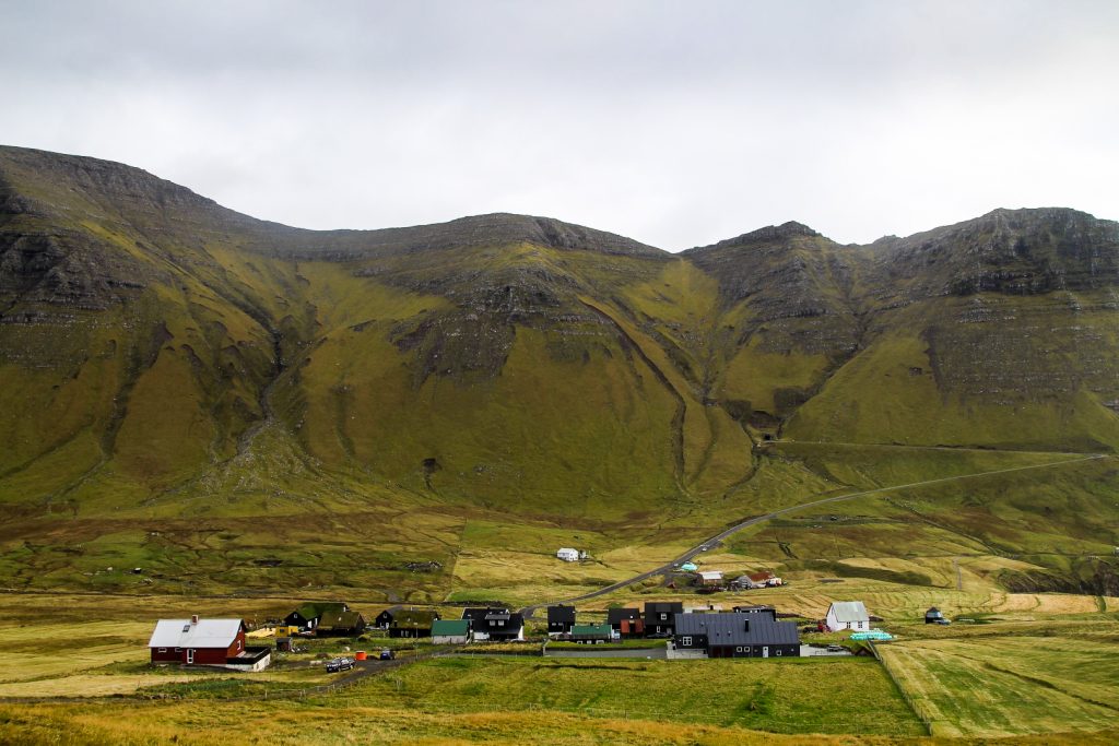
Up until 2004 when a tunnel was built through the mountain, Gásadalur was isolated from the rest of the country. Boats were only able to dock at the tiny harbour on calm days so getting to and from the village mostly happened on foot, following cairn trails either to Bøur to the southeast, Víkar to the northeast, Slættanes even further to the northeast or to Sandavágur 30 km away to the southeast. These were no easy trips as Gásadalur is surrounded by Vágar’s highest mountains. Nevertheless, the villagers embarked on these journeys every week to attend church or to bring coffins to Bøur where the dead were buried. But one man hiked these trails more often than anyone, the postman. Once a week he’d embark on a journey to the now abandoned villages of Víkar and Slættanes, and three times a week, he’d climb over a mountain pass from Bøur to deliver post to the people of Gásadalur. The latter was the trail I was going to hike that day.
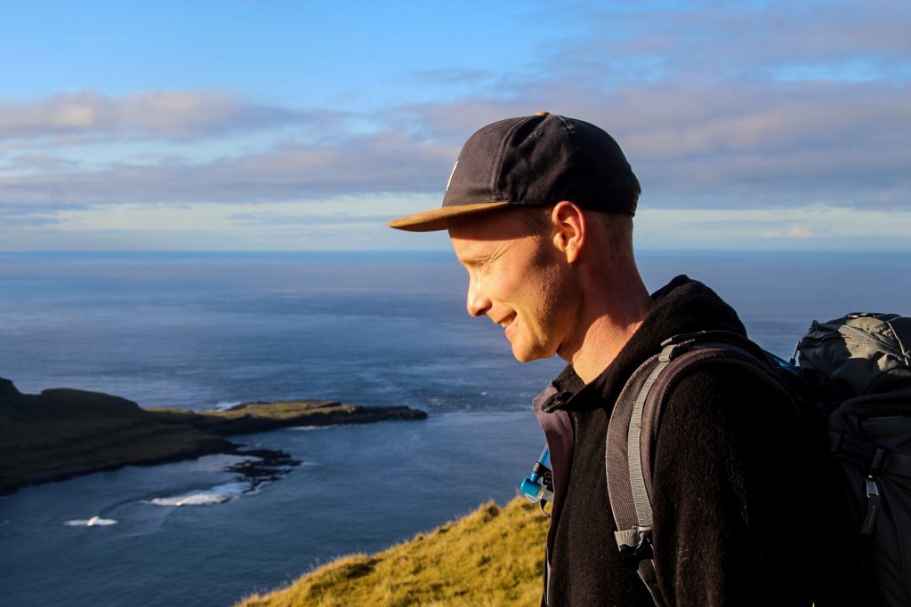
The day before, Lars who is also Danish had arrived at the hostel and I asked if he wanted to join me on the hike. He was well keen, especially since the hike ends at the famous Múlafossur Waterfall which is an absolute must-see!
We set off around 08.30 AM and caught a ride to Sørvágur from where we were hoping to be able to hitchhike to the trailhead just past Bøur. We walked towards Bøur for a little while but it wasn’t long until we were picked up by a local man who was actually the former mayor in the municipality and owns the land that we would be hiking on! Such a funny coincidence.
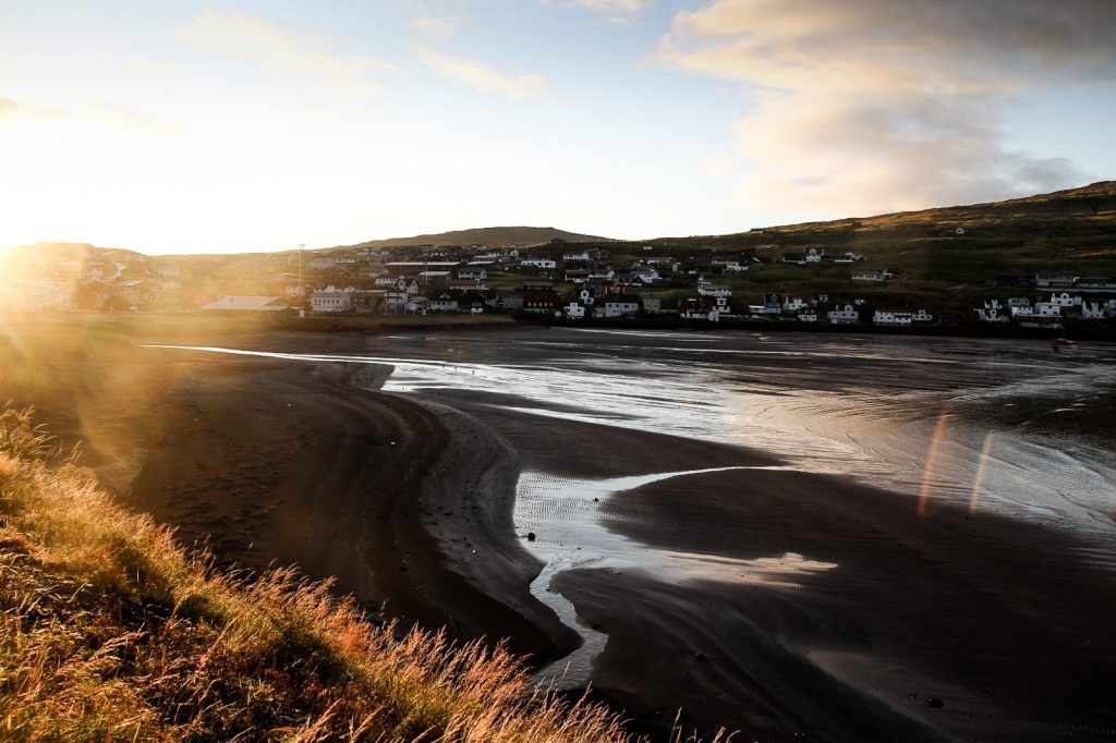

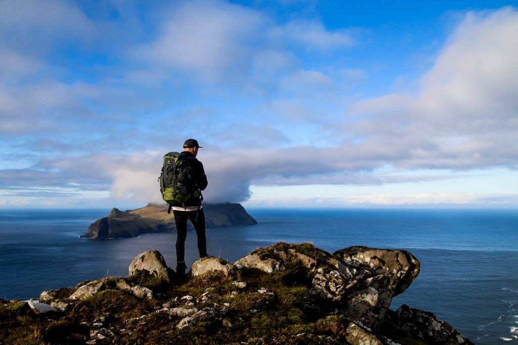
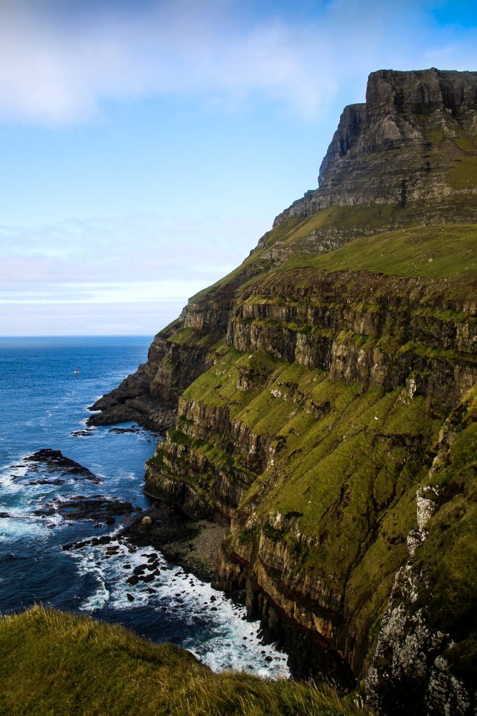
He dropped us off at the trailhead, complete with a sign and cairns going up the side of Mt. Rógvukollur. The beginning of the hike was a bit steep along a muddy path with plenty of opportunities to slip! But it offered incredible views from the get-go. And with the sun shining on us, it just couldn’t get any better.
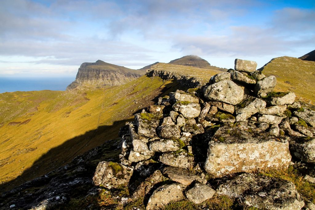
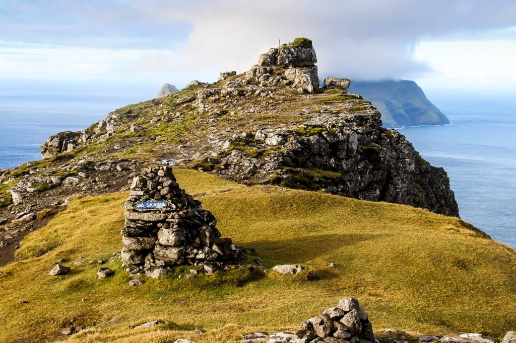
It didn’t take us long to reach the part of the trail that flattens out on the mountain pass. It’s very close to the summit of Rógvukollur at 464 m. so we’d already decided beforehand that we would take a detour up the summit – and once there, we would continue to the summit of Knavin at 485 m. since they’re only about 500 meters apart!
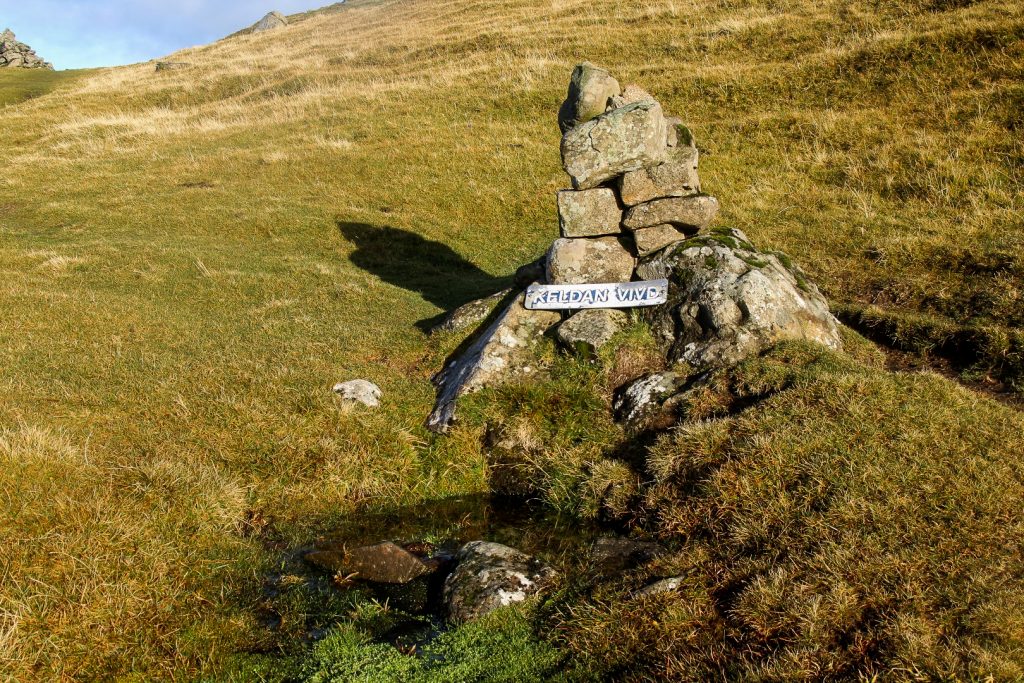
But first, we made a quick stop at the small spring Vígdá. Legends says that a baby in Gásadalur became ill and had to be taken over the mountain pass to the doctor in Bøur. On the way the baby’s condition worsened, and according to the local Lutheran faith, the soul does not gain salvation if the person dies unbaptised. Therefore, the baby was quickly baptised by a priest in the spring which had been blessed for the occasion.


Leaving the spring behind, we headed to the highest point of the trail where we turned towards the rocky summit of Rógvukollur. It wasn’t long until we spotted a bunch of rocks with crystals inside them, so incredibly beautiful. As much as I wanted to take them home, we decided to leave them on the mountain side for future hikers to enjoy.
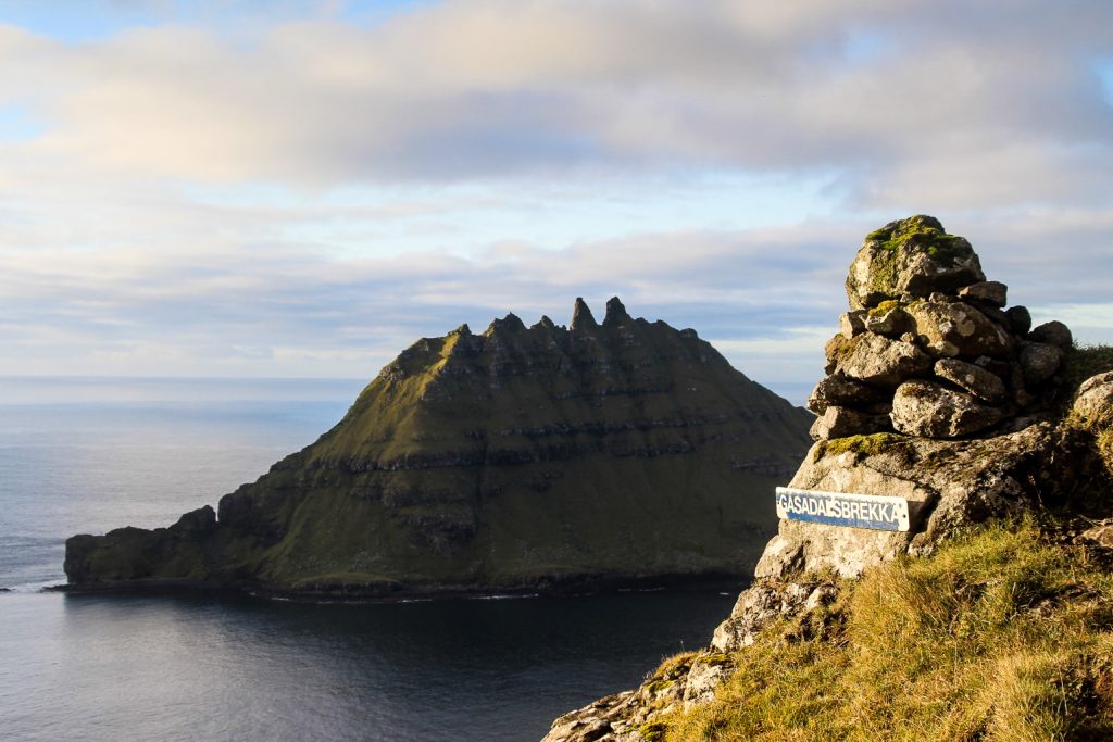
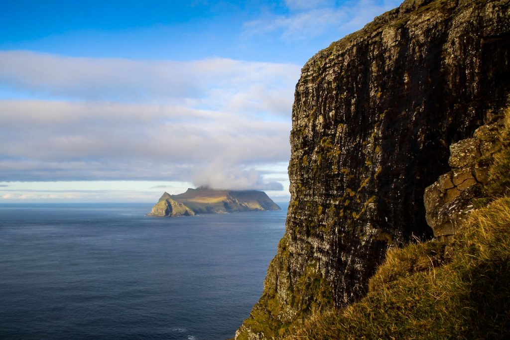
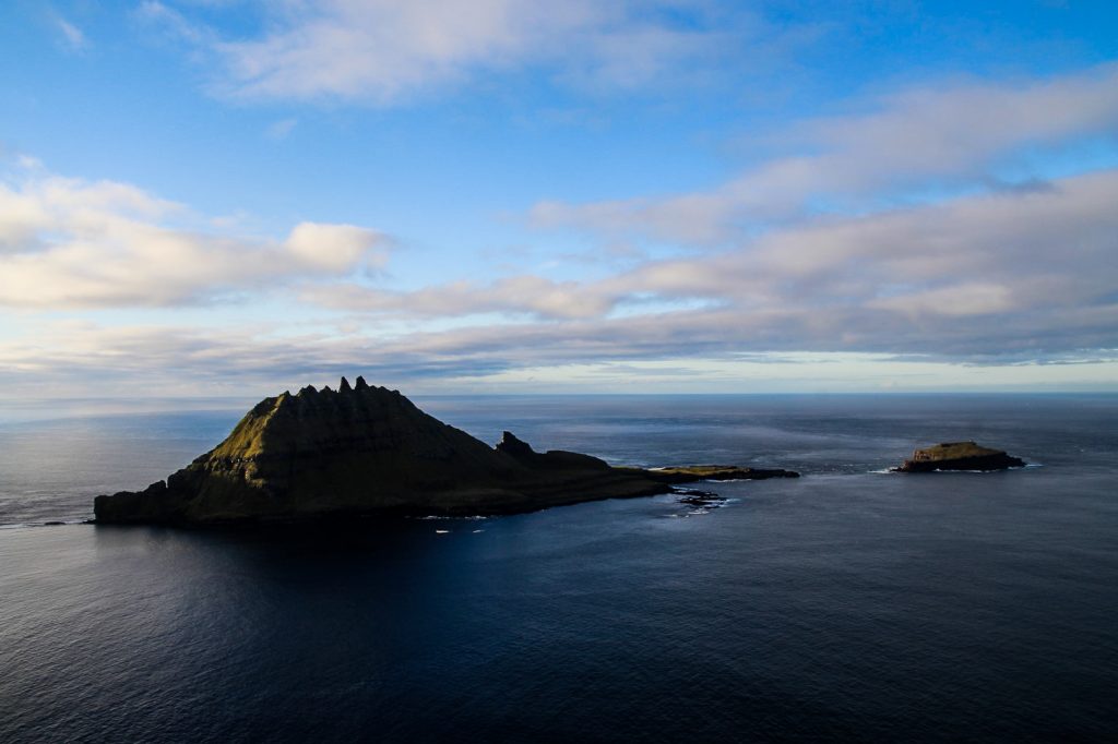
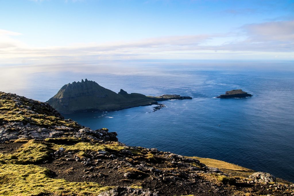
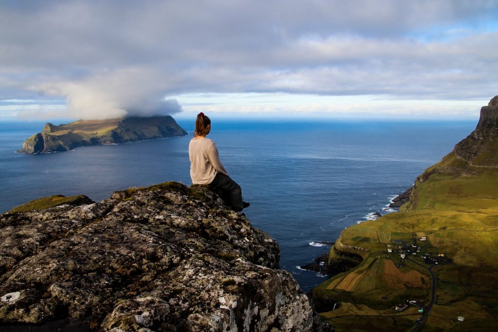
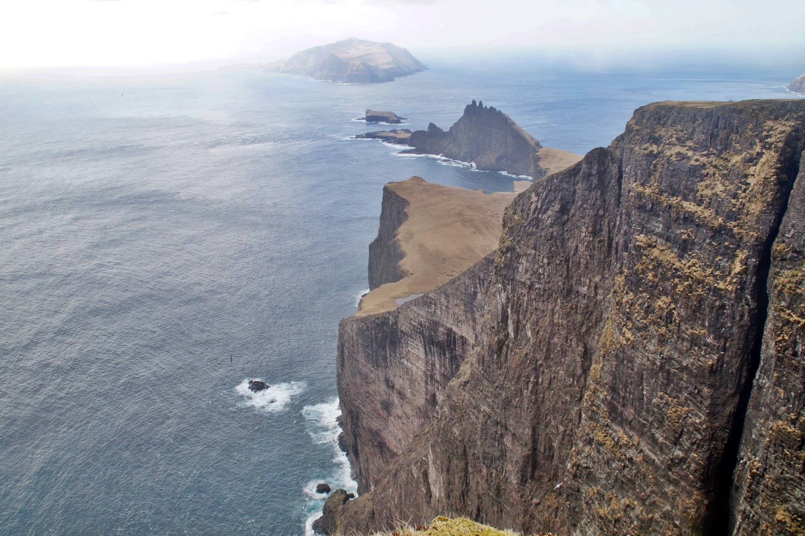
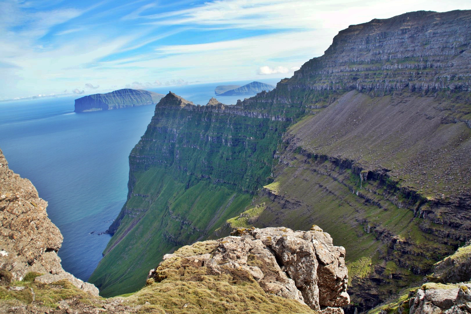
Since we were already up so high, we didn’t have to put in much effort to get up the mountain, although it did require a bit of bouldering to reach the summit. But once we were up there, it was an easy hike to Knavin’s summit with the trail running neatly beneath us. Up in the heights, we could see the mountains surrounding Gásadalur and had a clear and perfect view of the islet of Tindhólmur and Mykines, the puffin island.


To return to the trail, we had to climb carefully down a bunch of rocks, but it wasn’t as bad as it looked and soon, we found ourselves at the beginning of the descend towards Gásadalur. But we didn’t want to go down just yet. Because we wanted to see the famous Múlafossur Waterfall from above first!
So we walked along the edge of the cliffs until we spotted the tiny waterfall way down below us. With the steep mountains behind Gásadalur rising in front of the waterfall, the scenes looked unreal. Almost as if the area was being lifted away from the earth. That was an incredible spot and a perfect short detour from the route!
As we headed back, we noticed four people coming towards us. We met them just before the descend; a father and his three daughters from Denmark. They had completed the trail a lot faster than us, although they hadn’t done any detours, but it was very impressive especially since two of the girls were wearing sneakers!
Unfortunately, the descend made them wish they were wearing hiking boots as this section of the trail was really steep and slippery. They fell a lot, and I also fell on my butt once because I slipped on a wet rock. Ooops!
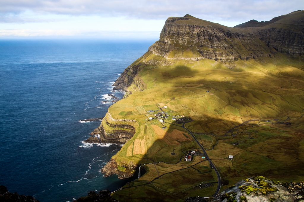
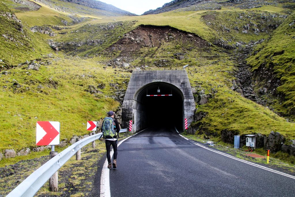
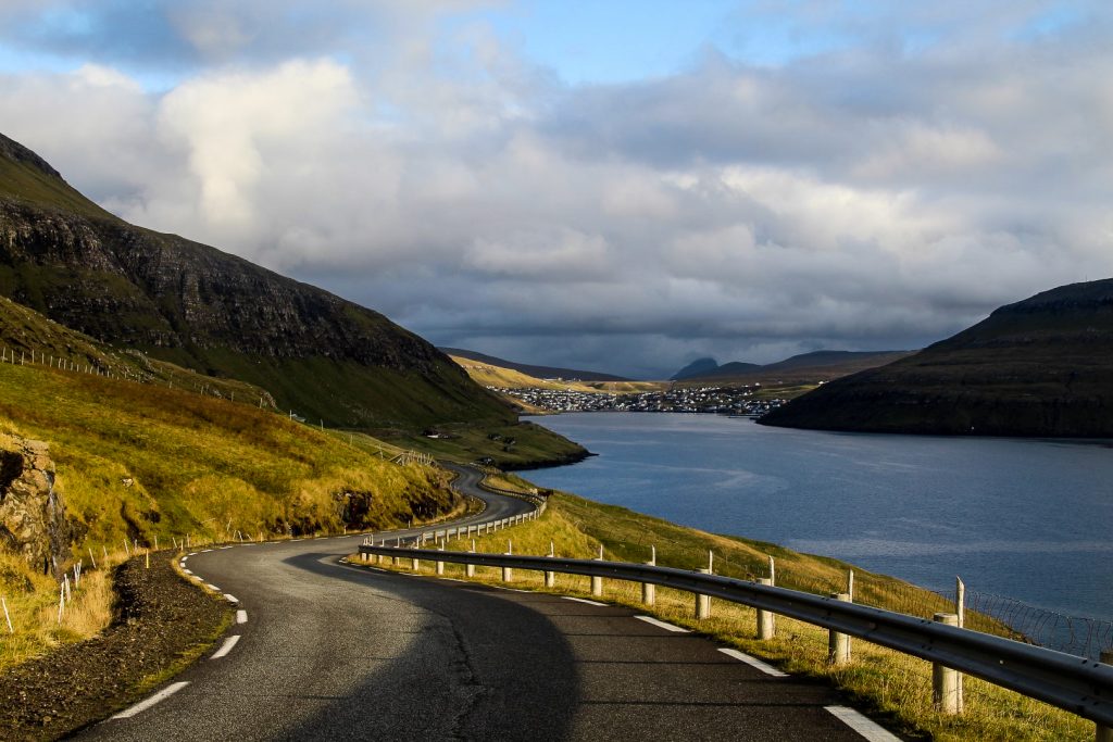
But before we knew it, we were down on the road just before the entrance to the tunnel. Now we just had to follow the road down to the iconic waterfall!
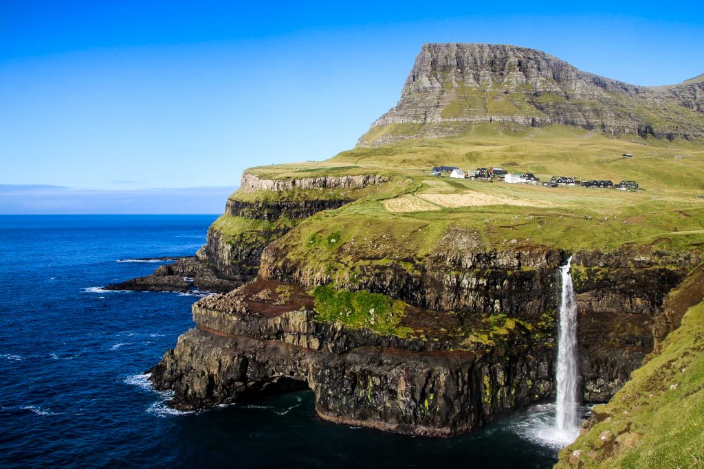
Múlafossur Waterfall with its characteristic backdrop of Gásadalur nestled beneath Árnafjall and Heinanøva is the natural end destination for this hike, but Lars and I felt like continuing. We hiked along a nice little trail that goes from the waterfall along the coast and around the village. It offers really nice views of the steep cliffs that we’d just come down and of the village from a different angle than its usually seen.
We tried to find the highland cows that I’d seen a week back when attempting to climb Árnafjall and Heinanøva, but they had moved further into the valley. Instead, we headed to the small crafts shop Uanni for a long chat with the owner who told us all about the village gossip and the upcoming communal elections.


When it was time to leave Gásadalur, we had three options. Either we do the same trail again in reverse, we walk or we hitchhike. We chose a combination of the latter.
Daredevil Lars wanted the experience of walking through the dark and narrow tunnel but I didn’t, so I caught a ride with a nice elderly man to the end of the tunnel where I waited for Lars to come out on the other side. Luckily, he didn’t meet many cars on his little walk and he came out in one piece! Funny enough, I had no other choice but to walk through the tunnel some days later. But that’s a story for another day!
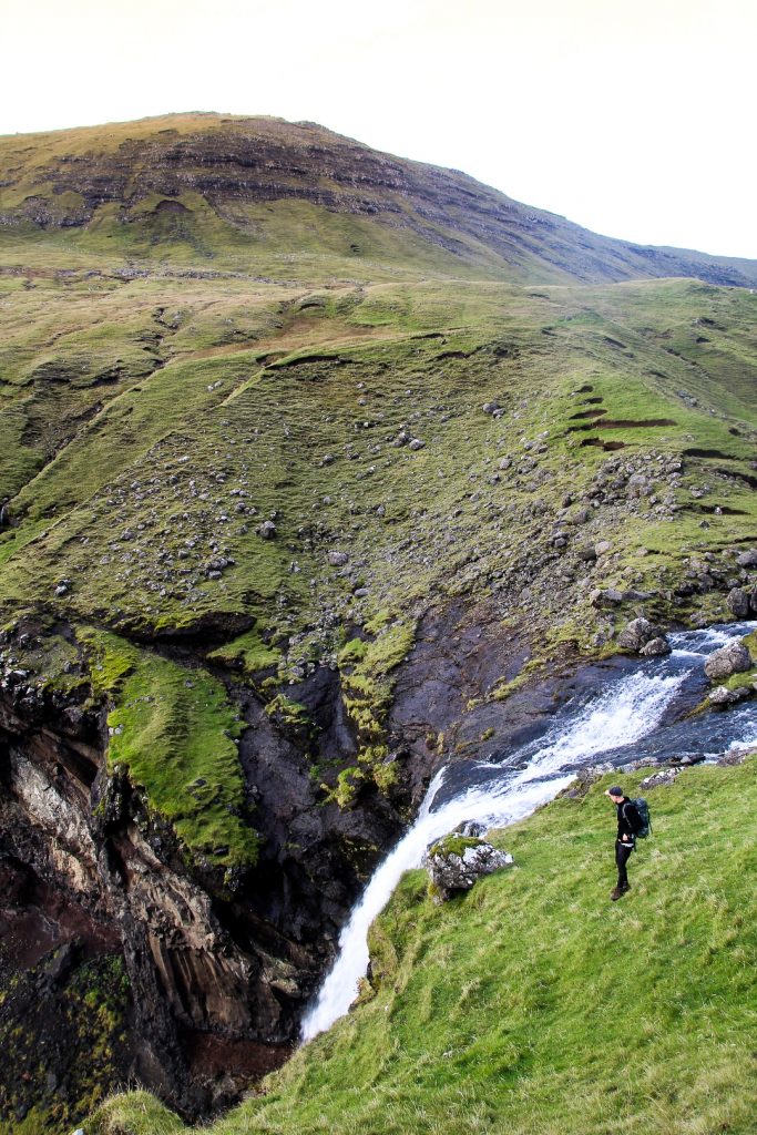
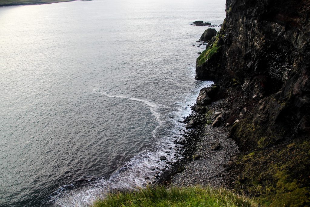
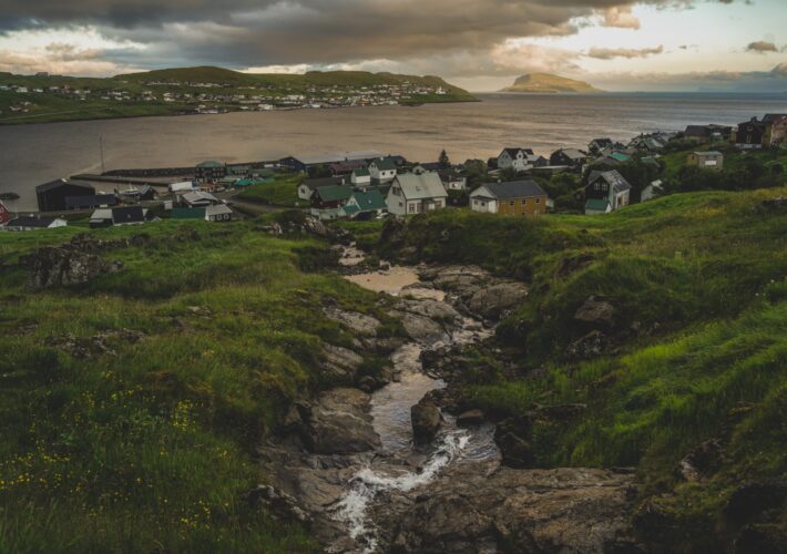
We weren’t quite done with our exploring as we had spotted a waterfall on our way up on the trail earlier that day. I later learned that it’s called Skarðsáfossur. It’s located just a few hundred meters from the trailhead and falls onto a stony beach. It seems to be as high as Múlafossur, and I do remember seeing it from the ocean when sailing to Mykines and thinking how impressive it is.
But the waterfall is well hidden away. It was difficult to find a spot where the fall was in full view, although I realized later on that we’d attempted it from the wrong side. I did return some weeks later to see it in all its glory!


When we were done exploring, we started walking towards Bøur and stuck our thumbs in the air whenever a car passed. Eventually, two elderly ladies stopped for us and drove us to Sørvágur. From there, we easily caught a ride all the way to the hostel where we crashed after a long and incredibly beautiful day!

Hiking route description: Bøur to Gásadalur + Rógvukollur and Knavin and the Gásadalur village trail
The hike begins about 300 meters from the tunnel to Gásadalur, at the left-hand side of the road. Follow the dirt track until you see a sign with information and cairns going up the mountain pass behind it. Follow the cairns up to where the trail flattens out and hike to the little spring.
From the spring, go right up Mt. Rógvukollur. It requires a bit of bouldering, but it’s not too difficult. When you reach the summit, you will see the summit of Mt. Knavin in front of you. Go there next. Find a good spot to climb down the rocky summit of Knavin and rejoin the trail. For the best view of Gásadalur and Múlafossur Waterfall from above, walk along the cliffs to the left of the trail before descending.
Then return to the trail and descend down the zigzag path towards Gásadalur. When you reach the road, follow it down to the beginning of the village and turn left along the first dirt track, Inni á Bakka, to see the most famous view of Múlafossur Waterfall.
About fifty meters north of the viewpoint, the trail around the village begins. It’s easy to follow and is a nice addition to the longer hike you just completed. The hike ends once you reach the village.
The hike is 7 km, takes 3-4 hours and is of moderate difficulty.
Tours to Gásadalur and the Múlafossur waterfall
If you don’t have a rental car and feel uncomfortable hitchhiking, it’s still possible to reach Gásadalur and its famous waterfall by joining a tour. This 7-hour “Everything in One Day” tour takes you to all the highlights around Vágar, Streymoy and Eysturoy, and of course includes the waterfall in Gásadalur.
If you just want to explore Vágar, you might consider this 4-hour tour of the island, including a visit to the waterfall and a hike to the famous Trælanípa cliffs at the edge of Lake Leitisvatn. Or if you just want to reach Gásadalur and are visiting in the winter months, this tour is perfect for you!
Leave a Comment
Pingback: Sørvágur to Oyrargjógv via Slættanes: A long hike across the middle of Vágar – Northtrotter on 19/11/2020
Pingback: My 10-year Faroeversary: Turning My Passion for the Faroes into a Research Journey – Northtrotter on 19/11/2020

2 COMMENTS