It was a cloudy day with no promise of the sun appearing, but I felt like going for a hike although not a long one. Some years ago, I climbed three mountains on Vágar’s southwestern coast and during this hike, I discovered an area known as Dunnesdrangar.
Back then, Dunnesdrangar was unknown. Instagrammers had yet to discover the beauty of this spot, but this is all about to change. I see pictures of Dunnesdrangar often now, and although most tourists and even locals still haven’t heard of the place, I’m sure it will become very popular very soon. Partly due to how majestic and beautiful the place is, and partly due to how accessible and easy it is to get to.
When I went on that mountain hike and saw Dunnesdrangar for the first time, I only viewed the place from the west side, but the best views are said to be on the east side, so I always knew I had to come back. On this cloudy day, I finally did. I set off to find that magical spot where I could see Dunnesdrangar in all its glory. But I didn’t stop there, I also continued along the coast and discovered even more spots that deserve the same fame that Dunnesdrangar is on the verge of experiencing.
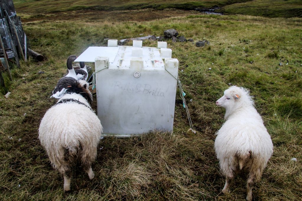
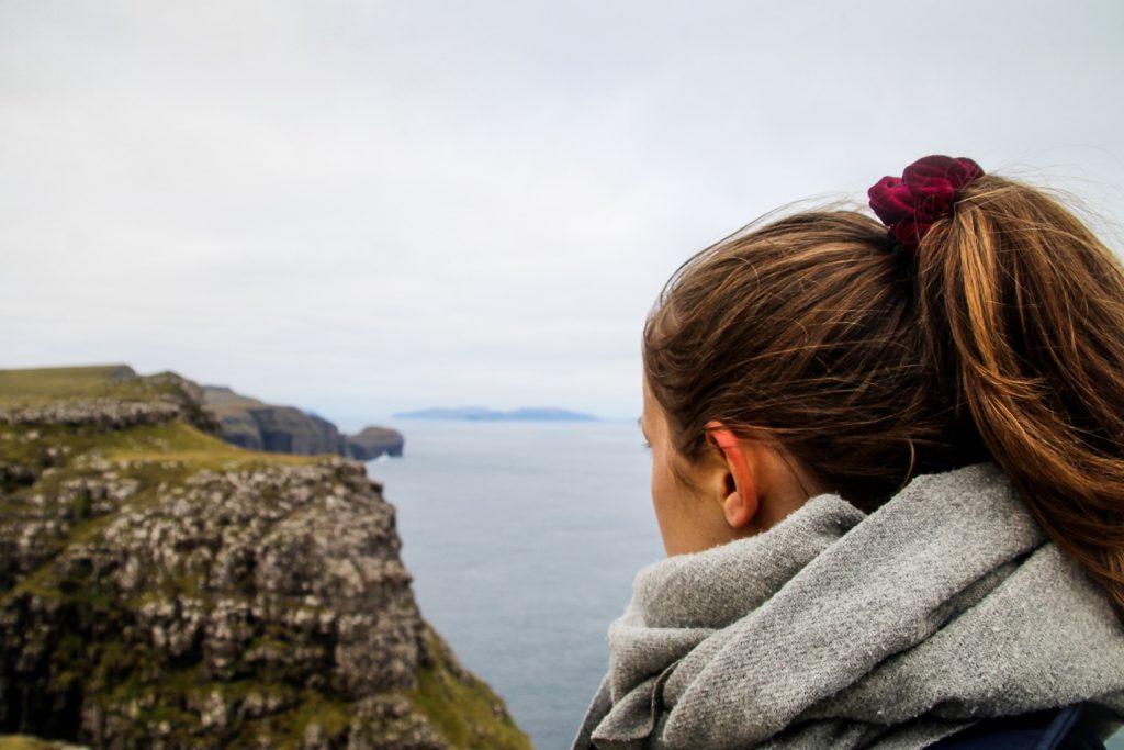
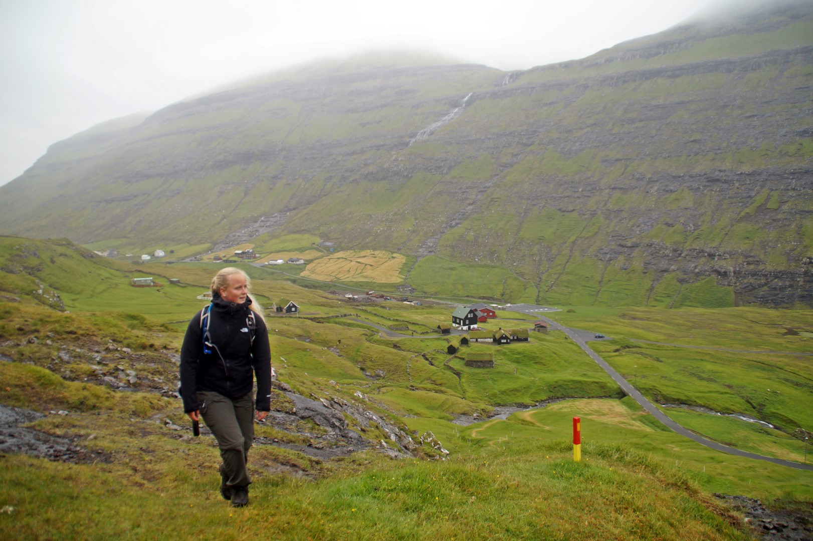
I hitched a ride from my hostel in Sandavágur to Sørvágur where I began my hike at the edge of the village. As far as I know, there is no trail out to Dunnesdrangar so I just made my way there following a map. But before I could even head out into the nature, I was stopped by two adorable and curious sheep, Bella and Brilla. I figured out their names from a large box which might be where they go for shelter in bad weather. I’m guessing that they’re pets as they were so incredibly friendly. Usually, the sheep on the Faroe Islands run away as soon as they see humans!
It was almost 2 pm when I finally started the hike. I had a rough idea of where to go, but it meant sliding under a few fences and climbing over some using rocks (so I didn’t step on the actual fences!). I don’t like doing this at all, but some friends of mine had done this hike the day before and told me this was the way to get there.
The hike out to Dunnesdrangar took me about an hour and it was very easy as there are no steep ascends or descends. It just goes through a meadow which was surprisingly dry when I was there, so dry that I sat down on the soft grass to eat my lunch before continuing to the coast where dramatic views awaited me.
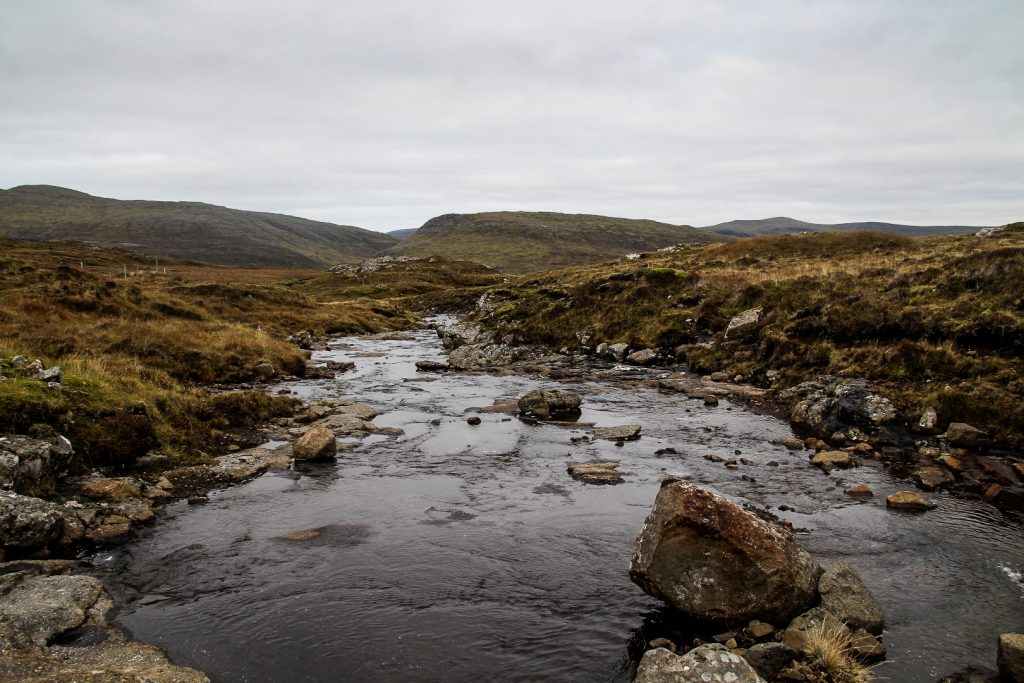
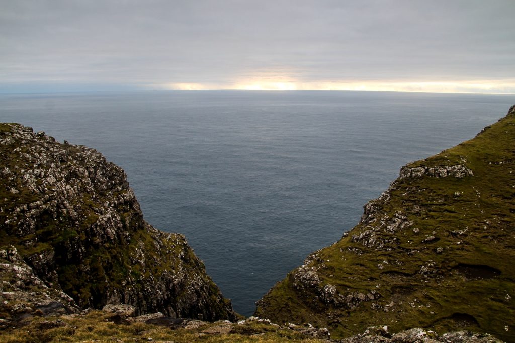
I continued along a stream which took me almost all the way out to the coast. A few hundred meters later, and I finally saw the view I’d been waiting so long to see.
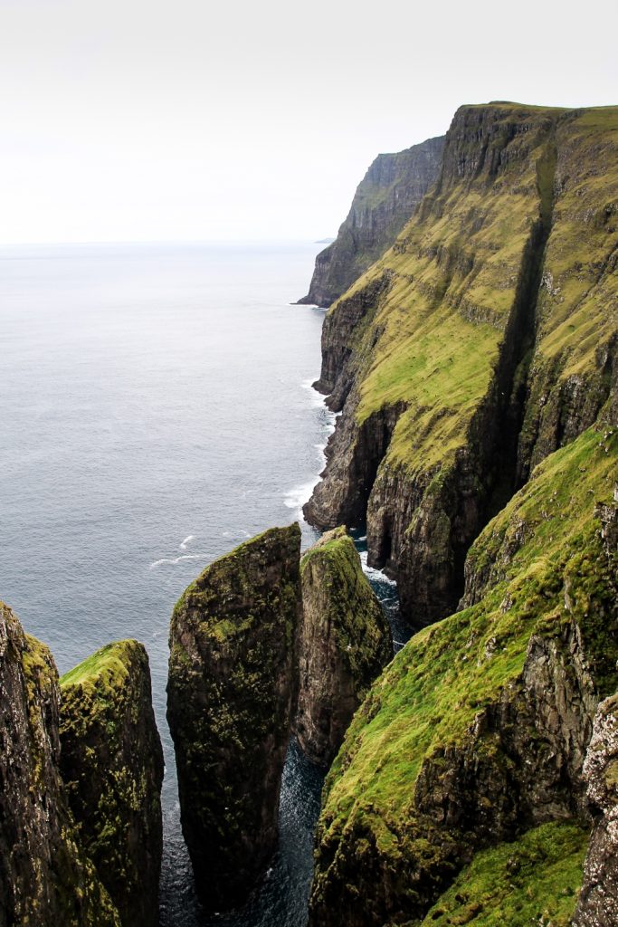
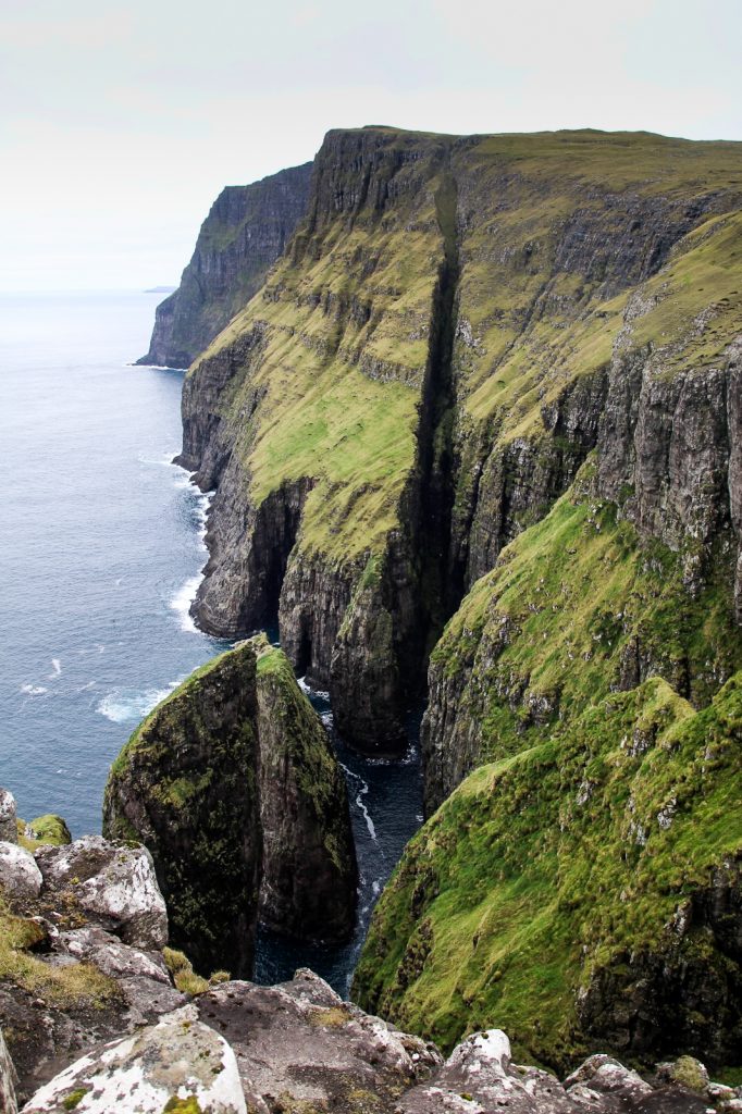
There, in front of me, stood the two sea stacks that make up Dunnesdrangar, perfectly situated beneath steep cliffs and deep gorges. This area is truly incredible.


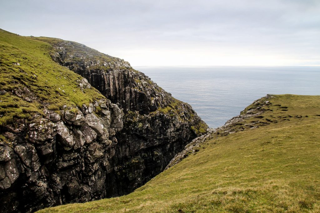
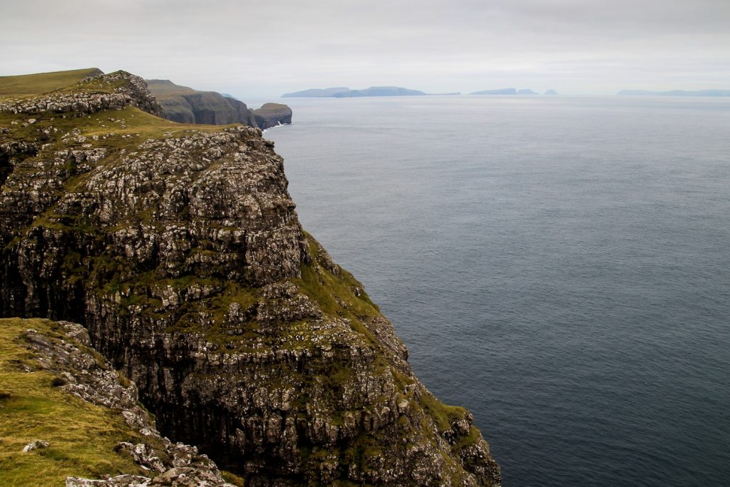
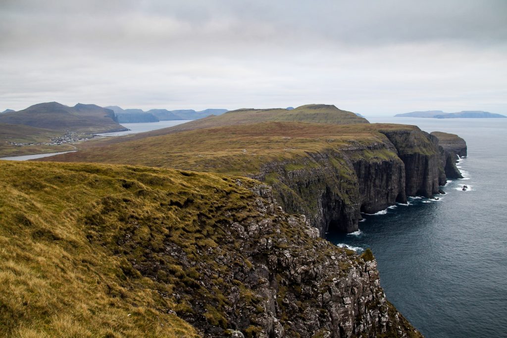
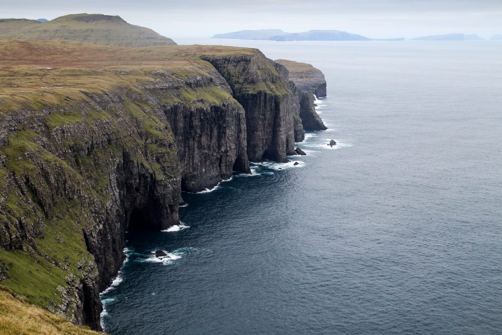
I continued my hike following the coast as closely as possible all the way to the low mountain, Suður á Fjalli, which I wanted to summit. I couldn’t believe the views I saw on my way; deep gorges, rocky cliffsides, caves upon caves and three small lakes with reflections of the soft landscapes.
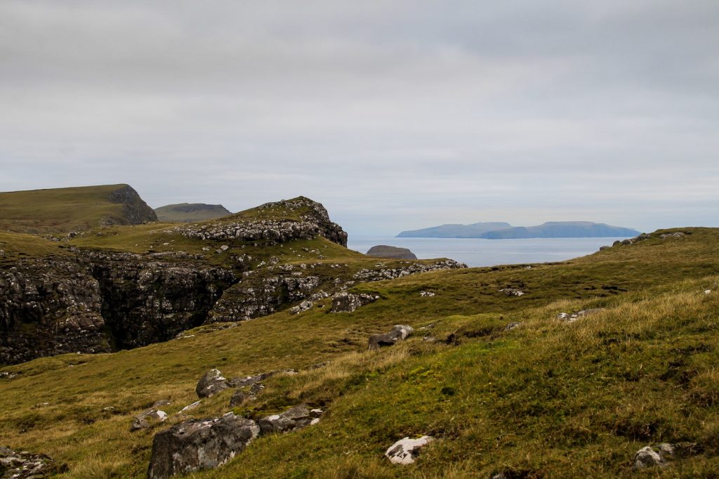
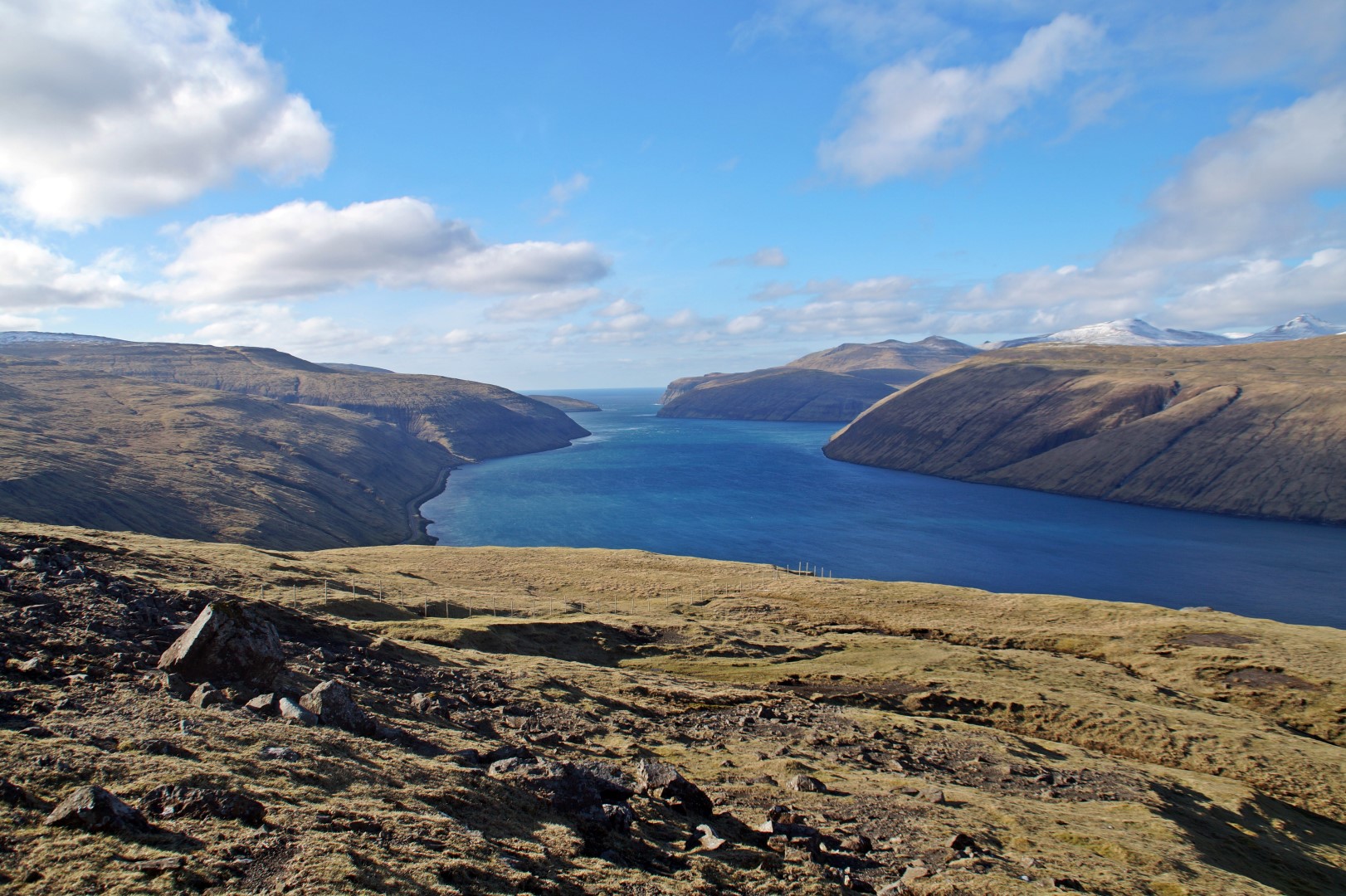
I reached the area known as Slættabergsmúli, which offers the most incredible view out to the famous Trælanípan cliffs and the Bøsdalafossur waterfall at the edge of Lake Leitisvatn. It’s always fun to see a famous spot from a different angle, and this hike offered lots of them!


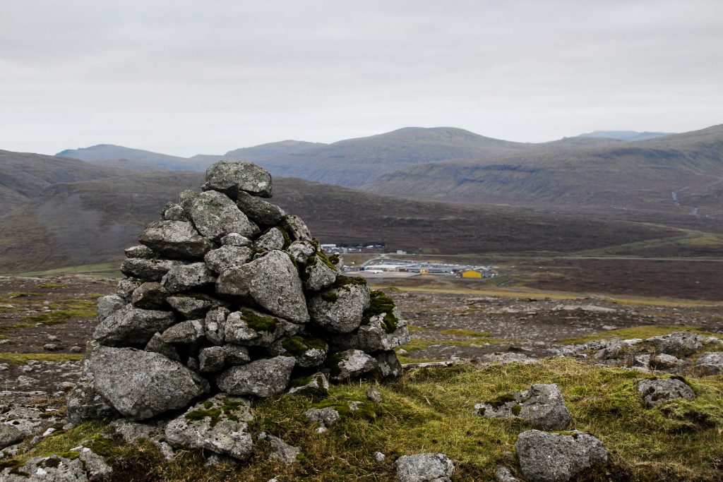
It was a short and easy ascend up to Suður á Fjalli which is located directly behind the airport.
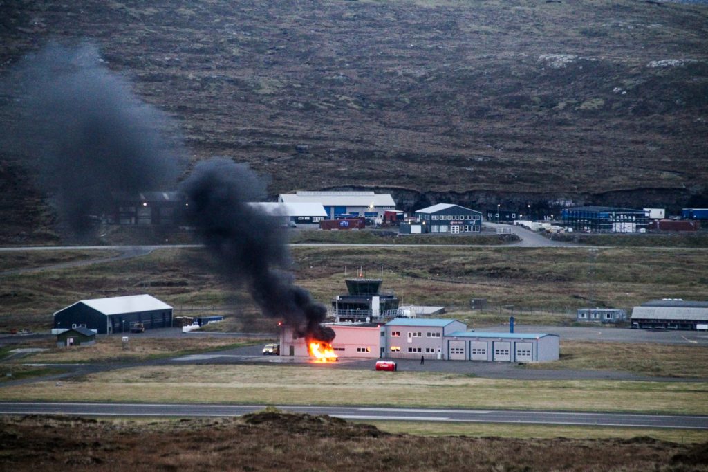
As soon as I got up there and looked towards the airport, I noticed a fire near the traffic control tower! Thankfully, the firefighters quickly got the situation under control, but what a sight to see – at an airport!
It was nearing sunset as I headed down the summit, and I just happened to check the bus times and saw that there was one leaving from the airport 45 minutes later. According to maps.me, it would take me over an hour to walk there from the summit, but I stepped it out and ran some of the way to make it in time. I was even a few minutes early!
A wonderful, short hike had come to an end; a hike that offered majestic views that I’ve wanted to see for a long time as well as more incredible views that my curiosity discovered!
Hiking route description: Dunnesdrangar and Suður á Fjalli
The hike begins in the village of Sørvágur. When entering the village after the airport, turn left at the first road, Mýravegur. Then take the second left up á Svartafossi. Drive or walk along this road until you see a turn to the left. There’s enough space to park a car at the side of the road.
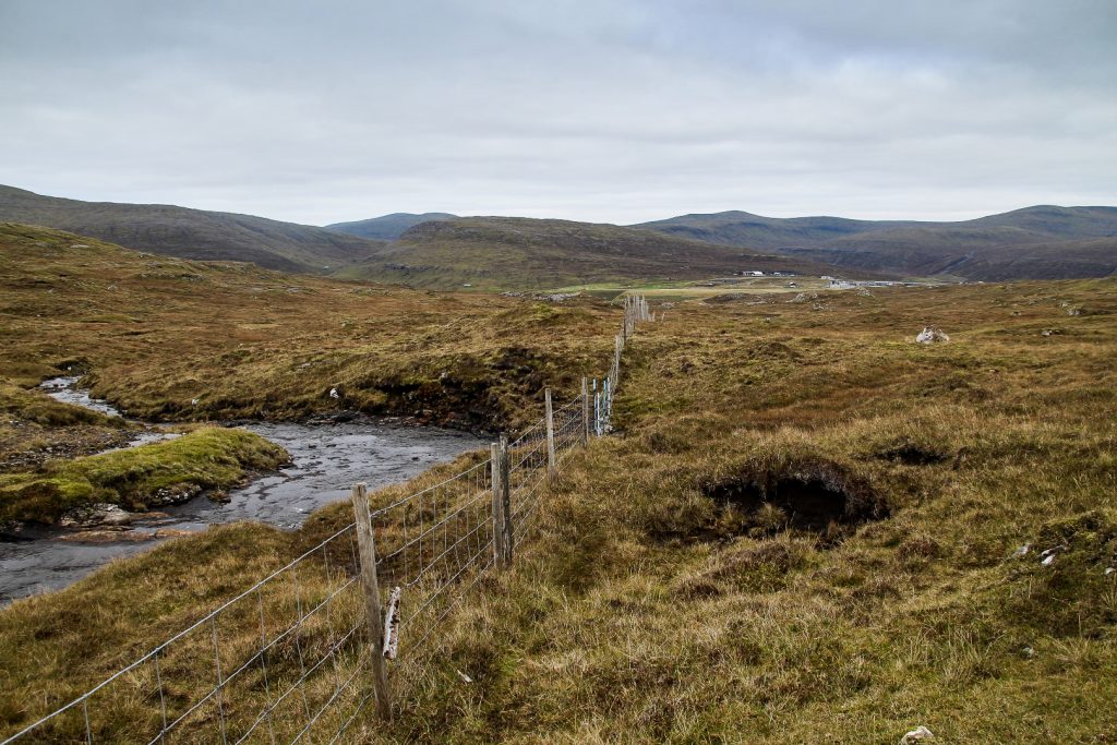
Don’t take the left turn, instead walk through a hole in the fence to your right and follow the river south. There are a few fences to cross, but there are plenty of rocks to stand on so you don’t ruin the fences. Continue following the river on the right side of it. You will have to cross a few streams, but they are all easy to cross.
The river ends a few hundred meters from Dunnesdrangar. Continue straight ahead and you will soon reach this magical spot! The best view of the Dunnesdrangar sea stacks is found to the east of the location, at 62.04731. -7.318209.
Continue hiking east, following the coast as closely as possible. You will come by gorges and lakes and see amazing views of the steep coastal cliffs. Just over two kilometers from Dunnesdrangar, you will reach the low mountain, Suður á Fjalli. It’s a short ascend up to the summit which is found 500 meters inland. To get back to Sørvágur, descend from the mountain and head towards the west side of the airport. Join onto the dirt track where the hike began.
The hike is 8 km, takes 3-4 hours and is easy to moderate.
Please note: The hike is now restricted
As of 2023, the hike to Dunnesdrangar has been restricted, and tourists are now required to book a guide for 450 DKK to visit the place. Click here to book your tour!
Updated 12/07/2023

2 COMMENTS
Emma
3 years agoHello! We are considering a 5-day trip to the Faroes in October. Do you think it is still worth it during October with the weather? We are used to cold and hiking, but wondering if the fog/clouds get so low that the views are almost entirely blocked. I realize with 5 days there is less room for rescheduling if the weather is horrible. I’d appreciate any advice! Thank you very much.
Melissa Cherry Villumsen
3 years agoHi Emma! I’m so sorry for the late reply. I’ve been travelling for the past two weeks and somehow missed your comment!
In my experience, October usually has nice weather. Of course, there are rainy days (every month has those!), but generally, I’ve been lucky with the weather in October on the Faroe Islands. The fog is usually only a problem during the summer (in my experience, July is the worst month for fog), so I wouldn’t worry about that for an October visit.
If possible, I would definitely try to go for longer than five days, but if that’s what you have available, check the weather report before going and GO! Five days is still plenty to get a good feel of the country and go on many beautiful hikes! Enjoy your trip! 😀