This post contains affiliate links. If you make a purchase through these links, I may earn a commission at no extra cost to you. Thank you!
Lake Leitisvatn (or Sørvágsvatn) is the host of the most popular hiking trail in the Faroe Islands. Tourists flock to the edge of the lake to see the optical illusion created by the cliffs of Trælanípan with Lake Leitisvatn appearing to be floating above the ocean. But the area has much more to offer than just this iconic view and I wanted to discover it all.
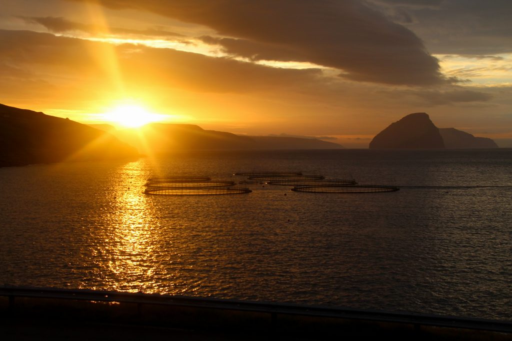
On my third day on the Faroe Islands, I woke up before sunset to get myself ready for a long day of hiking and mountain climbing. The sun rose half an hour later and with the orange colours that appeared on the sky, it made the promise of a bright day.
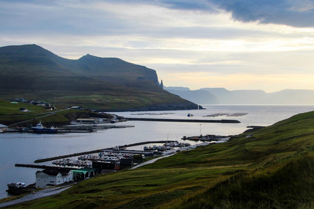
I set off for Miðvágur and walked to the highest road where I began my hike which would take me up the mountains of Ravnsfjall, Middagsfjall and Ritubergsnøva before descending to Trælanípan and the Bøsdalafossur waterfall at the edge of Lake Leitisvatn.
Then I would attempt to cross the lake where it narrows to then become a waterfall before hiking up the mountain Suður á Fjalli on the other side and ending the hike with a stroll along the west side of Lake Leitisvatn.

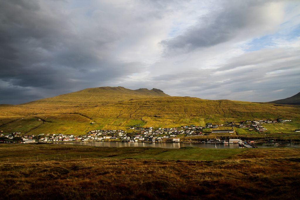
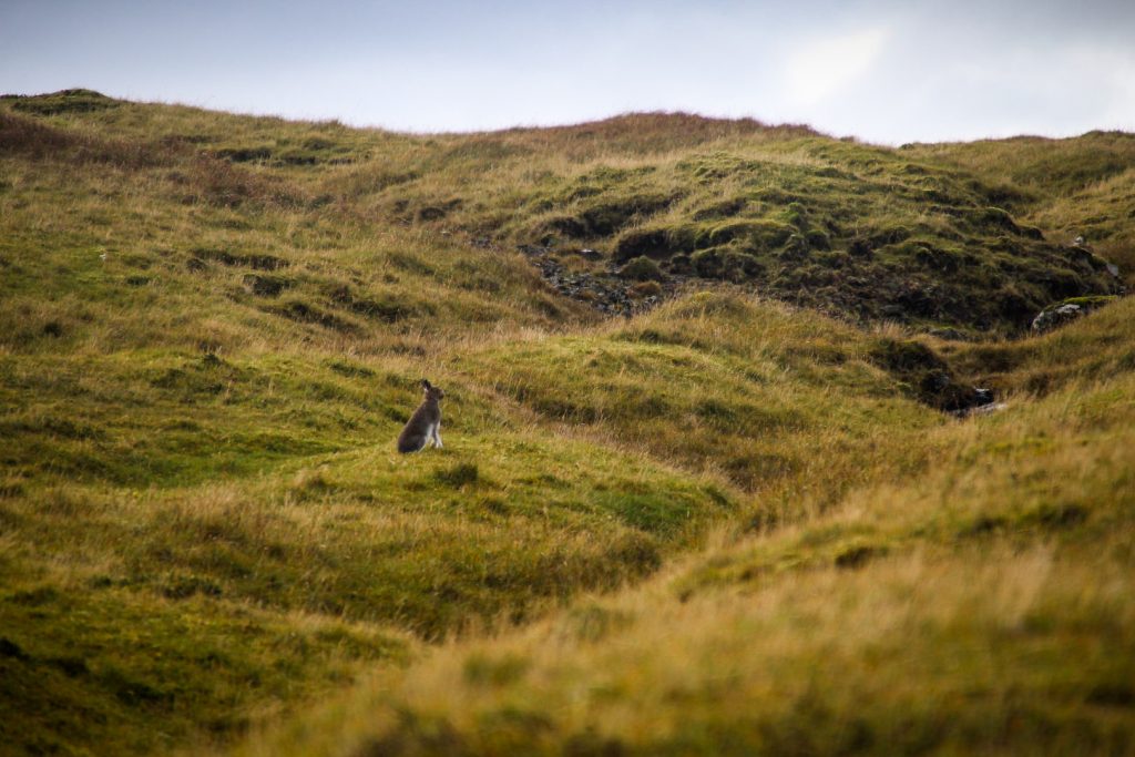
It was still early when I started the ascend to the first mountain of the day, Ravnsfjall at 269 meters. This was my first mountain climb since Mt. Sorgschrofen in Jungholz in August, so I was a little rusty and quickly got out of breath. But I hiked and hiked, up and up, and watched as Miðvágur and Sandavágur behind me got smaller for each step I took. A hare popped up from the grass, took a quick look at me, decided I was dangerous and skipped away. Forty minutes after I’d started hiking, I stood atop the first mountain of the day.
I was rewarded with the most incredible views of the Southern isles, bathed in the soft light from the sunrise. Behind me, I had wonderful views over Miðvágur, Sandavágur and the famous rock formation, Trøllkonufingur.
The weather was so calm and it wasn’t one bit cold, so I decided to take it easy and explore the summit in depth. I walked a bit down the mountain to the east to get a view of Prestangi, the eastern end of this little peninsula of Vágar, before starting the climb of the second mountain.

It was a steep climb up. I met a guy walking down the mountain and felt just a little bit envious, but I soon forgot all about it when I reached the summit of Middagsfjall at 343 meters.
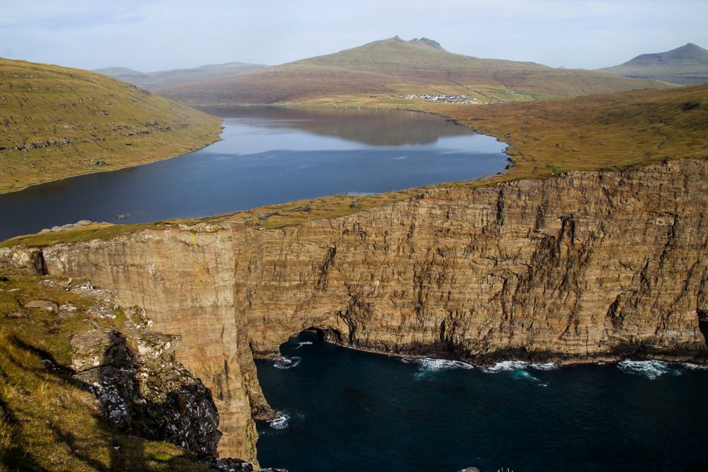
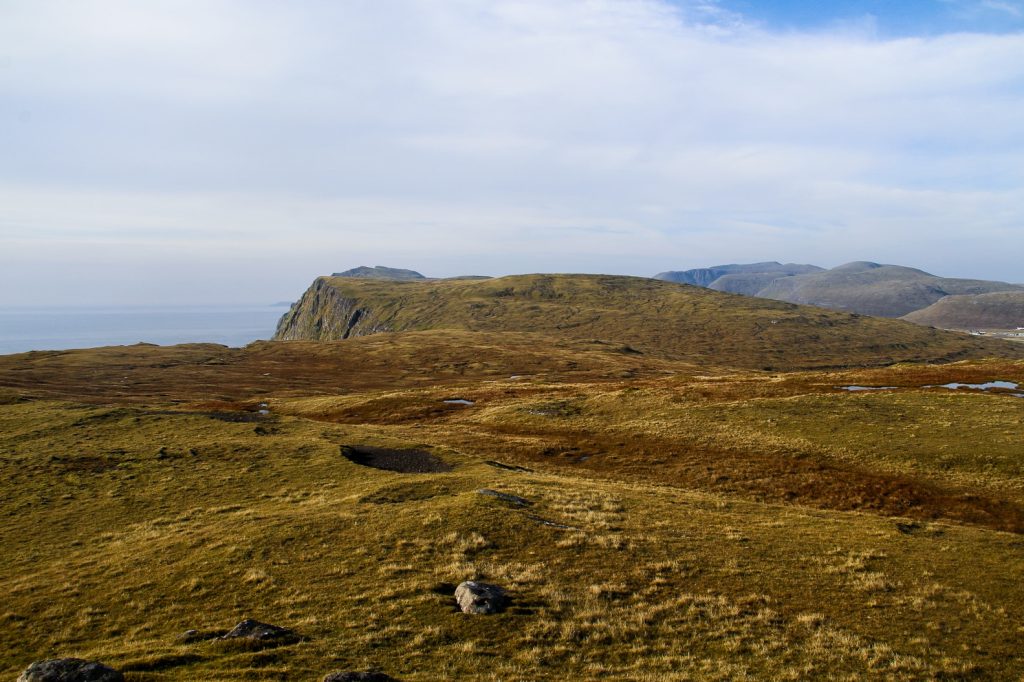
I was rewarded with a fantastic view of Leitisvatn, the airport and the sunkissed mountains of Vágar in the distance.

The third mountain of the day, Ritubergsnøva, is a bit further apart than the first two. So I had a very nice and easy stroll for about a kilometer, before ascending the last 40 meters to the summit which was rather steep.
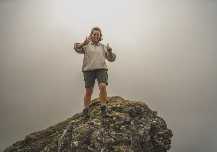
Ritubergsnøva at 376 meters offers one of my favourite views in the country. I climbed this mountain back in 2017 and swore I’d come back. Today, I finally did.
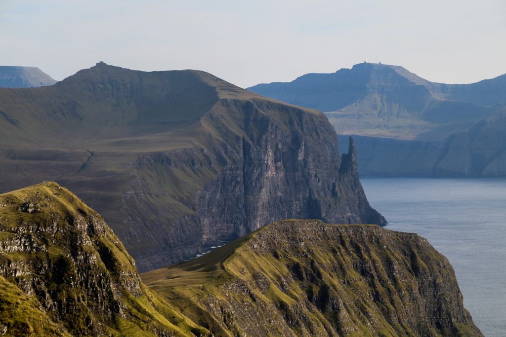
Everything about the view is just incredible. Mykines peeping out in the west, Leitisvatn with Trælanípan at its edge, Miðvágur and Sandavágur nestled beneath high mountains, the views of the Southern isles and the iconic view of Trøllkonufingur behind the rugged cliffs of Middagsfjall and Ravnsfjall. Ritubergsnøva delivers big time!

I was still before noon when I started my descend from Ritubergsnøva. I was surprised that it hadn’t taken me longer to climb three mountains, but that just meant I’d have time for more hiking on that glorious day!
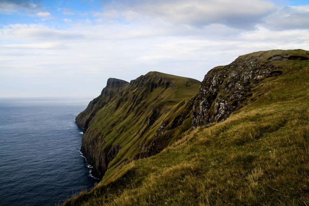
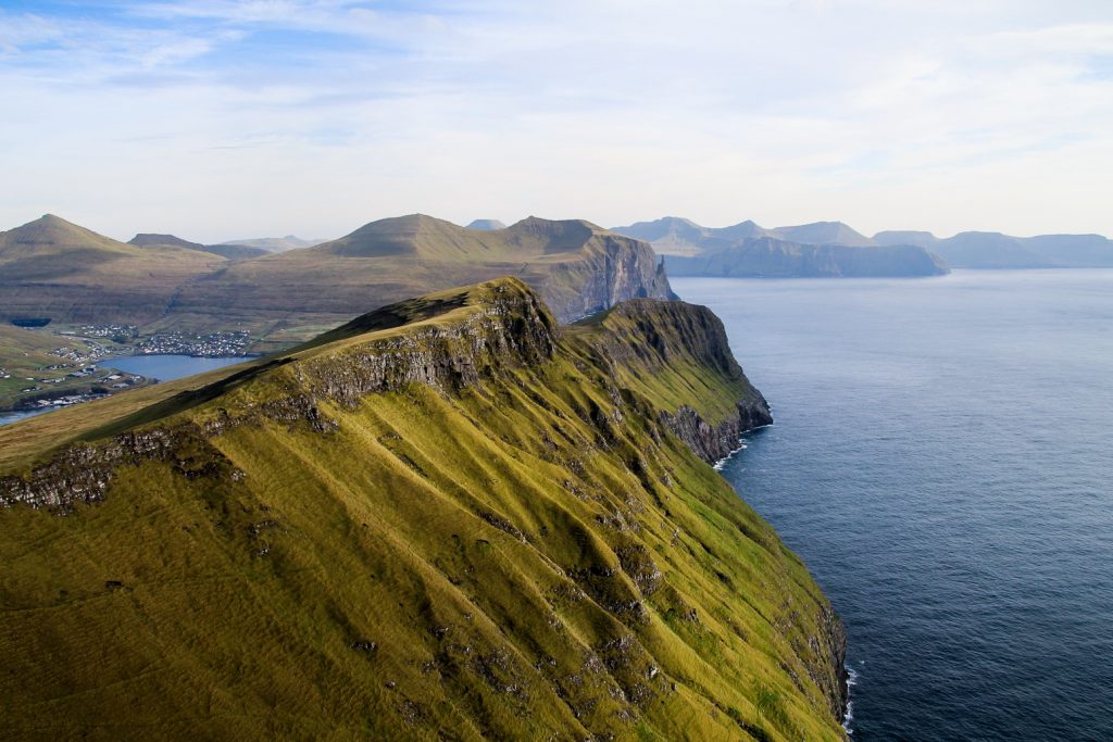
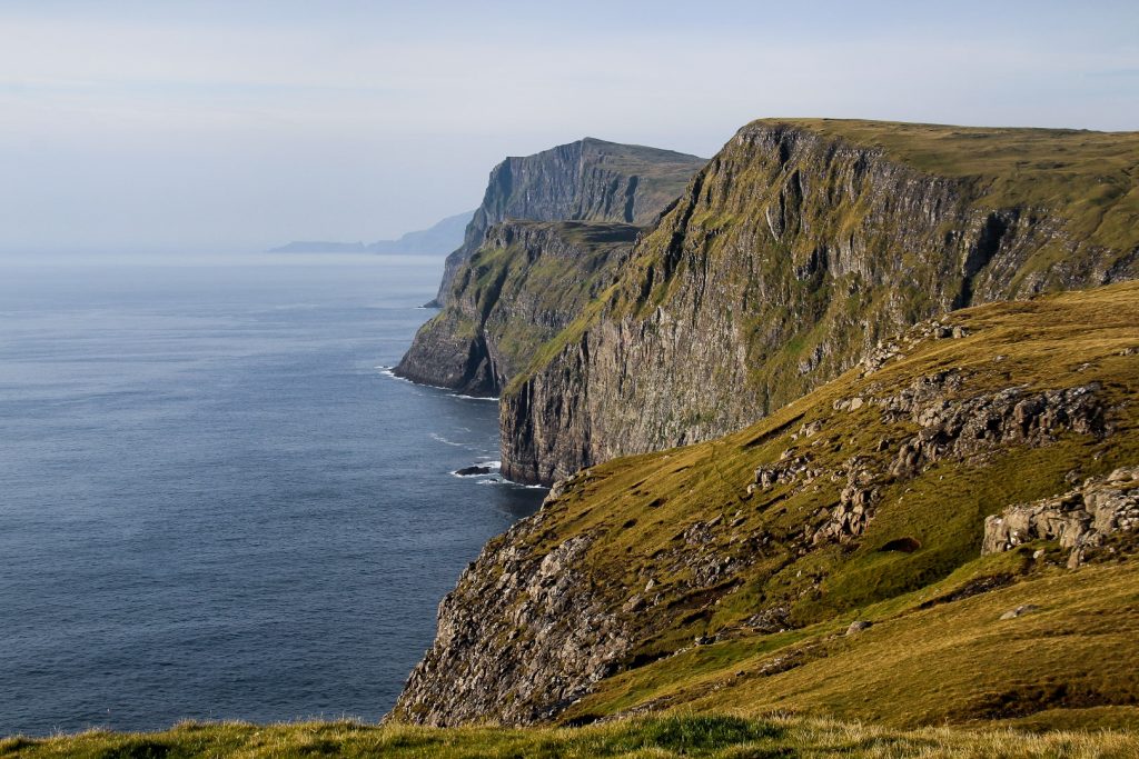
The descend was quite steep so I had to be careful in places. But I spent so much time just taking in the views and capturing images of the surreal landscapes that came in to view as I got closer to Trælanípan.
At the bottom of the famous cliff, I found the new footpath that was made last year. I followed it all the way up the cliff where I met an elderly French couple who were staying at the same hostel as me. They were seeing this place for the first time, and I could see stars in their eyes!


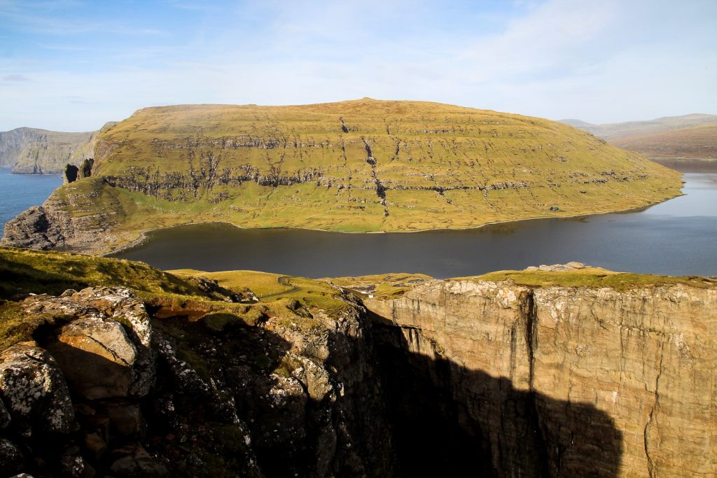
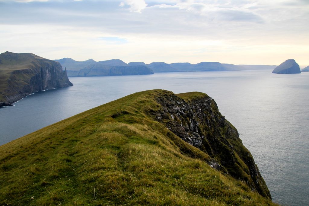
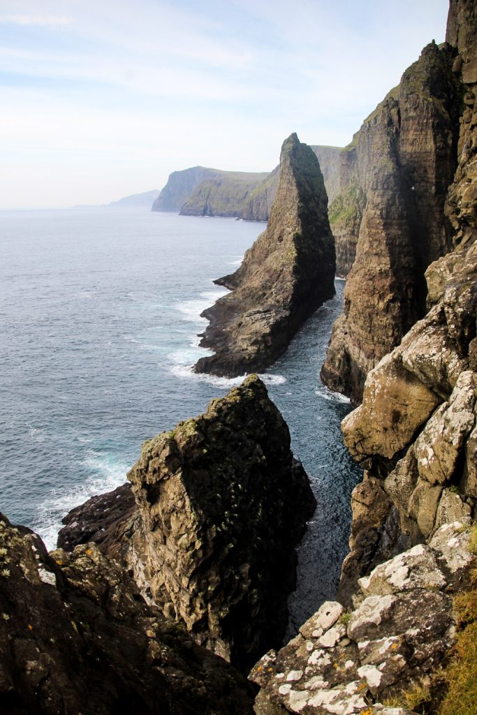
Trælanípan at 142 meters was as beautiful and surreal as the first three times I went there. But I didn’t linger much and continued down to the famous waterfall, Bøsdalafossur.
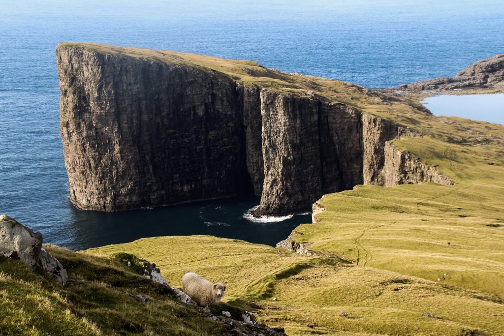
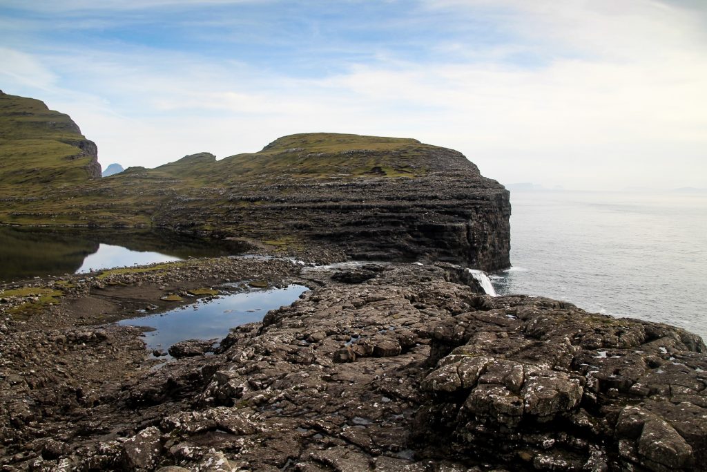
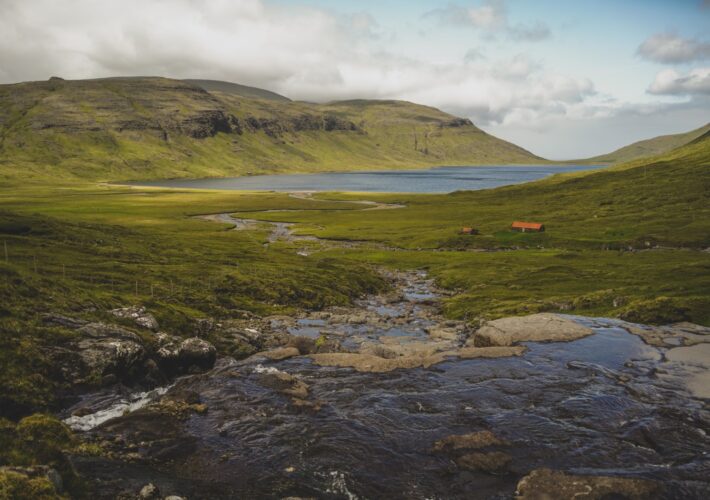
Once I had descended from the cliff, I found a footpath that took me to some rocks that offer wonderful views of the forceful waterfall with the Geituskoradrangur sea stack behind it.

With the day still young, I decided to continue my hike on the other side of the waterfall, which meant crossing the lake at its narrowest point.
I had to take my shoes, socks and clothes off as I was wearing tights under my trousers, but I stupidly put my trousers back on before crossing. They got drenched as it was much deeper than I thought, but I managed to get over just fine! I had to walk in tights until my trousers dried though, so I just prayed I wouldn’t meet anyone!

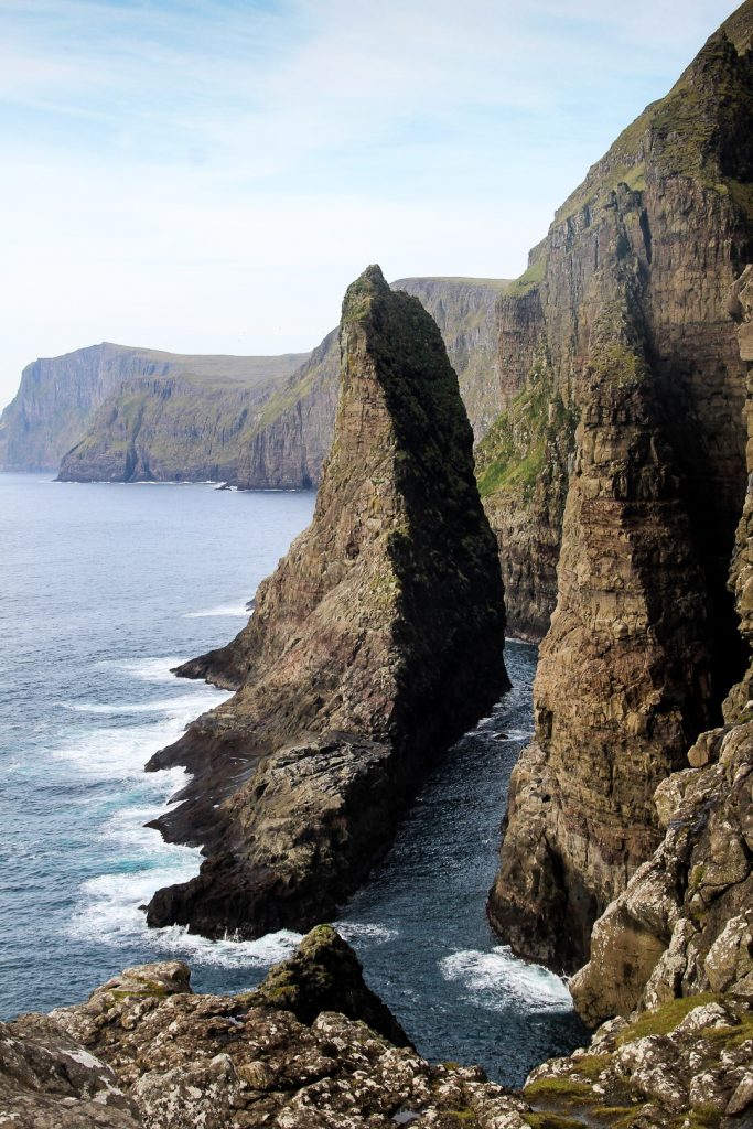
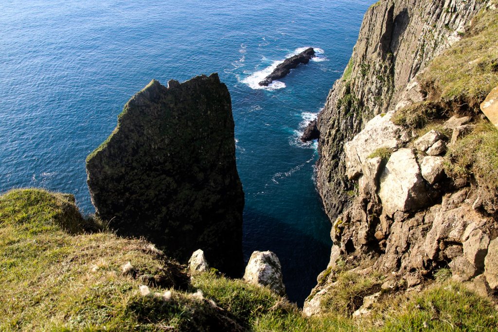
I continued up a small rocky hill to get as close as possible to the sea stack Geituskoradrangur. In awe, I just stood there staring at the beautiful rock with waves crashing against it. Most people only ever see it from afar, behind Bøsdalafossur, but it is a beauty in its own right.
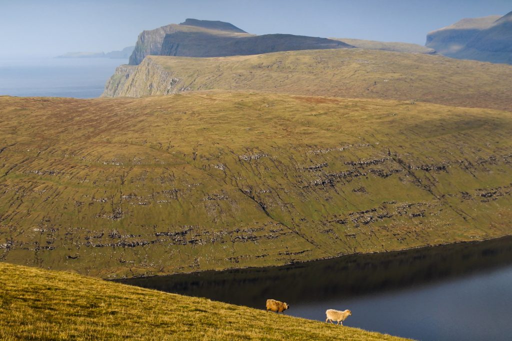
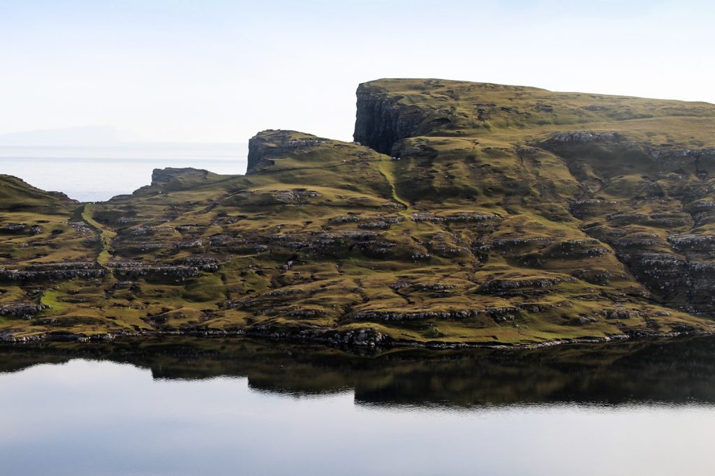
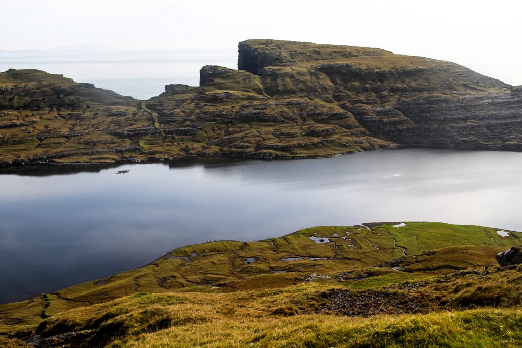
I turned around and my eyes almost popped out of my head. Ritubergsnøva was reflecting itself beautifully in Lake Leitisvatn, and between the mountain and Trælanípan, Koltur stuck his head out as if to say hello.
I truly felt like I was a pioneer, exploring new land as the first human. Of course that’s not true, but I do think this side of the lake is just as magical as the more famous side and it was wonderful to have it all to myself!


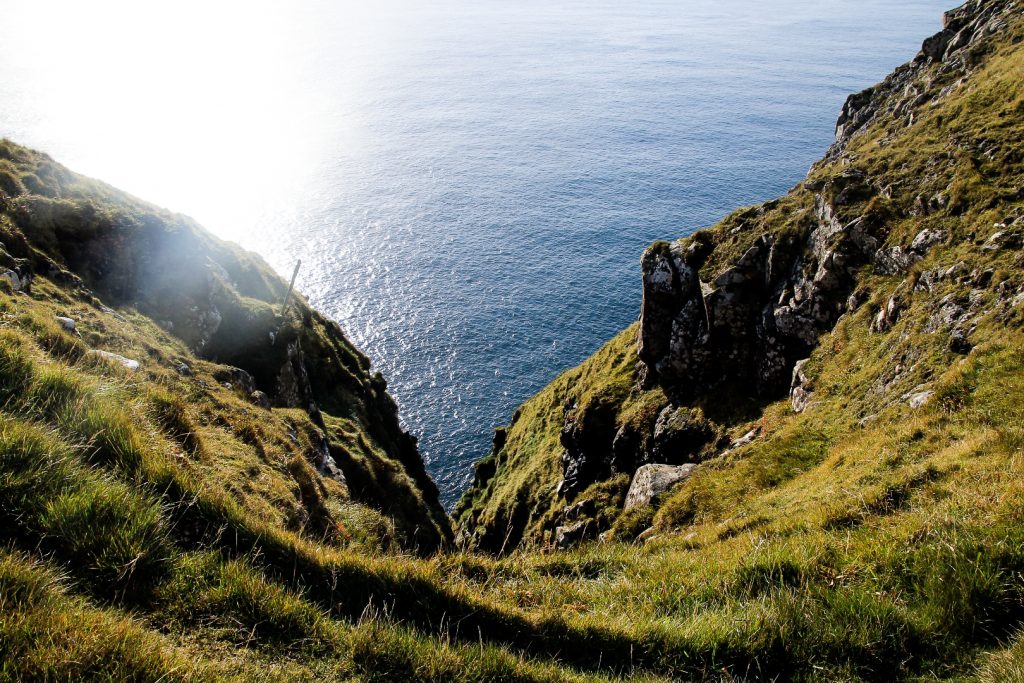
I continued up the hill, hoping it was somehow connected to the mountain I was going to climb next, Suður á Fjalli at 305 meters. But alas, a steep gorge separates the two, so I had to go all the way back down to the lake and past the gorge to find a good spot where I could get up the mountain.
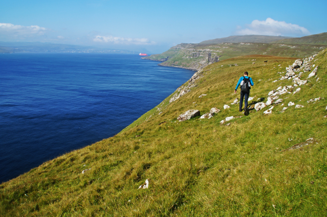
It didn’t take long until I found some sheep tracks that went gradually up, so I followed them for a while. But it was as though I just kept going up and up, and it felt like that mountain had no end to it. But then I got over a pass and saw the massive summit ahead in the distance. I was still over two kilometres away and getting to it would mean descending 100 meters to climb another 200 meters. I decided to do it, but looking at my map, I realized I’d missed the gorges and coastal cliffs of Geituskor. Since I don’t want to miss any beauty that the Faroe Islands has to offer, I backtracked 500 meters, descending about 100 meters. I was bummed that I’d have to climb them again, but the views I saw weren’t to be missed.
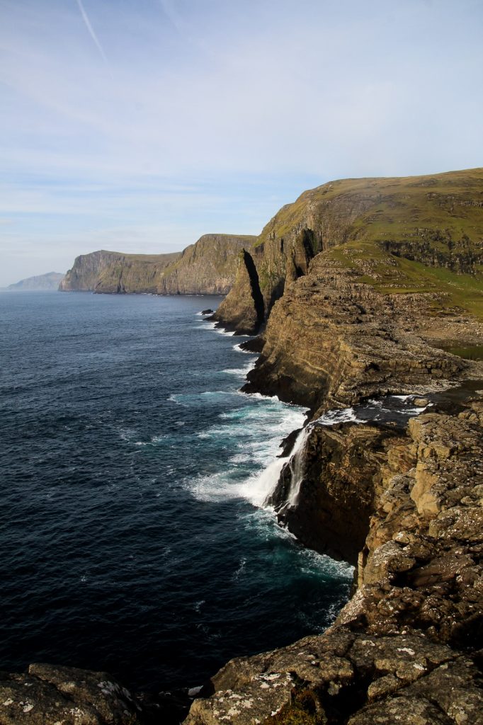
I walked as close as possible to the coast and came across lots of small gorges. At one point, I discovered a wonderful view of the rugged coastline of Slættabergsmúli. I continued a bit and suddenly found myself above the sea stack! I was able to carefully looked down at it from above. Wow!


I started walking up again, determined to complete the mountain climb, but after over 1,5 hour of ascending, descending and backtracking, I decided to call it a day. The thing is, Suður á Fjalli isn’t the only thing I want to see in the area. I also wanted to hike an additional 2 km to Dunnesdrangar, and I just know that would’ve exhausted me completely.
My legs were tired and I was hungry and had run out of food, so I decided to wait with the other two sights for another day.
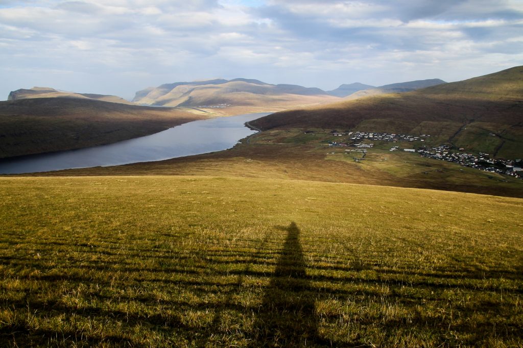
So I just started walking down so I would meet the path that runs along the west side of Lake Leitisvatn. But I couldn’t find a good way, and ended up following a steep waterfall. That was maybe not the smartest decision, but at least I knew where it was going!
I finally got down after a very steep climb just before 5 PM. Now I just had to follow the path along the lake to a road so I could catch a ride back to the hostel before sunset.

I finally got to the road at 6.30 PM after what felt like forever. I stood there for a few minutes trying to hitchhike when I saw the bus turn into the airport. I was 700 meters away and the bus was going to leave five minutes later! I ran as fast as I could and I made it! For just 20 DKK, it was so worth giving up hitchhiking. I couldn’t wait to get back to the hostel to (finally) feed my rumbling stomach and have a warm shower! I think I deserved it after 4,5 mountain climbs + a hill and 35,400 steps over 22,5 km!
Hiking route description: From Ravnsfjall to Trælanípan and Geituskor
Turn left at the first road after the church in Miðvágur. Continue straight along Hornavegur and join onto the dirt track. Walk along it until you see a giant hole in the fence to your right. Start walking up towards the mountain on your left. This is Ravnsfjall. There are some fences to cross, but there are holes to be found everywhere. Spend some time taking in the gorgeous views and then head to the next mountain, Middagsfjall (on your right when facing the ocean). It’s a steep climb, but short.
Then continue to Ritubergsnøva on your right, an easy stroll except for the last ca. 40 meters ascend to the top which is rather steep. There is one fence to cross, but there’s are some poles to step on so it’s easy and legal. Head down the mountain by following the ridge. Soon you’ll see Trælanípan. Continue your descend until you see the footpath up Trælanípan. Follow it until you get to the top and don’t forget to look for that iconic view! Head down the cliff to Bøsdalafossur. Just walk towards the ocean and you will hear it.
This is where the hike ends if you don’t want to cross the waterfall. If so, just follow the usual tourist trail along Lake Leitisvatn out to the road, which takes about 45 minutes. If you do want to keep going, continue down the rocks to the narrowest point of the waterfall. Remove your shoes, socks and trousers and walk over. Choose a spot far from the actual fall, then there is no danger.
Walk up the rocky hill to your right for some amazing (not commonly instagrammed) views of Lake Leitisvatn and Bøsdalafossur. Don’t forget to go out on the rocks near the ocean to see the sea stack Geituskoradrangur up close! Climb back down the hill and walk along the lake until you see a series of sheep tracks to your left. Follow them to the top of yet another hill and then walk out to the coast and follow it for about 600 meters to Geituskor where you can see the sea stack from above. If you walk some hundred meters further, you’ll discover gorges and a view of the rugged coastline of Slættabergsmúli.
Climb back down the hill to the path that runs along the west side of the lake. I followed a waterfall to get down the hill, but I can’t really recommend that as it was steep and slippery. Once you get to the path, follow it to the airport and you’re back in civilisation! The path disappears once in a while, but just follow the lake and you can’t get lost.
The entire hike is 16 km, takes 6-7 hours and is of moderate difficulty.
Want to explore Leitisvatn and Trælanípa with a guide?
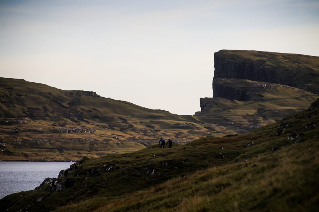
Make sure you don’t miss any of the iconic views and choose a hike with a local guide. This will also give you an opportunity to learn about the history of the place – and perhaps you can persuade the guide to take you up the three mountains too!
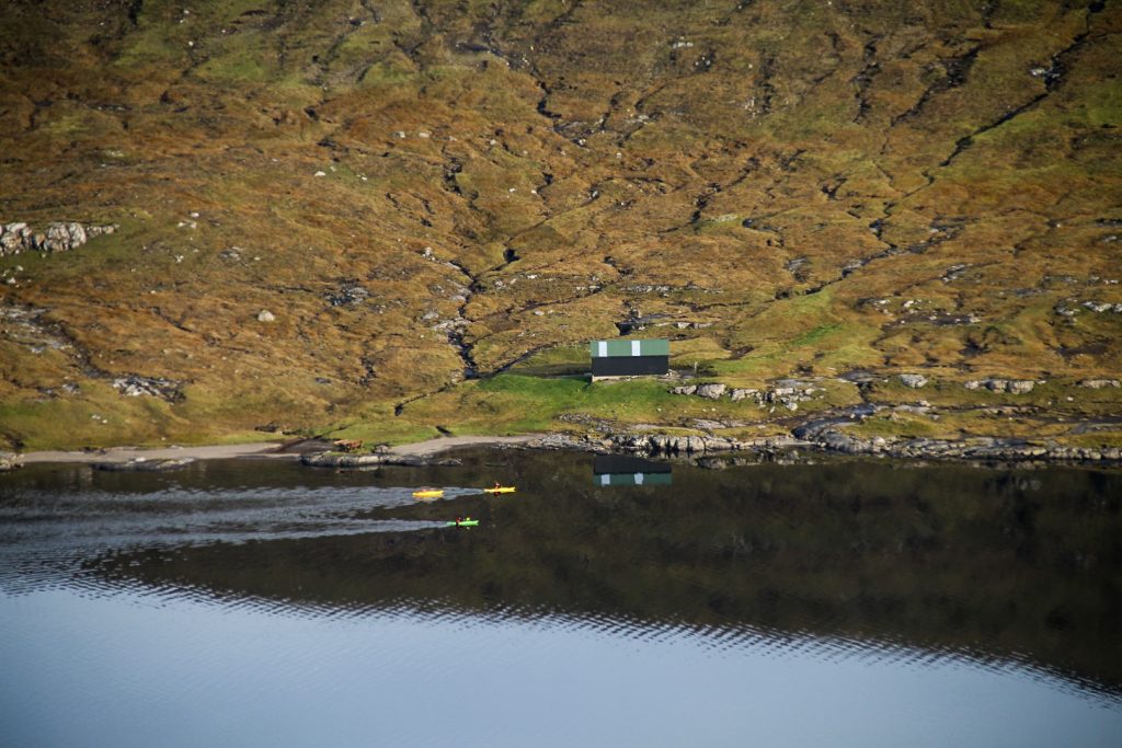
If you prefer an alternative way of getting to Trælanípa, kayaking might be the right choice for you. It’s a lot of fun and it’s cheap, too!
Leave a Comment
Pingback: A short hike to Vágar’s unknown lake, tucked away below the misty mountain peaks – Northtrotter on 11/10/2020
Pingback: Six peaks in a day: Climbing the mountains above Fjallavatn – Northtrotter on 11/10/2020
Pingback: Kayaking on Lake Leitisvatn: An adventurous alternative way to Trælanípan – Northtrotter on 11/10/2020
Pingback: Dunnesdrangar and Suður á Fjalli: To the dramatic cliffs of southern Vágar – Northtrotter on 11/10/2020
Pingback: Sørvágur to Oyrargjógv via Slættanes: A long hike across the middle of Vágar – Northtrotter on 11/10/2020

7 COMMENTS
QuentinSymbolful
4 years agoStill more, I think this route can be continued to the Dragasund, of course inevitably, you have to pass the night in a tent halfway.
Melissa Cherry Villumsen
4 years agoYeah it can, although it would be a very long and difficult hike – better to split it up into two days! 🙂