This post contains affiliate links. If you make a purchase through these links, I may earn a commission at no extra cost to you. Thank you!
The weather report had promised a day without much rain, so my new buddy, Daniel from Sweden, and I had planned out a day of mountain climbing on Vágar. Fog permitting, the plan was to climb five mountains above Miðvágur but as we drove up towards them, we saw that their summits were swallowed up by the fog.
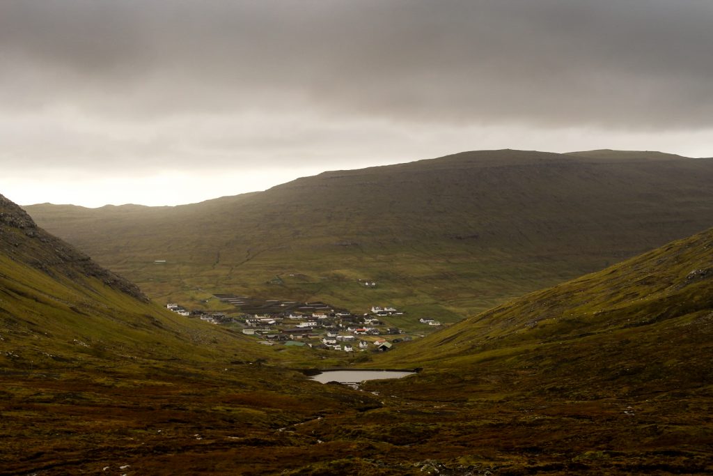
Fog is the single most dangerous thing when hiking on the Faroe Islands as it’s so easy to get lost and fall off a cliff face if you can’t see anything. So we drove further into the island, hoping to find some mountains that were free of fog. As we approached the village of Sørvágur, we noticed a few lower mountains that weren’t consumed by fog and decided they would be our goal for the day. The mountains that we were going to climb were Vørufelli at 284 meters, Eindalsfjall at 449 meters and Vatnsdalsvatn at 514 meters.
I was really excited to be embarking on this hike, especially because we’d get a view of the special heart-shaped lake of Vatnsdalsvatn that I’d been wanting to see for years!
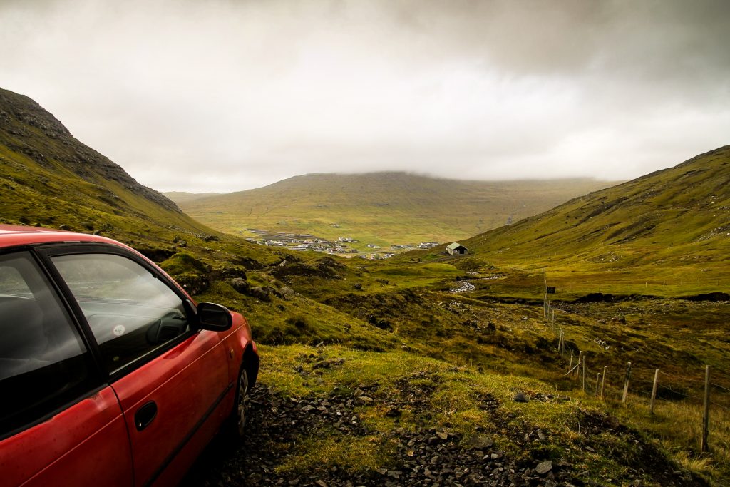
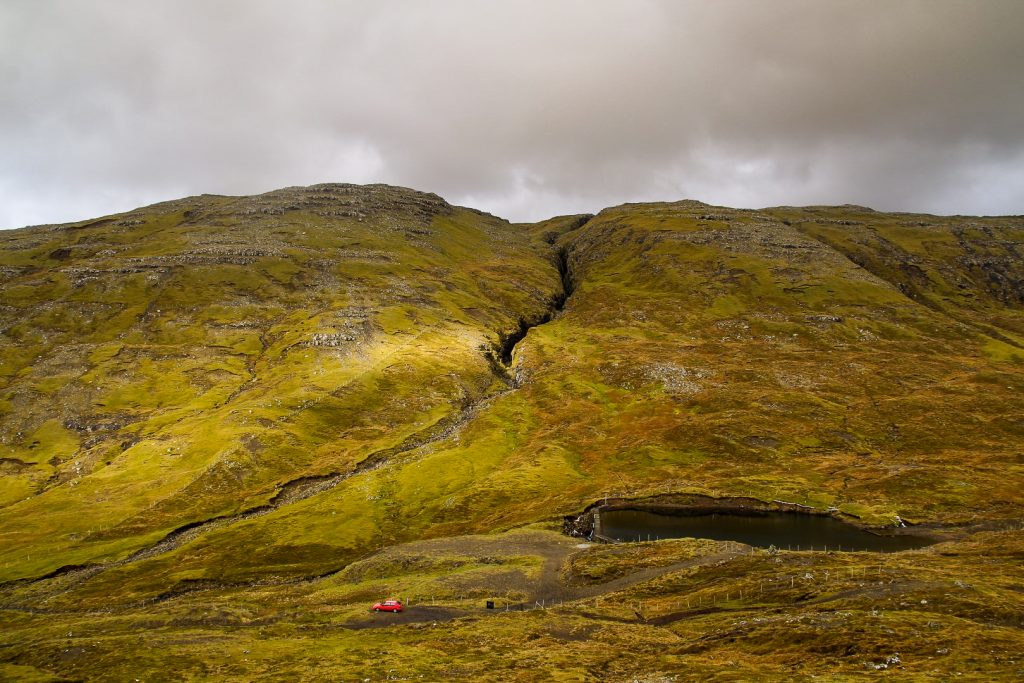
We drove up as high as we could into the mountains and parked the car by a small lake. The lowest of the three mountains, Vørufelli, was right next to us and the climb up didn’t look very difficult, so we decided to start with that one. But instead of looking for a logical place to hike up, we just started climbing. It was much steeper than it looked and later on as we looked back at Vørufelli from the other mountains, we saw that we had actually chosen the steepest part. Ooops.
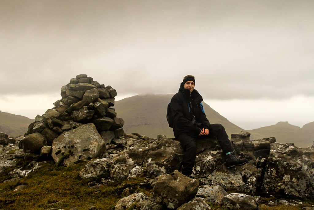
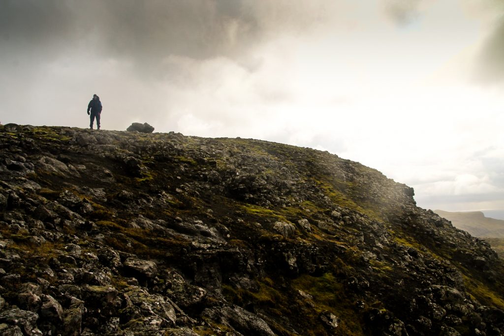
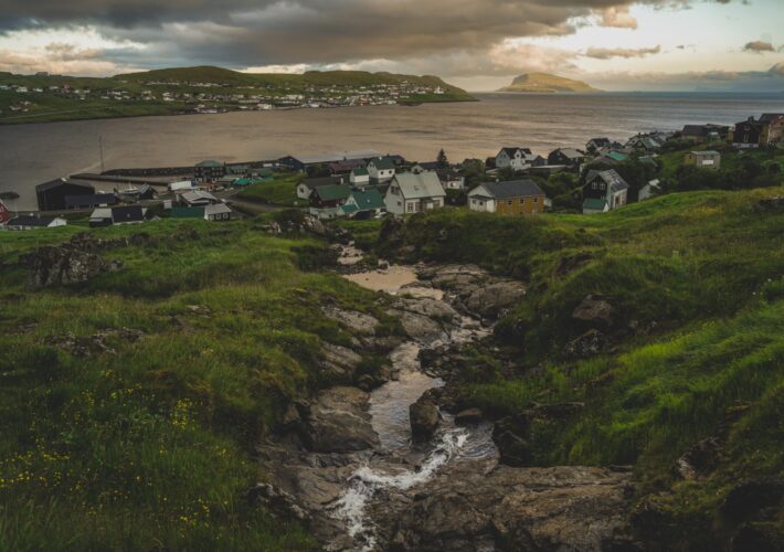
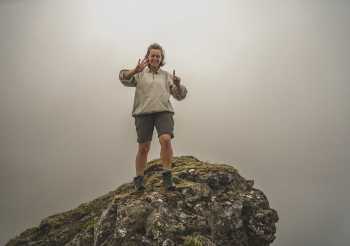
However, it didn’t take long until we reached the summit, complete with a cairn and an incredible view over Sørvágur and the islet of Tindhólmur in the distance. It started pouring as we snapped photos of each other on the summit, but thankfully it stopped shortly after, leaving only dramatic clouds and a slight hope of some sunshine.
The other two mountains are located on the other side of the valley where we parked the car. From the summit, we spotted a ridge that would take us over the valley and over to the other two mountains, instead of climbing all the way back down to then climb up again. It was a detour of maybe two kilometers, but it was definitely worth it.
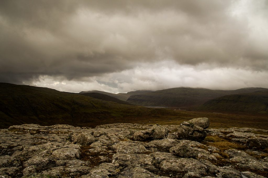
As we walked towards the ridge, the isolated lake Fjallavatn peeped out from its spot beneath high mountains. Despite it being the second-largest lake in the country, it’s rarely visited by tourists due to its isolated location. Myself included. But I knew that I would get there soon (and I did – but that story is for a different blog post!).
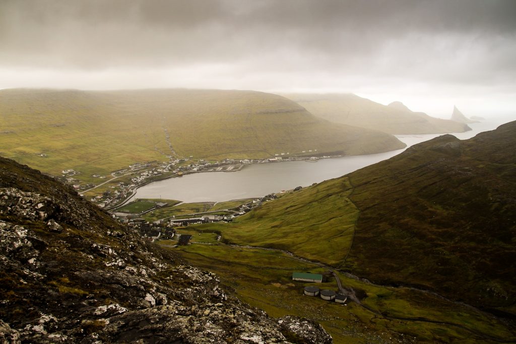
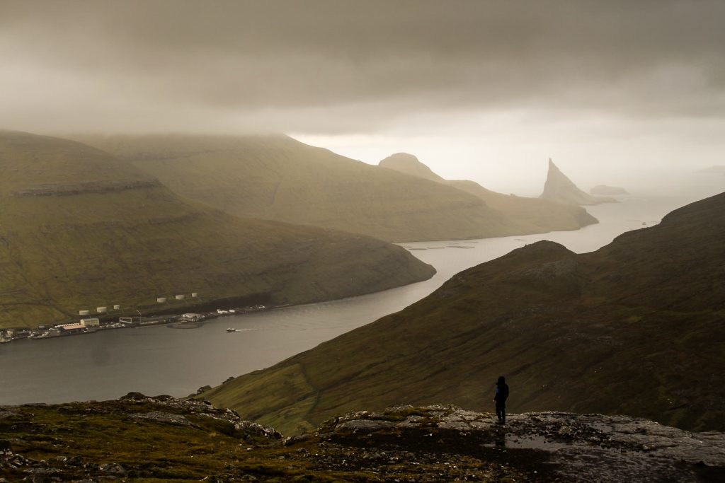
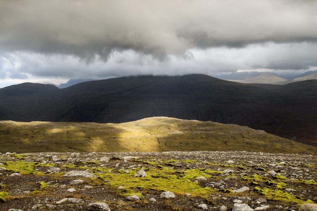
As soon as we were over the ridge, we started hiking upwards and soon spotted what we thought was the summit of Eindalsfjall. But as we neared the top of the “summit”, we realized that we were too far east. Instead, the summit was looking at us a kilometer away. Thankfully, we were now so high up that it didn’t take much ascending to get to the real summit, which offered wonderful views over Sørvágur and the only airport in the country.


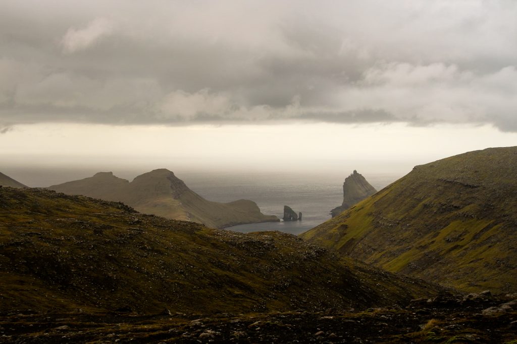
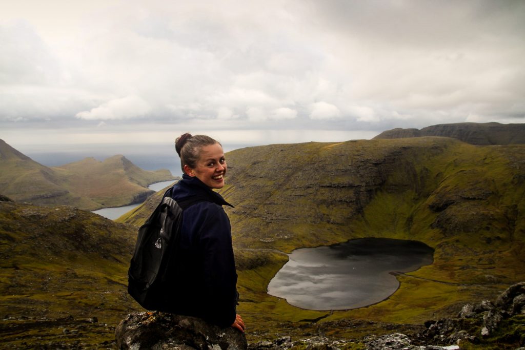
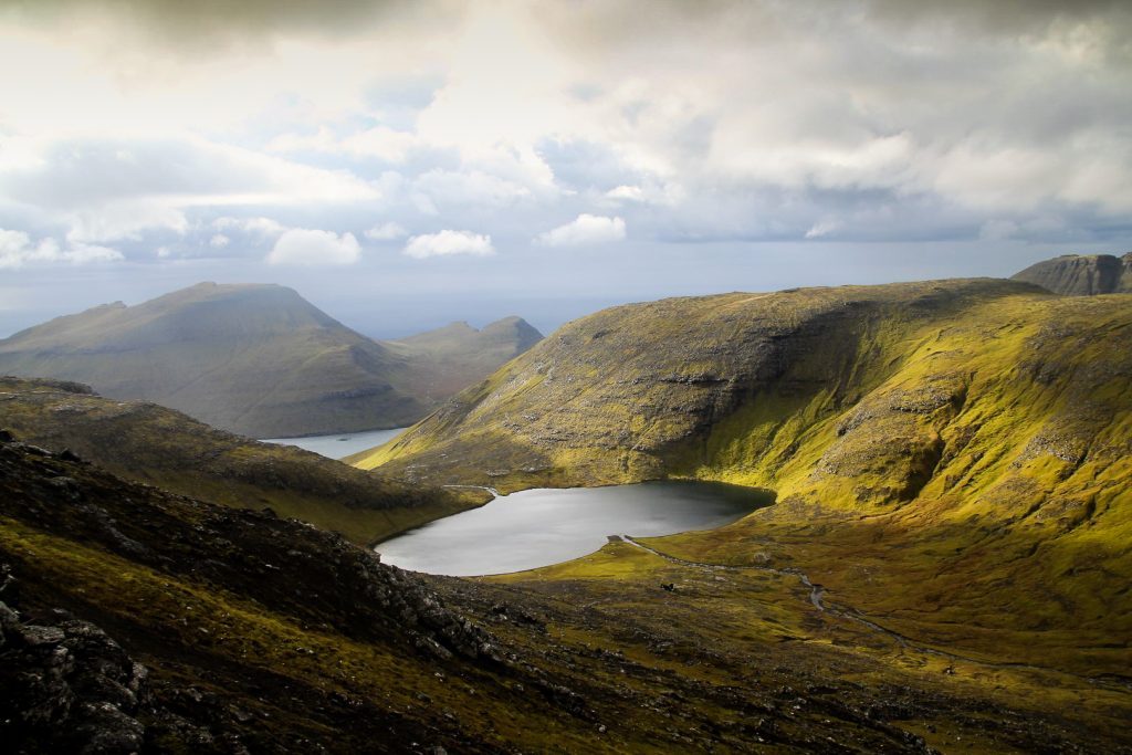
The summit of the last mountain of the day, Vatnsdalsfjall, was only 500 meters away but getting there took ages because we kept stopping for photos. Suddenly, the iconic Drangarnir sea stacks appeared in the distance with the geologically interesting islet of Tindhólmur by their side. As if those views weren’t crazy enough, we suddenly caught sight of the star of this hike; the heart-shaped lake, Vatnsdalsvatn. The sun sent a few rays through the dense clouds, illuminating the golden landscape surrounding the lake.
As we slowly approached the summit, the lake came into full view and we could truly admire its almost perfect heart shape. I stood there in awe, amazed at the view I’ve been wanting to see for years since spotting this lake on the map. I can’t believe it took me so long.
At 514 meters, Vatnsdalsfjall was the highest we went that day, but our hike certainly wasn’t over yet. Because we both really wanted to go to Fjallavatn.
We started descending from the mountain towards the valley Kvígandalur where Fjallavatn is located, but it wasn’t long until we realized that it would be a very long and exhausting hike with lots of descending and ascending to reach the lake and then get back to the car. If we didn’t have the car, we could’ve just gone to the lake and followed a marked trail to Vatnsoyrar, but that wasn’t an option. Instead, we would likely be hiking in the dark.
So we made the decision to turn back. Unfortunately, that meant ascending back up the mountain in order to locate the small lake in the valley where we’d parked the car. It took us a good while, especially because it was a lot longer than we thought, but after a while, we finally spotted Vørufelli and knew that we were close. All of a sudden, I noticed a bright red spot, the car, waiting patiently for us! We walked back to the ridge we’d come up on and descended towards some large cairns that mark the trail between Sørvágur and the abandoned village of Slættanes. We followed the cairns along a well-trodden footpath that took us all the way back to the car.


Because of our little detour, we ended up spending 5,5 hours doing this hike, which probably would’ve taken us at least an hour less without it. But I’m glad we did it as we got some unique views of the Kvígandalur valley with the prominent Marknará stream!
I really enjoyed this hike, and I didn’t feel that it was too much two days after my long 22,5 km hike across four mountains above Lake Leitisvatn. In fact, it was great to get those tired legs working again!
Hiking route description: Vørufelli, Eindalsfjall and Vatnsdalsfjall
The hike begins in the village of Sørvágur. Walk or drive up the road Húsadalsvegur, which soons becomes a dirt track. Continue until you see a small lake on your left. There is enough space to park a car and turn around.
Climb Vørufelli first. The mountain is on your right. There is no path, but just find a good and not too steep spot to climb up. The next mountain is Eindalsfjall. To avoid going all the way down to climb back up again, walk north down Vørufelli and over a mountain ridge to the other side of the valley between the two mountains. Start hiking up, facing the ocean, and soon you will see two summits. The one on the left is Eindalsfjall.
Continue right to the summit of Vatnsdalsfjall, which is only about 500 meters away. From this summit, you will be able to see the heart-shaped lake of Vatnsdalsvatn. The view is better if you walk a bit down from the summit to your right. To get back to Sørvágur, reverse the last part of the hike, going from Vatnsdalsfjall to Eindalsfjall and then down to the ridge. Before you reach Vørufelli, descend to the footpath below you and follow it back to the small lake.
The entire hike is ca. 9 km, takes 4-5 hours including breaks and is of moderate difficulty.
Hike to Vatnsdalsvatn with a guide
Eager to see the heart-shaped lake but not quite up for doing the hike yourself? Then take this tour with a local farmer with the added bonus of a traditional lunch after the hike!
Leave a Comment
Pingback: Misty Vágar: A spontaneous afternoon hike to Vatnsdalsvatn and Snældansfjall – Northtrotter on 06/11/2020

1 COMMENT