This post contains affiliate links. If you make a purchase through these links, I may earn a commission at no extra cost to you. Thank you!
One of the best known viewpoints on the Faroe Islands is also the most expensive to get to. I’m talking about the viewpoint of the Drangarnir sea stacks, made famous by everyone’s favourite app, Instagram. In recent years, the landowner has started charging tourists for the hike, asking an astronomical fee of 550 DKK for a guided tour with no option of hiking on your own.
I’ve been kicking myself ever since I climbed three mountains in this area back in 2018, as my friend and I decided to turn back after climbing Høgafjall instead of continuing to the famous viewpoint. We thought we could return any day we’d like to do this part of the hike. But not long after, the hike became restricted and all hope seemed lost. I didn’t think I’d ever get there as I certainly wasn’t interested in paying 550 DKK for a short hike. I believe in paying a small fee of maybe 50 or 100 DKK to maintain paths etc., but 550 DKK for a short and easy hike is a rip-off.
But this October, when I was trying to see every corner of the island of Vágar, I just had to make it work somehow. My friend Lucy convinced me to give the landowner a call to ask if there was any possible way we could do this hike on our own and for a smaller fee. We called him in the morning of the day we wanted to do the hike, and to my big surprise, he told me that he didn’t have time to guide us that day so we could go on our own for free. Score!
I couldn’t believe our luck, but I think it could’ve had something to do with the fact that we called him from a Faroese number and spoke in Danish. I don’t know if this would work for the average tourist. But anyway – miraculously – Lucy and I were free to go, so we set off straight away and headed to Sørvágur where the hike begins.

The hike is often described as difficult and taking at least six hours, but we found it very easy and rather quick. There is a trail to follow for almost the entire hike, and although the coastline is very steep, it felt perfectly safe as long as we kept a good distance to the edge, and we were able to hike in our normal speed.
Had we only walked the official trail out to the viewpoint, we probably would’ve done it in 3,5 hours, but of course we didn’t. I don’t think I’ve ever “just” hiked the official trail anywhere on the Faroe Islands as there’s always so much more to see!

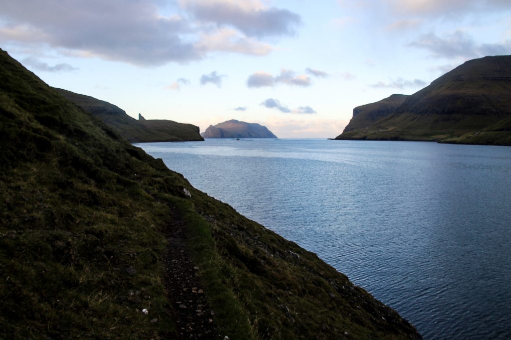
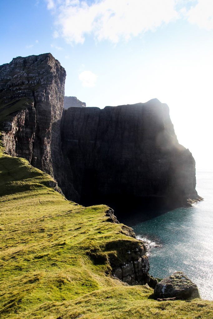
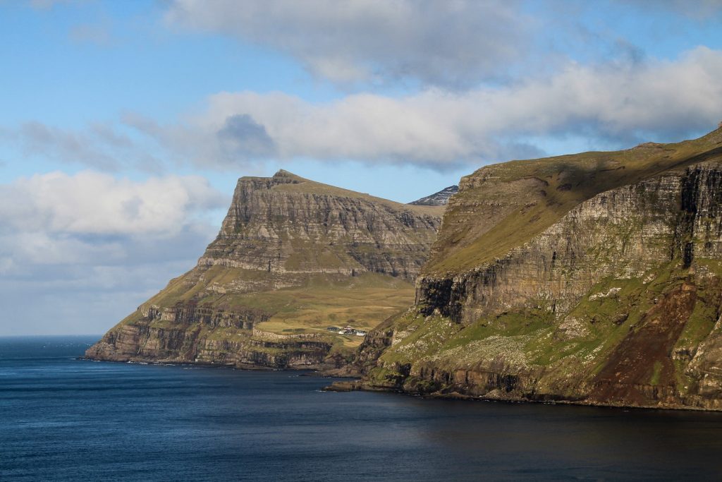
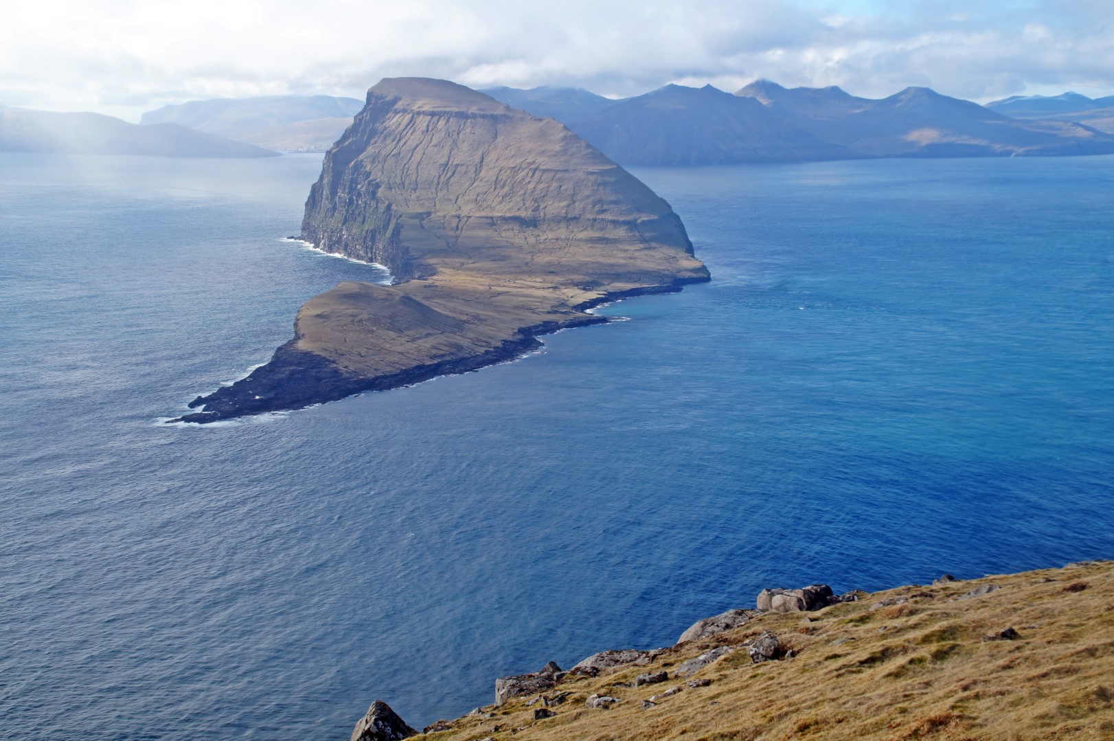
When we got to the tiny lighthouse at Múlin, we went away from the trail and headed up the first of two mountains, Sundsnøva. Although the mountain is only 286 m. high, it was quite a tough climb up as it’s steep and rather long. We got a big surprise as we neared the summit as it’s as steep as anything. The summit itself is a cliff, and it’s the same story with the summit of the mountain next to it, Kvívíksskoranøva at 263 m.
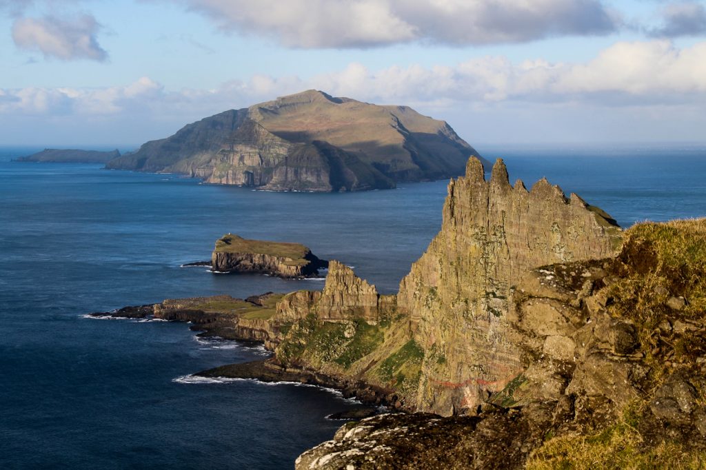
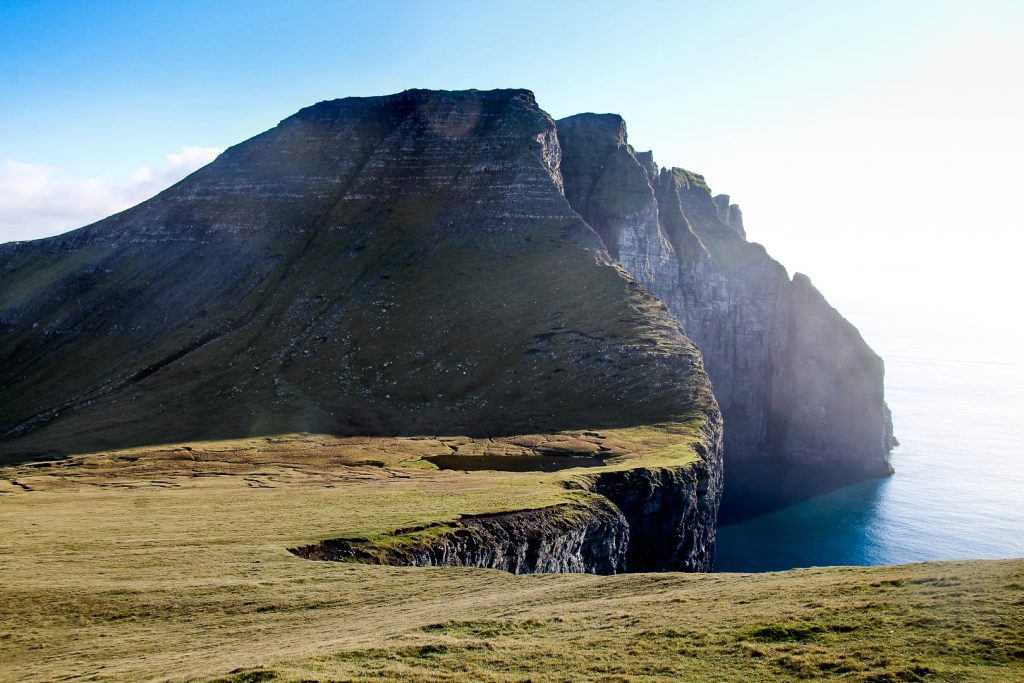
Both mountain summits offered jaw-dropping views of the Drangarnir sea stacks and the Tindhólmur islet with the island of Mykines in the backdrop, as well as the steep cliffsides of Høgafjall behind us. The views to all sides were surreal!
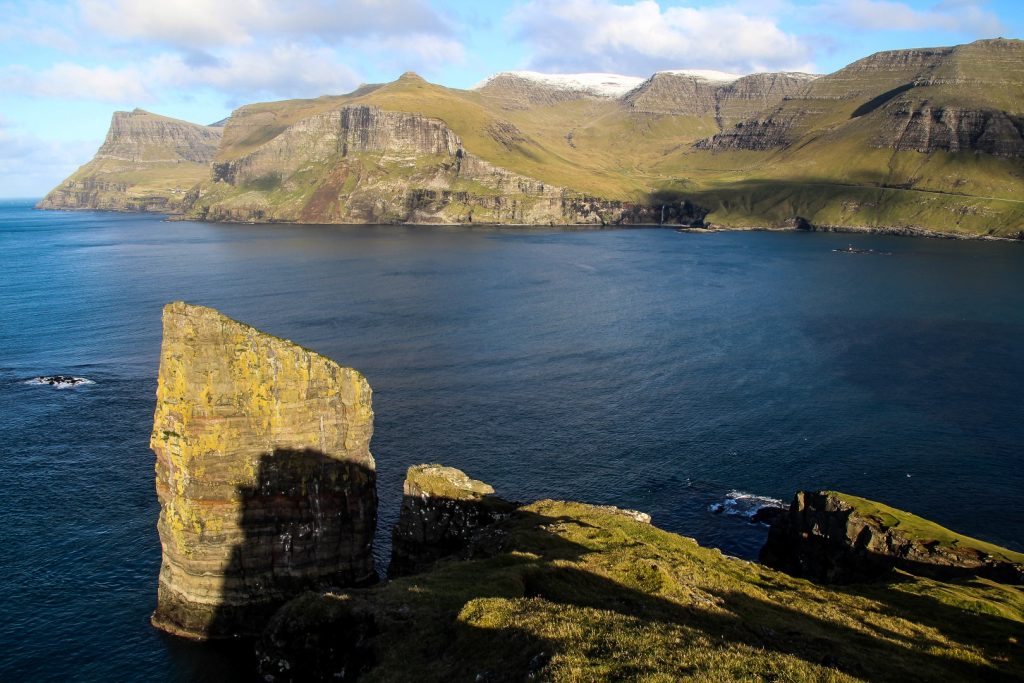
But my favourite view of the day – even better than the famous viewpoint – was found between the two mountain summits where the steep cliffside of Sundsnøva dramatically crashes into the ocean where the sea stack Filpusardrangur sticks his rocky head up over the water. It reminded me so much of the equally breathtaking view from the summit of Høgafjall!


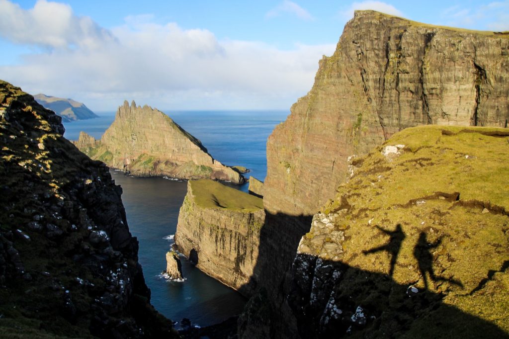
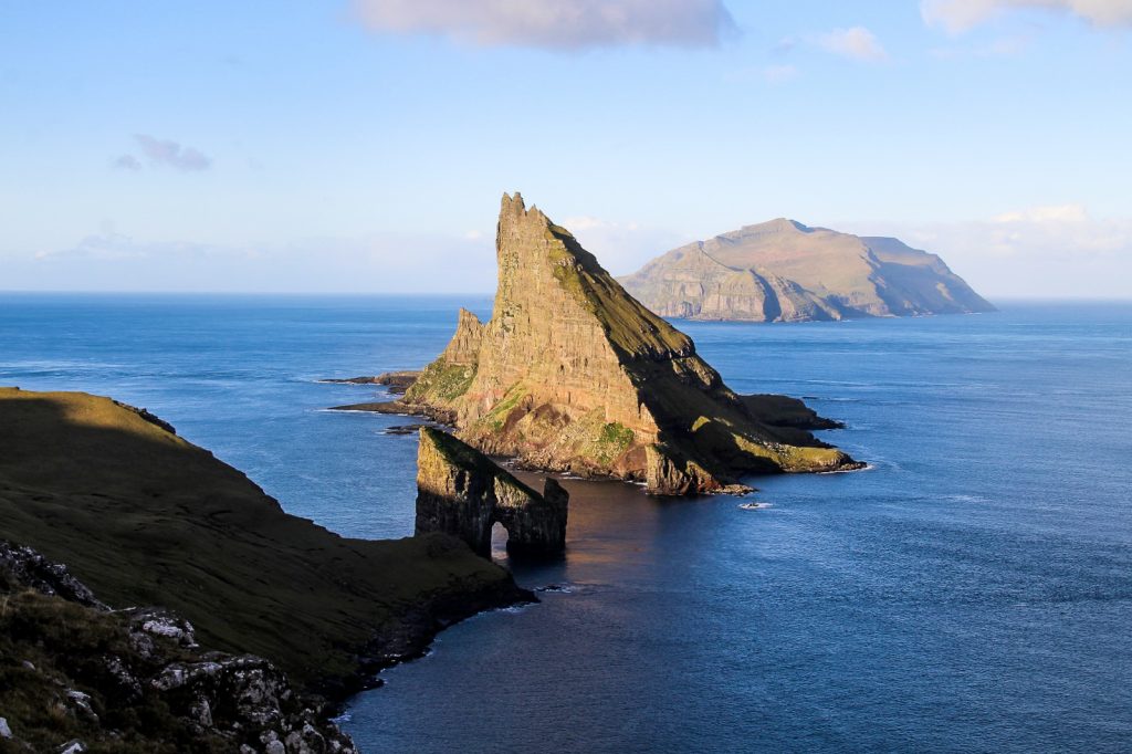
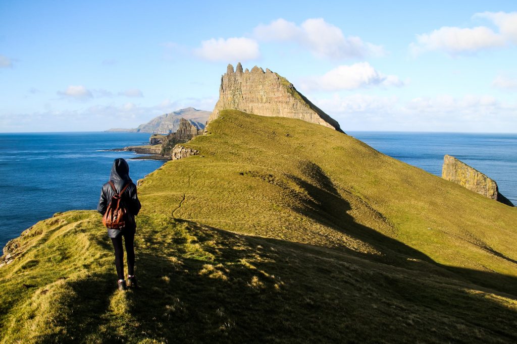
It was time to head down to the edge of the peninsula to see the famous view over the Dragasund sound with the unusual-looking sea stack, Stóri Drangur, the star of the area.
We spent a good while searching for the best views of this iconic spot and taking in the fact that we were actually there – and for free! I actually still can’t believe our luck. Thank you, kind landowner!


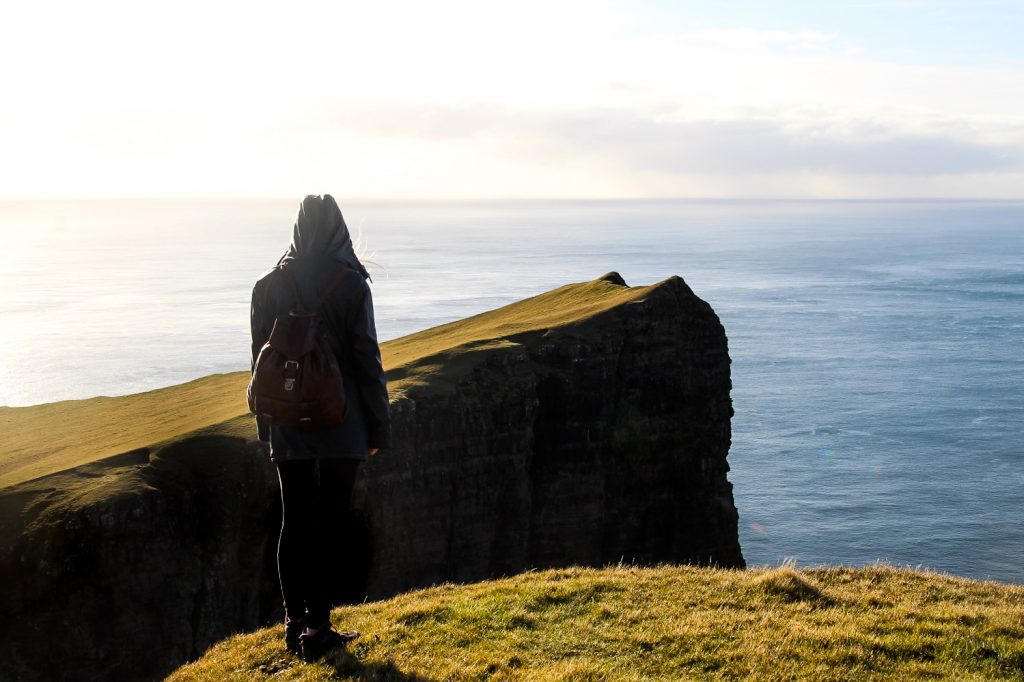
The wind was strong and we were getting really cold, so we had to head back along the shadowed trail that we’d come out on. I looked back several times as we left the incredible view behind, thankful that I had finally been able to see it for myself. And with wonderful company!
It wasn’t long until we reached Sørvágur and looked at our clocks that revealed that we had only spent 4 hours and 20 minutes on this hike including the mountain detour! Not bad going, huh!
Hiking route description: Sørvágur to Drangarnir and back
Usually, this hike can only be done with a guide for 550 DKK/73 EUR. Read more here. But if you want to do this hike by yourself and (maybe) for free, give the landowner a call beforehand, but do respect a no. His name is Gutti Guttesen and he can be contacted on +298 22 30 72. Alternatively, kayaking out to the sea stacks or going on a boat tour would give you unique perspectives of the popular place!
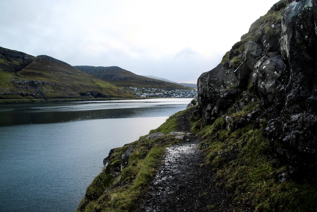
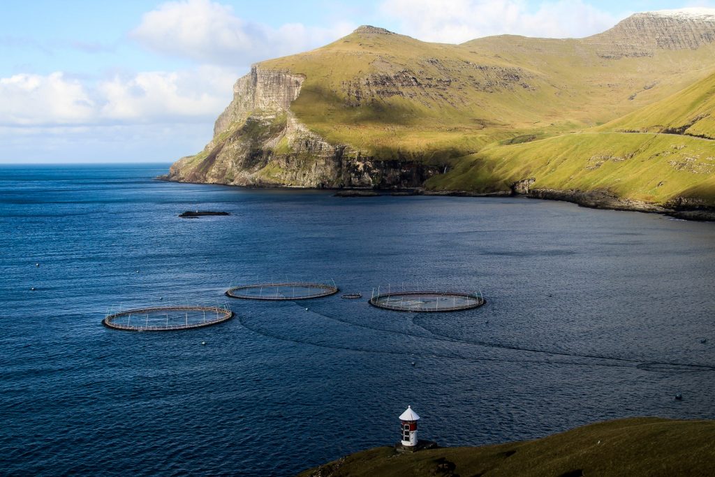
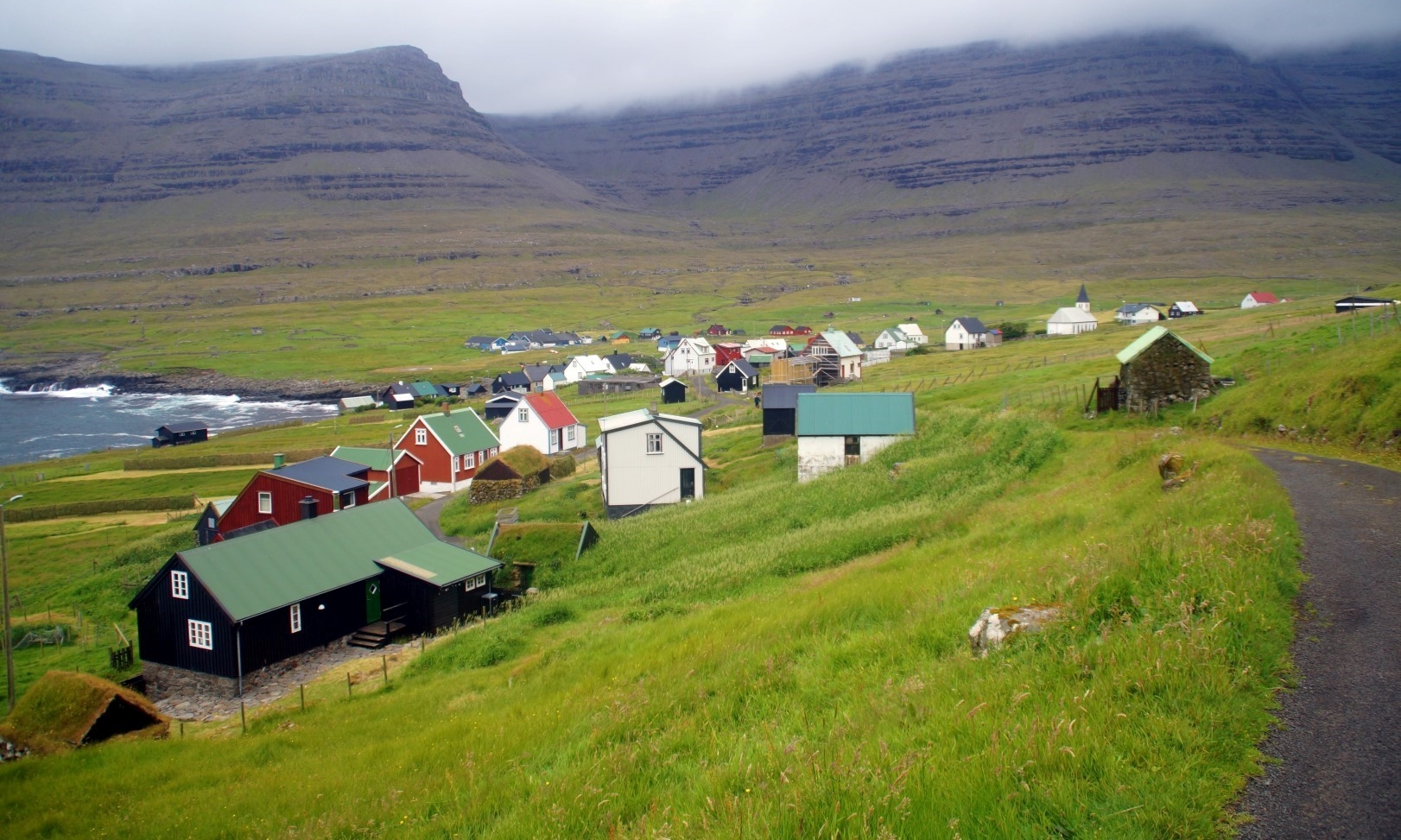
The hike begins behind the Hidden Fjord building in Sørvágur. There is a wooden door in the fence that you need to open to get to the trail. Remember to close it behind you. Follow the trail along the steep coastline to the tiny hamlet of Selvík where the rocky beach breaks up the trail.
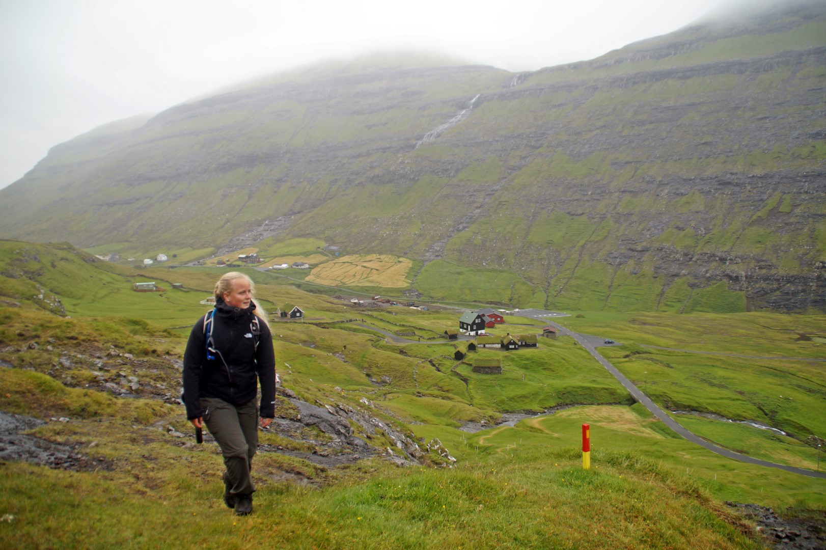
Afterwards, the trail can be quite difficult to locate but if you can’t find it, just continue along the coast following the sheep trails. You will have to cross one river, which isn’t difficult as there are plenty of rocks to step on. When you reach the tiny lighthouse at Múlin, start hiking up to your left. After about 1,5 km of ascending, you will reach the steep summit of Sundsnøva. Take care here as it’s very steep!
The summit of Kvívíksskoranøva is about 400 meters from Sundsnøva and is a very short hike and easy ascend. Go here next and don’t forget to take in the amazing views of Høgafjall’s cliffside. Descend to a sheep path just below the rocky part of the mountains or go back the way you came up and follow the official path out to the famous viewpoint of the Drangarnir sea stacks.
At the end of the peninsula, you will see a small hill which is worth climbing for amazing views over Dragasund. Don’t forget to also walk down to the rocky lower part for close-up views of Drangarnir. Follow the official trail to get back to Sørvágur.
The hike is 11 km, takes 4-5 hours and is of moderate difficulty.
Leave a Comment
Pingback: My 10-year Faroeversary: Turning my passion for the Faroes into a research journey – Northtrotter on 13/12/2020

5 COMMENTS
roger e
2 years agoI would say, a must hike for Faroe island but for $80 pp per hike, it’s a bit a heavenly price price for me. I would rather buy a circu de soleil ticket in Las Vegas ..
Melissa Cherry Villumsen
2 years agoYeah, I agree it’s a ridiculous price. I hope it will change in the future!
QuentinSymbolful
3 years agoSo the price were risen? Guess I have to keep on studying Faroese… Wonderful place though.
Melissa Cherry Villumsen
3 years agoI think the price was always this high (well, apart from when it was free)! It’s the highest price in the country, unfortunately…