Norway’s second-largest city, Bergen, is notorious for its rainy weather, so when my bestie and I looked at the weather report during my visit in November 2021 and it promised sun for two whole days, we could hardly believe our eyes. Even more unbelievable, it was during the weekend – my only weekend in the city.
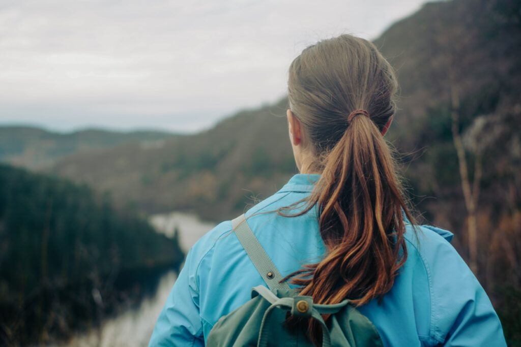
So of course, we decided to spend a day hiking. I was eager to get out on the trails, to see what the nature beyond Bergen has to offer, and my bestie was excited to share her favourite hike with me!
Her apartment is conveniently close to the Svartediket lake, the starting point of our hike. We followed the gravel road running alongside the lake for two kilometres, which was also my running route while I was in the city. But when we reached the end of the lake, I no longer knew anything about the area. I had been no further, so I just followed my bestie who knows the area inside out.
She told me the story of a submerged farm, Garmannslund, that disappeared beneath the dark waters of Svartediket when a dam was built in 1954 to supply Bergen with clean drinking water. Apparently, the ruins were visible during the summer of 2021 when the water levels were down due to an unusually dry summer. As I would soon find out, Garmannslund is only one of several abandoned farms in the forests surrounding Svartediket.
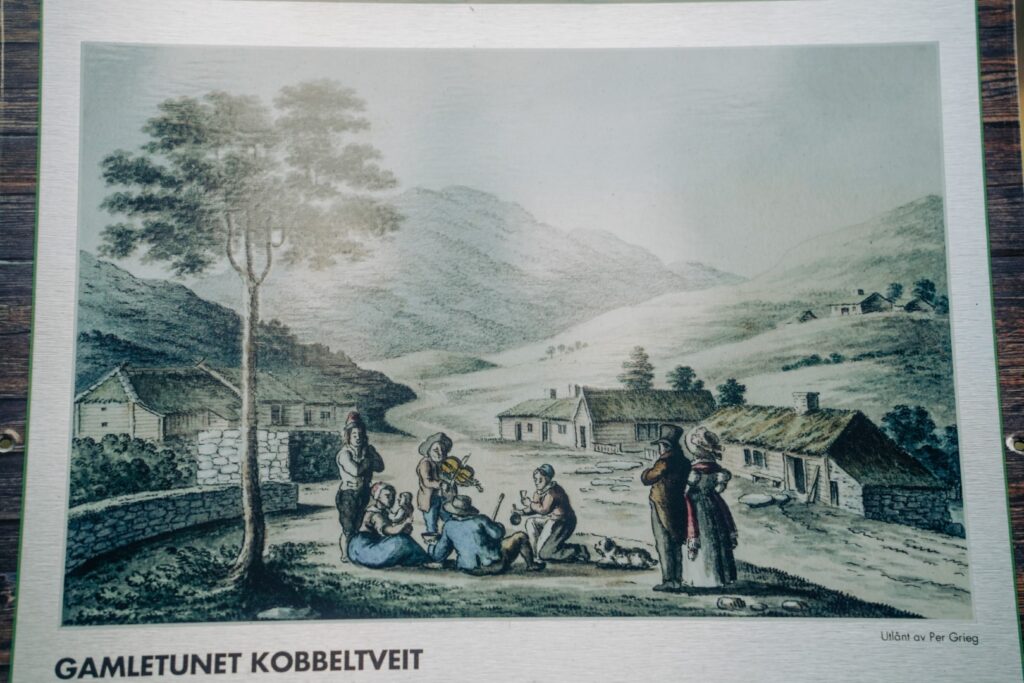
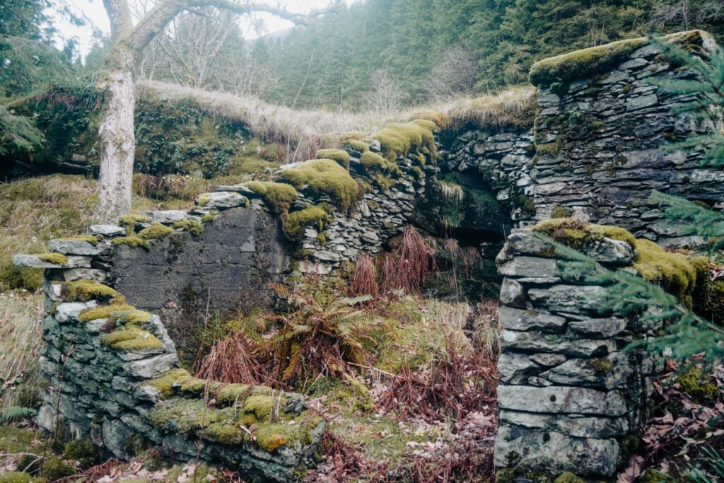
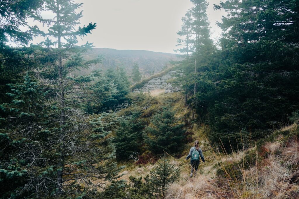
We continued along the main trail for a bit, but soon turned off along a small trail into the forest. We came past the abandoned farm of Kobbeltveit, which was expropriated by the local municipality in the beginning of the 20th century to keep Bergen’s drinking water from being contaminated.

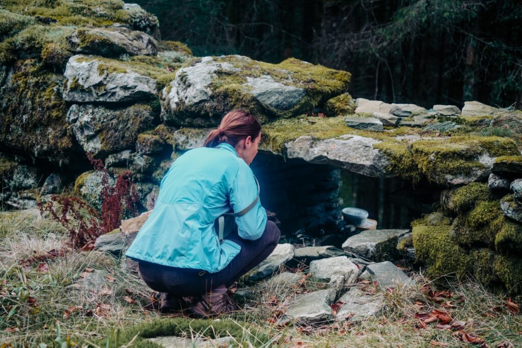
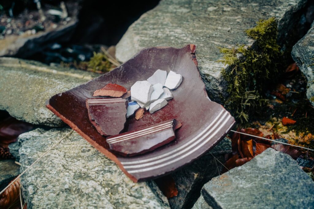
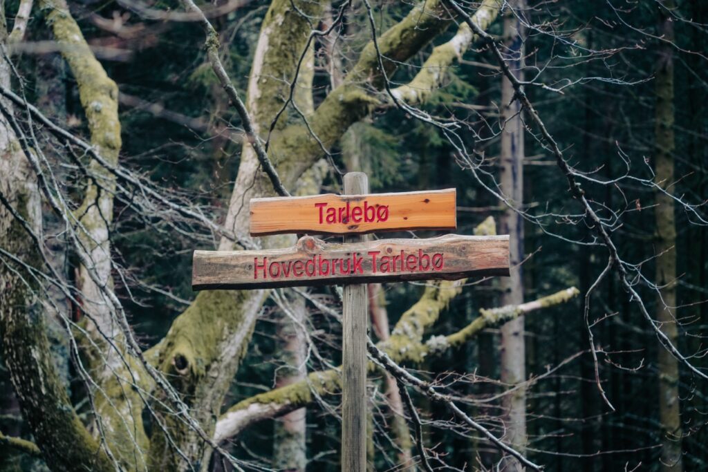
It wasn’t long until we were back on the main trail, among all the other hikers that had also chosen to spend this glorious November day outdoors. But we soon left the crowds again to see the abandoned farm of Tarlebø, which suffered the same fate as Garmannslund and Kobbeltveit. We were surprised to find a bunch of broken pottery in a pile on one of the old window sills; and us being archaeologists, we couldn’t help but go through it to see what we could find!
The trail that we were on is called Tarlebøveien, named after these well-preserved farm ruins.

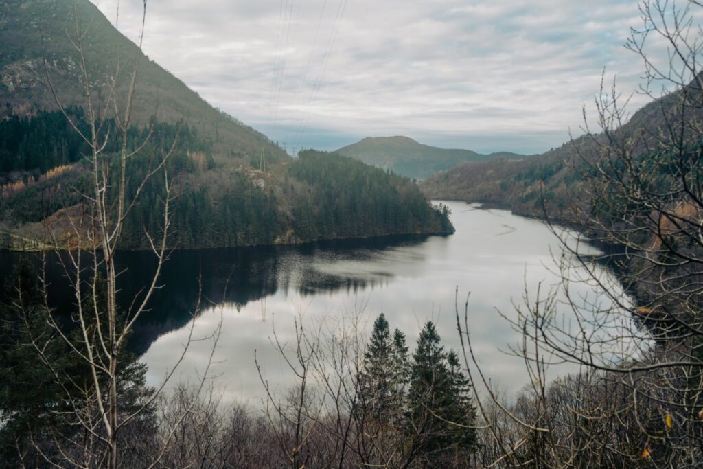
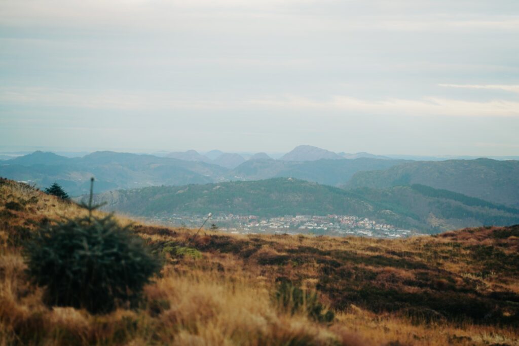
By now, the trail started going gradually up as we made our way past the small lake of Tarlebøvatnet and towards Rundemanen, one of Bergen’s seven city mountains. We were rewarded with great views of the high mountains beyond as we continued upwards; some of the mountains in the distance even had snow on the top!
At one point, I spotted what I thought was another abandoned building in the forest, so we decided to take a closer look. But what revealed itself before our eyes was a long stone building going down the mountainside with no entrance to be seen. I’ve never seen a building like it before, and we still don’t know what it is! Perhaps something belonging to the military? Or aliens? Who knows!
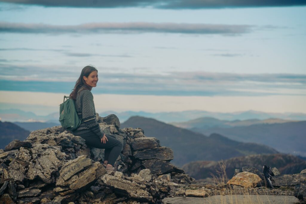
It wasn’t long until Rundemanen came into view with its phone mast on the summit. We took a small detour from the trail just to say we’d been at the peak and spent some time there enjoying the magnificent views over Bergen. At 568 m., Rundemanen is the second-highest of Bergen’s seven mountains, although some don’t consider it one of the seven mountains since it’s not visible from the city centre – instead, they replace it with Askøyfjeldet on the island of Askøy, which is visible from Bergen.


Leaving the mountain summit behind, we started descending towards the city. We followed Rundemansveien, although we tried to take any narrow trails whenever we’d spot one.
We continued downwards, taking in the beautiful views of Bergen and Storediket, one of the larger lakes in the area. Soon, we reached the Brushytten café, which is only open on Sundays and public holidays. Luckily, we had brought our own lunch, so we sat down on a bench to enjoy it together with a bunch of other hikers and dog walkers.
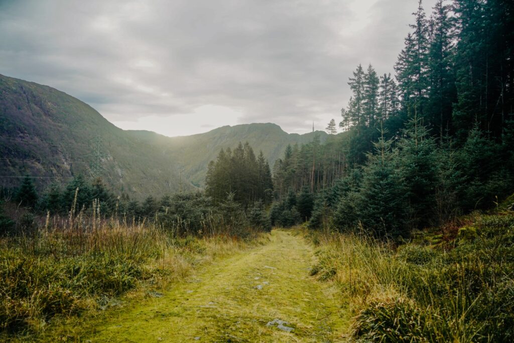
My fingers were frozen by the time we’d finished our homemade pizzas, so we quickly got up and started hiking towards the city. We had to stop a few times, though, as we came past some beautiful viewpoints that I just had to photograph! The last section, along Søre Kamveien and back down to the city, was especially scenic!
The sun never actually appeared (although it came out in full force the next day), but it was perfect hiking weather. Not too cold, not too warm, just perfect. And the trail is one that I can definitely recommend as it packs beautiful views, a mountain peak and plenty of archaeology! It’s the perfect day hike in Bergen!


Hiking route description: Along Tarlebøveien and up Rundemanen
The hike begins at the start of Tarlebøveien at Svartediket. Follow the gravel road to the end of the lake where you’ll come to a crossroad with some signs and information boards. Turn left, and then 350 metres later, turn left again into the forest. Soon, you’ll reach a few ruins from the former farm of Kobbeltveit.
At the next crossroad, turn right and hike down to the main trail again. Then turn right and immediately left over the bridge and follow the trail to the abandoned farm of Tarlebø. Continue north, and turn left at the next crossroad, and follow the trail back to the main trail. Turn right here and hike up to Tarlebøvatnet.
Turn left and walk along the lake until the trail leaves it behind and goes gradually up towards Rundemanen. You’ll soon meet a trail going right, ignore this and continue hiking up. Look to your left and you’ll see a mystery building in the forest. Do take a detour if strange, possibly abandoned, buildings interest you!
You’ll soon reach the road leading up to the summit of Rundemanen. Take a small detour from the trail to the summit and enjoy the view before hiking back down to the trail. The trail is now called Rundemansveien, and you’ll be following this almost all the way back to the city. If you want to take some smaller trails, there are a few along the way that follow the main trail, but try to stick to the main trail so you don’t get lost. You’ll pass by Storediket, and soon after, you’ll reach the Brushytten café, which is open on Sundays and public holidays.
Leaving Brushytten behind, continue along Rundemansveien for one kilometre, passing by some beautiful viewpoints of Bergen, and then turn left to Skomakerdiket. Walk along the lake and then continue straight for 200 metres. Turn left here and left again, and then follow the scenic trail, Søre Kamveien, back to the city. It’s a bit steep in parts, so take your time. There are some beautiful viewpoints along this last stretch, so don’t forget to stop up once in a while to enjoy it!
The hike is 12 kilometres, takes 4-5 hours and is easy to moderate with some gradual ascents and descents. There are trails the whole way, and the route can easily be made into a loop by starting and ending at Svartediket.