It was yet another cloudy day on Vágar, my island of choice for the month of October. But at least it wasn’t raining, so I decided to go hiking. I wasn’t feeling great that day, a combination of laziness and a bit of pain (that once a month thing, ya know), but I couldn’t stay indoors all day. So after working on my blog for a bit, I set off on a hike at 1 PM.
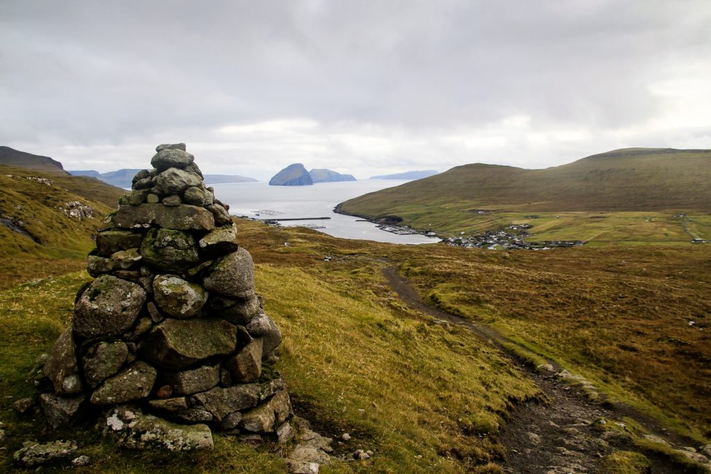
I had planned to just hike the easy 1-hour cairn trail from Miðvágur to Vatnsoyrar, which I’d done a few days earlier and then see if I could be bothered to hike more. I wasn’t planning to go anywhere near the mountains that day, but then I spotted another cairn trail that went off the trail I was on, up into the mountains. I couldn’t help myself. I just needed to know where it went.

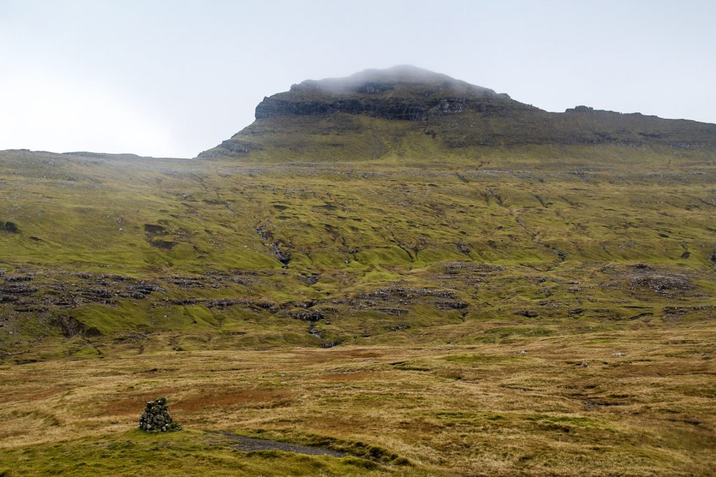
So I went up, following the cairns that took me closer and closer to Mt. Jógvansfjall. Soon, I could see its summit.
But the trail didn’t lead up the mountain. It kept going, far into the distance. I could see the cairns ahead and figured it must either go to Oyrargjógv or as far as to Slættanes, something I would’ve loved to find out but there simply wasn’t enough time before sunset because I’d started so late. So after much consideration, I left that hike for a different day and instead got lured in by the summit of Jógvansfjall that looked so incredibly close.


It was now 2.30 PM and the sun was going to set four hours later. I knew that once I was up on the summit of Jógvansfjall, I would want to continue to the other four mountains in the area. It was risky as I didn’t want to be in the mountains in the dark, but I figured I could do it. So I started climbing up.
It wasn’t a difficult climb, although I could feel that I hadn’t done much hiking the past two days. Still, it only took me about half an hour to reach the rocky summit at 585 m. even though I felt like I was slow. It was indeed as close as it had looked from the trail!
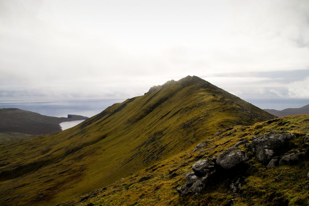
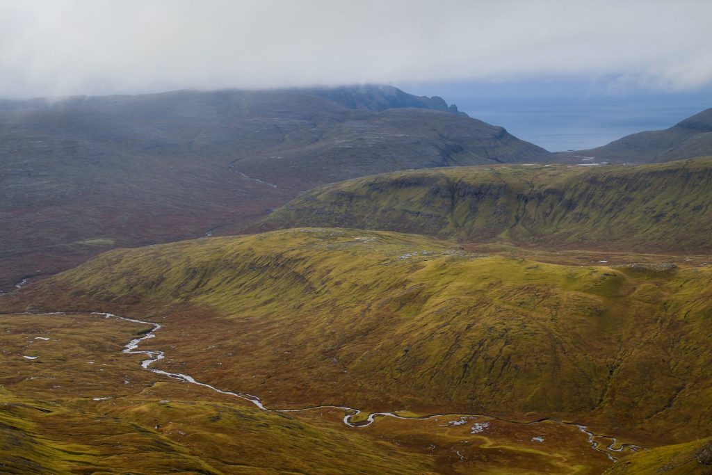
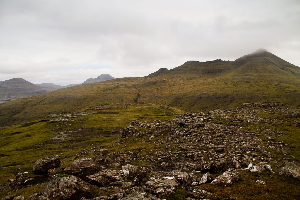
The summit awarded me with wonderful views over the Kvigandalur valley with the Tjørndálsa and Sjatlá rivers running through it, and towards the ocean I could spot a tiny Trælanípan at the edge of Lake Leitisvatn. Behind me the rocky ridges of Giliðtrítitindur and Reynsatindur promised a challenging onwards climb.
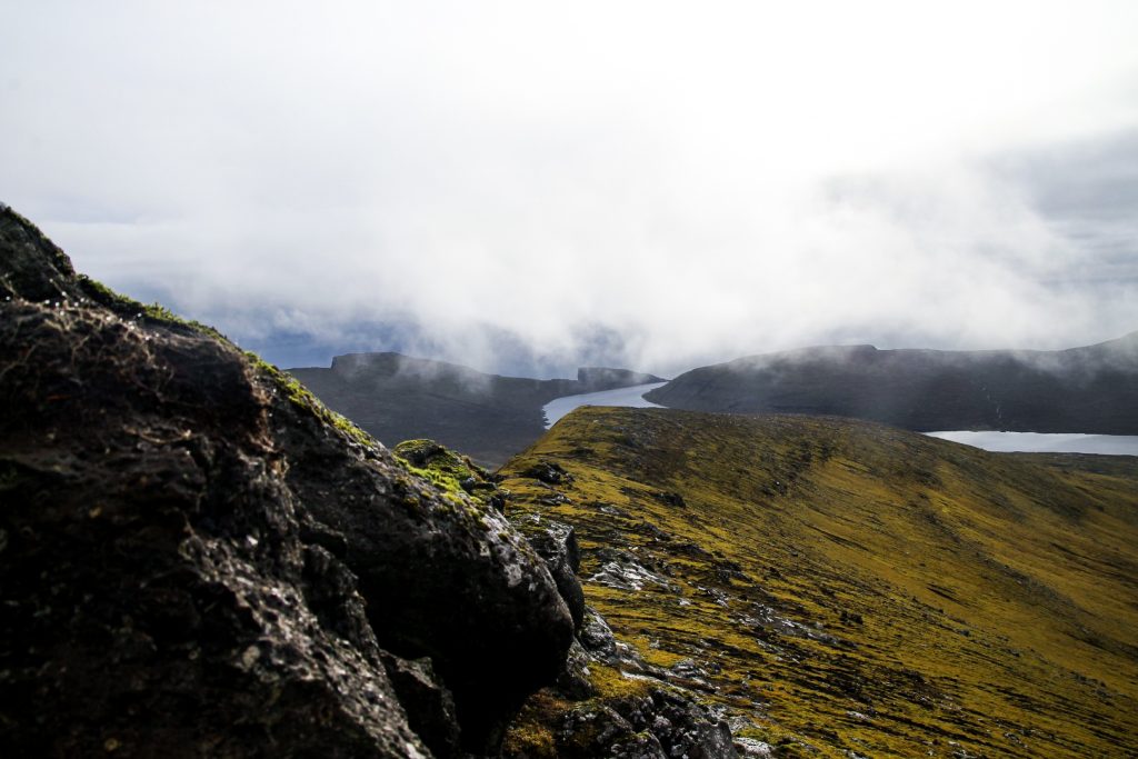

The summit of Giliðtrítitindur is a mere 500 meters from the summit of Jógvansfjall, but it took quite some effort to get up there. The summits are both narrow and rocky, and the grass was still slippery from the rain that had fallen in the night.
But I managed to get up there with careful steps. Just as I reached the summit at 643 m., a white hare jumped away below me.
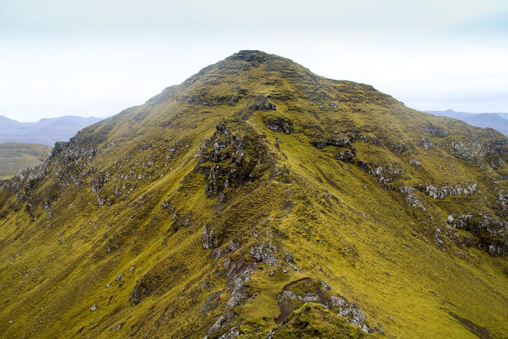
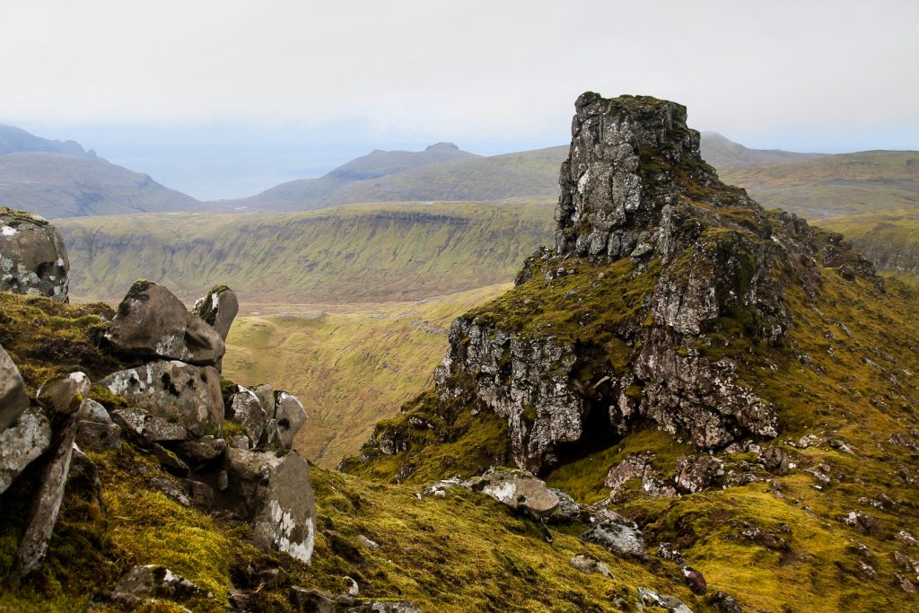
Giliðtrítitindur is home to some interesting rock formations that I spent a while studying and photographing before continuing. I love finding places like this in the Faroe Islands that are different to what the average instagram post shows!
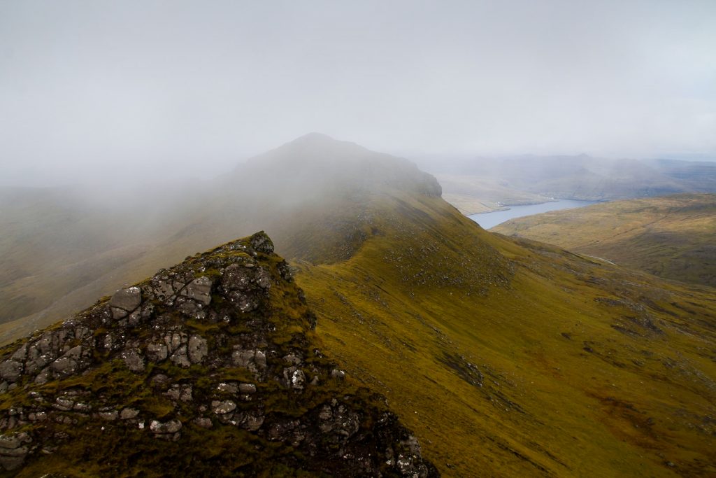
Fog kept sweeping in and out of the area, sometimes covering the summits. I got lucky as it always disappeared before I started climbing up, and with Reynsatindur, the highest mountain of the day at 676 m., it was no different.
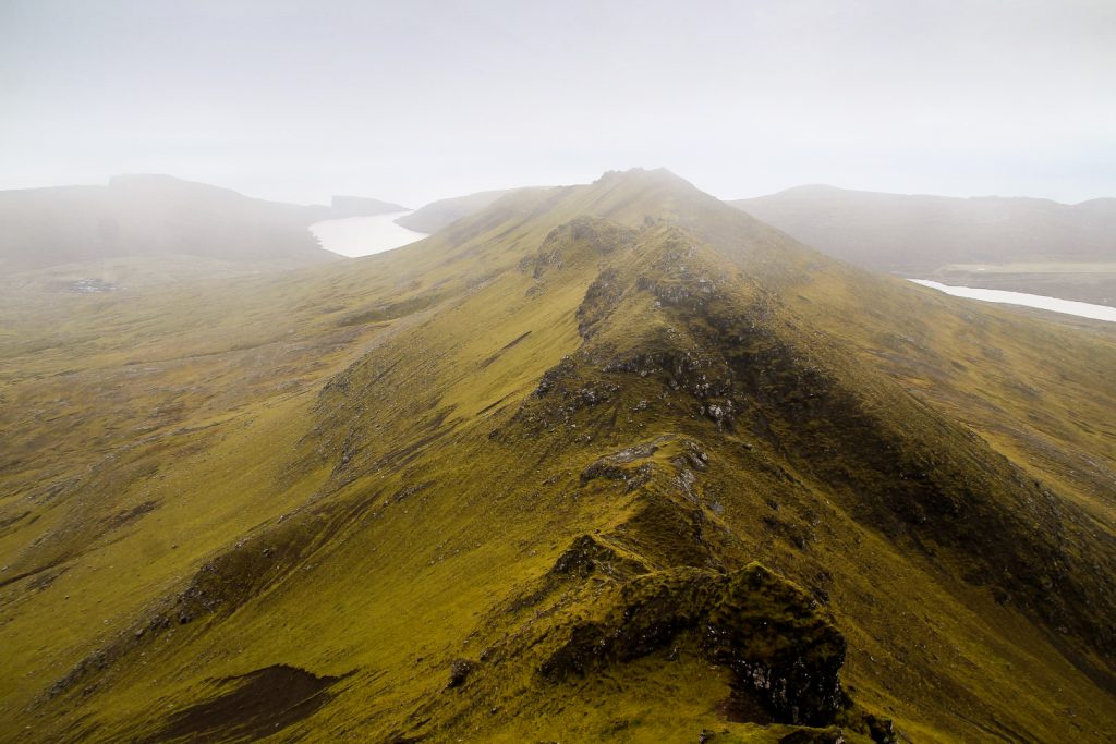
The summit of Reynsatindur is only about 200 meters from the summit of Giliðtrítitindur, but it is so incredibly steep and narrow and with deep drops on both sides, so I had to be really careful when climbing up. I scrambled my way to the top, taking 20 minutes for such a short distance. But it’s always better to be safe than sorry!
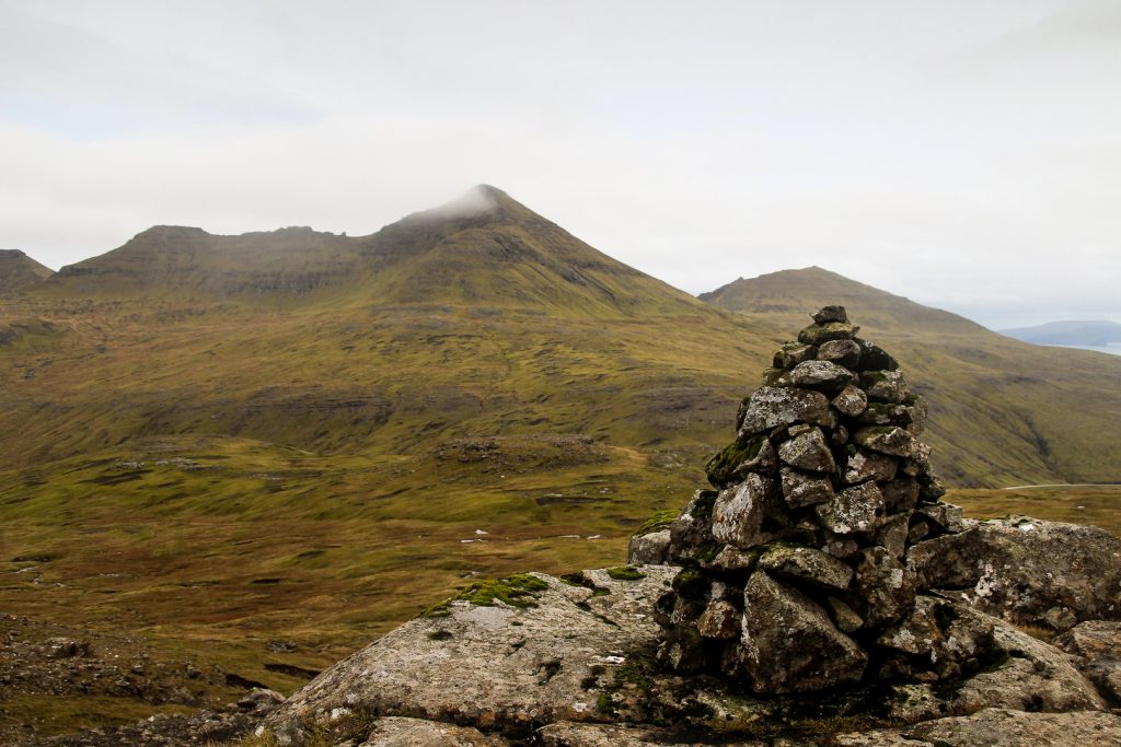
I looked back at the other two mountains that I had just climbed and saw the fog sweeping in over them, and soon swallowing their summits. Reynsatindur was next, so I had to start heading down.


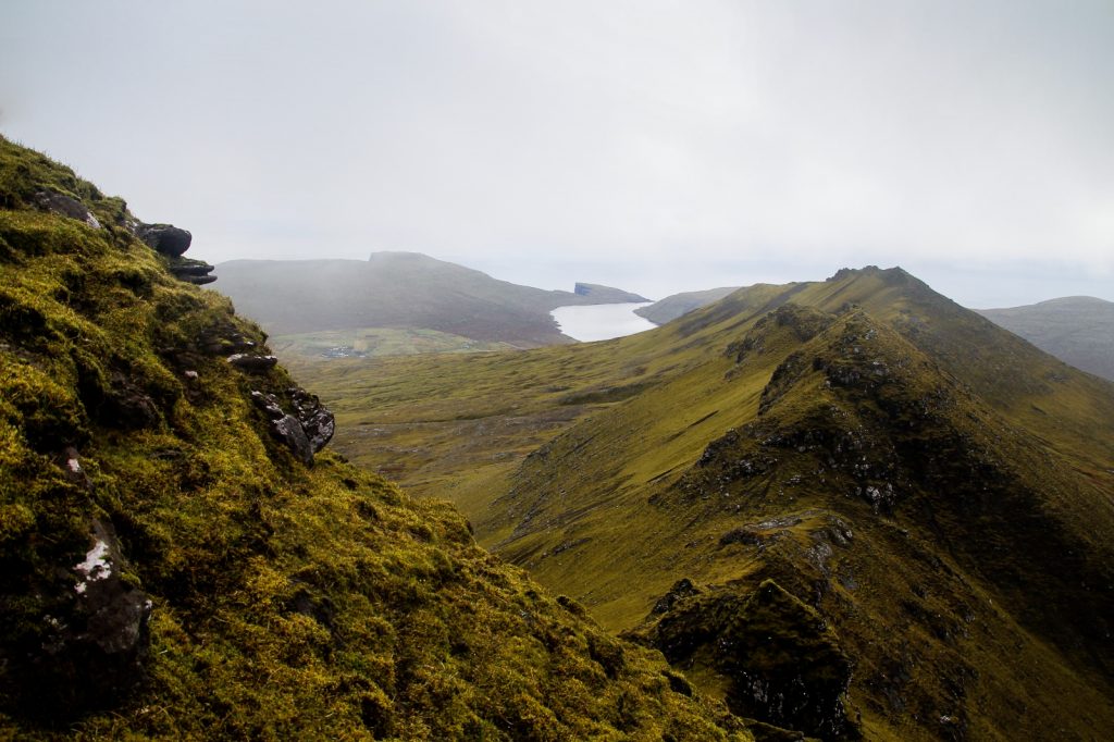
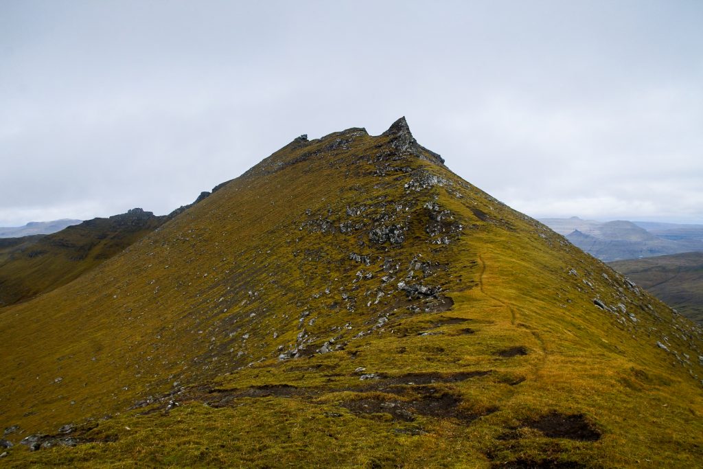
I headed to the next mountain, Gásafelli, which is about 1,5 km from Reynsatindur and about 100 meters lower. It’s an easy mountain to climb, but the way down Reynsatindur towards it is one of the steepest and most treacherous climbs I’ve ever done. I was on my butt constantly so I wouldn’t have to worry about falling over, and it took me over half an hour just to get down the summit!


When I finally did get below the summit, I half ran up Gásafelli as it was so nice to feel free again. Free from the steep and rocky ridges and on a mountain that had lots of space to fall without injury. I was hungry but I didn’t feel like sitting on the wet grass so I just grabbed some bread and continued up the mountain.
Soon after, I reached the summit of my fourth mountain that day, 572 meters above sea level!
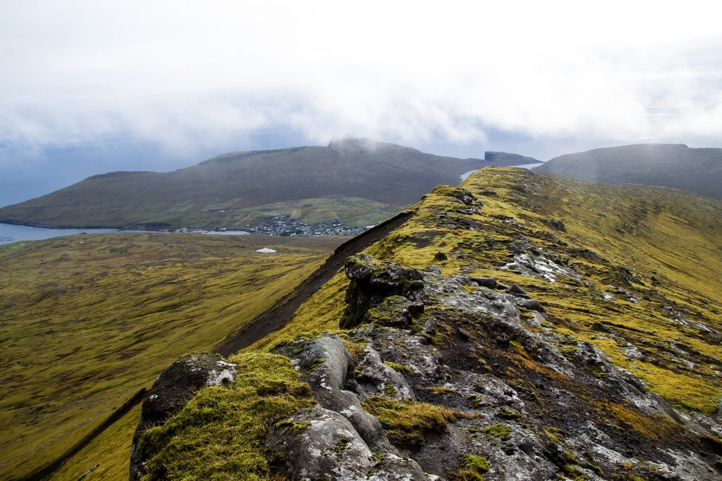
I was now surrounded by fog on all sides, although the summit was clear of it. But I looked back and saw that Reynsatindur’s summit had disappeared. I was so glad I wasn’t up there at that point. With its narrow and rocky summit, being there in fog could’ve been really dangerous.
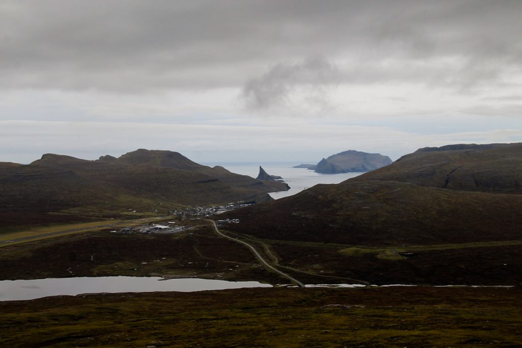
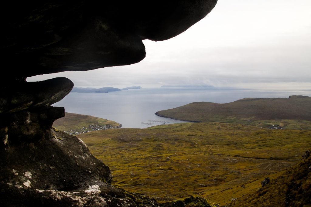
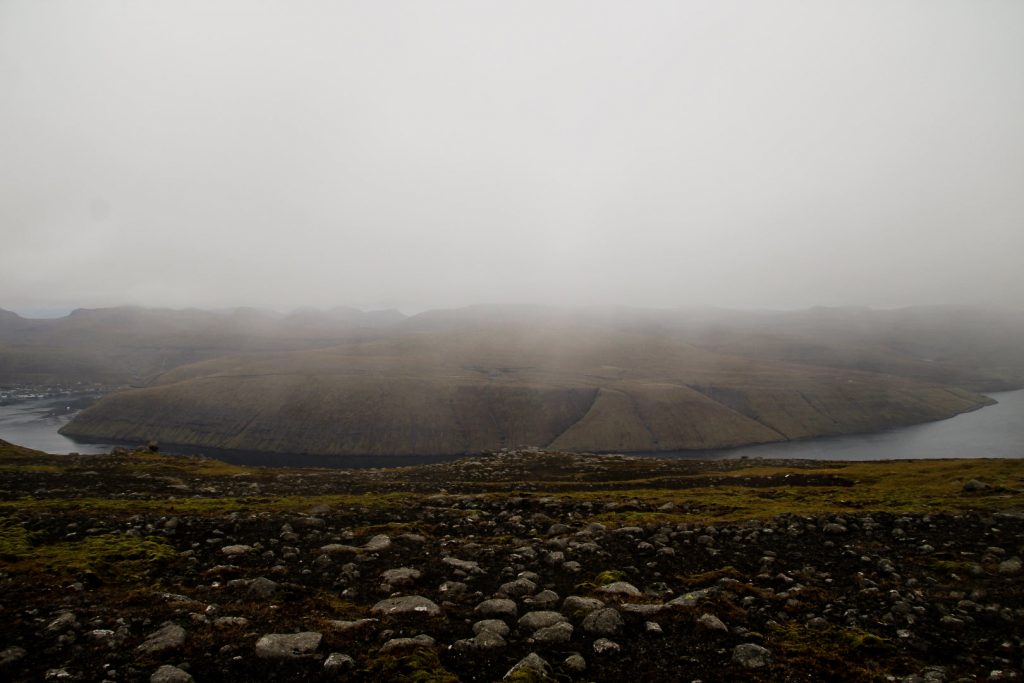
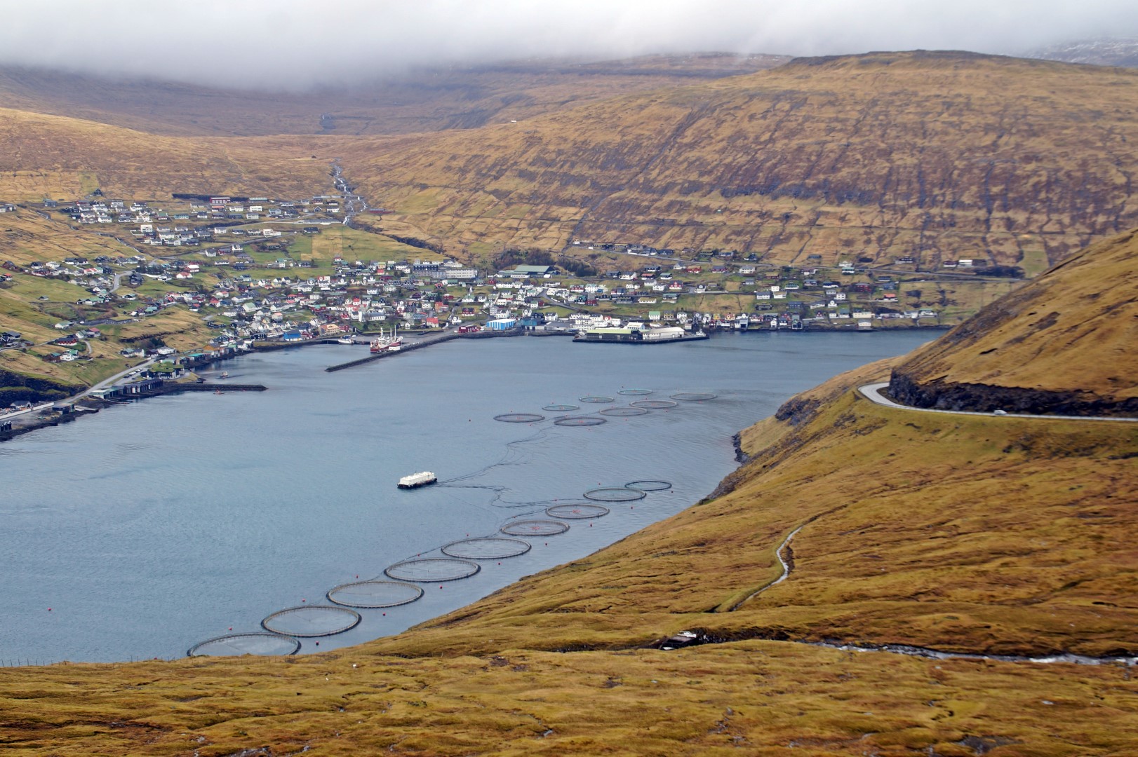
I walked around on Gásafelli for a while, seeking out a view of Vestmanna where some of my friends used to live (they now live in beautiful Strendur!). As the fog lifted, the village finally came into view.

I noticed that the sky was getting darker as the sun hid behind clouds and was getting ready to set for the night, but it didn’t matter as the fifth and last mountain of the day was on the way back to Sandavágur.
As I was climbing down Gásafelli, I came across the cairn trail that goes from Sandavágur to Slættanes, an abandoned village that I actually hiked to a week or so later! I followed this trail for a while and it lead me nice and easily to Lírisfelli, the last mountain of the day.
It didn’t feel like a mountain climb at all. Lírisfelli is only 351 meters high, and from where I was standing, it was maybe 50 meters that I had to climb. But as I hiked down to the road and looked back, I could see it rise behind me and it looked more like a mountain. Still, since it’s not free-standing and is surrounded by much higher mountains, it really just looks like a hill to me. But it’s on the official list of mountains in the Faroe Islands so it counts!

The cairns ended above a little dirt track that joins onto the main road towards Sandavágur. I walked alongside a deep gorge and soon found the road that I had to follow for another hour before I was finally back home at the hostel. What was supposed to be an easy day with a short trail hike turned into a personal record day with five mountains completed in just five hours!
Hiking route description: Jógvansfjall, Giliðtrítitindur, Reynsatindur, Gásafelli and Lírisfelli
The hike begins above the village of Miðvágur on Kálvalíðvegur. Follow this road that turns into a dirt track and then a footpath with cairns. The trail goes past a few waterfalls but there are plenty of rocks to step on. Continue along the trail until you see another trail going up to your right. Follow this one up into the mountains.
Soon, you will see the summit of Jógvansfjall to your right. Find a spot where it looks easy to climb up and leave the trail. Be careful once you get to the summit as it’s rocky and quite steep. There’s no cairn on any of the summits on this route, but you’ll know once you reach the highest point of each mountain.
From Jógvansfjall, you can see the next two summits in front of you. It is a steep climb up Giliðtrítitindur, but just take care and you’ll be fine. Once you reach the summit, the next summit will be straight ahead. Be very careful when climbing down from Giliðtrítitindur and especially when going up Reynsatindur as it’s steep and with deep drops on both sides. I recommend scrambling to the top.
Once you’re on the summit of Reynsatindur, you’ve reached the highest point of the hike. Gásafelli is 1,5 km in front of you, but it requires very careful climbing to get down Reynsatindur first. At one point, you’ll see a sheep trail just below the summit rocks. Follow it carefully until you make your way down the summit. From then on, it’s an easy hike up Gásafelli.
At the summit, look towards the road that goes to Sandavágur and you should spot some cairns from the trail between Sandavágur and Slættanes. Hike down to a cairn and follow the trail down towards Sandavágur until you see two small “hills” in front of you. This is Lírisfelli and the “hill” on the right is the summit. Walk up to the summit and then aim for a little black building as you walk down towards the road. You will cross a river and then get to a dirt road that connects to the main road back to Sandavágur. This is where the hike ends.
The entire hike is 10 km, takes 5-6 hours and is of moderate difficulty.

Leave a Comment