I woke up and looked out of the window. It was still raining hard. According to the weather forecast, the rain was bound to stop at anytime and be replaced by the sun and blue skies. Andras and I decided to trust the weather forecast and headed out for one of the hardest, longest and most adventurous hikes I’ve ever done.
We were going to climb three mountains on the southwest side of the island of Vágar. It was a spot on the map that I’d never heard of anyone going or even seen any pictures from, so I was really excited to see what views the mountains would offer.

The location of the three mountains on Vágar
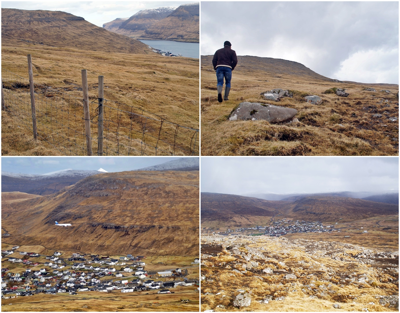
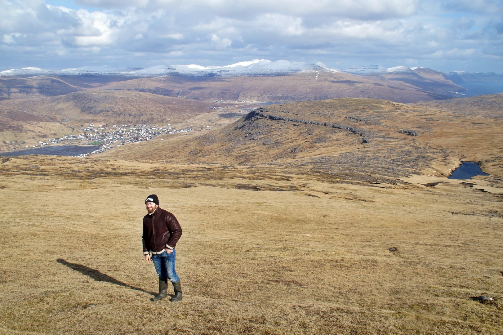
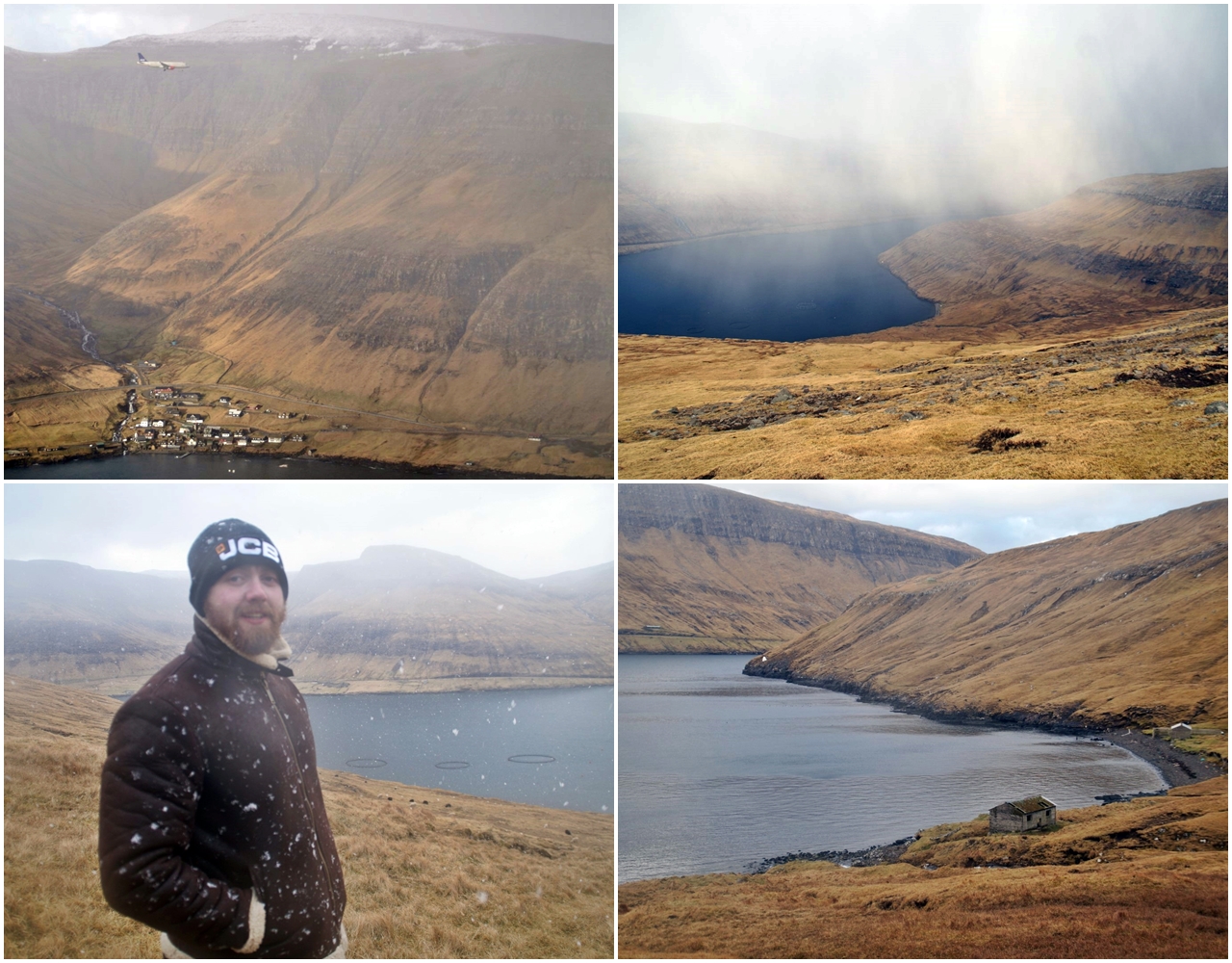
We left Sandavágur at 11.30 AM and headed to the highest point in Sørvágur, as the first mountain we were about to climb, Mount Nónfjall at 367 meters, is located directly above the village. We parked the car as high up as possible and then started the long and steep ascend towards the top.
The name ‘Nónfjall’ translates to ‘Noon mountain’, which in Faroese refers to 3 PM. The name was given to the mountain many years ago, as the sun is visible at the top of the mountain at 3 PM when seen from the center of the old village of Sørvágur.
After the long day I’d had the day before, I was already tired in the legs before even getting started, and I would lie if I said that the first part of the hike was a piece of cake. It was tough and we had several breaks, but we made it to the top eventually. Luckily, the weather had changed and the weather forecast was right – the sun was out and the skies were as blue as ever!
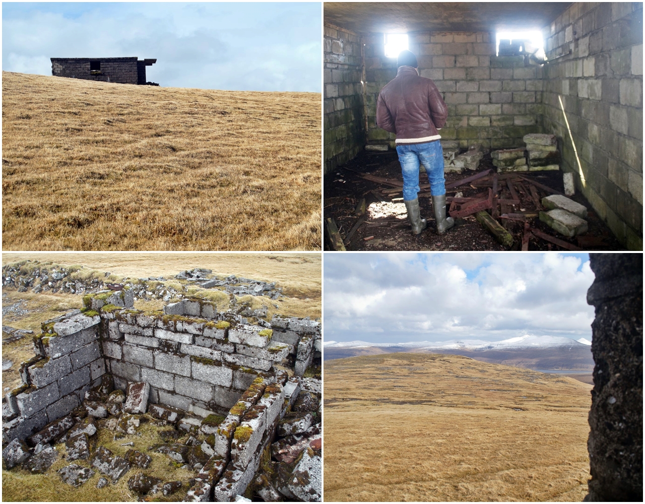
We saw many ruins from the Second World War on the way up to the top of the mountain, which are basically just left to decay. They are very interesting to explore and it’s possible to find artefacts from the war that are still just lying around.
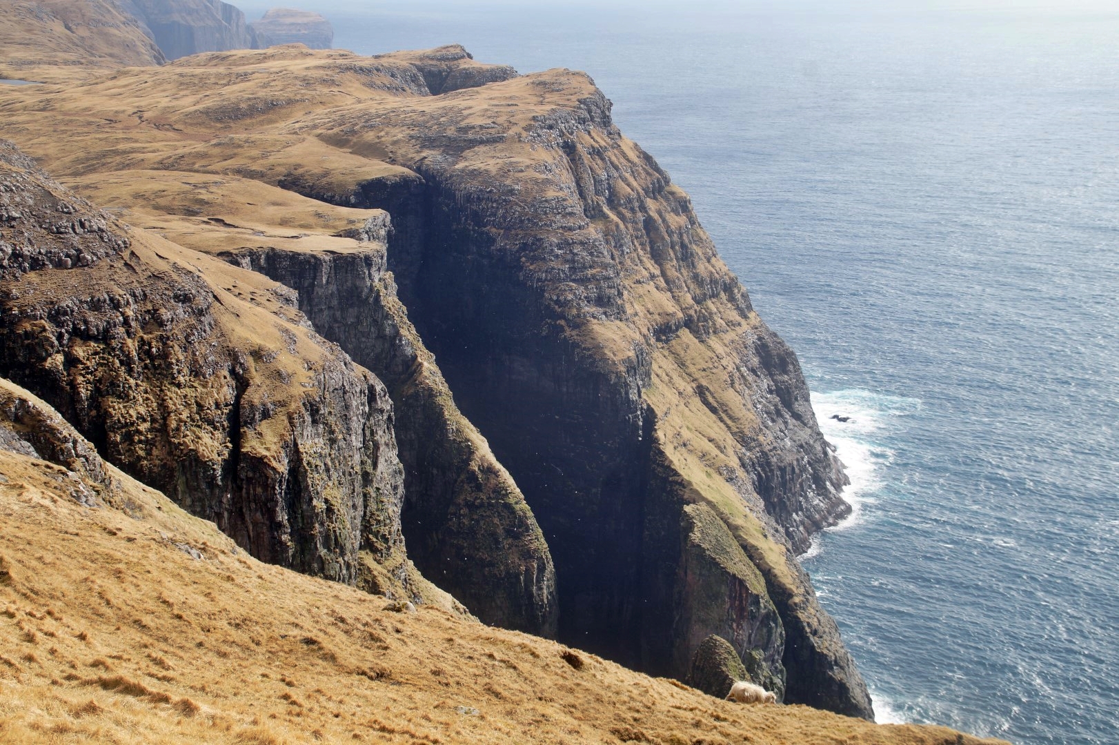
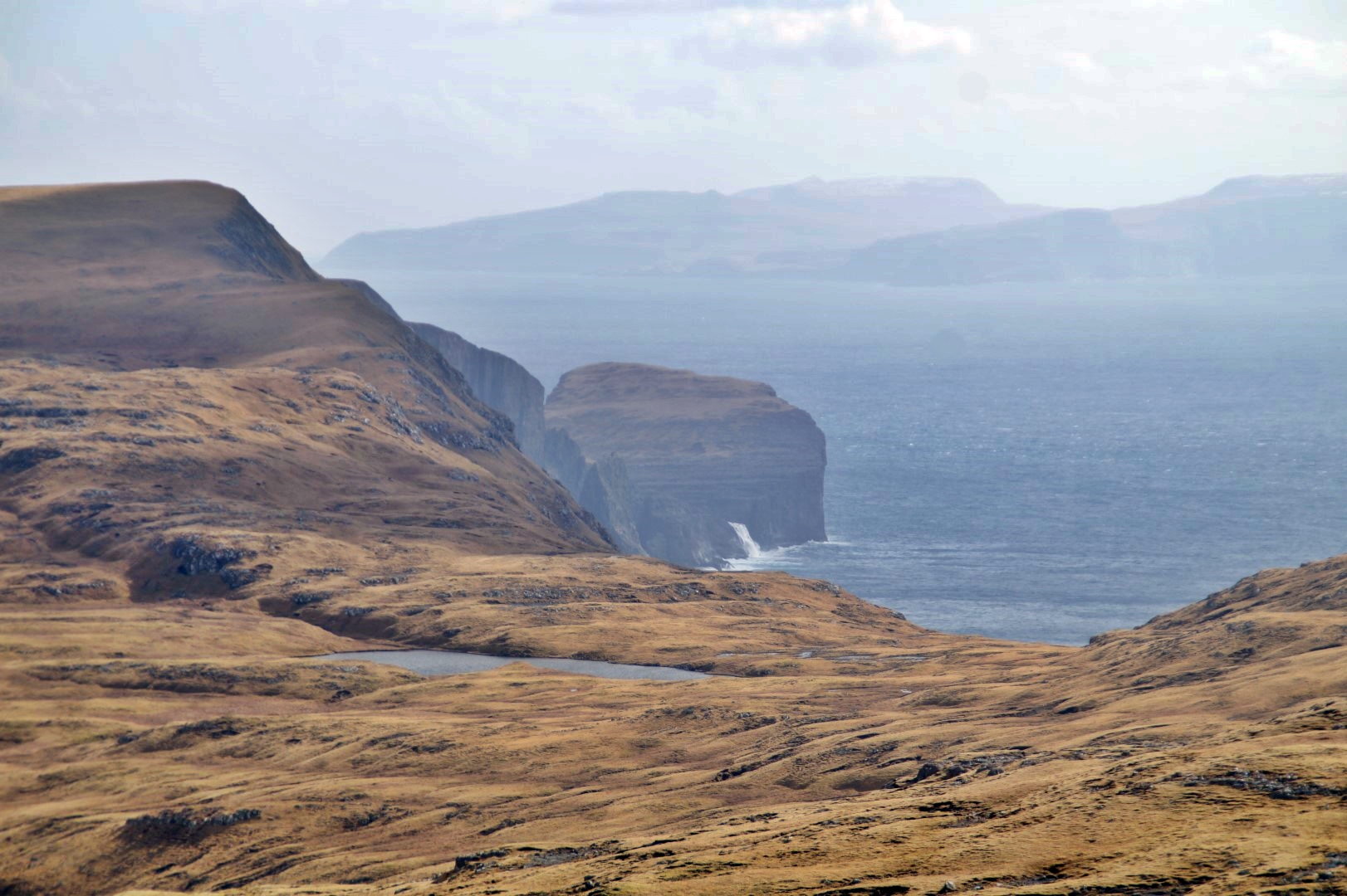
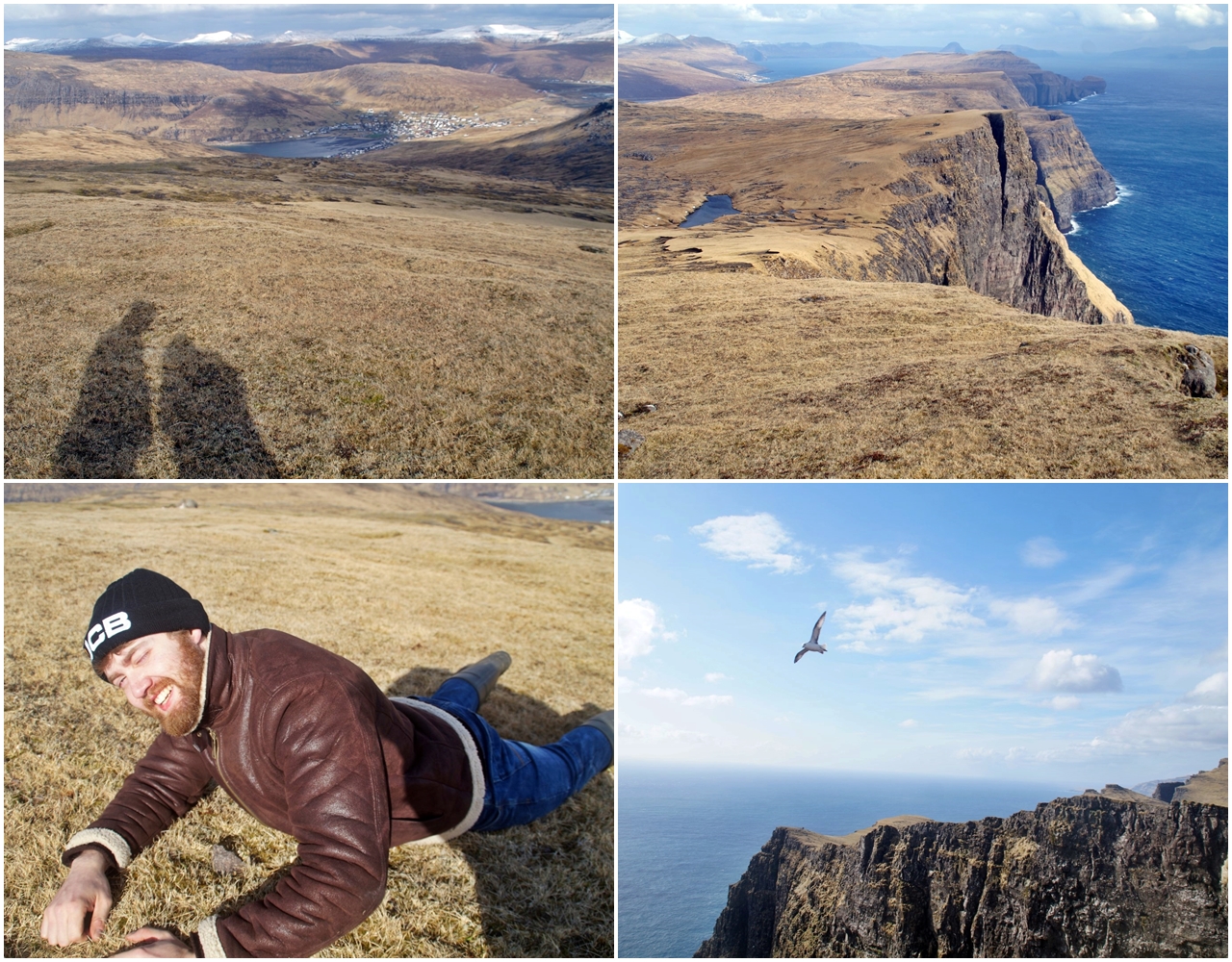
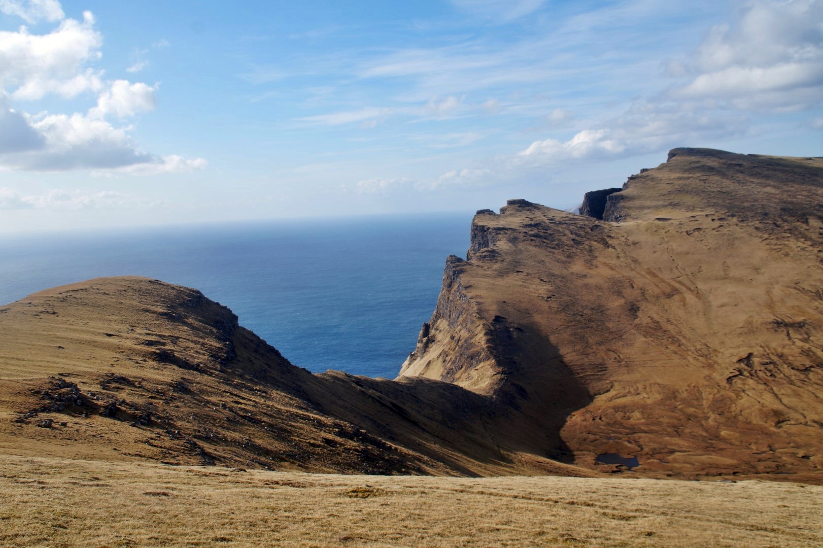
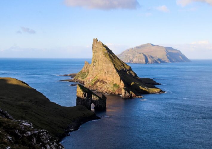
Before going all the way to the top, we headed further south to the coastline, where we saw the majestic cliffs and sea stacks of Dunnusdrangar. This kind of view is exactly what I love about Vágar – it’s the wildest, most dramatic and most beautiful island of the country in my opinion.
According to Andras, Dunnesdrangar is just as spectacular seen from the other side, so a hike out to that side of the cliffs is a project for my next visit to the Faroe Islands!
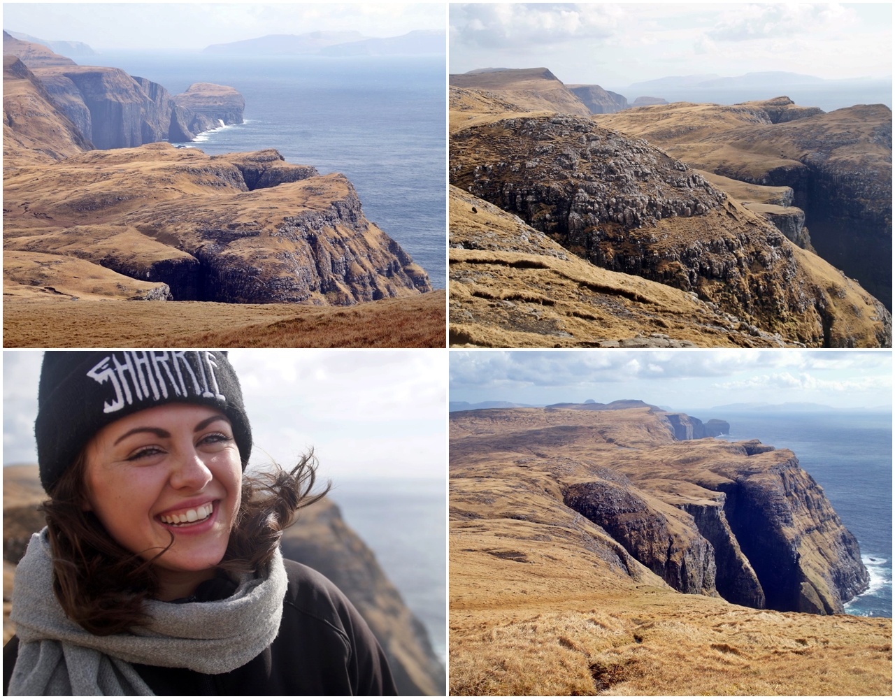
Up the mountain we went and soon we got to the top of it, where we could see as far as to Suðuroy, the southernmost island of the country. We actually counted that we could see 9 out of the 18 islands in the Faroe Islands from the top!
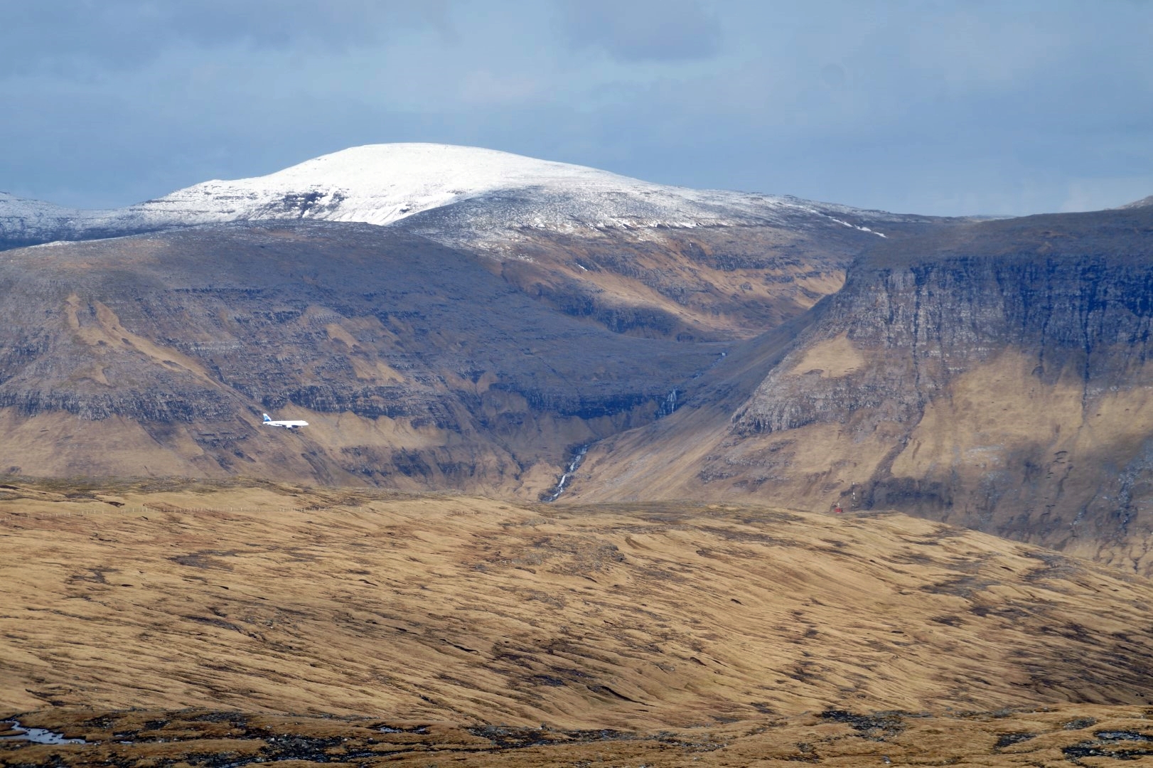
Throughout the day, we saw many planes coming in to the country, as the airport is located just a few hundred meters from the mountains that we were climbing – and we actually also saw the plane that my friend Katrine and her boyfriend Klæmint landed in!

The next mountain on our itinerary was Mount Bolafløttur at 458 meters. It’s located right beside Mount Nónfjall, but there’s a valley between the two, so we had to climb down for a while before we could start ascending again. Despite this, Mount Bolafløttur was quite an easy mountain to climb.
We walked right beside the coastline for the entire climb and also took several breaks to lay on the grass, look down at the bird cliffs and enjoy the sun that had gotten quite warm at that point!

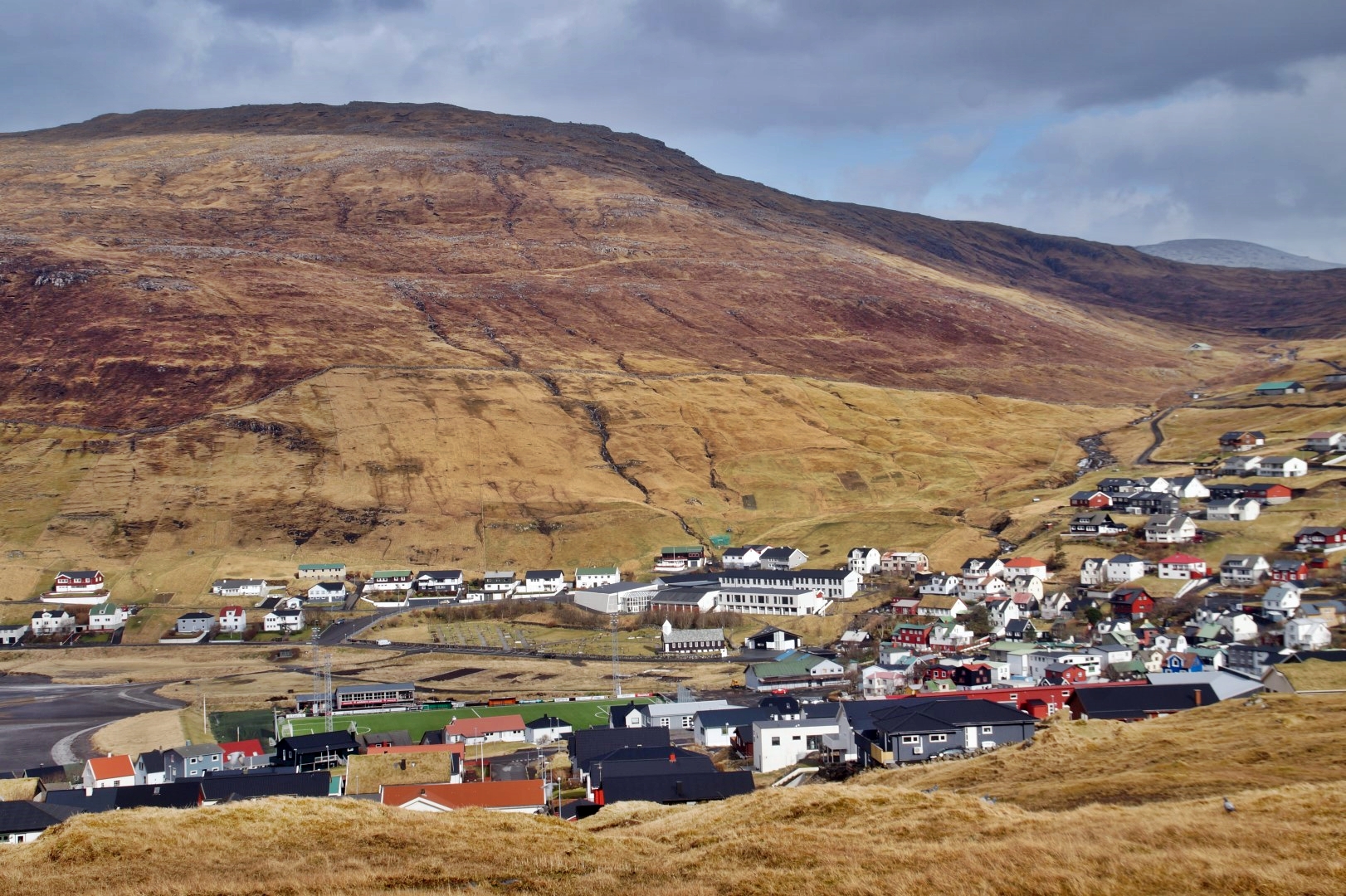
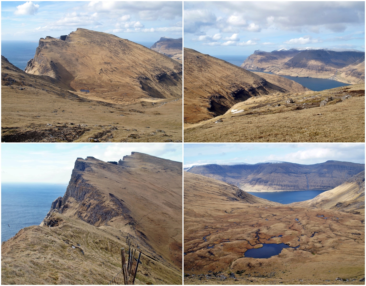
From the top of the mountain, we had the most amazing views of the interestingly shaped Mount Høgafjall, the next and last mountain on our itinerary, as well as the valley in-between the two mountains, but it was a bit disheartening to see that we would have to climb almost halfway down Mount Bolafløttur to start ascending Mount Høgafjall.
Mount Høgafjall is 515 meters high, so it was the highest mountain on our itinerary that day. The descend from Mount Bolafløttur was treacherous through a rocky landscape with an almost vertical drop, so Andras had to help me down. He’s used to the extremely steep cliffsides of the country, but I get scared when there’s literally no grip and one wrong step could mean rolling down the entire mountain!
Unfortunately, the mountain is equally steep to climb, so it took us a while to reach the top. But when we did, oh my, the views were worth every effort!
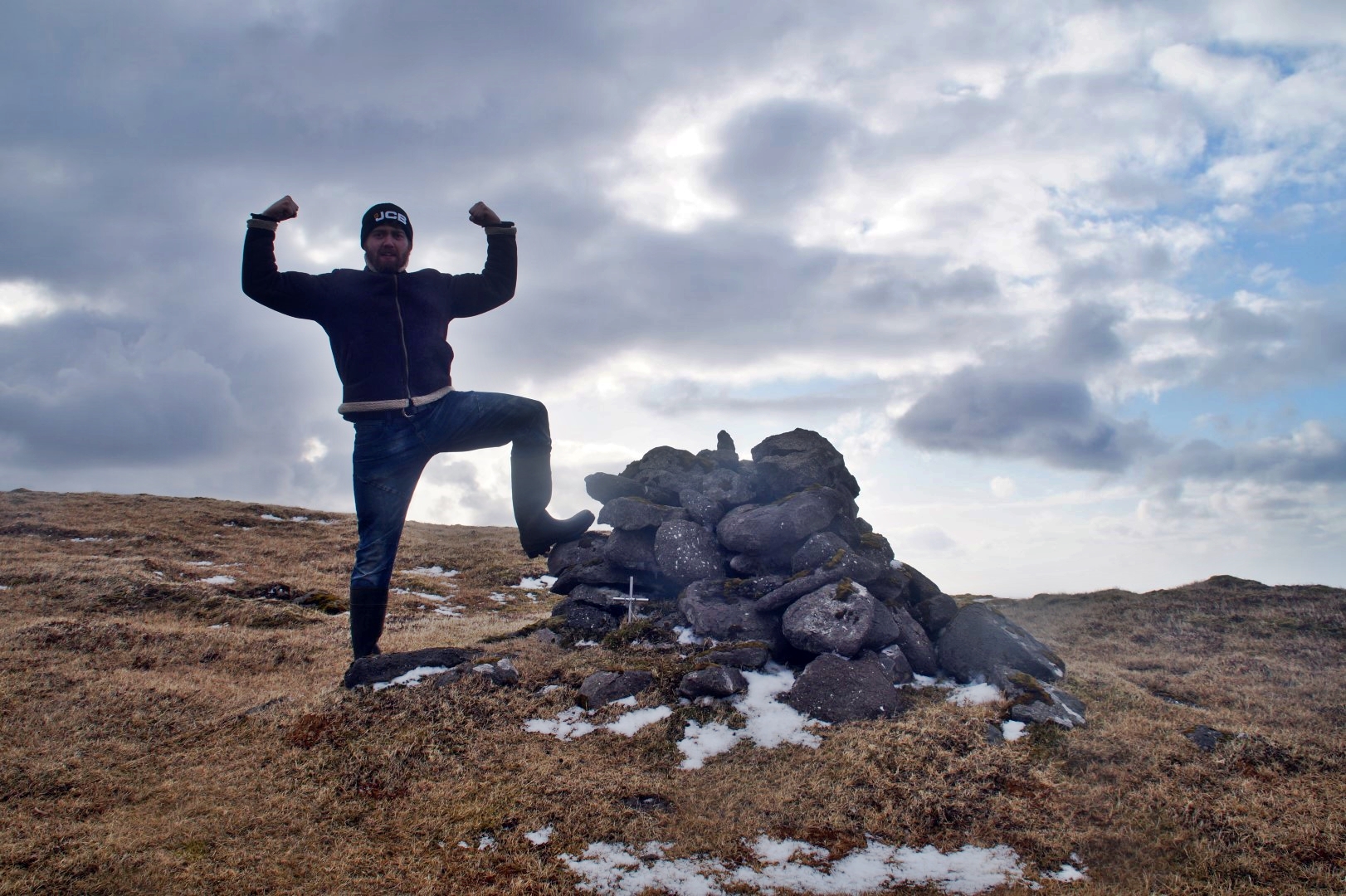
You should’ve seen my face when I finally got to the top and saw the view. I was full of joy and felt like I could stay right there for the rest of my life!
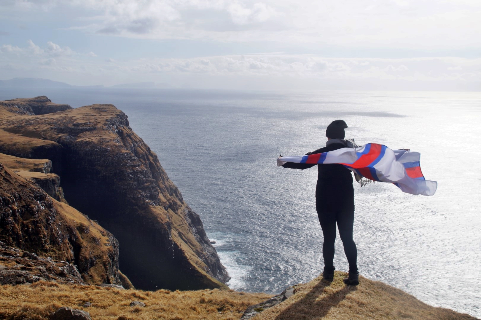
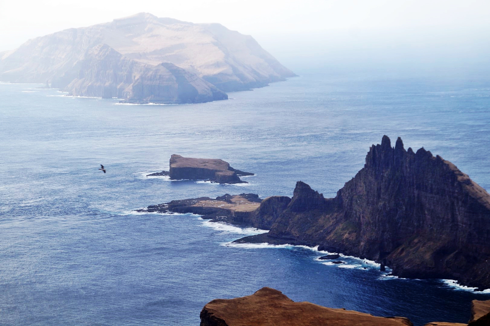
We had the most spectacular views over the crown-shaped islet of Tindhólmur, the flat islet of Gáshólmur and the Jurassic Park-like island of Mykines. Actually, we were right above one of the most famous spots in the Faroe Islands, the view point to Drangarnir, Tindhólmur and Mykines, but in my opinion, the view from the summit of Mount Høgafjall is so much better.


The way down the mountain is very steep, so we had to go very slow and steady. We actually wanted to hike to the famous viewpoint as well, but we decided to save that for another day. It was already 6 PM and we were very tired after the long hike to the top of the three mountains. I’m glad we did, as it took us ages to climb down the steep and rocky mountain side and also, several loads of rain and hailstones came our way during the descend! The weather in the Faroe Islands is truly enchanting.


When we finally got back down, we just had to walk a few kilometres along the bottom of the mountain range back to Sørvágur. We came past a stony beach with beautiful crystals and sea shells, but also way too much waste such as plastic and oil bottles (!), which have presumably been driven on land from the open ocean.
For the last half an hour, we walked with the sunset to Sørvágur, where Andras’ dad Eyðun picked us up and drove us to the parked car, so we could finally head home.


After such a long but incredible day, we were both ready to lay flat out on the sofa! It was lovely to spend a relaxing evening with Andras’ lovely family and eat some great food and ice cream – and to finally rest those legs!

A beautiful hike to the unexplored southwest coast of Vágar was over, but I’m sure it won’t be the last time that I head to that part of the country. I still want to see the famous viewpoint of Drangarnir, Tindhólmur and Mykines, and I really want to see Dunnesdrangar from the other side and climb the two mountains behind it!
Leave a Comment
Pingback: Up close and personal with Drangarnir: A gorgeous hike to one of Vágar’s hotspots – Northtrotter on 25/04/2018
Pingback: Dunnesdrangar and Suður á Fjalli: To the dramatic cliffs of southern Vágar – Northtrotter on 25/04/2018
Pingback: My April 2018: Faroes, North Jutland and Öland – Northtrotter on 25/04/2018

8 COMMENTS
QuentinSymbolful
4 years agoFascinating landscape! It’s sure that a day-long hike climbing three mountains would be tough and exhausting, but the view is totally worth it! Also, this trail you guys hiked can also reach to the point where the famous Drangarnir can be seen closely. But this place is owned by a landlord, Gutti Guttesen (I believe this is his name?), and a fee and permission is required to get there. So you guys just walk there, Would it be any problem?
Melissa Cherry Villumsen
4 years agoWe walked there before the fee became a thing. We actually planned to continue to the Drangarnir viewpoint, but we were too exhausted after the third peak!
Erik de jong
6 years agoI am leaving for faroer next monday and stay at sorvagur. I read on the internet that you can only hike in This area with a guide or the landowner. But When I read your story you did it without a guide. What is true or wise
Ann
6 years agoBreathtaking views and best place ever! You are so luck to discover this place, dear Mel!
Melissa Cherry
6 years agoThank you Ann, it was truly amazing! Definitely a place to come back to 😀