This post contains affiliate links. If you make a purchase through these links, I may earn a commission at no extra cost to you. Thank you!
Planning a trip to the Faroe Islands and eager to explore the outdoors, but not sure where to start? Whether you’re new to hiking, facing a day of less-than-ideal weather, or simply want to experience the islands’ natural beauty without committing to a full-day hike, this guide is for you.
Over the course of 14 visits to the Faroe Islands, I’ve hiked extensively across the archipelago. In this post, I’ll share ten of my favourite easy hikes, each under five kilometres. These hikes are not only scenic but also manageable in just a couple of hours or less, giving you plenty of time to enjoy other activities during your stay. These hikes are also off the beaten path, meaning you’ll likely have the trails to yourself – and get to experience sights that most tourists never do!
Vágar: Cairn trail from Miðvágur to Vatnsoyrar
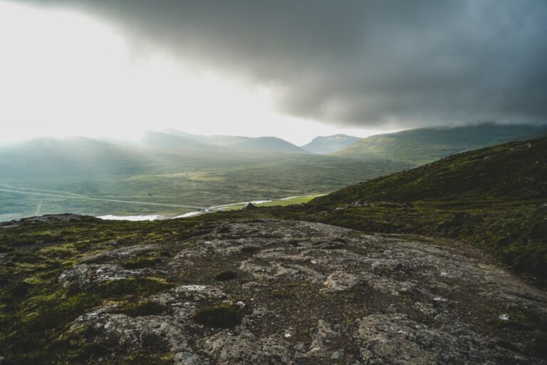
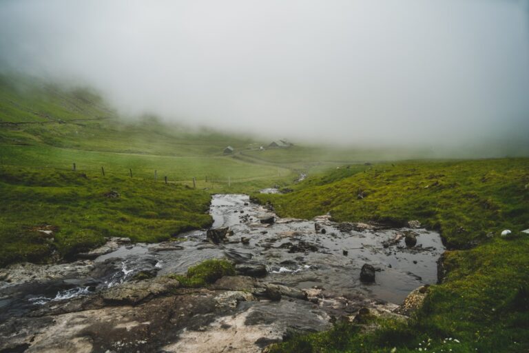
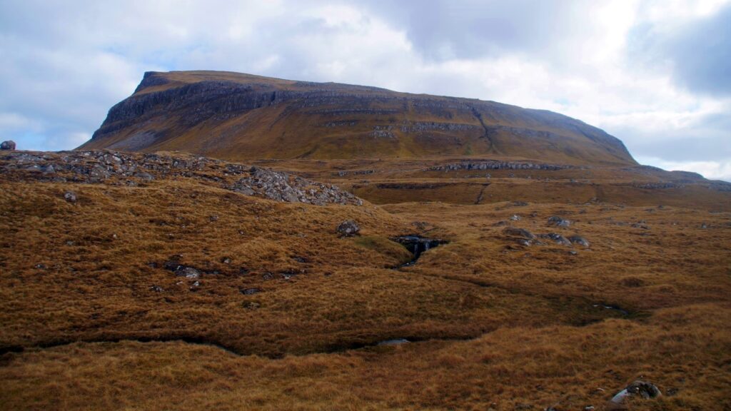
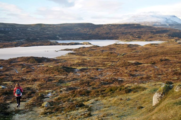
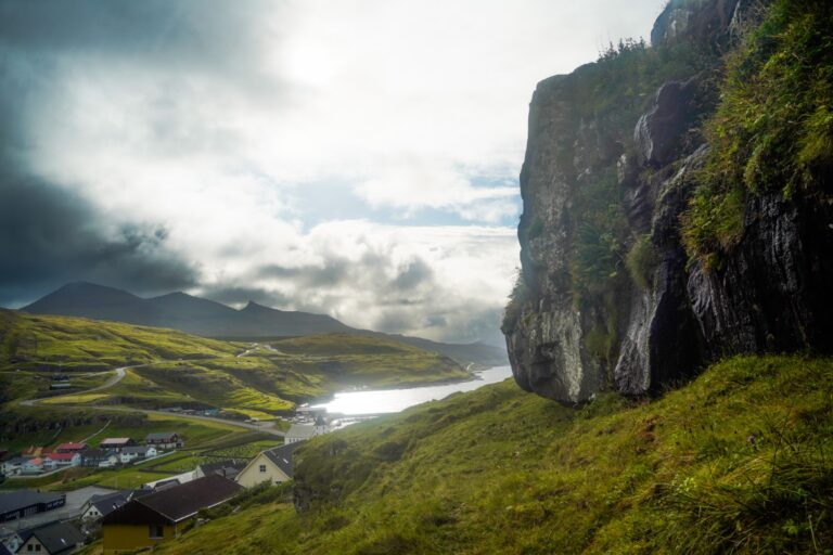
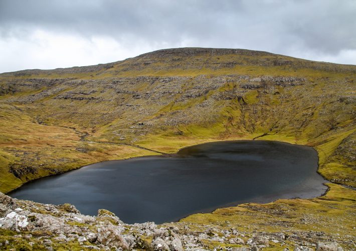
One of the shortest and most accessible trails on the island of Vágar is the cairn trail connecting Miðvágur – the island’s largest village – to Vatnsoyrar, the only inland village in the Faroe Islands. This four-kilometre trail can be completed in about an hour, making it ideal for a quick adventure. That said, don’t let the trail’s simplicity fool you – on a sunny day, it’s absolutely stunning and well worth your time, even on an island known for other iconic hikes.
The path follows the gentle slopes of Jógvansfjall and meanders past several small streams and waterfalls. Thanks to strategically placed stepping stones, crossing these water features is easy and safe. The trail itself is well-defined and easy to follow, marked by large cairns the entire way, and is also popular with horseback riders. Even in thick fog, navigation is straightforward – getting lost here is virtually impossible.
As you walk, you’ll be treated to sweeping views of Lake Leitisvatn and the dramatic Trælanípan cliffs. And keep an eye on the sky – this trail is a great spot for plane spotting, as it lies close to the airport’s flight path. All in all, it’s a peaceful, picturesque hike with minimal elevation.
Route description
Distance: 4 kilometres (one way)
Highest elevation: 190 m.
Time: 1-2 hours
Level: Easy
The trail starts at Kálvalíð, located on Kálvalíðvegur in the village of Miðvágur. From there, follow the road as it transitions into a gravel track. About 600 metres in, the road splits – take the right fork and continue along the gravel road, which soon narrows into a footpath. From this point on, the route is easy to follow, with large cairns marking the way.
You’ll need to cross a few small streams, which may be slightly more challenging after heavy rain, but there are plenty of stepping stones to help you across. At one junction, you’ll notice cairns leading up the mountainside – ignore these and stay on the lower path. The hike ends at Oyravegur in the village of Vatnsoyrar.
To return to your starting point in Miðvágur, you have a few options: hike back along the same trail, walk two kilometres to the airport to catch a bus, or arrange a pickup in advance.
Read more: A rainy day on the mountain slopes: Hiking from Miðvágur to Vatnsoyrar
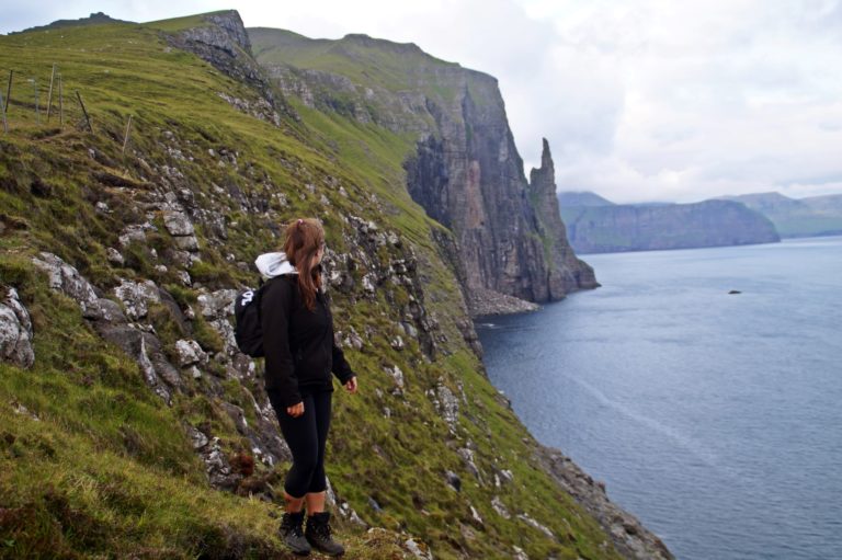
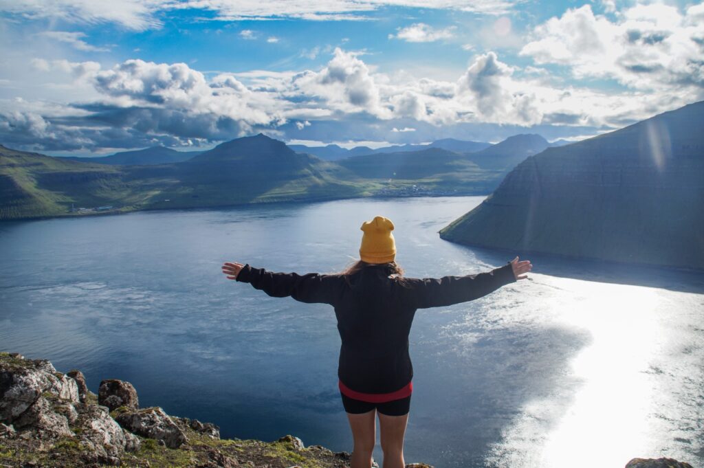
Vágar: Trøllkonufingur and the Klovningur sea stack
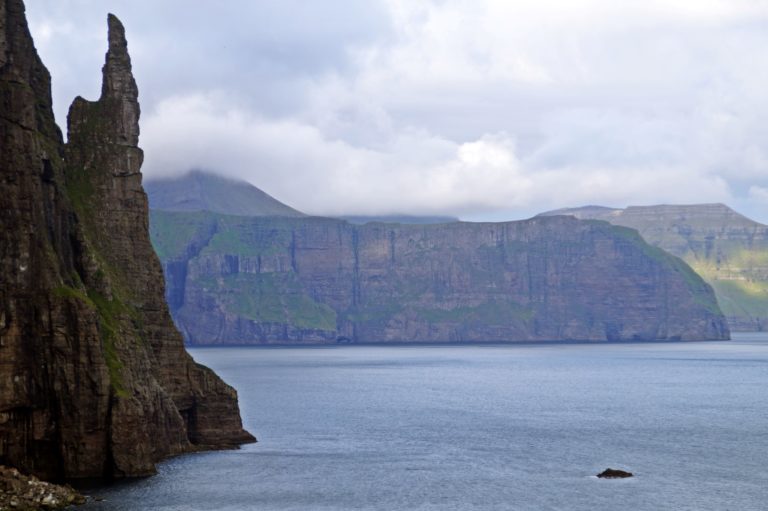
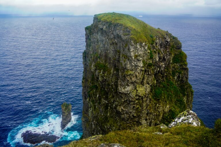
Trøllkonufingur, or “the Witch’s Finger,” is a striking monolith on the southern coast of Vágar near the village of Sandavágur. According to legend, it’s the petrified finger of a giant witch who tried to hurl the Faroe Islands all the way to Iceland. As she reached the sea south of Vágar, the sun rose and turned her to stone. She was so massive that when she sank to the bottom of the ocean, the back of her head and one of her fingers remained above the surface. The back of her head became the island of Koltur, and her finger is what we now call Trøllkonufingur.
While Trøllkonufingur itself is a well-known attraction, most visitors don’t realize there’s a dramatic sea stack just beneath it called Klovningur. If you walk downhill from the trail, you’ll reach a vantage point where you can look out over Klovningur and see Trøllkonufingur from a completely different angle.
The walk to Trøllkonufingur is easy and doesn’t require a guide. That said, having someone to share the area’s folklore and history can make the experience even richer. If you’re curious to learn more about the legend and the landscape, consider joining a guided tour to deepen your appreciation of this magical spot. Read more here!
Route description
Distance: 3,5 kilometres (return)
Highest elevation: 100 m.
Time: 1 hour
Level: Easy to moderate
The hike begins on the highest road in Sandavágur, called Traðarvegur, which transitions into the footpath known as Úti á Trøð. Follow this path all the way to its end for the classic view of Trøllkonufingur rising dramatically from the sea.
Then backtrack about 50 metres from the gate to a nearby bench. From there, head downhill towards the ocean. This descent takes you to a viewpoint directly above the sea stack Klovningur, where you can watch the waves crash against the rocks and admire Trøllkonufingur from a lesser-known angle. Be cautious on this section – it’s steep, often slippery, and there are no barriers near the edge. Stay back from the cliffside and watch your footing, but if you’re careful, this short detour rewards you with an unforgettable and rarely seen view.
Read more: The legend of Trøllkonufingur | Back on the Faroes: A sunset hike to Klovningur on Vágar
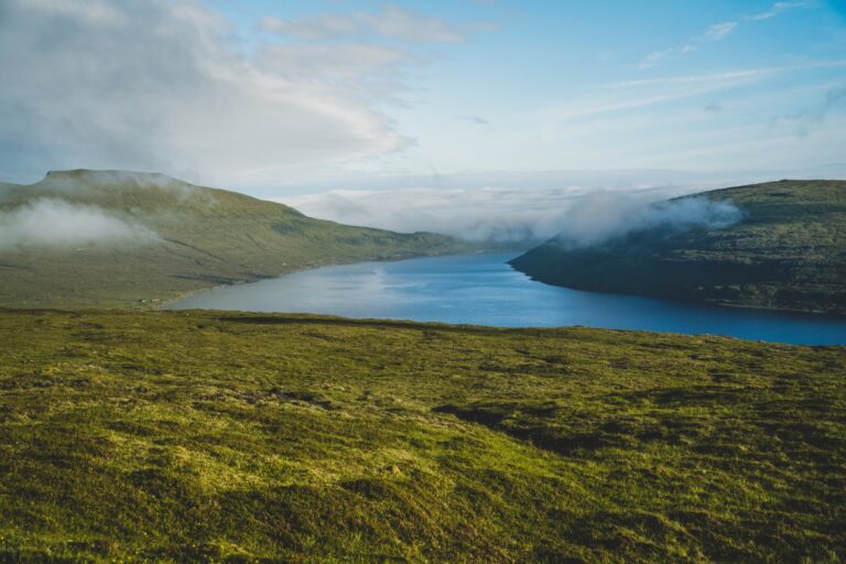
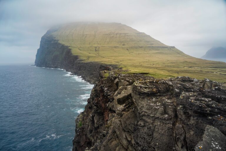
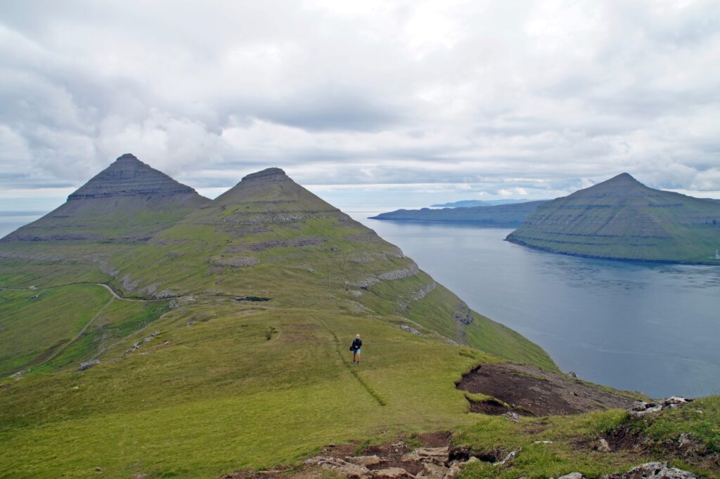
Vágar: Tjørnudalstjørn, the unknown lake
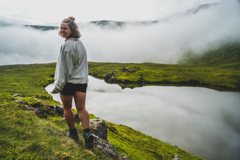
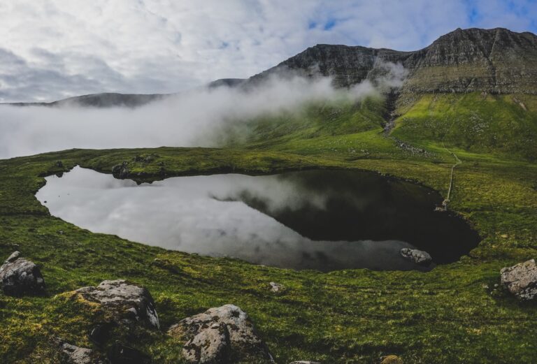
The island of Vágar is home to the largest lakes in the Faroe Islands, as well as the most popular. But here’s one you’ve probably never heard of before! Above the village of Bøur, hidden in a lush green valley beneath some of the island’s tallest peaks, lies the tranquil lake, Tjørnudalstjørn. It’s a short uphill walk from the road, and the scenery feels straight out of a fantasy film.
At the lake, a profound silence surrounds you, broken only by birdsong. On still days, the jagged mountain peaks reflect perfectly in the mirror-like surface of the water. It’s an easy hike to a peaceful and stunning location that you’ll almost certainly have entirely to yourself.
Route description
Distance: 2 kilometres (return)
Highest elevation: 260 m.
Time: 1 hour
Level: Easy to moderate
The hike begins about two kilometres west of Bøur, just before the tunnel to Gásadalur. Look for a gravel road leading up into the mountains – it’s easy to spot and marks the start of your ascent. Follow this road past two farm buildings, continuing uphill until the track ends at the meeting point of two streams.
Cross the wider of the two streams, then follow the narrower one upstream. The climb from here is short but fairly steep, so take your time. Eventually, you’ll reach a barbed wire fence – leave the stream at this point and follow the fence as it leads you towards the mountains. The ground soon levels out and becomes quite boggy as you near the lake.
At the very end of the fence, you’ll find a spot without barbed wire where you can easily climb over and access the lake. If you decide to walk around the lake, you’ll encounter another barbed wire fence about halfway around – but don’t worry, there’s enough space to crawl under a large rock and continue. When you’re ready to head back, simply retrace your steps down to the road.
Read more: A short hike to Vágar’s unknown lake, tucked away below the misty mountain peaks
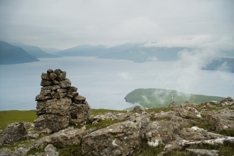
Nólsoy: Eggjarklettur, the highest point of Nólsoy
Mount Eggjarklettur is the highest peak on the island of Nólsoy, standing at just 372 metres. While its rugged basalt cliffs might make it look intimidating from below, don’t be fooled – it’s a much easier climb than it appears and well within reach for most hikers. On this hike, you’ll also pass by the ruins of the abandoned settlement of Korndalur.
Despite its modest height, the summit offers one of the most rewarding views in the Faroes. From the top, you’ll be treated to a stunning panorama stretching across at least seven islands: Streymoy, Sandoy, Hestur, Koltur, Eysturoy, Borðoy, and of course, Nólsoy itself – right beneath your feet. It’s a short but satisfying hike that proves you don’t have to climb high to see far.
Route description
Distance: 5 kilometres (return)
Highest elevation: 372 m.
Time: 2-3 hours
Level: Easy to moderate
The hike starts just beyond the village on Nólsoy, heading south towards the island’s highest point, Eggjarklettur. Follow the road all the way to its end, passing the old ruins of Korndalur along the way. From there, you’ll spot cairns guiding you partway up the mountain.
At one point, you’ll need to leave the cairns behind to tackle the final stretch to the summit. Although there’s said to be a trail, I haven’t found it yet – maybe you’ll have better luck! Don’t worry, going off-trail here isn’t a problem. This is the steepest part of the hike, but it’s short and quite manageable.
Once you reach the top, take a moment to soak in the incredible views. If you’re up for it, continue on to the small hill just ahead, perched right at the cliff’s edge. This is Uppi á Manni, Nólsoy’s second-highest peak at 352 metres. It involves a small descent followed by an even easier climb to the summit.
When you’re ready, simply retrace your steps back down to the village to complete the hike.
Read more: Climbing Eggjarklettur, the highest mountain on Nólsoy
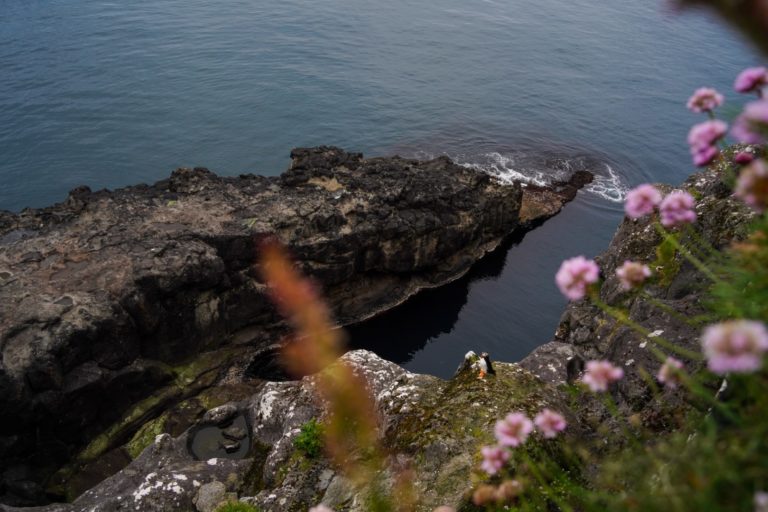
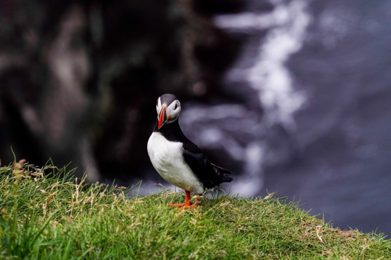
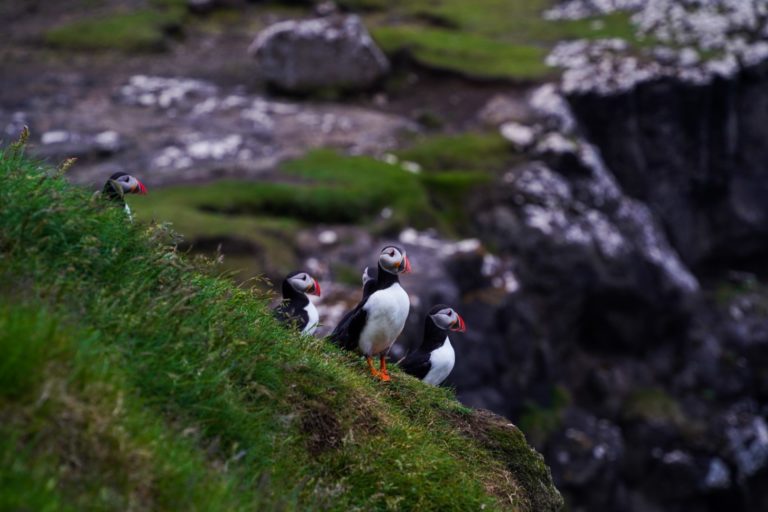
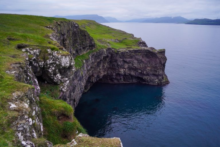
Nólsoy: Stongin, a hidden puffin paradise
Most summer visitors to the Faroe Islands dream of visiting Mykines to see puffins, but the island can be tricky to get to – and sometimes even to leave – thanks to frequent ferry delays and cancellations. What many don’t realize is that Nólsoy offers a much easier, safer, and more affordable way to spot puffins, with far fewer tourists around.
The puffins nest along the cliffs of Stongin, the northern part of Nólsoy. A scenic loop hike takes you out to the very tip of the island and passes several cliffs where puffins can be observed up close. The best times to do this hike are early morning or late evening, when puffins return to their cliffside nests carrying fish for their chicks.
While summer is the only season to catch sight of these charming birds, the hike itself is beautiful year-round and well worth doing even in the off-season.
Route description
Distance: 5 kilometres (loop)
Highest elevation: 30 m.
Time: 2-3 hours
Level: Easy
The hike begins at the northern edge of the village, at the end of Í Geilini. From there, head onto the gravel road Í Stong. About 200 metres in, take a right detour up to the wind turbine for a fantastic view over the village. Afterwards, return to the gravel road and follow it all the way to its end. This first section is fairly easy, with some gentle ups and downs.
When the road ends, you’ll spot a footpath leading out to Boðin, the northernmost point of the island. Follow the footpath to its end, then venture out onto the rocks beyond. Don’t miss the chance to explore and climb around these rocks – this area is a prime spot for puffin watching.
Retrace your steps back to the footpath and then follow the coastline to the left, passing under a rocky plateau towards Mánagjógv, a gorge known for even more puffin sightings. Continue along the edge of the rocks until you find a safe place to climb above the plateau – about 100 metres past the gorge is a good spot.
As you follow the coast, stay close to the edge but never too close! Soon, you’ll come across a massive cliff with a sheep trail leading into it. Do not follow this trail! The cliff is hollow and could collapse at any time. This area is a hidden puffin paradise, where you’ll often see puffins perched on cliff edges.
Continue along the cliffs and the rocky plateau of Rivtangi will soon appear below you. Take extra care here as the cliffs are steep and vertical. The final stretch back to the village descends along the coast, offering more stunning cliff views and potential puffin sightings. Head towards the red fence, which marks the path back into the village where the hike ends. You’ll need to climb a few fences during the walk, but most are broken or have openings that make passage simple.
Read more: Stongin, Nólsoy: Finding a hidden puffin paradise on the Faroe Islands
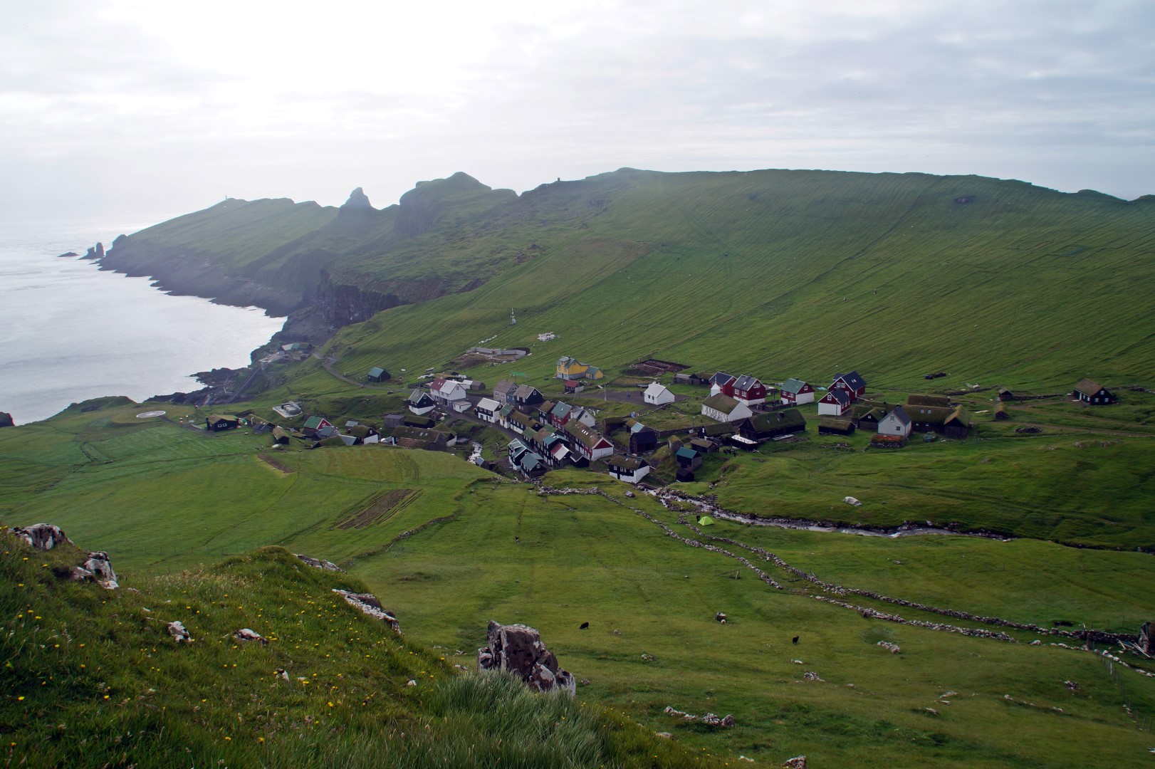
Koltur: Fjallið, the smallest mountain in the Faroe Islands
Fjallið, the smallest mountain in the Faroe Islands, rises to just 101 metres and sits at the southern tip of the tiny island of Koltur. This scenic loop hike takes you past dramatic gorges, rocky skerries, and vibrant rock pools – a rare and stunning landscape that you won’t often see elsewhere in the Faroes.
The route leads you first to Kolturstangi, the island’s southernmost point and a fantastic spot for seal watching. From there, you’ll ascend to Fjallið itself, where despite its modest height, you’ll be rewarded with magnificent panoramic views.
The hike continues along a breathtaking stretch of cliffs, with skerries and vivid green rock pools below. Finally, the trail loops back to the abandoned village of Heimi í Húsi, which is well worth taking your time to explore as well.
Route description
Distance: 4,5 kilometres (loop)
Highest elevation: 101 m.
Time: 2-3 hours
Level: Easy
Start your hike at Heimi í Húsi and head south, following the west coast of the island. Stick as close to the shoreline as possible to catch the small gorges and colourful rock pools along the way. While there’s no official trail for most of this route, it’s easy to navigate as long as you keep the coast in sight. When you reach Kolturstangi – the island’s southernmost point – you’ll need to climb up some rocks to get there. Keep an eye out for seals lounging nearby, and be cautious not to get too close to the edge since waves can crash high and splash over the rocks.
From Kolturstangi, continue north along the east coast towards the summit of Fjallið. The climb is short and easy, with beautiful views to enjoy on the way up. After summiting, follow the east coast to the base of Uppi á Oyggj, the only other (and much taller) mountain on the island. If you’re feeling adventurous, you can continue up this mountain, or choose to head back to Heimi í Húsi instead.
Important note: Getting to Koltur can be tricky. Until June 2024, there was helicopter service a few times a week, but that’s no longer available. Your best options now are to take a tour or connect with a local who can take you by boat.
Read more: The return to Koltur and a hike up the smallest mountain in the Faroe Islands
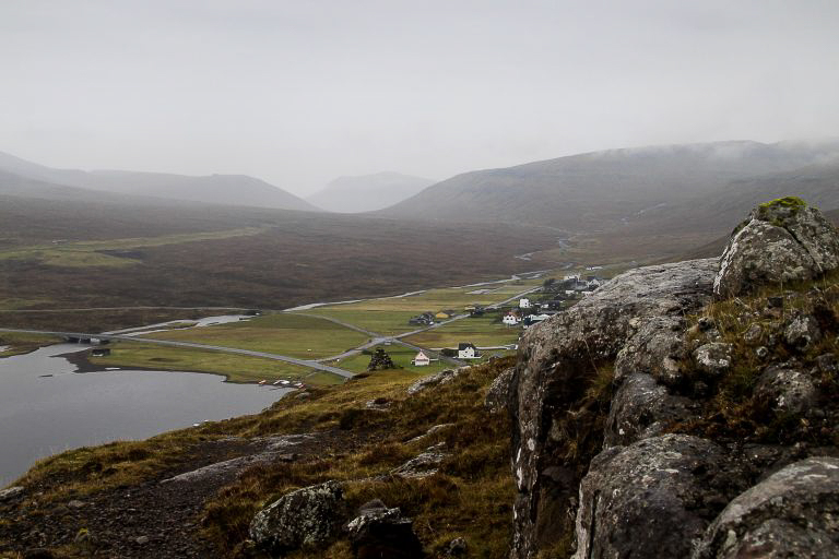
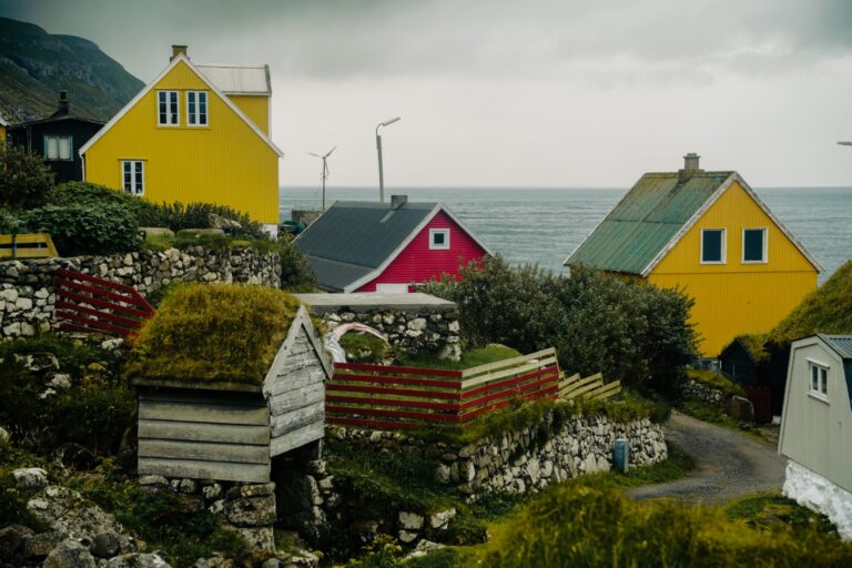
Sandoy: Cairn trail from Skarvanes to Dalur
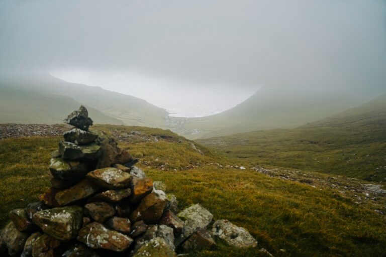
This hike takes you between two of the most picturesque villages on the island of Sandoy, following the historic cairn trail from Skarvanes on the southwest coast to Dalur on the southeast. This classic route was once the main path villagers used before roads existed. Because of all the blue wooden poles and cairns guiding you along the way, it’s a safe trail to hike even in fog.
The journey begins with a steep climb out of either village, rewarding you with stunning views back over the village. The ascent remains steep up to the first cairn, then the terrain levels off, making the climb progressively easier. About halfway through, the trail gently descends towards the opposite village, offering yet another series of breathtaking views along the way.
Route description
Distance: 5 kilometres (one way)
Highest elevation: 320 m.
Time: 1,5-2 hours
Level: Easy to moderate
You can start this hike from either Skarvanes or Dalur. I began the hike in Skarvanes, so I’ll describe the route from there, but if you start in Dalur, just follow the directions in reverse.
From Skarvanes, take the upper road heading south out of the village. You’ll walk along a gravel road for a short stretch before it narrows into a trail. The path can be a bit tricky to spot, but don’t worry – there are small blue wooden poles marking the route the entire way, along with occasional cairns. Along the trail, you’ll climb over a few fences using small wooden steps.
Continue uphill until you reach the first cairn. Shortly after, the climb becomes gentler and less steep, though there’s another brief steep section before the terrain flattens out again. About halfway through the hike, the trail begins a gradual descent towards Dalur. The village soon comes into view, and before long, you’ll reach a gravel road that leads down to the charming, colourful houses.
There’s no direct bus between Skarvanes and Dalur, but Dalur is connected by bus to larger villages on the island. To get back to your starting point, you’ll need to either hike back the same way or arrange for a pickup.
Read more: Across Sandoy in thick fog: A short cairn hike from Skarvanes to Dalur
Eysturoy: Lake Toftavatn and Húsklond
Lake Toftavatn is one of my favourite spots in the Faroe Islands. As the country’s fourth-largest lake, it stands out with a lush, bush-filled landscape that feels more like western Jutland or Iceland than the typical Faroese scenery. Set against a backdrop of high mountains, it offers a stunning blend of both worlds. The area is especially magical in winter, when the lake freezes over.
Just behind the lake rises the gentle mountain Húsklond, standing at just 129 metres. It’s an easy climb that rewards you with spectacular views of the Skálafjørður fjord, the long Raktangi peninsula south of Strendur, and the island of Streymoy stretching beyond.
Route description
Distance: 4 kilometres (loop)
Highest elevation: 129 m.
Time: 1-2 hours
Level: Easy
The hike starts about 600 metres south of the village of Runavík, where a trail begins from the roadside leading to Lake Toftavatn. Follow this path until you reach a fork – take the left trail to circle around the lake. Continue until you come across a statue of a man and a dog. About 100 metres past the statue, you’ll see a trail veering left and heading up towards Húsklond.
Follow this trail for roughly 300 metres, then leave it behind and hike off-trail to the summit, which is to your left. After enjoying the panoramic views from the top, return to the lake trail and continue your loop around the lake. When you reach another fork again, you can either take the right path to return to your starting point or go left to continue into Runavík, which adds just 500 metres to your hike.
Read more: A walk along frozen Lake Toftavatn and to the top of Húsklond
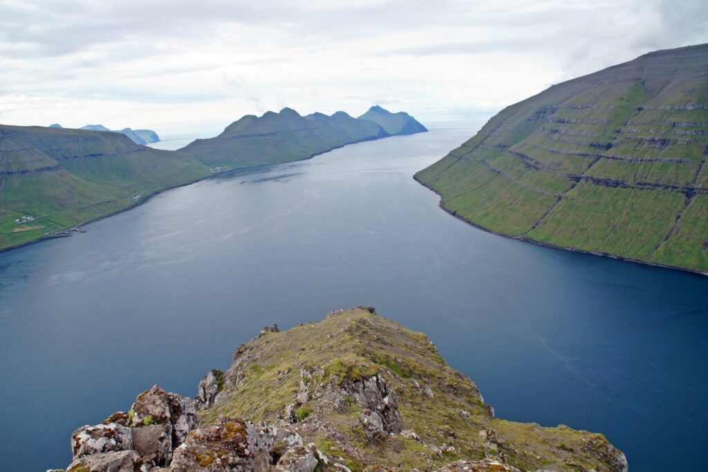
Eysturoy: Eiðiskollur and Risin and Kellingin from above
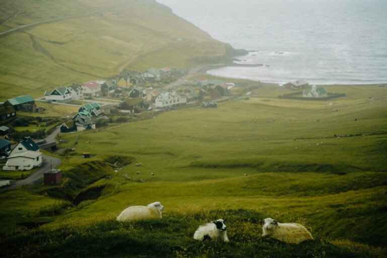
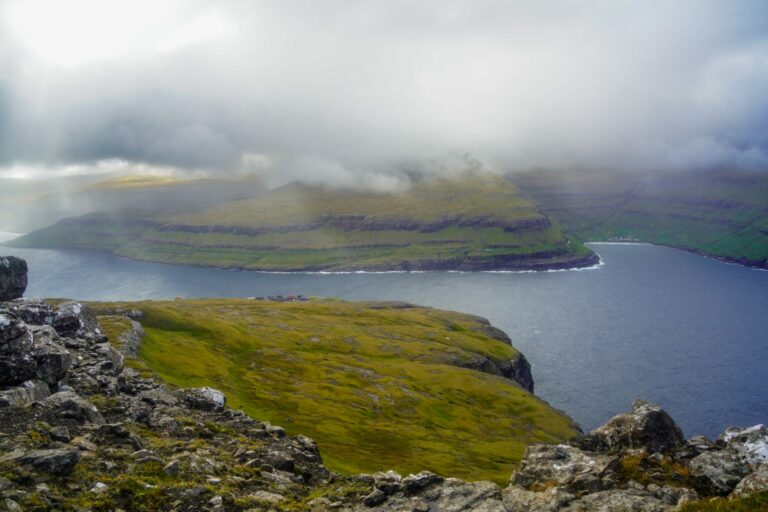
At the summit of Eiðiskollur (352 m.) on Eysturoy island, you’ll be rewarded with an iconic view of the famous sea stacks Risin and Kellingin (“the Giant and the Witch”). The hike up from the village of Eiði is relatively easy, with stunning views appearing early on, including a sweeping overlook of the village framed by rugged mountains.
Once at the summit, you’ll find remnants from the Second World War, adding a historical touch to the experience. From here, the panorama stretches out to the village of Tjørnuvík and the striking Tjørnuvíksstakkur sea stack, before revealing the breathtaking view of Risin and Kellingin from above.
While this hike is more popular than others on this list, it still doesn’t draw anywhere near the crowds you’ll find at more famous spots like Trælanípan and Kallur Lighthouse.
This hike is also available as a guided tour – read more here!
Route description
Distance: 5 kilometres (return)
Highest elevation: 352 m.
Time: 2-3 hours
Level: Easy to moderate
The hike starts in the village of Eiði, right at the end of the Á Barnalofti street. Follow the uphill trail and keep ascending even when the path seems to vanish. You’ll spot a few cairns along the way to guide you, but getting lost is nearly impossible – just keep heading upwards. Be sure to glance back regularly, as the views get more stunning the higher you climb!
The trail briefly reappears for the final steep push to the summit. Once you reach the top, continue to the northern edge of the mountain and look down – you’ll be standing right above the dramatic sea stacks! Exercise caution here, as the cliff edge is vertical, and avoid attempting this hike in thick fog.
To return to Eiði, simply retrace your steps back down the same way.
Read more: A hike up Eiðiskollur: Standing above the sea stacks of Risin and Kellingin

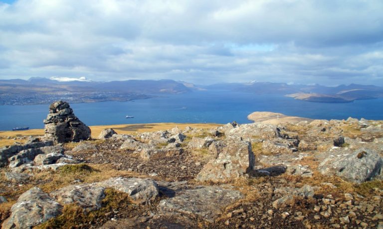
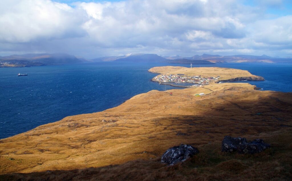
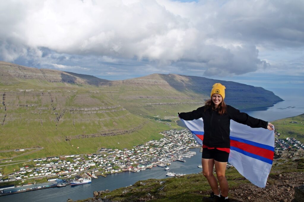
Borðoy: Klakkur, an easy mountain above Klaksvík
Klakkur, standing at 413 metres, is one of the easiest mountains to climb in the Faroe Islands, making it a fantastic option for hikers of all levels. Despite its relatively modest height, the summit offers some of the most breathtaking panoramic views you’ll find in the Faroes. Overlooking the town of Klaksvík – the second largest in the Faroes – it treats hikers to stunning views not only of the town itself but also of the surrounding islands Kunoy, Kalsoy, and Eysturoy.
This hike is great year-round, whether summer or winter. And rumor has it that you can even ski there in the winter – though don’t quote me on that!
If you’d like to have a guide lead you on this mountain hike, you can find more information here!
Route description
Distance: 3 kilometres (return)
Highest elevation: 413 m.
Time: 1-2 hours
Level: Easy to moderate
The hike begins at a pass called Hálsur, located at the end of Ástarbreytin road – about an hour’s walk from the centre of Klaksvík. From there, enter the gate and follow the well-trodden path, guided by cairns all the way to the summit. The trail is straightforward and easy to navigate.
Once you’ve soaked in the incredible views from the top, just retrace your steps back down to Hálsur to complete the hike. It’s really that simple – no complicated directions or detours, just a rewarding climb with stunning scenery throughout!
Read more: Climbing Klakkur: A short sunshine hike above Klaksvík
Whether you’re seeking peaceful solitude, breathtaking views, or a gentle introduction to hiking in the Faroe Islands, these trails offer something special for everyone. Each path reveals a unique side of the islands’ rugged beauty and a chance to connect with nature away from the crowds.
So lace up your hiking boots, pack a rain jacket just in case, and get ready to explore some of the Faroe Islands’ best-kept easy-to-reach secrets!
Leave a Comment