Approximately 15 kilometers off the coast of my hometown, Hov, lies the island of Samsø. Home to over 3,700 people, this island is well-connected by ferries to both Jutland and Zealand, and due to its central location, it may soon become the stepping stone for a bridge between the two. Naturally, locals fear that this may destroy the delicate nature of the island. There’s no doubt that Samsø will change drastically with a bridge connecting it to the mainland, a fact that makes me eager to explore the unspoilt island while I still can.
Despite growing up in the harbour town where the ferry to Samsø docks, I can’t remember the last time I went there. I don’t think I’ve been there since playing football against a local team as a child! Thankfully, that changed this summer when my parents suggested that we take a day trip to the island, making use of the free ferry tickets that our government had blessed us with following the corona crisis.
Geographically, Samsø is divided into three areas; the North Island, the South Island and the Stavns Fjord, a shallow lagoon with many small uninhabited islands. Although separated by an artificial canal during the Viking Age, the North and South Islands are no longer separated, although they still differ greatly in terms of landscape.
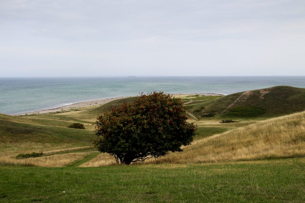
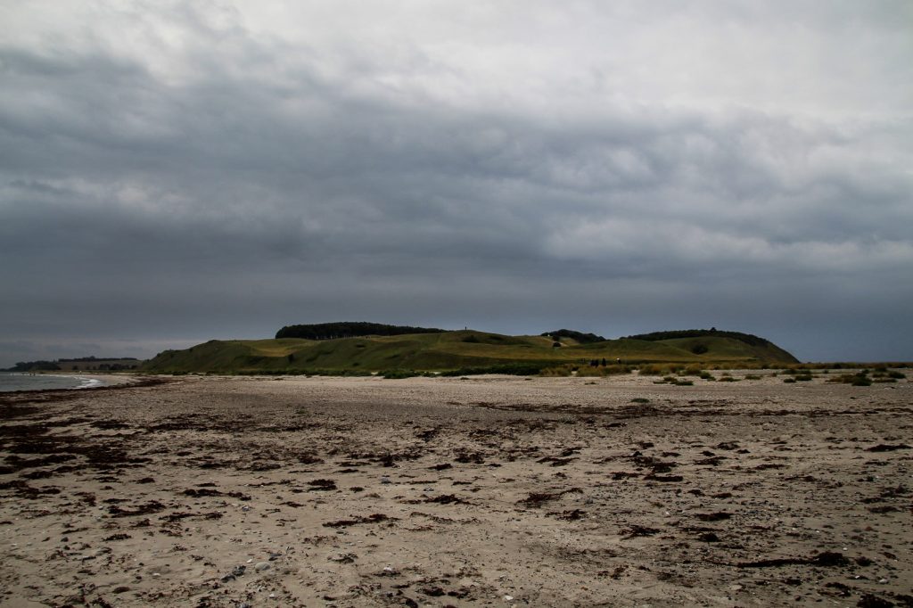
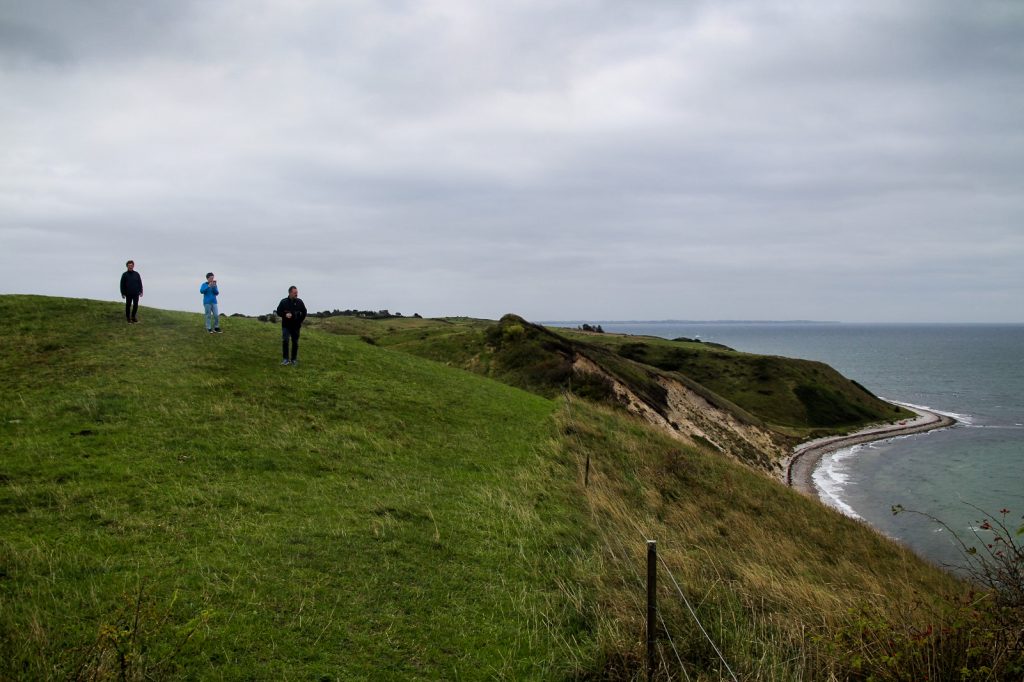
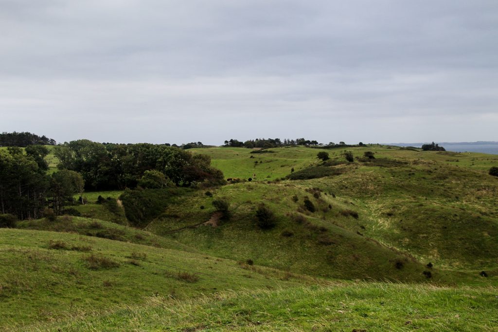
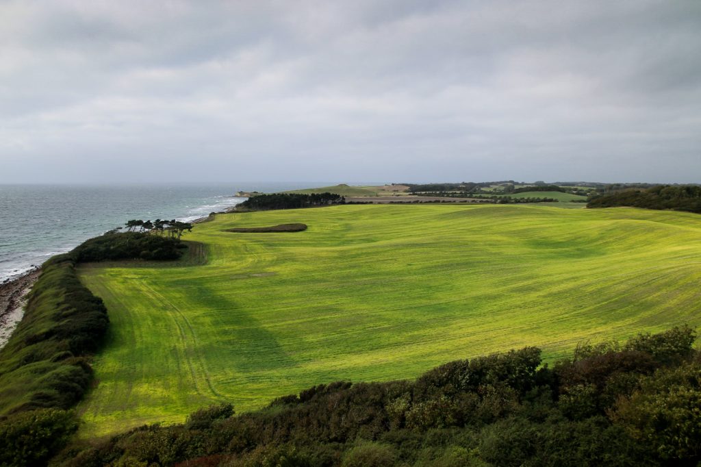
Arriving on Samsø after an hour on the ferry, we immediately drove north to the uncultivated and varied landscapes consisting of hills, meadows, heathlands and woodlands. We drove as far north as possible, all the way to the end of the road. There, we started our first hike, a short 1 km hike along a well-trodden trail through the hills of Nordby Bakker to Issehoved, the northernmost point on Samsø. The landscape here is incredibly picturesque with the hills rising steeply behind the beach at Issehoved.

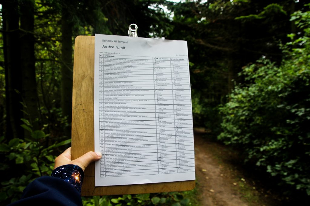
A few kilometers further south, we stumbled upon Samsø Labyrinten which is the largest permanent labyrinth in the world! Founded in 2000, the labyrinth was designed in a 60,000 sq m patch of conifer woodland.
We weren’t sure whether or not the experience would be only for children, but we found out that the challenge of getting through the labyrinth involves answering questions either in an adult or child-friendly version, and we were sold. We chose the subject “Around the World” as we (well, mostly I) love geography. Most of the questions were quite easy but we did have to guess a few and one of them we answered wrong, so we had to backtrack to figure out which one it was. We did eventually make our way out! It was a lot of fun, especially for a geography nerd like me!

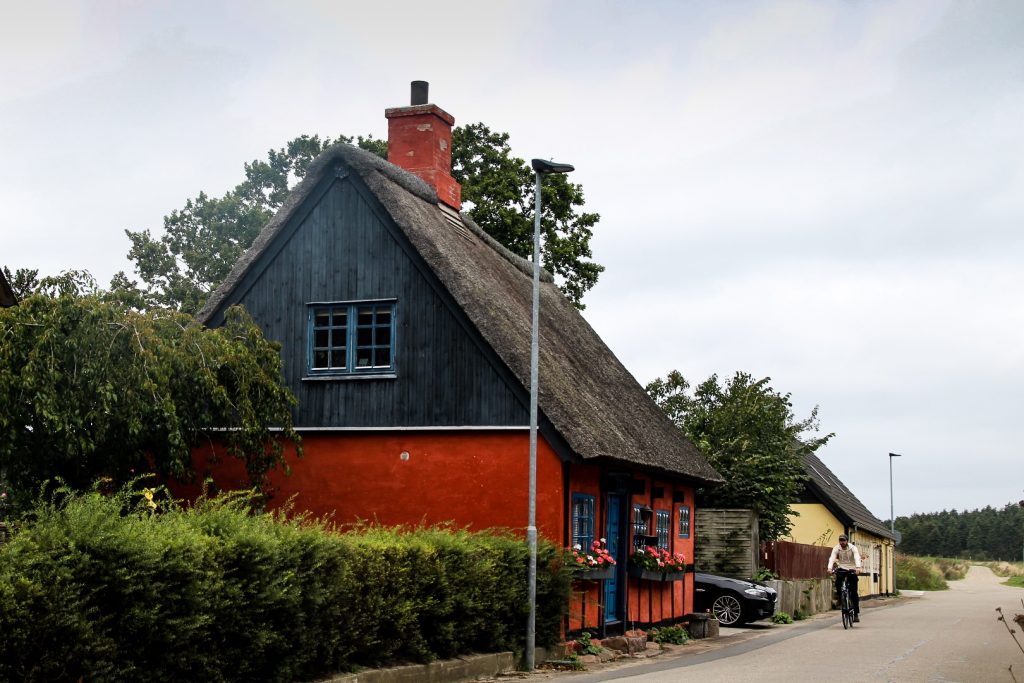
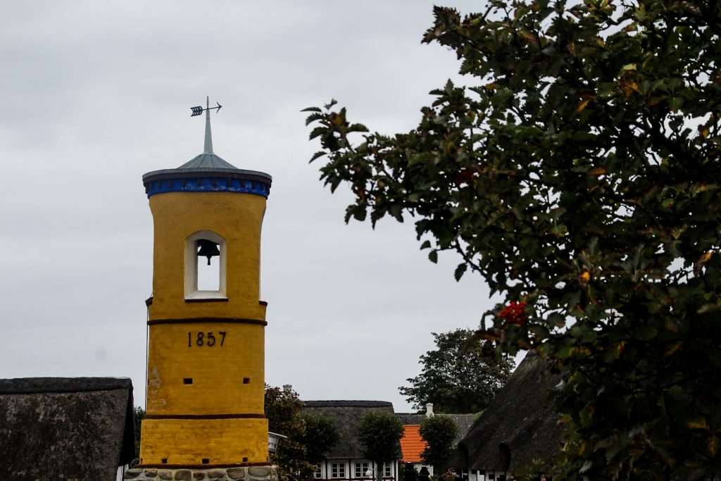
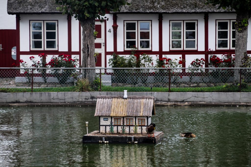
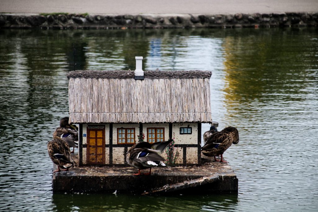
We made our way to Nordby, Samsø’s northernmost village and also the prettiest, according to many locals. And I have to agree. Nordby is a feast for the eyes with its many half-timbered cottages, an old bell tower from 1857 and a little pond where even the ducks have a miniature half-timbered cottage.
We enjoyed hot chocolate, coffee and homemade vegan cake on a bench by the pond while soaking in the atmosphere in this quaint village.

After our sugar fix, we were ready to explore the north further and headed back to the coast, to the valley of Møgelskår, nestled beneath the hills of Nordby Bakker.
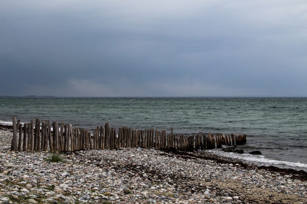
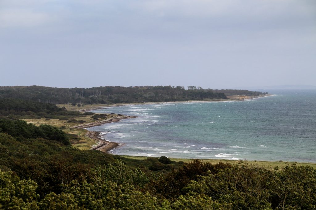
We walked out to the ocean, a mere 500-meter hike from the parking lot. There, we discovered some incredible views of Samsø’s rugged northwestern coastline as well as the closest view of the nearby island of Tunø.


It was time to work our way down to the southern part of the island where the landscape is flatter and cultivated, and where most of the Samsings reside.
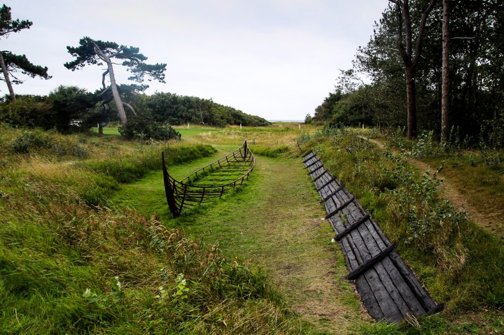
We made a quick stop at the prehistoric Kanhave Canal, Samsø’s most well known ancient monument. Dug between 726 and 729 AD during the Viking Age, the 500 m long and 11 m wide canal secured a passage for ships through the narrowest point on the island, at a time when Samsø was a central meeting place.
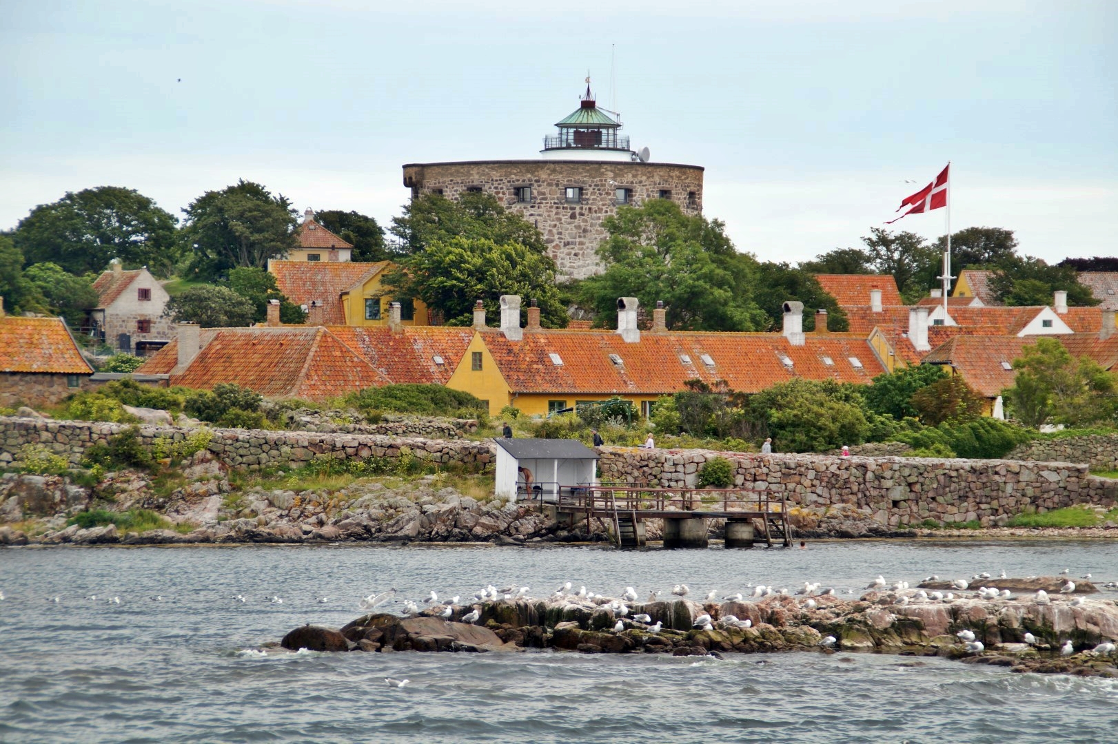
One of the absolute must-sees on Samsø is the lighthouse at Vesborg, and especially the views from the viewing platform at its top. It’s located near the southernmost point of the island where we headed next.
The 19 m high lighthouse was built in 1858 on the site of a former royal castle founded by King Valdemar Atterdag in the 1360s. The lighthouse was named after the castle, commemorating the time when Samsø was of central importance.
For just 20 DKK each, we climbed the staircase inside the lighthouse to take in the view of the windswept lowlands with Zealand and Funen in the backdrop.

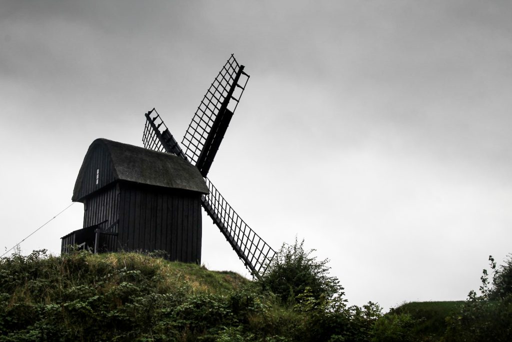
Continuing our little history tour, we drove a few kilometers north again to the small village of Brundby to see the second-oldest mill in Denmark, Brundby Stubmølle.
The mill was built in the beginning of the 17th century on the nearby island of Endelave, but it was sold and moved to Samsø in 1683. It was in operation until 1939 and in 1961, the mill became protected as a landmark, after which it was restored to its former glory.
Our day of sightseeing ended at the mill, and afterwards, we drove to the lively village of Ballen for a well–deserved meal at the cozy harbour. I shared my fries with a baby sparrow!

This day served as a great reintroduction to the island, and it certainly gave me a taste for more. I would love to return in the spring or summer for a trek around the entire island, and an expedition to the uninhabited islands of Stavns Fjord!

Leave a Comment