Returning to the Faroe Islands this summer, I was somewhat desperate to complete a personal goal of mine; to climb all 41 mountains on the island of Vágar. The island is my favourite in the country, if not in the world. But it’s only the beginning. Someday, I hope to climb all 340 mountains in the Faroe Islands. One island at a time.
After my October visit where I spent the whole month on Vágar, I only had six peaks left to summit. All six are located in the northwestern corner of the island, above the villages of Gásadalur and Bøur, and they include the two highest on the island.
On a cloudy day in early July, I set off to scale four of them.
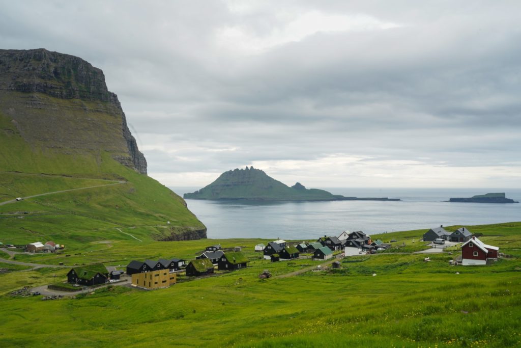
I hitchhiked to Gásadalur with some difficulty, and made it there just after 1 PM. I walked into the valley beyond the village, a valley I’ve hiked through many times during my adventures on the island. But this time was different. The valley was full of small, white birds aggressively protecting their nests in the grass. I stayed on the trail, avoiding the grass, but they still flew closely over my head four times.
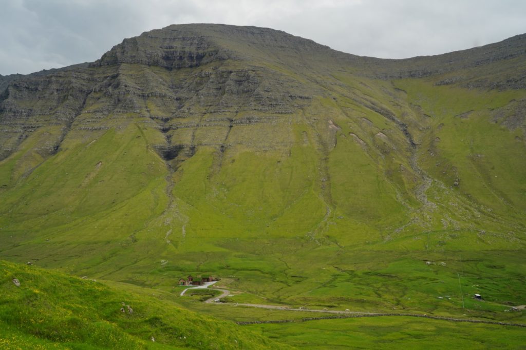
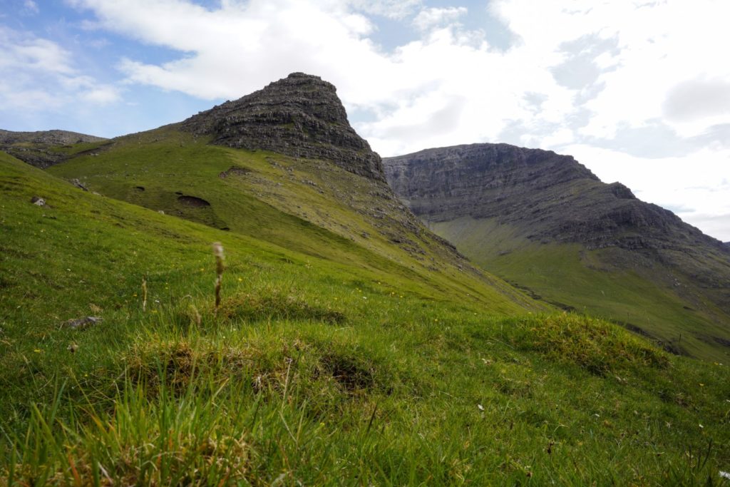
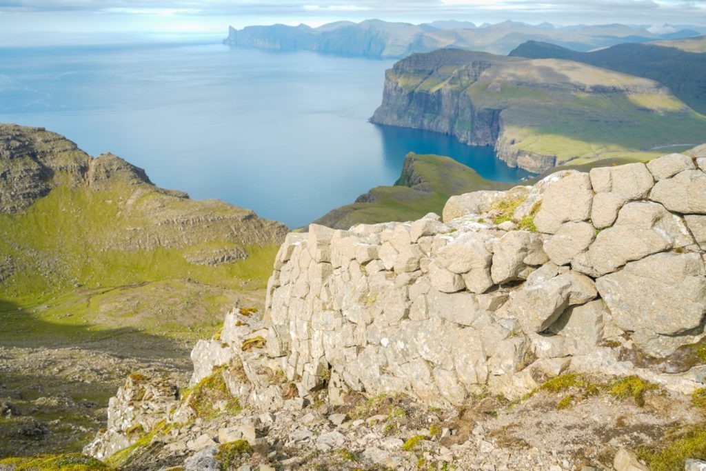
It started raining lightly as I got closer to the mountains, but thankfully, that was all the rain I had that day. I filled up my water bottle directly from a stream, taking advantage of the cleanest water on this planet, and then started the ascent up the paved trail that ends on top of a ridge between the two highest mountains on the island, Árnafjall and Eysturtindur.
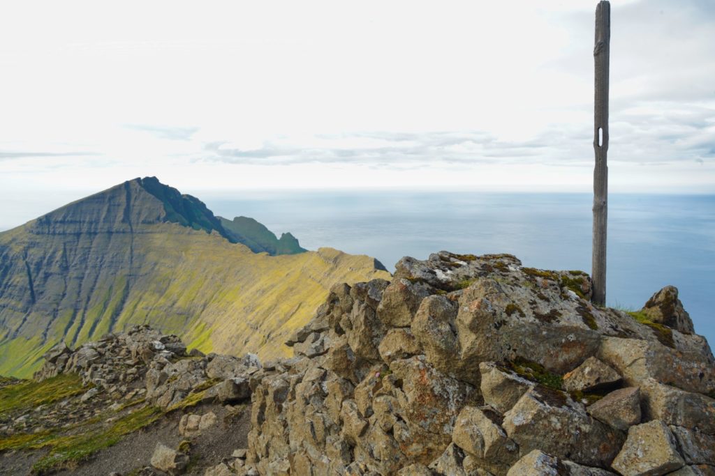
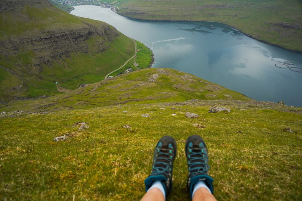
Eysturtindur, the second-highest mountain at 715 m., was where I was heading. The skies cleared and gave way to brilliant sunshine as I dragged myself up the steep trail. I was rather rusty after eight months of no mountain climbing, so I took it slow and made many photo stops to catch my breath. It was surprisingly warm and I hiked in just shorts and a t-shirt, something quite unusual for the Faroe Islands – even in the summer.
Shortly before reaching the top of the ridge, I started my ascent up the mountain. I took a little break before reaching the summit as I was tired and hungry, and it was a good call, because it gave me the energy I needed for the last stretch. And then I was there, easy as that. On the summit of Vágar’s second-highest mountain with no climbing or scrambling involved.
I reached the summit shortly before 5 PM, almost four hours after leaving Gásadalur! That’s kind of sad considering how relatively easy the hike up was…
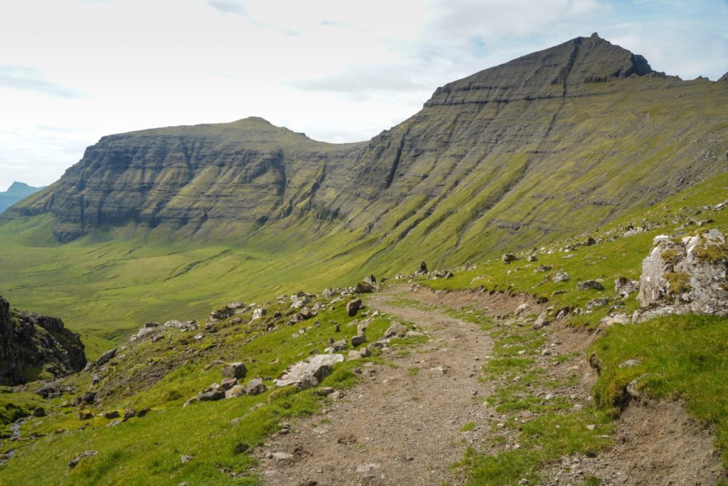
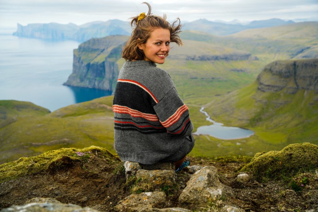
After descending for a short while, I soon started the ascent towards the second peak of the day, Jatnagarðar at 676 m. The hike was easy and enjoyable, and I made sure to take it slow so I could take everything in. Here I was, standing on the mountains of my favourite island in my favourite country. With breathtaking views, fresh air and as much clean water as I desired.
It was almost like a dream.
And it was so good that I didn’t want to leave. I spent ages messing around with my new camera and GoPro, capturing images from all angles, playing with the landscapes that continued to take my breath away.
Halfway between the two mountains, I came to a place called Akranesskarð where the ridge edges narrow and the drops are steep. I clung to the left side where the edge was less steep, and made it over safely for a short and easy ascent to the summit with new-found energy.
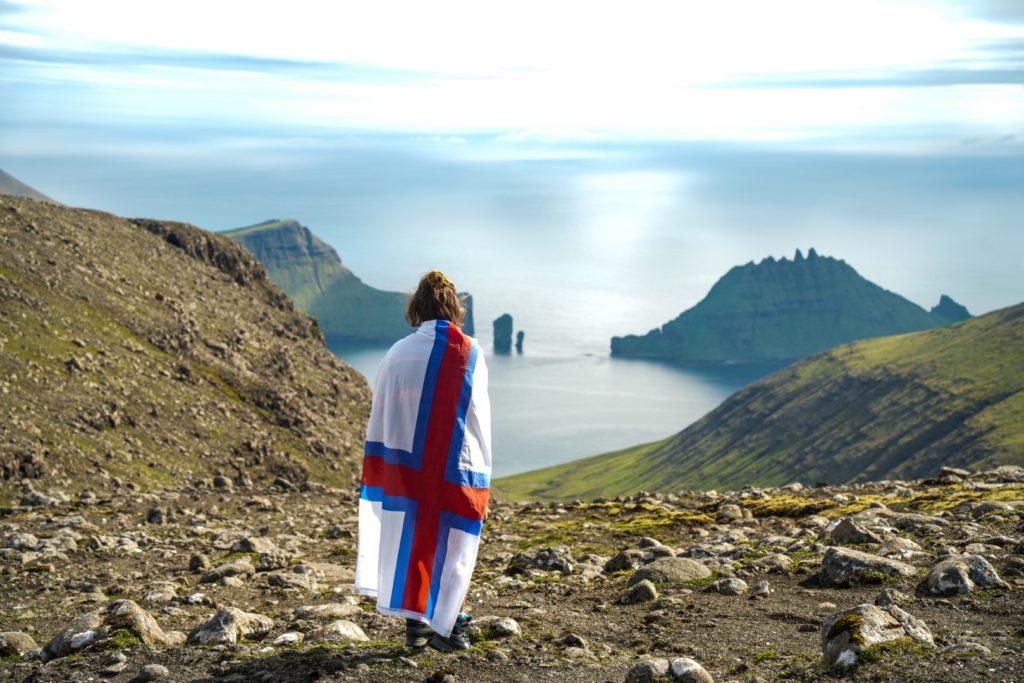
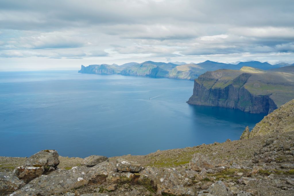
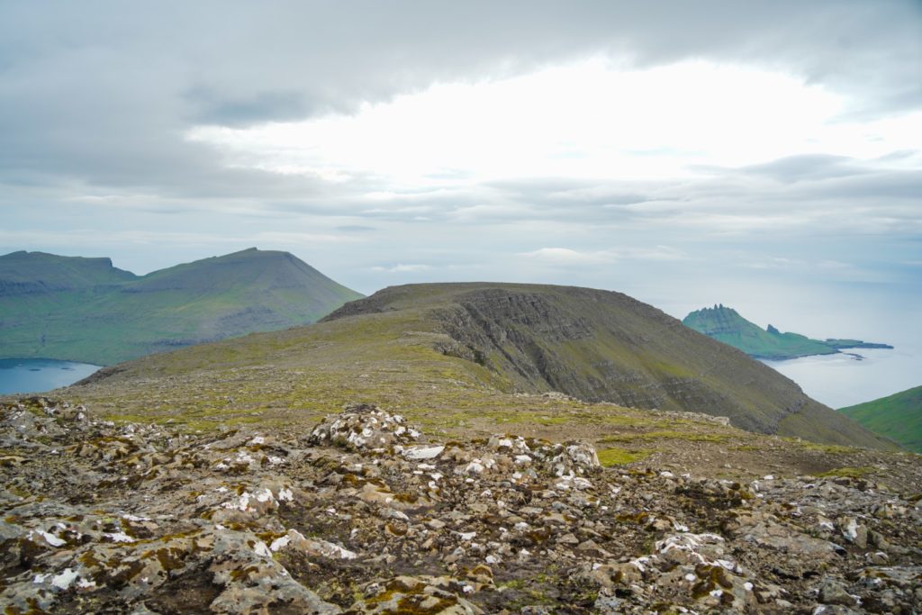
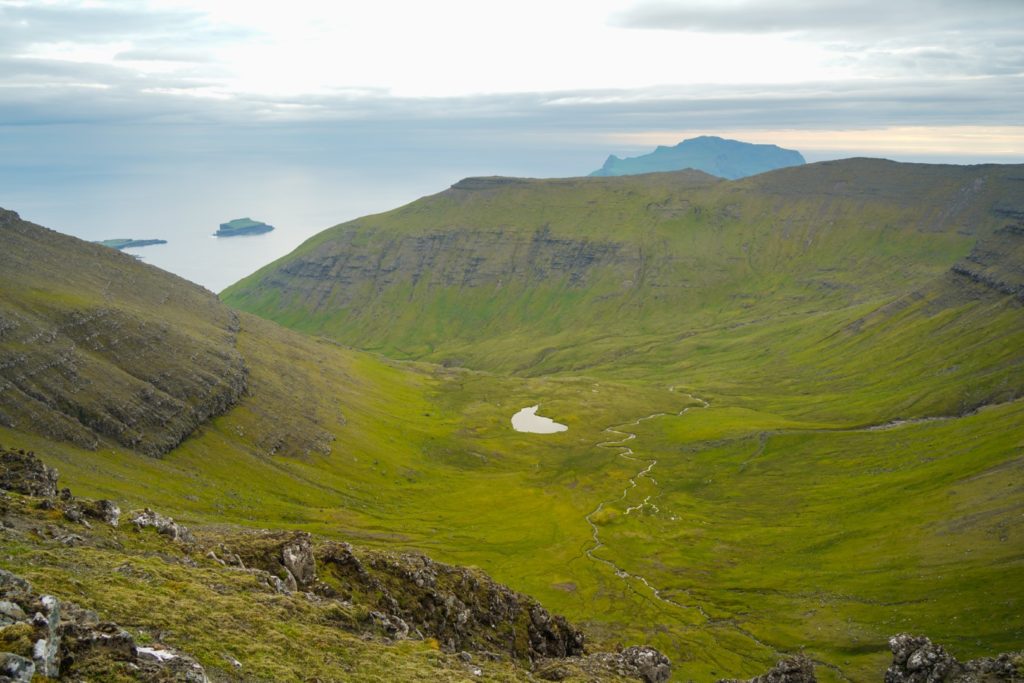
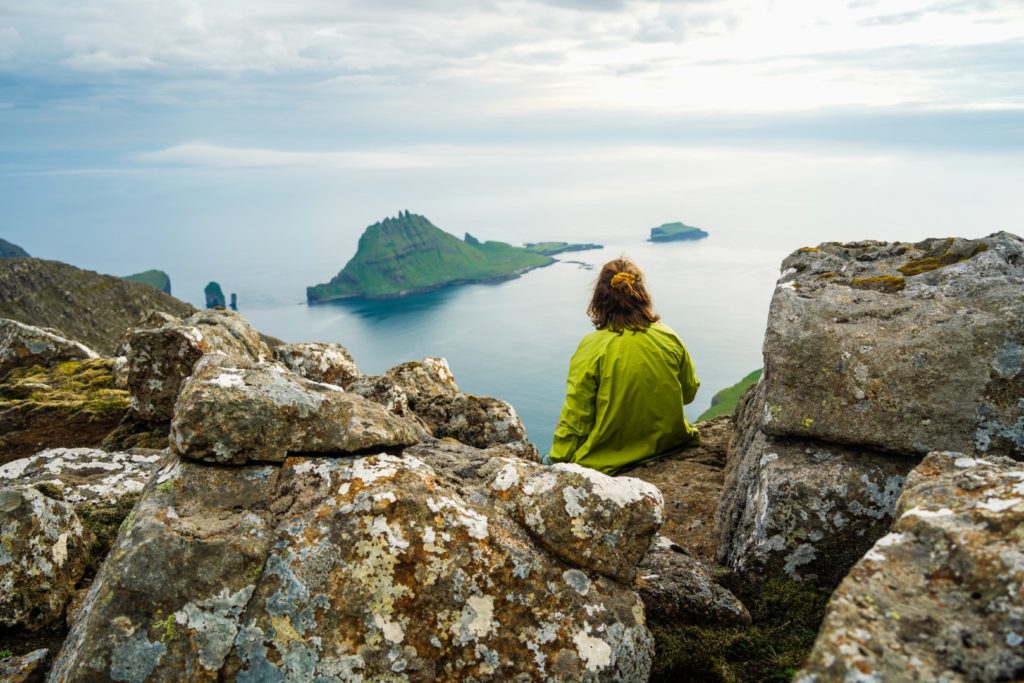
Fog rolled in over the neighbouring island of Streymoy as I continued straight ahead towards the flat summit of Knattarheyggjur at 630 m. Thankfully, the fog never reached me on Vágar, nor did it hover above the islets in the ocean beyond Vágar that provide possibly the best view in the entire country.
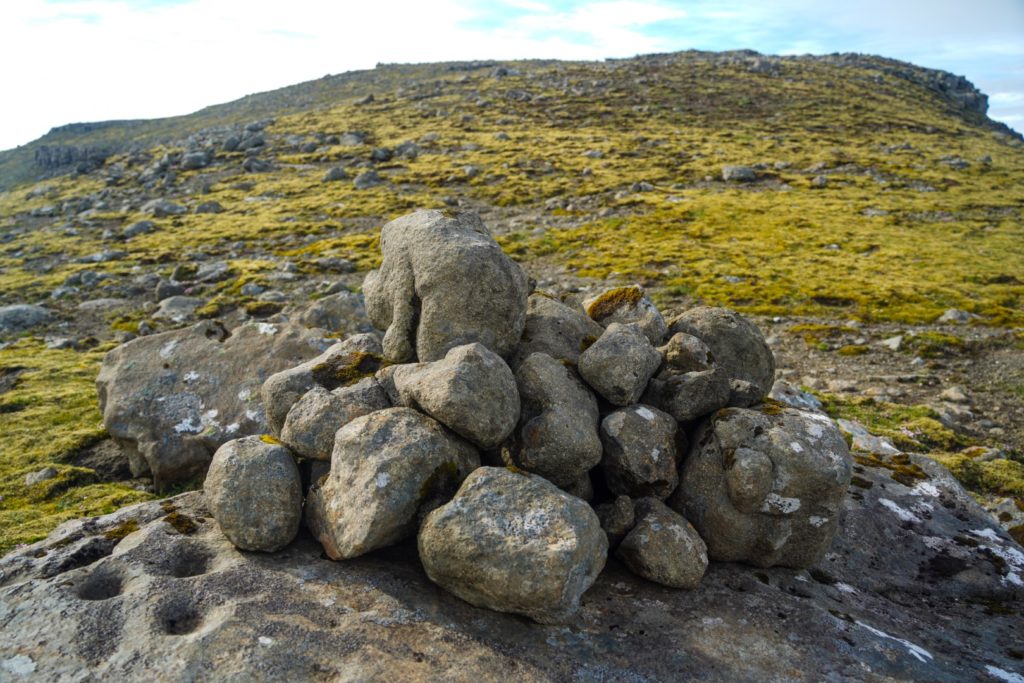
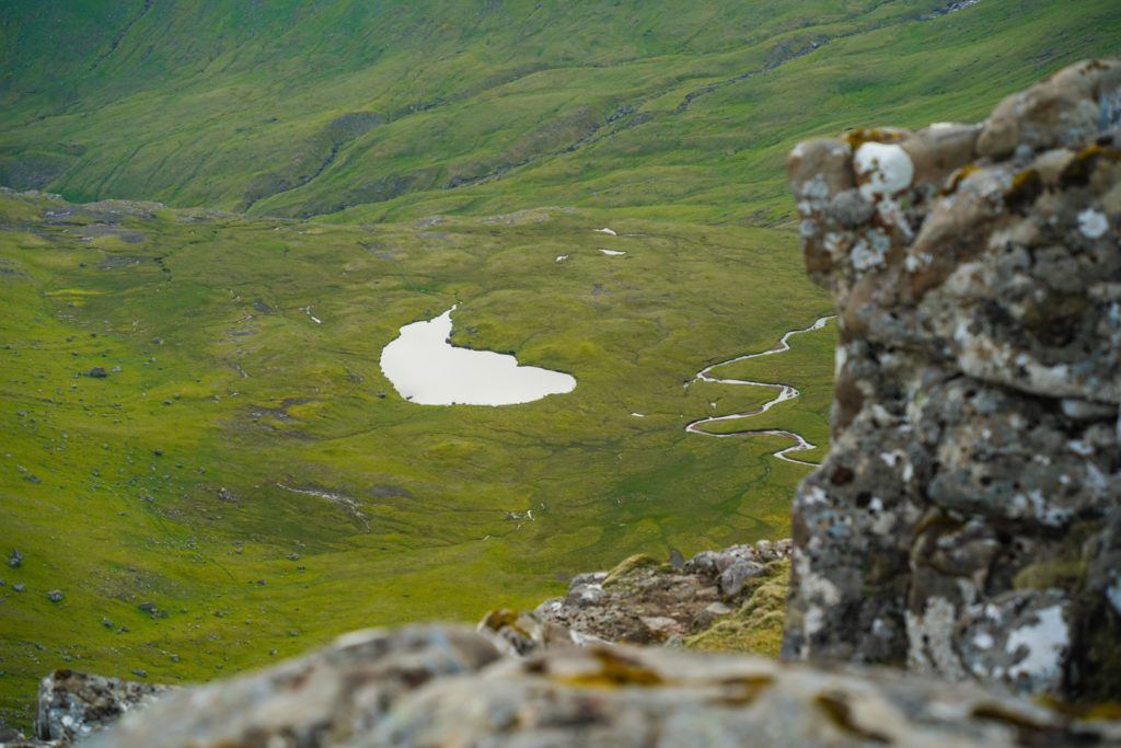
The descent from Jatnagarðar was nice and easy, and the ascent was equally easy, but it still took me ages to complete as I kept stopping for photos. By then, the small lake of Hvilvtkinnavatn, which is also the most isolated lake on Vágar, had come into view, giving me photo opportunities I just couldn’t miss.
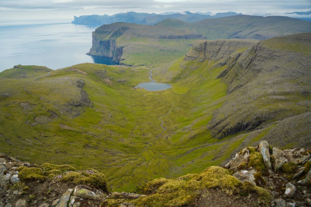
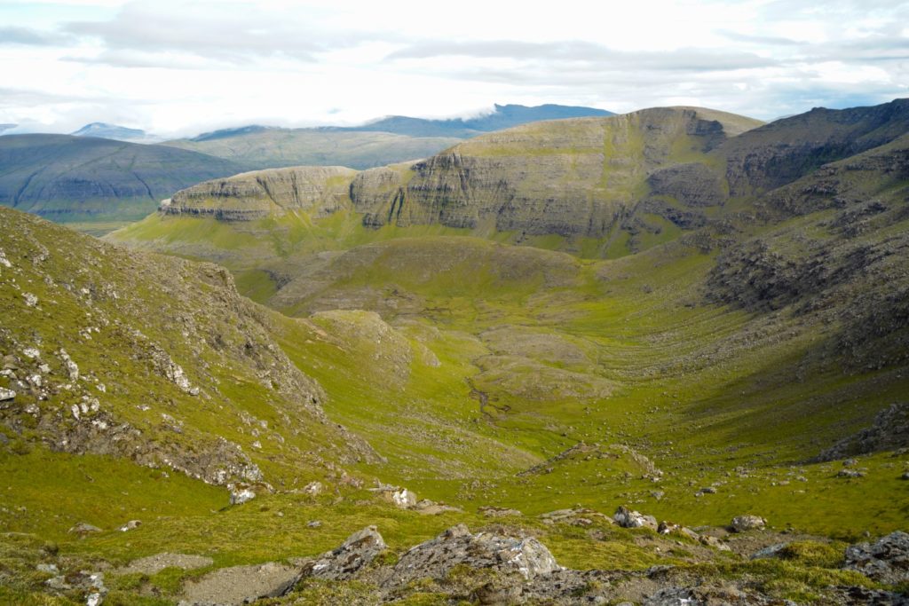
Descending towards Berinartindur, the fourth and last mountain of the day, I made sure to stay near the edge of the ridge to get a view of a small lake I’d never seen before. That lake is called Tjørnudalstjørn, something I first learned after hiking to the lake itself some days later.
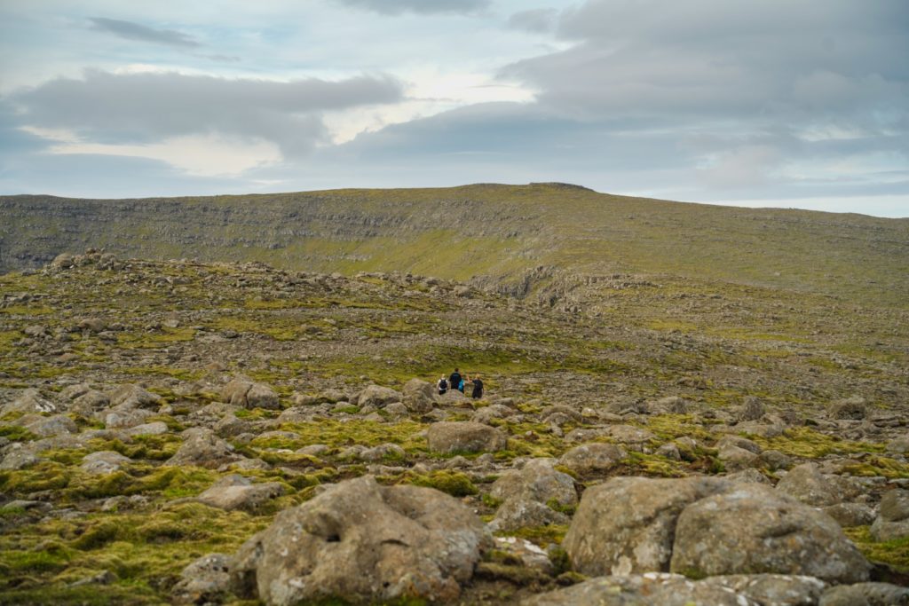
The easiness of the hike continued as I trotted towards Berinartindur. I was surprised to meet four locals that were doing the same route as me but reversed. It was 7 PM by then, but it really doesn’t matter when you start your hike on the Faroe Islands in the summer as the sun sets late and it never truly gets dark.
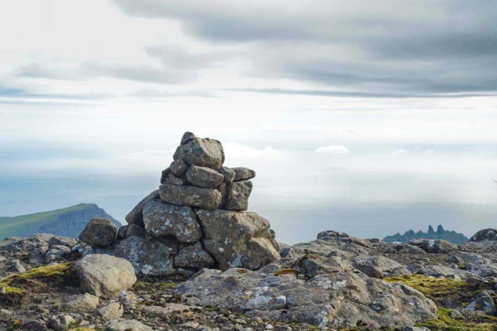
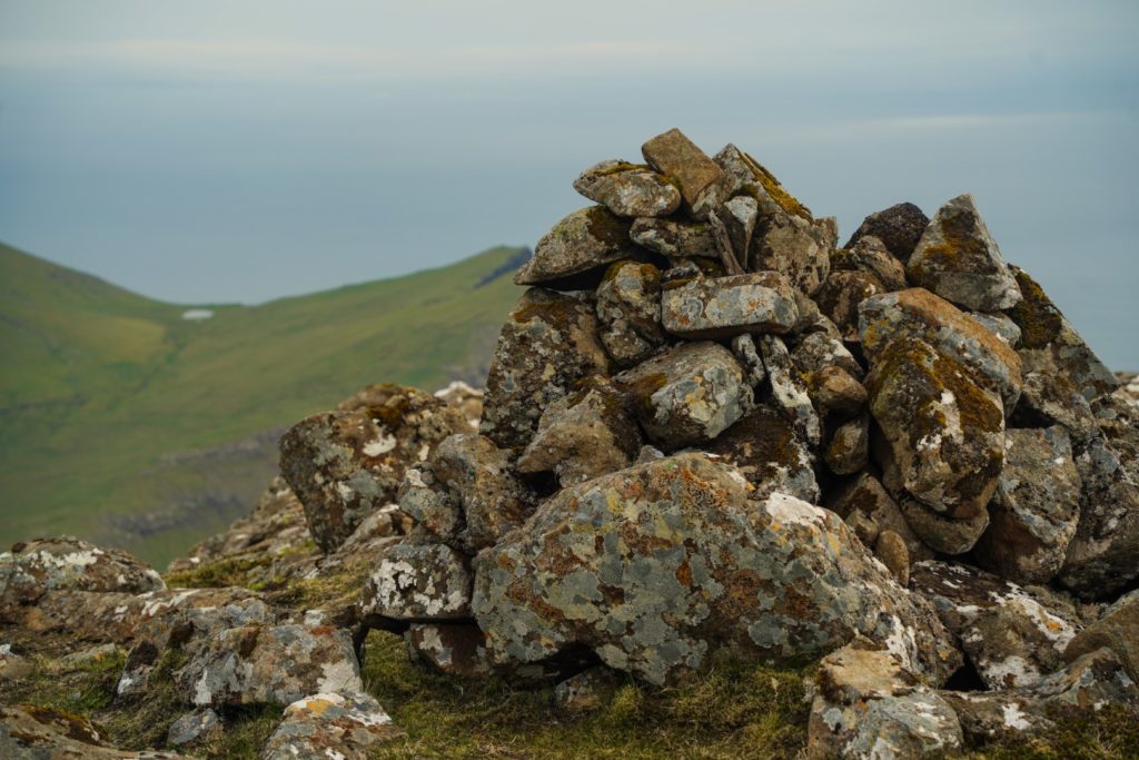
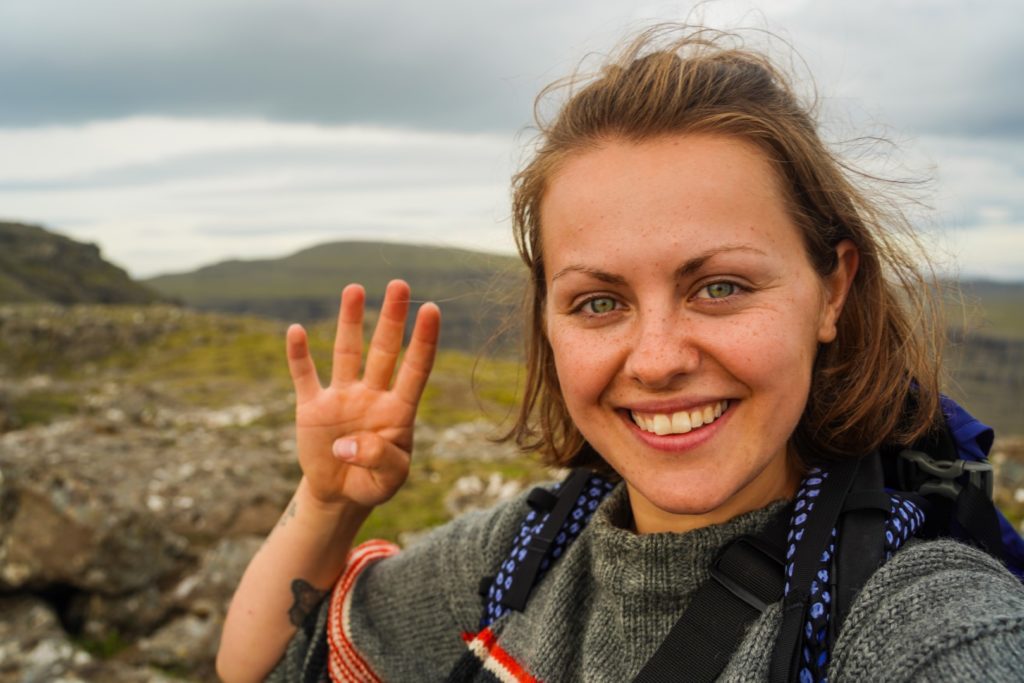
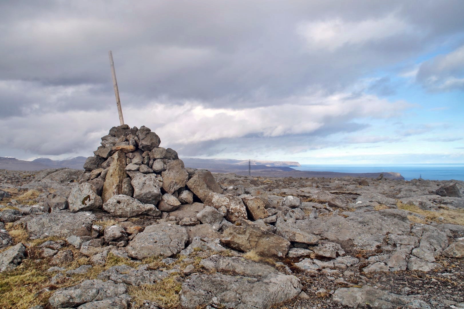
The villages of Bøur and Sørvágur came into view as I neared the summit. And then came the biggest challenge of the day. I had to descend a little to then ascend over a very narrow ridge. Nervously, I made my way through, and clung onto the rocks as I climbed over the ridge. And then I saw it. The summit cairn! After 6,5 hours, I had finally reached the fourth mountain of the day – and the 39th mountain on Vágar. Just two to go!
With Bøur just below me, I was expecting a quick and easy descent, but it was far from it. Most of the time, I was going sideways, minding every step I took down the steep mountain. Once in a while, when the grass wasn’t full of rocks, I sat down on my butt and slid down. It took me over an hour just for this short stretch because of how steep it was!
Once I was safely back down in Bøur, I walked along the road, happy to stretch my legs and walk on flat terrain again. I ended up having to walk to Sørvágur before a young local picked me up. He was out for a drive with no predecided destination – something very Faroese! Why go for a walk when you have a car? 😂
Hiking route description: Eysturtindur, Jatnagarðar, Knattarheyggjur and Berinartindur
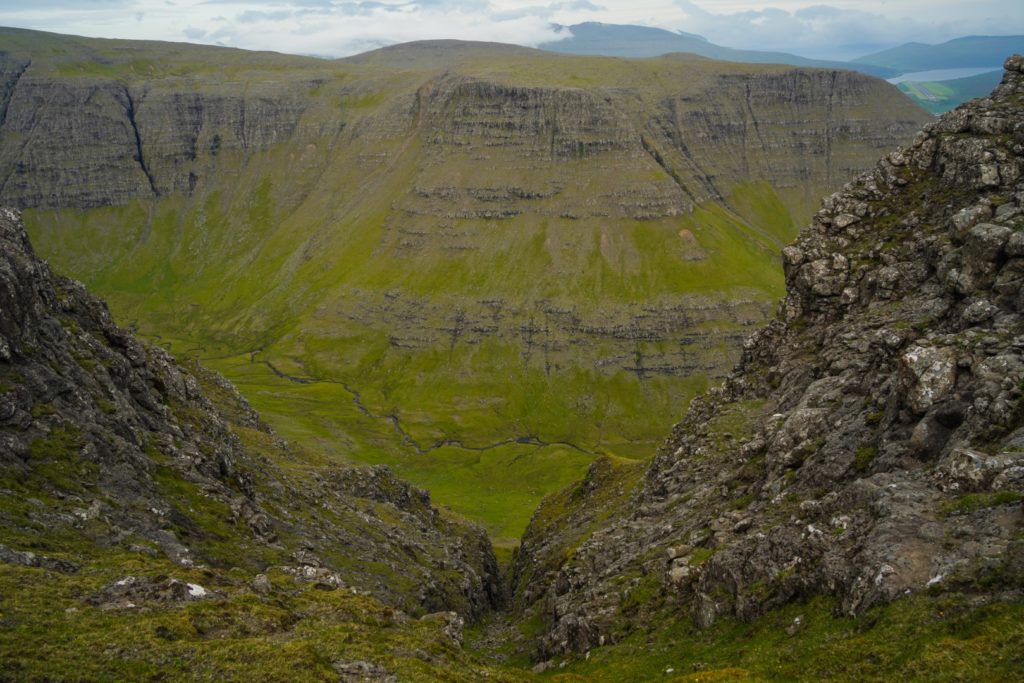
The hike begins in Gásadalur at the end of Gerðisvegur. Follow the dirt track to two gates that you have to open to enter the valley where the dirt track begins. Follow the dirt track which is marked with cairns to the end of the valley and head up the well-trodden footpath that goes up into the mountains to your right.
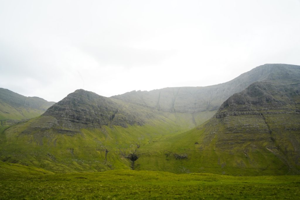
Shortly before you reach the top of the trail, head to your right towards the summit of the first mountain, Eysturtindur (715 m.). The ascent is long, but easy. Only the last part of the summit climb is steep and near a vertical edge, so do take care here.
Continue to the next peak, Jatnagarðar at 676 m. You’ll have to descend a little to an area where the mountain ridge narrows and the drops are vertical. Keep to your left and then begin the short and easy ascent towards the summit. Look in front of you and you’ll see the next mountain, the flat peak of Knattarheyggjur (630 m.). This stretch is even easier than the previous ascents, so take your time to enjoy it.
The fourth and last mountain, Berinartindur (524 m.), is in front of you towards the ocean. Descend from Knattarheyggjur and stay on the right side of the ridge for a lovely view of the small lake of Tjørnudalstjørn. The ascent to Berinartindur is long but very easy. It’s only the last few metres that are tricky. You’ll have to first descend a little and then ascend over a narrow ridge. Take care here as both sides have steep, vertical drops. When you reach a gorge on your left, climb up the rocks in front of you. The last stretch to the summit cairn is easy.
Depending on where you want your hike to end, descend towards your left if you want to end at Bøur or towards the right if you want to return to Gásadalur (going through the tunnel – so remember a flashlight!). The way to the tunnel looked a lot easier than the way to Bøur, which was the one I took. The descent is long and steep, but it’s easy to find your way as long as you just head towards the village. You might have to jump a fence or two to reach the road, so remember to not damage them if you do.
The hike is ca. 8 km, takes 6-7 hours and is of moderate difficulty.
Leave a Comment
Pingback: My best travel moments of 2021 – I Live as I Dream on 16/08/2021
Pingback: Summiting Árnafjall and Heinanøva, my final two peaks on Vágar – Northtrotter on 16/08/2021

6 COMMENTS
Heini Davidsen
3 years agoHavi sagt tað ofta: “Tú ert ófør!” Tú hevur sæð meira av Føroyum enn flestu føroyingar,og væl meira enn eg sjálvur. Men at lesa tínar frásøgnir er sum ar vera har sjálvur. Halt áfram at gleða okkum. Blíða heilsan og góðan ferðahug. Heini
Melissa Cherry Villumsen
3 years agoTúsund takk, Heini! Det betyder meget at få det at vide fra en færing! Tak for alt, hvad du har lært mig! Jeg savner vores undervisningstimer i Kbh 😀
Alba
3 years agoHi Melissa,
I’ve just came back from the Faroe Islands and your blog was a great inspiration for planning the trip! Wished this post would have come some weeks ago, it looks so beautiful! 😀 I hiked to Dunnesdrangar Cliffs following your post, and I loved it. I was a bit worried to be trespassing though.
I’ve loved Faroe, but being so used to hike in Denmark/Sweden/Norway, I found that not all the hikes were so well marked. We mostly focused on the hikes appearing in the hiking Faroe official guide or those with clear markings for safety. Personally, I think there’s some room for improvement on that, which would also make it better for sustainable tourism/hiking and keeping farmers’ land and nature well cared.
Cheers,
Alba
Melissa Cherry Villumsen
3 years agoHi Alba!
I hope you had an amazing trip – I’m so glad my blog posts were a help for you!
As for trespassing, unfortunately, it’s impossible not to do that on the Faroe Islands as every bit of land is privately owned. So it’s all about being as respectful as possible 😀
Yeah, the country is quite new with tourism and so, most hikes aren’t marked. I like that though, it feels more “real” in a way, and you get to choose your own way. But for sure it could be better in terms of making sure tourists keep to the desired areas, but marking a trail would certainly also mean an increase in hikers to that specific area which I’m not sure the farmers would be interested in. I cover all the hikes I do on the Faroes so the people that do find my blog will have more hikes to choose from – that way, the popular trails might get a break, and tourists will be more spread out. Either way, I hope tourism doesn’t take off even more than now as the impact is already visible, especially at places like Trælanípan, Mykines and Gjógv.