The mighty Alps span eight countries, but did you know that they’re also home to a number of geographical oddities? There’s a piece of Germany AND Italy inside Switzerland. Three parts of Austria are cut off from the rest of the country and can only be reached via Germany. There’s a lake that belongs to no country. And there’s even a mountain where four borders meet in a quadripoint on the summit! There are also a number of tripoints in the Alps where three country borders meet, as well as two towns that are cut off from their motherland by the river Rhine!
This is a mini guide to all of the geographical oddities of the Alps. Maybe you’re a geography nerd like me and enjoy seeking out these unusual places, or maybe you’re just curious to explore alternative places in the Alps that don’t see many tourists (Kleinwalsertal excluded). Either way, I hope this guide will be helpful and interesting to you. It sure was fun gathering all the information!
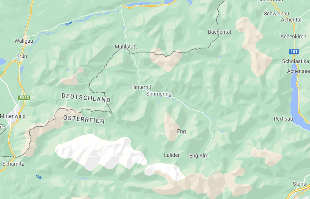
Hinterriß-Eng, the prettiest Austrian pene-exclave
Hinterriß-Eng is one of three Austrian pene-exclaves (or practical exclaves), which means that an area is geographically connected to its motherland but cannot be reached without going through a different country – in this case Germany. Hinterriß-Eng is the least populated of the three, with just 41 people living there year-round.
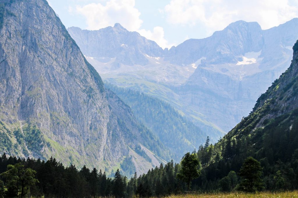
Hinterriß-Eng is situated in a rift valley at 928 m. above sea level, and is separated from the rest of Austria by the Karwendel mountain range with peaks reaching over 2,000 m. The other two Austrian pene-exclaves, which I’ll touch on below, both had tax-free status until Austria joined the EU in 1995, but Hinterriß-Eng has never had a special status.
Hinterriß-Eng is by far the least visited of the three pene-exclaves which is partly due to its rather isolated location, and partly because it’s simply less known than the other two. However, it’s well worth making the journey there. I thought Hinterriß-Eng was the most beautiful of the three!
Read more: Hinterriß-Eng: Discovering Austria’s unknown pene-exclave
How to get to Hinterriß-Eng
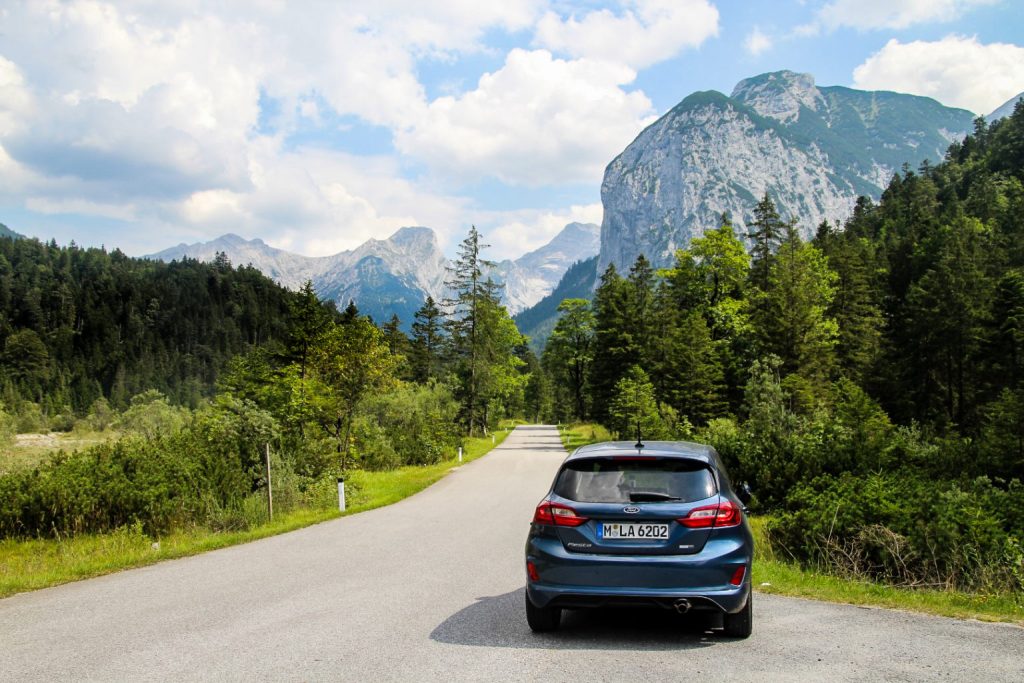
Hinterriß-Eng is best reached by car or taxi. The pene-exclave can be entered via the tiny German town of Vorderriß, which can be reached from two sides, either via the small toll road Risser Straße/Mautstraße Wallgau-Vorderriß or the road B307 from Bad Tölz. The latter was closed due to construction work when I tried to go in August 2020, so I had to take a detour of 1,5 hour and enter via the toll road which I paid 5 euros for. This small road can be a bit hard to locate, but it’s just north of Wallgau and 9 km south of Walchensee. Once you reach Vorderriß, turn right and you’ll soon be at the Grenzbrücke where you’ll enter Hinterriß-Eng (and Austria!).
The village of Hinterriß can be reached year-round, but the road leading to the settlement of Eng is closed in the winter – and in the summer it’s a toll road costing 4,5 euros. The road is a total of 19 kilometers long, and this is the only road within the pene-exclave (although there are hundreds of hiking and mountain biking trails!).
If you’re not travelling by car, it’s still possible to reach the pene-exclave from June to mid-October. A bus runs from Lenggries in Bavaria to Eng twice a week. Read more about tickets and the timetable here!
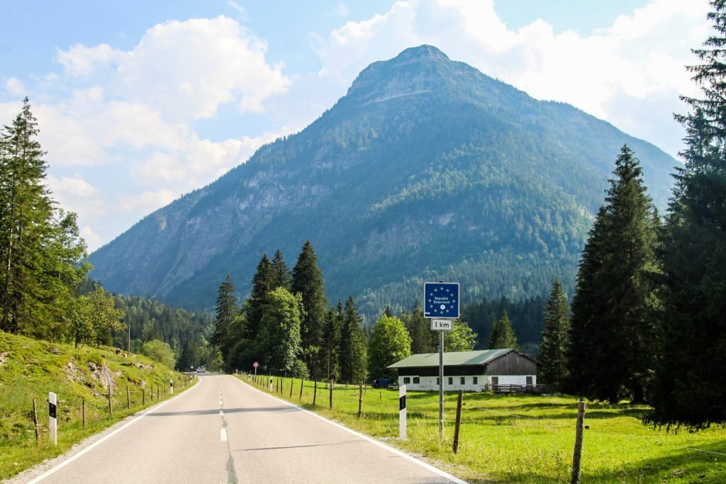
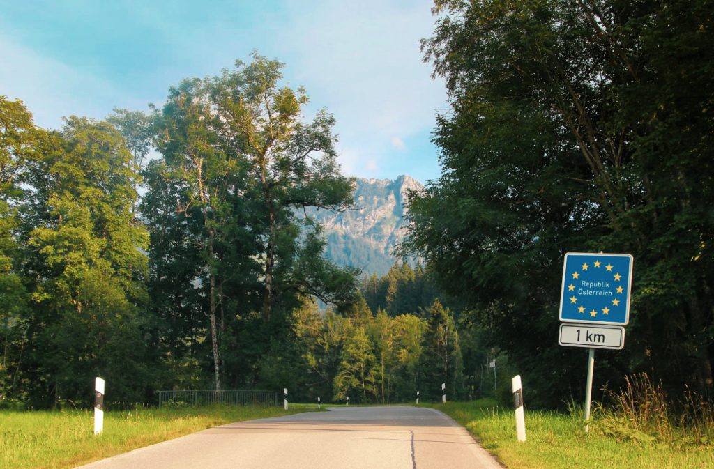
There is no border control, in fact there is hardly a noticeable border at all. There’s a sign for Austria 1 km from the border, and two signs for Bavaria and Landkreis Bad Tölz-Wolfratshausen at the border, but none for Germany as a whole.
What to see and do in Hinterriß-Eng
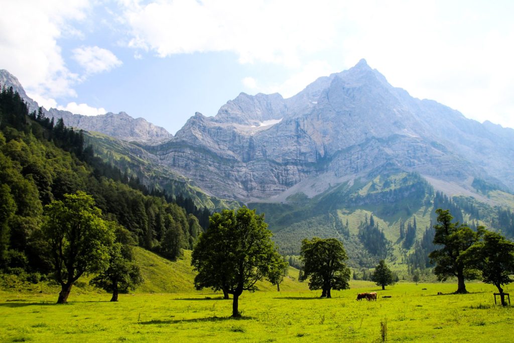
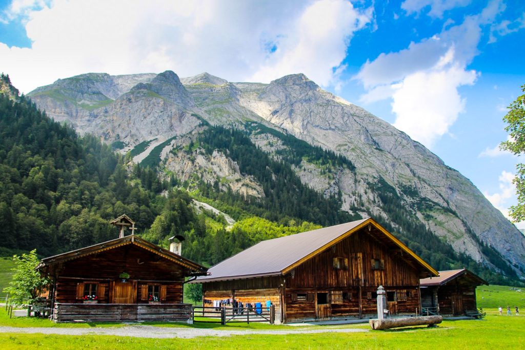
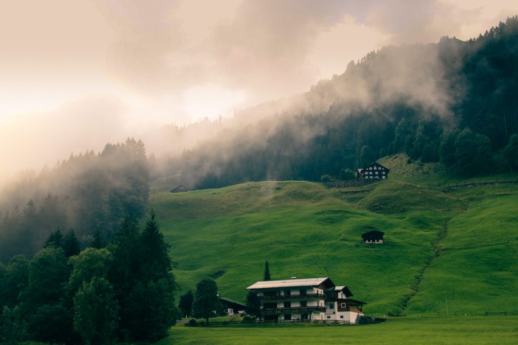
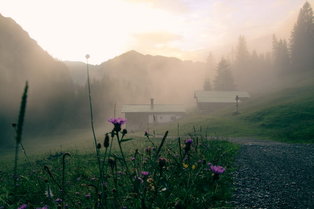
- Go hiking, mountain biking or skiing. Hinterriß-Eng is incredibly beautiful, nestled below the high Karwendel range, with turquoise rivers, green pastures and traditional Tyrolean houses. There are trails in every direction, so you could easily spend weeks exploring!
- Visit the quaint summer village of Eng. Located at the end of the only road in the pene-exclave is Eng, a small collection of traditional Tyrolean houses, cafés and restaurants. The village is also home to Tirol’s largest alpine dairy farm. It’s without a doubt the most beautiful part of the pene-exclave! Road access is blocked in winter, and hikers and ski tourists are prohibited to enter the area due to the risk of avalanches. So if you want to see Eng, you should visit during the summer!
- Explore Große Ahornboden. This large sycamore maple grove is home to hundreds of 300-600-year-old gnarled sycamore maple trees. The area was declared a natural monument in 1927 and is one of the oldest protected natural areas in Tyrol. You’ll find it one kilometre before reaching Eng.
- Dip your feet in the river Rißbach. The source of the river is in the Karwendel mountains, which means that the water is clean and as turquoise as can be. It’s the perfect way to cool down on a hot summer day.
- Take a walk through Hinterriß. Enjoy a lunch or just take a stroll through the pene-exclaves largest town.
- Explore the church of Maria Schmelz. Located in Hinterriß, this small church from 1744 features a beautiful golden interior and colourful murals on the exterior.
Jungholz, the most intriguing Austrian pene-exclave
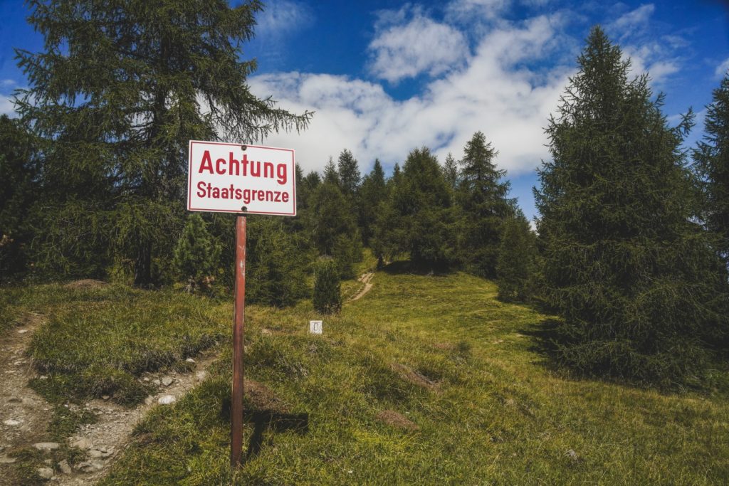
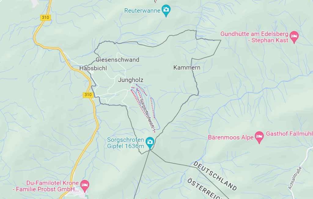
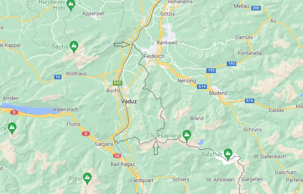
Jungholz is another of Austria’s pene-exclaves which can only be reached via Germany. But Jungholz is different than the other two, as it’s only connected to its motherland by one point – the summit of Mt. Sorgschrofen at 1.635 m. above sea level (read more below), located in the Allgäu Alps! As far as I’m aware, it’s the only pene-exclave of this kind in the world, so that in itself is pretty special!
The historical connection between Jungholz and Austria dates back to 1342, when Hermann Häselin, a farmer from Germany, sold the area to Heinz Lochpyler, a taxman from Austria, who incorporated the area in his other possessions in Tyrol. In the Bavarian-Austrian border treaty of 1844, Jungholz officially became part of Austria, although the area formed a customs union with Germany in 1868. Jungholz was included in the German customs area until Austria joined the EU in 1995, and the pene-exclave continued to use the Deutsche Mark instead of the Austrian schilling as currency until the Euro became the currency in both countries. Jungholz is home to around 300 people, and if you want to send one of them a letter, you can choose if you want to use a German or Austrian postal code!
Read more: High up in the Alps: Standing between four borders on Mt. Sorgschrofen
How to get to Jungholz
The easiest way to reach Jungholz is by car or taxi. There are two roads in, both coming off B310. The main road in is St 2373/L23, which is found just 4 km south of Wertach in Germany.
If you’re not coming by car, you can catch a bus to Jungholz. Bus 48 runs from Sonthofen in Germany to the centre of Jungholz, although I wasn’t able to find out if it goes year-round. You can find the timetable here. There’s also a bus connecting Jungholz with Oberjoch and Unterjoch between late April and late December. Click here for the timetable.
There is no border control but there are signs for both countries to let you know when you’ve crossed the border.
Looking for a place to stay? There’s a very scenic and cozy campsite in Jungholz, located just after the border crossing in the village of Habsbichl. I paid 11 euros for a night in my tent, including parking.
What to see and do in Jungholz
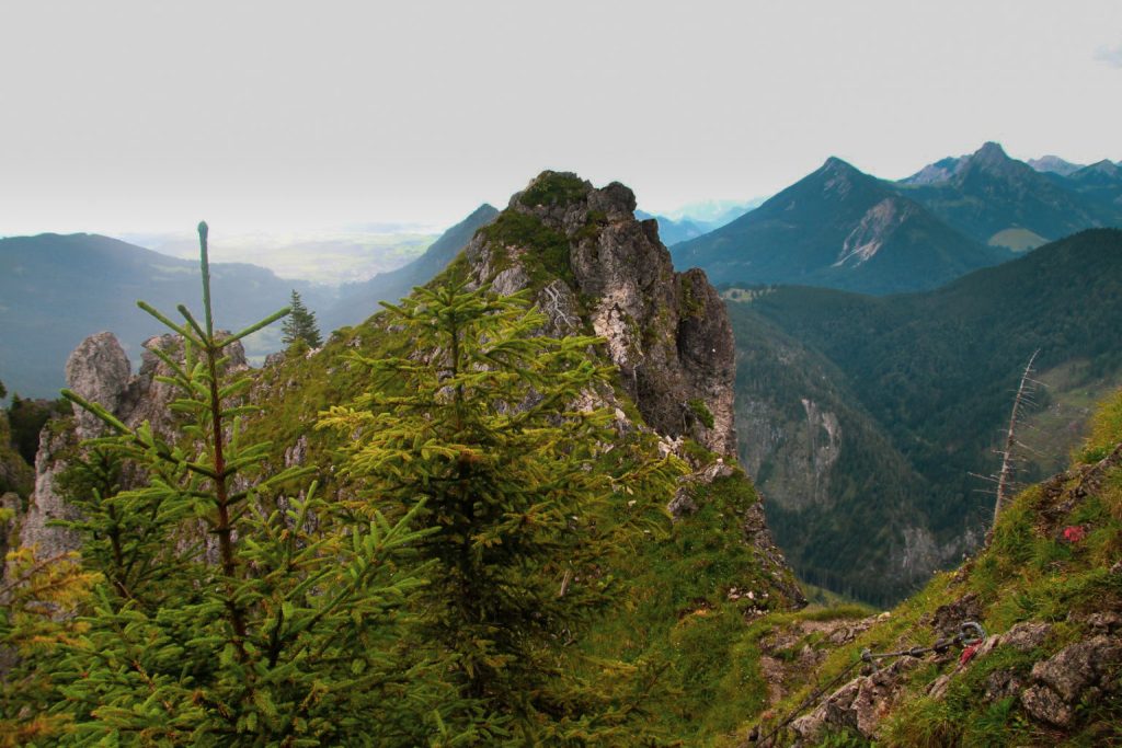
- Climb Sorgschrofen. It’s the ultimate thing to do in Jungholz in the summer if you’re a geography nerd or just love hiking. Do not attempt this hike in the winter or in bad weather, as the ascent to the summit is steep and rocky. A full description of the hike can be found below!
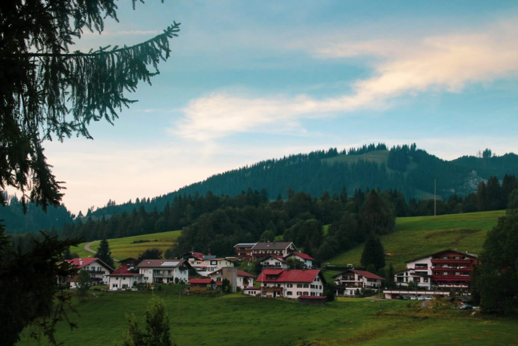
- Go hiking, mountain biking or skiing. There are trails in every direction, and Jungholz offers beautiful views throughout. Pick any trail, you really can’t go wrong!
- In the winter, take the skilift halfway up Sorgschrofen. The views are mesmerizing from here, and apparently the slopes are quite family friendly! Read more here.
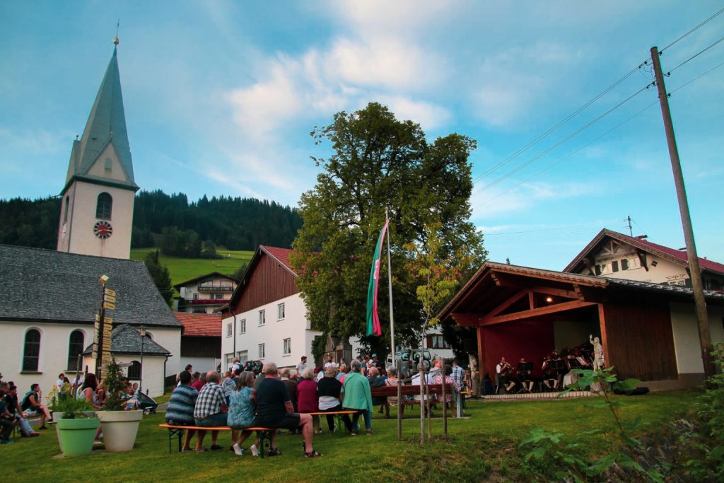
- Enjoy the atmosphere in the small villages. There are four small villages within Jungholz, with quaint Tyrolean houses, little cafés and gorgeous churches. I got lucky and ran into a small concert with local folk music!
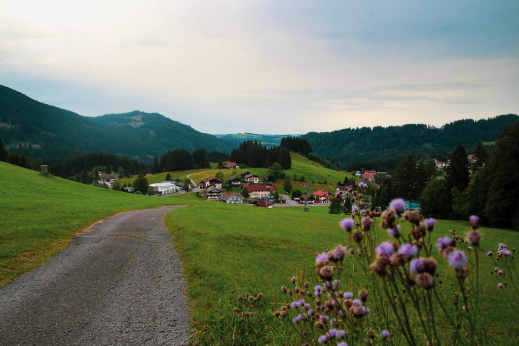
Kleinwalsertal, the most popular Austrian pene-exclave
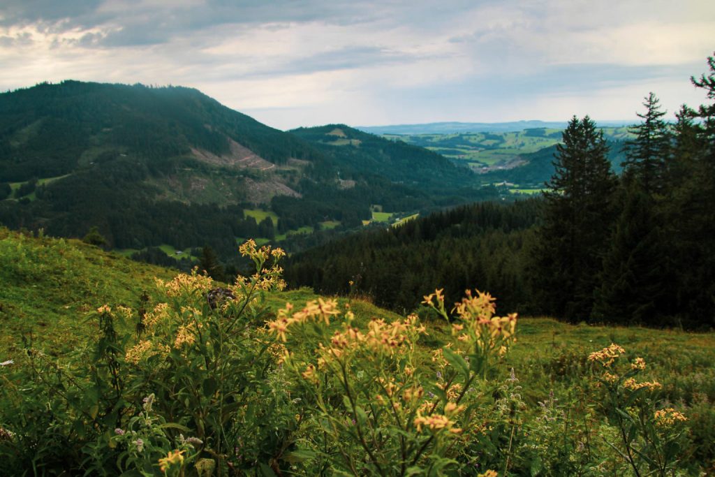
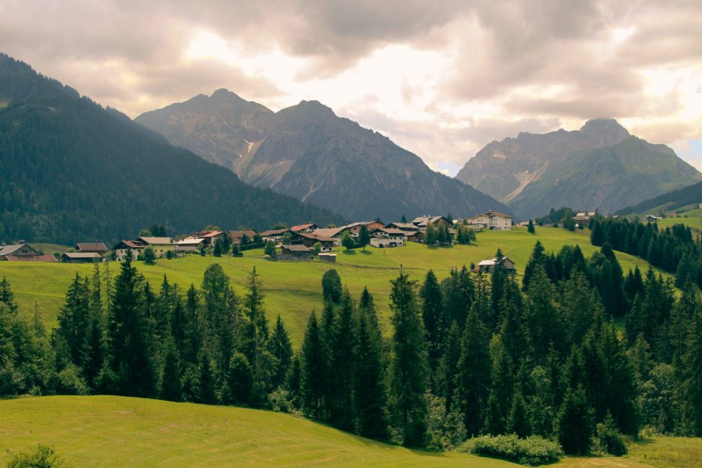
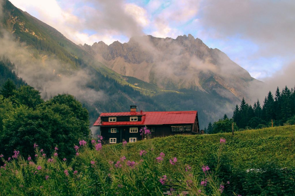
The Kleinwalsertal Valley is by far the busiest of the three Austrian pene-exclaves with approximately 5,000 inhabitants and almost two million tourists per year. The valley is well-known for its ski and hiking resorts, and it especially attracts young families and seniors – and the odd geography nerd like me! If you’re looking for outdoor adventures, Kleinwalsertal is the best pene-exclave to visit as the hiking and mountain biking trails are endless, and it turns into a ski paradise in winter!
Just like the other two Austrian pene-exclaves, Kleinwalsertal can only be reached by road via Germany since the Allgäu Alps stand between the valley and the rest of Austria. Kleinwalsertal used to be part of a customs union with Germany and use the German Marks as currency, but since the introduction of the Euro in both Austria and Germany in 2002, you barely notice when moving from one country to the other. However, the weird geography still causes some headaches despite both countries joining the union. For example, Kleinwalsertal’s football club, SV Kleinwalsertal, plays in a German league – I guess it’s just too much of a detour to play in an Austrian league!
Read more: After the rain: A spontaneous hike in Austria’s Kleinwalsertal Valley
How to get to Kleinwalsertal
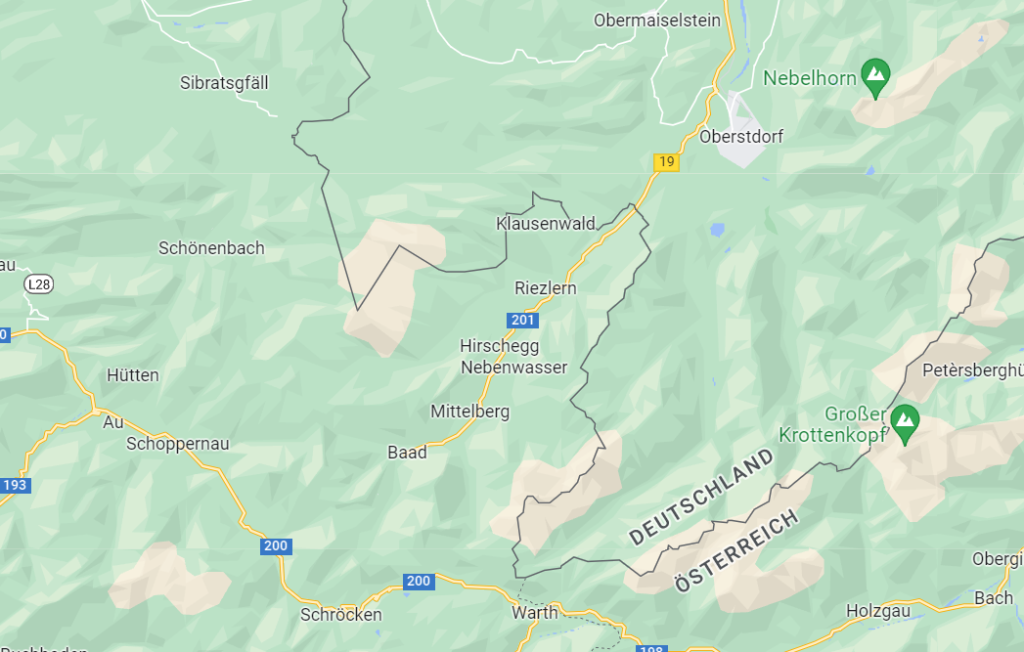
There is only one road in to Kleinwalsertal, highway 19 via Sonthofen and Oberstdorf in Germany. This is also the main road that goes through the valley and connects to all the villages.
Be aware that parking is costly in Kleinwalsertal. I didn’t see any free parking spots, except for one just outside the pene-exclave. So expect to pay quite a bit if you’re coming by car!
If you’re not travelling by car, there is a bus from Oberstdorf bus station in Germany that goes all the way to Baad at the end of the road in Kleinwalsertal (Walserbus Line 1). Within the pene-exclave, the Walserbus has four other bus lines so getting around without a car is very easy. You can find all the timetables here.
There is no border control, but there are several signs and flags for both Austria and Germany.
What to see and do in Kleinwalsertal
- Go hiking, climbing or mountain biking in the summer. Kleinwalsertal has over 800 trails to explore! If you’re into climbing, two popular climbing routes (Mindelheimer Klettersteig and Zweienland Klettersteig) are accessible from Kleinwalsertal. For hiking, I can recommend the short five-kilometre Gemsteltal loop, which was especially beautiful after a heavy rainfall!
- Go skiing in the winter. Kleinwalsertal is famous for its ski resorts, so this is the perfect place to come if you enjoy the slopes!
- Explore the valley’s three villages; Mittelberg, Hirschegg and Riezlern.
- Drive up high for viewpoints. There are plenty of viewpoints to be found throughout the valley. One of my favourites was right next to the Fatima-Kapelle just north of Riezlern!
Büsingen am Hochrhein, a slice of Germany inside Switzerland
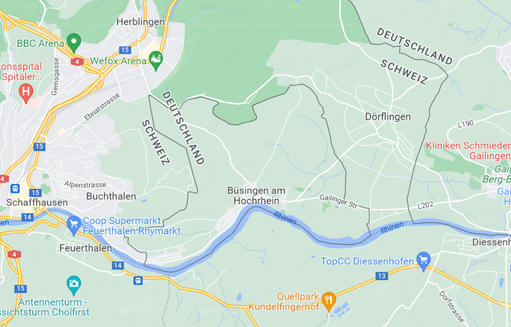
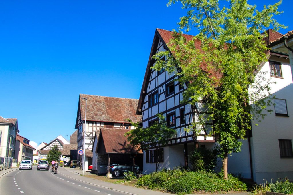
In the northwest corner of Switzerland, on the foothills of the Alps, you’ll find a tiny slice of Germany – more precisely, the German exclave, Büsingen am Hochrhein. This isn’t a pene-exclave like the Austrian ones described above; this one is entirely removed from its motherland, Germany, and surrounded by Switzerland! The rest of Germany is only 680 metres away, separated by a narrow strip of land.
The tiny exclave was long under Austrian control although the Swiss authorities often tried to annex the area, especially during the 17th and 18th centuries. In 1835, the conflict was settled when Büsingen became part of the German customs territory. In 1918, after the First World War, a referendem was held in Büsingen in which 96 % voted to leave Germany and become part of Switzerland. However, this never happened as Switzerland couldn’t offer any suitable land in exchange to Germany. The exclave was formally defined in 1967, and Büsingen officially entered into a customs union with Switzerland. At the same time, the former German exclave of Verenahof, consisting of just three homes, became part of Switzerland.
The 1,400 inhabitants of Büsingen have since managed a binational existence where they’re politically and legally part of Germany, but economically Swiss. It’s the only place in Germany that doesn’t belong to the EU nor uses the Euro, instead it unofficially uses the Swiss Franc. The local football team, FC Büsingen, is the only German team to play in the Swiss Football League. Swiss police are permitted to arrest German citizens of Büsingen and bring them into Switzerland. Both German and Swiss postal codes can be used to send letters to Büsingen, and letters may be franked with a German or Swiss stamp. Electricity is provided by Switzerland although the wall sockets are generally standard German Schuko sockets, and residents usually have both a German and a Swiss phone number. Residents can choose either a German or Swiss health insurance policy, and after primary school, children can go to either a German school or a Swiss school for secondary education. It must all be terribly confusing!
The borders are entirely open, although it hasn’t always been that way. Switzerland shut down the border during the Second World War, cutting the exclave off from the rest of the Third Reich. Today, you barely notice when you cross the border!
Read more: A brief visit to Switzerland and the German exclave of Büsingen
How to get to Büsingen am Hochrhein
There are several roads in to Büsingen and parking there is free.
Alternatively, bus line 25 runs hourly from Schaffhausen to Büsingen. You can find the timetable here.
Despite Switzerland not being in the EU, there is no border control when entering or leaving the exclave. It feels like entering any other Swiss village!
What to see and do in Büsingen am Hochrhein
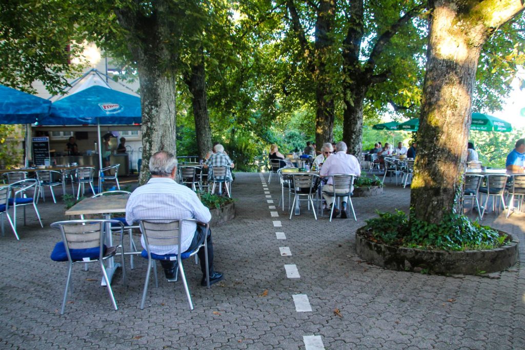
- Stand in two countries at once at Waldheim Restaurant. The border runs right through the restaurant and several of the tables, so you can have your plate in Germany while your glass is in Switzerland!
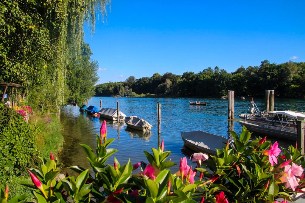
- Explore the village. Büsingen is a really cute village with half-timbered houses and beautiful Rhine river views.
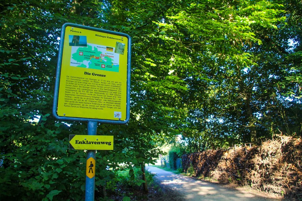
- Walk Enklavenweg. This well-signposted circular route takes you around the exclave while explaining life in Büsingen and its special geographical and political status.
- Swim to Switzerland. If it’s a hot summer day and you enjoy swimming, why not swim across the Rhine and enter Switzerland a little alternatively?
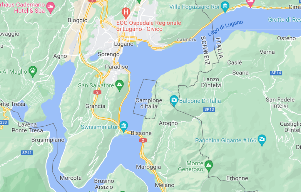
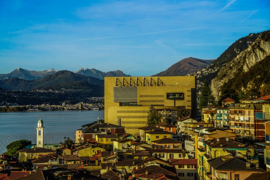
Campione d’Italia, a pocket of Italy inside Switzerland
Büsingen am Hochrhein isn’t the only exclave within Switzerland – as a matter of fact, there’s an Italian exclave located within the Swiss canton of Ticino called Campione d’Italia! The exclave is beautifully situated on the bank of Lake Lugano and is home to around 1,800 people. At its closest, the exclave is just one kilometre from the rest of Italy. However, due to the challenging mountainous terrain, reaching the nearest Italian town requires a journey of more than 14 kilometres through Switzerland!
The exclave was formed in 1798 when Ticino chose to become part of Switzerland, while the residents of Campione wanted to remain part of Italy. A referendum was held in 1814 and the citizens voted against joining Switzerland. However, during the Unification of Italy in 1848, Campione sought annexation by Switzerland, but the request was denied because Switzerland wanted to remain neutral. In the 1930s, Italian dictator Mussolini added “d’Italia” to Campione’s name to emphasize that it is indeed part of Italy.
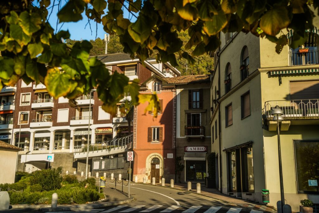
Today, Campione d’Italia is known for its unique status as a tax haven and for having one of the largest casinos in Europe! Going against the wishes of the residents, the exclave became part of the EU customs territory in 2020, however the tax rate remained that of Switzerland which is significantly lower than in Italy. The mail system also changed as before Campione d’Italia used to have both Swiss and Italian post codes, but after 2020, the Swiss code became invalid. However, the telephone system remained Swiss, with the one exception being the town hall, which can only be reached using the Italian dialing code!
Read more: Blog post coming soon!
How to get to Campione d’Italia
There is only one road in to Campione d’Italia, the road Via Campione that connects to the Swiss village of Bissone. There is plenty of free parking within the exclave.
Alternatively, you can catch bus line 439 from Lugano, which will get you there in just 25 minutes. Check the timetable here!
As a more scenic (but also more expensive) option, you can take a 15-minute ferry from Lugano. See more here!
There is no border control but unlike the other exclaves and pene-exclaves mentioned in this post, there is a clear marking of the border in form of an ornamental gate ordered by Mussolini in the 1930s!
What to see and do in Campione d’Italia
- Go crazy in Casino di Campione. The main attraction in the village which might just make or break you. Even if you’re not into gambling, the casino is worth taking a look at, not because it’s beautiful (in fact, it’s quite the eyesore), but because it’s one of the largest in Europe and that in itself is impressive for a small town!
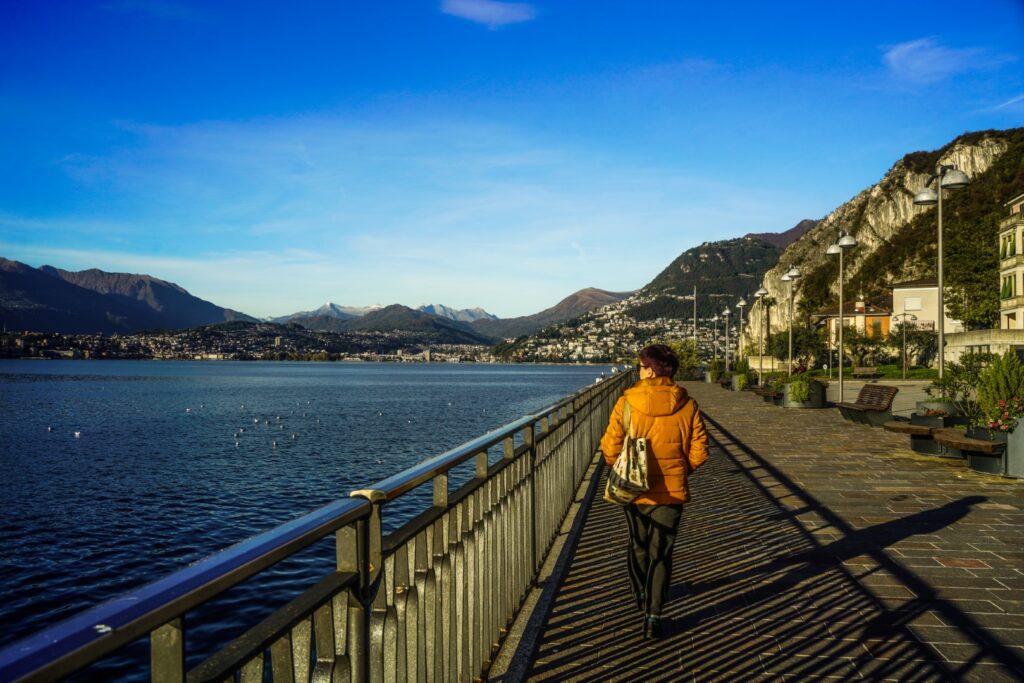
- Take in the views along the banks of Lake Lugano. The best thing about Campione d’Italia is its location. It’s just stunning!
- Go hiking in the mountains. Not only is Campione d’Italia next to a beautiful lake, it’s also surrounded by mountains on the three other sides. So don’t forget to bring your hiking boots!
- Explore the quaint town. And enjoy some gelato – you are in Italy, after all!
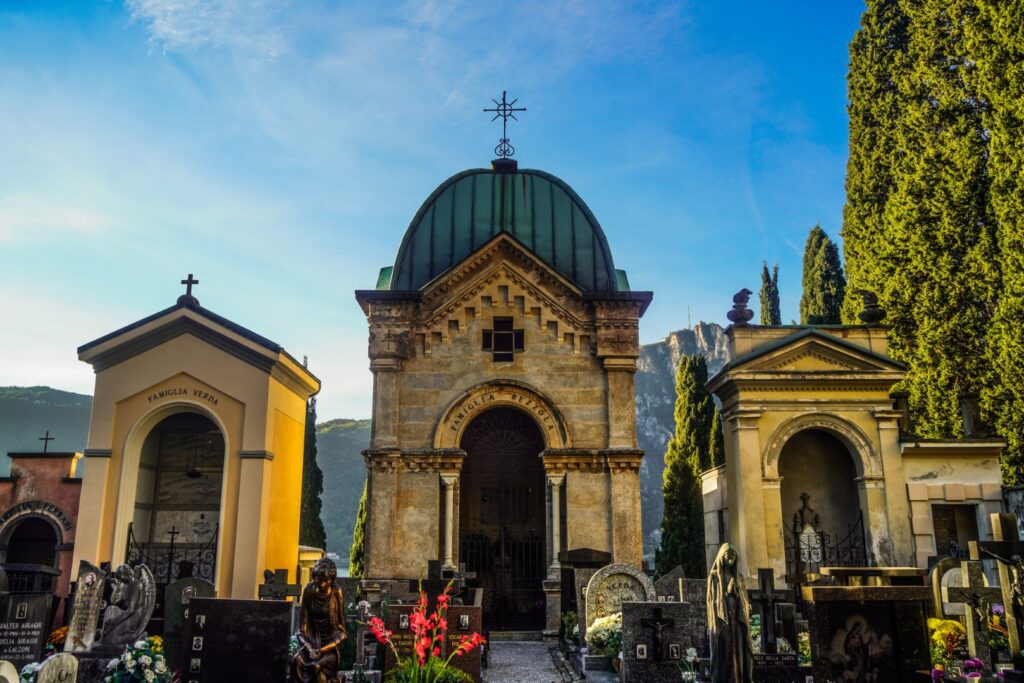
- Visit the Church of Santa Maria dei Ghirli. This gorgeous 17th century church is home to several stunning frescoes and a gorgeous view over Lake Lugano.
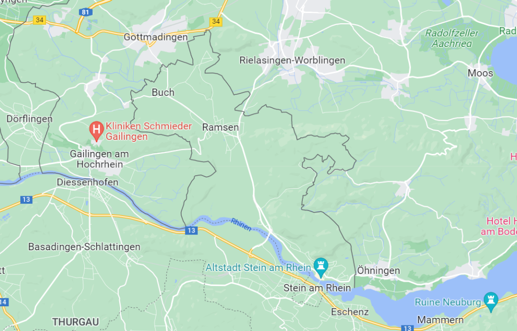
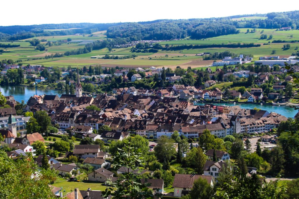
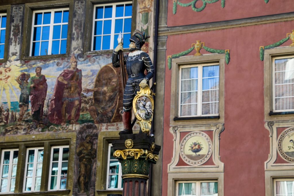
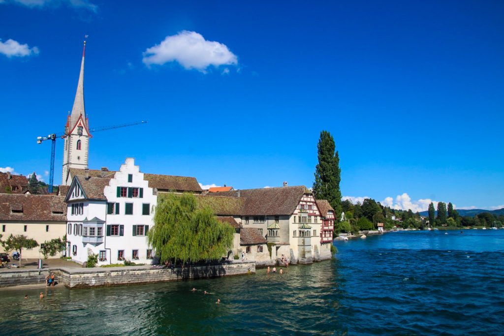
Stein am Rhein, a Swiss city with a geographical twist
Far from the beaten track of Switzerland lies the small historic town of Stein am Rhein, which has possibly the prettiest and best-preserved medieval centre I’ve ever seen.
But Stein am Rhein didn’t make it to this post because of its beauty; instead, it made it here because of its rather odd location. Half of the town sits in a ten-kilometre wide projection of Swiss territory extending north of the Rhine river into what is typically considered the German side of the river. If the border followed the Rhine here as it mostly does, half of Stein am Rhein would be part of Germany and the other half still be part of Switzerland – but the two halves are both Swiss and are connected by a bridge!
Read more: A brief visit to Switzerland and the German exclave of Büsingen
How to get to Stein am Rhein
Stein am Rhein is well-connected with the rest of Switzerland, so it’s easy to get there both by car and public transport. The town has its own train station with trains coming from several Swiss cities and there are also several busses connecting to the city. Find your preferred route here.
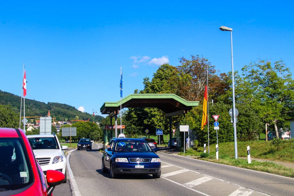
There is technically border control when entering Switzerland from an EU country, but I wasn’t stopped!
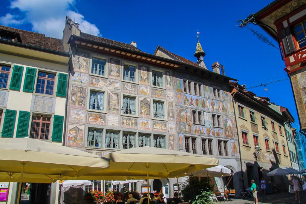
What to see and do in Stein am Rhein
- Explore the beautiful town centre and its many medieval murals. Rathausplatz is the heart of the city and where you’ll find the most impressive murals, but don’t forget to venture beyond. There is plenty to discover!
- Relax by the Rhine. Stein am Rhein has some gorgeous views of the river, and it’s a nice place to hang out for a while.
- Swim in the Rhine. I saw several people peacefully floating in the river and secretly wished I could’ve joined them!
- See the view from Hohenklingen Castle. The best views of the town are found along the castle road!
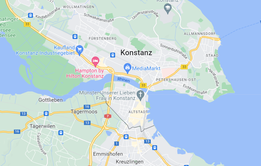
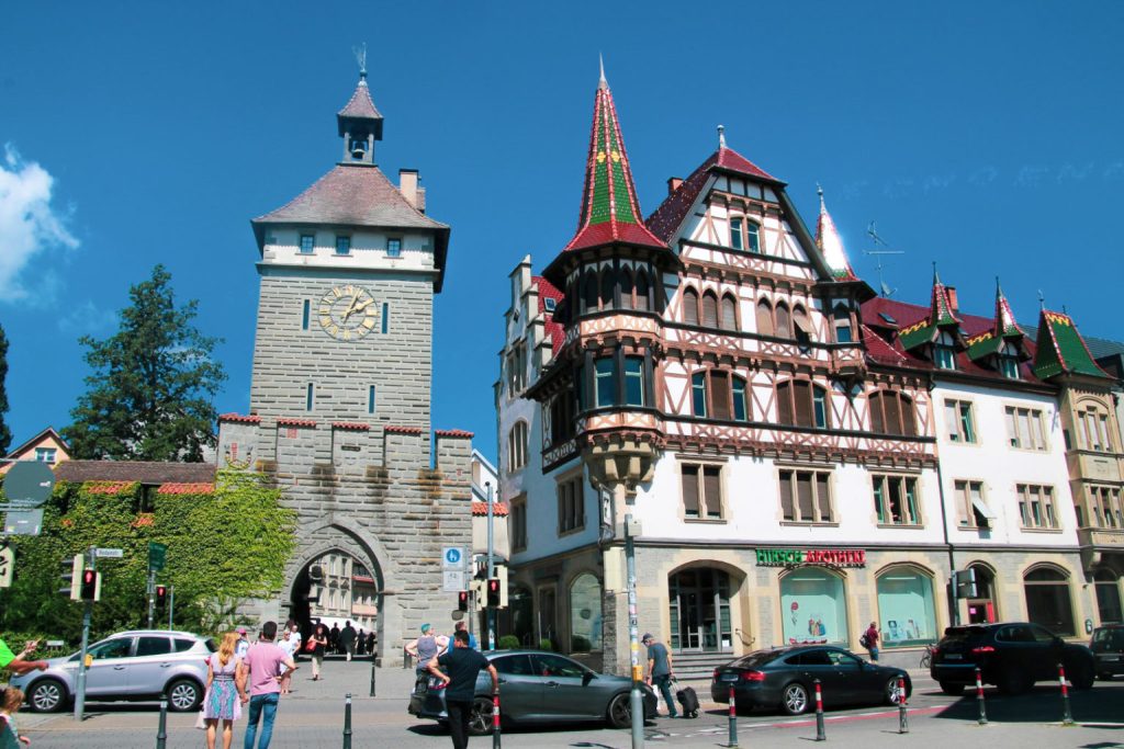
Konstanz, a German city with a detached city centre
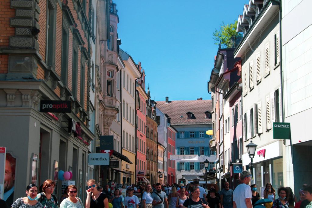
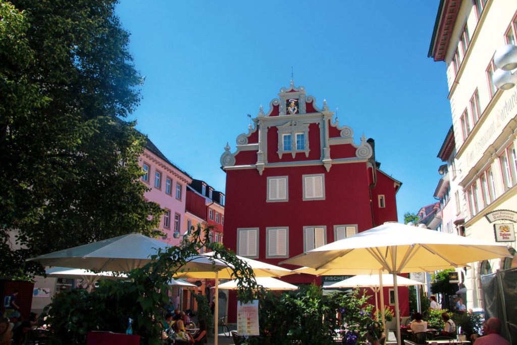
Germany’s Konstanz is another city that I’ve included because of its weird geography – but this one is even more odd than Stein am Rhein! Because the city centre is actually a pene-exclave which is cut off from the rest of the city and the rest of Germany by the Rhine, and bordered only by Switzerland! So if the borders were defined by the course of the Rhine, Konstanz would just be suburbs!
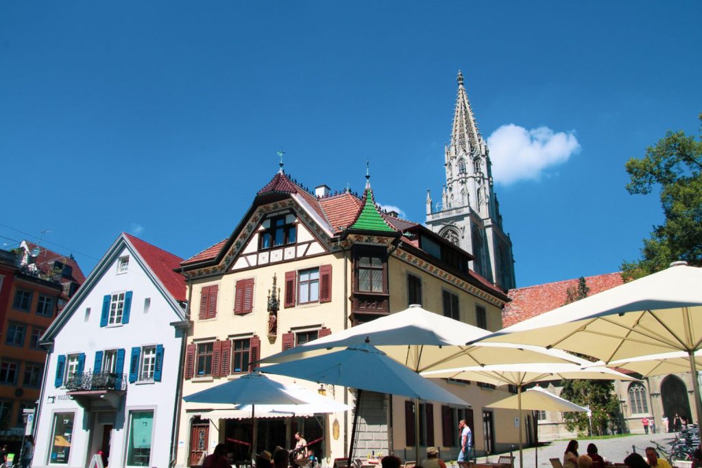
Konstanz is a beautiful university city on the banks of Lake Constance, home to around 83,000 people – and just like Stein am Rhein, it has a gorgeous medieval city centre! So even if you’re not into weird geography, the city is well worth a visit!
Read more: On the banks of Lake Constance: Prehistoric pile dwellings and a very special island
How to get to Konstanz
Konstanz is well-connected with both Germany and Switzerland, so getting there by either car or public transport is easy. Parking can be difficult in the city centre, so I’d recommend parking just across the border in Switzerland where there’s less traffic. If you’re coming by train or bus, you can find your preferred route here.
There is border control in Konstanz and I actually got stopped! But as an EU citizen, moving in and out of Switzerland and Germany is no problem!
What to see and do in Konstanz
- Explore the Altstadt (Old Town). The medieval charm is preserved in the narrow streets, colourful buildings and the gorgeous Cathedral of Konstanz from the 11th century.
- Cross Rheinbrücke (the Rhine Bridge). Go for the gorgeous views of Lake Constance and to cross over to the rest of the city from the part that’s a pene-exclave!
- Take a trip to Reichenau Island. I can not recommend this pretty island enough. It’s full of UNESCO sites and it’s just a short drive away from Konstanz!
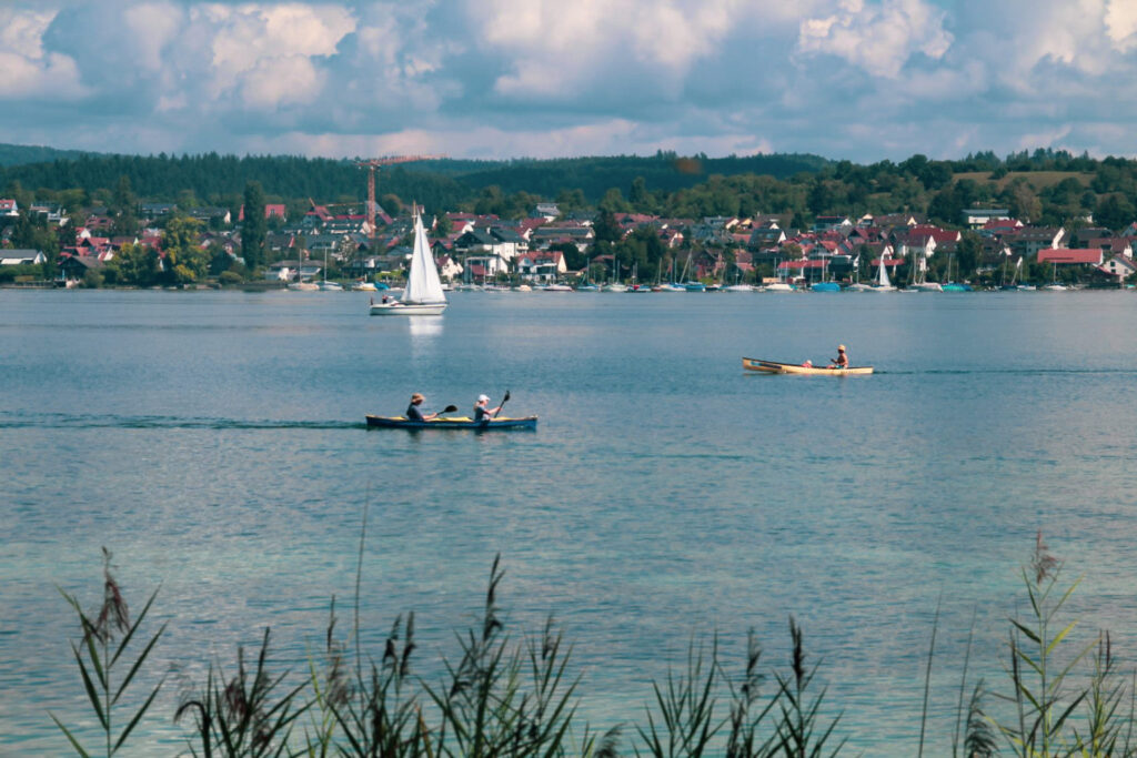
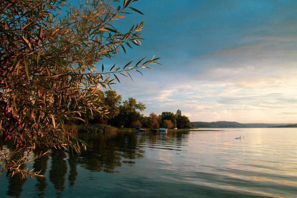
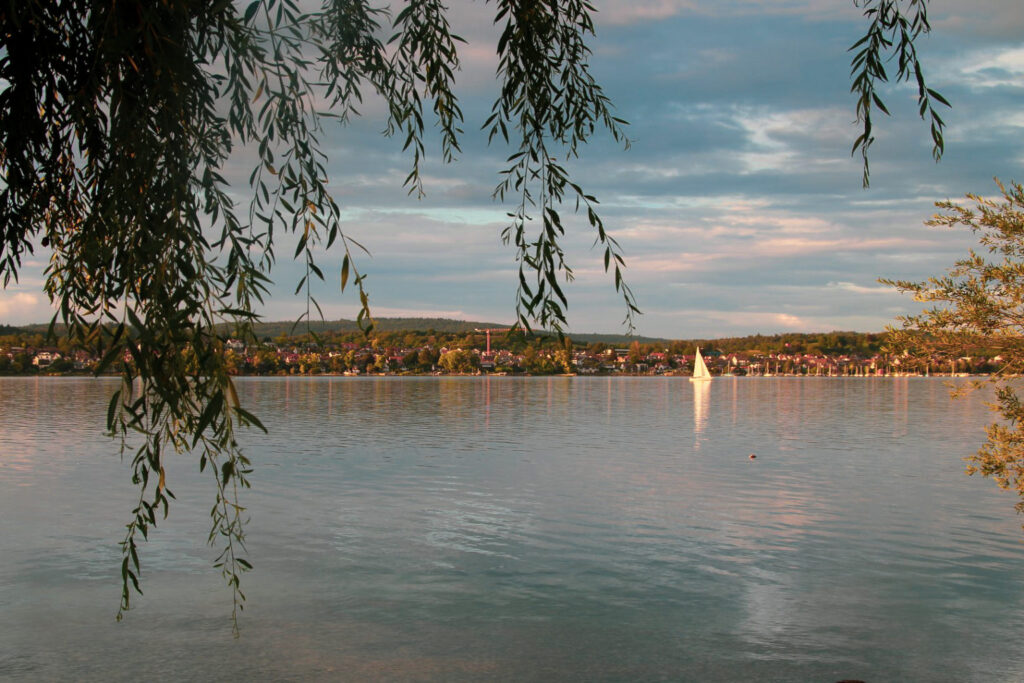
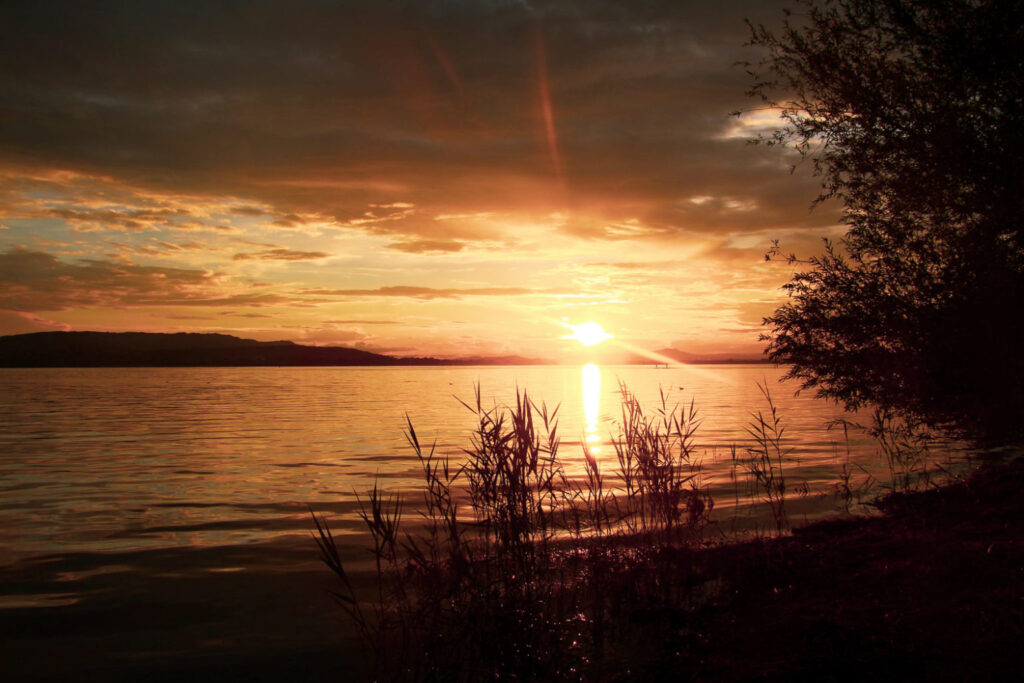
Lake Constance, the only place in Europe where borders don’t exist
Lake Constance is the third largest freshwater lake in Western Europe, and it’s in a unique geographic position as it’s the only place in Europe where borders essentially don’t exist. Lake Constance borders three countries; Germany, Austria and Switzerland, but none of them claim it. This is due to a disagreement on how to define the boundaries. While Switzerland advocates for a border dividing the lake in the middle, Austria proposes that the three countries share the lake. Germany, on the other hand, has not officially taken a position on the issue!
Usually, when a body of water sits on an international border, the boundaries are clearly defined, even if they extend into the lake. Different parts of the lake will belong to different countries. But in the case of Lake Constance, it doesn’t belong to anyone. This lake is essentially a no man’s land!
Read more: On the banks of Lake Constance: Prehistoric pile dwellings and a very special island
Tripoints in the Alps
A tripoint is a geographical point where the borders of three countries meet – and if the tripoint is on land, you can actually stand in two countries and place your hand in a third all at the same time! And in a rare anomaly, Liechtenstein actually shares two tripoints with Switzerland and Austria!
In the Alps, there are five tripoints:
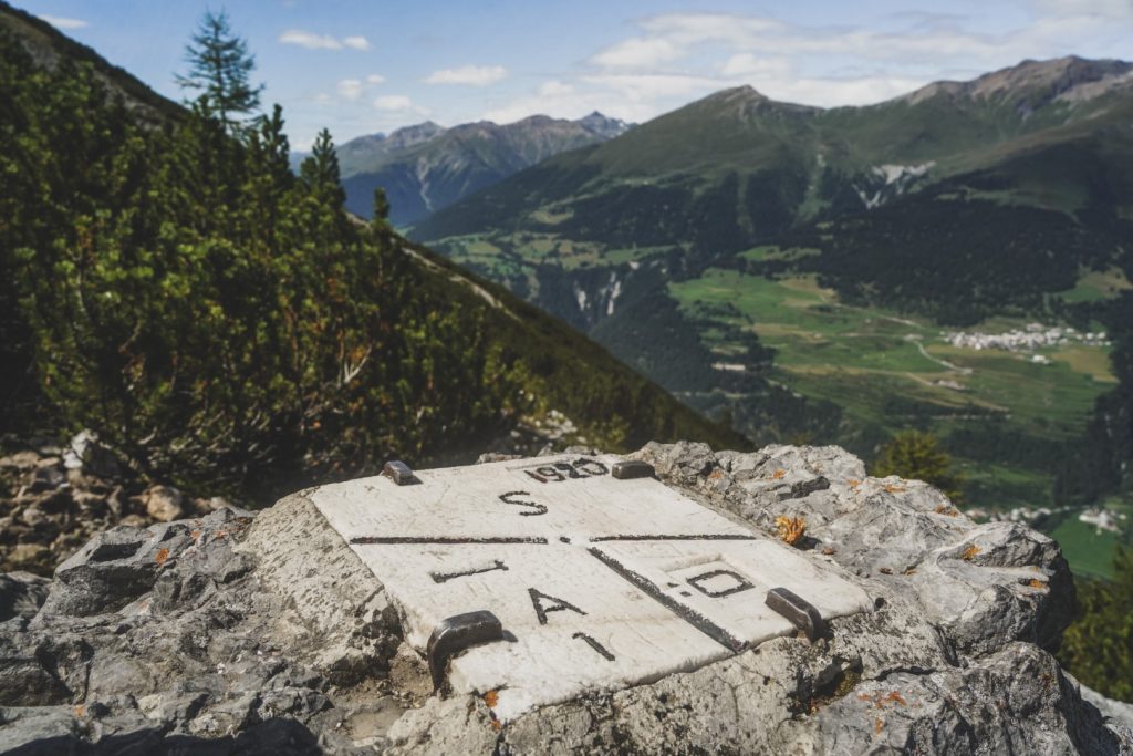
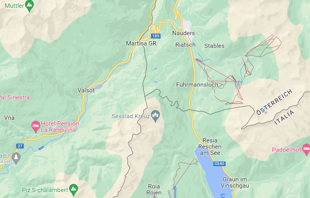
- Dreiländerspitze (The Three-Country Peak). The tripoint between Austria, Switzerland and Italy is situated near the Piz Lad summit in the Sesvenna Range. The Dreiländergrenzstein (Three-Country Border Stone) marks the border! I did this hike with my mum back in the summer of 2021 and I highly recommend it! Read more: Where three countries meet: A hike to Dreiländergrenzstein in the Alps
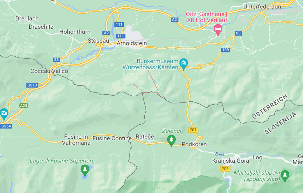
- Dreisprachenspitze (The Peak of the Three Languages). The tripoint between Austria, Italy and Slovenia is a summit located in the Ortler Alps.
- Dreiländereck (The Three-Country Corner). Located in the middle of the Rhine, the northern tripoint between Austria, Liechtenstein and Switzerland is the only one that you can’t stand on – unless you can walk on water!
- Naafkopf. This mountain in the Rätikon Range marks the southern tripoint of Austria, Liechtenstein and Switzerland!
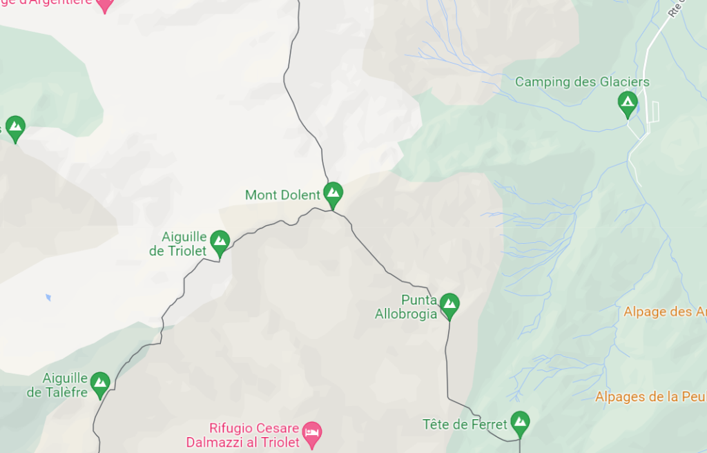
- Mont Dolent. The tripoint between Switzerland, Italy and France is just 100 metres from the peak of Mont Dolent on the Mont Blanc massif. It’s without a doubt the hardest of the tripoints to reach!
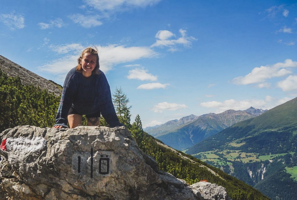
Sorgschrofen – a mountain with a quadripoint
With quadripoints it gets even more exciting as this is where the borders of four countries – or in this case, municipalities – meet! In the Alps, there is a very interesting quadripoint and that’s the summit of Sorgschrofen, the very mountain that marks the only point where Jungholz is connected to the rest of Austria!
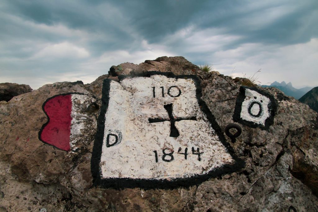
On the summit, two Austrian municipalities (Jungholz and Schattwald) and two German municipalities (Pfronten and Bad Hindelang) meet! The four borders meet at border marker 110, which is carved into a rock on the summit. For a geography nerd like me, Sorgschrofen is the ultimate mountain to climb – and considering that it’s in the Alps, it’s actually not that difficult to climb!
Read more: High up in the Alps: Standing between four borders on Mt. Sorgschrofen
Sorgschrofen sums up the many geographical oddities scattered around the Alps. These are fun and unusual destinations to seek out in a tourist-heavy. I hope this post has inspired you to explore these hidden beauties of the Alps. Even if you’re not a self-proclaimed geography nerd like me, I feel sure you’ll find each of these areas worth the trip!

Leave a Comment