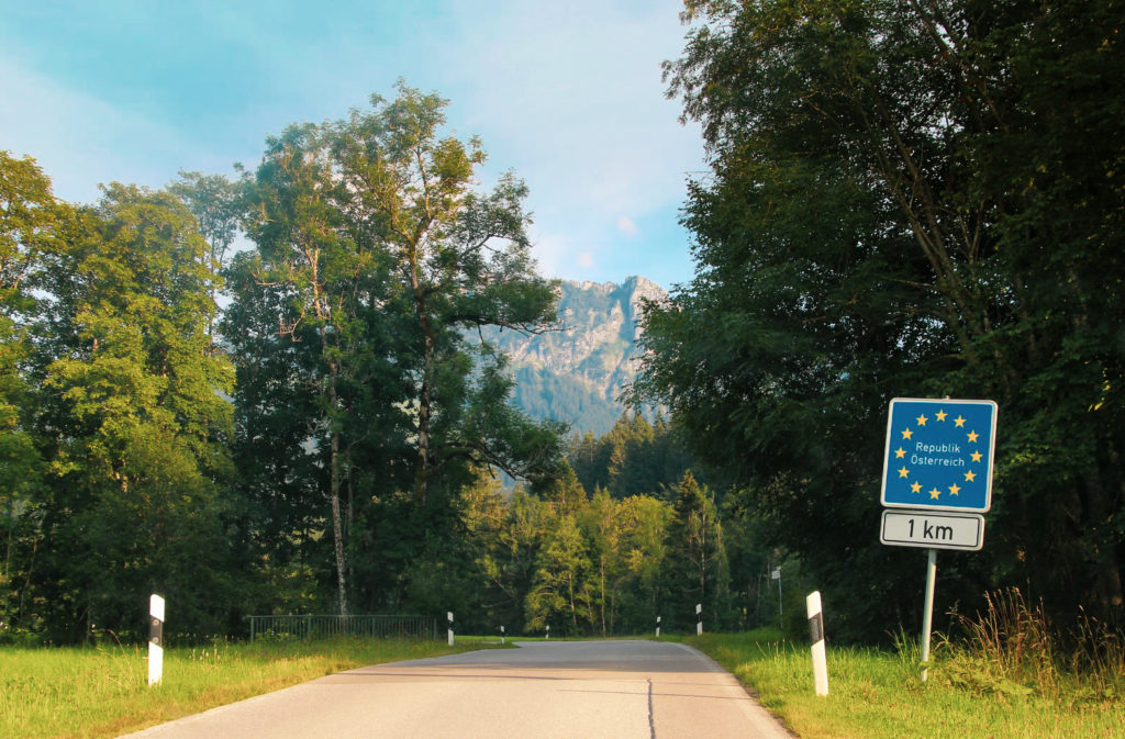
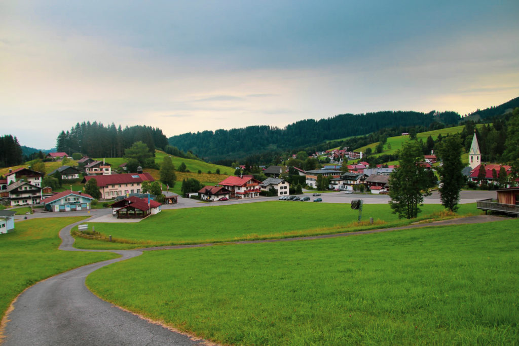
I’d spent the entire day chasing castles, churches and lakes in the Bavarian Alps when I made my way back to Austria to spend the night. I entered the second of Austria’s three pene-exclaves, Jungholz. All three pene-exclaves can only be reached via Germany as the high Alps separate them from the rest of Austria, but Jungholz is actually only connected to the rest of Austria at one point – the summit of Mt. Sorgschrofen at 1.635 m. above sea level. As far as I’m aware, it’s the only pene-exclave of this kind in the world, so that in itself is pretty special!
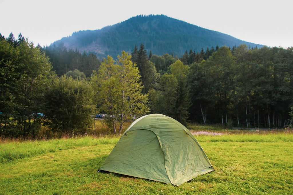
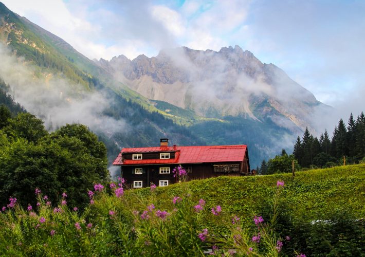
Upon entering Jungholz, the first place I saw was the campsite. Lucky for me, they had just one tent pitch left which I grabbed for the night. It was nice to get a break from sleeping in the car, and to finally use the tent that I’d been dragging around with me for weeks!
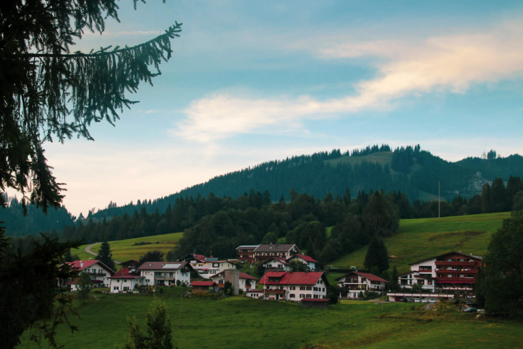
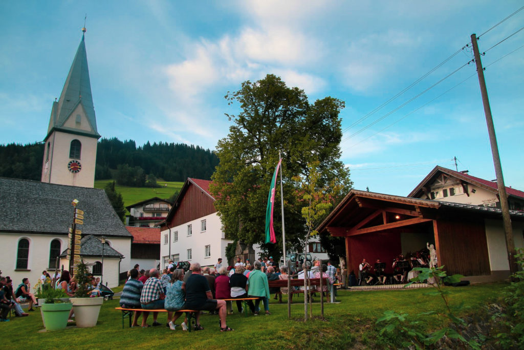
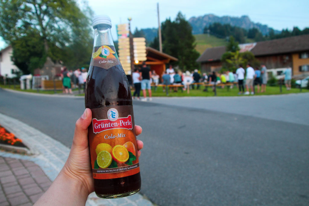
After I’d set up my tent, I drove into the village of Jungholz to find some food for dinner. But I never got that far as the village was having a party! A local band was playing Tirol folk music and a guy was selling beer and sodas to all the locals and tourists watching the show. I bought some kind of soda I’d never tried before and sat down on a rock to enjoy the special atmosphere of this warm summer evening in Jungholz.
I never managed to find any food, so I only had a few snacks before getting cozy in my little green tent.
The next morning, I woke up at the crack of dawn to do something a little crazy. I was going to attempt to climb Mt. Sorgschrofen – in sneakers! I never even considered climbing the mountain before arriving in Jungholz since I hadn’t brought my hiking boots. But I had a chat with the owner of the campsite who told me about the climb, and ensured me that only the last part to the summit was technical and challenging. I wasn’t sure if it would be possible for me to do wearing sneakers, but I decided to give it a try.
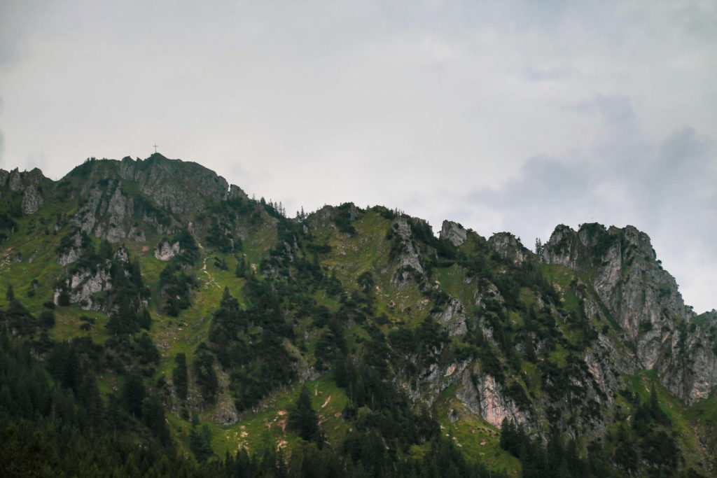
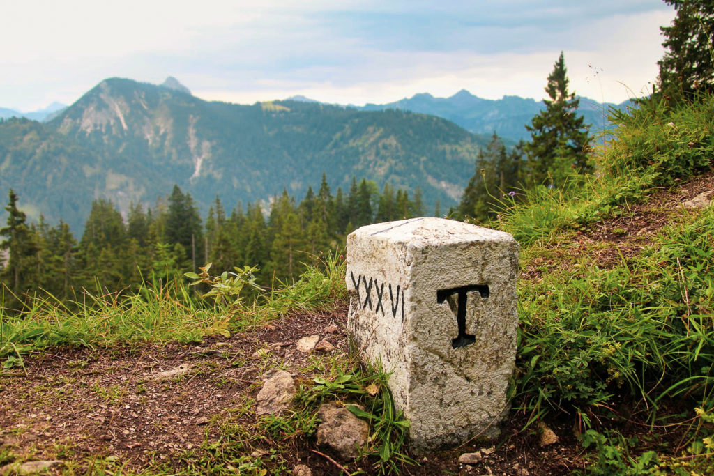
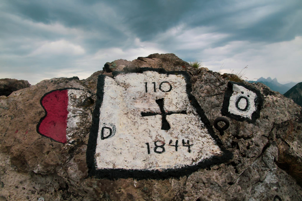
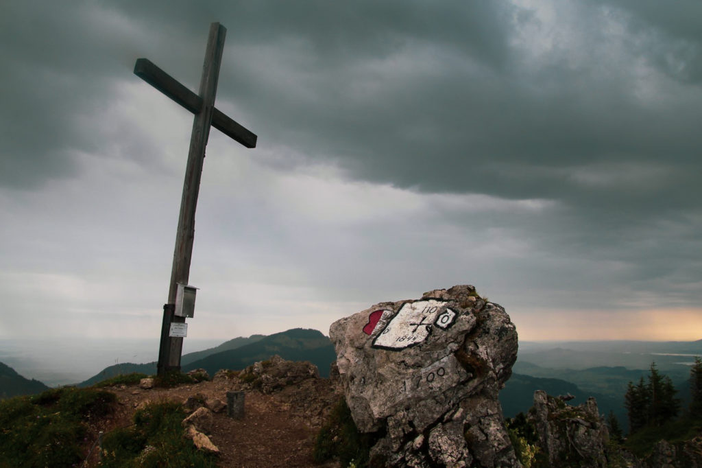
As I wrote earlier, Sorgschrofen is a pretty special mountain as it’s the only land link Jungholz has with the motherland, but it doesn’t end there. A rare occurrence is found on the summit where four borders meet in a quadripoint – two of them Austrian (Jungholz and Schattwald) and two of them German (Pfronten and Bad Hindelang). The four borders meet at border marker 110, which is carved into a rock on the summit. For a geography nerd like me, Sorgschrofen is the ultimate mountain to climb!
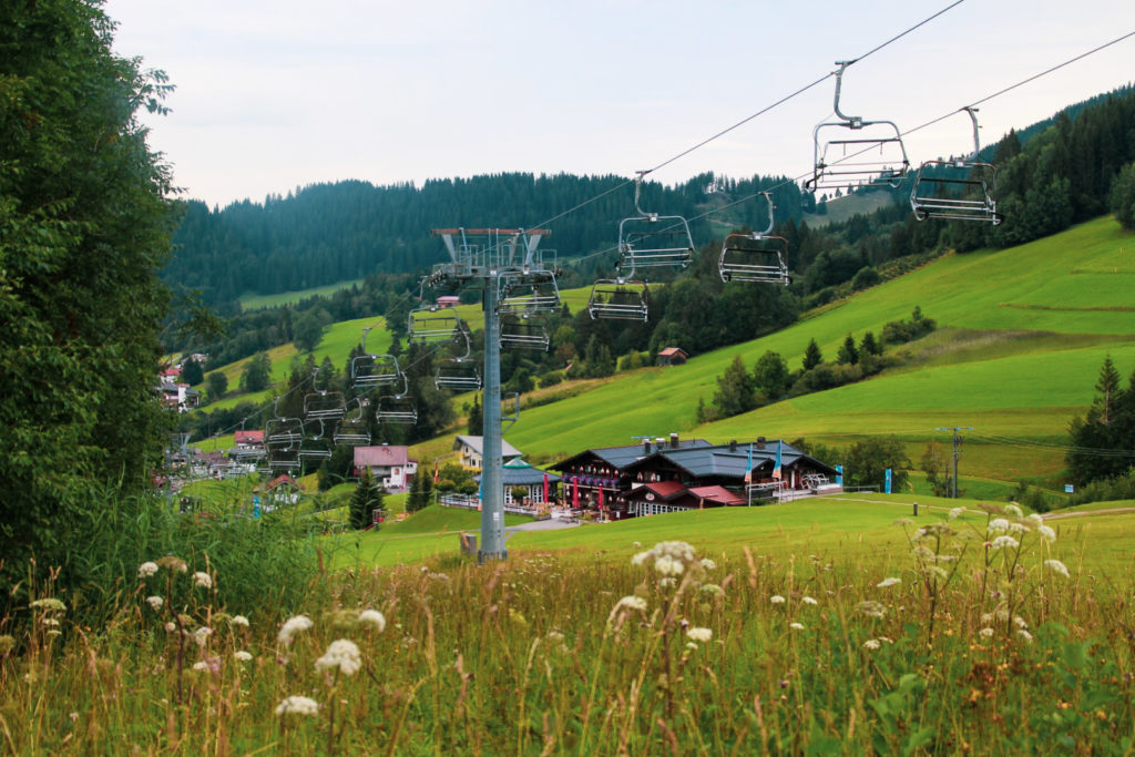
I drove into town again and parked my car at a big parking lot by a ski lift which is only a few minutes from the trailhead. At 7.15 AM, I was ready to go. I followed the trail on maps.me the entire way, although there were also plenty of signposts so staying on the trail wasn’t going to be an issue!
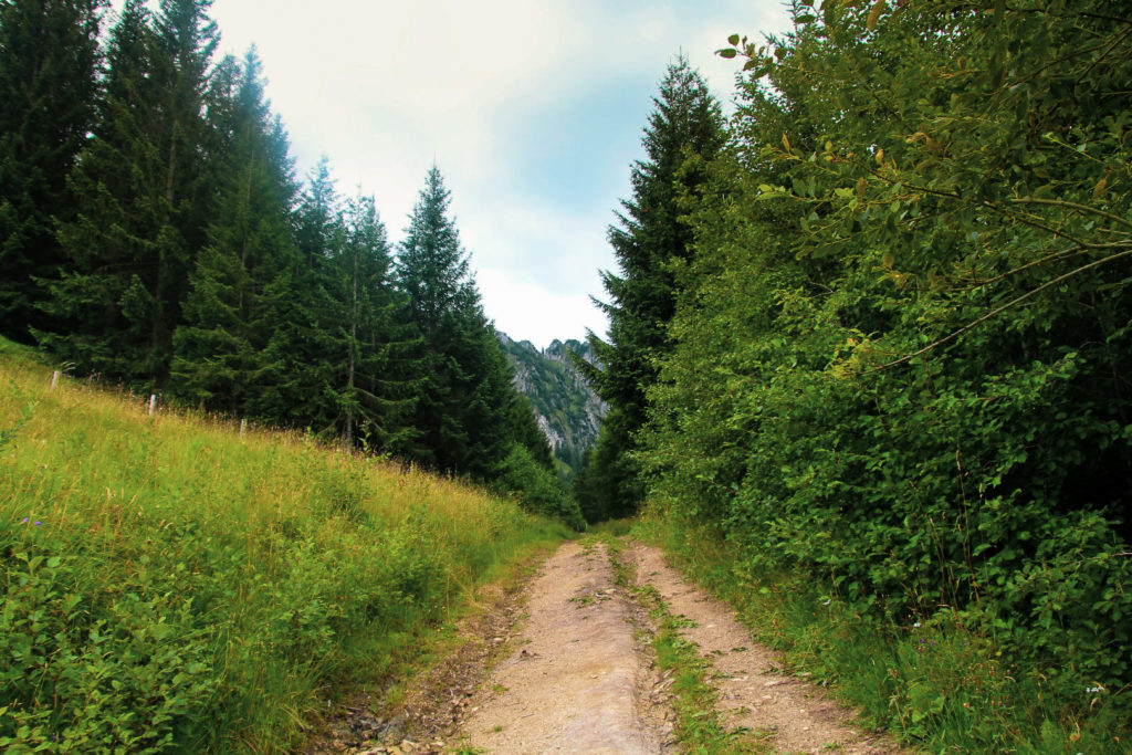
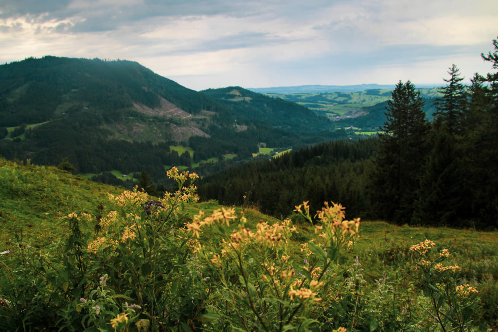
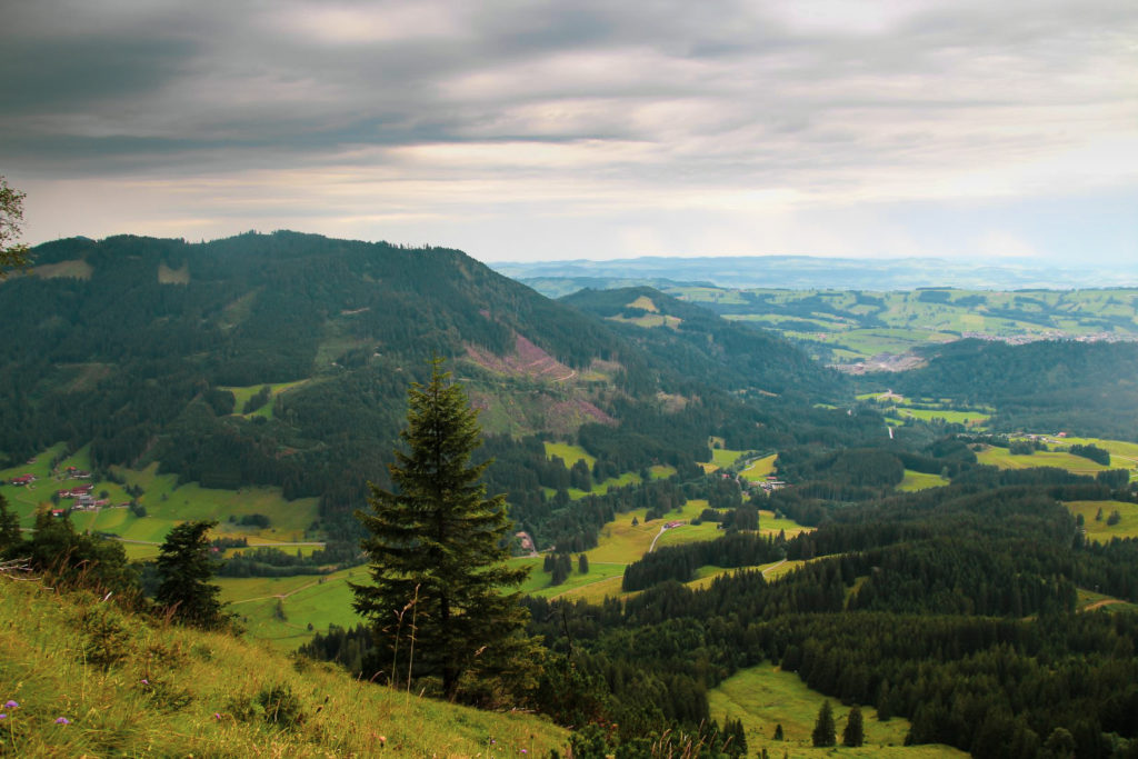
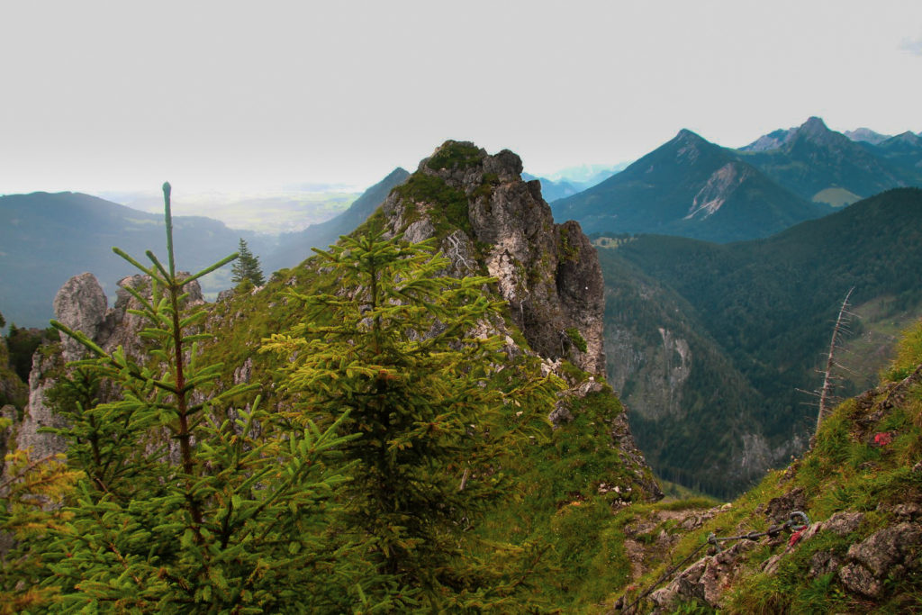
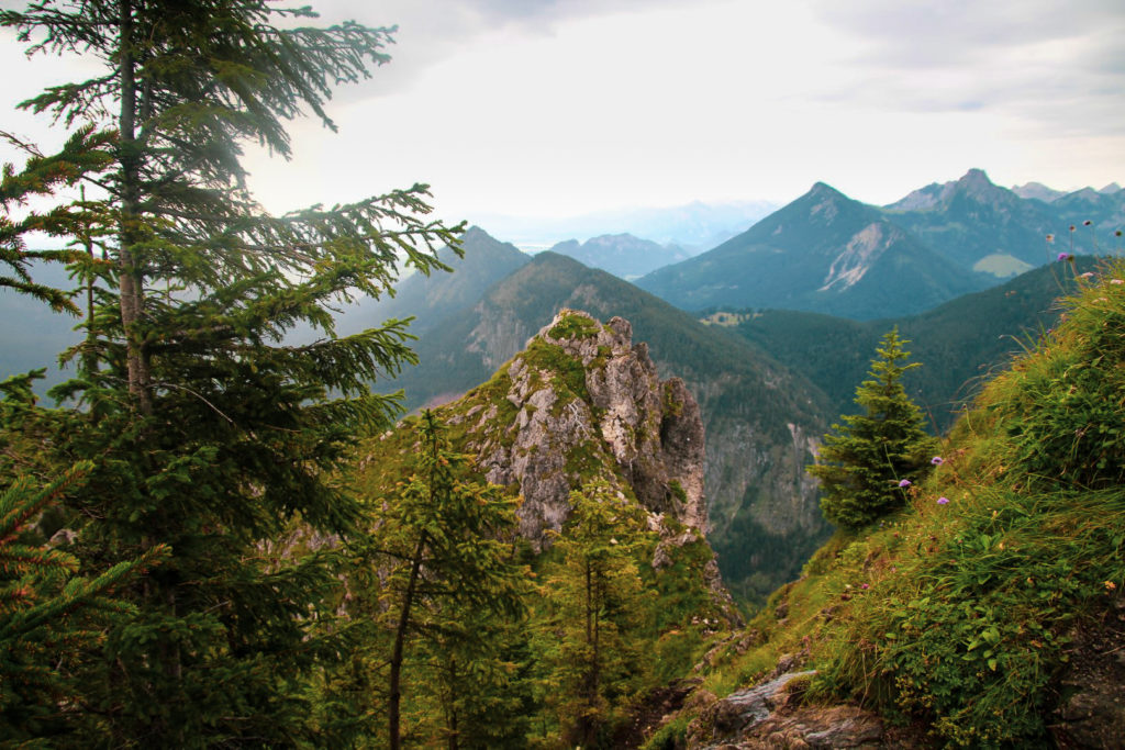
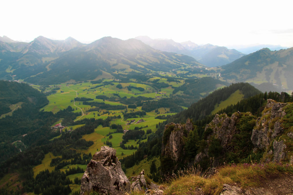
I was tired after a night of just six hours, so I was rather slow in the beginning. The path went steeply uphill almost the entire way, but I pushed myself and as I got higher up towards the mountain, I saw the village disappear beneath me.
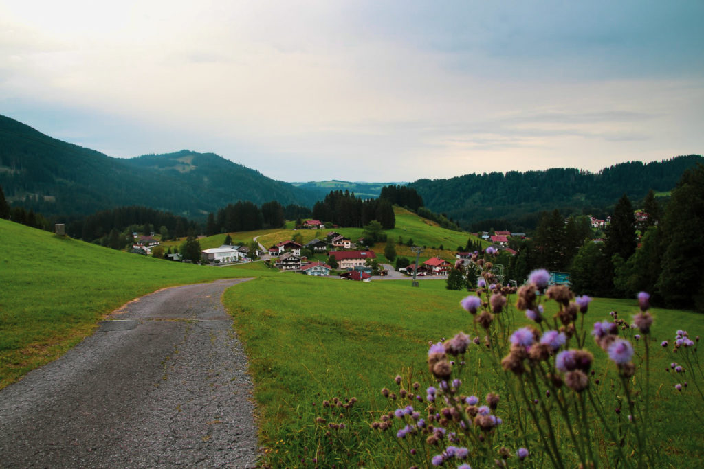
The weather was perfect for hiking. It was overcast and drizzling slightly most of the time, which was wonderfully refreshing in the summer heat.
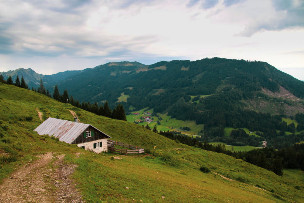
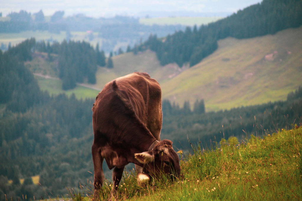
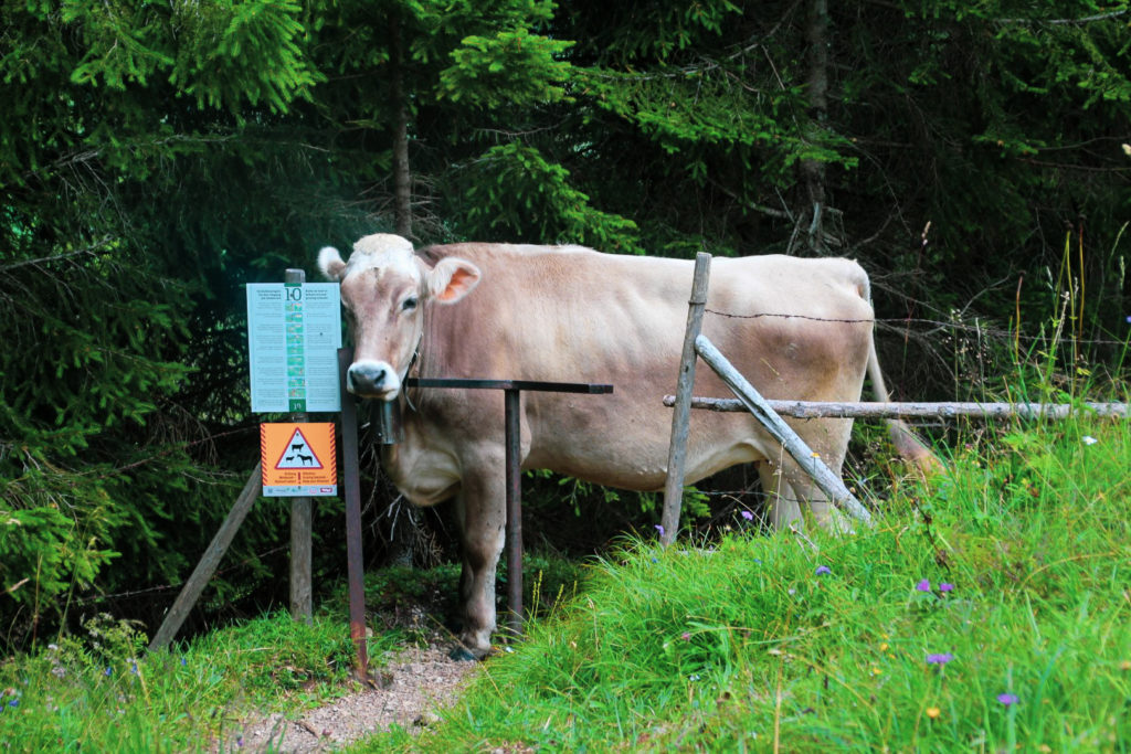
I hiked up through a forest and soon came to the Älpele mountain hut near the end of the ski lift. I was met by a herd of cows that were quietly grazing, but with every move I’d hear a loud *ding* from the cruel cowbells that they wear around their necks. I do wish this “tradition” would come to an end.
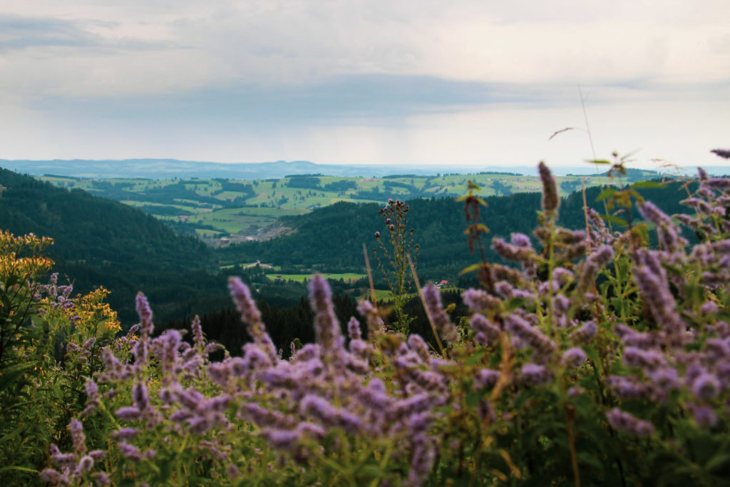
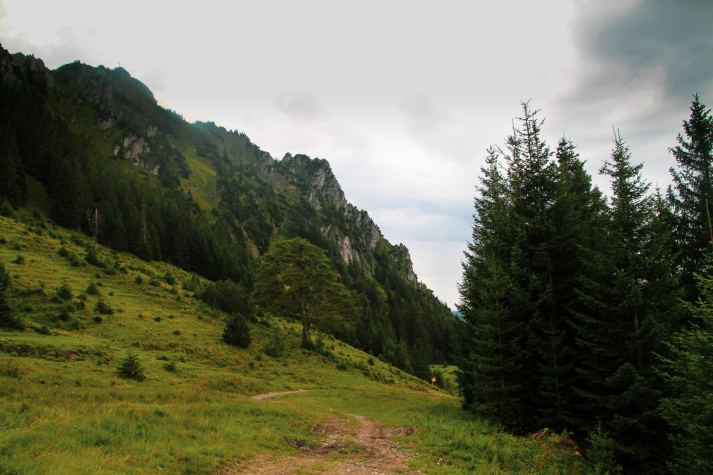
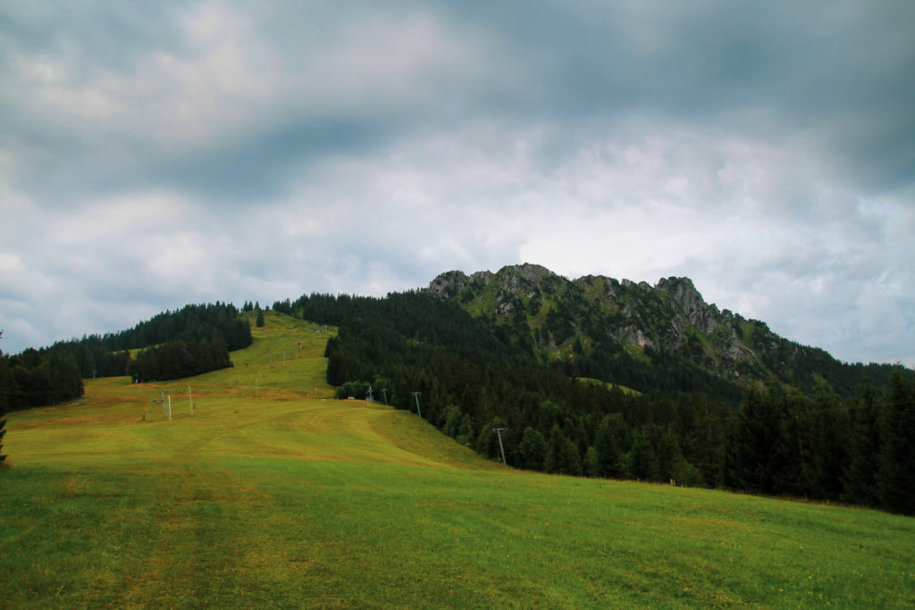
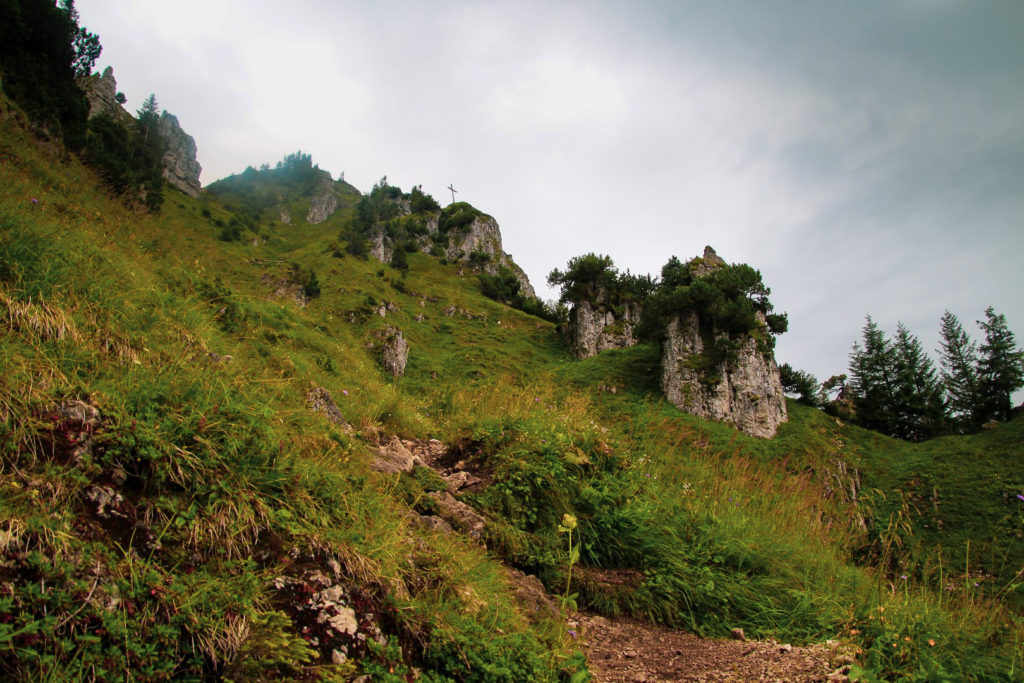
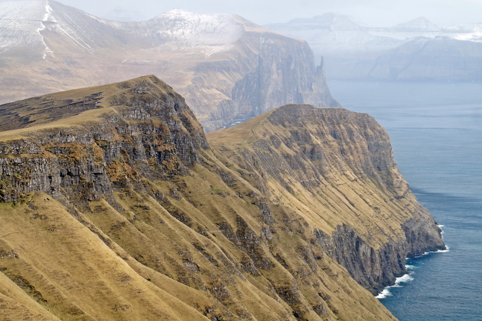
The next short section was quite a pleasure actually. For a short while, there was no ascending and I could just stroll through the forest along the footpath. But the sweet relief soon ended. The trees disappeared behind me and I looked up and saw the summit that consists of massive bare rocks which, from below, look inaccessible for anyone to climb. But an arrow was pointing towards a small path which was accompanied by a steel wire to hold onto. I pulled myself up the steep rocks, clinging onto the wire.
Suddenly, the heavens opened and it started pouring down, making the rocks slippery and difficult to hold onto. Had it not been for the steel wire, I wouldn’t have gone any further.
I was clinging to the steel wire and watching every step. I’m always incredibly scared of falling when I’m on the edge of a mountain (duh), so I take it really slow because I’m so careful with every movement. The steel wire didn’t follow the path all the way to the summit; in some places there were wooden steps instead, and in some places there was nothing but bare rock. But the wire did help in the most difficult sections.
As I neared the summit, I stopped to take some pictures while singing loudly, thinking I was alone. But then I looked up and saw a German couple just a few meters away from me on the summit. Laughing to myself, I was praying that they hadn’t heard me!
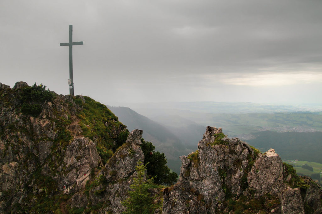
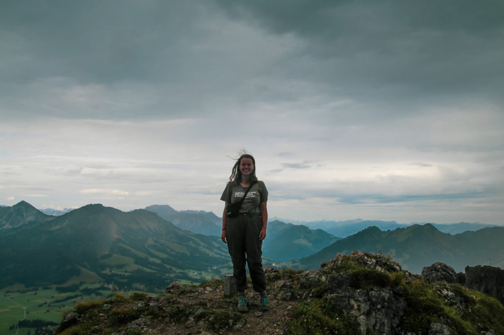
The last stretch was the most technically challenging as the path was really narrow with steep edges on both sides. But I clung onto the solid rocks and in the end, I made it. I reached the summit of one very special mountain and stood between four borders while looking down on two different countries at the same time!
I reached the summit at 9 AM; 1 hour and 45 minutes after I’d started. A lot slower than it should’ve been, but I was just glad I’d made it up there safely (and with lots of dramatic pictures!). I was so happy with my achievement, it felt amazing to have conquered a mountain in the Alps – and in sneakers, too!
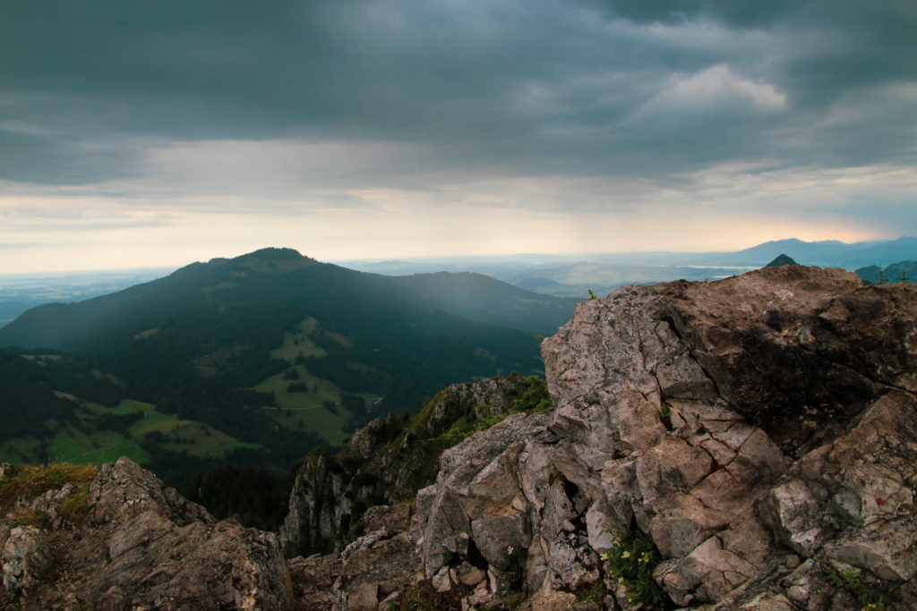
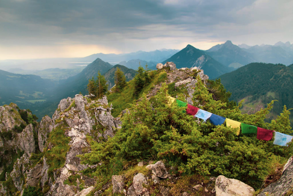
The German couple and I took some photos of each other so we could all get proof of our achievements before I decided to head back down as mist and more rain showers were approaching. There is a second summit on the mountain, Zinken at 1.613 m., but the ridge between them is treacherous and not recommended for inexperienced hikers. I wouldn’t call myself inexperienced, but my lack of hiking boots certainly made me look the part!
The way down is always more nervewracking than the way up, but it actually went quite well although my legs were really shaky. I was relieved when the trickiest part was over, when I was below the rocky summit and could finally relax.
But little did I know, there would be another unforeseen danger on the mountain. Or should I say, funny encounter? Because the cows of the Alps aren’t really dangerous unless you walk directly behind them or startle them, but they do like to block the way for hikers! One cow was standing in front of a gate that I needed to get through to continue along the path, and with barbed wire around the fence, there was no way around it. I approached the cow slowly and spoke softly to him, and eventually he moved a little so I could squeeze out through the gate.
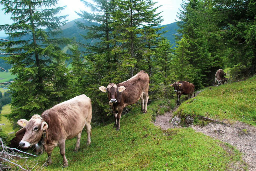
But alas, just a few meters further along, I met the rest of the herd. They took up the path, but this time, there was enough room for me to go past without disturbing them. None of them bothered to move or even look up at me. I was insignificant compared to the delicious grass they’d encountered.
The rest of the way down was easy peasy. An hour and a half after I’d left the summit behind, I was back at the car. It was only 11 AM and I still had the whole day ahead of me even though I’d just climbed a mountain! What a great feeling that was.
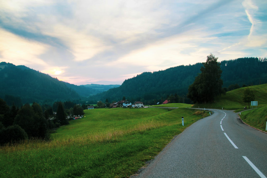
I went back to the campsite to pack up my tent and have a shower, and then I left Jungholz to travel to the third and last of the Austrian pene-exclaves. Stay tuned!
How to climb Mt. Sorgschrofen from Jungholz
There are two ways to climb Mt. Sorgschrofen. You can either go from Unterjoch, a small village in Germany, or from Jungholz like I did. If you’re not dependent on a car or bike, you could also hike up one way and down the other. The climb from Unterjoch is very difficult as it requires crossing the ridge from Zinken, so it’s only recommended for experienced hikers. The climb from Jungholz can be done by most, but do take care during the last part of the ascent. Below is an explanation of how to climb the mountain from Jungholz:
The climb begins and ends to the left of the ski lift in front of the tourism information centre in the village of Jungholz. Follow the path up to the Älpele mountain hut, and from there begins the steep and rocky ascent up to the summit. There is a path most of the way, as well as signposts and arrows ensuring that you stay on the right trail. Do use the steel wire when climbing up the steepest parts to the summit, which is marked by a large cross. Remember to take in the views and enjoy the fact that you’re standing between four borders, two of them international!
If you are an experienced hiker, you can continue along the ridge to the other summit, Zinken, which you’ll see to your right. It’s also marked by a summit cross. Climb back down the same way as you came up.
The climb is 6 km, takes 3-4 hours and is moderate to difficult with an elevation gain of 1.635 m.
Leave a Comment
Pingback: A week in Sesselebene, our tiny summer village in Tirol – Northtrotter on 20/03/2021
Pingback: After the rain: A spontaneous hike in Austria’s Kleinwalsertal Valley – Northtrotter on 20/03/2021
Pingback: An Odd World: Uncovering the Border Complexities of the Alps – Northtrotter on 20/03/2021

5 COMMENTS
Pierre
1 year agoIs it possible to go from the summit down the south side into Austria? (With mountain climbing equipment)
Has anyone ever crossed from north Austria to south Austria without entering Germany? (Except for a few steps around the cross at the summit)
Mel
1 year ago AUTHORI believe so! I met a couple on the summit that came up from the Austrian side and they didn’t have any special equipment. For a winter climb, that would absolutely be necessary, but in the summer, it’s probably fine without 😀