Visiting Fugloy, the easternmost island in the Faroe Islands, has been a dream of mine for many years. It was the last inhabited island on the Faroes that I had yet to visit, and I’d actually already tried back in 2018 but the ferry couldn’t dock due to high waves. But last summer, I finally made it!
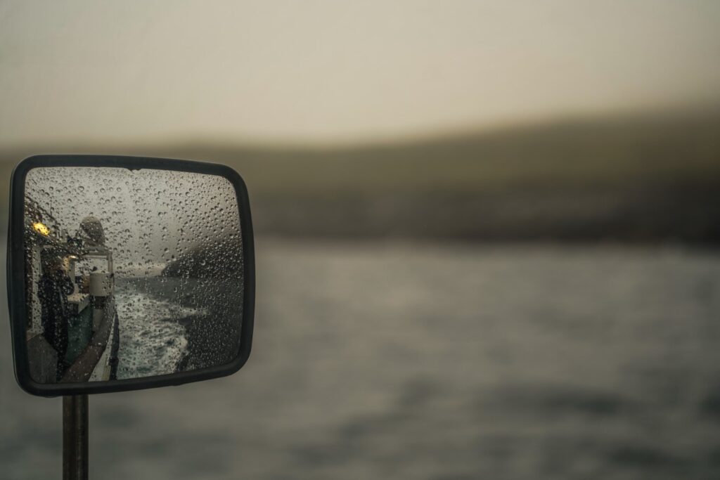
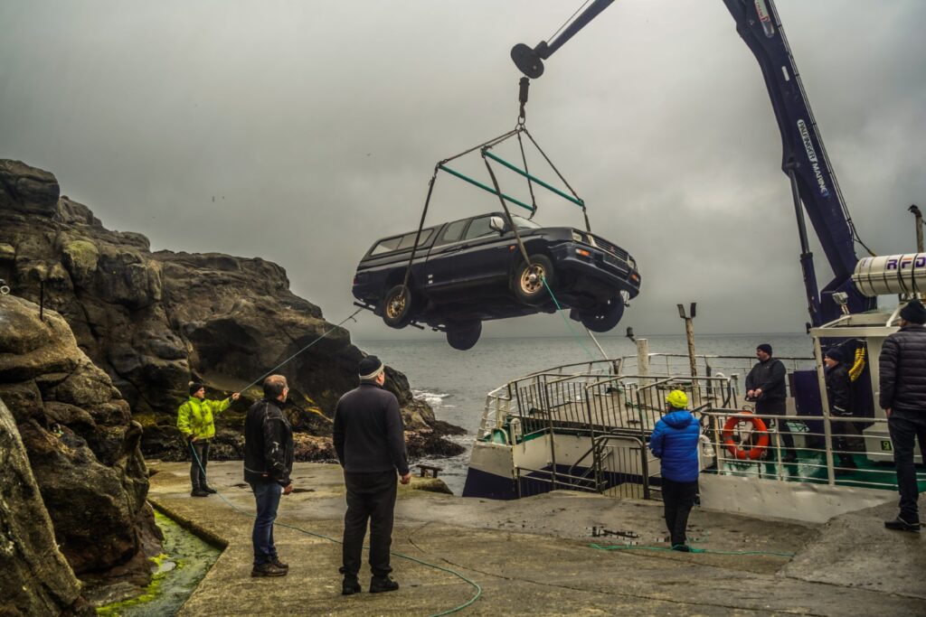
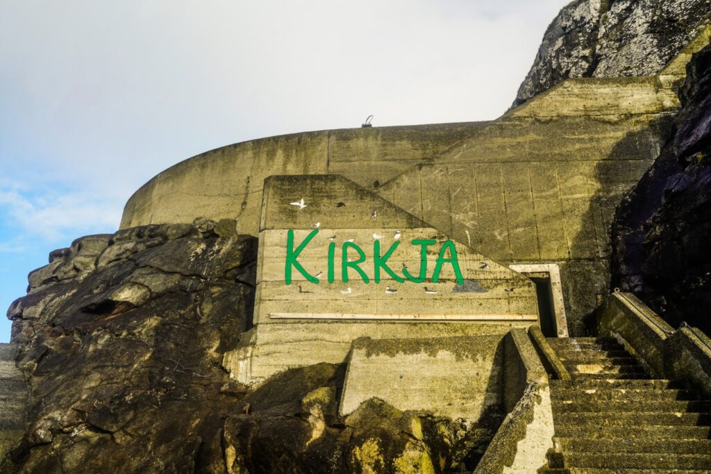
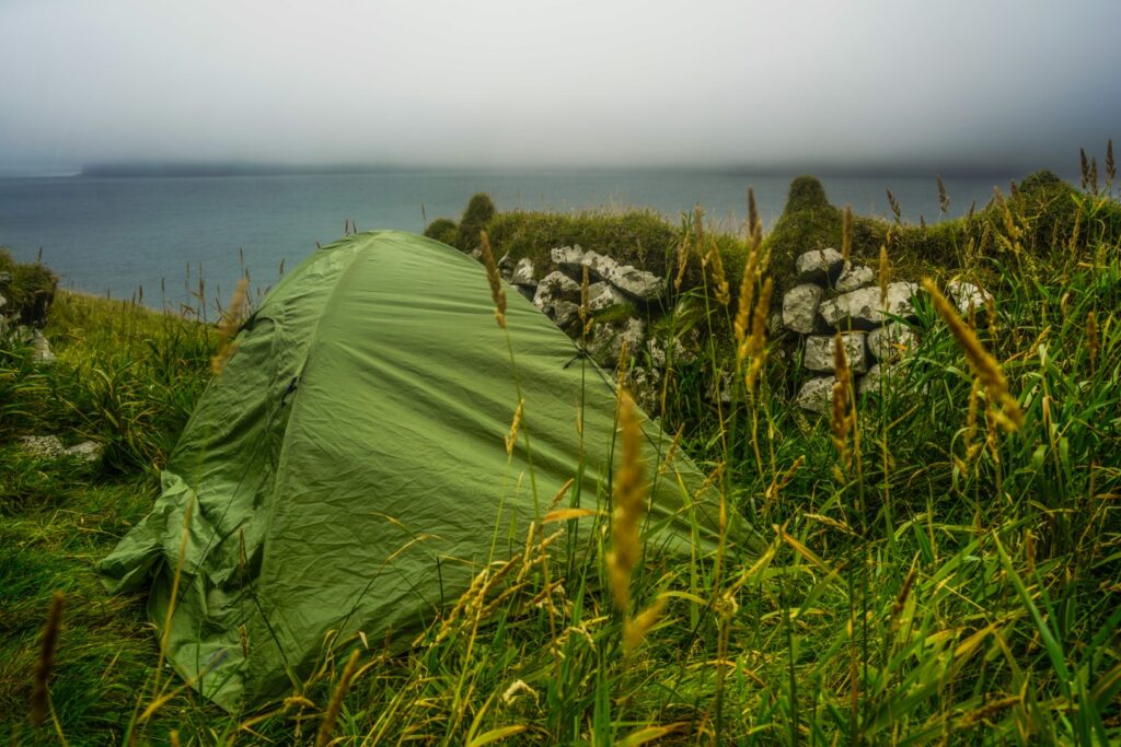
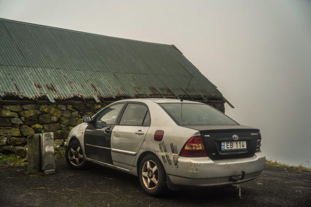
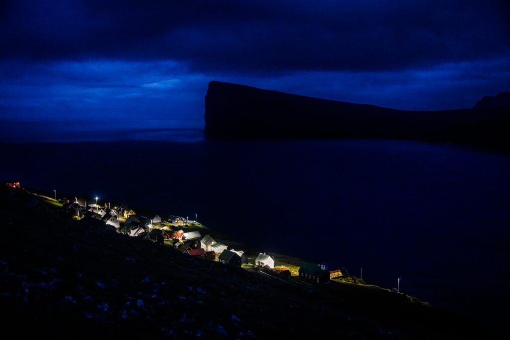
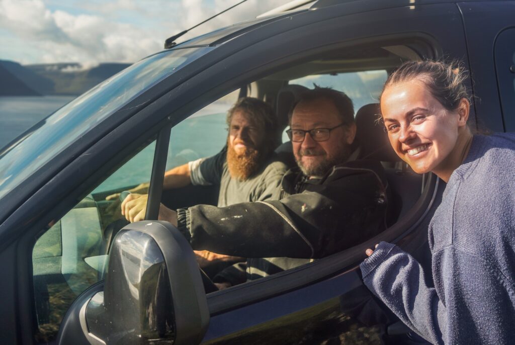
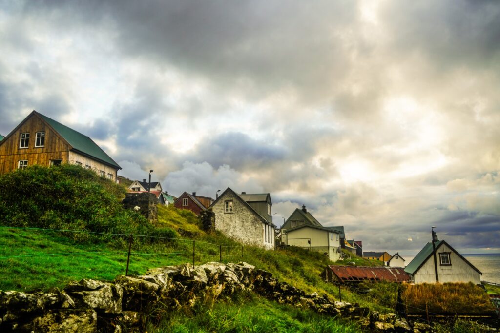
After a very foggy ride from Hvannasund on Viðoy in a very small ferry, my travel buddy and I stepped off at the small dock in Kirkja, the largest village on Fugloy, and watched as a car got lifted off the ferry and onto the island (that’s a first!). We were welcomed with kisses from an adorable dog, and ran into a few locals who let us pitch our little green tent in a sheep shelter on their land below the village.
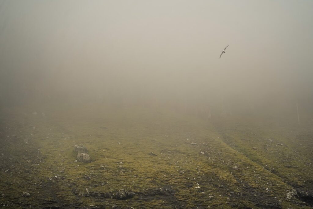
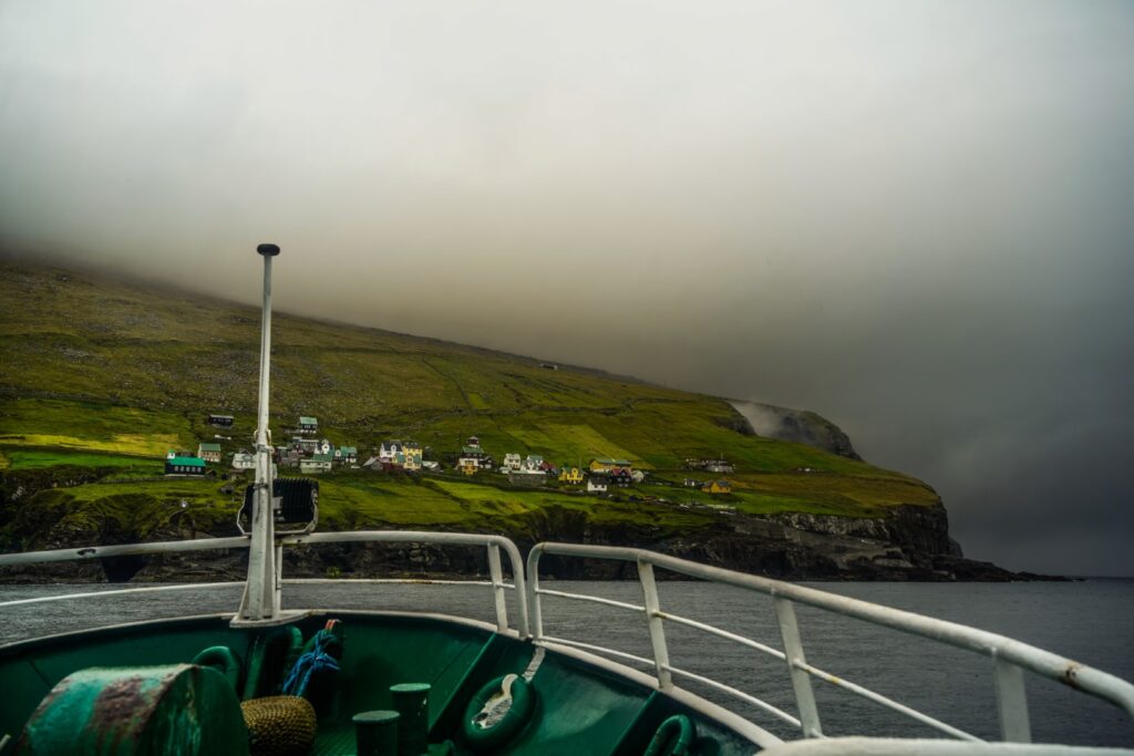
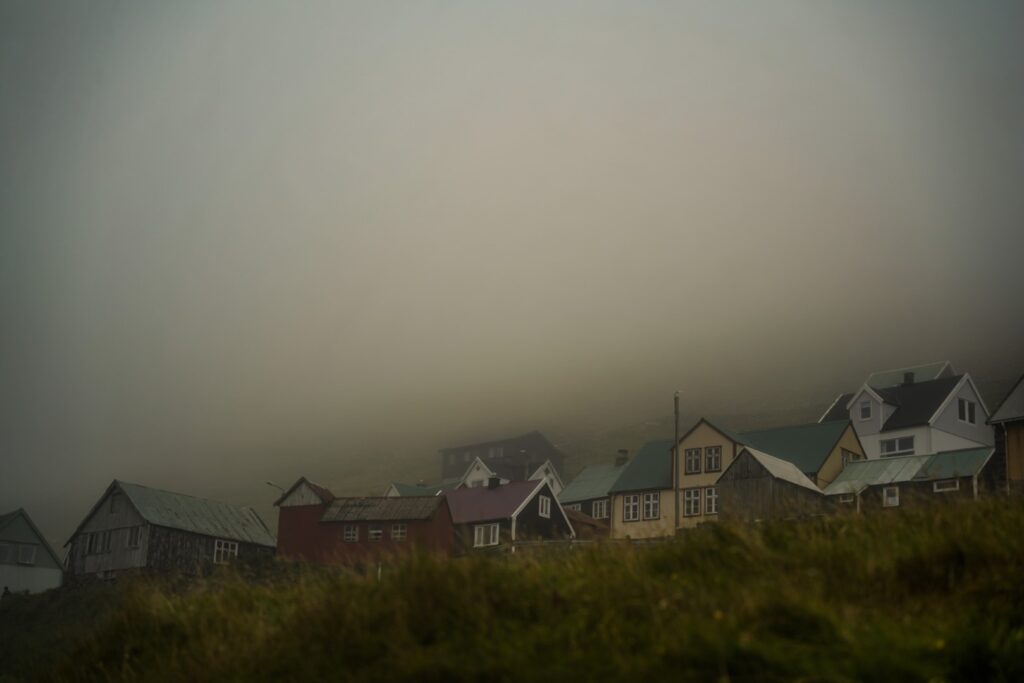
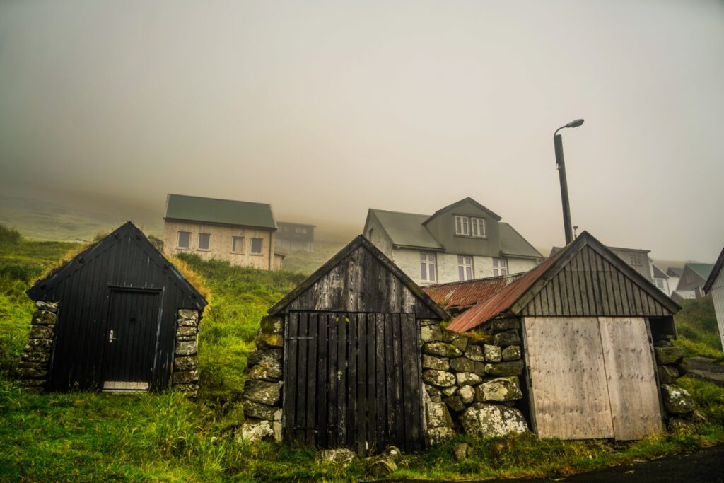
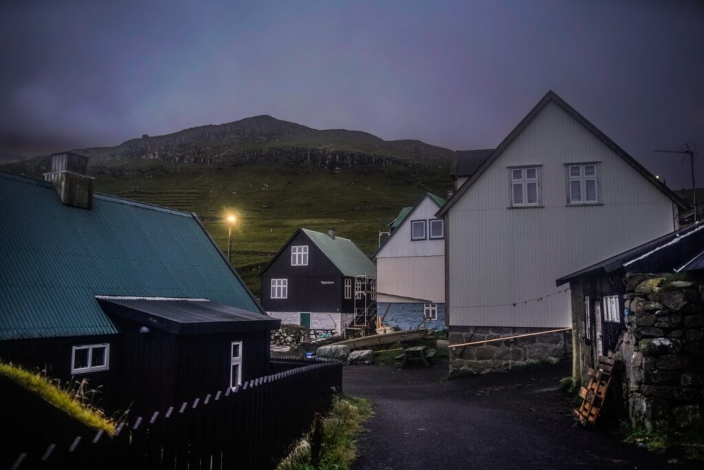
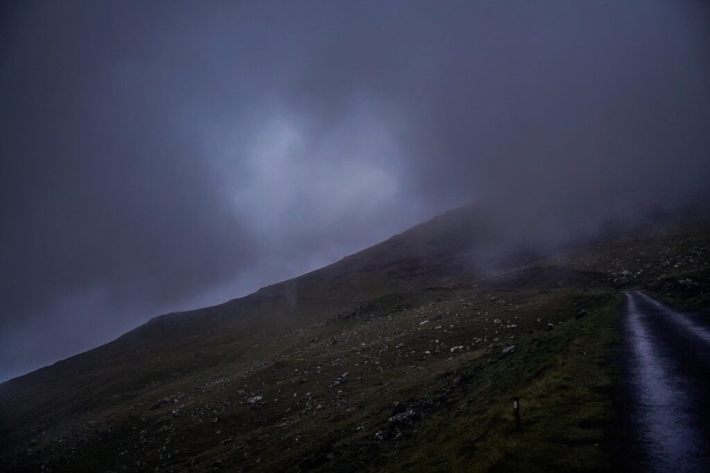
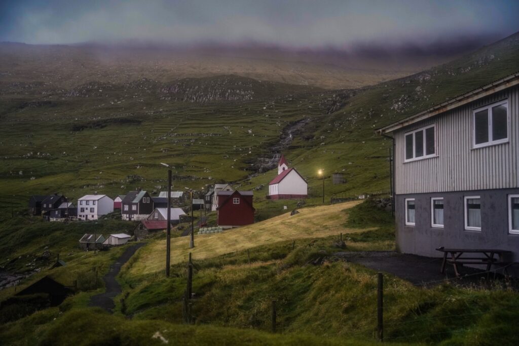
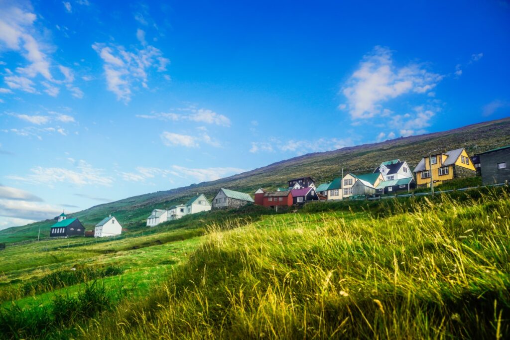
Fugloy is a small island, home to around 40 people. There are two villages; Kirkja in the southern part of the island, which is home to the majority of the inhabitants, and Hattarvík on the eastern part of the island, which is only home to three people. On our first evening, we spent some time exploring Kirkja and then headed out on a foggy walk following the mountain road to Hattarvík, which is approximately 5,3 kilometres long.
Despite not being able to see much of anything, it was an enjoyable and atmospheric walk. We arrived to Hattarvík just as dusk set in, so we only spent a little time exploring before heading back in the dark on the same long mountain road.
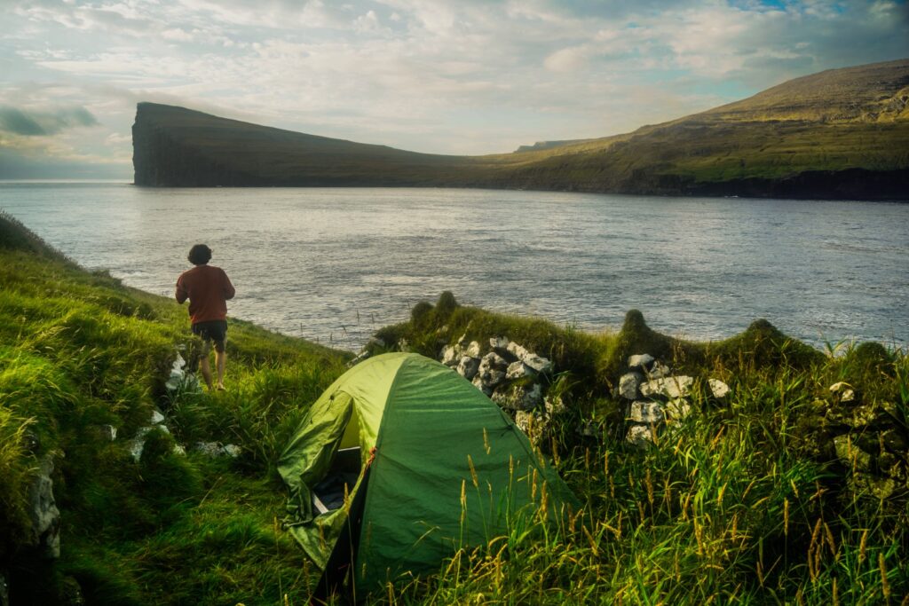
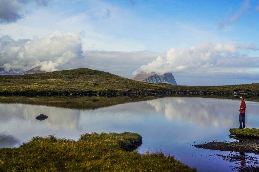
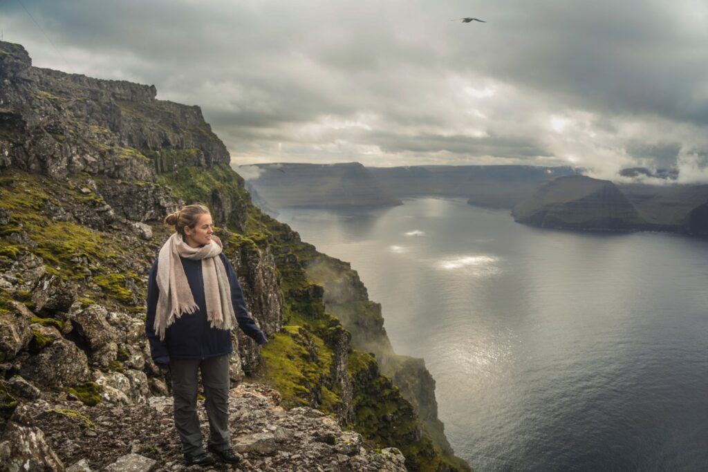
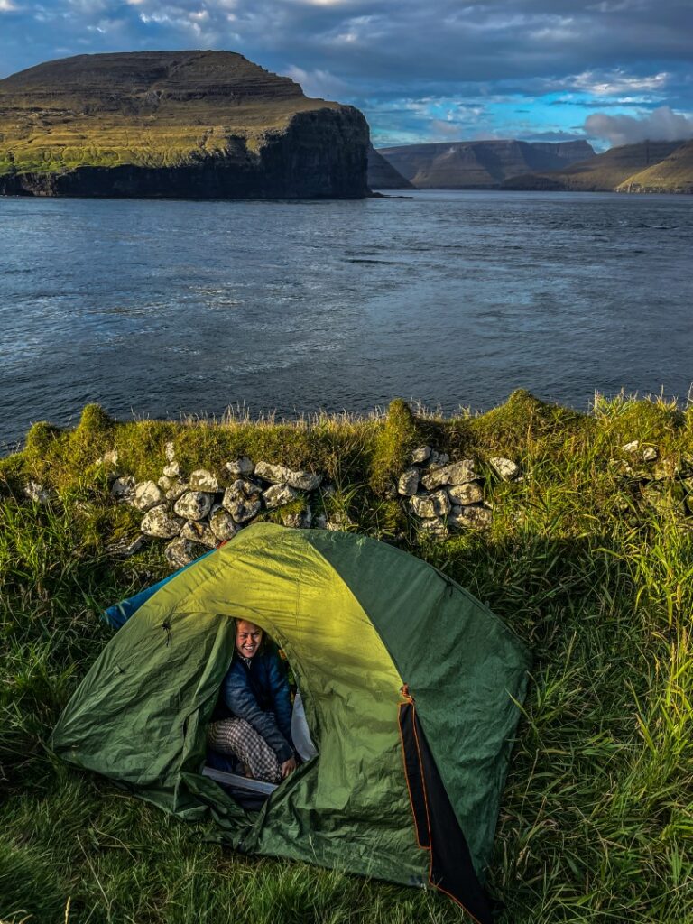
After a nice long sleep in the tent, we woke up to rain and decided to snooze a little, hoping the sun would appear. And sure enough, when we woke up an hour later, the sun was out! We’d had no idea about our tent view when we first pitched it, so we were pleasantly surprised when we saw the gorgeous view of the other northeastern islands as our backdrop. We had our own little 5-star hotel! We had a slow morning enjoying our view, and then set out at 10 AM to explore the island!
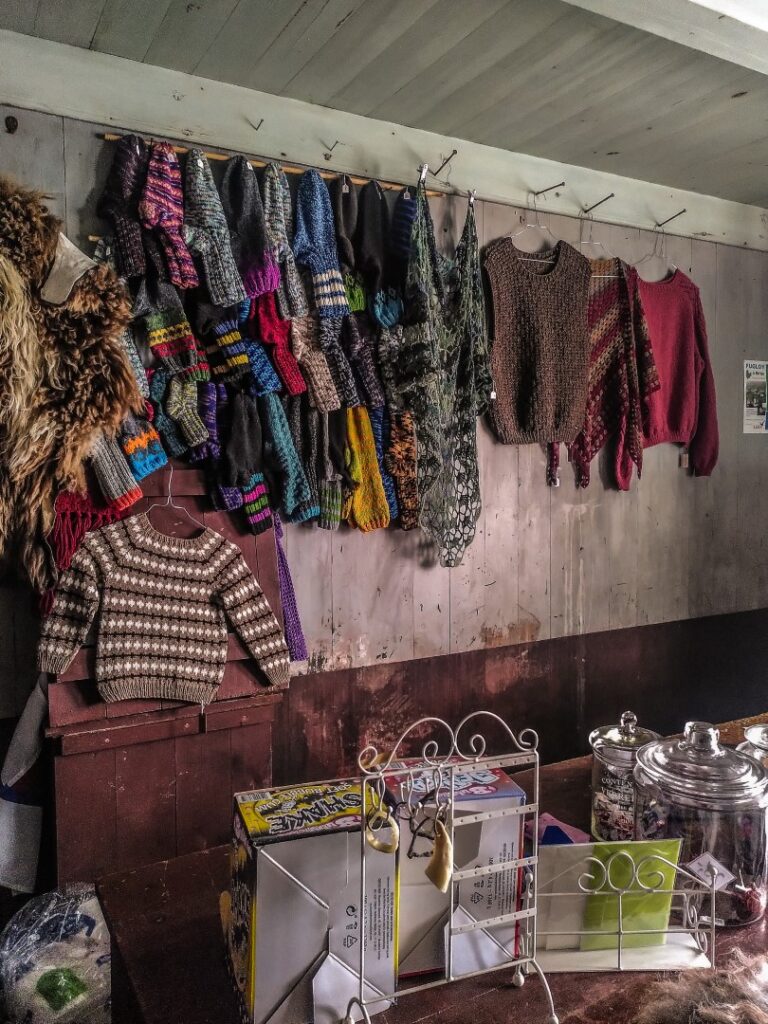
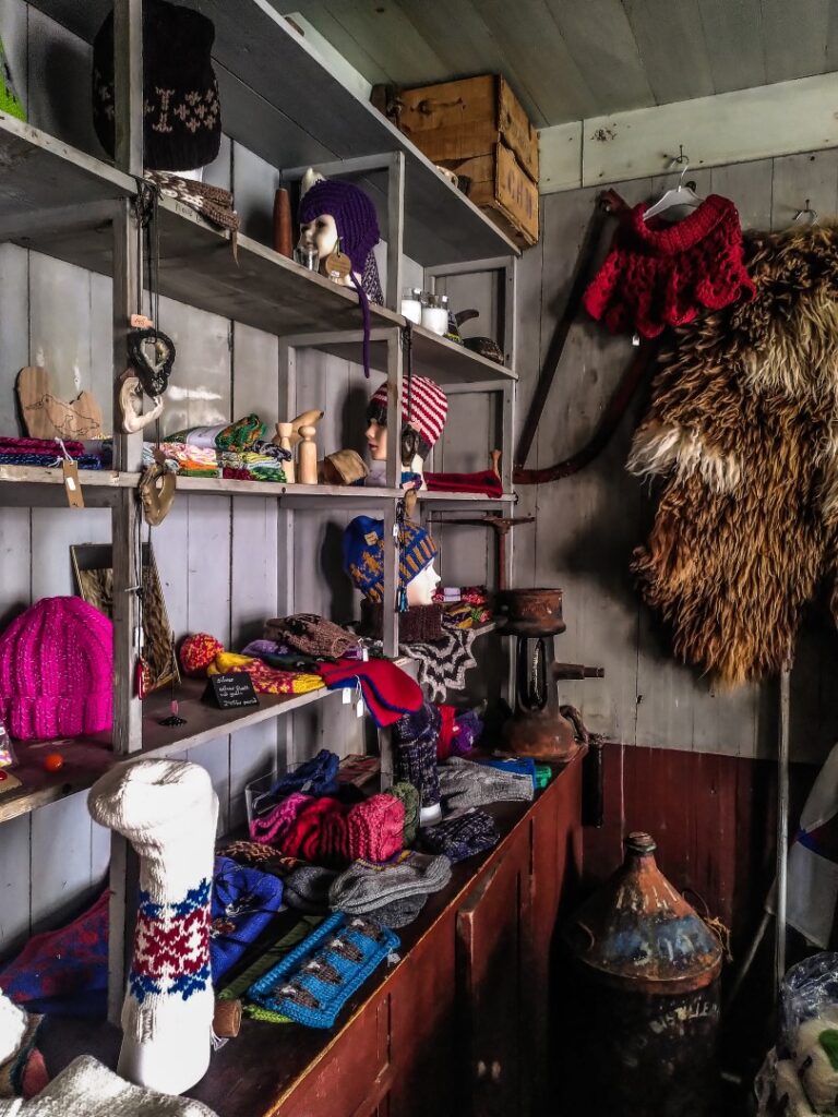
We met some of the villagers we’d spoken to the day before, and they told us about some of the sights on the island and called the owner of the only shop on the island so we could have a look. The shop is run by a young local woman and stocks mainly craft items and snacks. I bought a pair of beautiful warm woolly socks for winter!
As you might know, I’m quite obsessed with the Faroes, and I want to see every corner of every island. So for our only full day on Fugloy, I’d planned a route that would take us all around the entire island, including to the summits of its two mountains!
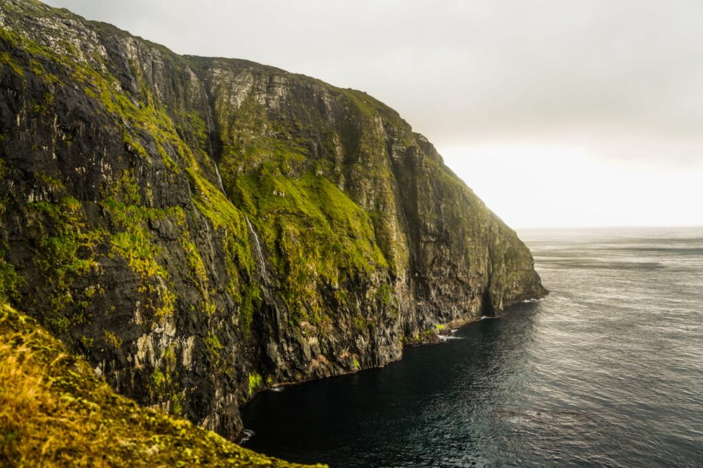
We set off from Kirkja, and after a steep climb upwards, we reached Vatnið í Vatnsdali, a shallow lake below Klubbin, the highest point on Fugloy at 621 m. This was where we took our first break, enjoying some snacks at the lake shore.
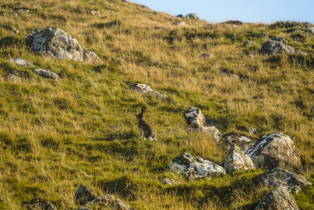
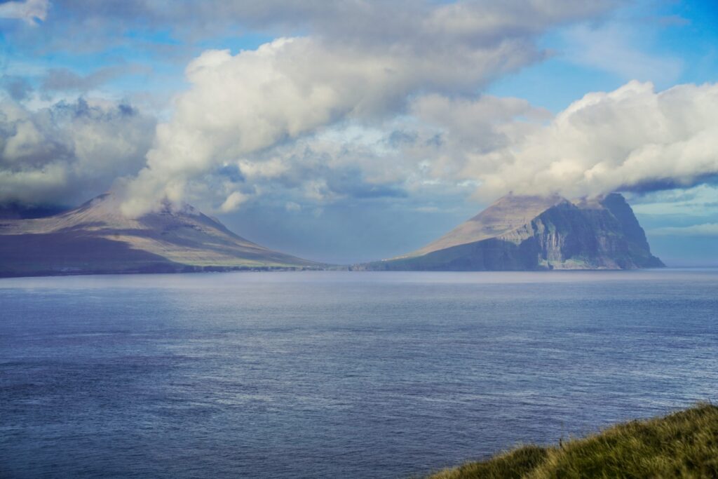
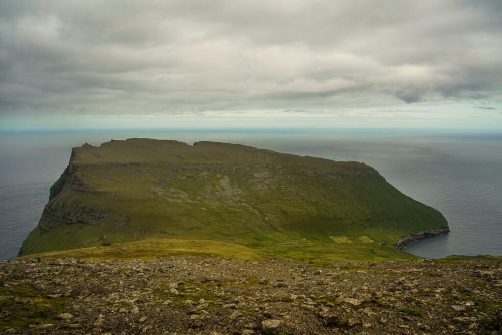
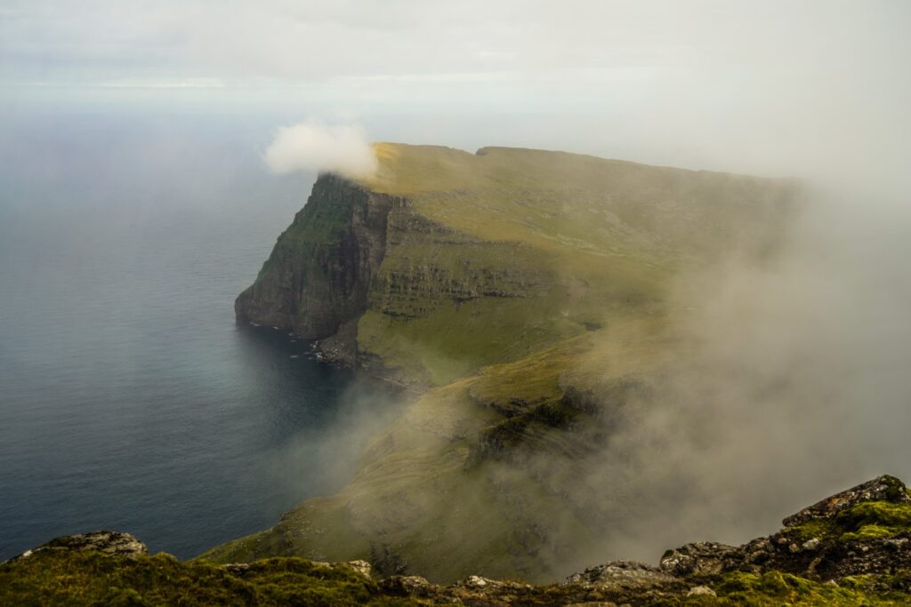
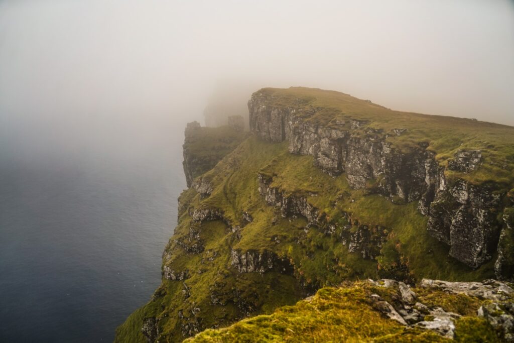
Then it was time to head up the mountain, following a ridge with a gradual ascent. We were met by a few hares that ran away as soon as they spotted us. Further up, the climb got quite steep and rocky. The further up we got, the better the views got, and soon, we could see all the way to Hattarvík and Fugloy’s second mountain, Eystfelli, as well as all the other northern isles. As we neared the summit, we were engulfed in fog but it cleared a few times, allowing us to see the astonishing views.
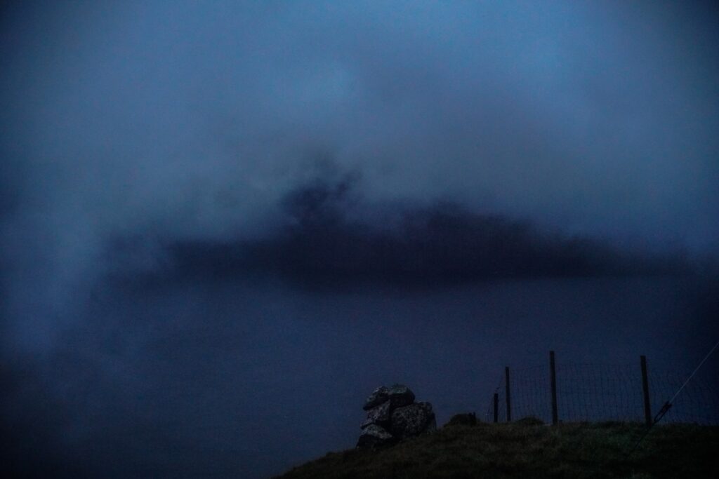
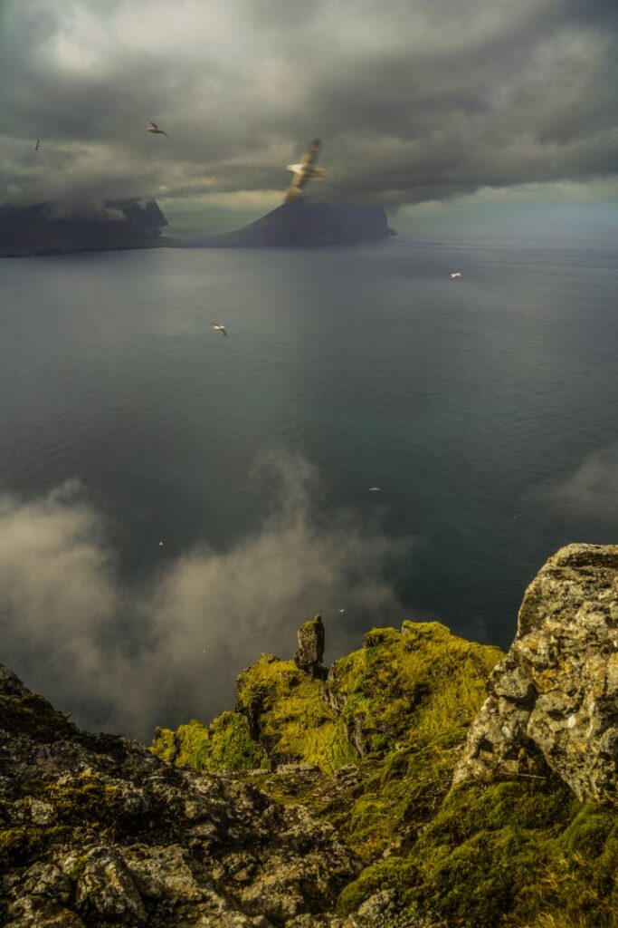
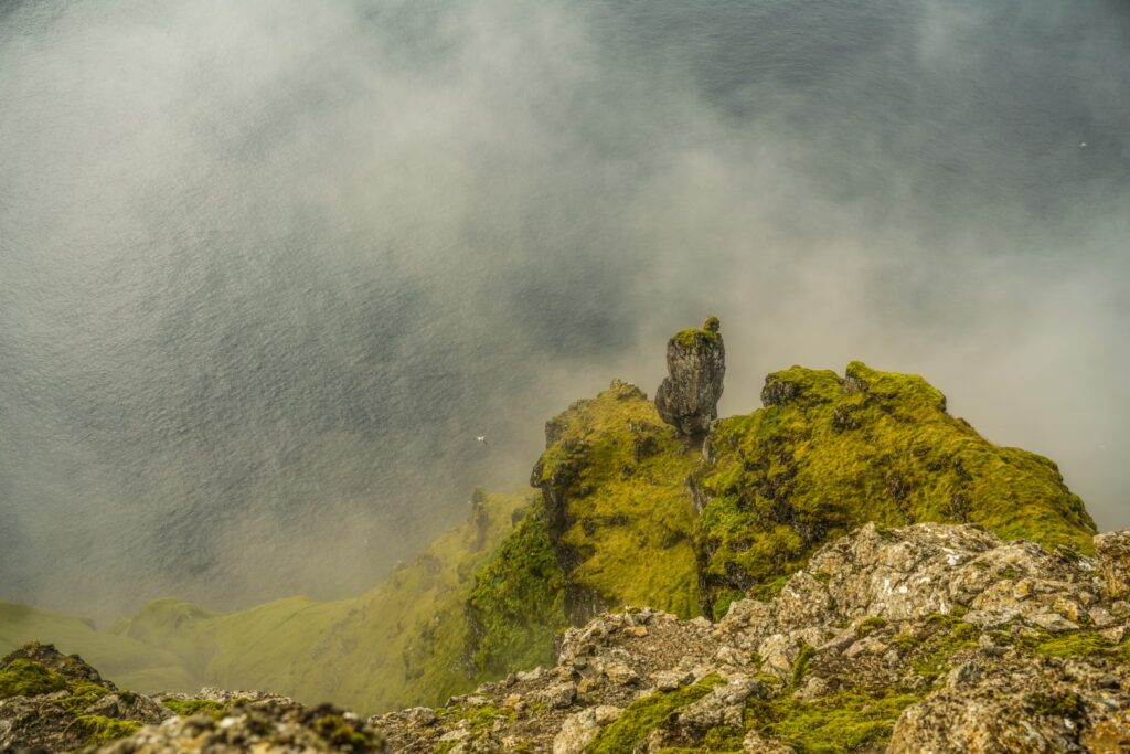
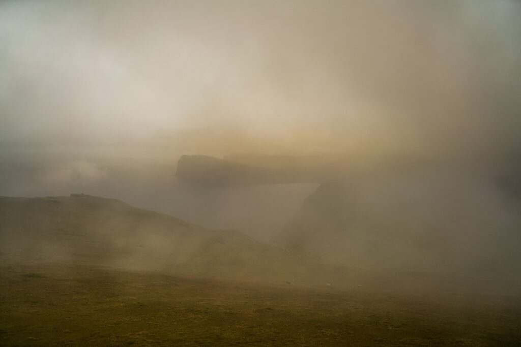
After 3,5 hours of hiking, we finally reached the summit, but our endeavours didn’t stop there. We found a spot to enjoy our lunch and then trotted along the north ridge where we were surprised to find the most amazing, ethereal viewscape. The fog kept coming and going, revealing more and more of Klubbin’s rocky bird cliffs! Seeing these views, Fugloy immediately rose to my top three islands in the Faroes!
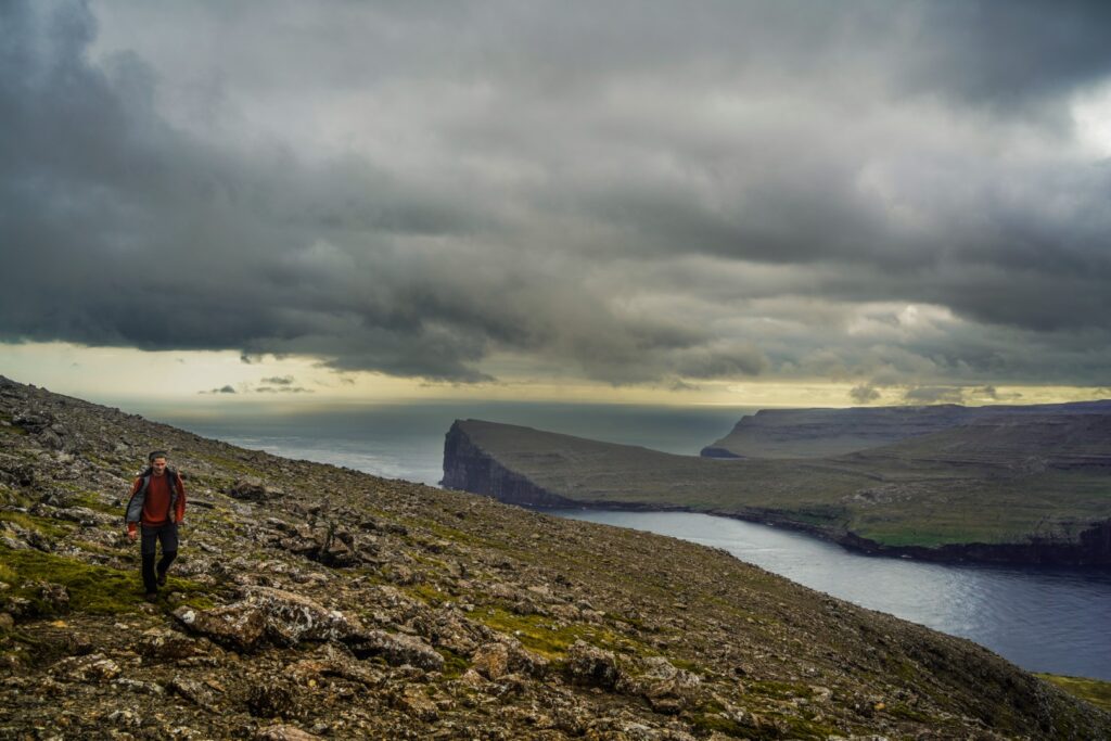
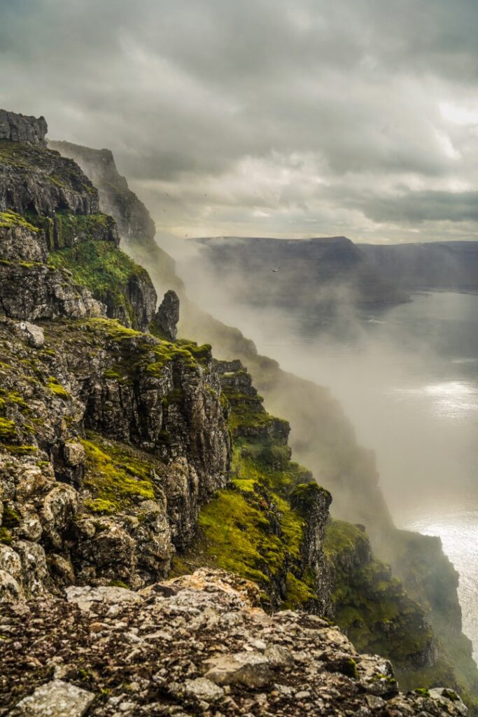
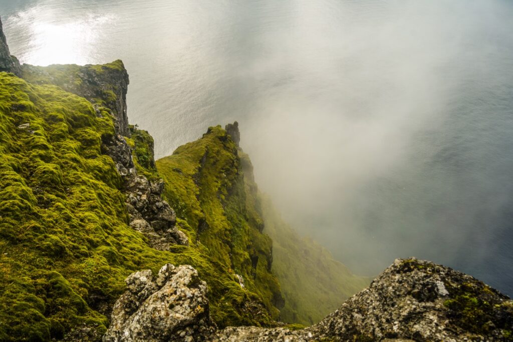
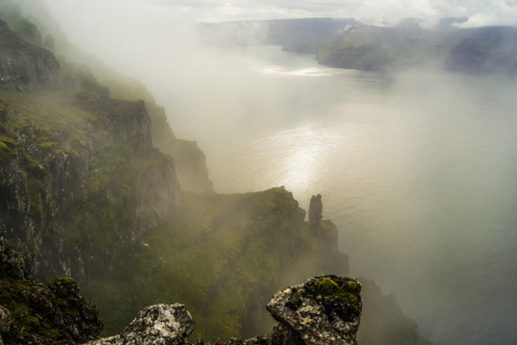
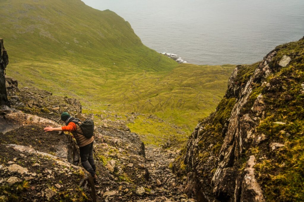
It was tough to pull ourselves away from the ethereal views, but eventually, we had to continue our hike. We headed down the mountain a different way, towards the Skarðsvík valley. The way down was steep and slippery and we had to scramble down parts of it, so we took our time. The fog kept coming and going, which did not help!
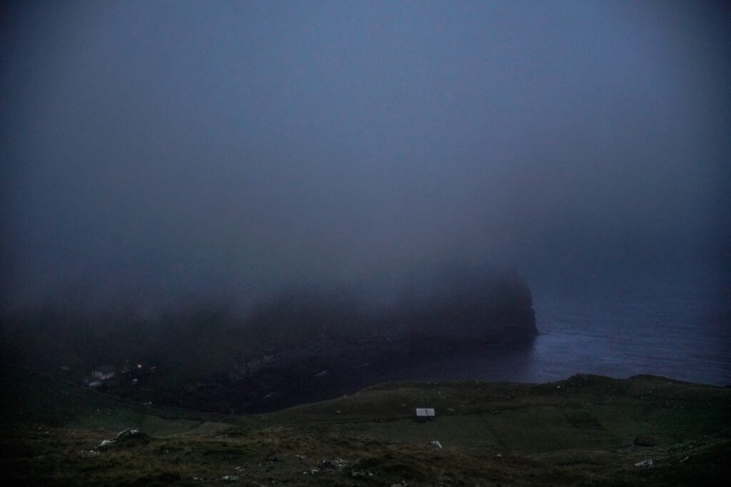
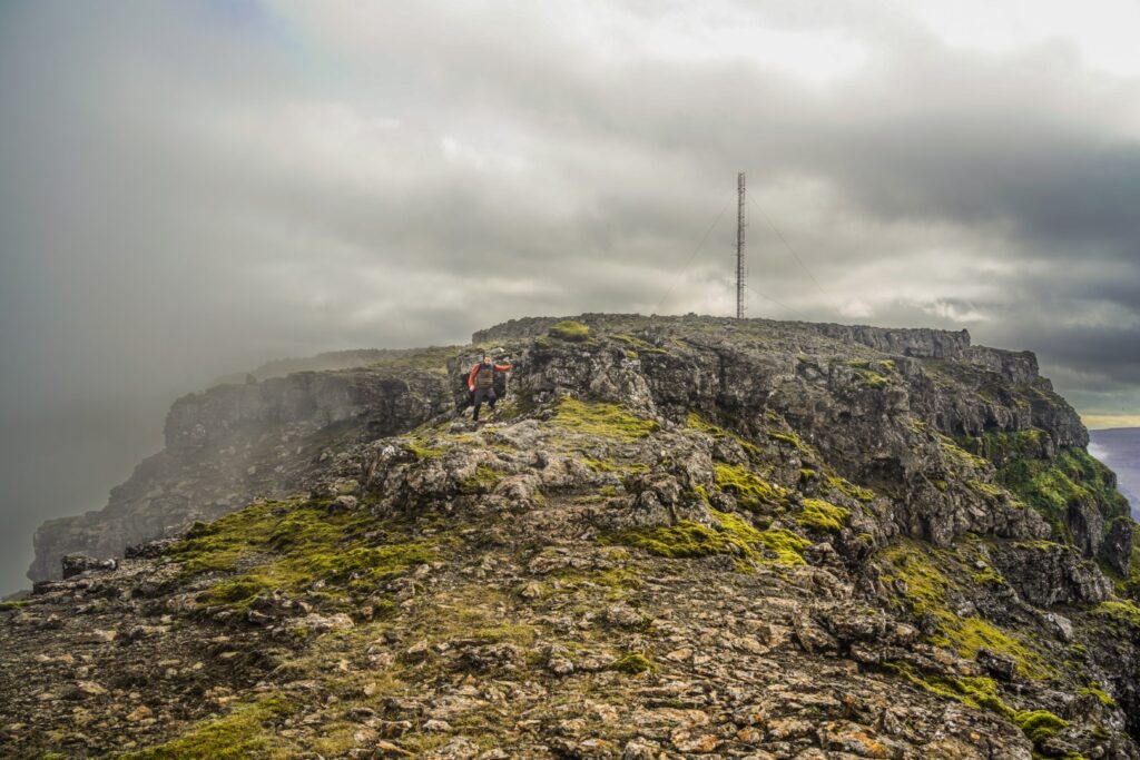
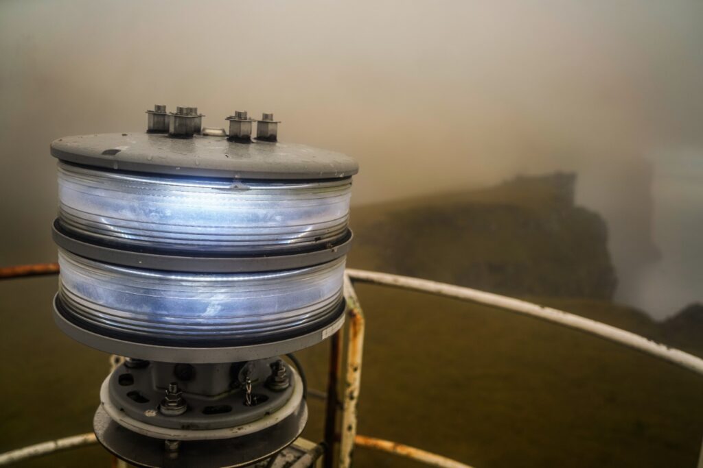
Once we finally got down from the mountain, we hiked towards the small lakes of Inni á Tjørn, and then headed straight up the second mountain, Eystfelli at 449 m, which sits above Hattarvík. It only took us an hour to summit this mountain but the sun was just about to set when we got up there. Unfortunately, it was too foggy for a beautiful sunset, but we did get some gorgeous scenes with Eystfelli’s cliffside and the skeleton of a lighthouse on the summit, which seemingly has never had an exterior! Climbing the lighthouse was a scary experience, especially in the dark!
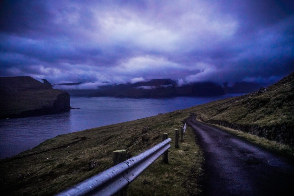
It started raining a little so we quickly hiked back down the mountain to Hattarvík. We then attempted to hike the village trail back to Kirkja but it soon got too dark to see where we were going, so we headed to the road and followed that instead. An hour or so later, in the late evening, we were finally back in our little tent, exhausted like never before!
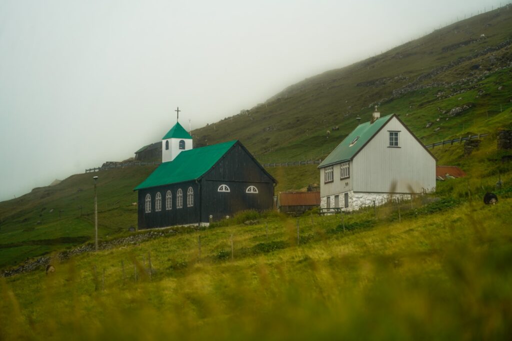
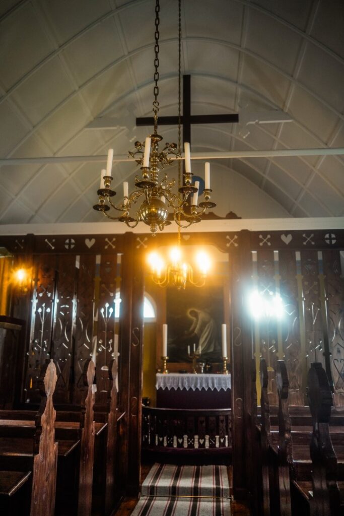
The following morning, we got up early as we were leaving in the early afternoon and I wanted to wander around Kirkja one last time. We asked a local to open the church so we could see it and then went to visit one of the locals we’d met when we arrived. He invited us into his old village house to give me an article about the islands’ archaeology. The house was built in 1916 by his wife’s great grandfather, who also built a small windmill, making them the first to have electricity in the Faroes. At the time, the house was considered very modern, but today it looks like a museum!
And then it was time to pack up our stuff and catch the ferry back to Hvannasund. Our adventure on Fugloy had come to an end, but I’m sure it won’t be my last visit to the island. I know I say this about most islands in the Faroes, but there’s truly something special about Fugloy. Maybe it’s the locals who were friendlier than ever. Maybe it’s the remoteness, the feeling of absolute isolation. Or maybe it’s the otherworldly views. All I know is that I have to return. Two days was enough to see everything the island has to offer, but it was not enough to satisfy my heart.
Hiking route description: The ultimate Fugloy hike
The hike starts in the village of Kirkja, which is reachable by ferry from Hvannasund on Viðoy. Head west out of the village, following the main street, Í Tuni. At the bend of the road, take the trail going west (so don’t turn upwards along the road). Follow the trail to its end and then start hiking upwards. You’ll have to climb a few fences on the way, so take care not to damage them. The climb is quite steep. Head towards the lake, Vatnið í Vatnsdali, and don’t forget to take in the wonderful views there.
Now it’s time to climb up Klubbin. Go up on the right ridge, which is much easier than just going directly up. It’s a gradual ascent to begin with, but it gets steeper closer to the summit, and evens out again towards the peak. Take in the views at the summit, but don’t stop there. From the tower, go north along the ridge for the best views on Fugloy – just be careful where you step!
When you reach a fence, start hiking down to the valley below. Take care here as it’s very steep and can be slippery (if there is snow or ice, do not attempt to hike this way!). There is no easy way to hike this part of the route, and if you find it too challenging, you can take a safer detour by going back to the summit and hiking down the south ridge until you meet the road and then follow that to Hattarvík.
Once you’re down, head towards the small lakes of Inni á Tjørn and the second mountain, Eystfelli. The climb up the mountain is relatively easy and very straight forward. Just head to the skeleton of a lighthouse and you’re on the summit! Take care to not go too close to the edge as the mountain is a cliff with a vertical drop to the ocean on the other side! Climb the lighthouse if you dare, and then head down to Hattarvík.
From there, you can either catch the boat back or hike back to Kirkja, using either the road or the cairn trail. You’ll find the beginning of the trail at the second bend of the road (just after the heliport). It’s easy to follow all the way to Kirkja as there are cairns along the entire trail.

1 COMMENT
Fugloy Farm
4 weeks agoLovely article. I live in Hattarvik.