In early February, I took my first trip out of Aberdeen since moving to the city in mid-January: a Sunday hiking adventure full of pretty views, serene lakes and interesting archaeological sites.
I’d originally wanted to climb Mount Keen (939 m.) as I desperately wanted to get started on bagging munros (the Scottish word for a mountain over 3,000 feet or 914.4 m.), but without a car, I wouldn’t be able to make it in time for the early winter sunset. Instead, I set out to conquer a few smaller mountains, so-called marilyns which are between 492 ft / 150 m and 2000 ft / 610 m in height.
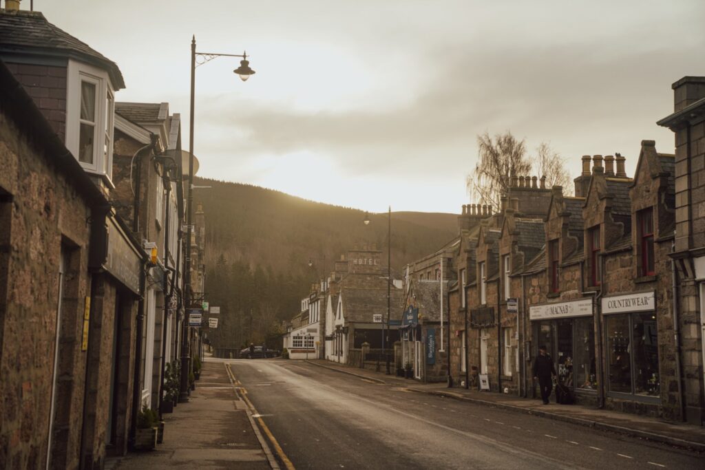
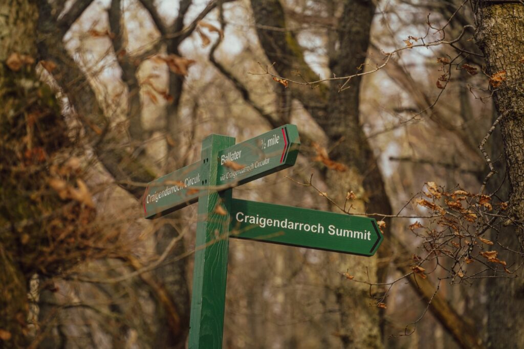
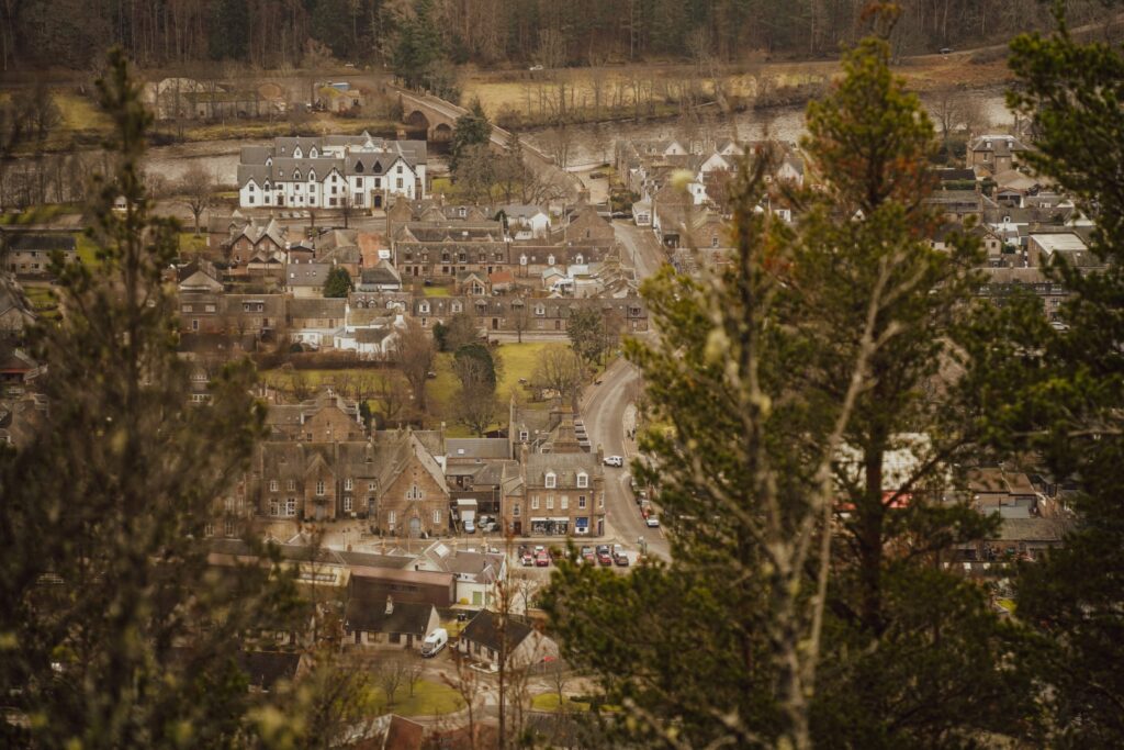
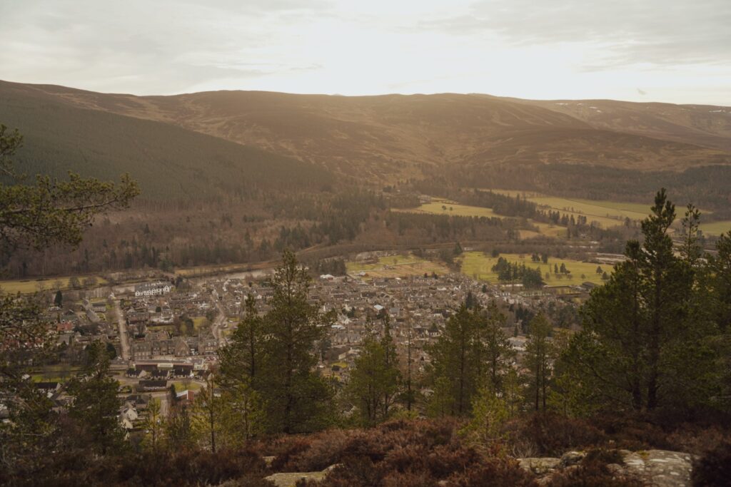
I got off the bus in Ballater, a 1,5-hour trip from Aberdeen, and decided to start with the marilyn that gives Ballater its beautiful rocky backdrop: Craigendarroch at 402 m. I followed a well-trodden trail from the village centre and up to the summit, and met two deer and a few other hikers on the way up. One thing I love about hiking in Scotland is that people always greet each other on the trails – that doesn’t usually happen in Denmark.
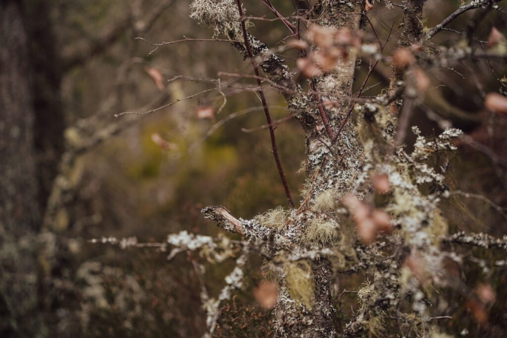
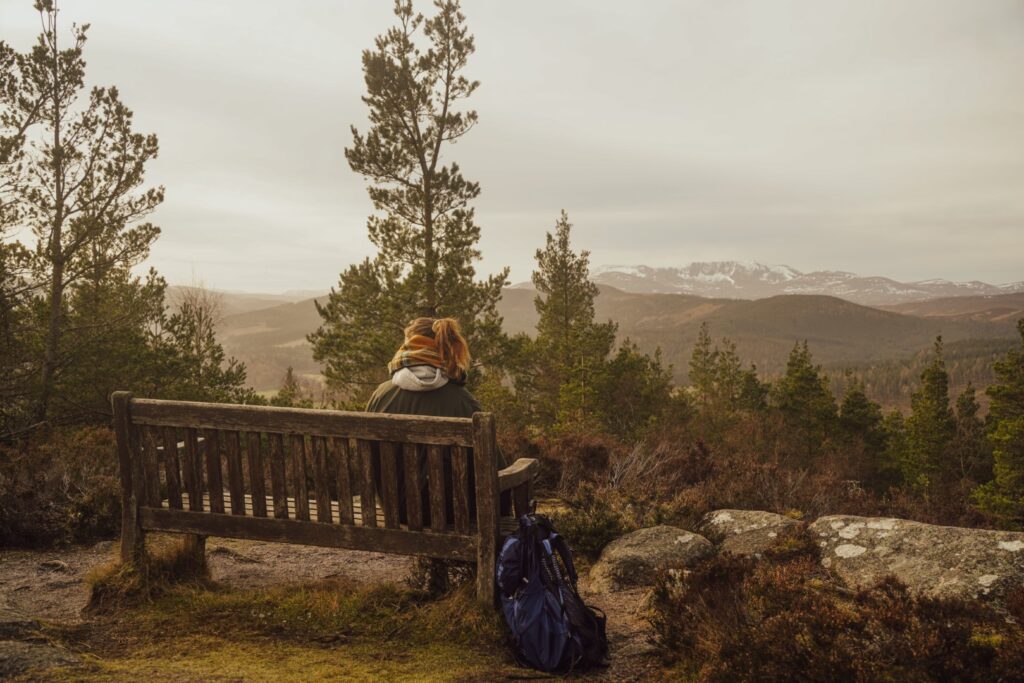
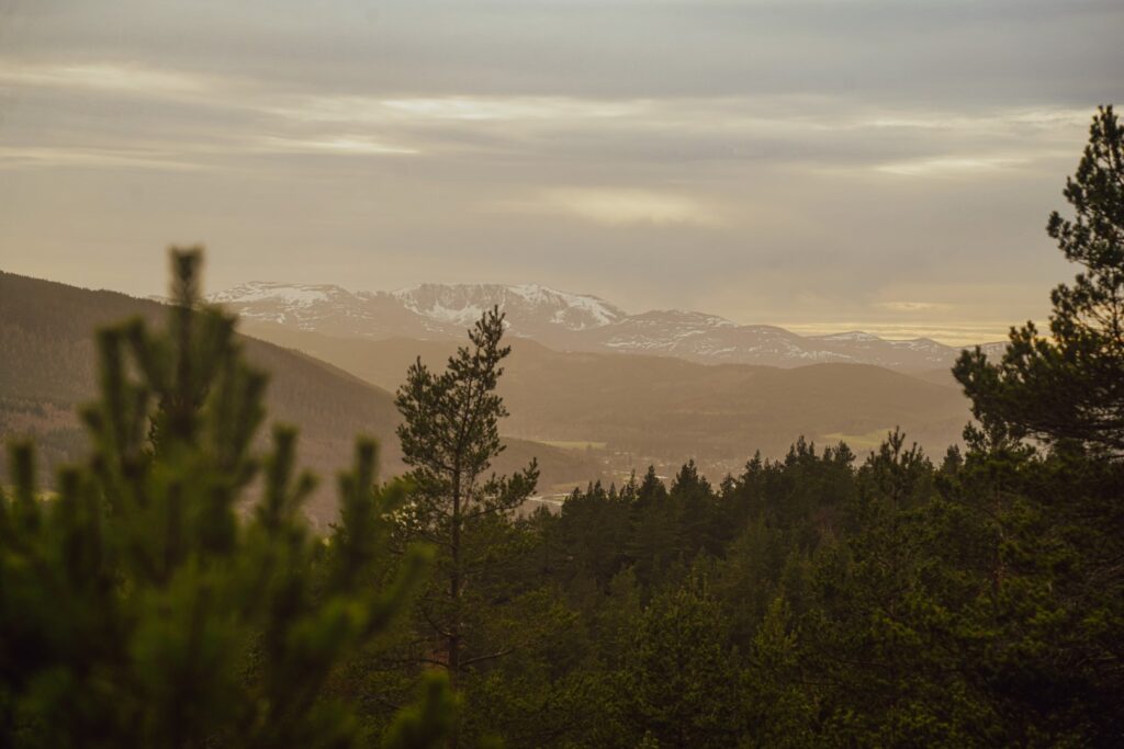
It was cloudy but the sun was trying to break through. It took me an hour of very slow uphill hiking to reach the summit where I was rewarded with views of several munros including Lochnagar, Beinn-Á-Bhuirg and Mount Keen. The clouds finally gave way to the blue sky and sun that I’d been craving as I hung out on the summit, enjoying my lunch and taking plenty of pictures. I continued down the mountain on the other side but it wasn’t long until I stopped again as I noticed how completely silent it was. I just stood there listening. No people, no cars, no wind, not even any birds. Just me and the silent trees.


When I got back down to Ballater, I met a local elderly couple who asked me about my hike and where I was headed. They told me that their son in law runs up the mountain every morning before breakfast – talk about dedication! They also told me about the yellow brick houses of their neighbourhood that were shipped all the way from Sweden, my neighbouring country. Sometimes the world feels very small!
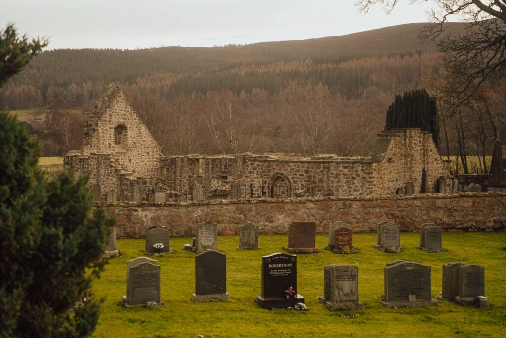
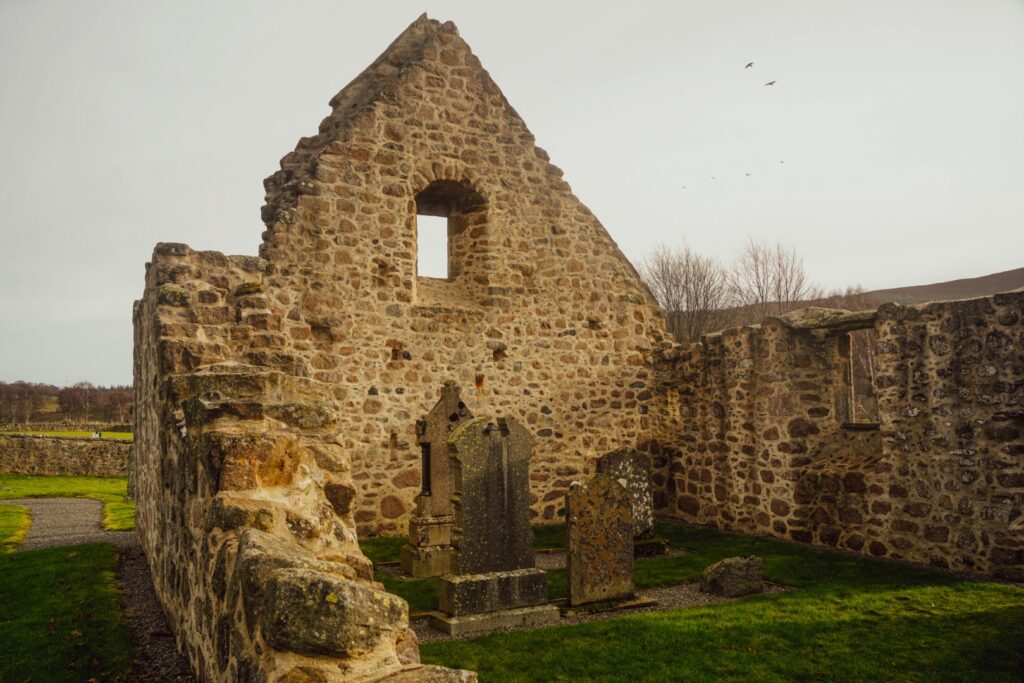
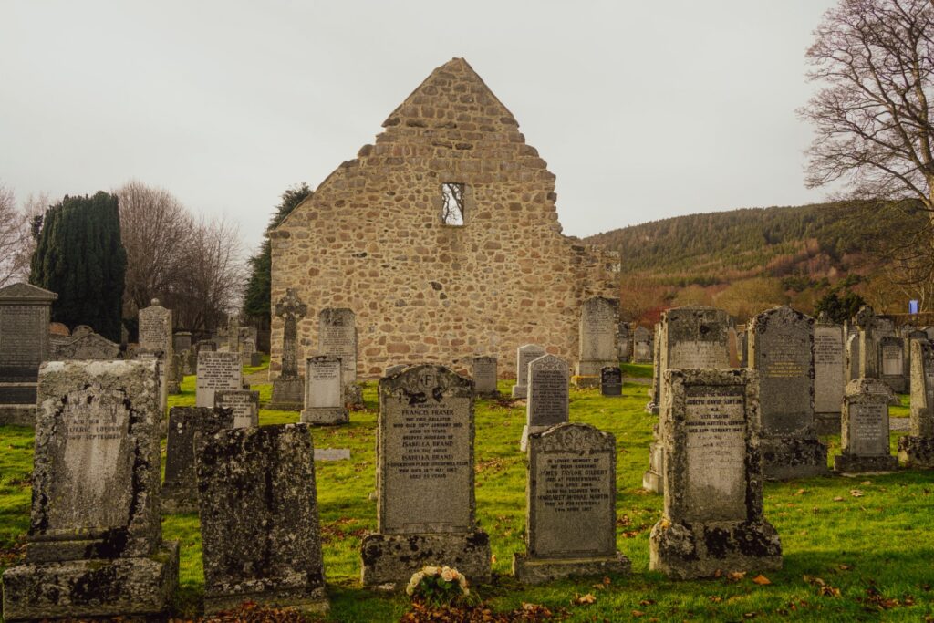
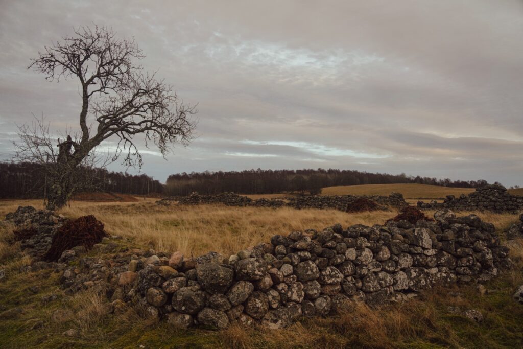
The next part of my hike was quite uninspiring as I was just walking alongside a road but I had to in order to reach a roadside attraction that I wanted to explore: the ruins of Tullich Kirk.
Tullich Kirk dates back to around 1400, and used to be one of three parish churches serving the area after the Reformation, but when the three were merged in 1798, Tullich Kirk was abandoned and left to decay. However, the circular graveyard surrounding the church continues to be in use.
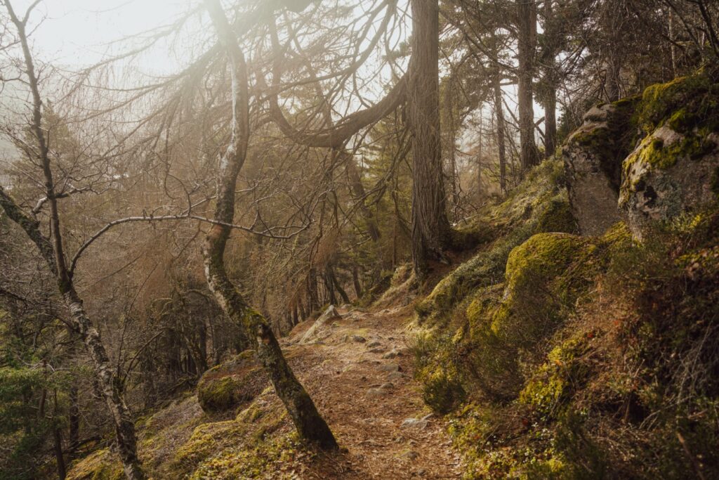
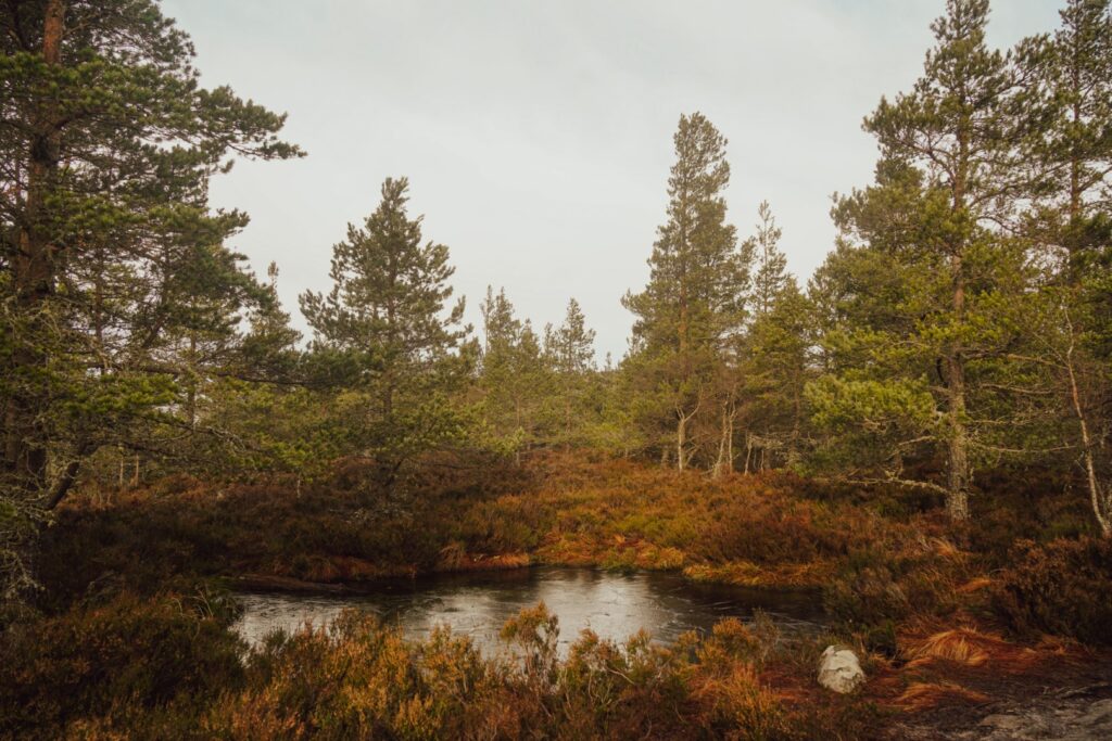


After my church visit, I headed up into the wilderness again in direction of the Cnoc Dubh marilyn at 325 m., located in the Muir of Dinnet National Nature Reserve. It was a nice and easy hike along a well-trodden trail, and much more relaxing than the hike up Craigendarroch.
At one point, I had to take a detour as a route had been closed off for seemingly no reason, but it only meant more forest hiking which is never a bad thing. Once I reached the top of the small mountain, I was rewarded with gorgeous views of the higher parts of the Cairngorms. I met a couple of mountain bikers up there who had passed by me earlier, and they advised me to walk down the opposite way of where I’d come up. It was very windy so didn’t stay long at the summit, I just grabbed a bite to eat and then headed down the trail they’d recommended, towards two large lakes, Loch Davan and Loch Kinord.

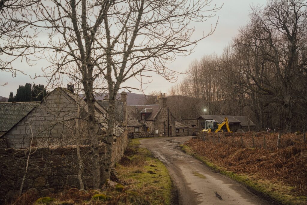
Back down from the mountain, I headed into a forest and met a cat hanging out in the window of a campervan! I made my way to the neck of land between Loch Davan and Loch Kinord where I came across the first of many archaeological sites on the local heritage trail, ‘the Little Ord Trail’; the abandoned farmhouse Old Kinord. In the 1840s, Old Kinord was a thriving community home to 22 people, but like many other hamlets in the Scottish Highlands, the site was abandoned in the early 20th century as people moved to the cities to find work.
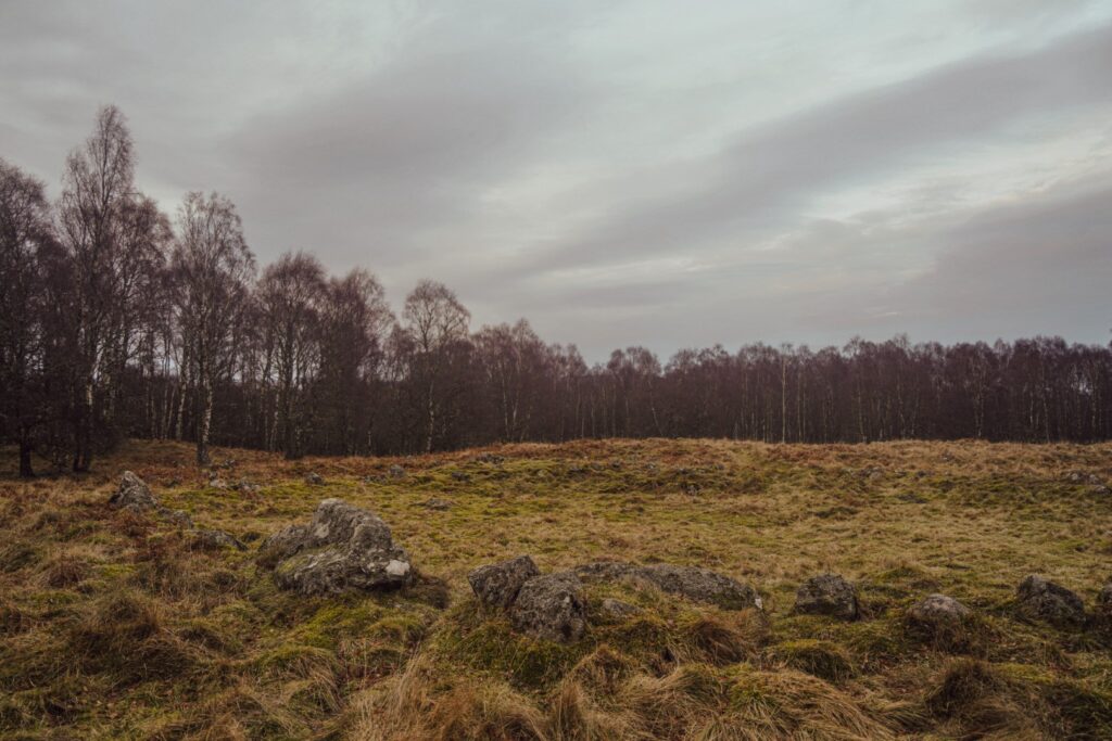
I continued along the heritage trail into another forest to locate the site of an Iron Age settlement with hut foundations, trackways, souterrains and field boundaries still visible today. The site is thought to date back to the first millennium BC until the end of the first millennium AD.
By now, I had to hurry to reach my bus in time, but there were still more archaeological sites to see. So I hurried down to the banks of Loch Kinord, past the modern-day New Kinord village which looked just as abandoned as its ruined equivalent.
By the 800s, the area was home to a Christian community, as witnessed by the Kinord Cross which stands right at the edge of the lake. A kite-shaped slab with a well-preserved interlace-filled Christian cross carved on the surface, the Kinord Cross represents one of many Pictish stones found around eastern Scotland, dating to the 9th century.
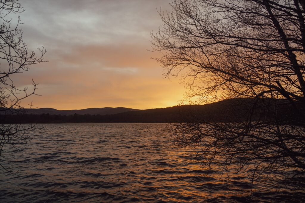
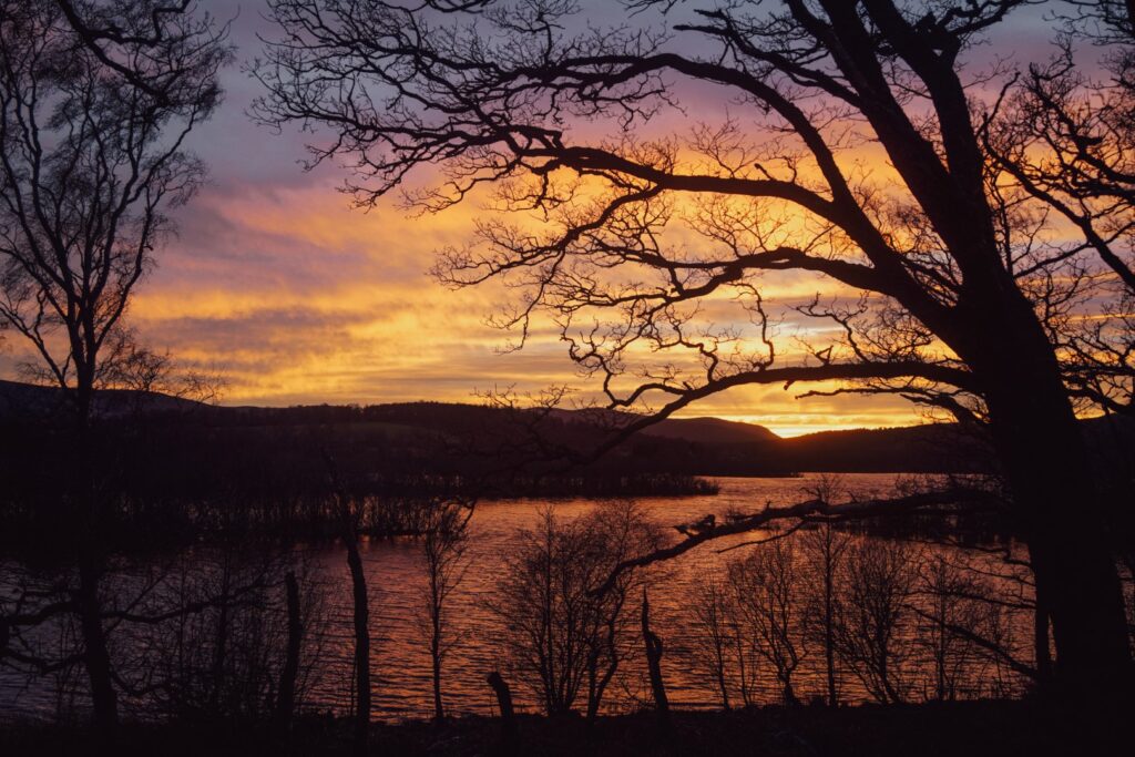
As the sun began to set, I hurriedly walked along the lake shore and watched the spectacle while peering out to Crannog Island, a manmade island that once held a large hut on stilts dating to the Iron Age, and Castle Island where the remains of King Malcolm Canmore’s hunting lodge from the 11th century stands. This area sure is full of history!
The sun put on a brilliant colour show and I found it difficult to remove myself from the lake, but eventually, I had to as I would’ve missed my bus. The last section of the hike took me past another small lake, Loch Clarack, where I stopped to photograph the last colours of the sunset before running to catch the bus in Dinnet. I made it just in time, after 21 kilometres and a set of very tired legs!


Hiking route description: Hiking around Ballater and Loch Kinord
The hike begins in the village of Ballater. Follow Bridge Street northwest towards Craigendarroch (402 m.) and turn right at Craigendarroch Walk. A few metres in, you’ll see a trail going left up the mountain. Follow the signs that point towards the summit. Once at the summit, you can go back the same way or continue in the opposite direction, eventually ending back down on Craigendarroch Walk but 200 metres from the starting point.
Follow Craigendarroch Walk northeast, then turn left at Monatrie Avenue. After the paved road ends, take a right turn onto the grassy path and then join onto the Cinder Track, going left. You’ll soon reach Morven Way which you should follow until it reaches B972. Go right and continue until you reach the ruined church on the right-hand side of the road in Tullich.
After exploring the church ruin, go back to the main road, take a left turn and then a right turn immediately after. Follow the street to a gate that will lead you to a grassy path, going right. Follow the trail past a small lake and shortly after, take a left turn (this turn can be easy to miss, so keep your eyes peeled!). This trail is nice and easy with a very graducal ascent. Continue along the trail and after a bend, take a left turn. When I was there, this part of the trail was closed off, but you can take a short detour down to Cambus o’ May and back up a different trail if that’s the case.
Keep going straight along the trail, and soon you’ll see a right turn towards the summit of Cnoc Dubh (325 m). Enjoy the beautiful views, and then head down the trail on the opposite side of where you came up, going towards Loch Davan and Loch Kinord. Take the first left turn, then a right turn after the many fallen trees. You’ll soon reach the B9119 road. Follow the road for a few hundred metres, then turn right and follow the forest trail that hugs the road.
At the end of the trail, take a right turn and then immediately left. When you reach the crossroad, turn left then right shortly after. Soon after, you’ll reach the abandoned farmhouse of Old Kinord, and if you continue along the heritage trail, you’ll eventually reach the remains of an Iron Age settlement. Follow the trail to the present-day village of New Kinord, and then follow the trail along Loch Kinord until you reach the Kinord Cross. Head back along the same trail but instead of going back to the New Kinord village, continue following the lake south. The trail will leave the lake after a while, and instead take you past Loch Clarack and then you’ll arrive in the village of Dinnet where the hike ends.
The hike is 21 kilometres, takes 5-6 hours and is of moderate difficulty.
Travelling to the route by bus? Find the timetable here!

Leave a Comment
Pingback: My March 2023: Exam time in Aberdeen – Northtrotter on 06/03/2023
Pingback: Beneath the munros of the Cairngorms: Hiking a 32 km loop to Lock Muick – Northtrotter on 06/03/2023

2 COMMENTS