After a long Christmas holiday at home, mixed with some Covid-19 at the turn of the year, I finally arrived back on Lolland twelve days into January. When the weekend came around and the weather forecast promised a sunny day, I jumped at the opportunity for a hike. My first hike in 2021!
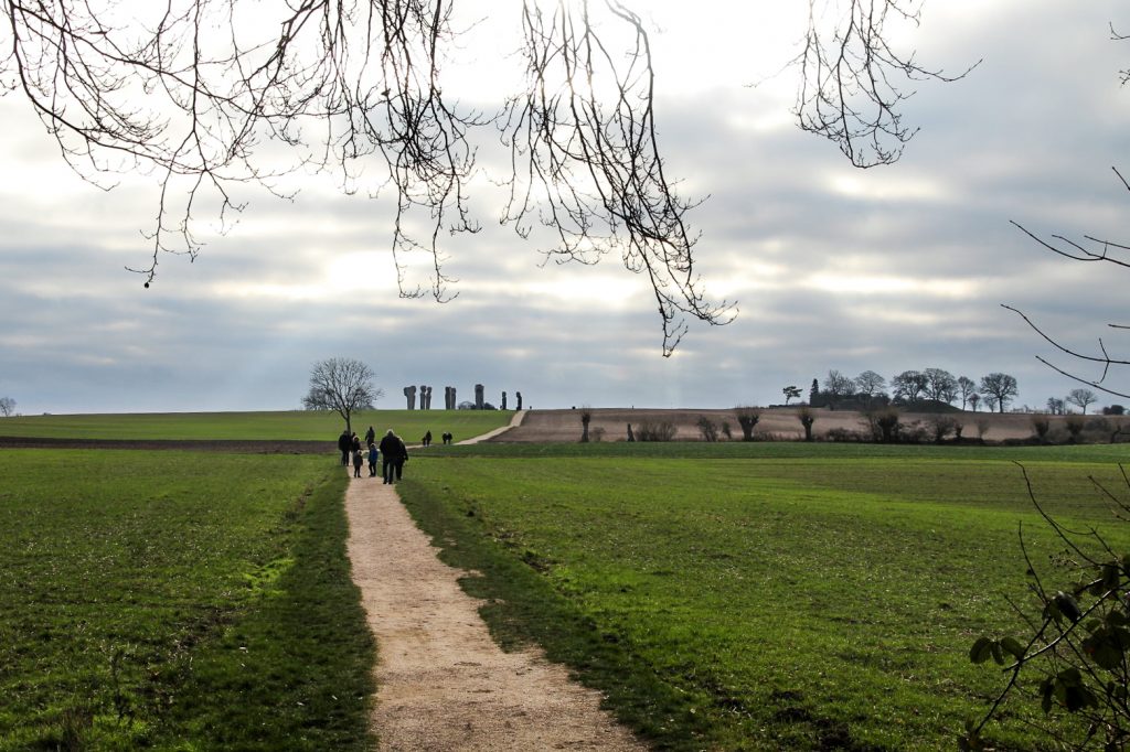
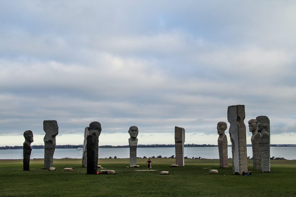
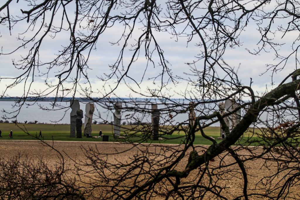
There was one place on Lolland that I had yet to see that everyone was raving about. Everyone told me to go there, asked me why I hadn’t yet been. I’m talking about Dodekalitten, a stone monument consisting of twelve menhirs with faces carved in granite. It’s Lolland’s most famous landmark (well, besides Lalandia, an enormous waterpark!). So on that Saturday, I plotted out a hiking route in the area surrounding Dodekalitten, known as Ravnsby Bakker.
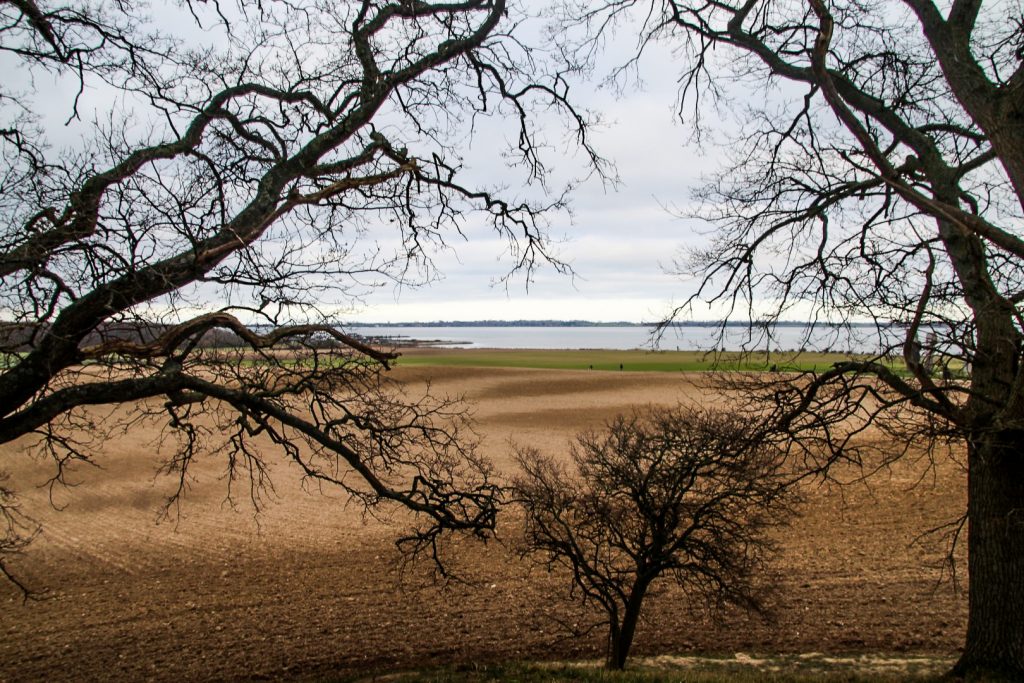
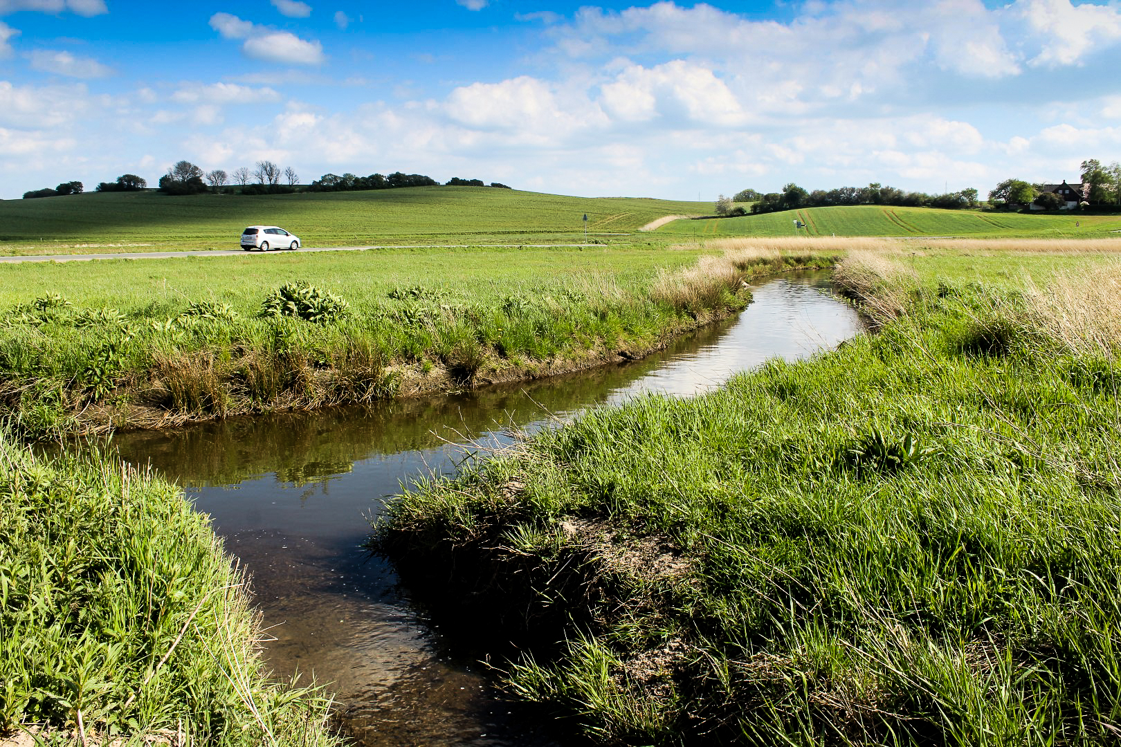
It’s the hilliest area on Lolland, in fact it’s locally called “the Lolland Alps”, although that says more about the rest of the island as the highest point is a mere 30 meters above sea level. And it’s not even natural – it’s a burial mound from the Bronze Age! But I was excited to hike in just a little bit more terrain than I’m used to in the southern parts of Lolland.
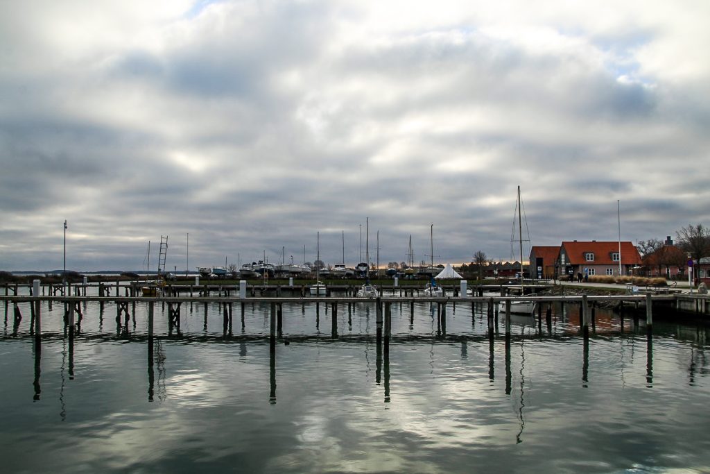
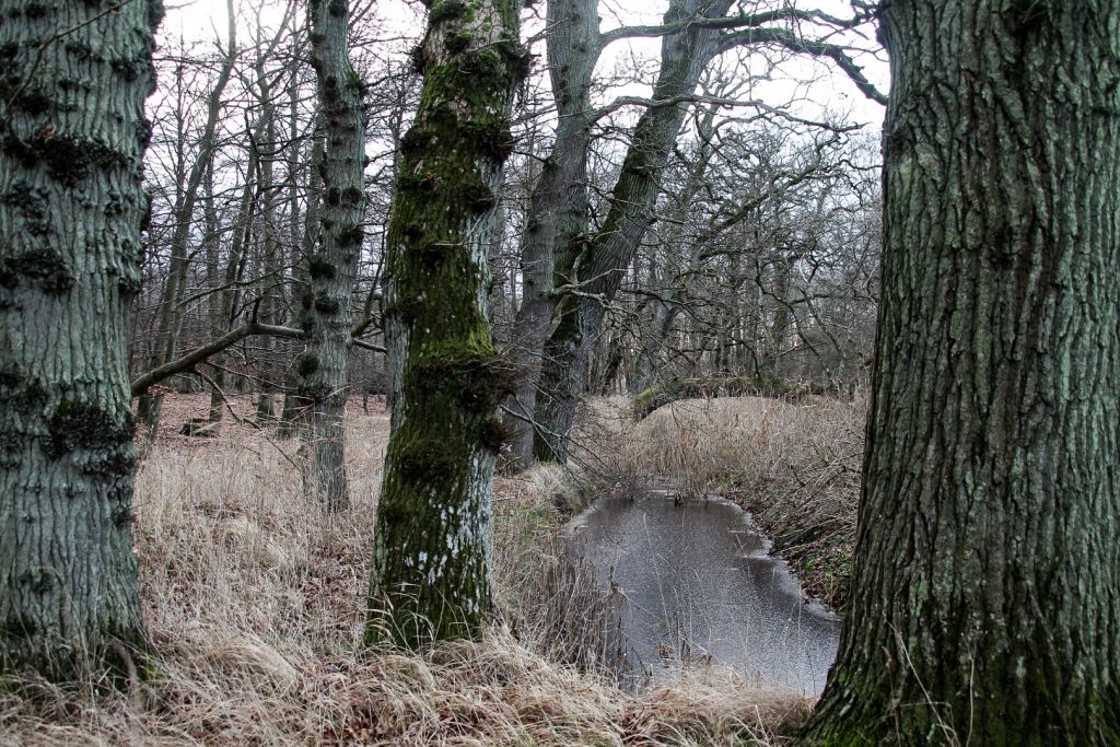
I started my hike in the tiny harbour village of Kragenæs. The sun was still hidden behind clouds when I set off through Klinkeskoven, a tiny forest in the village with a path leading to Dodekalitten. I wasn’t alone, in fact many people were out enjoying this calm Saturday in January.
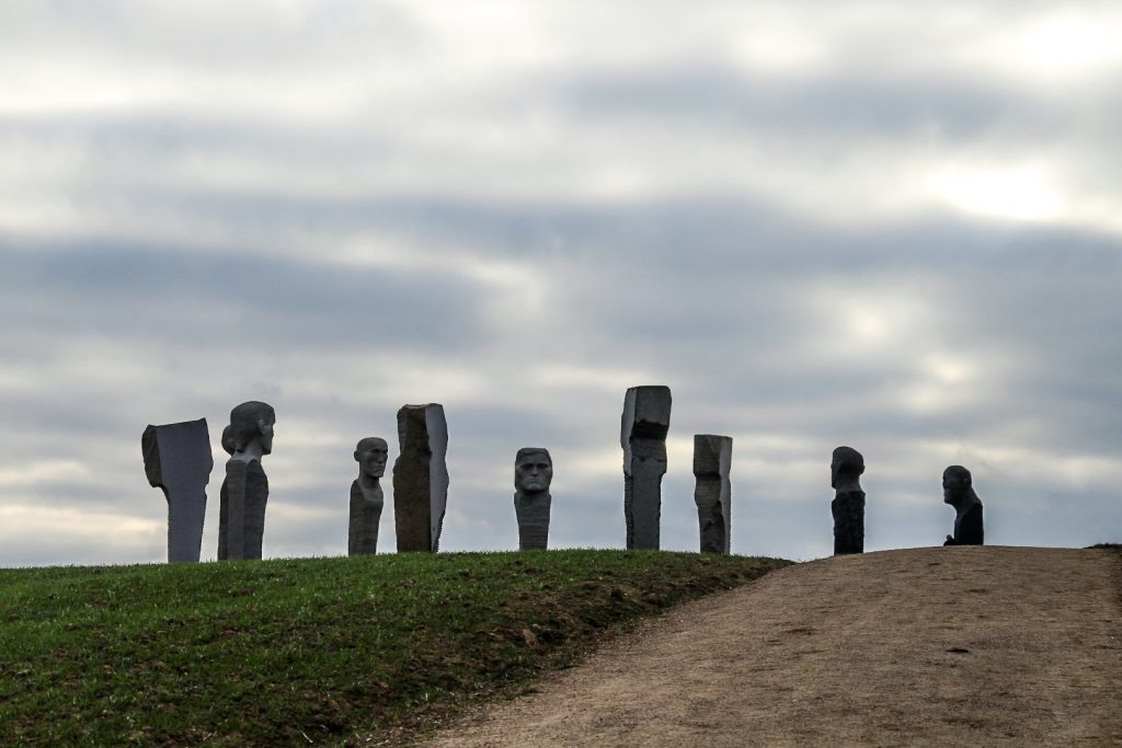
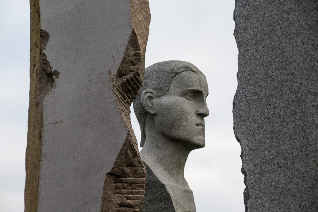
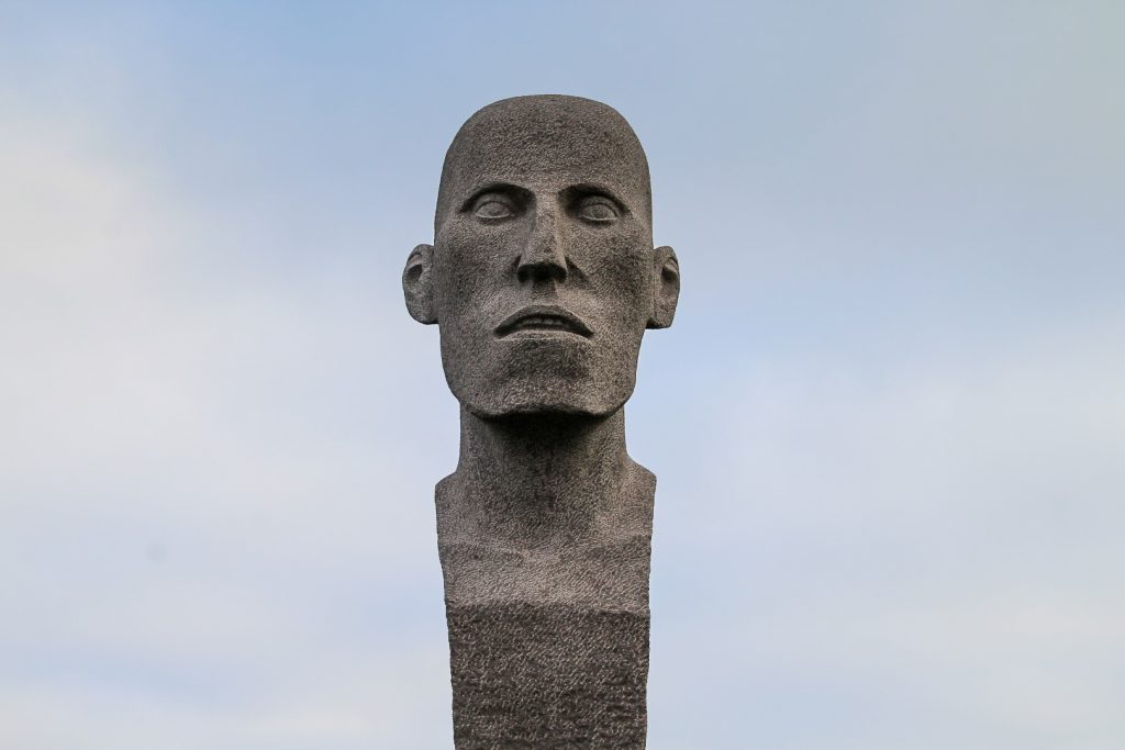
Slowly, I approached Dodekalitten and listened for the electroacoustic music that has been installed at the stone circle. It’s a majestic, impressive sight, even though the monument isn’t yet completed. In fact, only five out of the twelve 7-9-meter-tall stones are completely done, the rest are set to be done by 2025.
From afar, the monument resembles Neolithic stone circles such as Stonehenge and the Calanais Standing Stones, but when you get close, you start to see that this stone circle tells its own story. A story of Lolland’s past, present and future.
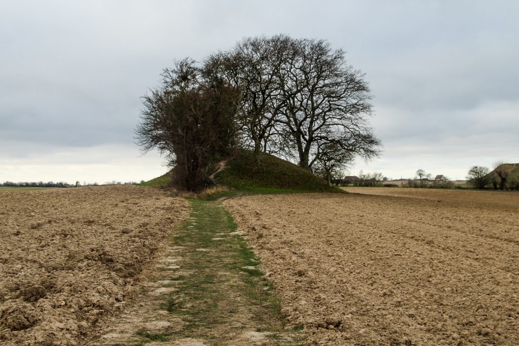
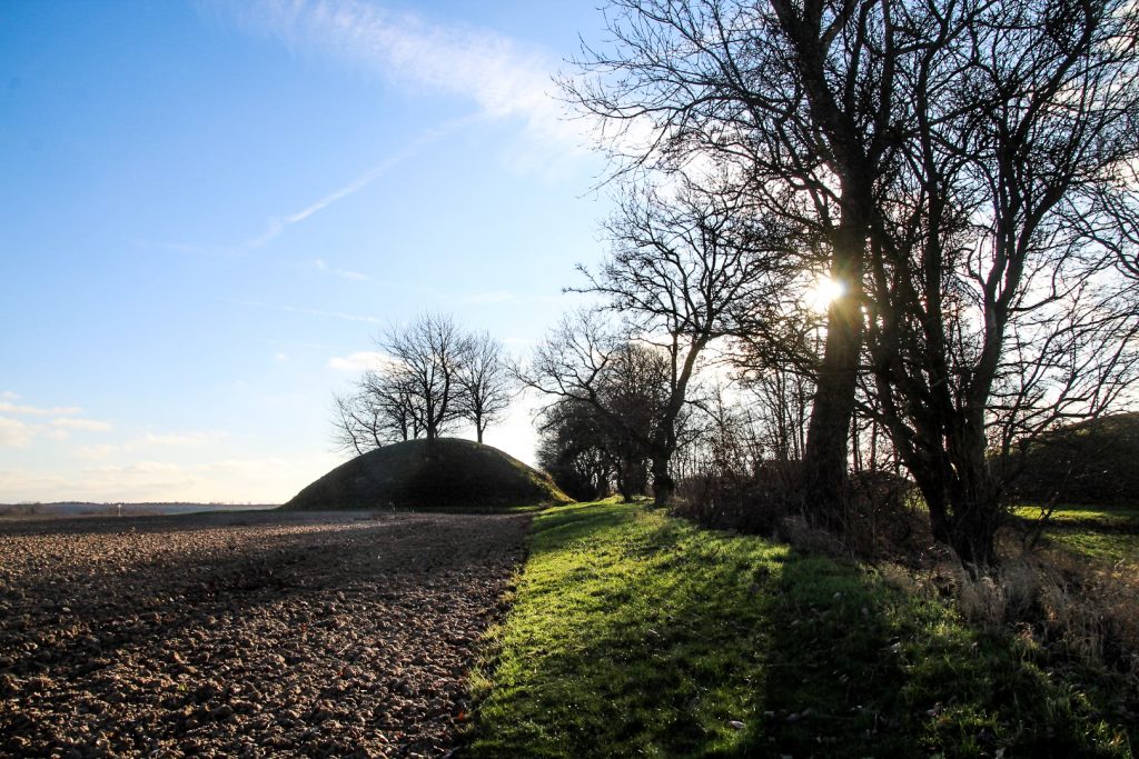
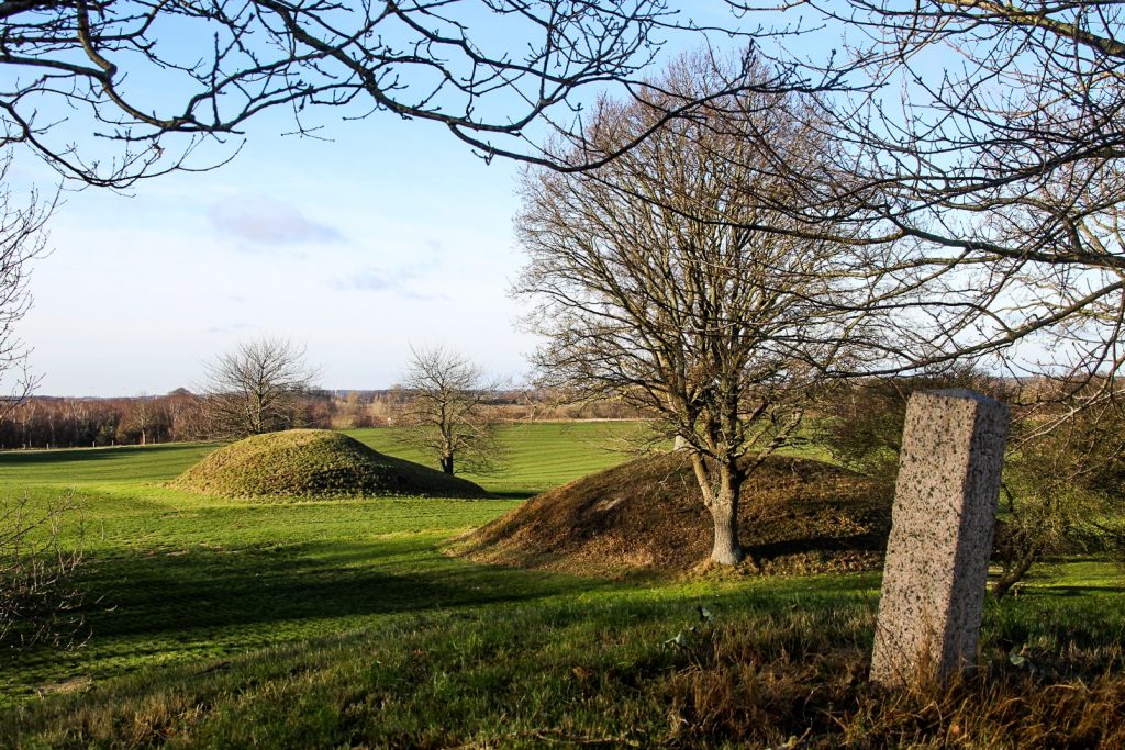
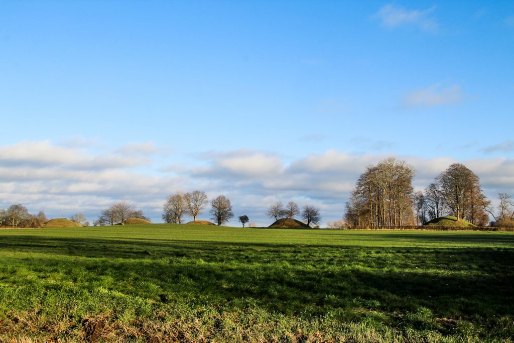
Behind Dodekalitten stand three burial mounds from the Bronze Age. But these are only a few of the more than seventy burial mounds found in the area. You see them everywhere as you drive through Ravnsby Bakker, and I set out to explore quite a few of them on this hike!
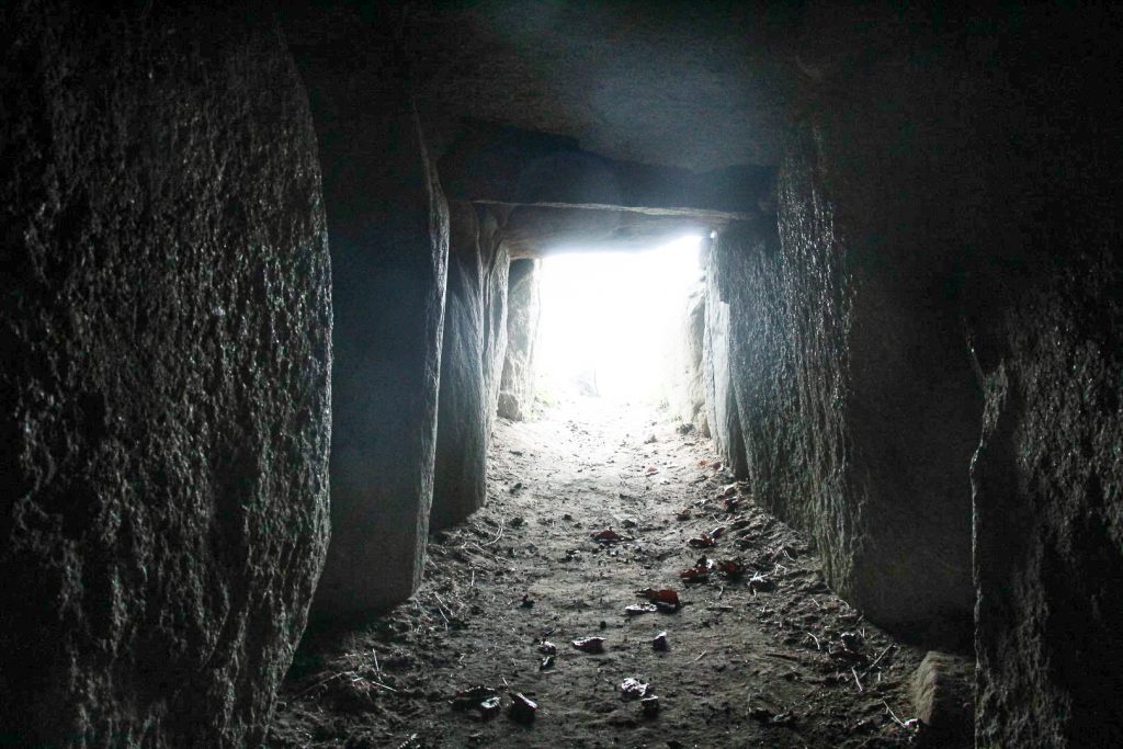
Next to the three burial mounds is an even older burial structure, a passage grave from the Neolithic called Glentehøj. It’s incredibly well-preserved and open for the public for those who fancy crawling in. I did! I climbed to the top of the mound afterwards, and looked over at Dodekalitten, still swarming with people but not one of them headed to these nearby archaeological gems. I had them all to myself.
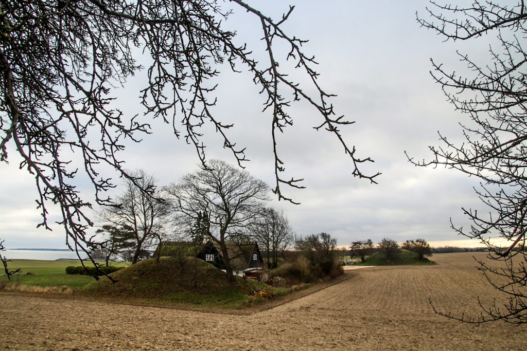
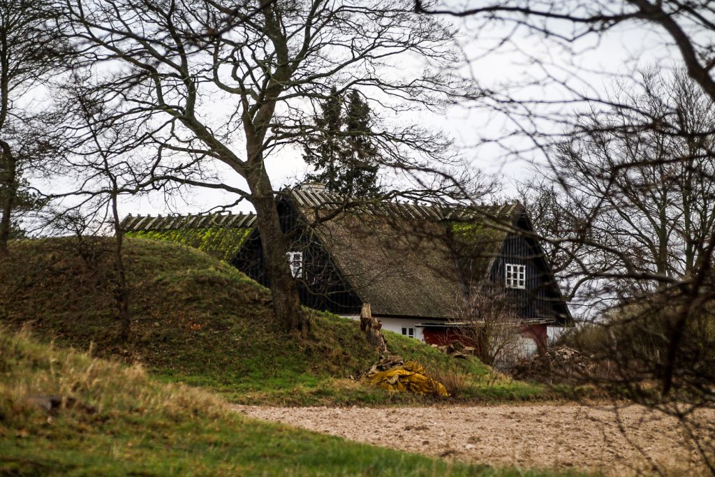
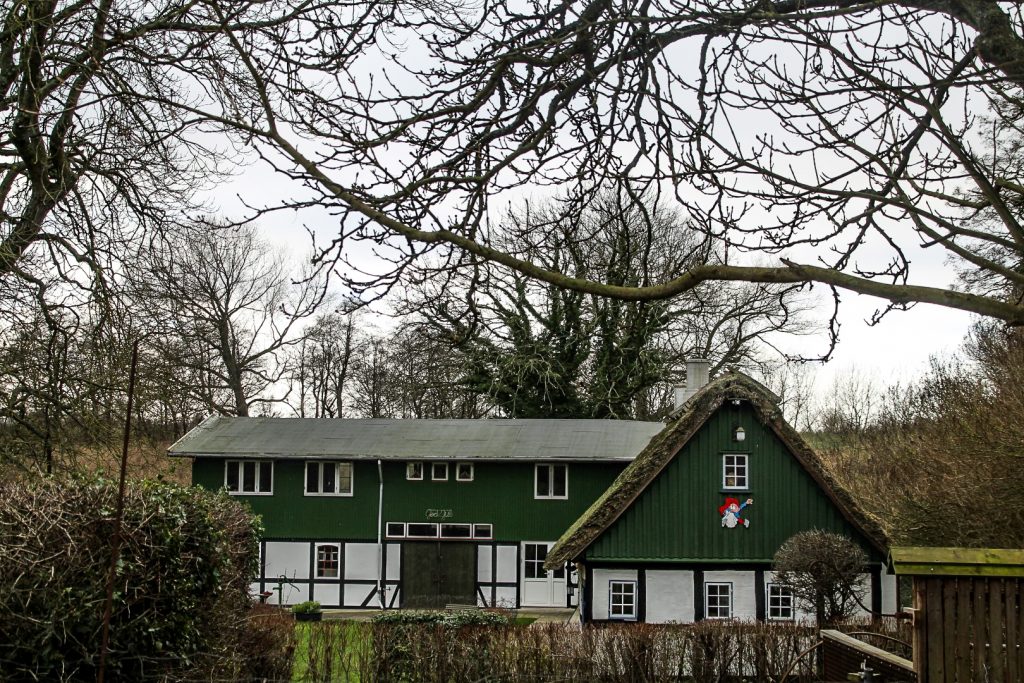
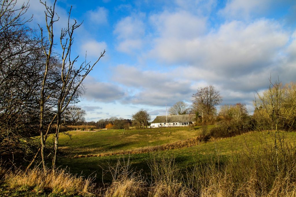
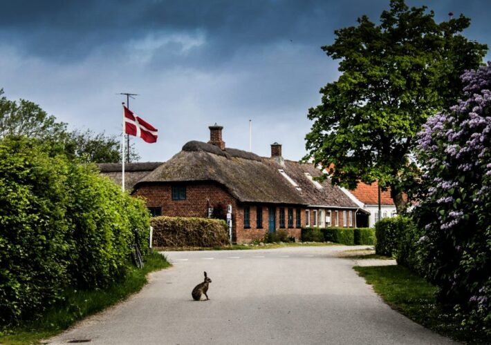
I left Glentehøj and Dodekalitten behind and walked towards the village of Ravnsby. It wasn’t long until I reached the tiny village, which consists of only a few farms and thatched cottages.
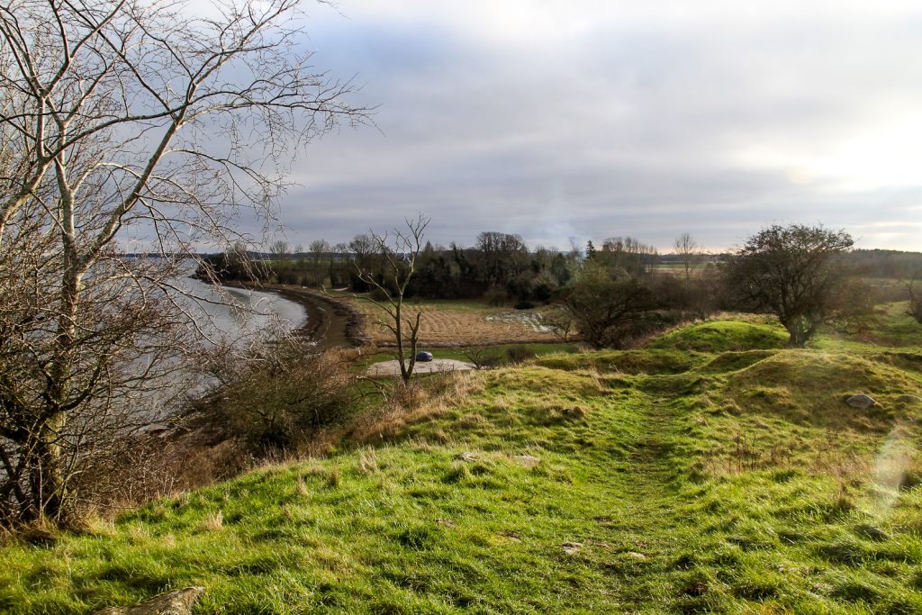
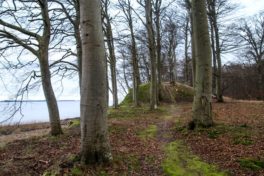
Further along, I came to Ravnsborg Voldsted, the ruins of a large castle and rampart, located beautifully by the coast. It was built in 1330, and was since in the hands of several kings and Denmark’s first queen, Margrete 1., before being demolished in 1510. Most of the original bricks were used as building material elsewhere, and only parts of the foundation still stands.
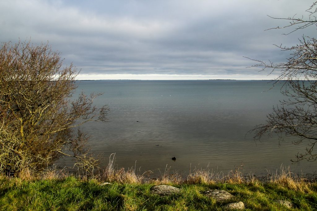
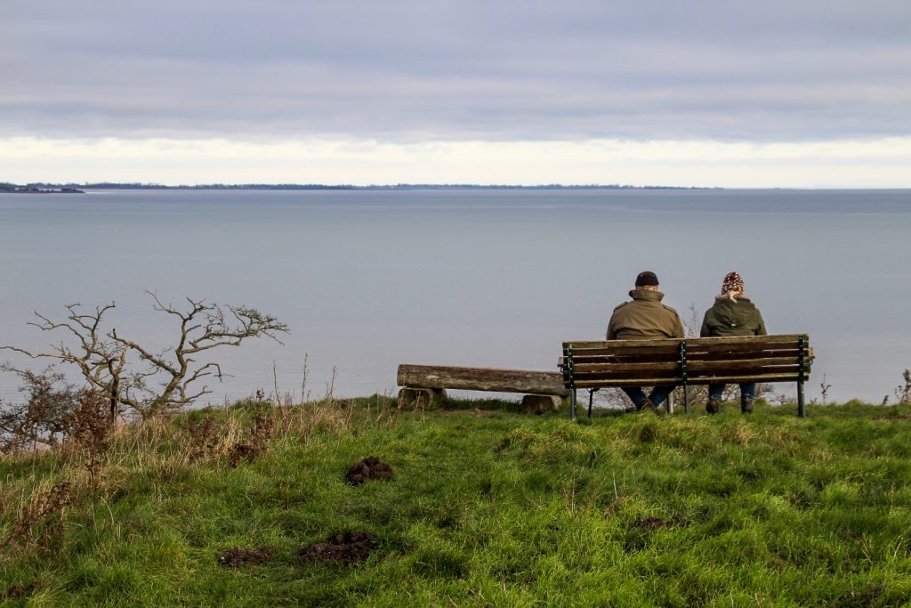
As I stood on top of the castle ruins, looking over Smålandshavet to the islands of Askø, Lilleø, Femø and Fejø, the sun came out for the first time. It was wonderful to feel its warm rays on my cold face for the first time in many days.
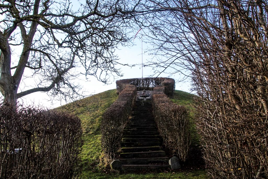
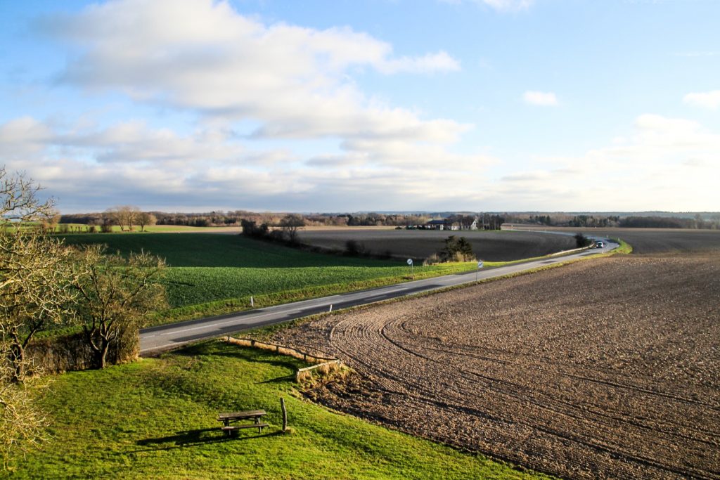
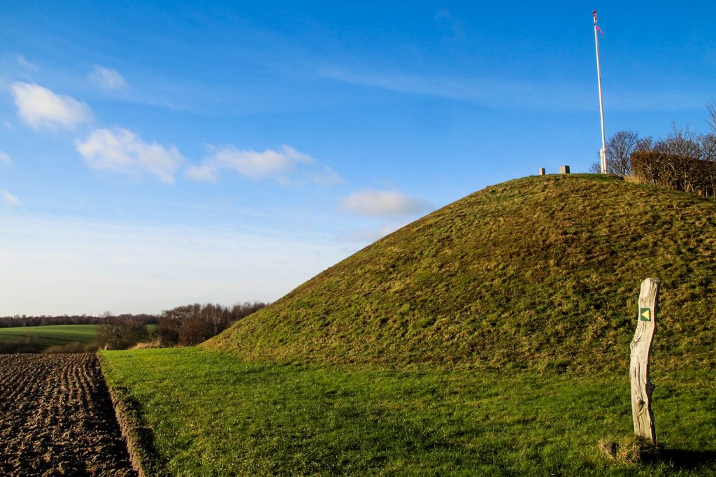
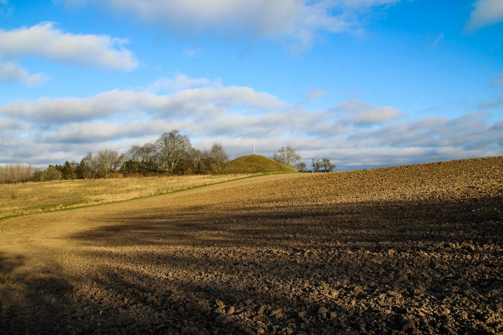
I continued inland to Lolland’s highest point, the burial mound Bavnehøj at 30 meters above sea level. In fact, it’s one of the largest burial mounds in Denmark! A modern staircase lead me up to its top where I was awarded with a lovely view over Lolland’s hills and fields. I spotted a small path and some small burial mounds in the distance, and decided to follow it to see where it would lead me.
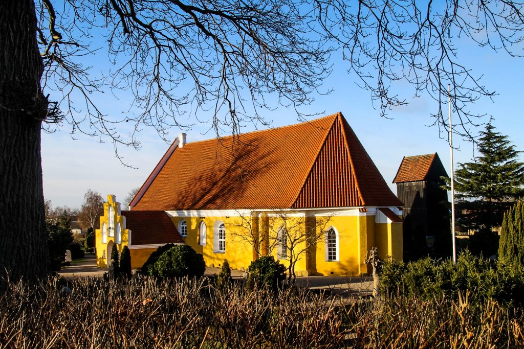
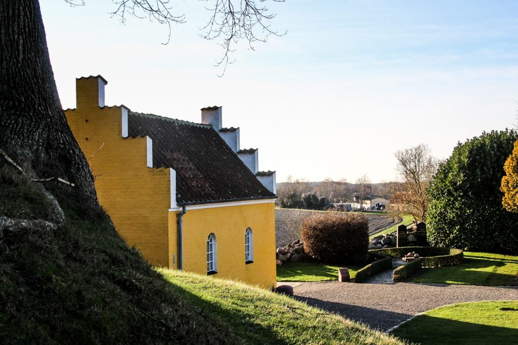
Sure enough, it lead me to the burial mounds, located beautifully amongst trees near the village of Birket. The path ended just outside Birket with only a short distance to the gorgeous village church, one of the only yellow churches in Denmark! Built in the mid-14th century, the church interior has over 1,900 murals and a wooden bell tower which is believed to be the oldest and best-preserved example of its kind in Denmark! The bell tower stands on (yet another) Bronze Age burial mound, and another burial mound sits at the other end of the graveyard. I climbed to the top of this one and listened to the birds singing a beautiful song. The sun was shining brightly on a blue sky with hardly any clouds, and I felt completely at peace. It was a beautiful moment.
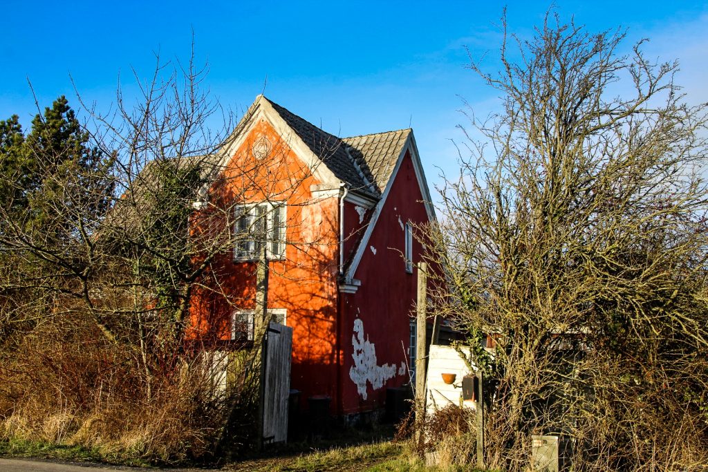
I continued my walk through Birket and the neighbouring village of Torrig, both of which were sad sights as they are full of abandoned houses. It’s an issue all over Lolland, people move away because opportunities are few and everything else is so far away. I, on the other hand, chose to move to Lolland to try something new, and I love it here. I don’t mind being far from the big cities!
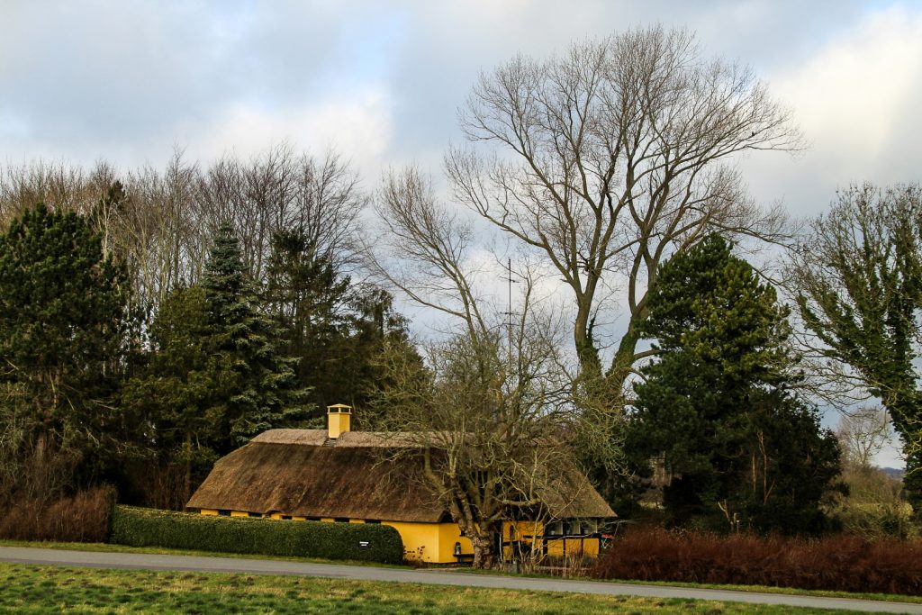
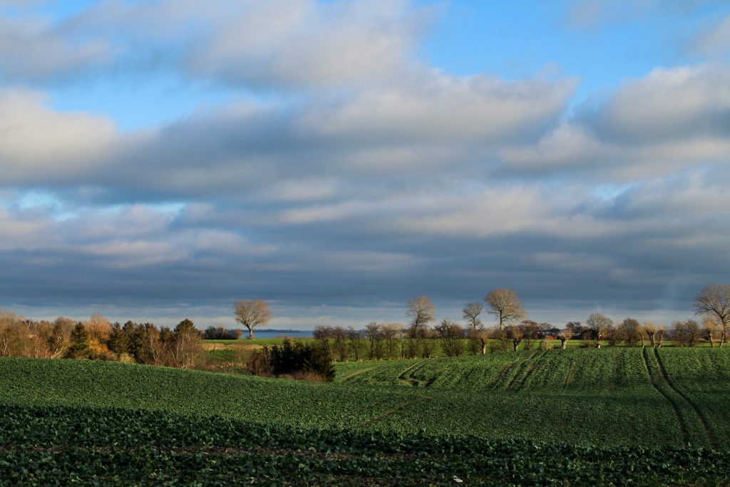
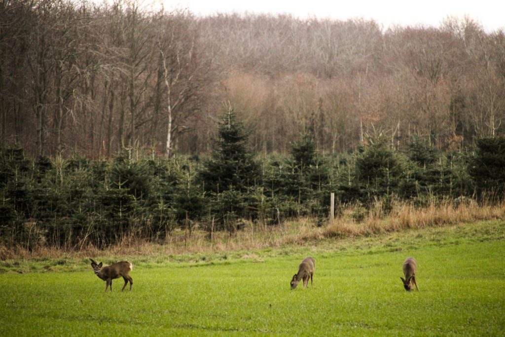
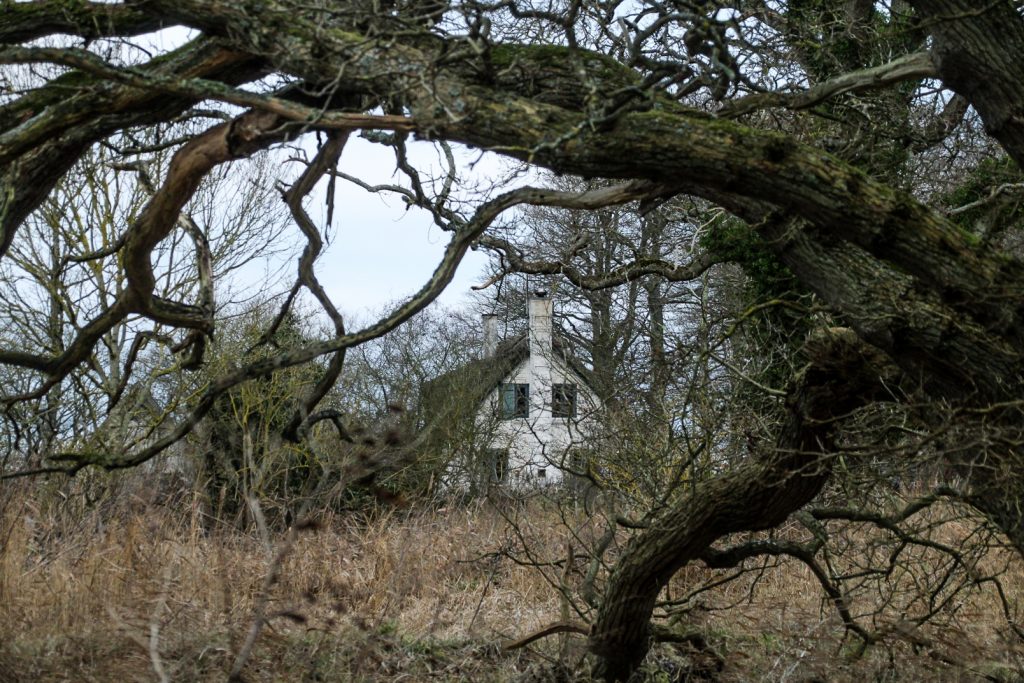
My last destination on the hike was Torrig Skov, a beautiful forest full of – can you guess it? – burial mounds from the Bronze Age! I was greeted by three deer as I entered the forest, following a dirt track through the forest to the ocean. I spotted a narrow footpath running along the coast, which took me past many burial mounds, over tiny wooden bridges and past a little thatched cottage by the ocean.
Unfortunately, I had to rush a little to catch my bus in Kragenæs, as I’d taken too long with photography as usual. The path came to an end shortly before I reached the town, so I had to walk the last few meters along a rocky beach before being able to get back onto a road and back to the harbour. I made it to the bus with seconds to spare!
A gorgeous day had come to an end. A day that offered views beyond what I thought Lolland was capable of, burial mounds for days and many interesting sights. Ravnsby Bakker is definitely the most captivating part of Lolland, at least of what I’ve seen so far!
Hiking route description: Ravnsby Bakker and Dodekalitten
The hike begins and ends at the harbour in Kragenæs. Follow Kragenæsvej, the main road from the harbour towards the village and turn left onto a path when you reach the tiny forest, Klinkeskov. Follow the path out of the forest and onwards to Dodekalitten, which you’ll soon see in the distance. Remember to linger for a while to enjoy the special atmosphere at the monument.
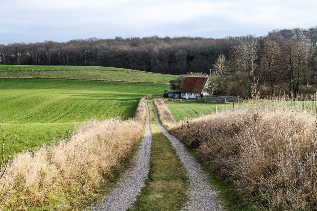
A few meters further along the path, you’ll see a bunch of burial mounds from the Bronze Age and one passage grave from the Neolithic. Take the path to your right to explore them, and then return to the main path. Continue along the path past a farm and then follow the road to a crossroad. Turn left onto Ravnsborgvej. You’ll soon arrive in the tiny village of Ravnsby. Take the first left just past the village and follow the road to Ravnsborg Voldsted. Return to Ravnsborgvej and take a left turn when you’ve finished exploring the ruins.
Follow Ravnsborgvej to the crossroad and then turn right onto Bandholmvej. A few hundred meters along, you’ll see Birket Bavnehøj, Lolland’s highest point, at the left hand side of the road. Behind the mound is a small path that leads to more burial mounds. Follow this path until you reach Lyngmosevej, and then turn right towards the yellow Birket Church. From the church, walk straight onto Signe Stubsvej and then turn left at Bandholmvej, going through the villages of Birket and Torrig.
At the end of Torrig, turn right onto Vigvejen, which will lead you into the gorgeous Torrig Forest. Follow the woodpath to a crossroad and then turn right and immediately after, turn left. This path will take you down to the ocean and a small path which follows the shore. There are many burial mounds along this stretch. You’ll reach a cottage where it seems like the path ends, but it continues beyond the cottage, still along the coast. It does end shortly before Kragenæs, but it’s easy to walk on the rocky beach until you can get onto a road. Make your way back to the harbour, which is just a short 500-meter walk from the end of the path.
The hike is 15 km, takes 3-4 hours and is easy and paved most of the way.

Leave a Comment