The shortest trail on the island of Vágar has to be the cairn trail that connects the largest village on the island, Miðvágur, with the only inland village in the country, Vatnsoyrar (okay, maybe except from the trail to Trøllkonufingur, if you can even call that a hike!).
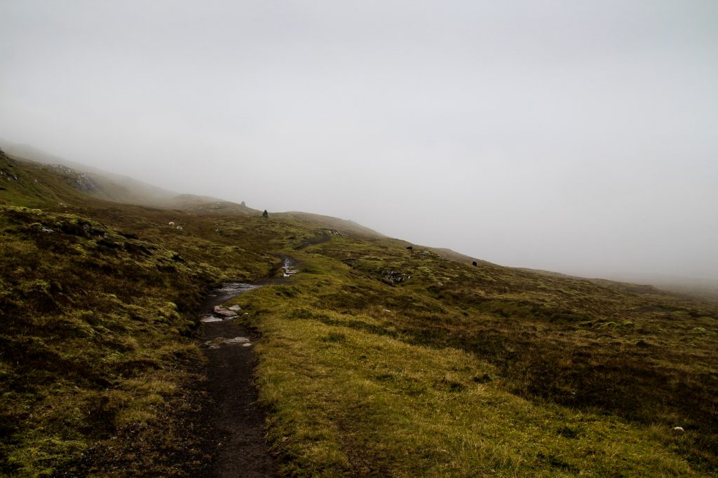
The cairn trail is only 4 km long and can be completed in an hour! It’s the perfect hike for a rainy or foggy day where mountain climbing shouldn’t even be considered. And rainy and foggy is exactly how I would describe my fourth day on the Faroe Islands this October.
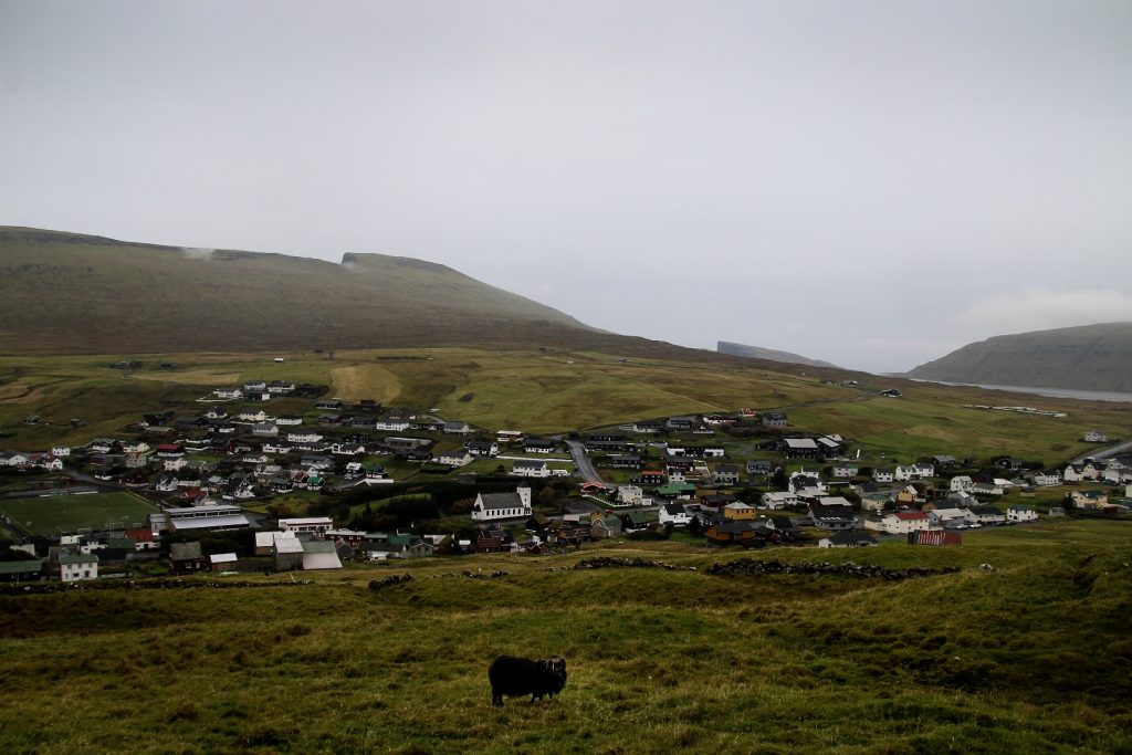
I was on fire after climbing four mountains the day before and eager to get out into nature again, even despite the rather miserable weather. I’d recently read about the trail from Miðvágur to Vatnsoyrar and I was really eager to go. So despite the rain, I decided this short hike would be perfect for that day. I walked from my hostel in Sandavágur to the highest road in Miðvágur where the hike begins just past Kálvalíð, a tiny local museum set in a traditional Faroese house.
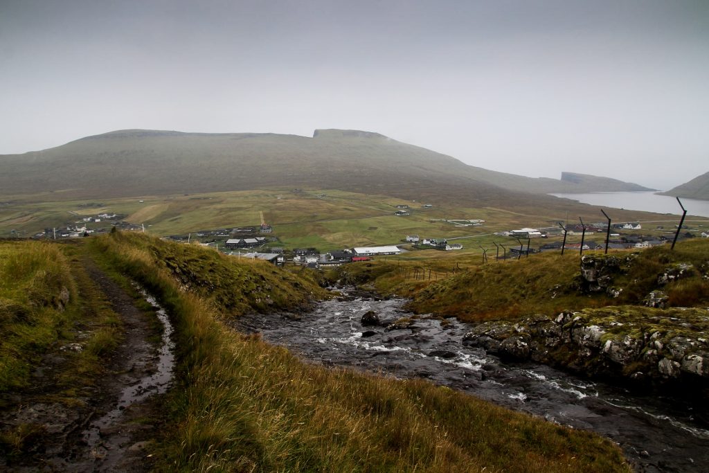
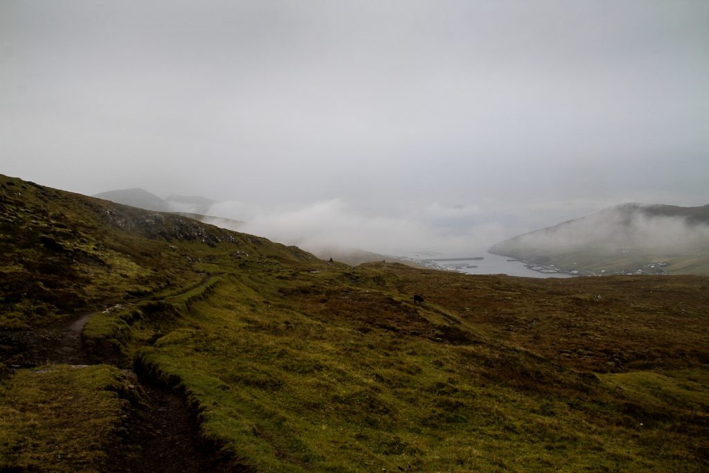
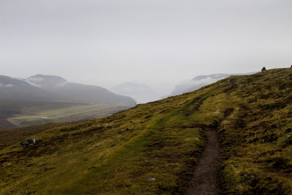
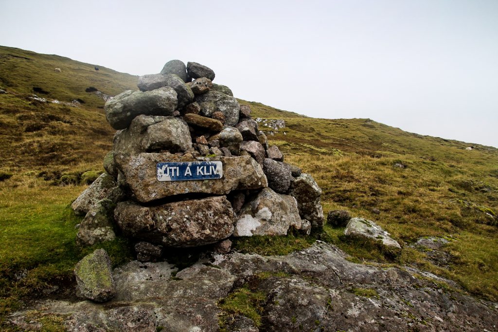
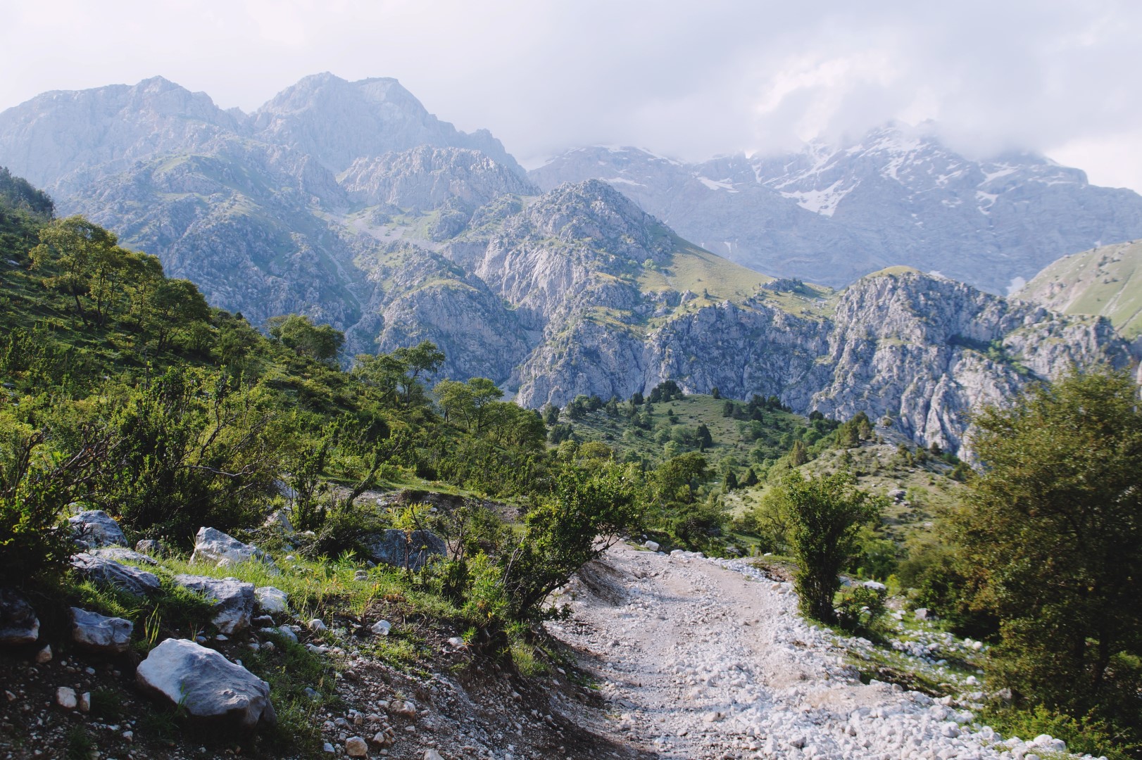
The trail runs along the slopes of Jógvansfjall and winds through several streams and waterfalls, but none were too challenging to cross as large stones had been laid out. And as for following the route, it was as easy as can be. There’s a well-trodden footpath (which is also popular for horseback riding) as well as large cairns the entire way. Even in the most foggy conditions, getting lost on this trail is impossible.
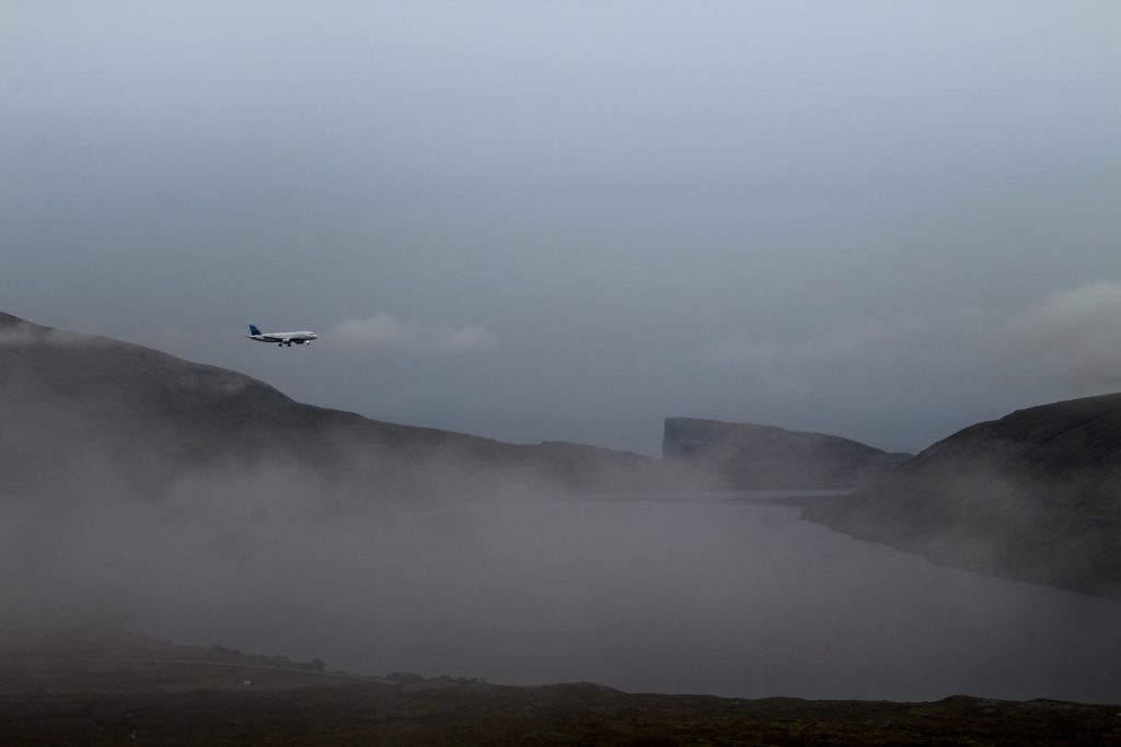
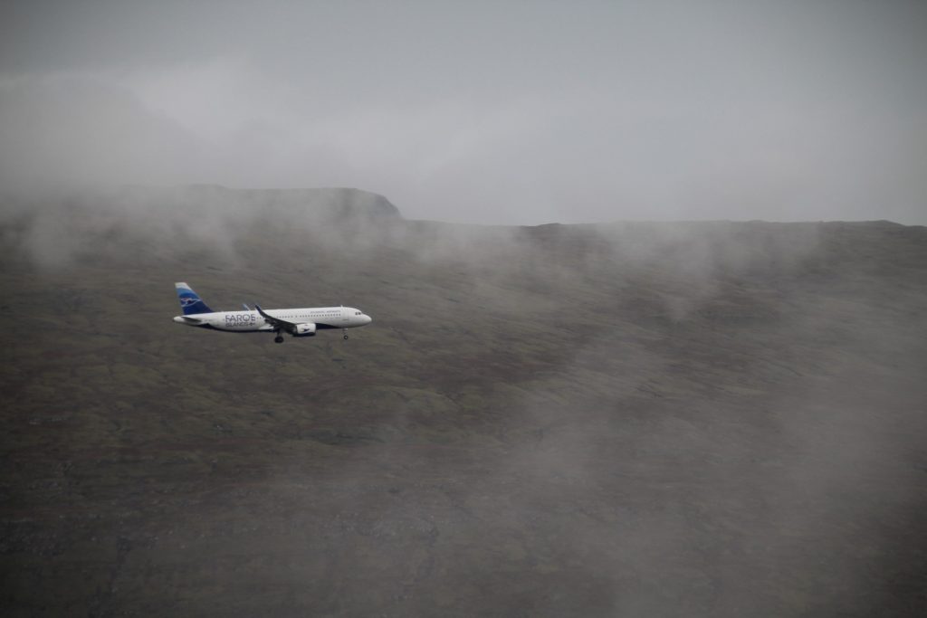
I took my time hiking the trail, enjoying the cold rain on my face and the views of Miðvágur and its mountainous backdrop before they disappeared behind a thick blanket of fog. Since the trail is just a few kilometers from the airport, it was also the perfect place for some plane spotting.

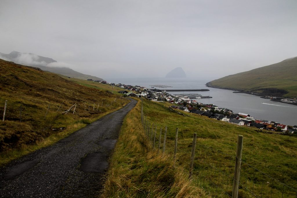
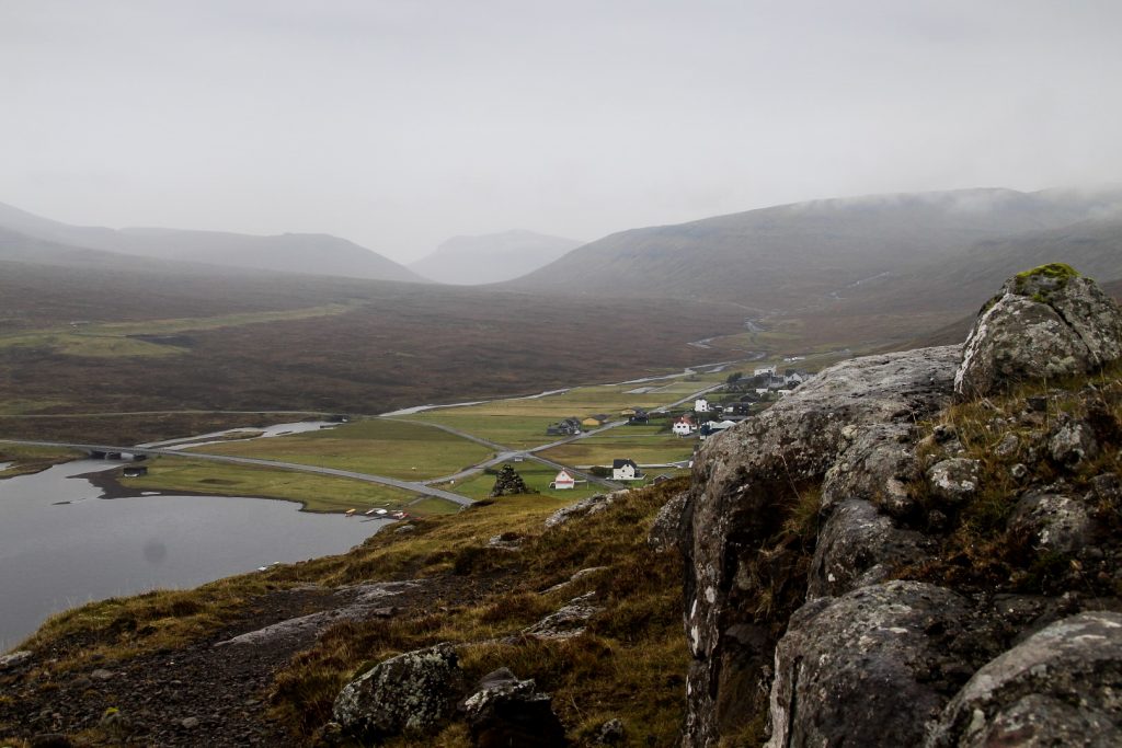
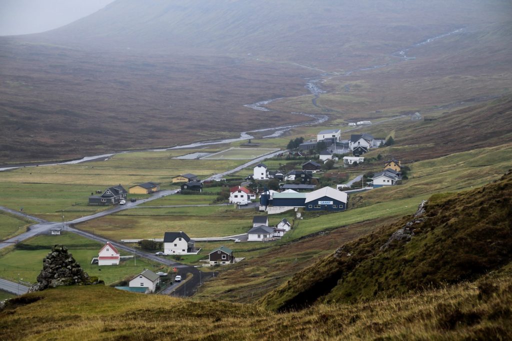
The fog lifted slowly, revealing the tiny village of Vatnsoyrar that had appeared beneath me.
Vatnsoyrar is a special village for many reasons, not only because it’s the only inland village in the country – although it is located on the banks of Lake Leitisvatn and near Lake Fjallavatn. The village, which is home to 44 souls, is also one of the youngest in the country, founded in 1921 by three members of the local Christian Brethren Church. Even today, the village remains central to the faith as it is home to Zarepta, a large building complex that hosts children’s camps.
But Vatnsoyrar also has a dark history. It was occupied by the British Army during the British occupation of the Faroe Islands under the Second World War, following the German invasion of Denmark in 1940. Many remains from the war can be found scattered around the village.
I’ve been curious about the village for a long time, but that day was the first time I ever went there (besides driving past maaaany times). I followed the footpath down the mountain slope to the edge of the village where my short hike ended, and then continued my walkabout by exploring every street of the tiny village.
After my little tour of Vatnsoyrar, I walked along the main road to get back home to Sandavágur. It was long and boring, and I regretted not taking the trail back as the sound, smell and feel of nature is always nicer than that of traffic. Oh well, I’m sure this wasn’t the last time I will hike this easy and beautiful trail!
And it certainly wasn’t the last time I hiked the trail! I returned the following summer for a beautiful hike in sunny yet misty weather! Read about it here!
Hiking route description: Miðvágur to Vatnsoyrar
The trail begins at Kálvalíð on the street Kálvalíðvegur in Miðvágur and follows the road which becomes a gravel road. 600 meters in, the road splits in two. Turn right here and continue along the gravel road that turns into a footpath shortly after. The trail is easy to follow from then on as there are cairns the entire way. There are a few streams to cross which could be difficult if it has been raining a lot, but there are many rocks to step on. At one point, you will see cairns going up the mountain, ignore these and continue on the lower trail.
As you get closer to Vatnsoyrar and get a view of the airport, look out for incoming flights as this trail is the perfect place for plane spotting. The trail ends at Oyravegur in Vatnsoyrar.
This easy one-way hike is 4 km and takes 1-2 hours depending on how many breaks you take.

Leave a Comment