The Outer Hebrides, also known as the Western Isles, are among the most breathtakingly beautiful islands in Scotland, yet they remain relatively untouched by tourism. Located off Scotland’s west coast, this island chain spans over 200 kilometres, forming the longest archipelago in the British Isles. The archipelago comprises 15 inhabited and more than 50 uninhabited islands. The total population is approximately 26,000, and the islands are widely regarded as the traditional heartland of the Gaelic language with around 45 % of the population still speaking the ancient language.
The largest island in the Outer Hebrides is Lewis and Harris. Although often thought of as two separate islands, it is actually one landmass divided into two distinct regions: Lewis in the north, which is relatively flat, and Harris in the south, known for its rugged, mountainous terrain. South of Lewis and Harris lie the Uists – a closely grouped set of ten inhabited islands linked by causeways. The largest among them is South Uist, followed by North Uist and Benbecula. Further south is the Barra island group, made up of two inhabited islands: Barra, the larger of the two, and Vatersay.
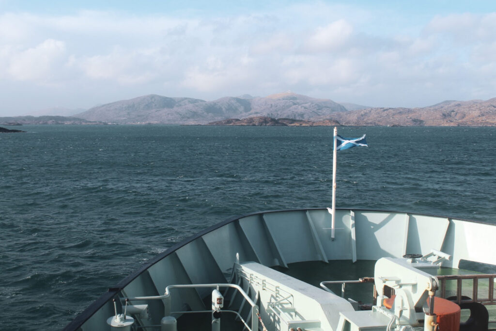
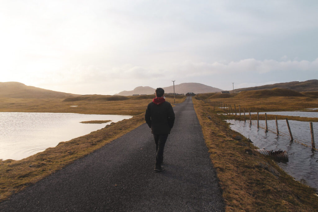
In early 2020, my younger brother and I spent a week roadtripping through the Outer Hebrides after having spent two months living and working on the Isle of Skye. Along the way, we discovered some truly unforgettable sights, and I wanted to share them here – both to inspire y’all to make the Outer Hebrides part of your Scotland adventures, and to help plan your potential itinerary through this remarkable island chain.
So here it is: my list of the 16 most incredible places to explore in the Outer Hebrides, starting in the north of Lewis and Harris and journeying all the way south to Vatersay.
Lewis and Harris
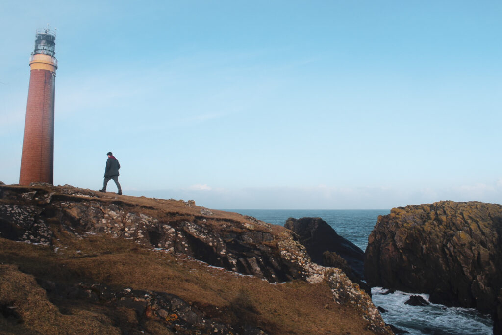
Butt of Lewis
At the very northern tip of Lewis and Harris stands the Butt of Lewis Lighthouse, built in 1862.
But the Butt of Lewis is more than just a lighthouse – it’s a dramatic and windswept spot where towering sea cliffs meet the endless expanse of the North Atlantic. The views are breathtaking, and standing at the northernmost point of the Outer Hebrides feels like being at the edge of the world.
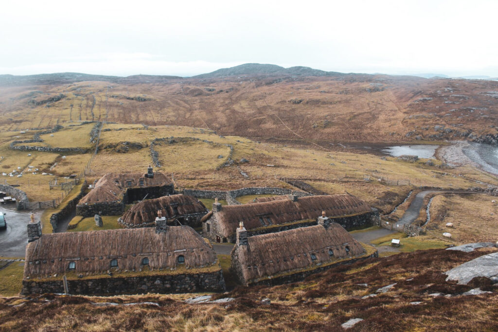
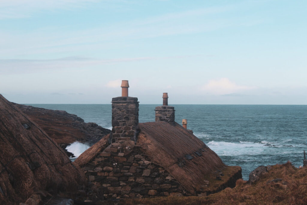
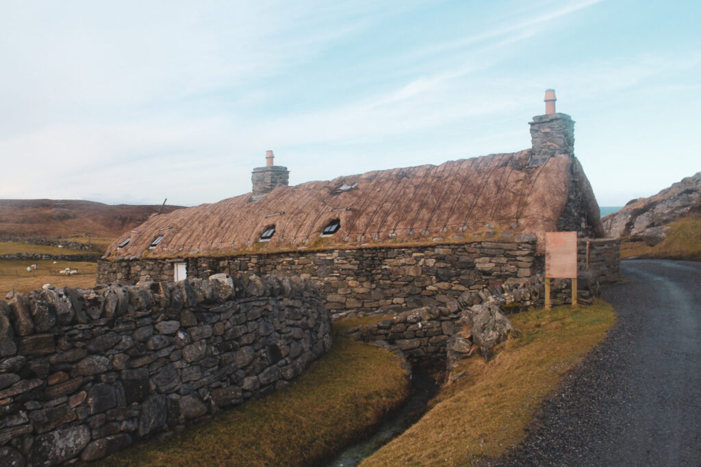
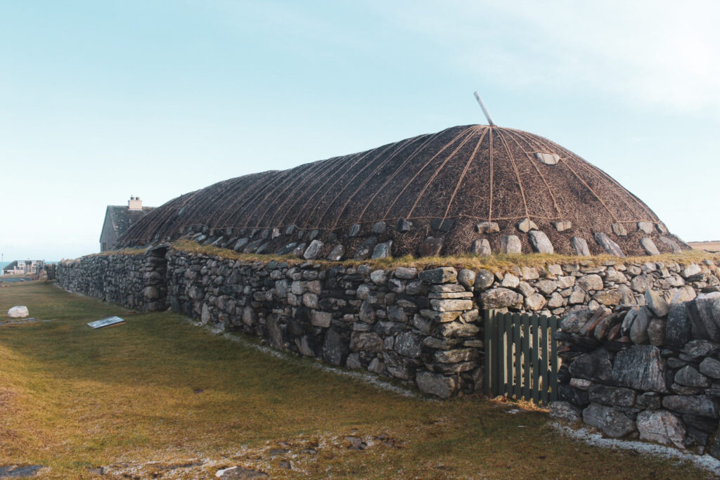
The historic blackhouses of Gearrannan and Arnol
Blackhouses are a traditional type of dwelling characterized by thick stone walls packed with earth or peat and topped with a thatched or turf roof. This ancient style of construction, found across Ireland, the Scottish Highlands, and both the Inner and Outer Hebrides, dates back thousands of years. Despite the name, these homes aren’t actually black – the term “blackhouse” was coined to distinguish them from the newer “white houses” that emerged in the late 19th century. Unlike blackhouses, white houses were designed to separate people from their livestock.
On the Isle of Lewis, blackhouses continued to be built well into the mid-19th century, and some were still inhabited until the 1970s.
The best place to experience these historic homes is the Gearrannan Blackhouse Village – a beautifully restored late-19th-century settlement that now serves as an open-air museum. Another excellent spot is the village of Arnol, home to a blackhouse museum that includes a fully furnished thatched blackhouse, a blackhouse ruin, and several examples of the white houses that eventually replaced them.
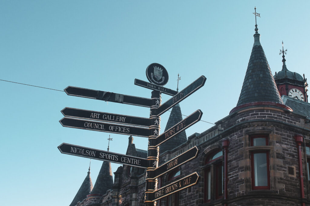
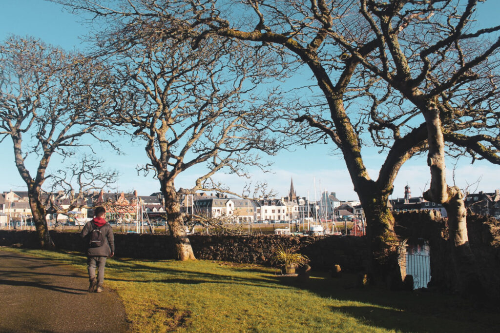
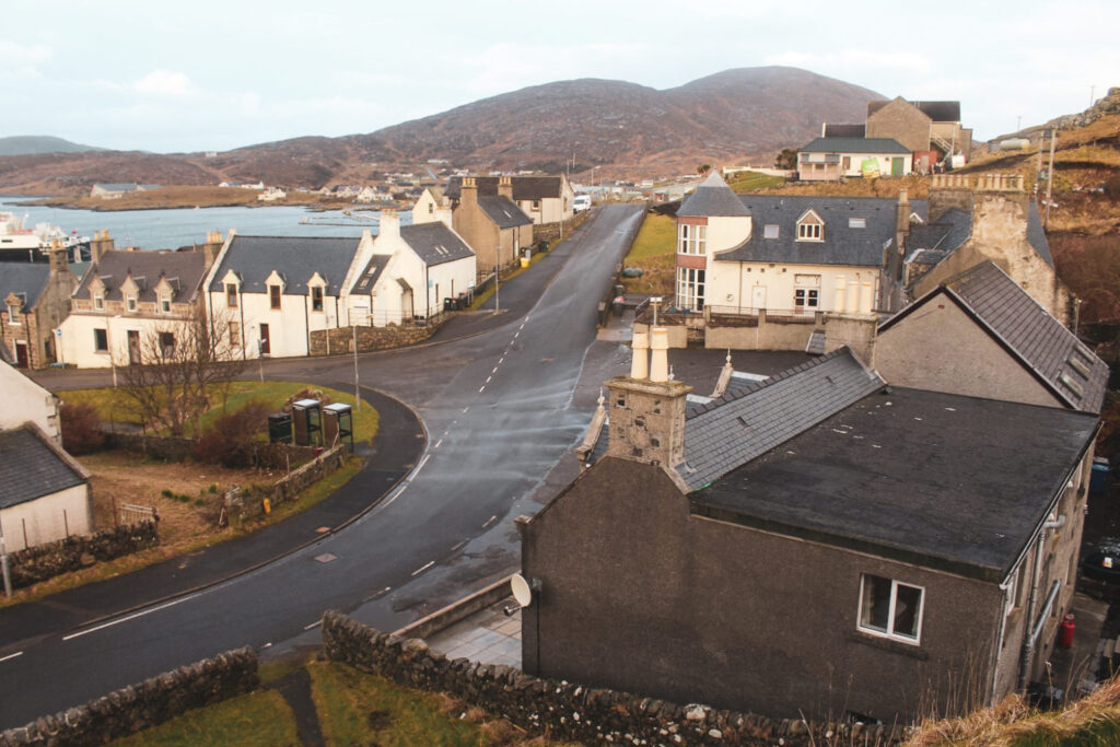
The town of Stornoway
Stornoway is the largest town in the Outer Hebrides, with a population of around 7,000. It’s the go-to spot for shopping, dining, and soaking up a bit of local culture.
The town centre is charming and picturesque, with the cozy feel typical of many British provincial towns. Towering above it all is Lews Castle, a grand mid-19th-century estate that offers stunning views over the harbour and town below. And while you’re there, make sure to listen to Peat and Diesel’s iconic anthem ‘Stornoway’ – the perfect soundtrack for your visit!


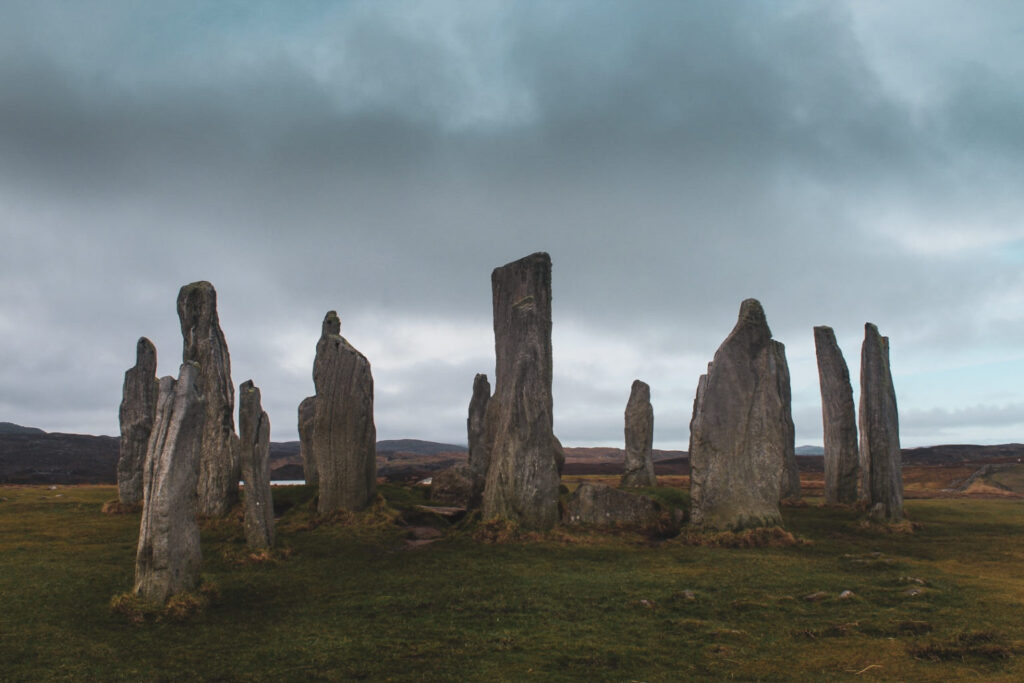
Calanais Standing Stones
Often dubbed ‘the Stonehenge of the Outer Hebrides’, the Calanais Standing Stones (also known as Calanais I) are a must-see for history lovers – and here’s the kicker: they’re actually about 500 years older than their far more famous cousin, Stonehenge!
Erected during the late Neolithic period, between 2900 and 2600 BC, the exact purpose of the stones remains a mystery. They were later used for ritual activity during the Bronze Age, adding even more layers to their ancient story. Walking among this dramatic stone circle feels like stepping straight into prehistory. When we visited, we had the entire site to ourselves – no crowds, no fences, and yes, we could even touch (and hug!) the stones. It’s a rare kind of intimacy you just won’t get at Stonehenge.
And for those hungry for more ancient mysteries, don’t stop at Calanais I. The surrounding area is home to a whole network of similar sites, numbered Calanais II through XIX, including smaller stone circles and solitary standing stones. It’s a fascinating prehistoric landscape just waiting to be explored!
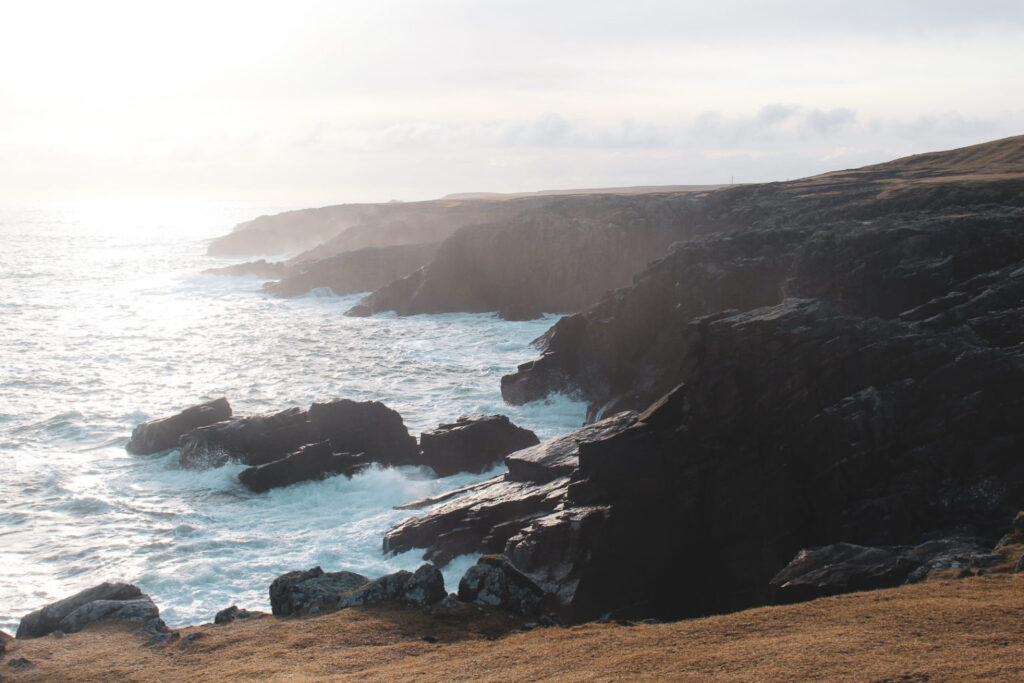
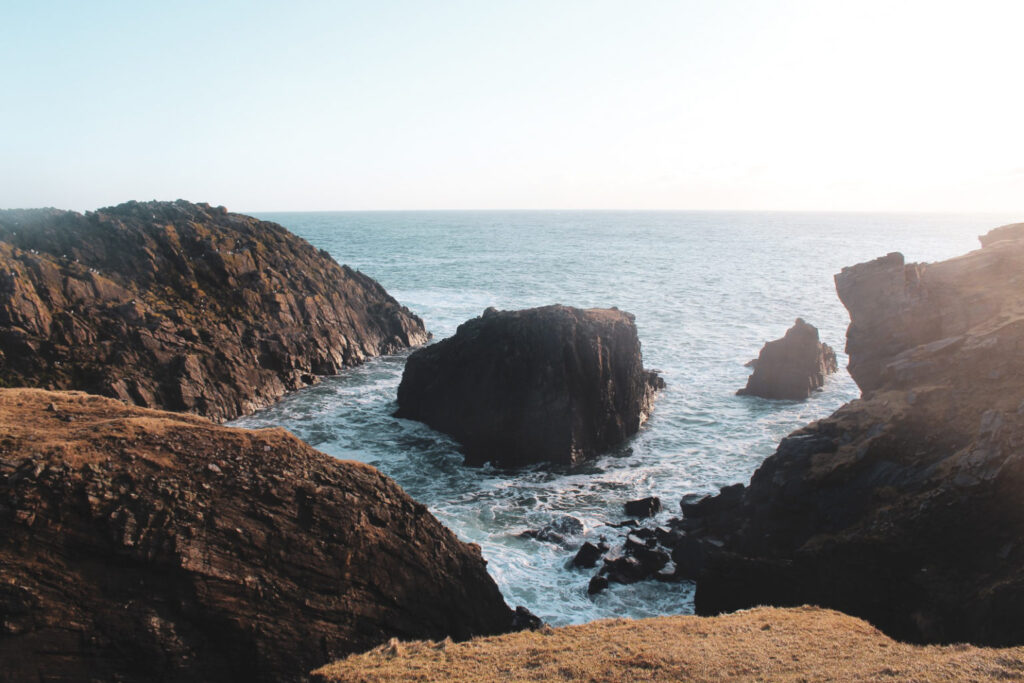
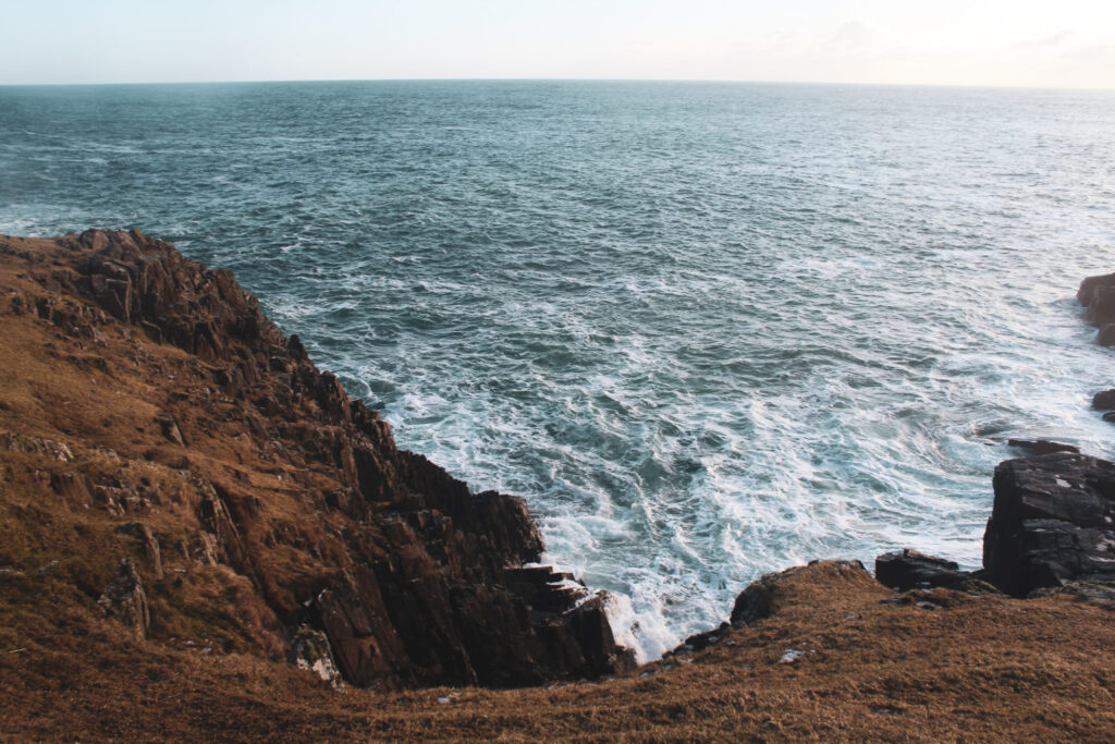
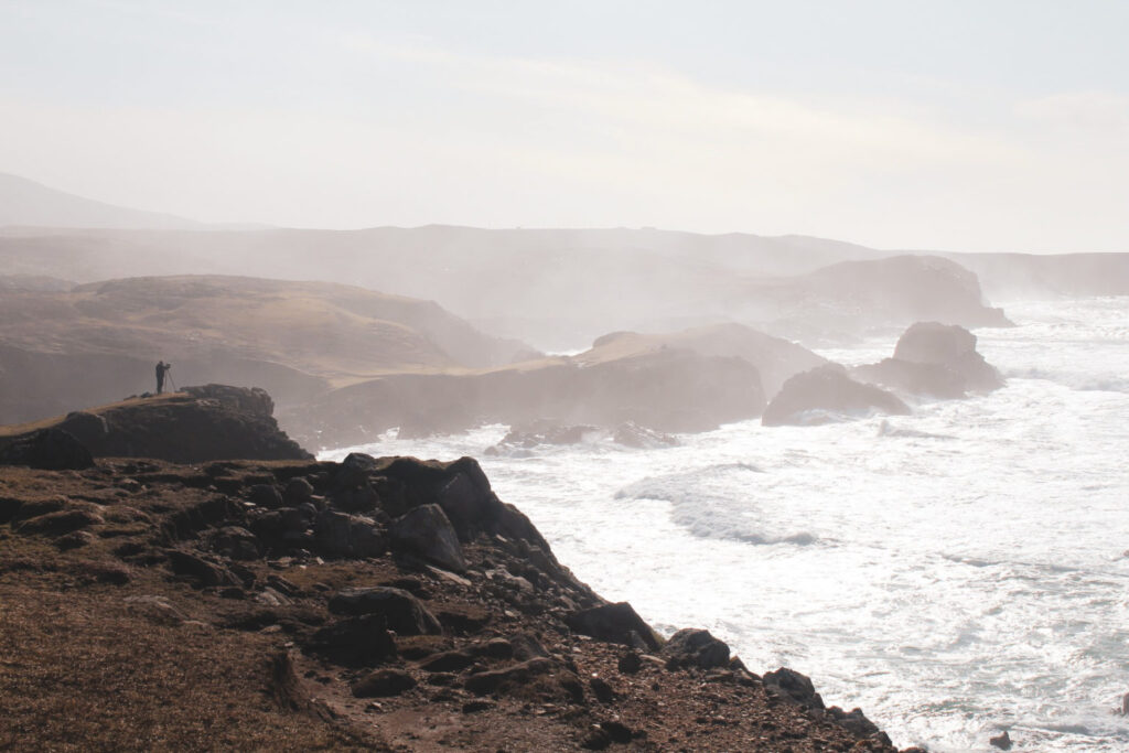
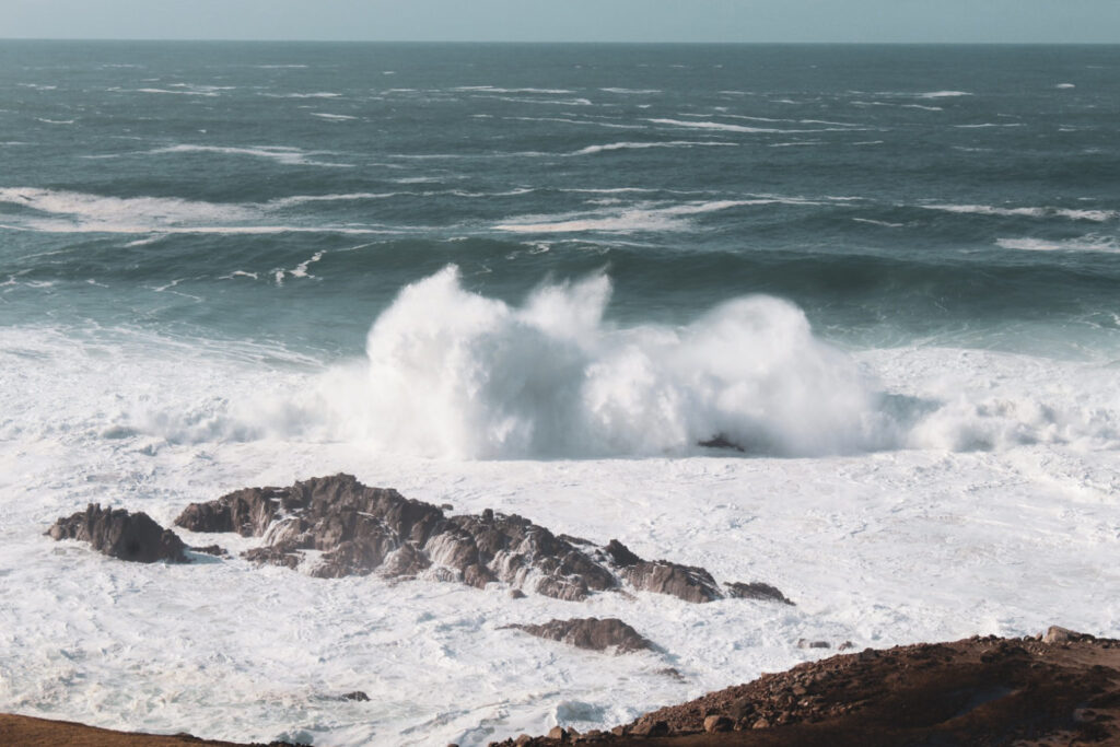
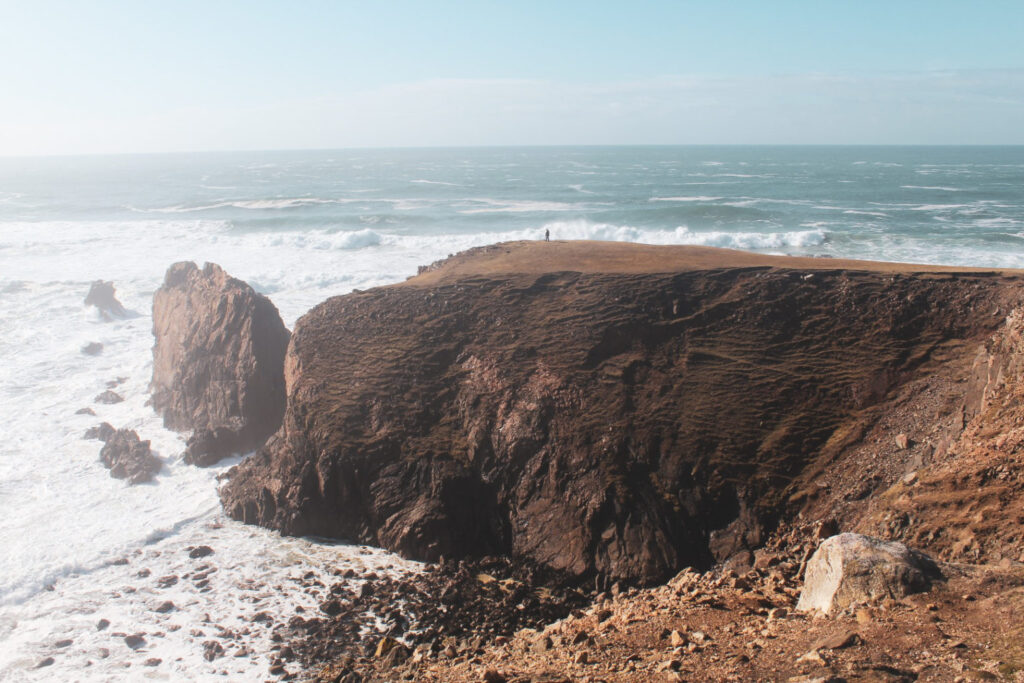
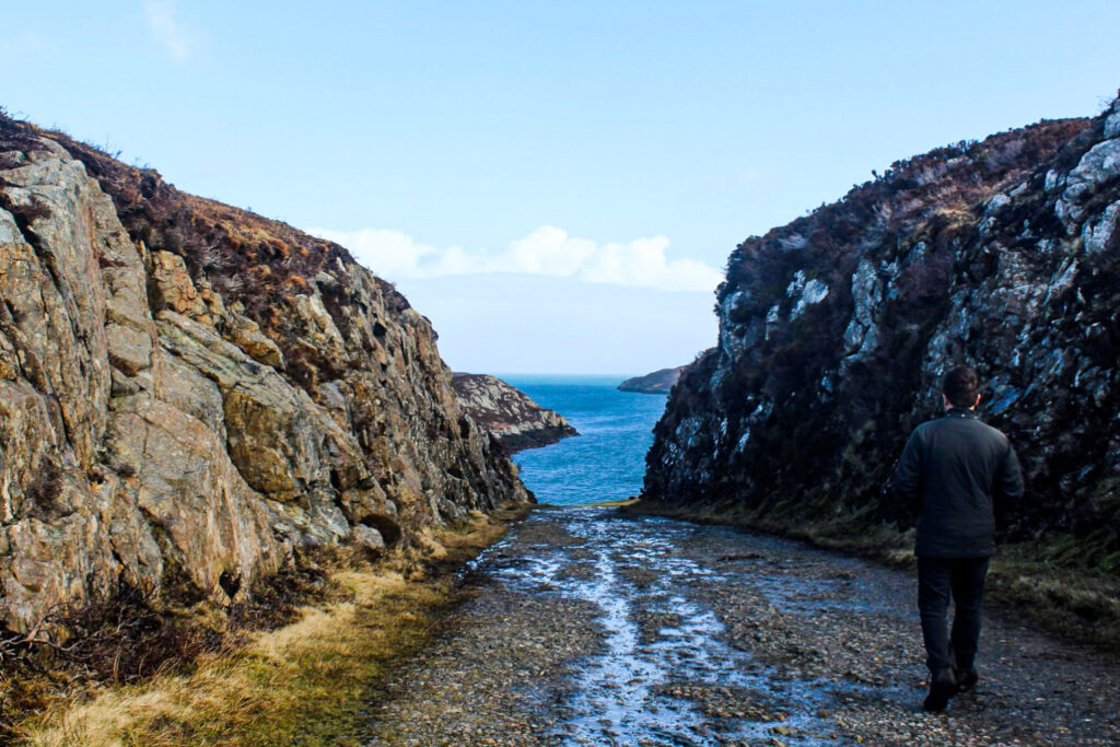
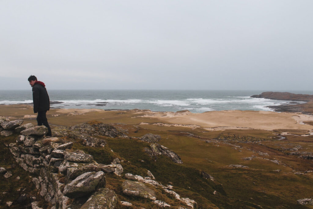
Mangersta Sea Stacks
My absolute favourite place on Lewis and Harris has to be Mangersta, with its dramatic, untamed coastline and striking sea stacks.
The landscape here is raw and breathtaking with towering cliffs, crashing North Atlantic waves, and a scattering of jagged sea stacks rising from the ocean. It’s the kind of place where you can lose track of time, hiking along the cliffs and soaking in the wild beauty that surrounds you. You could easily spend many hours here, just taking it all in.

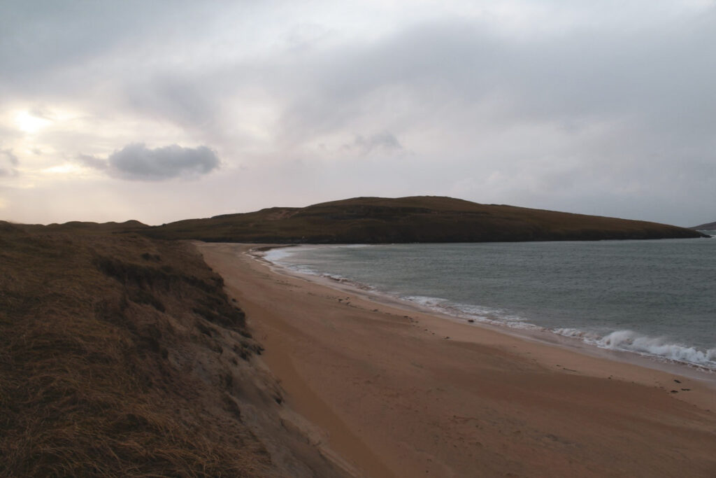
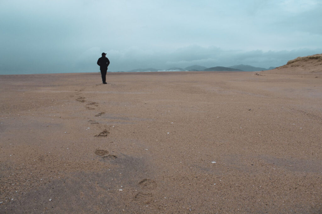
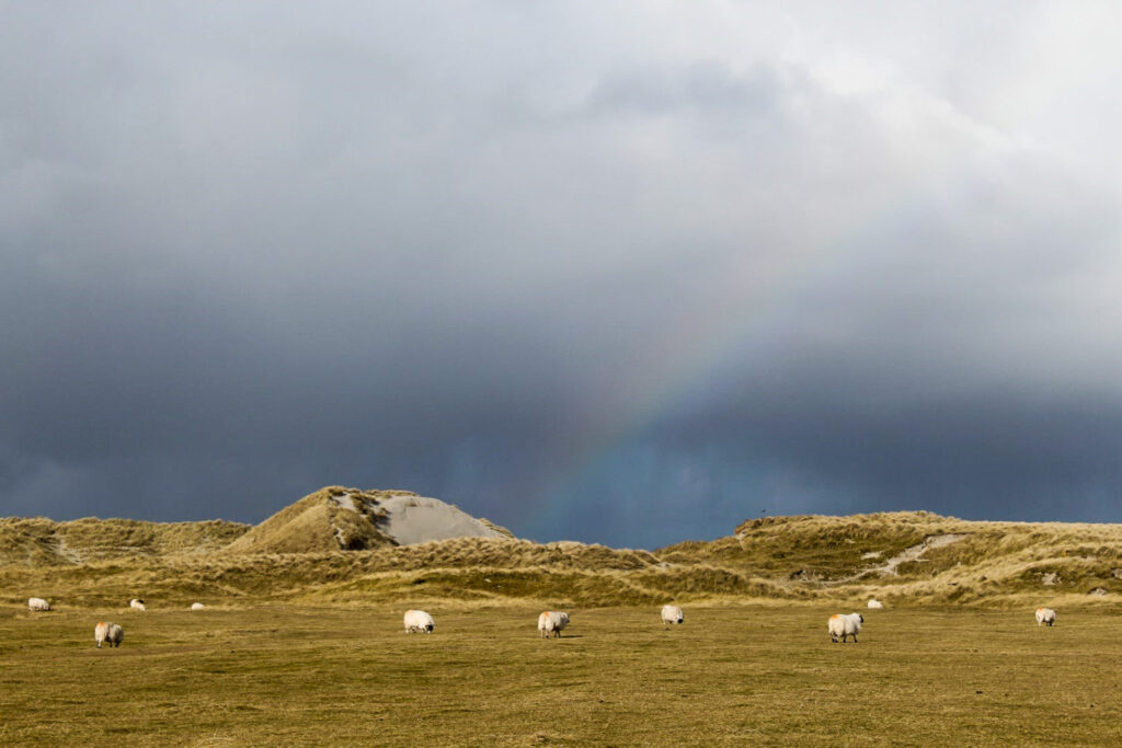
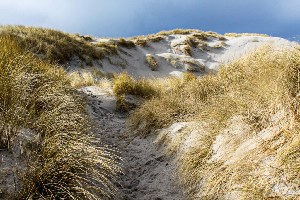
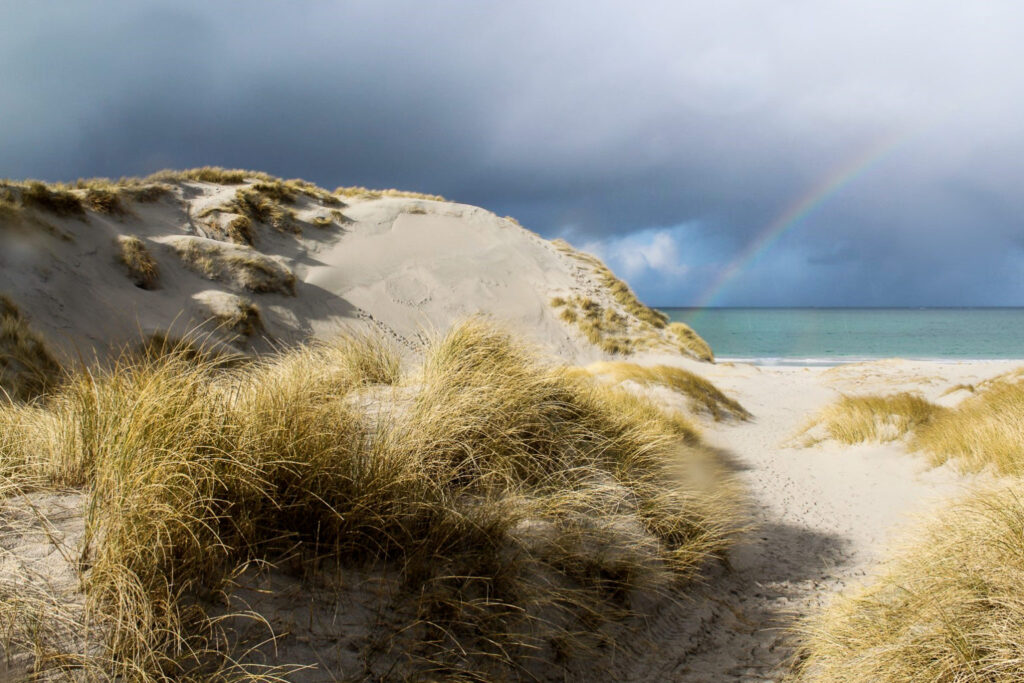
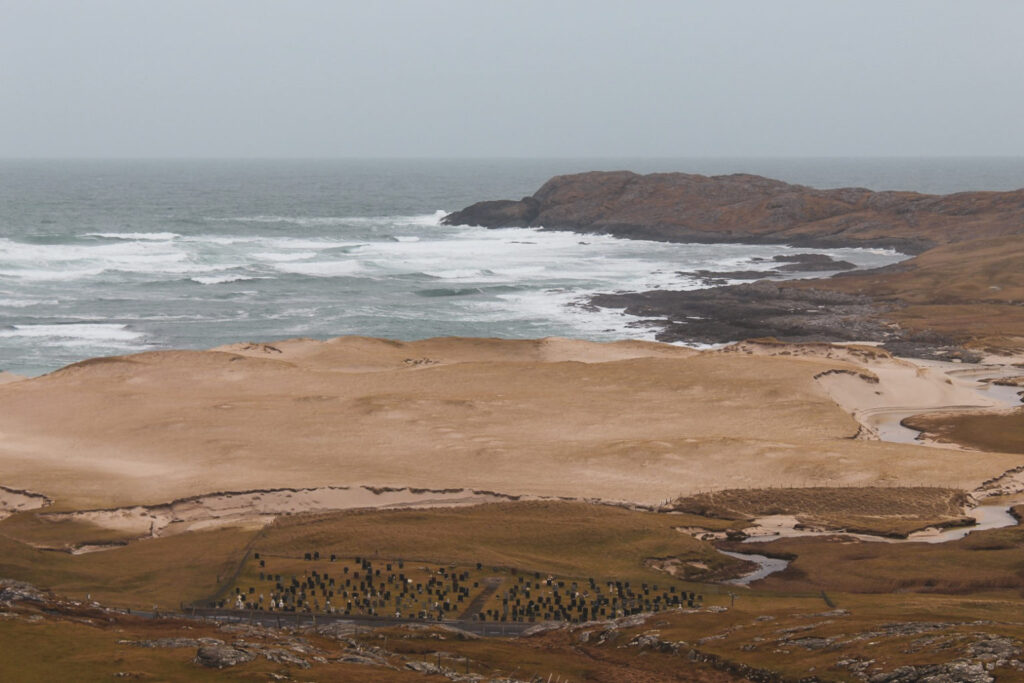
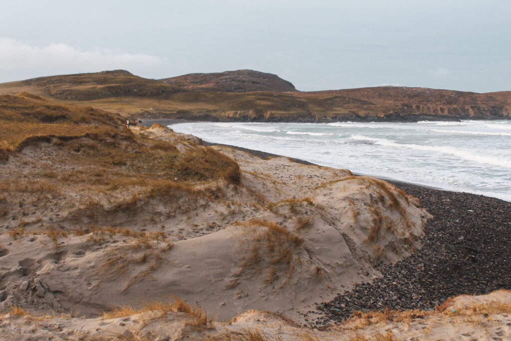
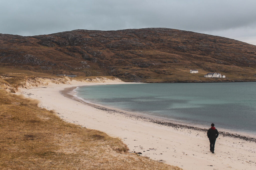
Scarista Beach
While Luskentyre is the most popular beach in the Outer Hebrides – and often ranks among the most beautiful beaches in the world – we found the nearby, far less visited Scarista Beach even more breathtaking.
This long, sweeping stretch of golden sand, bordered by gentle dunes, feels almost untouched. With its crystal-clear waters and serene atmosphere, it could easily rival the best beaches in the Caribbean – just with fewer footprints.
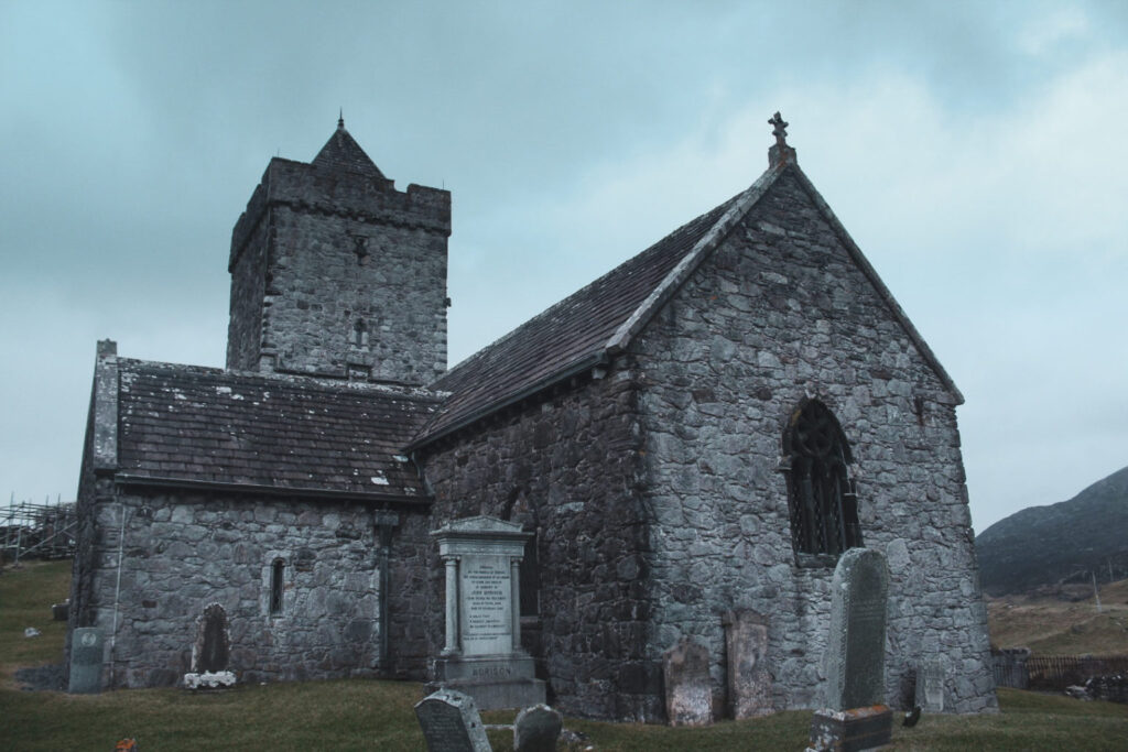
St Clement’s Church
St. Clement’s Church, built in 1520 on the site of an earlier church in the village of Rodel, is arguably the most impressive medieval building in this part of Scotland.
Perched in the stark, windswept landscape at the southern edge of Harris, the church looks almost out of place. Despite its remote setting, it was once a place of deep importance for the local Clan MacLeod. Even after the church fell out of use following the Reformation in 1560, clan members continued to be buried in its churchyard. Inside, you’ll find the ornately carved tomb of its founder, Alexander MacLeod.
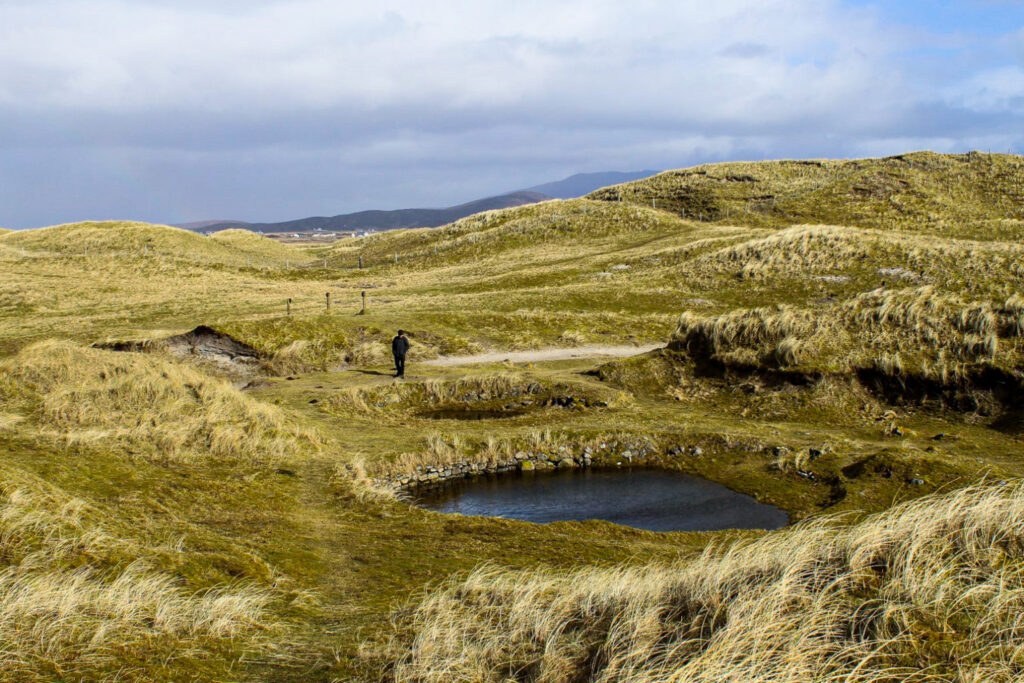
The Uists
Berneray’s West Beach
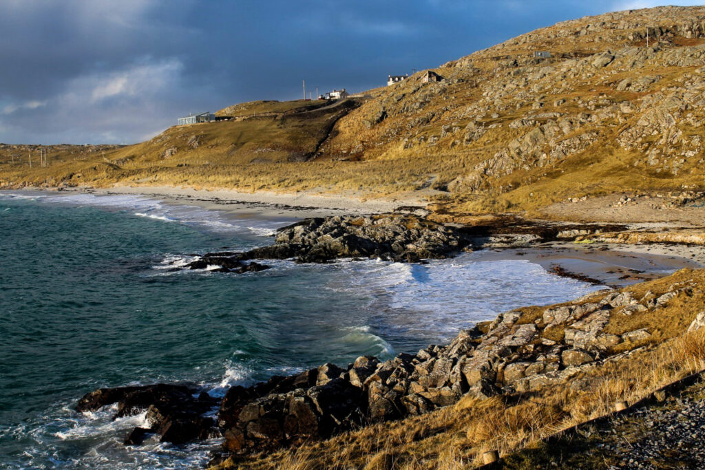
On the small island of Berneray, we discovered our favourite beach in the Outer Hebrides – West Beach, a hidden gem rarely visited by tourists.
You enter the beach through gentle, rolling dunes that instantly reminded me of Denmark’s West Coast. What unfolds before you is simply breathtaking. The beach stretches along Berneray’s entire west coast. The sand is dazzlingly white, and the ocean shimmers in shades of turquoise. It’s almost unbelievable that this paradise is in Scotland. In fact, the tourism board in Thailand once used a photo of this very beach to promote one of their own – proof enough that, despite the huge difference in climate, Berneray’s West Beach looks like a slice of the tropics!
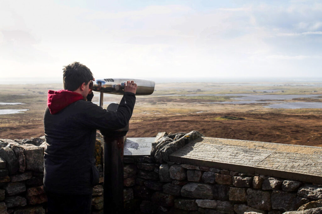
Cleitreabhal a Deas viewpoint
Up the hill Cleitreabhal a Deas on North Uist lies the so-called “St Kilda Viewpoint”.
While it’s officially designated for spotting the remote St Kilda archipelago – situated about 45 miles offshore – we couldn’t make out the islands themselves. Instead, our gaze fell on the much closer Haskeir Island and the panoramic views over the rolling lowlands of North Uist, with the hills of South Uist rising in the distance. A spectacular sight that makes the drive up there well worth it.
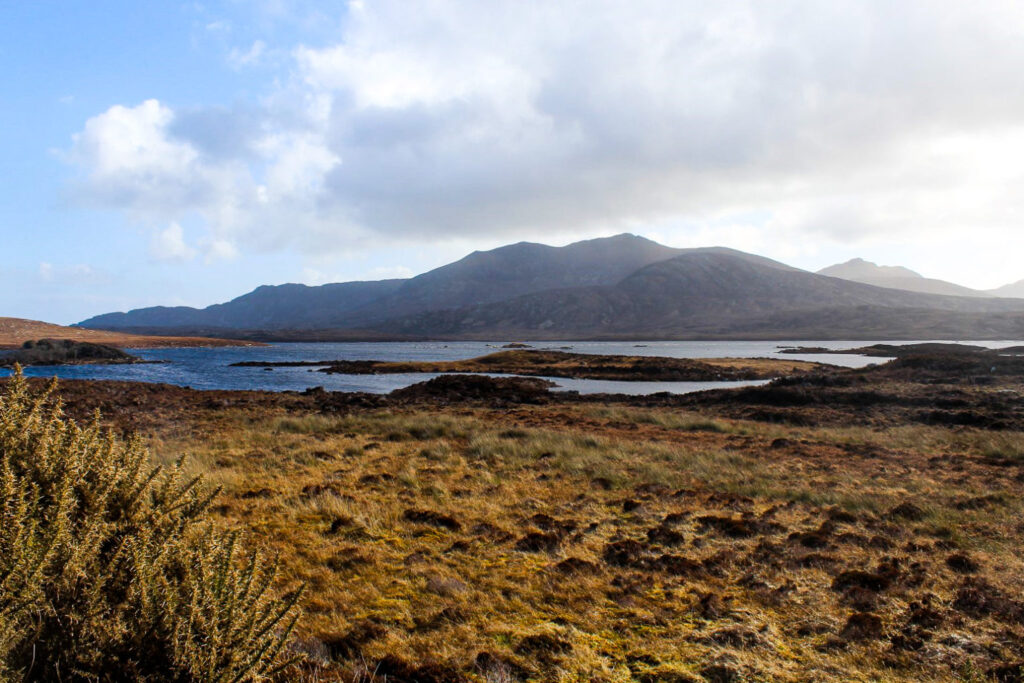
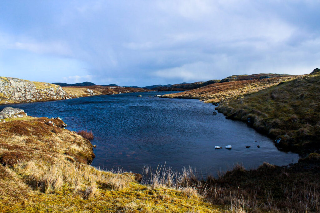
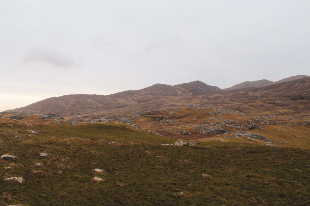
A scenic drive to Loch Sgioport
Loch Sgioport is a peaceful, well-sheltered sea loch on the west coast of South Uist, scattered dramatically with skerries and rocky islets.
While we both felt that North Uist is the more beautiful of the two largest islands in the Uists, the scenic drive along the narrow, winding road up to Loch Sgioport (also known as Loch Skipport) in South Uist certainly gave North Uist a run for its money.
Cladh Hallan and Britain’s only mummies
The Uists are rich in archaeological treasures, but none more fascinating than Cladh Hallan – a site featuring the remains of ancient roundhouses where Britain’s only prehistoric mummies were discovered. The site dates back to around 2200 BC, with the roundhouses themselves built around 1250 BC.
In 2001, archaeologists uncovered four skeletons here, initially unaware that they were dealing with mummies. The soft tissue had long decomposed, and they appeared like typical prehistoric burials. However, further analysis revealed a startling timeline: one skeleton dated to around 1600 BC and another to around 1300 BC, yet both had been buried much later – around 1120 BC.
It seems the bodies were first placed in peat bogs for 6 to 18 months shortly after death, likely to preserve them, before being retrieved and laid to rest inside a house. Some archaeologists interpret this as a ritual practice, though the reason for the centuries-long delay before burial remains a mystery.
The island of Eriskay
The small island of Eriskay, the southernmost of the Uists, is a charming little gem. Atop a hill in the main settlement of the island stands a quaint Catholic church, offering sweeping views over the rugged landscape and the causeway that links Eriskay to South Uist.
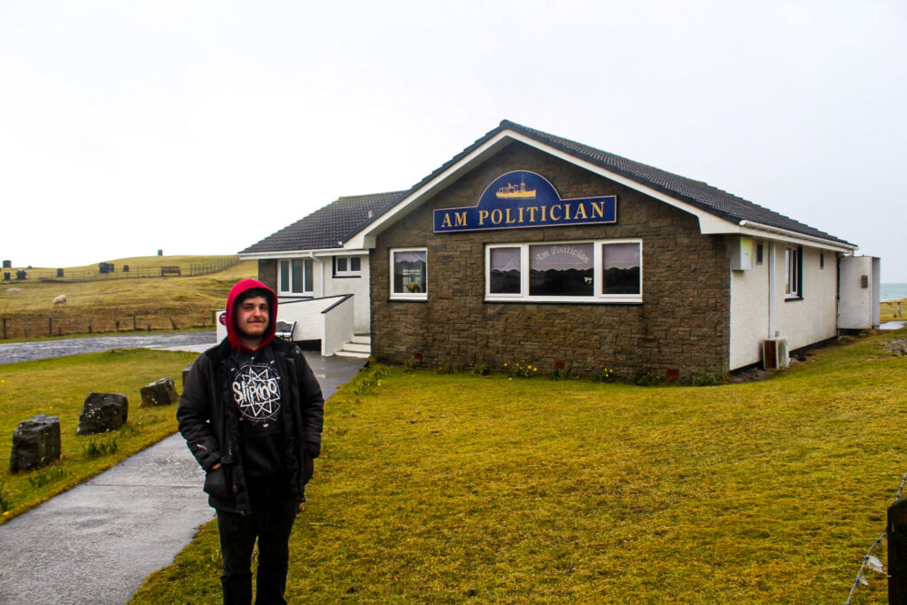
Be sure to stop by the cozy local pub, Am Politician, named after the SS Politician – a cargo ship that ran aground off Eriskay in 1941 carrying 22,000 cases of malt whisky and £3 million in Jamaican banknotes. While islanders salvaged the whisky, their celebration was short-lived, as HM Customs and Excise soon prosecuted them for not paying duty on their unexpected treasure.
Barra and Vatersay
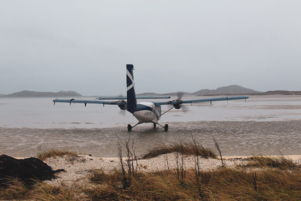
Barra Airport with the only tidal beach runway in the world
For plane spotters and airport enthusiasts, Barra Airport is truly one-of-a-kind. This tiny airport features a runway right on the tidal beach of Traigh Mhòr, which means planes can only land and take off during low tide. When the tide is high, the runway disappears beneath the sea! In fact, it’s the only airport in the world with scheduled flights operating from a tidal beach runway.
If you can, I highly recommend visiting Barra Airport to catch a scheduled flight – and witness the incredible sight of a plane landing or taking off on the sand. It’s a spectacle unlike any other!
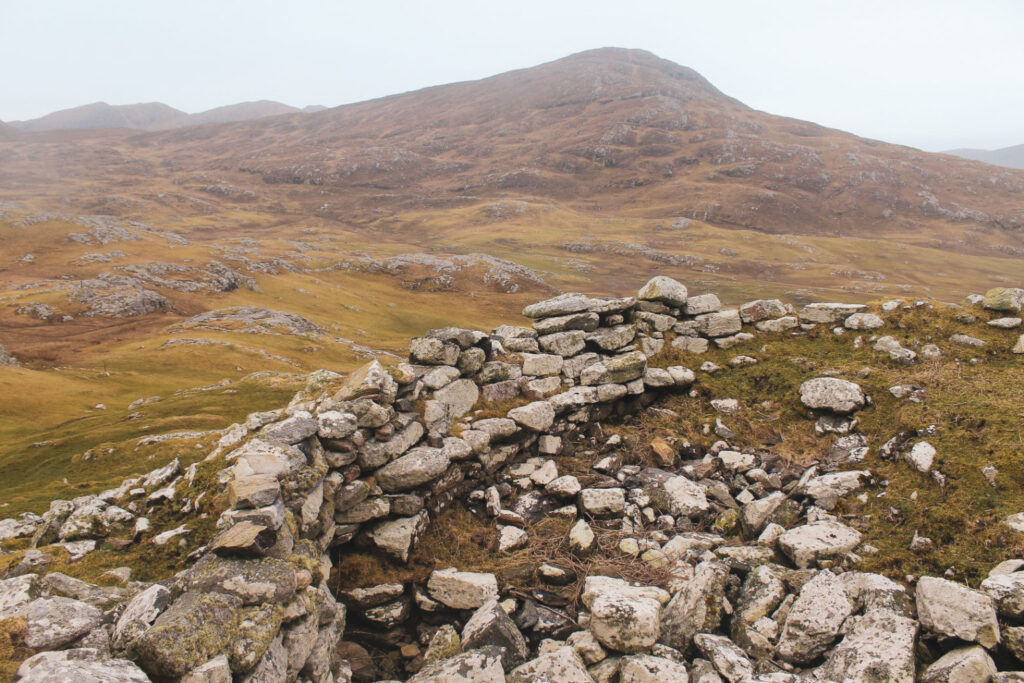
Dun Cuier, an Iron Age dun
Up in the hills of Barra, just above the Cuier cemetery, sits Dun Cuier – a well-preserved Iron Age dun that was in use from the 4th to the 7th century AD.
The dun can be a bit tricky to find, but even the hike up there is worth the effort for the stunning panoramic views of the hills of Barra and Cuier Beach below.
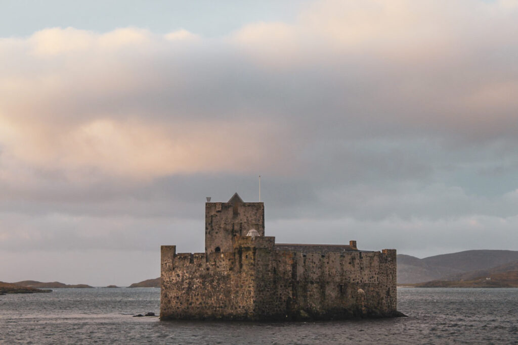
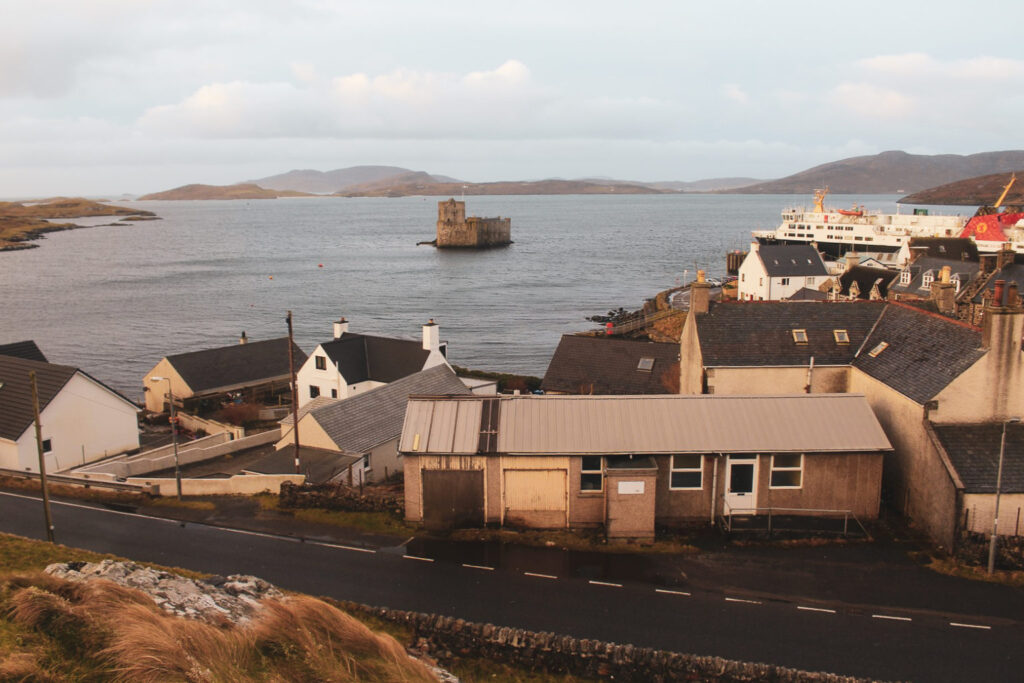
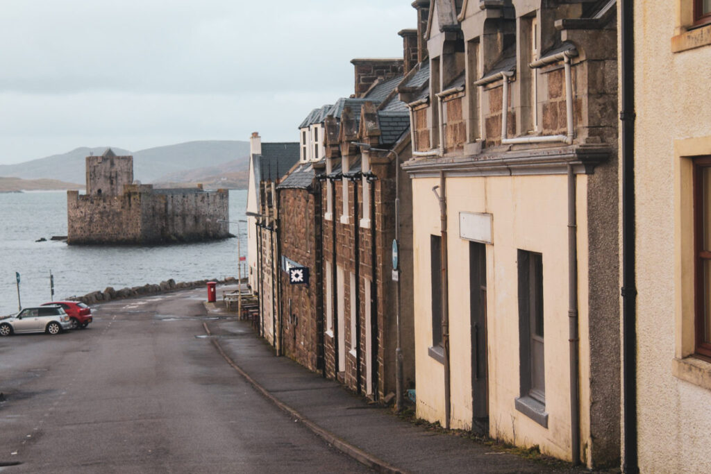
Castlebay and Kisimul Castle
Castlebay is the main village on Barra, beautifully set around a bay dominated by the medieval Kisimul Castle which sits on a small rocky islet. While archaeological excavations haven’t uncovered datable artefacts or architectural features to pinpoint its exact age, historical records mention the castle as early as the mid-16th century.
Kisimul Castle served as the seat of Clan MacNeil, a local clan known for piracy in the Outer Hebrides. The castle was abandoned in 1838, and over time it fell into ruin – some of its stones even found their way to Glasgow, repurposed as pavestones. About a century later, the then-chief of Clan MacNeil bought back most of Barra, including the castle’s remains, and undertook partial restoration to preserve this iconic landmark.
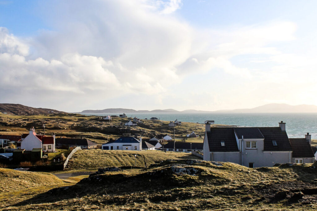
The island of Vatersay
Just three kilometres from Castlebay lies the 200-metre-long causeway connecting Barra to the smaller island of Vatersay – the southernmost inhabited island in the Outer Hebrides and home to Scotland’s westernmost village. Vatersay actually consists of two rocky islands joined by an isthmus of low sand dunes and long beaches.
It doesn’t take long to wander through the tiny village, after which you can enjoy a leisurely walk along the isthmus’ two contrasting shores. On one side, the ocean is calm with a soft sandy beach perfect for a gentle stroll, while on the other, the waves crash against a rugged, rocky shoreline. A world of difference with just a road separating them!
From ancient stone circles and medieval castles to breathtaking beaches and rocky shorelines, these 16 sites showcase the rich history, striking beauty and wild spirit of the Outer Hebrides. Whether you’re planning your first visit or returning to discover more, the Outer Hebrides promise a unique adventure off the beaten path – one that stays with you long after you leave. And fair warning: it’s likely to leave you craving a return visit!
Leave a Comment