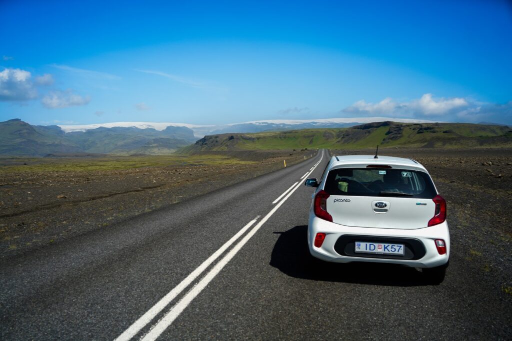
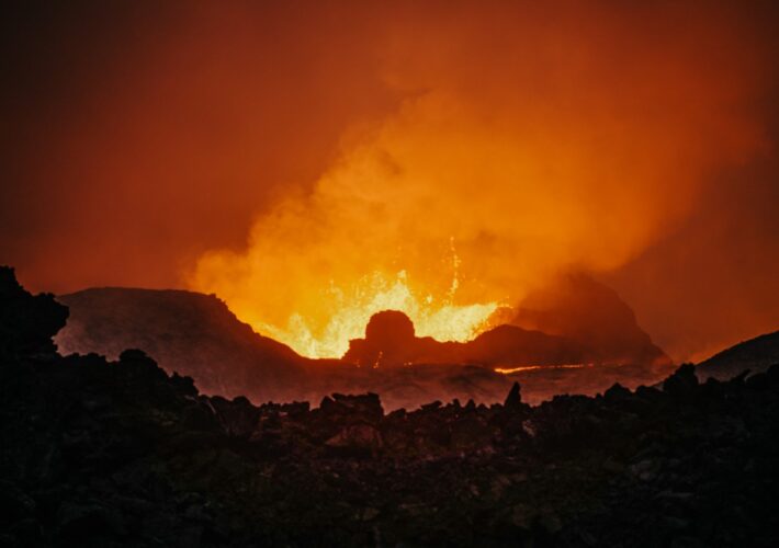
Back in July 2021, I visited Iceland for the fifth time. It’s a country I’ve explored in depth, with the exception of the south which I’d barely touched prior to this trip. I’d deliberately steered clear of the south due to overtourism, but when the Fagradalsfjall volcano in the Geldingadalur valley began erupting, I felt I should take the opportunity, not only to see my first active volcano, but also to explore this part of Iceland that has become so popular in recent decades. I spent only three days on this trip, and two of them were dedicated to volcano sightings. But on the third day, I roadtripped through a large part of the south, visiting a bunch of gorgeous places along the way.
I had hoped to wild camp during the trip, but soon learned that it is no longer legal in Iceland due to overtourism. So instead, I slept in my rental car on parking lots near the sights.
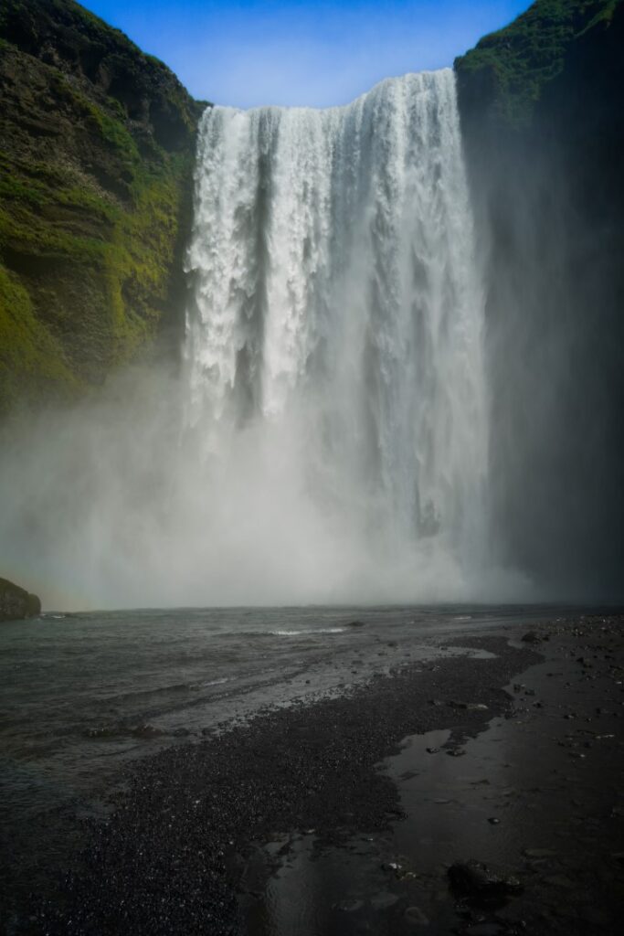
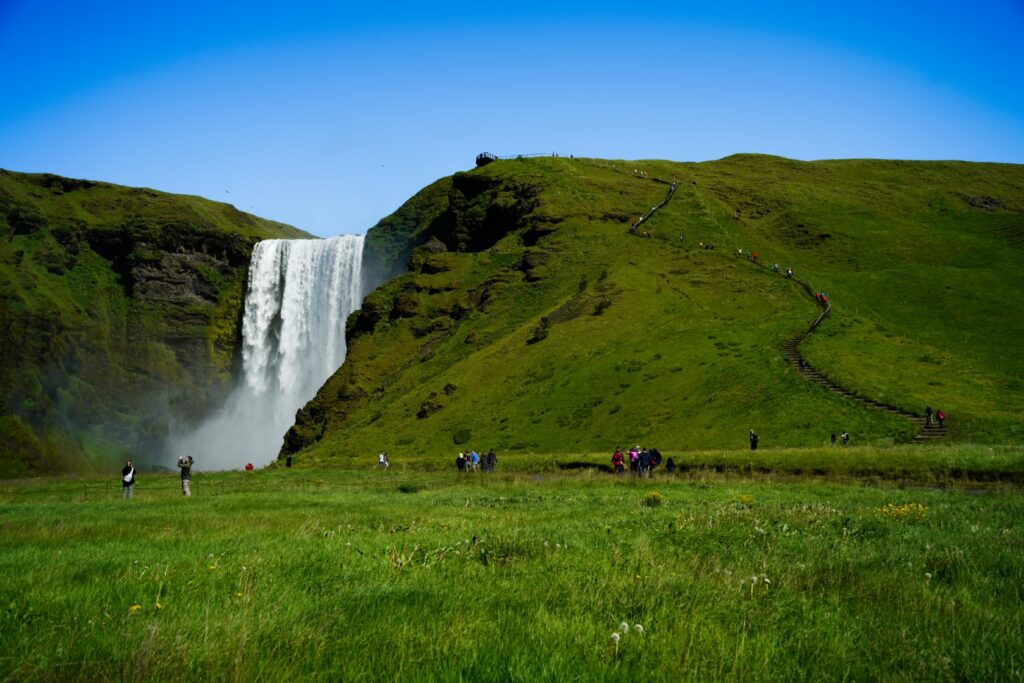
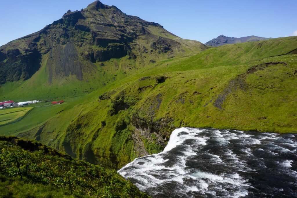
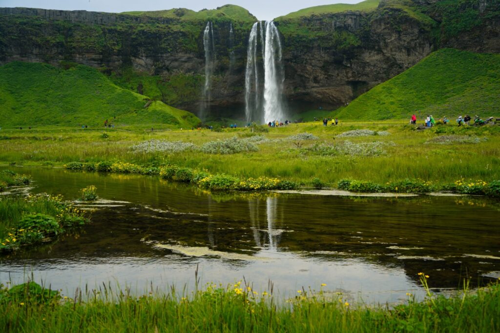
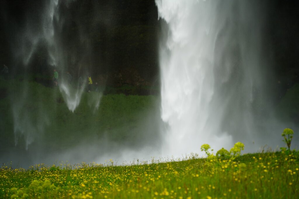
Skógafoss Waterfall
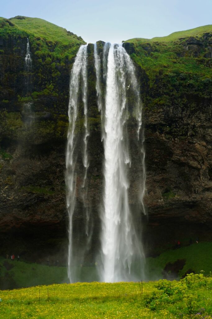
On my day of roadtripping the south, I woke up near the Skógafoss Waterfall, one of the most popular waterfalls in Iceland. There are so many waterfalls to choose from, but I believe this one is popular because it’s near Reykjavík and easily accessible from the Ring Road. That’s not to say that it’s not worth seeing, because it was a forceful sight that met me that morning! In fact, Skógafoss is one of the largest waterfalls in Iceland, with a drop of around 60 meters!
The nature and countryside surrounding the waterfall was some of the most beautiful I saw in the south. That alone was worth the pit stop!
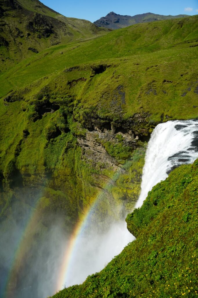
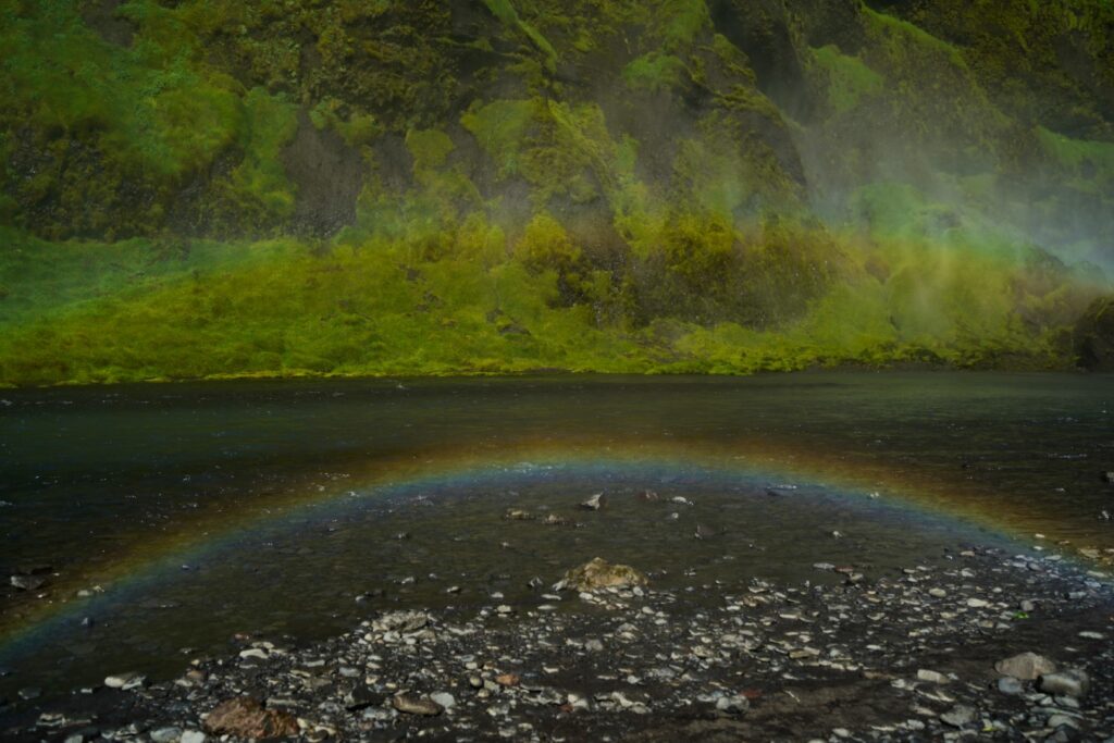
I decided to hike up to the top of the waterfall to see it from a different perspective, and that’s where little rainbows suddenly appeared. Part of me wanted to continue hiking the trail above the waterfall into the highlands, but there was still plenty more I wanted to see that day, so off I went.
Sólheimajökull Glacier
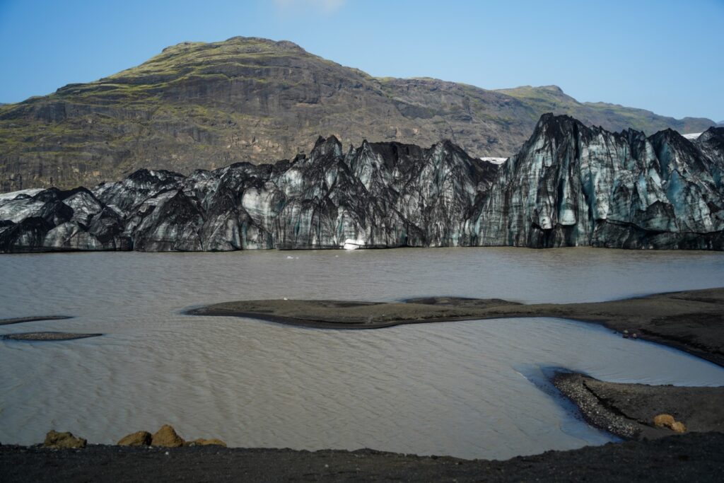
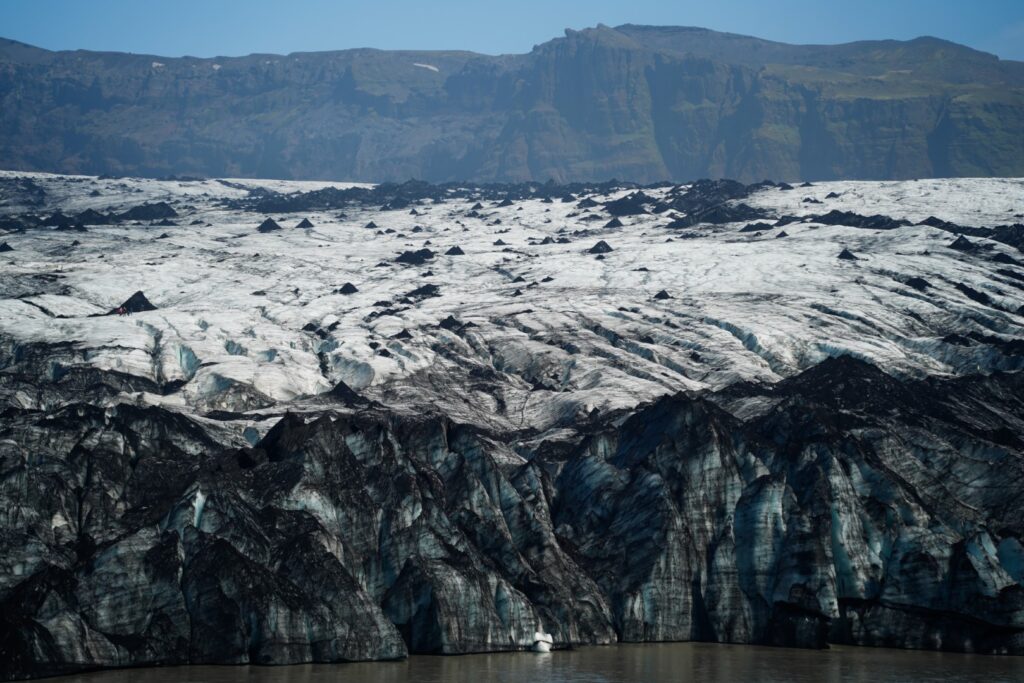
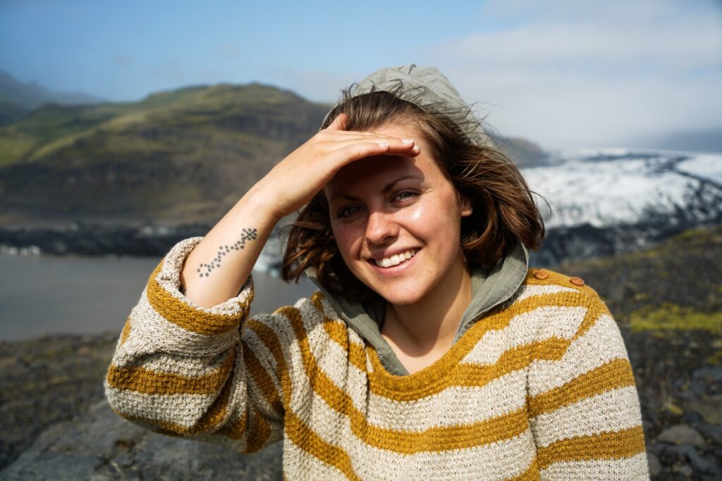
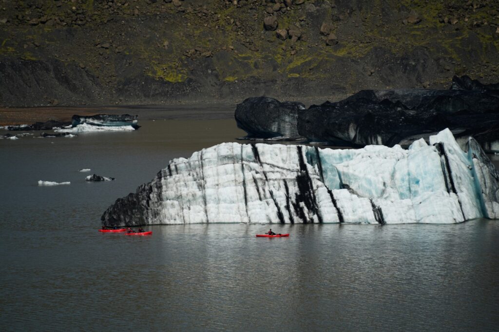
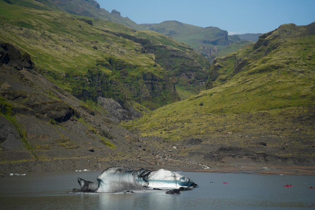
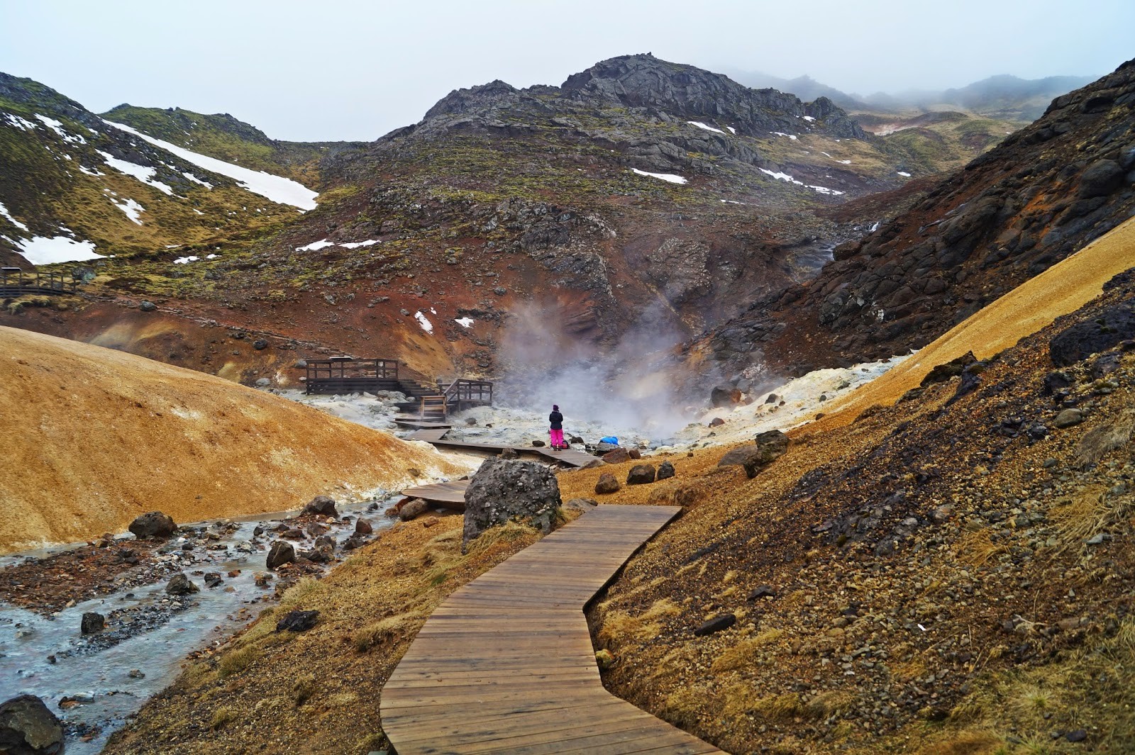
Something I really wanted to see while in the south was a glacier. Iceland has plenty of them, but they are mostly accessible from the south. I chose Sólheimajökull, a glacier tounge of Mýrdalsjökull, the fourth largest glacier in Iceland. Sólheimajökull is easily accessible by road and has a nice little trail that leads to the edge of it. I could even touch it and witness the ice melting in the sun! A bit of a contrast to the lava I’d seen with my own eyes the day before – Iceland is most definitely the Land of Fire and Ice!
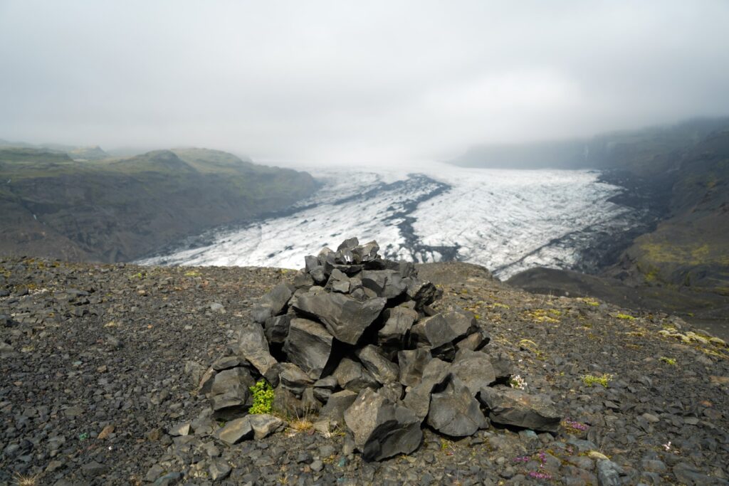
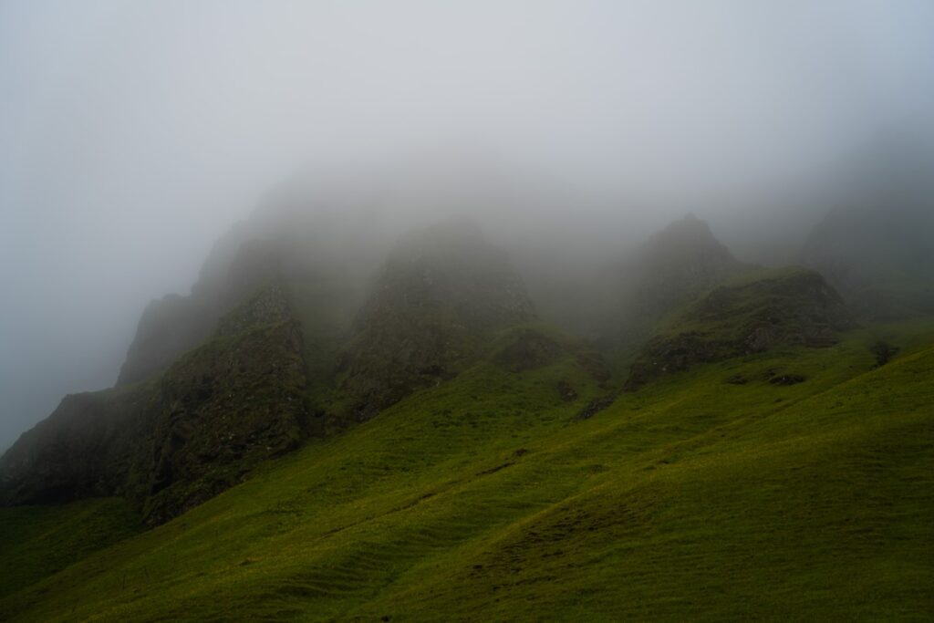
I wasn’t quite satisfied with the short hike, so I decided to climb the small mountain of Jökulhaus at 258 m., which sits in front of the glacier. It was a surprisingly steep climb, but very worth it for the beautiful view over the glacier and its lagoon complete with little icebergs below. Fog rolled in over the glacier as I reached the mountain summit, blocking my view of its extent, but it was pretty nonetheless. I spent a while on the mountain, eating snacks and enjoying the only solitude I’d find that day.
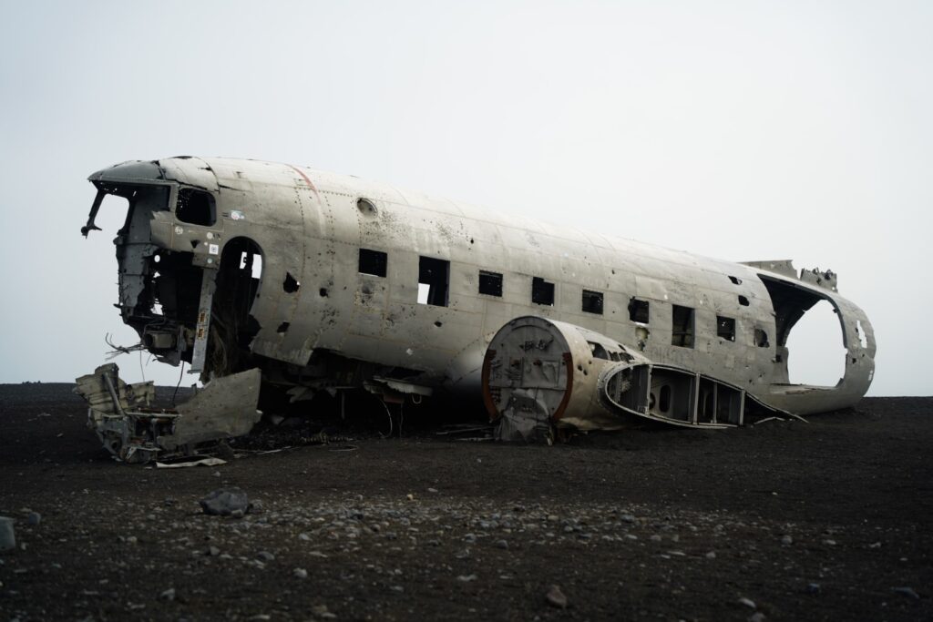
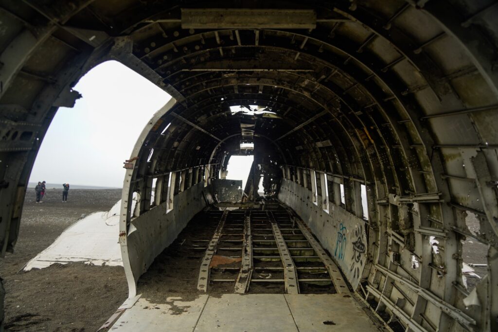
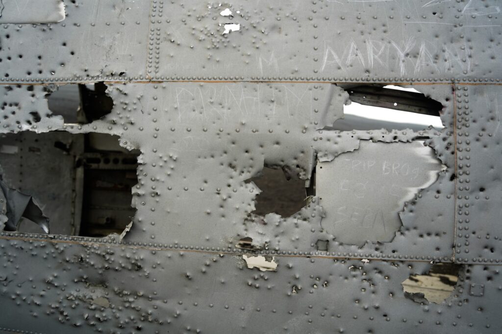
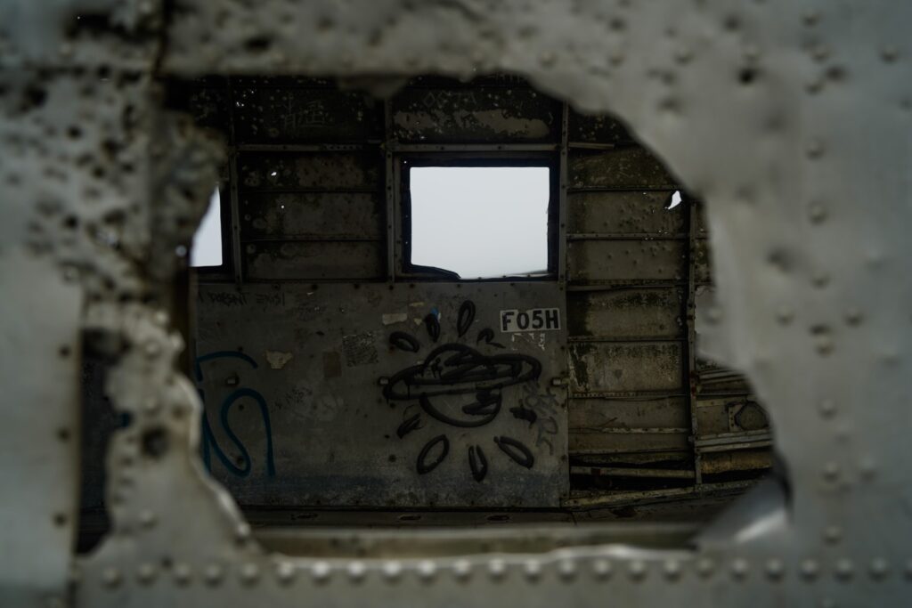
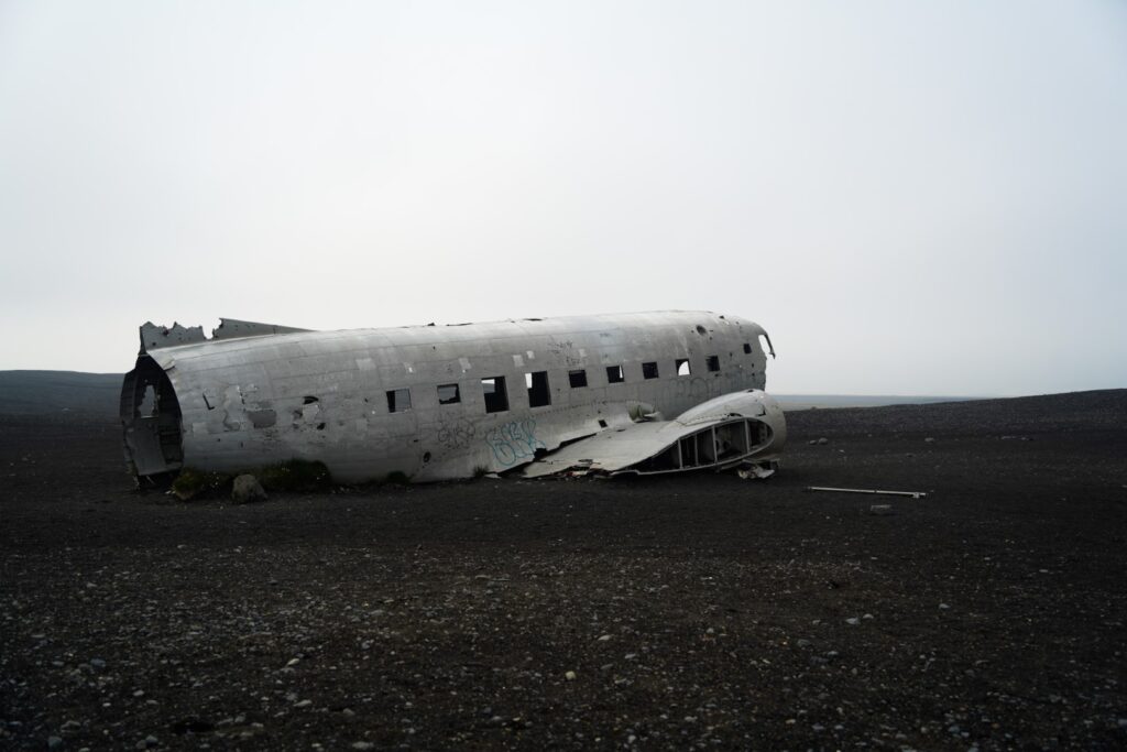
Sólheimasandur Plane Wreck
In 1973, a United States Navy DC plane reportedly ran out of fuel and crashed on the black rocky beach of Sólheimasandur. Thankfully, the entire crew survived the crash. All valuables were taken from the plane, and the wreckage was abandoned. But not anymore! In recent years, the wreckage has become a huge tourist destination despite its isolated location.
Walking from the parking lot to the wreckage, I couldn’t help but think how frightening it must’ve been for those that experienced the crash. Not only did they probably think they were going to die, but they also ended up in the middle of nowhere. From the crash site, nothing but sand can be seen, and it takes a good 45 minutes to reach by foot along a flat (and rather boring) stretch of sand!
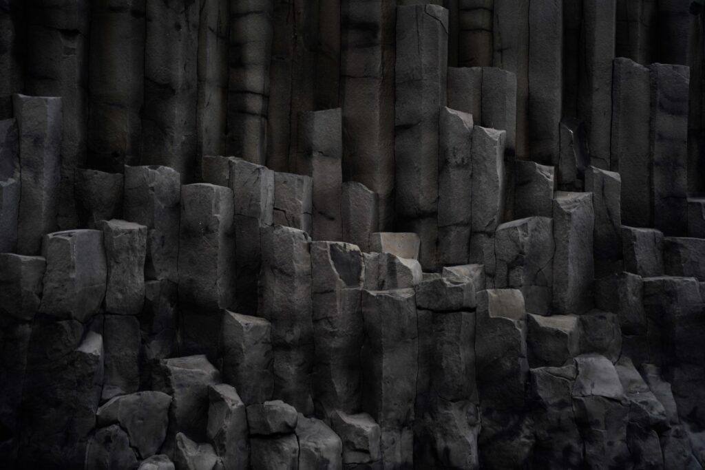
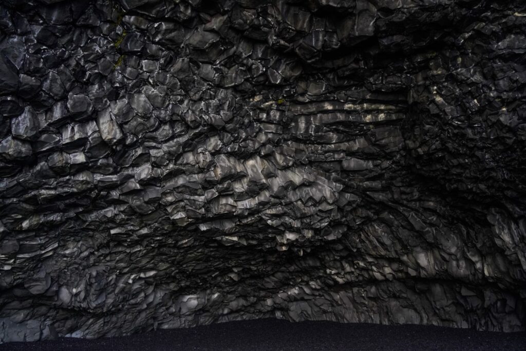
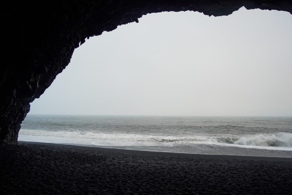
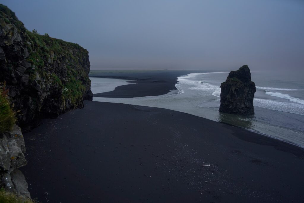
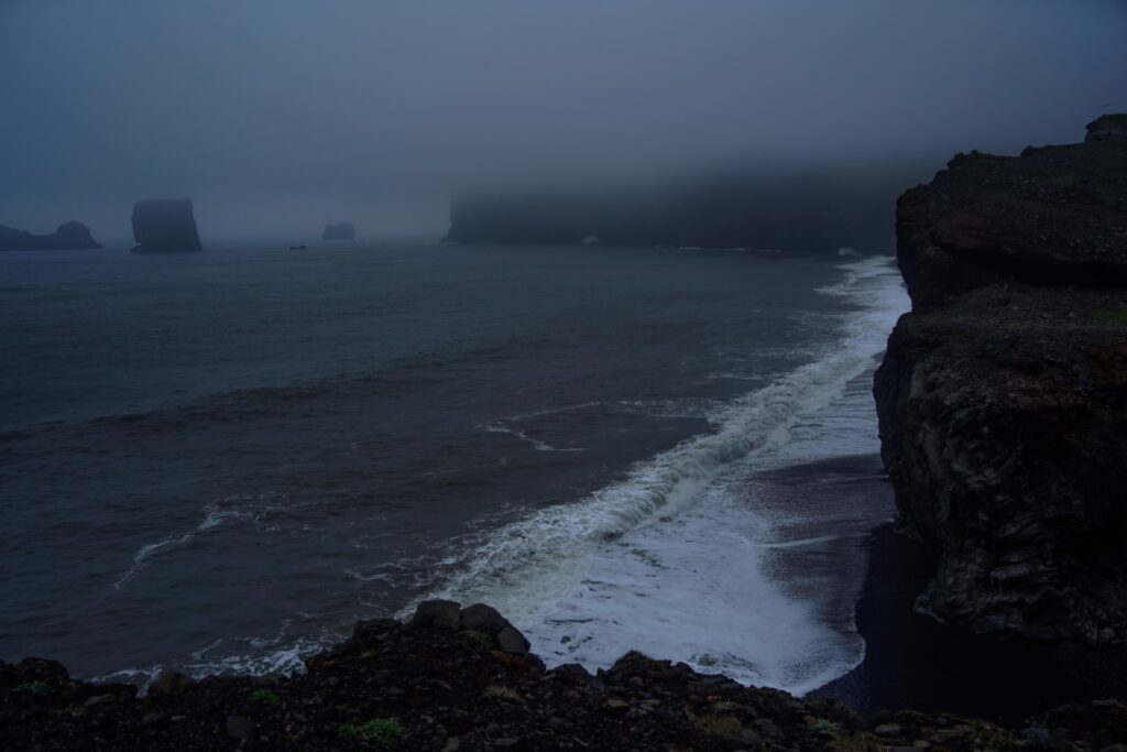
Reynisfjara Beach
As I continued my roadtrip east, fog took over and the wind picked up. But I still had a few hours of daylight left.
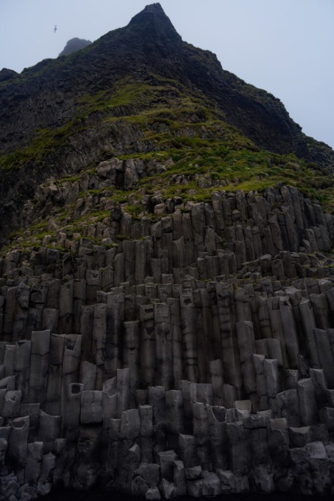
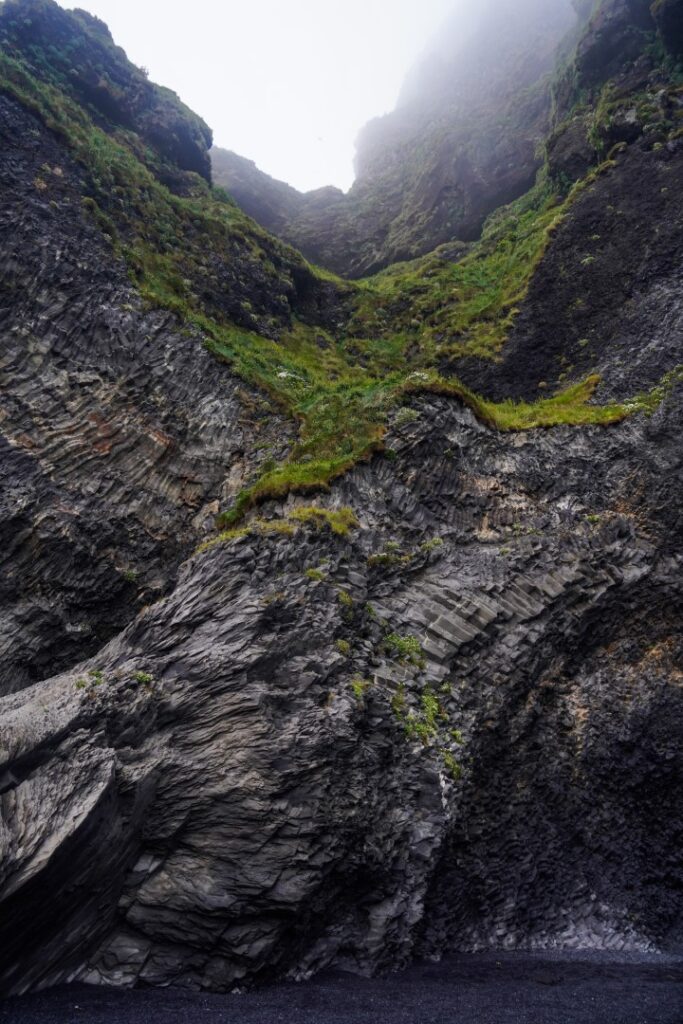
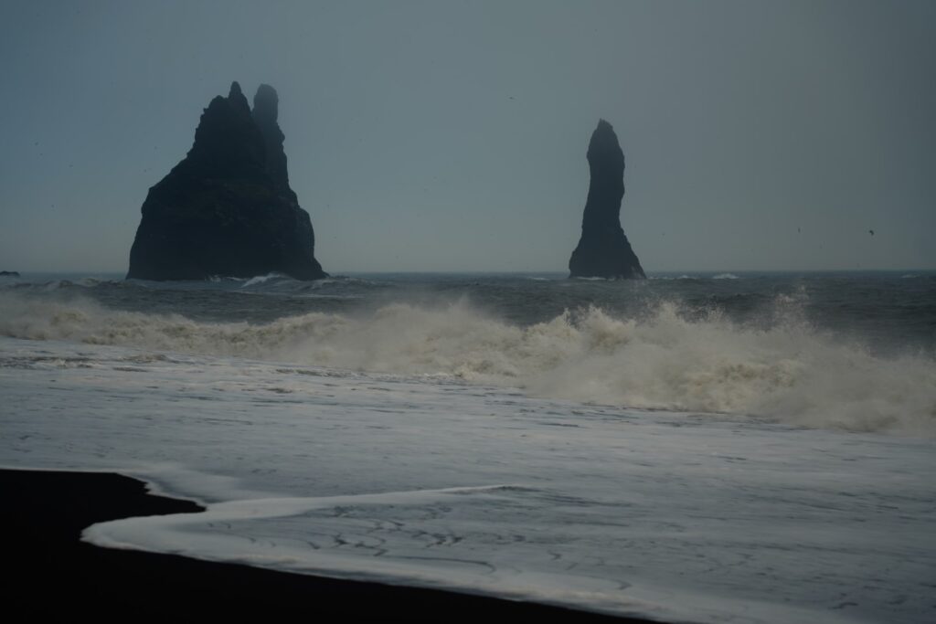
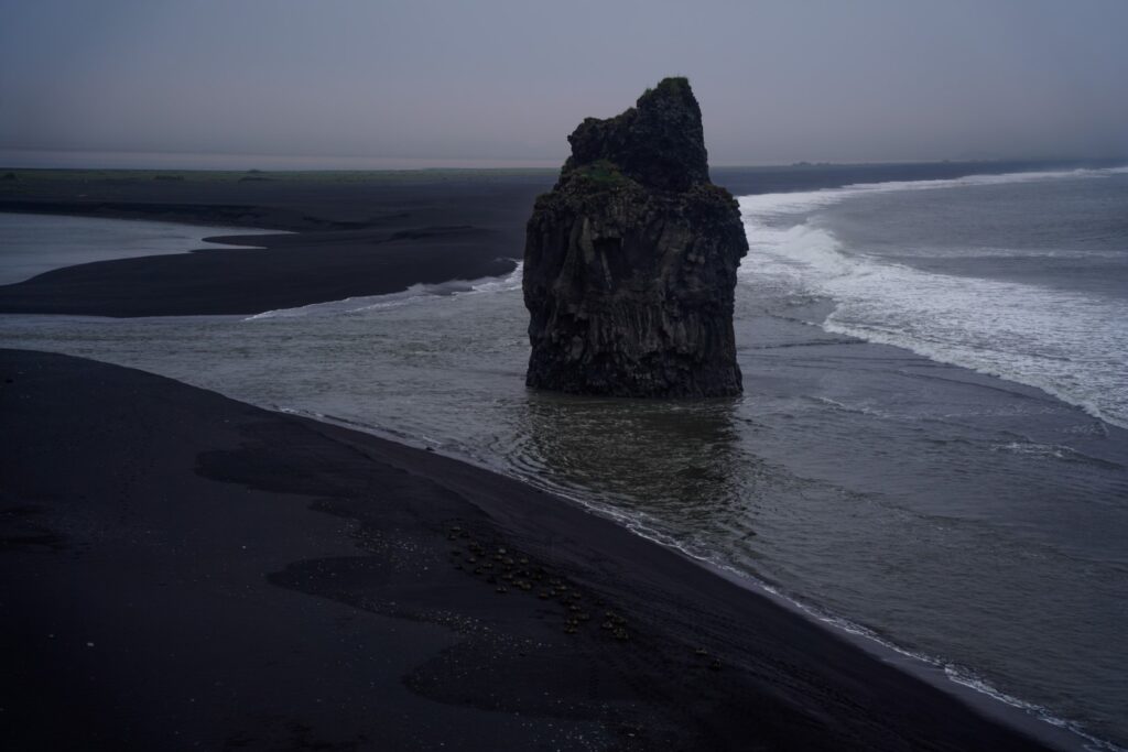
I drove to Reynisfjara, one of the most popular beaches in Iceland, and also thought to be one of its most beautiful. The black sand beach features basalt columns, caves and two iconic sea stacks in the ocean in front of it. The moody atmosphere of the afternoon only made it more ethereal. It’s a gorgeous place, but too crowded for my liking. And it’s also a rather scary place as there are frequent sneaker waves (enormous waves that suddenly appear amidst smaller waves) which do occasionally take people with them back to sea – in fact, Reynisfjara is known as one of the most dangerous places in Iceland for that reason. I saw way too many people walking too close to the ocean, ignoring the signs warning visitors to keep a good distance due to the risk of sneaker waves, and that definitely took away from the experience.
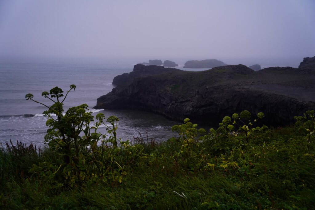
Dyrhólaey Arch
The last stop of the day was a bit further east, at a viewpoint to see the Dyrhólaey Arch, which is a massive rock arch, a result of thousands of years of erosion.
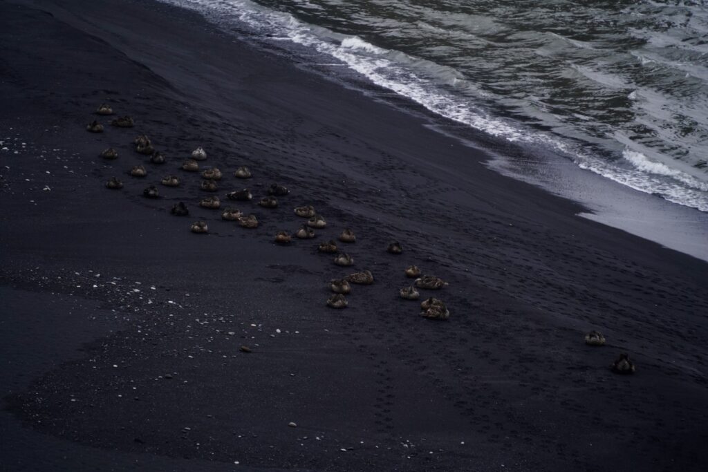
Unfortunately, it was too foggy for me to see the arch, but I was awarded with gorgeous views of sea stacks and ducks chilling on the black sand beach below.
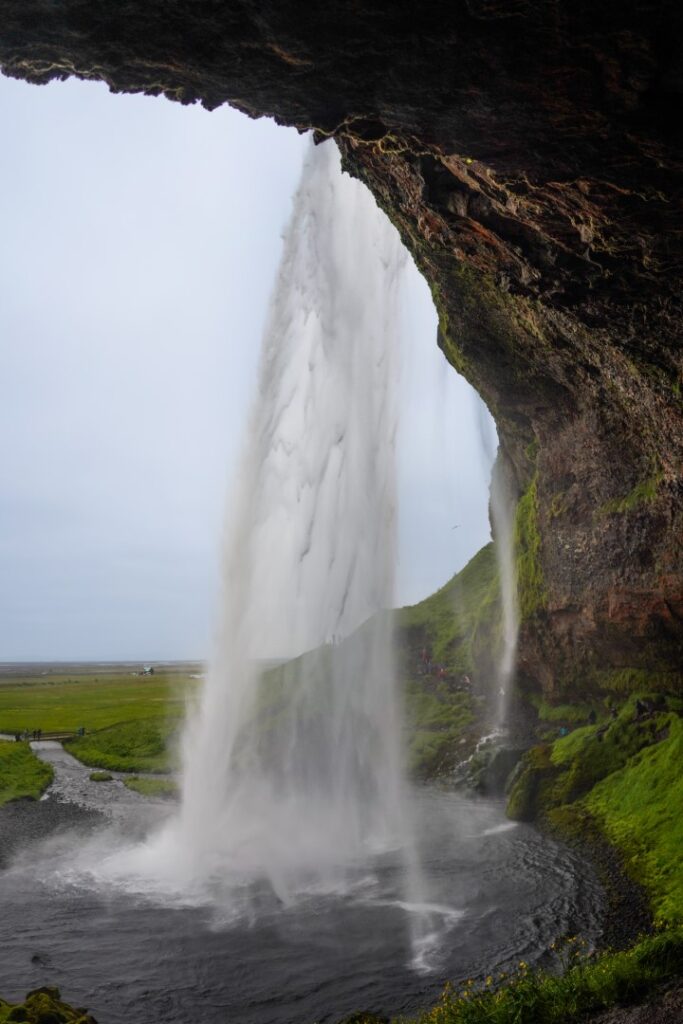
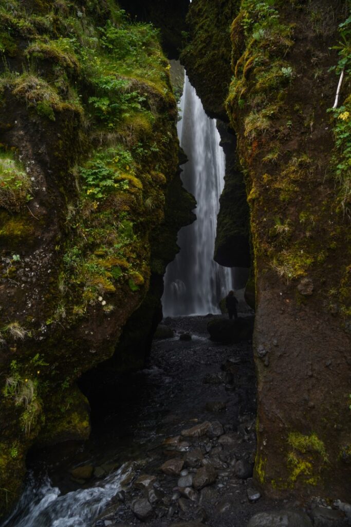
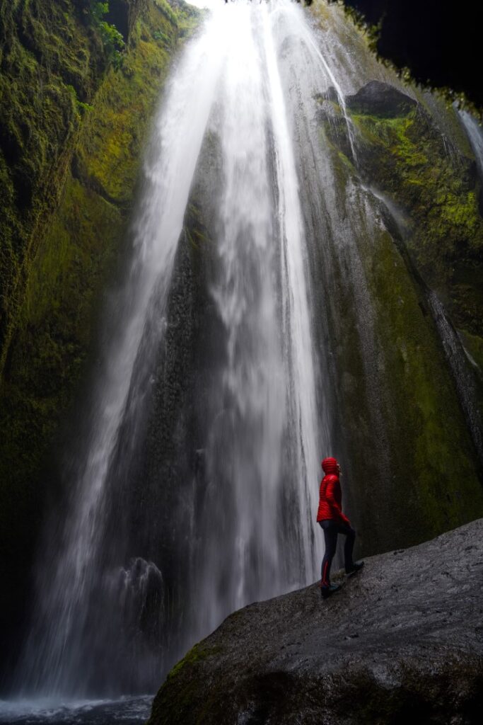
Seljalandsfoss and Gljúfrábui waterfalls
In the dusk, I drove back west to the parking lot at Seljalandsfoss, another of Iceland’s most famous waterfalls. There, I slept in my rental car, and then spent the morning exploring the sight.
Seljalandsfoss is a very interesting waterfall to visit as there’s a trail going behind its 60 m drop, into a small cave! I managed to not even get wet while walking behind the waterfall!
There are also other waterfalls nearby that are worth checking out. A short walking distance from Seljalandsfoss is Gljúfrábui, a waterfall hidden behind a cave!
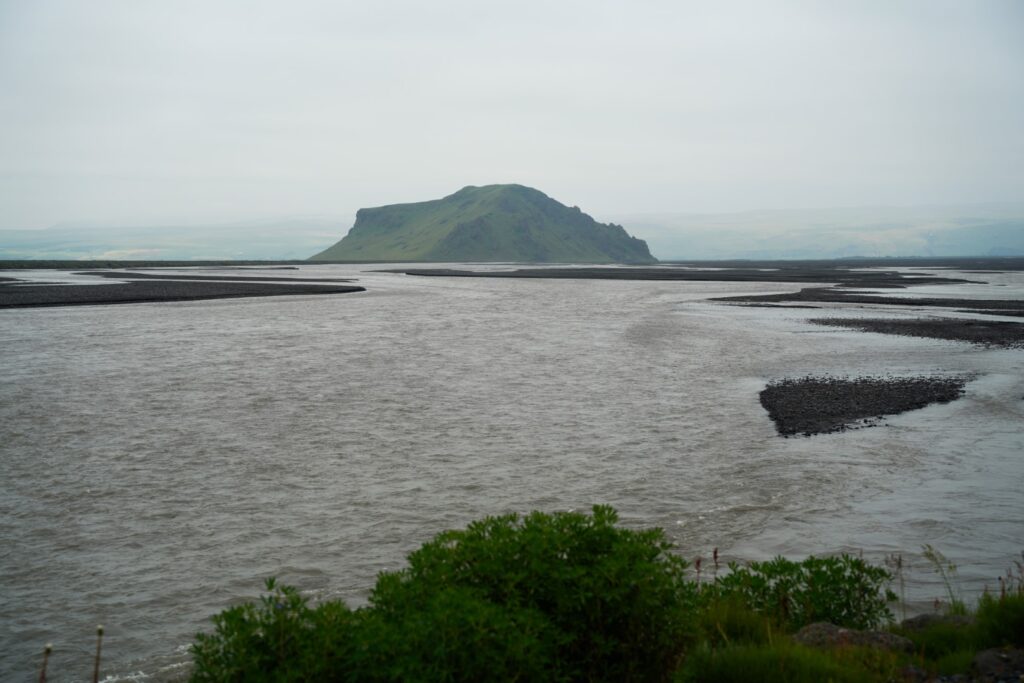
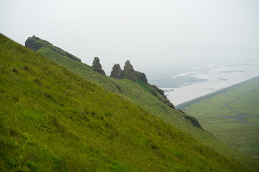
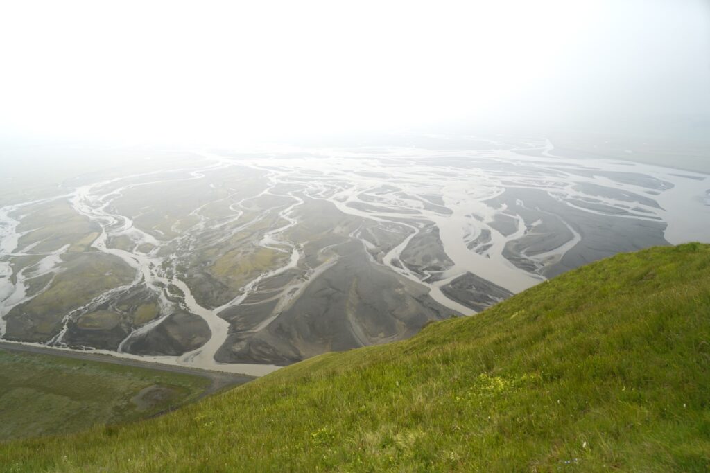
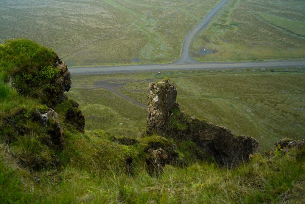
Stóra Dímun mountain
On my way back to Reykjanes peninsula and the volcano, I spotted a lone mountain in the distance. Stopping to check my map, I saw that it’s called “Stóra Dímun”, just like the little Faroese island. That was enough to make me want to climb it!
The “mountain” rises only 185 m. above sea level but it was a steep climb nonetheless. It was amazing finally having a bit of the south to myself in this rather unknown spot. Although, near the summit, I met a local couple and their two dogs who climb the mountain every day, and they showed me where to find the best views on the rugged summit! The views were amazing, but I knew it would’ve been better had it not been foggy, as I was close to several glaciers!

The mountain was the last sight I saw in the south before heading back to the volcano for my second hike there!
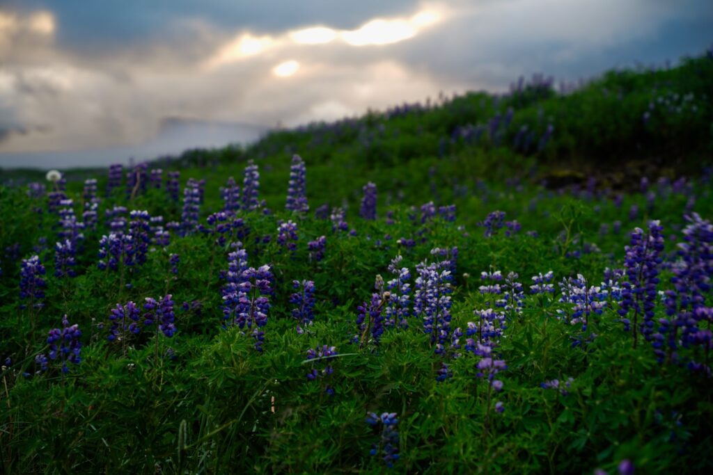
Because the trip was in the height of the Covid-19 pandemic, there wasn’t as many tourists as previous years, but still way more than is healthy for the landscapes. I felt rather guilty for contributing to the mass tourism, but I did my best to treat nature with care and only hike on established trails. I really enjoyed the roadtrip and the sights were of course incredible. However, I still don’t really understand the hype surrounding the south. To me, the Westfjords and the fjords of the east coast are the most stunning parts of Iceland, so it baffles me how most tourists choose to only explore the south. That being said, I’m really glad that I finally took the time to see some of it, especially at a time when the crowds weren’t as extreme as they can be.

Leave a Comment