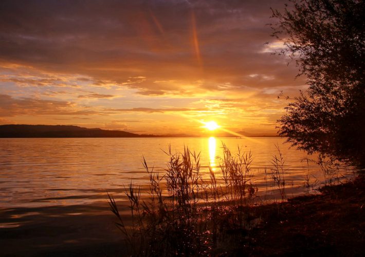
I have travelled extensively through Germany. I’ve seen the rugged peaks of the Alps of Bavaria. Felt enchanted by the mysterious Black Forest in Baden-Württemberg. Hiked in the dark forests of the Harz in central Germany. Been mesmerized by the white chalk cliffs of Rügen. Stared in awe at the impossibly red cliffs of Helgoland. But no region has blown me away as much as Saxon Switzerland (and nope, Saxon Switzerland is *not* actually in Switzerland!).
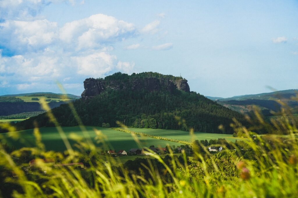
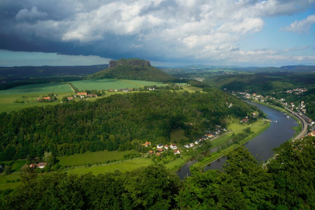
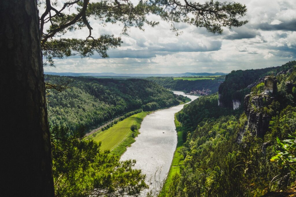
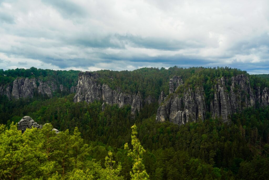
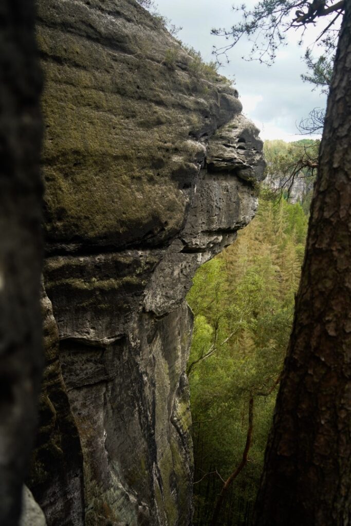
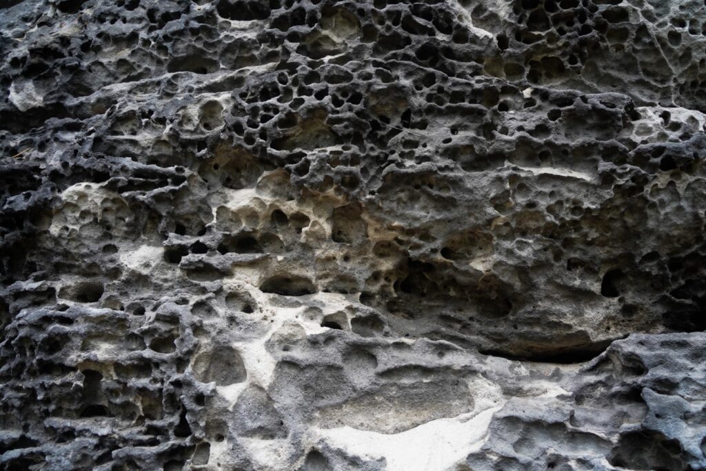
Located in the far southeast of Germany and stretching over the border into Czech Republic, Saxon Switzerland National Park is dominated by the rocky Elbe Sandstone Mountains that the river Elbe cuts through. The landscape is dominated by oddly shaped sandstone karsts, table mountains, rock needles and gorges. Saxon Switzerland is a landscape that shares no similarities with other places I’ve seen or heard of. It almost feels otherworldly!
It was during a long weekend in late May last year that I finally got to visit this mesmerizing region. My travel buddy and I based ourselves in the small Czech city of Děčín and spent two days of our trip exploring the German part of the national park.
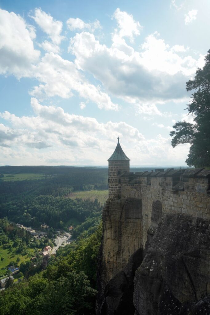
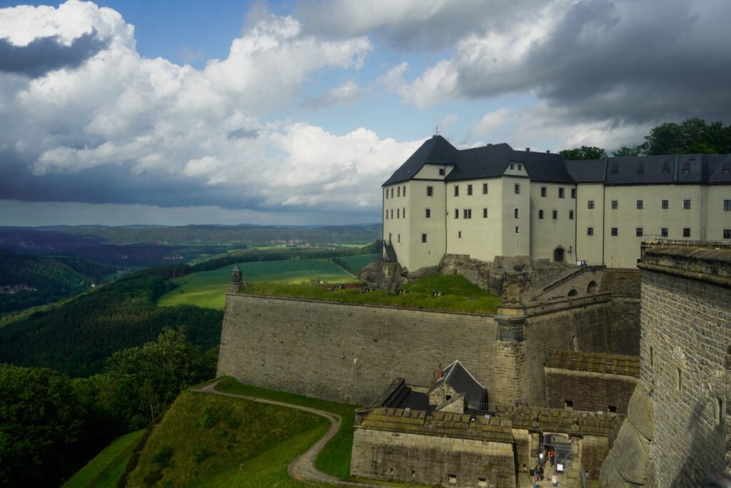
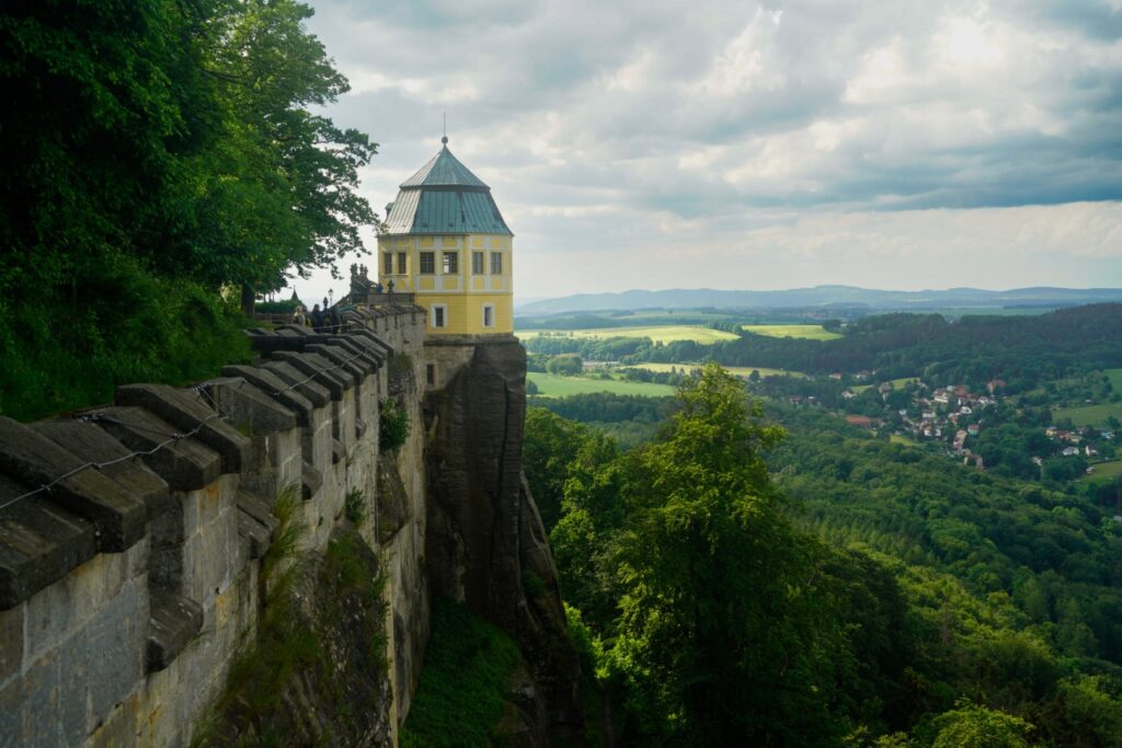
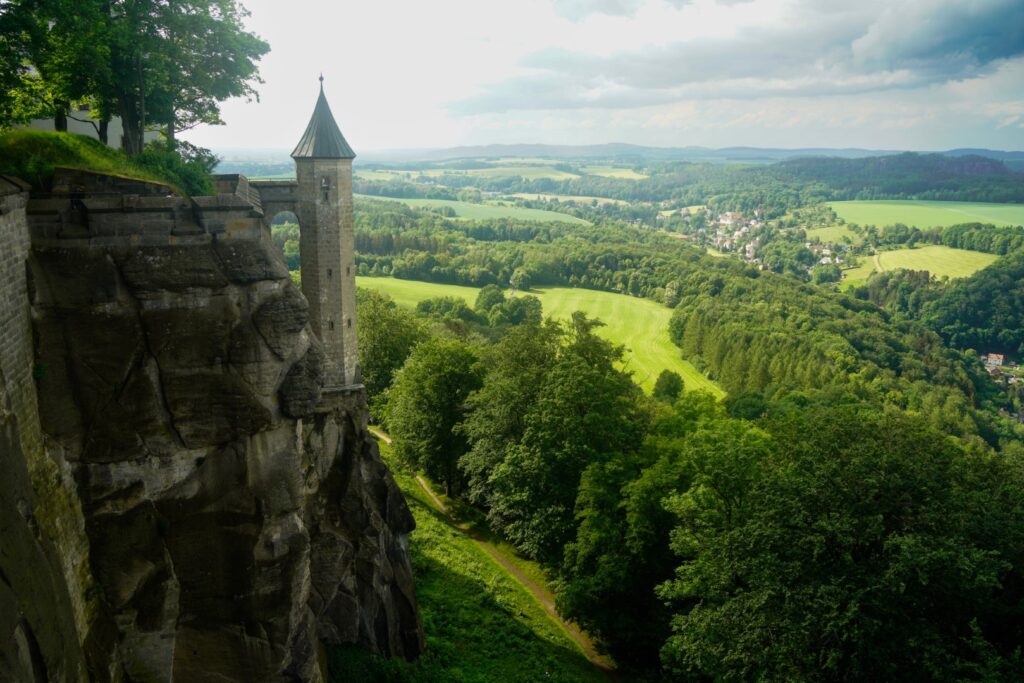
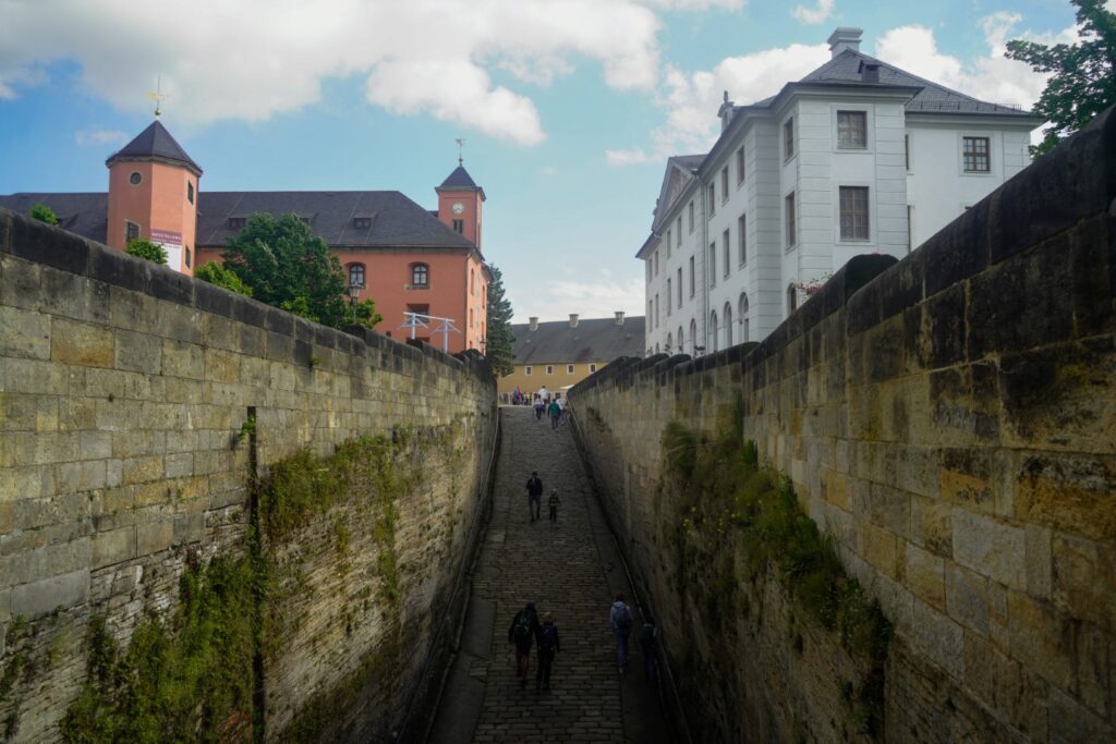
Königstein Fortress, the largest hilltop fortress in Germany
We spent the whole first day exploring the majestic Königstein Fortress, built atop a flat table mountain of the same name, towering 240 m. above the Elbe river valley.
It’s unknown when the fortress was first constructed, but it has been mentioned as far back as 1233. It was originally used as a stronghold and later a monastery before being converted into a fortress in 1589. It was since used as a prison, a retreat for soldiers, a hiding place for the royal family of Saxon and as a storage place for invaluable art during the Second World War. It’s one of few fortresses that has never been attacked which means it’s incredibly well-preserved!
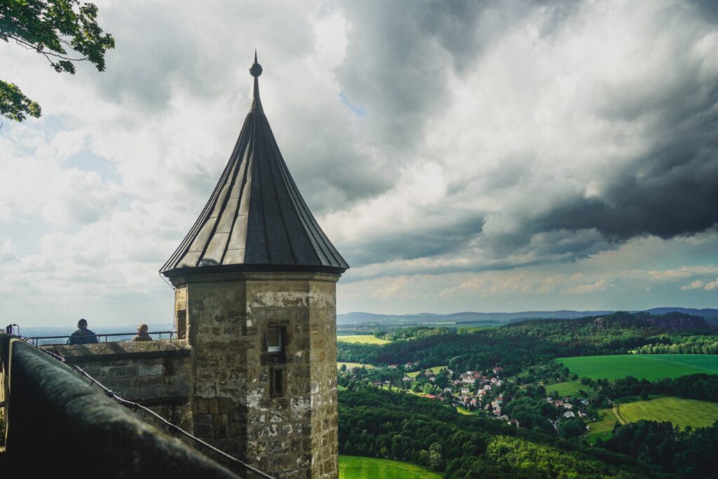
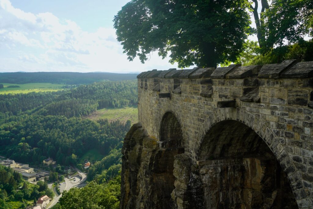
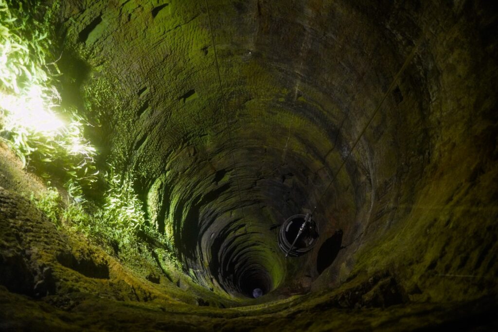
Today, the fortress is a museum, showcasing its history. There are over 30 buildings to explore as well as a trail along the base of the fortress and along the fortress walls. It’s easy to spend several hours there or even a whole day, like we did. It’s way too impressive for a quick visit, and the view alone is enough to make anyone want to stay! Oh, and did I mention that the fortress has the second-deepest well in Europe? At 152,5 metres deep, it’s an awe-inspiring sight!
It rained hard when we first arrived so we hid in a café below the fortress for a few hours. When the rain finally stopped, we walked up to the fortress and spent the rest of the day there. We enjoyed taking it slow, hiking around the giant fortress walls, taking in the views and exploring the fortress grounds. At 13 euros per person, the entrance ticket is quite pricey, but it was worth it for the magnificent views awaiting at the top of the fortress walls and that incredible well!
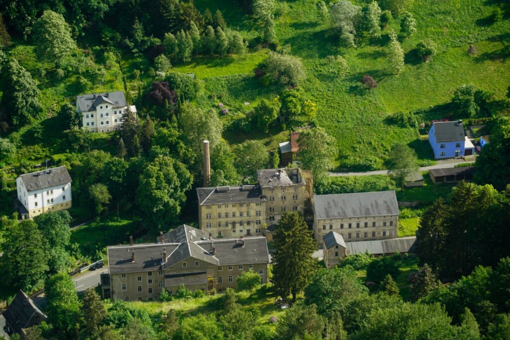
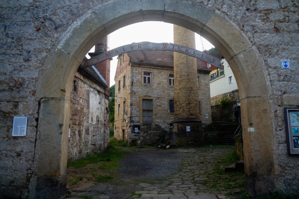
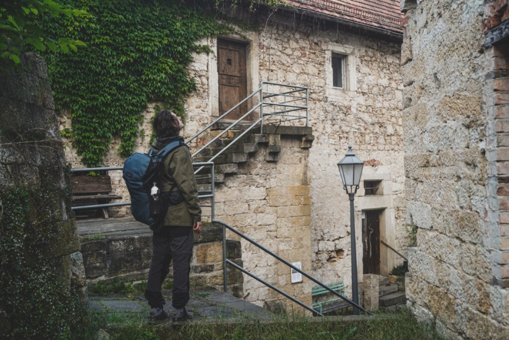
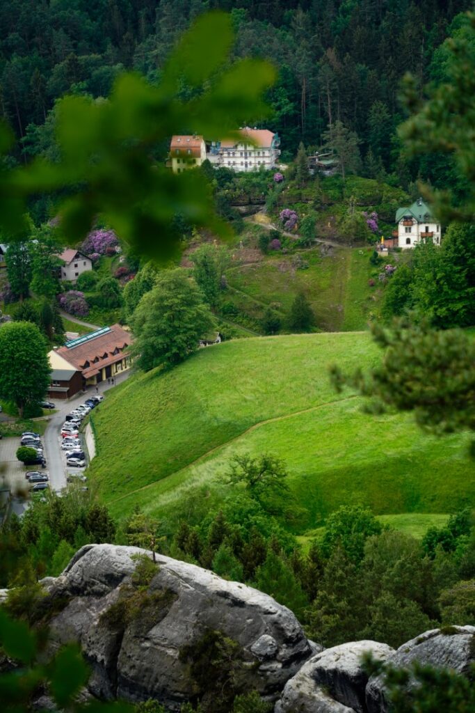
Before heading back over the border in the evening, we strolled through the quaint village of Königstein, located below the fortress. The village dates back to the 14th century and it’s very apparent in the architecture!
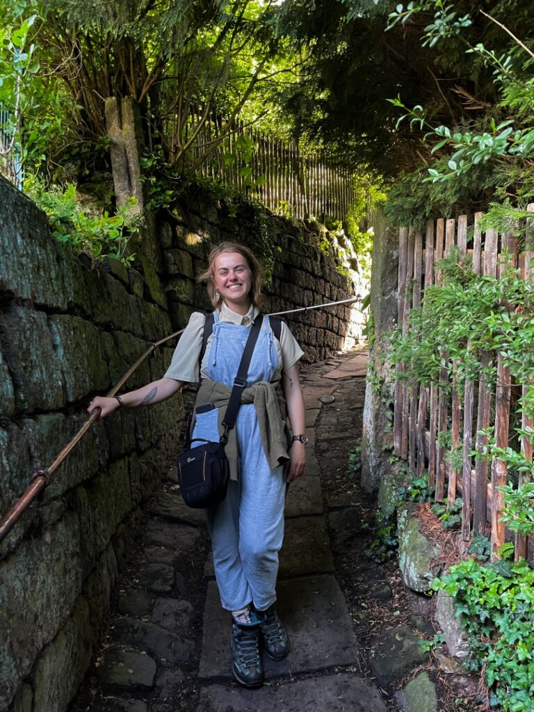
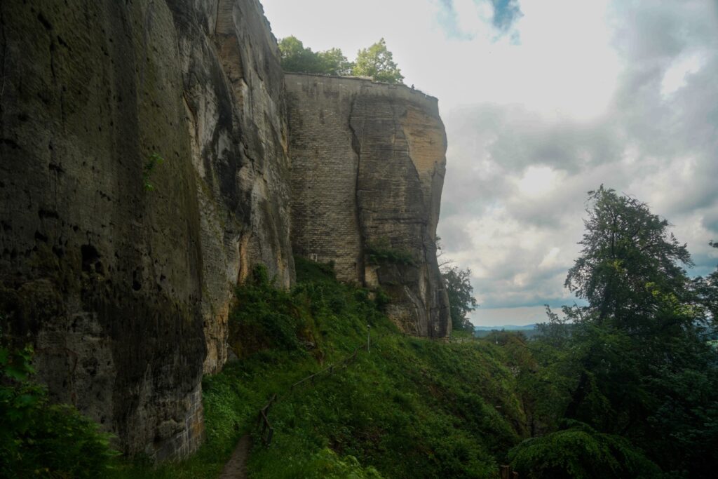
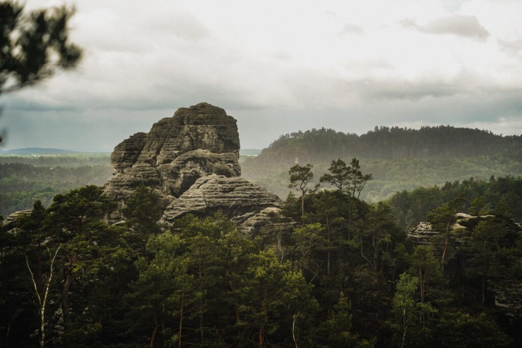
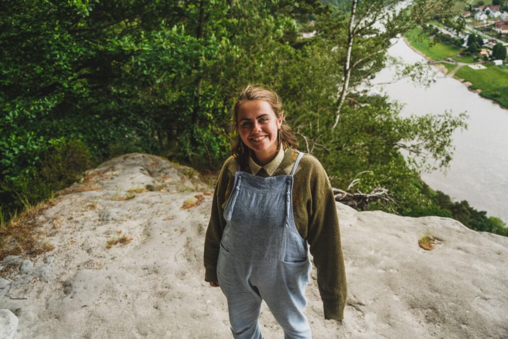
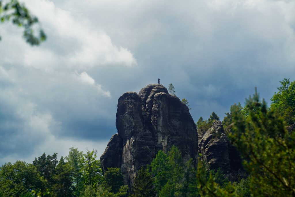
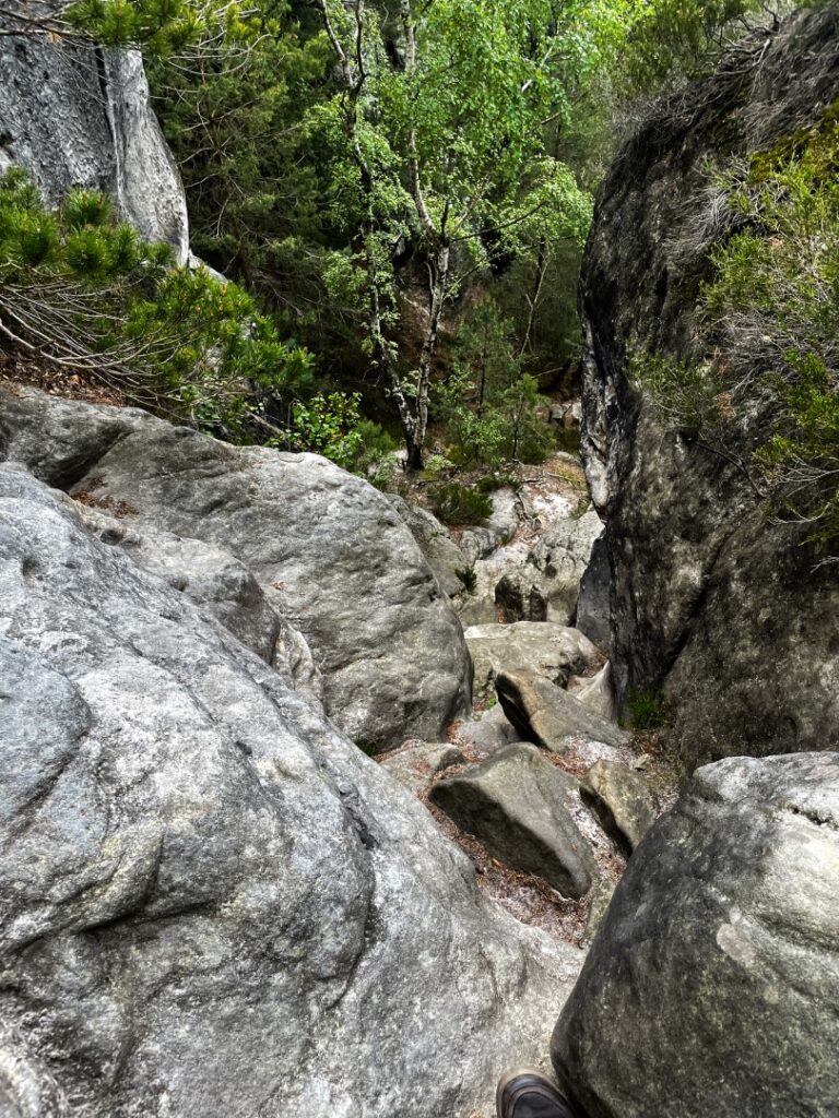
Climbing sandstone rocks above Kurort Rathen
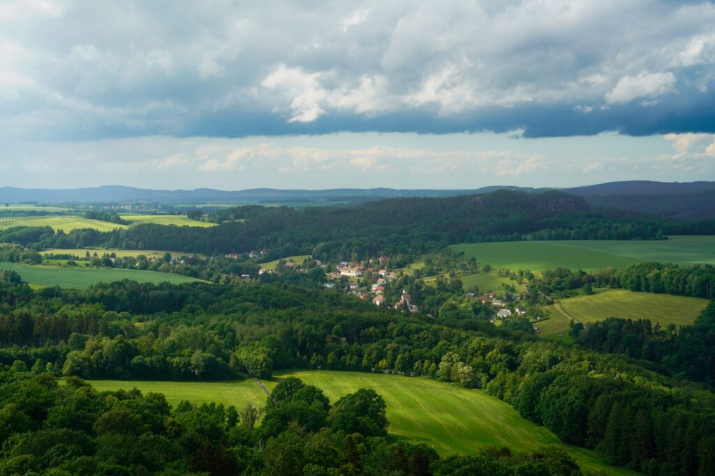
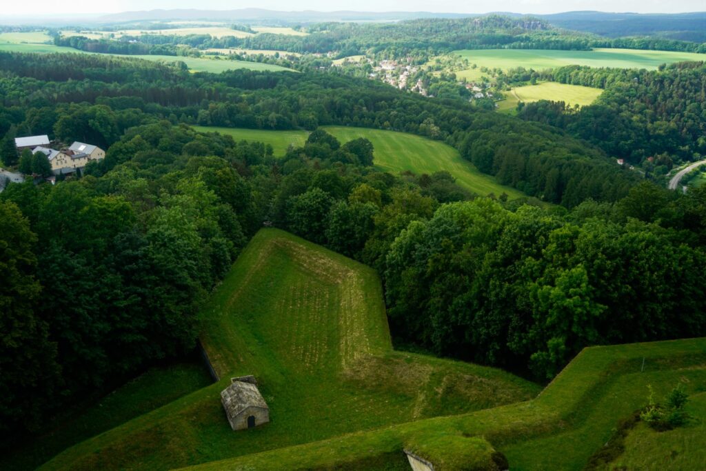
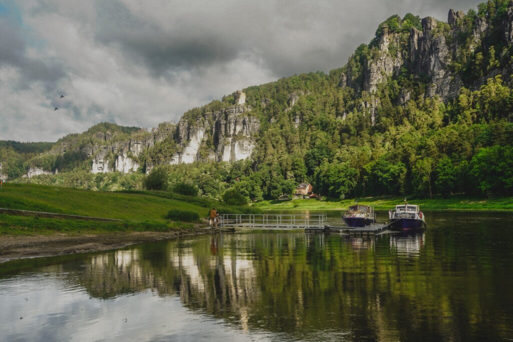
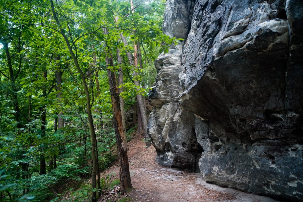
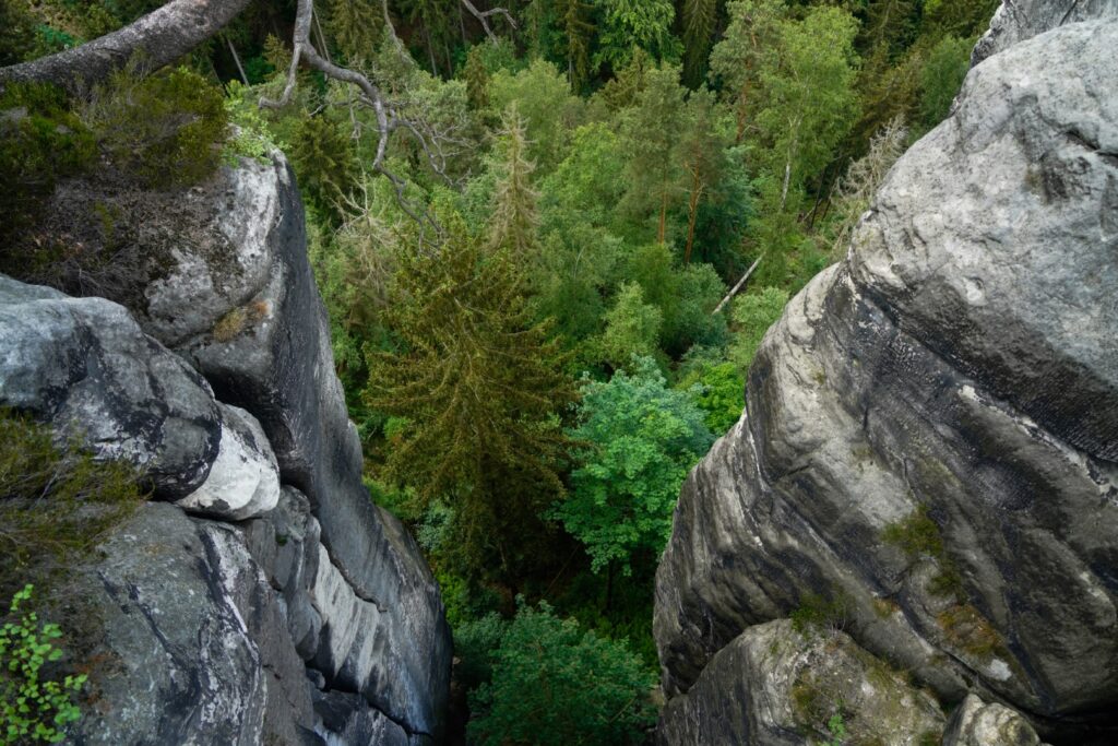
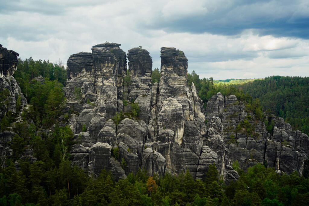
The next morning, we set off early to make the most of the day. We had one plan – to hike to the famous Bastei Bridge viewpoint. But we also wanted to see more of the area, so after the short journey over to Kurort Rathen with the ferry from the train station, we ditched the crowds and headed in the opposite direction, up towards a collection of rocky peaks called Feldsteine.
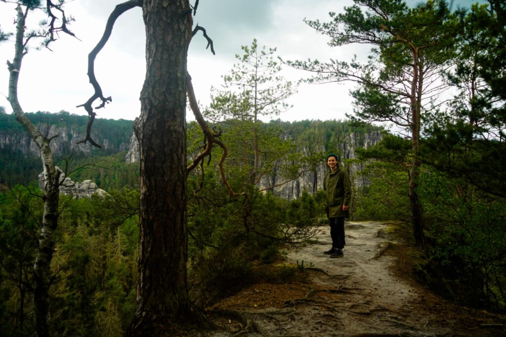
We tried following some routes on maps.me to a bunch of viewpoints but soon gave up as we found out their trails in this area are quite inaccurate. So we just followed random trails. We climbed random rocks, found our own viewpoints overlooking the village below, Königstein Fortress and the forested mountains beyond. And lingered there for a long time. This magnificent landscape is definitely not something to rush through.
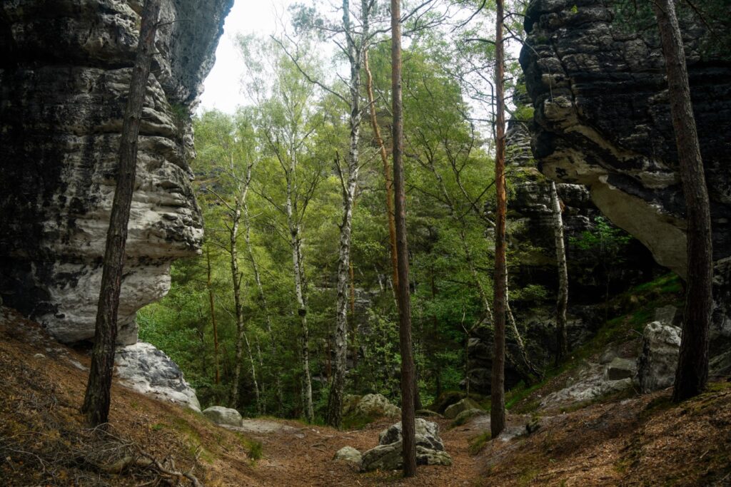
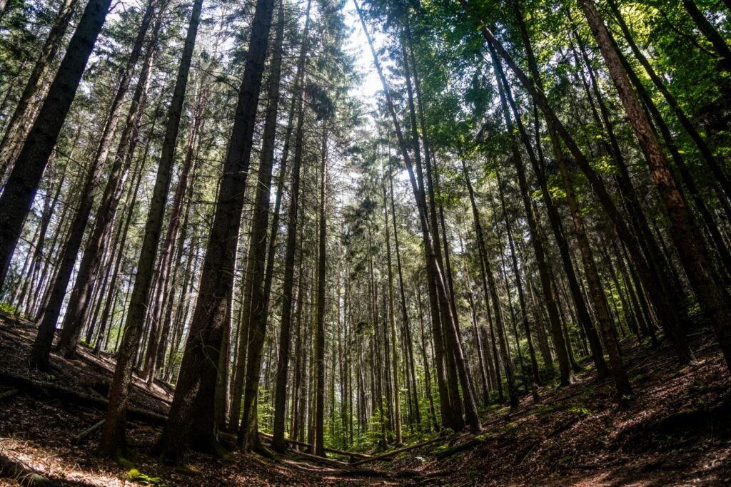
Our random route was a good mix of steep ascents, nice level hiking, easy rock climbing and steep descents. At one point, we realized we had gone in a circle so we tried out a few footpaths and eventually found one that lead us down to the) river Amselsee. We found the most perfect lunch spot on the way, on a rocky plateau beneath the Talwächter peak. There, we sat comfortably for well over an hour, soaking up the sun that occasionally peeked out from the clouds and ate our homemade guacamole with nachos!
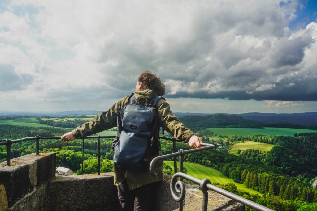
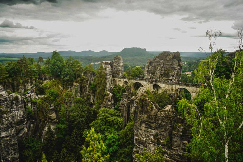
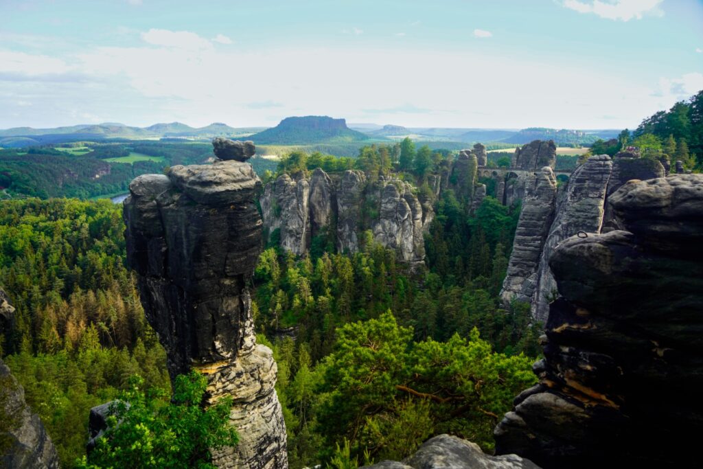
Finding the Bastei viewpoint
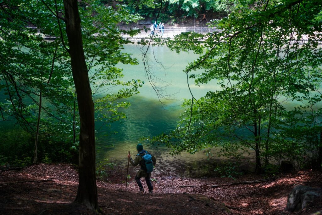
Down at the river, we found a staircase going through the forest on the other side, with a sign pointing to the Bastei Bridge. Certain that we’d found a less popular way up than the usual route, we started climbing the stairs, only to realize soon after that the trail joined the normal route. And so we joined the flocks of people slowly making their way up to the most famous viewpoint in all of Saxon Switzerland.
We took our time on the stairs, enjoying the evermore beautiful views and seeking out little secret spots to enjoy by ourselves in the sun!
It surprised me to find out that the Bastei rocks were inhabited in medieval times. For just 2,5 euros each, we got to explore the remains of the Felsenburg Neurathen Rock Fort, which dates back to the medieval period. And then it was time to see the view we’d come up there for. We followed the crowds across the Bastei Bridge where info signs tell stories and Iegends about the place. A bridge was first constructed here in 1824, but the wooden structure didn’t persist for long and it was replaced in 1851 by the present sandstone bridge. It’s a beautiful structure, but it is the location among the sandstone karsts that make it an absolutely magical place to visit!
We didn’t know exactly where the spot was, but the crowds guided us to the Ferdinandaussicht viewpoint which is indeed the spot made famous by Instagrammers and travel bloggers alike. The view is amazing, but I have to say that th crowds took away from the experience quite a bit. I enjoyed our random morning trails much more and found that the views there were equally incredible!
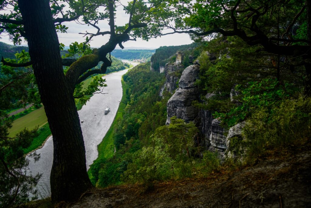
Just beyond the viewpoint, there are a few restaurants (and a much-needed toilet!). To our luck, the restaurants were closed so we sat down at a table with a view and enjoyed our own food! When it was time to head back down to Kurort Rathen, we chose a different trail, hoping to escape the crowds. In the beginning, everything went well. The trail on maps.me matched the trail we walked through the forest, and it even lead us to two great viewpoints of the Bastei Bridge which we only shared with a few others. My favourite view was at Kleine Gans Süd-Aussicht!
But after the viewpoints, things began to go wrong. We followed the trail maps.me recommended, but it lead us to a dead end. We backtracked and then followed a different trail but came to a sign where it said something along the lines of “no hiking route, only for climbers”. Oh well, it looked good, so we continued, ignoring the sign. Big mistake.
Not only did the trail disappear, but the rocks weren’t just easy little rocks to climb like earlier at Feldsteine. We’re talking giant steep rocks with huge drops. I have some climbing experience but nothing like this, and without gear it just seemed too treacherous. So we backtracked a bit and found a different route. Same story again. However, this time, my travel buddy felt confident that we could manage. Me, not so much.
There were two long drops to conquer. My travel buddy managed both just fine, although the last one was difficult even for him. An iron bar had been installed to help with the climb, but I would’ve needed at least another to feel safe. I kept saying that I couldn’t do it, there was no way, but he assured me that he would catch me if I fell, so I took a leap of faith, swung my right leg over to the iron bar, somehow managed to get my right hand there as well and found a place for my left leg on a fallen tree trunk. Pushing my whole body against the cliff wall, I lowered myself enough to be able to jump without breaking any limbs. I made it!!
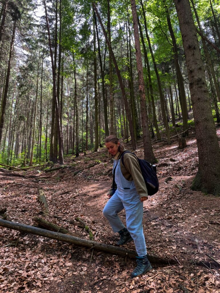
Thankfully, this little rock climbing experience was the last challenge of the day as we found a trail below the rocks that took us gradually down through the forest and back along the river to Kurort Rathen. We were minutes away from missing our train back to Děčín but we made it just in time!
How to find the Bastei viewpoint
There are hundreds of guides out there, but this one at Earth Trekkers includes all the details you need!
Where to stay in Saxon Switzerland
Want to explore Saxon Switzerland but can’t find a cheap place to stay? Consider basing yourself in the nearby Czech city of Děčín. It’s cheaper and more convenient than Dresden and incredibly beautiful. Read more here!
Leave a Comment
Pingback: My September 2023: A precious new beginning with Minnie – Northtrotter on 07/09/2023

1 COMMENT