First of all, please excuse the pun – it was my Aberdonian friends’ idea, I swear!
Secondly, let me tell you just how incredibly beautiful the Isle of Mull is and why you should definitely include it in your future Scotland plans (cause we all know everyone has those, right!?).
The Isle of Mull is the second-largest island of the Inner Hebrides, after the incredibly popular Isle of Skye. Since spending two months working as a bartender and adventuring on Skye in 2020, I’ve been intrigued to explore more of this string of Scottish islands, and Mull was the first one I explored since moving back to Scotland in January.
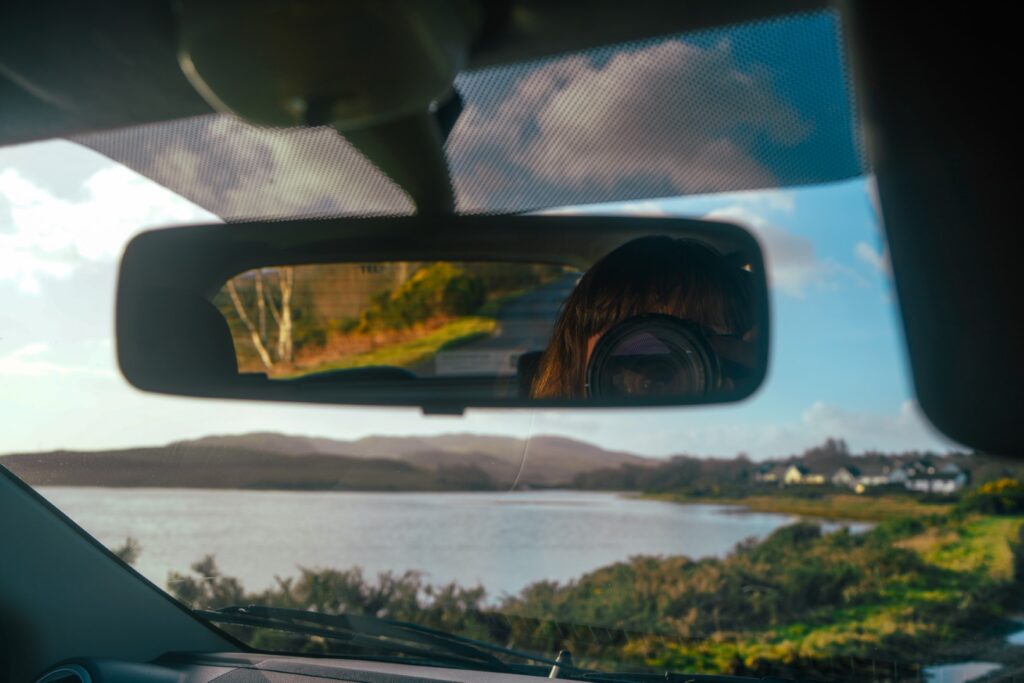
It was during an extended weekend trip to Oban, a small harbour town on the Scottish mainland, that I took the trip to Mull. I had booked my ferries in advance, leaving with the earliest and sailing back on the latest. I had a rental car awaiting me on the island as it’s not easy getting around without one. I knew one day would not be enough to explore all of Mull (it’s bigger than you’d think and driving is sloooow as most of the roads are single-track!), but I thought I’d have enough time to at least go for a hike, visit a few beaches, explore the town of Tobermory and maybe even hop over to Iona for a quick visit. But my plans didn’t quite work out…
Firstly, my ferry times changed so I arrived 1,5 hours later and left 1 hour later. That would’ve been fine had it not been February with its early sunsets. I couldn’t use the extra hour in the end for anything as it was already dark by then, so essentially, this change cost me 1,5 hours of valuable daylight.
Secondly, the hike that I had planned took me six hours to complete, and I’d counted on it taking three (maps.me was terribly wrong this time around!). So I actually didn’t do much else on Mull than this hike, but at least it was a pretty one!
Arriving on the Isle of Mull
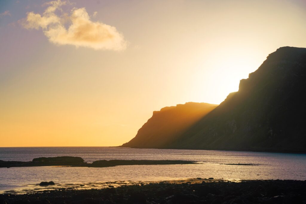
The journey to Mull is part of the experience. From the lookout to Oban’s townscape to the crashing waves of the Firth of Lorn and then to the mountains of Mull as we approached the island. The views all around were astonishing.
We sailed past Duart Castle which dates from the 13th century. It was actually part of my original plan to visit the castle, but it was closed due to construction so I drove onwards down the coast to where my hike began.
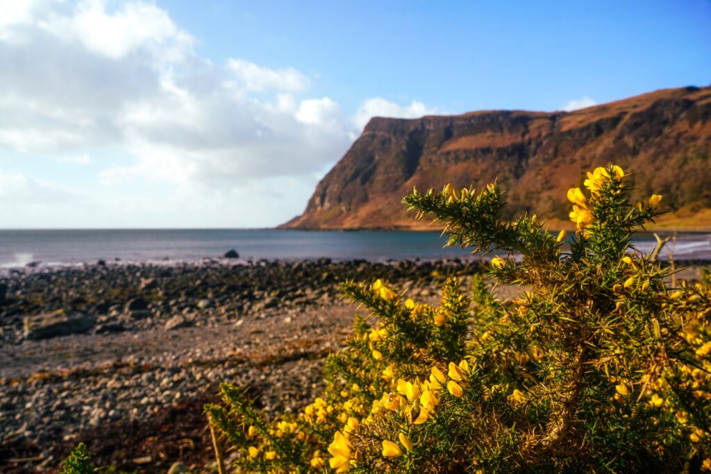
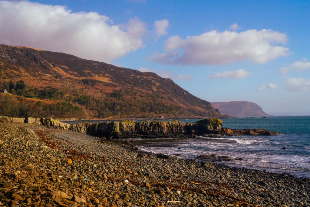
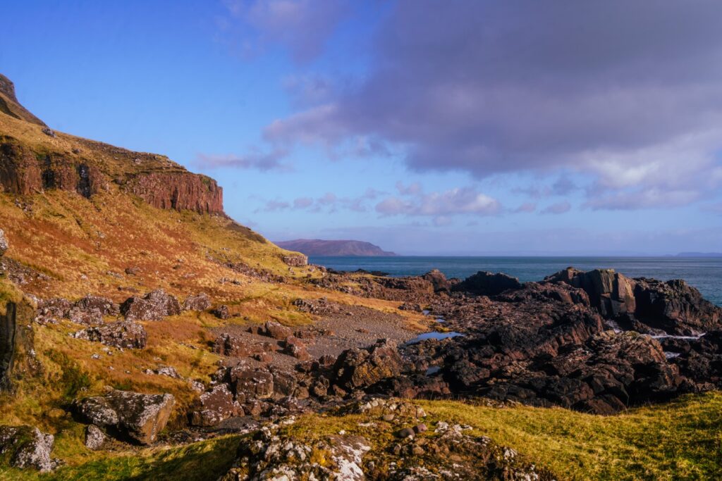
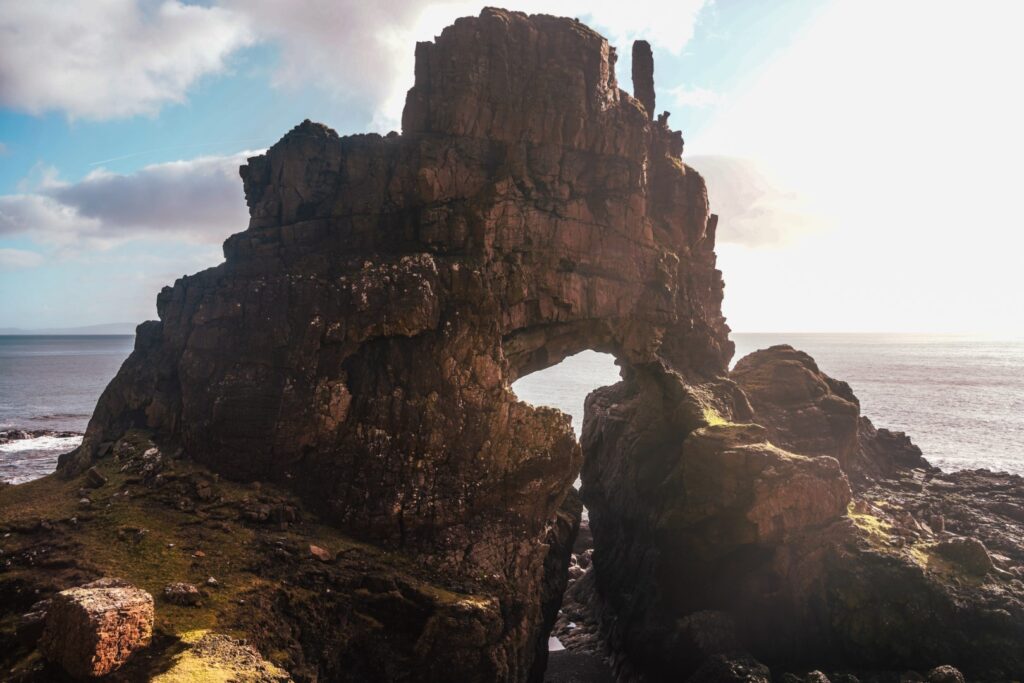
Hiking to the Carsaig Arches
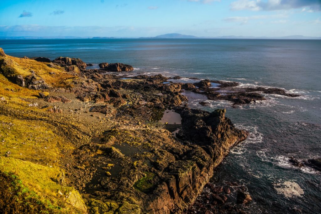
Instead of driving around all day, I wanted to go on a hike to truly experience the nature of Mull. I didn’t anticipate it taking up my whole day, however, I did not regret the decision when I finally reached my destination: the Carsaig Arches.
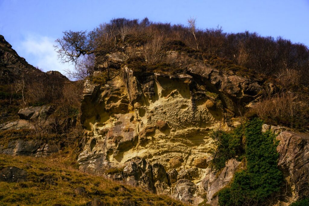
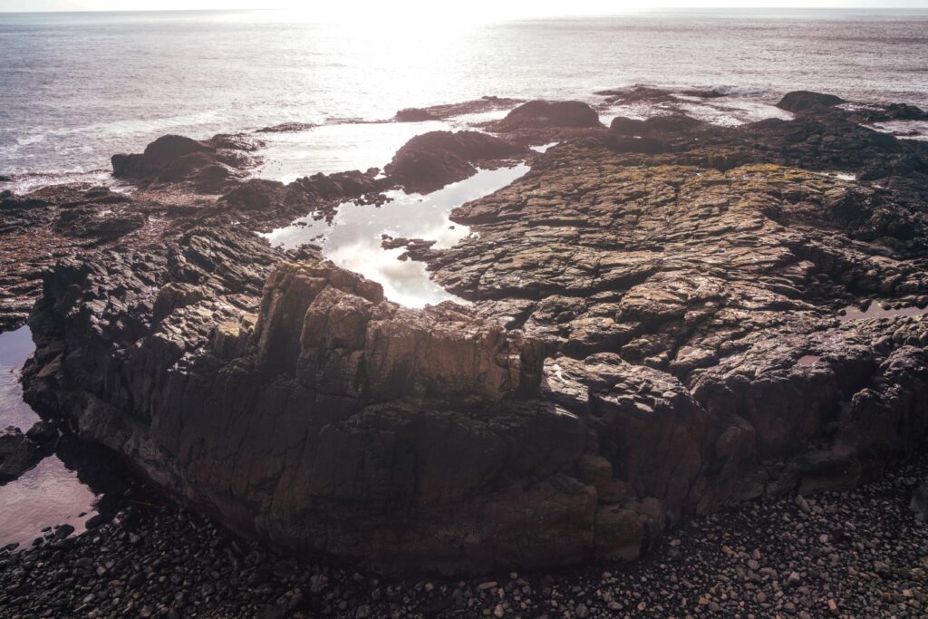
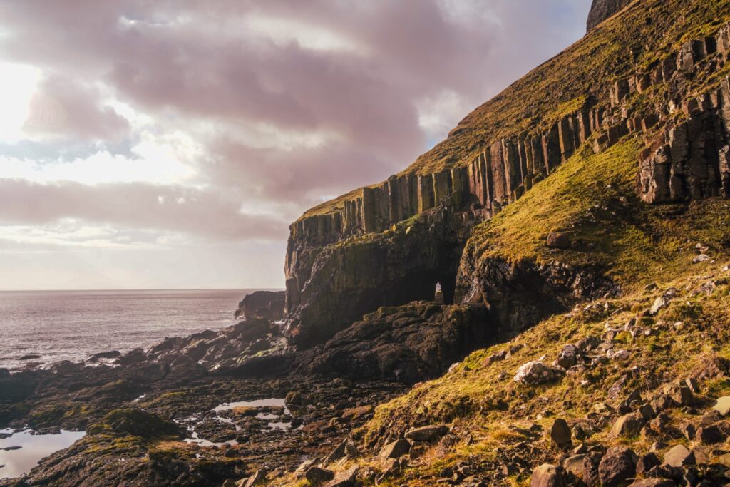
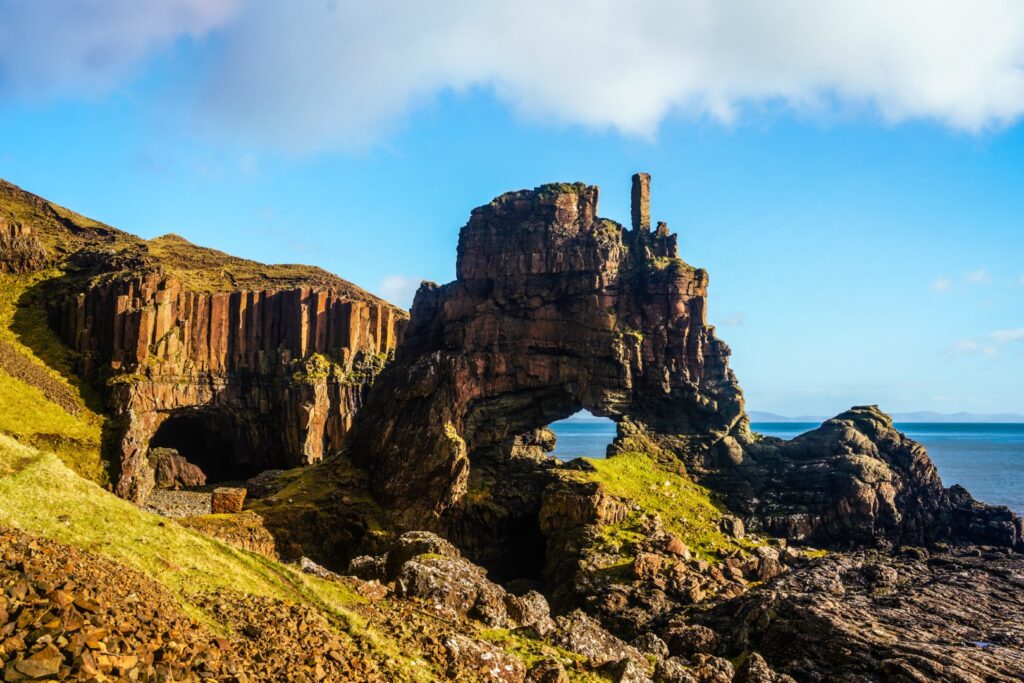
Formed by the erosion of oolitic rock beds, the sea arches can be found at the end of a narrow landslip-prone trail along the rocky shore on the Ross of Mull peninsula. The hike to the arches was a lot more difficult than I’d imagined. It wasn’t particularly steep, but the trail was incredibly muddy and slippery (I fell three times…), and included several sections of climbing over rocks and rivers.
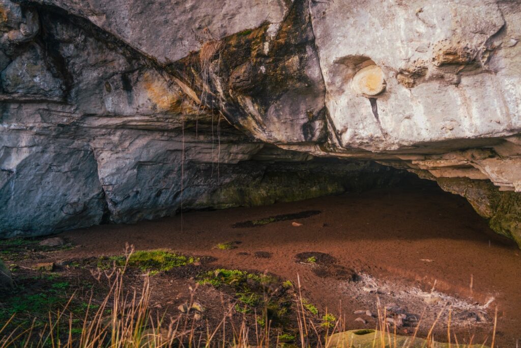
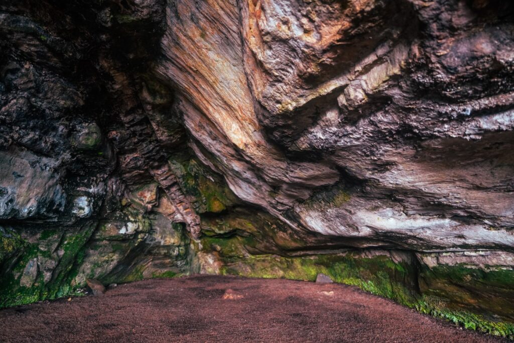
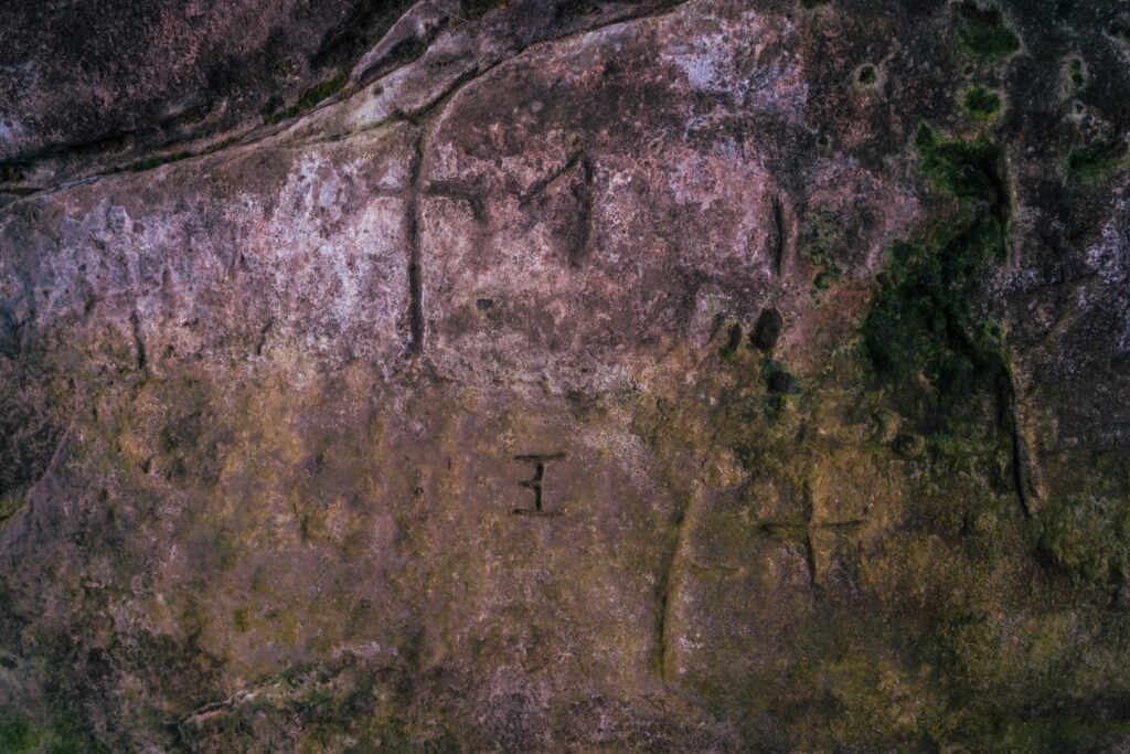
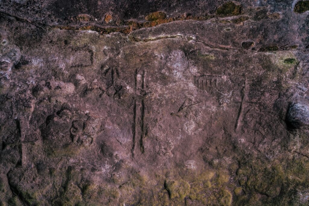
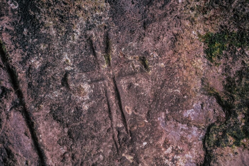
En route, I came past a natural basalt cave known as Nuns’ Cave (or Uamh nan Cailleach in Gaelic), named after the nuns who took refuge on the island after being driven out of Iona by reformers who destroyed the Christian archives and treasures that had been kept on the island. On the cave’s inner walls, the nuns carved various holy symbols, as did later visitors. Many of the earlier carvings are believed to date from the 6th to 9th centuries!
The hike out to Carsaig Arches is a fantastic journey which in many ways reminded me of the hike out to Brother’s Point, one of my favourite places on the Isle of Skye.
Hiking route description: Carsaig Arches, Isle of Mull
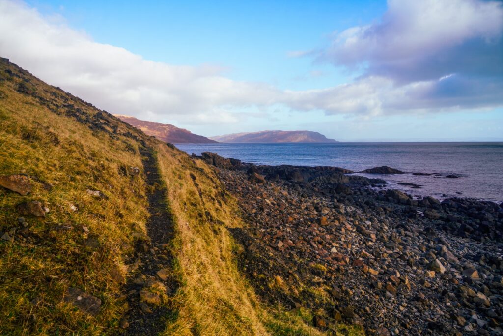
You’ll need a car to reach the trailhead as it’s in an isolated part of Mull. The hike begins at Carsaig Pier at the end of a long single-track road. Driving up to the red telephone box, make sure you take the road going to the pier (the one going up) and not the one to the cottages (I made that mistake and it was hell turning around, even in a small car!). There’s a small parking lot at the pier. Head west along a well-trodden trail which continues the whole way out to the arches. It can be difficult to follow it sometimes, but as long as you stick to the coast and keep going west, you can’t go wrong. The trail is very muddy and slippery and there are a few rivers to cross, so be sure to wear good hiking boots! The trail is steep and narrow in places and it’s prone to landslips, so take good care! The last section of the hike, going from the first arch to the second (where the best photo opportunity is!) is quite treacherous, so take extra care there.
The hike is 14 km return, takes 5-6 hours and is of moderate difficulty. There are a few dodgy sections, but if you stick to the trail and tread carefully, you’ll be fine!
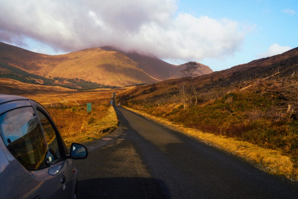
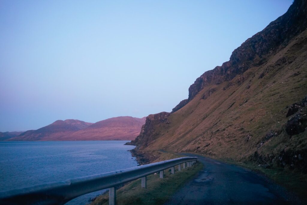
Driving ‘the scenic route to Salen’ at sunset
Despite spending way longer on the hike to the arches than first anticipated, I did have time to see a bit more of Mull before the sun bid farewell. I got in my rental and drove back up to the main road, and then took a road called ‘the Scenic Route to Salen’.
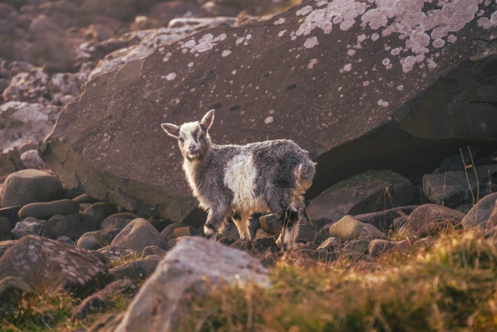
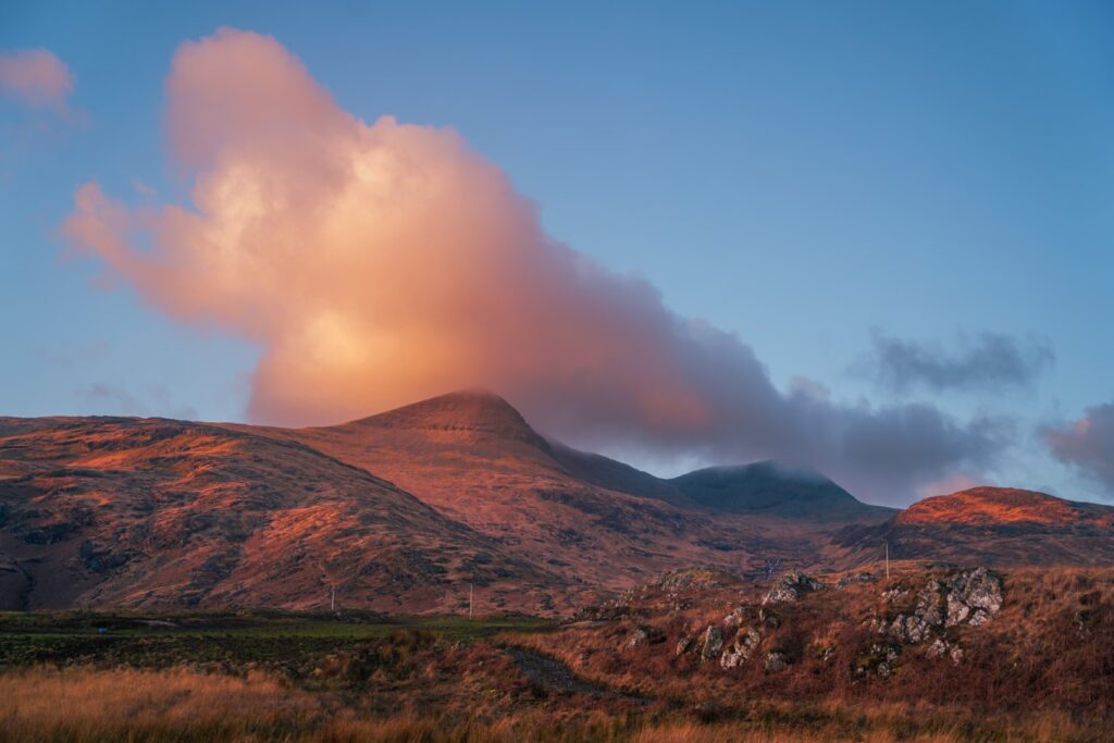
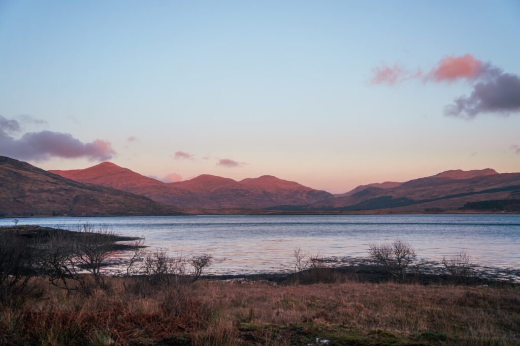
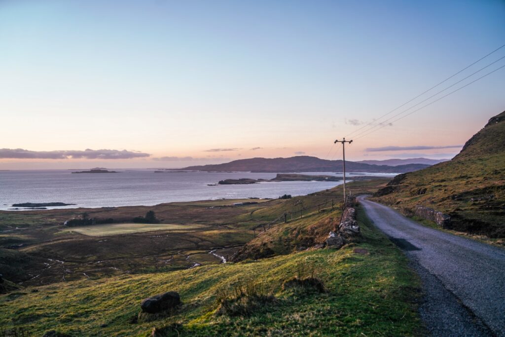
The 33-kilometre route took me along the shore and inland by the foot of Ben More, the island’s highest mountain (and only munro!) at 966 m. Reaching the shore of Loch Na Keal, I was rewarded with a gorgeous view of the island-dotted sea dominated by Ulva and Gometra. A deer and a rabbit came out at the same time but ran away as soon as they spotted the car. The next section hugged the sea, and it was a little scary driving there in the dusk. I made it to Salen just as darkness set in, and just in time to start heading back to the ferry.
Driving on Mull was surprisingly easy, despite not having much experience with left-hand driving, but since most of the roads are single-track, this isn’t an issue at all. There also weren’t many cars on the road, so it was very chill.
Helpful info for travelling to and on the Isle of Mull
GETTING THERE: There are several ferry routes to the Isle of Mull. I caught the ferry from Oban to Craignure, but you can also opt for the route from Lochaline to Fishnish or the route from Kilchoan to Tobermory.
GETTING AROUND: West Coast Motors offer bus routes around Mull, but since the timetable is rather limited, I’d recommend renting a car or bike. Hitchhiking might be ok in the summer, but outside the high season it will be almost impossible as there aren’t many cars on the island in general. I rented my car through Mull Car Hire at £65 for the day. They were there to greet me when I got off the ferry, and I just left the car in the same spot before my departure. I refilled the fuel in Salen (self-service, open 24h) before parking the car. The whole ordeal couldn’t have been any easier!
DRIVING ON MULL: One thing you should be aware of when driving on Mull is that most of the roads are single-track. It’s important to remember to only use the passing places to your left, and to let anyone who wants to come by pass you. I was told that many islanders volunteer to help those in desperate need and therefore often drive in their own cars instead of an ambulance, so you really don’t want to be in the way in case of an emergency. Keep an eye out for any cars behind you and let them pass you!

Leave a Comment
Pingback: Kerrera: A journey back in time to one of Scotland’s least known islands – Northtrotter on 18/07/2023

1 COMMENT