The Isle of Raasay is Skye’s unknown neighbour. It sits just off the coast of Skye and takes just 25 minutes to reach from the village of Sconser. Raasay is much smaller than Skye and is home to just over 150 people. It’s also much less visited, but that doesn’t mean you should skip this island when in the area. In fact, I loved Raasay even more than Skye. Raasay is an idyllic island paradise, away from the crowds and with plenty to offer for any nature lover.
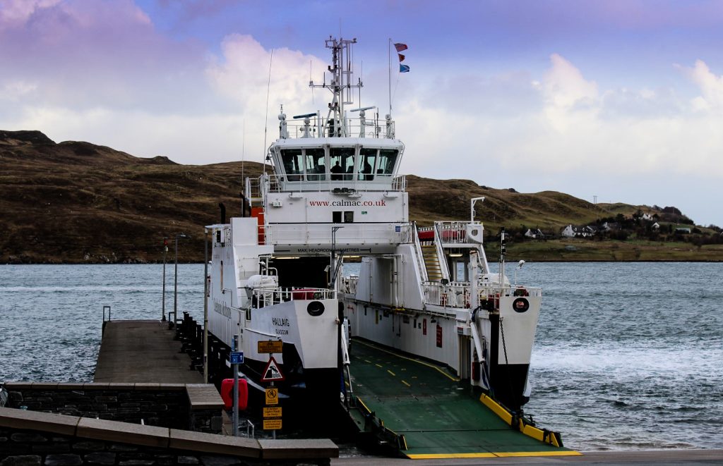
Over the Sea to Raasay
I have Brandon to thank for showing me Raasay. He had already been there once before and loved it, so he suggested that we should go there for a few days. As soon as we both had two days off in a row from our job in Portree and the weather looked decent, we packed our tent, caught a bus to Sconser and jumped on the ferry to Raasay.
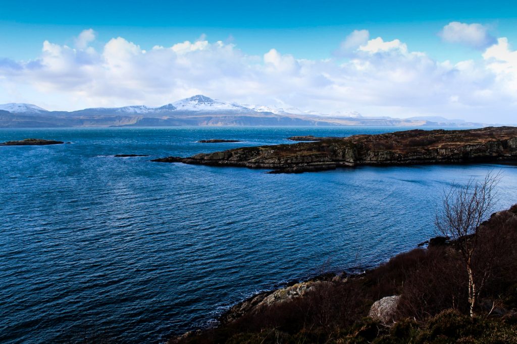
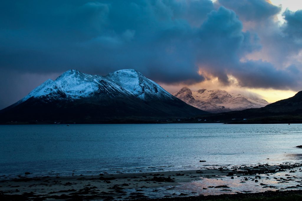
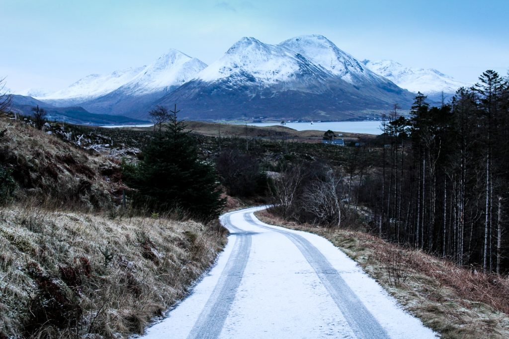
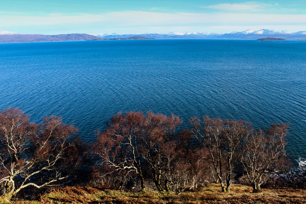
The 25-minute ferry ride gave us magnificent views of Skye’s Cuillin Mountains as we sailed further away from the island we called home and closer to Raasay, a paradise waiting to be explored.


Raasay House in sight
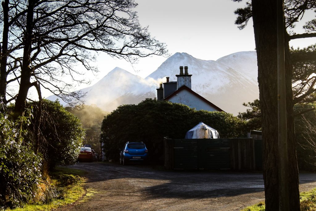
The morning was still young when we arrived on Raasay, and the clouds had given way to a beautiful blue sky which stayed for the rest of the day. That was quite incredible considering the fact that the calendar said February.
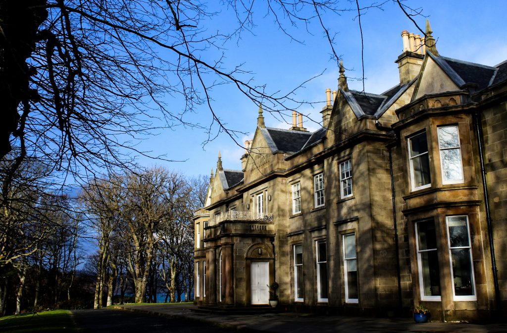
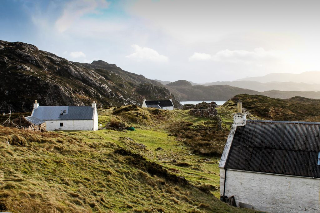
The first place we spotted as we approached the village of Inverarish was the Raasay House, a beautiful mansion with a long history dating back to the early 1500s. It was once the home of the Clan Macleod Chief of Raasay, and today it houses the majority of visitors to the island apart from those that choose to camp. Raasay House also has a restaurant, although it was closed when we first visited.
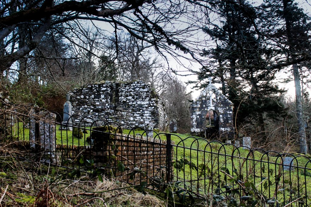
The ruins of St Moluag’s Chapel
Behind Raasay House, we found the old ruins of St Moluag’s Chapel and an old graveyard. The site is believed to have been a place of Christian worship since the late 500s, founded by the Irish monk St Molaug. The chapel that stands on the site was built during the 1200s and fell out of use after the Reformation in 1560, leaving it to decay.
It would’ve been a really interesting place to explore, but unfortunately, there was a fence around the entire complex with no open gate, so we were unable to enter.

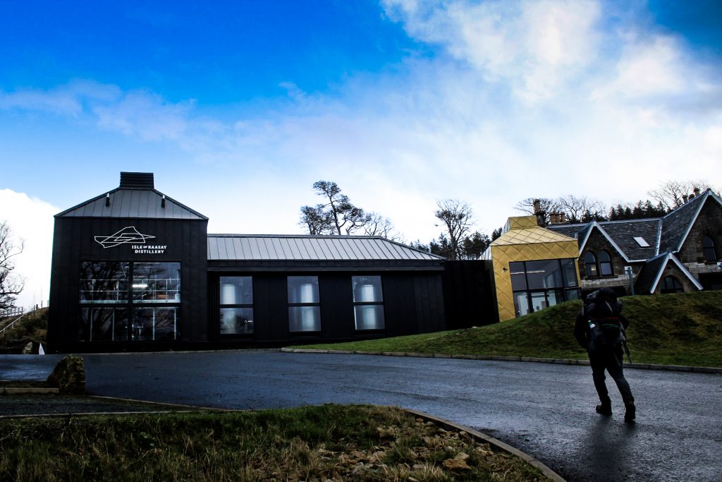
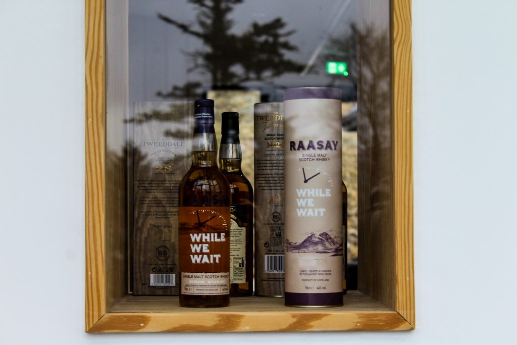
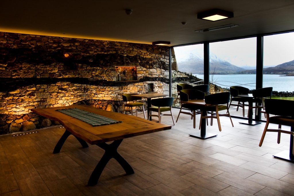
A visit to the Isle of Raasay Distillery
Further along the road, we came to what is probably the newest building on the island. The beautiful building is home to the Isle of Raasay Distillery, a Scotch whisky distillery which opened in 2014. Their whisky has been maturing ever since and is set to be ready this year, although they are selling their cleverly named While We Wait whisky until then, which Brandon decided to buy to support them.
I don’t drink alcohol, but I was actually really interested in seeing the building which is so beautiful, especially the interior. And also convenient for campers in terms of public toilets 😉

The village of Inverarish
As we continued further along the main road, we soon came to the centre of Inverarish, the largest village on the island. The village is incredibly quaint with small cottages, telephone boxes and narrow lanes nestled amongst woodlands.
The village is also home to the island’s only grocery store which supplies the islanders with all basic products. We had a long chat with the cashier who was surprised to meet travellers in February and even more surprised when we told her the plan was to camp overnight!


Heading north
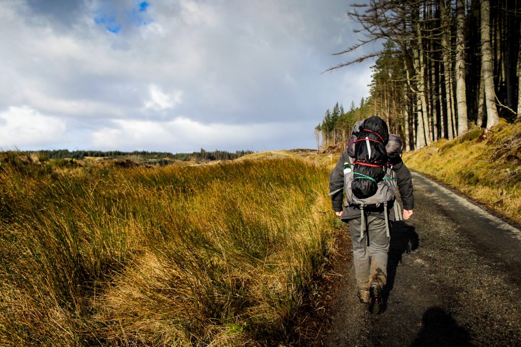
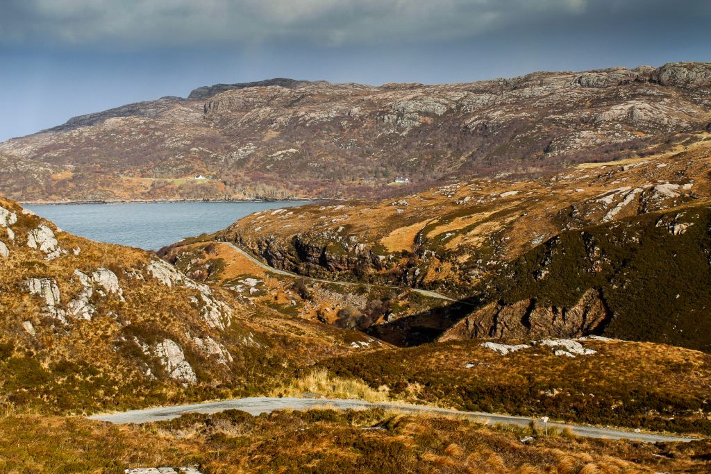
After buying some emergency snacks in the grocery store, we started walking north, along a road signposted “the North Pole”! We were hoping to make it to Brochel at the beginning of Calum’s Road by the end of the day. The distance is eight miles and it would take us about three hours, although we were hoping to hitch a ride. There aren’t many settlements north of Inverarish, so the chances were slim, but we actually managed to get a local man to stop – in the middle of a cattle grid!
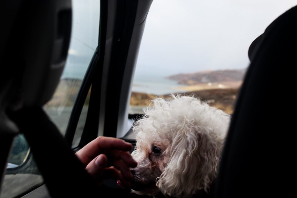
He wasn’t planning to go to that far north as he was headed to his home near Glame, but he offered to drive us anyways – probably because he knew he would be the only car we’d see that day. So off we went with our new friend John and his cutest little dog, Lola. As we stared out of the window at the gorgeous views, John told us all about the quiet life on the island that he loves so much.
A view of Brochel Castle
John dropped us off near Brochel Castle and we said our goodbyes to him and gorgeous Lola, while secretly hoping that we’d run into them again (unfortunately, that never happened).
Brochel Castle was built in the late 15th or early 16th century on top of a 15 meter high volcanic plug. It functioned as a stronghold for the MacLeod Clan until 1671 when it was abandoned and left to decay. Unfortunately, there is no access to the ruin today as it’s too unstable.

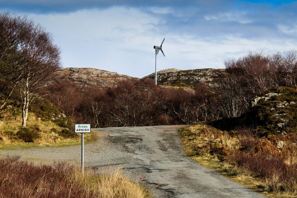
Along Calum’s Road
What we did next was a dream come true for Brandon. Ever since learning about this special road, he had talked about going there and walking the length of it. I, of course, was eager to join.
Until 1912 almost the entire population of Raasay lived in crofting townships north of Brochel due to earlier clearances of the rest of the island. But as the years went by, people started moving down south, leaving the former thriving settlements tiny and isolated. The road network on the island connected Brochel with the south but didn’t go any further north, meaning that those who continued to live in the north had to walk to Brochel to get anywhere on the island. This resulted in a steady depopulation of the north.
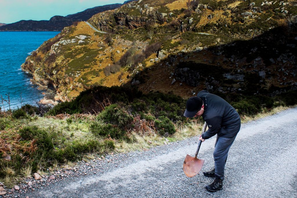
However, the few inhabitants left in the north tried campaigning for a road for decades but were unsuccessful. Eventually, local resident Calum Macleod decided to build the two-mile road himself. Between the mid 1960s and the mid 1970s, Calum constructed the road with little more than a wheelbarrow, a pickaxe and a spade, while combining the work with his job as a lighthouse keeper on Rona, crofting at his home in Arnish and being the part-time postman of the north end of the island. In 1982, the road was finally adopted by the local council and finished off with tarmac, and the tiny village of Arnish was finally connected with Brochel and the rest of Raasay. Unfortunately, by then, Calum and his wife, Lexie, were the last remaining inhabitants of Arnish.
Two miles might not seem like much, but we soon realized on our hike what an achievement it really was. The road constantly winds through boggy moorland and ascends and descends steeply at the edge of high cliffs. As we approached Arnish, I began to understand why Calum had gone to so much trouble to keep his village alive. There’s just something truly special about the place that’s hard to describe. I was in love instantly.


A hike to the tidal island of Fladda
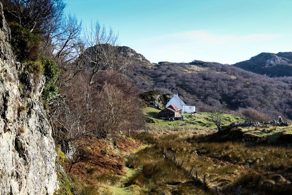
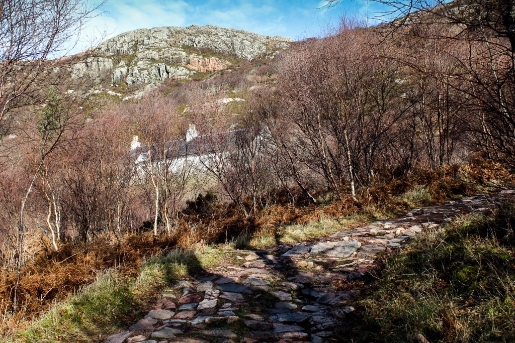
We decided to continue in Calum’s footsteps for another hike to explore the north further. From Arnish, the rest of the former townships of the north can still only be reached on foot. The footpath connecting the former township of Torran and the tidal island of Fladda were constructed by Calum and his brother Charles between 1949 and 1952, several years before the construction of Calum’s famous road.
From Arnish, we followed the winding footpath for three kilometers, past an abandoned school house and mission house and through native birchwoods until we reached the tidal causeway connecting Fladda to Raasay at low tide. Luckily, the tide was quite low when we got there so we were able to cross over to explore a bit of Fladda.
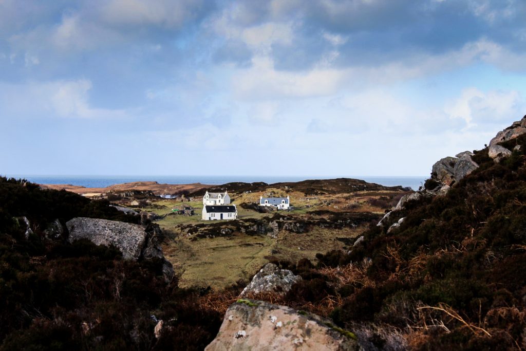
Fladda is – hence its name – a very flat island with just a few low hills, some lakes and a small forest. The island was once home to a thriving crofting community, but despite Calum and his brother building the track between Fladda and Arnish, it did not stop the inhabitants from leaving and in 1965, the last families left the island. Today, there are only three cottages in the village of Creag an Eoin which are used as holiday homes by the families that own them.
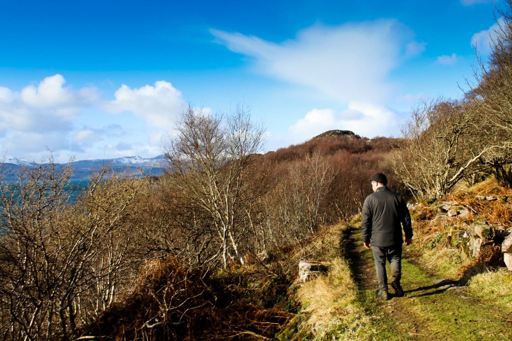
Exploring Fladda was an amazing experience. Despite how close it is to Skye, this is a place that tourists rarely venture to. We had the entire island to ourselves and spent a good while exploring the tiny village and walking to the very top of the island to see the views of the nearby Isle of Rona and the rest of Fladda below us.

Submarine in sight
As we headed back to Arnish and then back along Calum’s Road towards the south, I started to feel it in my legs after 15 km of walking. But we were nowhere near done walking that day.
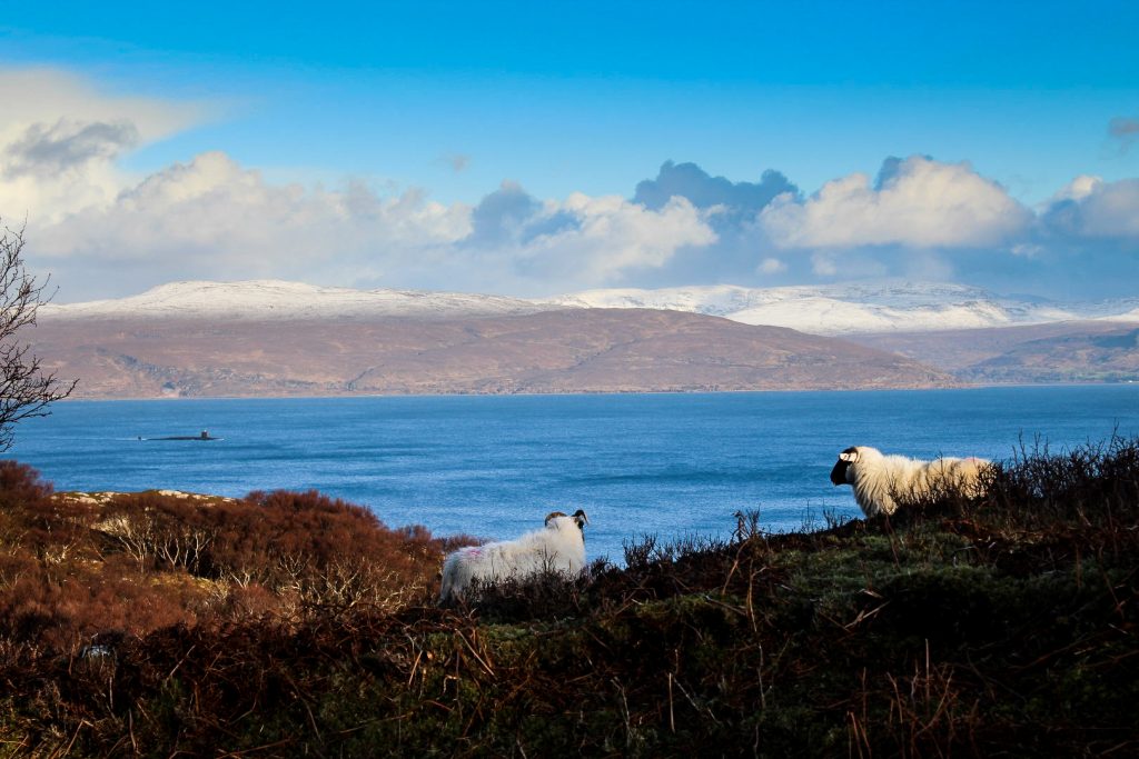
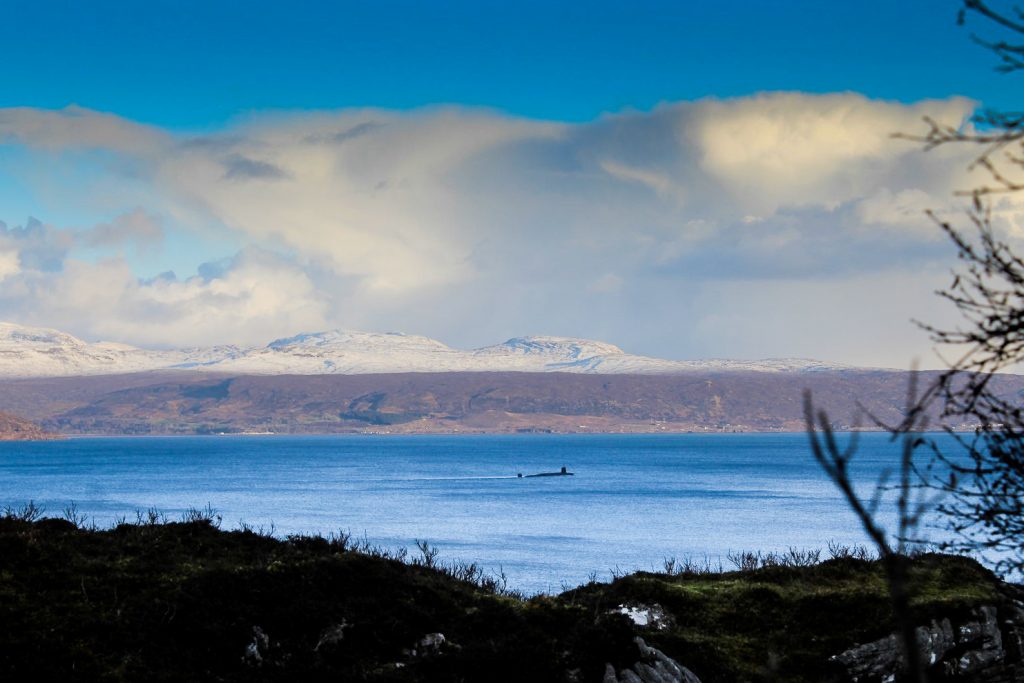
We had left Brandon’s backpack somewhere on Calum’s Road on the way out and managed to walk straight past it on the way back. When we had finally realized our mistake, we were at the beginning of Calum’s Road and we realized that we had left it on top of a hill about a kilometre back. Brandon ran to get it but suddenly, I spotted a submarine in the water and immediately called him back. Apparently, submarines are normal sights around there, but we’d never seen one before!
A few moments later, a car appeared. We had decided to try to hitchhike back to Inverarish to camp there instead of up north and this car could’ve been our only chance! But we still had a bag to find… Despite this, we decided to try our luck. A lovely family of five and a beautiful dog stopped for us and we explained the situation. They were due to catch a ferry an hour later and with half an hour’s drive to the harbour, it was a bit of a rush but they didn’t mind waiting while Brandon ran as fast as he could to find his bag.
While we waited, they told me about their incredible lives as photographers and shared their plans of moving to Raasay. I honestly can’t imagine a better place for children to grow up and for photographers to roam! I had forgotten all about the submarine, but suddenly, I noticed it again and pointed it out to the family who got (if possible) even more excited than Brandon and I!
Fifteen minutes or so later, Brandon came back exhausted but with a bag on his back, and we were able to set off for Inverarish. Before we said our goodbyes, we exchanged instagrams so I can now follow their lives forever while secretly wishing to live just like them. Maybe someday I will be lucky enough to do so!
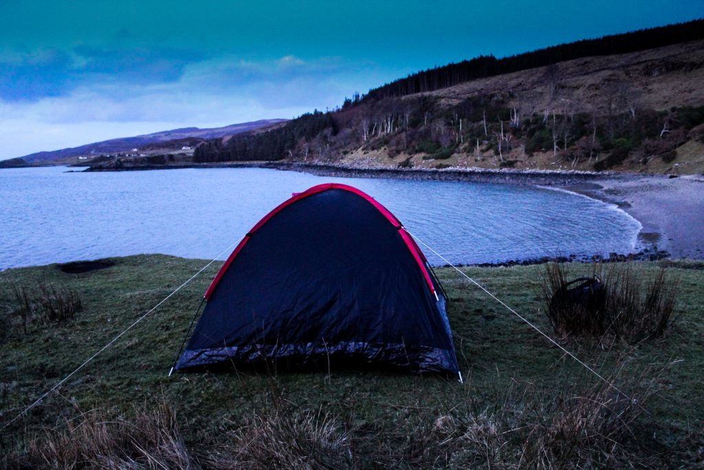
A night from hell
The evening was crisply cold but it was still our plan to camp, despite how hesitant I had been all along. Camping in February is never a good idea, and especially not when sharing one sleeping bag and one blanket… With no mattresses whatsoever. But for some strange reason, I had agreed to at least try.
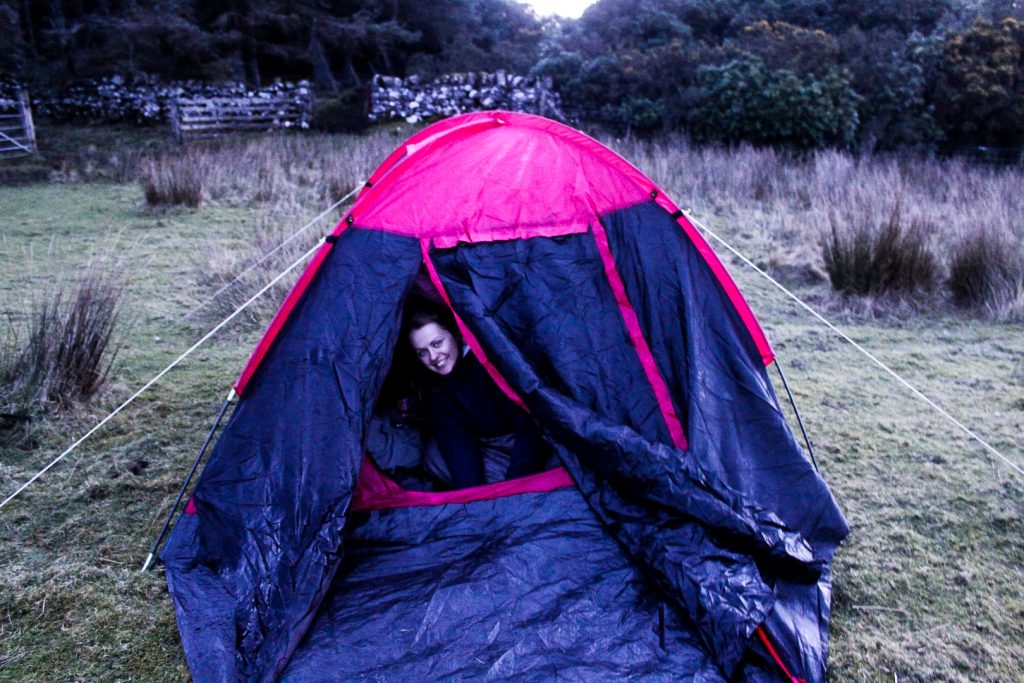
We went to a spot near the Raasay House where Brandon had camped on his previous trip. We soon set up the tent and got inside to eat our dinner while watching youtube videos. It took less than five minutes for me to feel the cold and I feared that sleeping would be impossible.
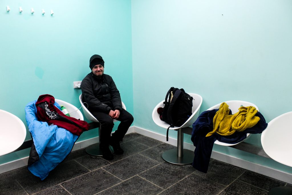
To warm ourselves up before the night, we went for a long evening walk and crashed an event at the community hall to use the toilets and get some heat into our bodies before going down to the harbour to see if the waiting hall was still open. It was – and that would be our plan B (and the nearby toilets our plan C if everything went wrong!).
Back at the tent, I tried my best to fall asleep, but it was just impossible because of the cold. Plan B it was. We took the sleeping bag and blanket and headed to the harbour, praying to God that the waiting hall would still be open. We were in luck. We now had a less cold (although much more uncomfortable) place to sleep with wifi, power outlets and toilets nearby. Thank you, waiting hall of Raasay, for saving our lives.

Climbing to the top of Raasay
The night was awful. I woke up several times and my back hurt terribly when I got up in the morning as I had attempted to sleep on the hard chairs. But when we looked outside and saw ice on the ground, we knew we had made the right decision.
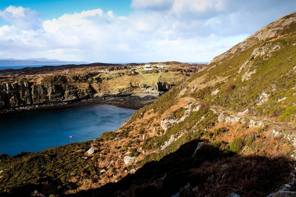
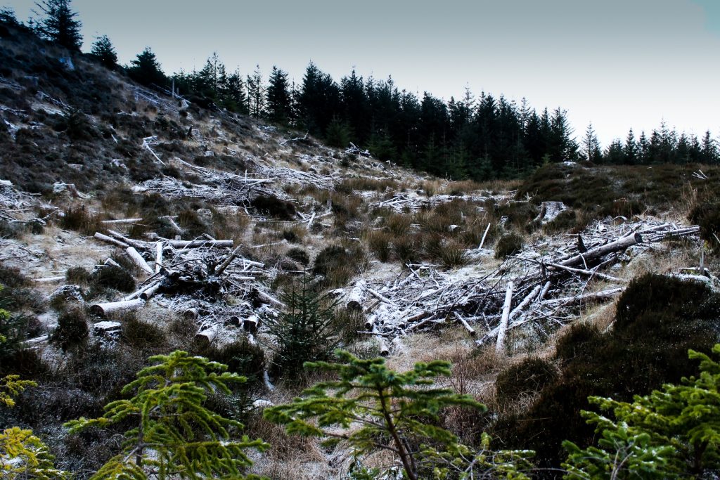
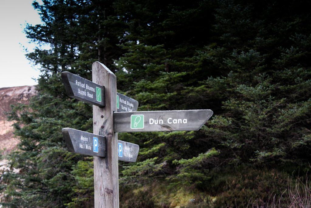
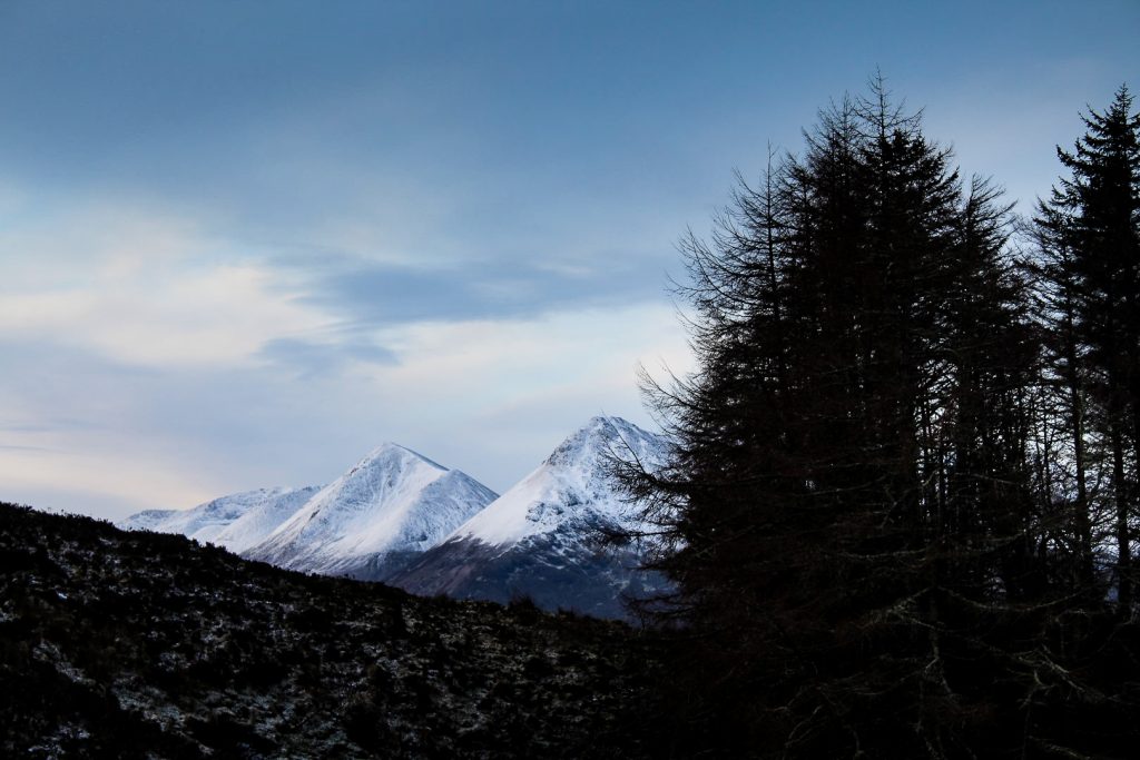
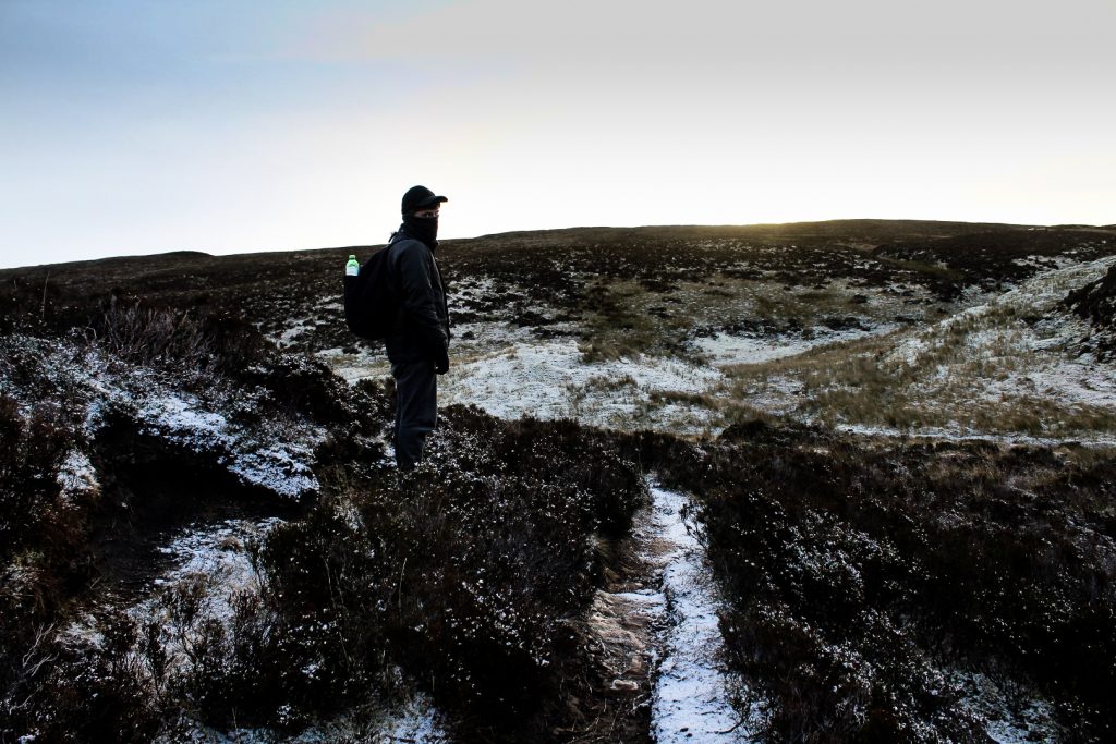
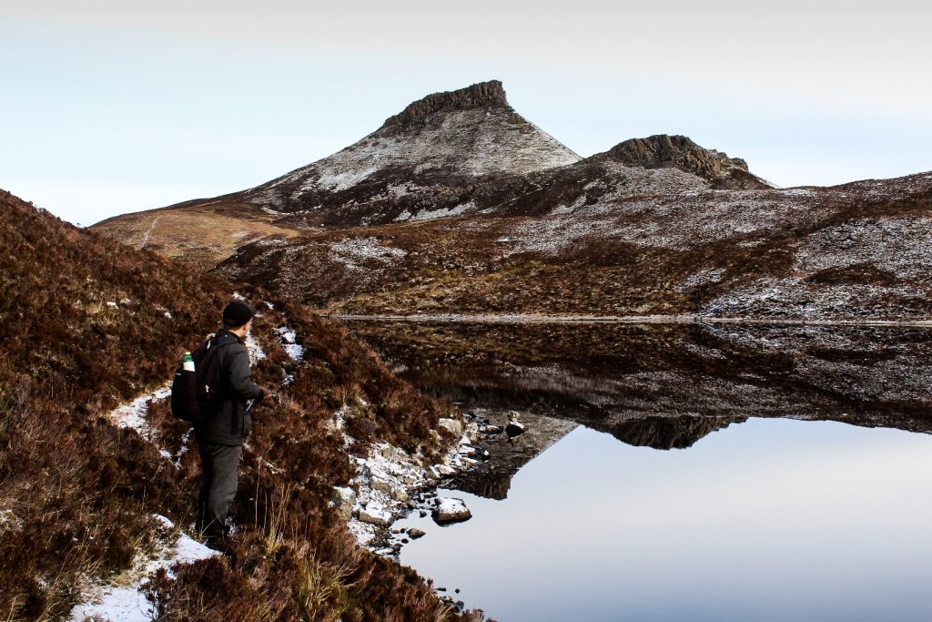
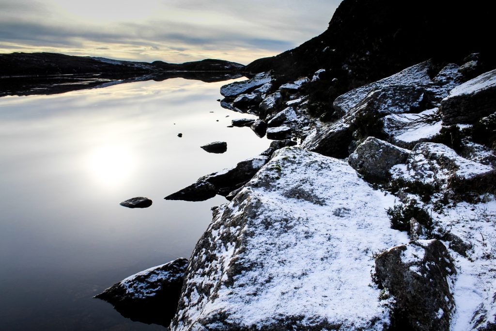
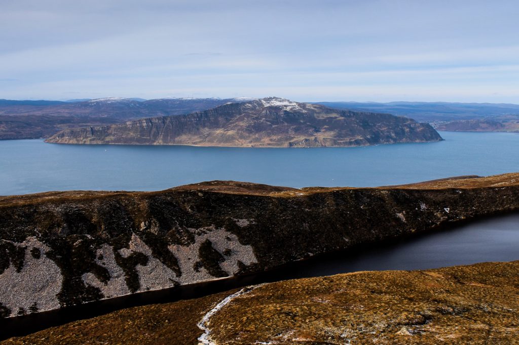
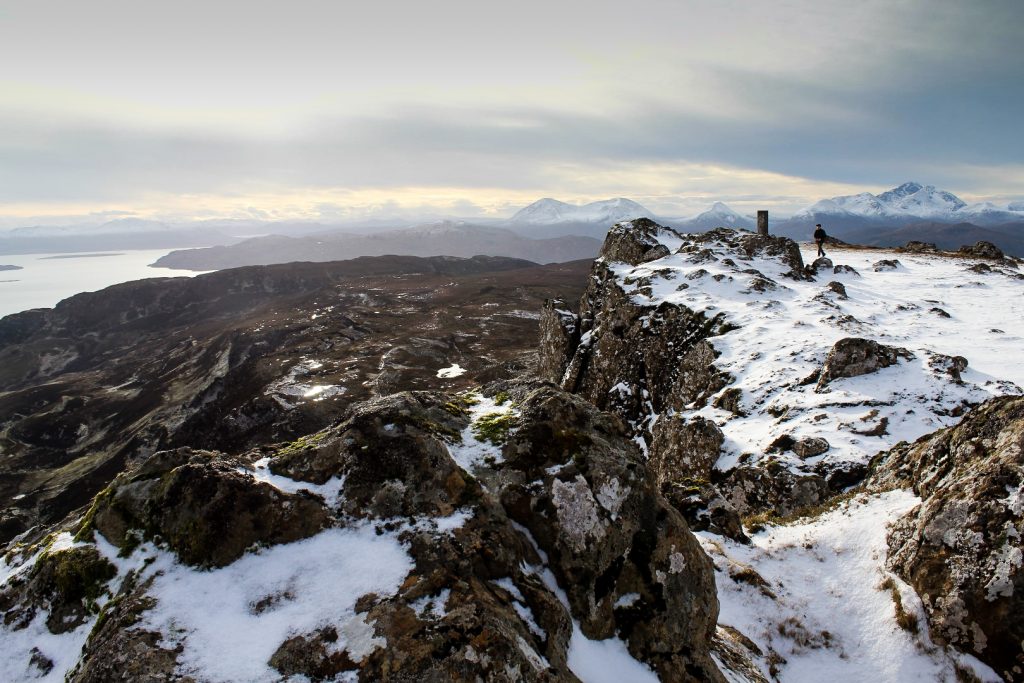
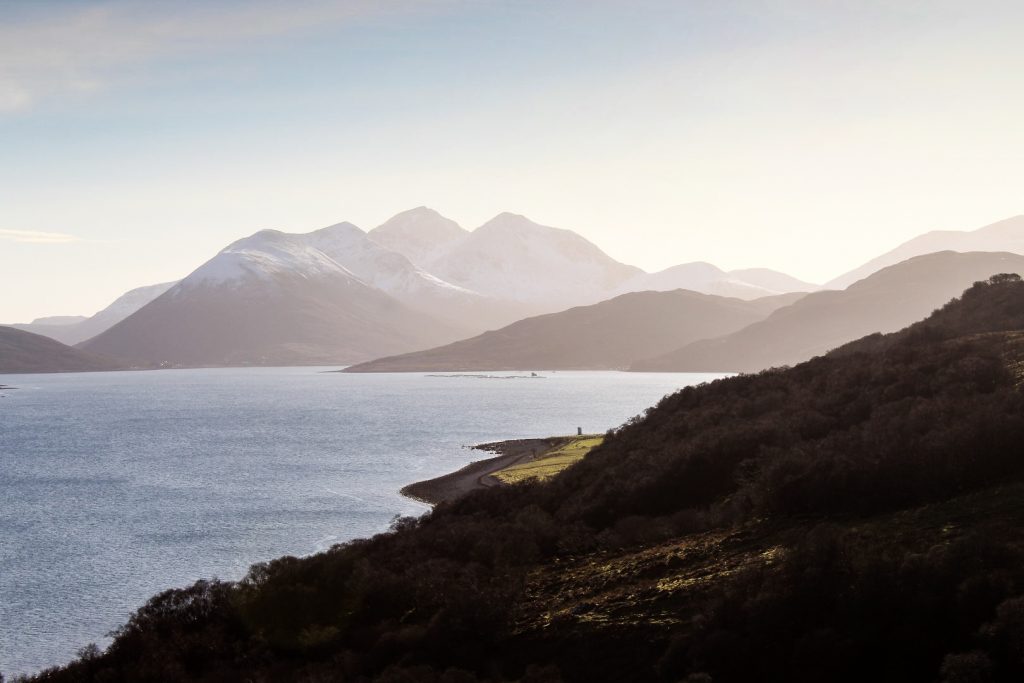
For obvious reasons, we were up before sunrise and despite the lack of sleep, we decided to spend our second and last day on Raasay doing lots and lots of hiking. The first place we headed to was Dun Caan, the highest point of Raasay. We found our way to the beginning of the trail near an old mine just outside Inverarish. From there, we followed a well-trodden footpath into the center of the island, gradually climbing higher into the hills. We passed waterfalls and small forests and soon came to a beautiful, still lake with the most amazing reflections. Before we knew of it, Dun Caan’s distinctive flat-topped summit appeared, something that we’d admired from afar many times when we were on Skye. It had been an easy hike and the summit didn’t take much effort to reach, even after we got up to the snow line. It took us just over three hours from the harbour to the summit.
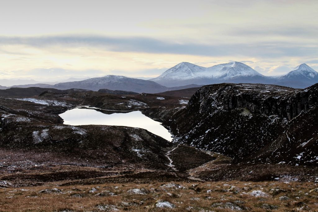
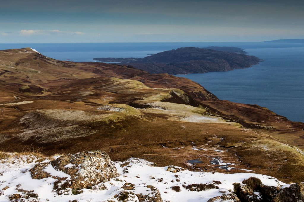
At 443 meters above sea level, the summit of Dun Caan offers exceptional views over the island and of Skye’s Cuillin Mountains, Ben Tianavaig, Brother’s Point and beyond. No views that I’d seen on Skye even came close to this one. And for the first time, we could see Raasay’s rugged east coast where we were headed next.


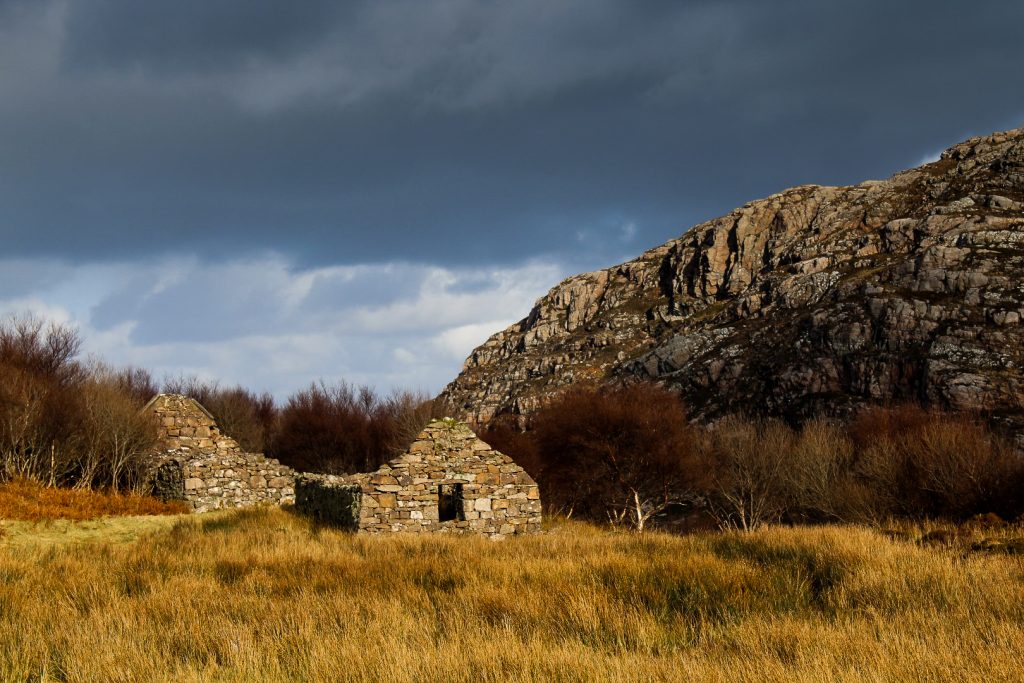
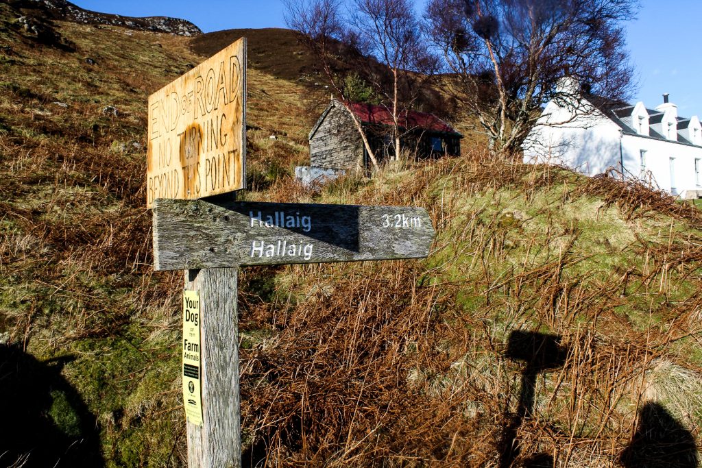
The abandoned settlement of Hallaig
The east coast is dotted with the remains of former thriving crofting communities that became victims of the Highland Clearances in the mid 19th century. One of these is Hallaig, which was once the largest village on the island. We decided to hike there from Dun Caan.
The official footpath to Hallaig begins in North Fearns on the southeast coast, a mere three kilometre walk, but doing that would mean having to hike all the way back to Inverarish and then to North Fearns before even beginning the hike. Instead, we chose to find our own way to Hallaig, which is located almost directly beneath Dun Caan, under a steep drop of massive cliffs.
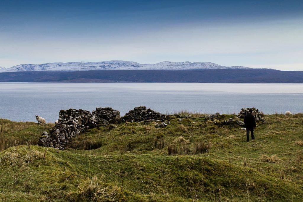
Not having a footpath to follow didn’t exactly make it easy. We had to climb down one treacherous ridge after the other, while being careful not to fall into one of the small canyons we came by. It took us an hour and a half just to climb down the mountain as we had to mind our every step, but we eventually made it to Hallaig. The village is a sorry sight today with all buildings in ruins and a history that is less than pleasant, but it was an interesting place to visit nonetheless. We had our lunch inside a ruin before continuing on. The next mission was to find the footpath to North Fearns.
That was much more difficult than it should’ve been. What we didn’t realize was that the footpath is located almost next to the ocean, but we only kept climbing higher and higher in our search for it. This section was tougher than climbing Dun Caan as we had to gradually ascend through wet marshlands. Eventually, Brandon realized our mistake and guided us down yet another cliff to the path which was several hundred meters below us.
We were way beyond Hallaig when we finally reached the path so we had to backtrack a little to see Hallaig’s memorial cairn before we could finally call it a day and start the hike towards North Fearns and then along the road back to Inverarish. Looking back at Hallaig and the rugged east coast, I thought to myself how wonderful it would be if the village still existed. I, for one, wouldn’t hesitate to move there!


Three hours after we set off from Hallaig, we were back in Inverarish. We quickly took the tent down and headed to the harbour to catch the ferry back to Skye. Two wonderful days on Raasay had come to an end. We had walked 54 kilometers and over 85,000 steps and seen so much! I left the island exhausted and with a feeling of wanting more. Much, much more. Raasay, I’m not done with you!
Leave a Comment
Pingback: 20 amazing experiences on the Isle of Skye, including local secrets – Northtrotter on 18/04/2020
Pingback: My February 2023: Adventures in the Cairngorms & Inner Hebrides – Northtrotter on 18/04/2020

2 COMMENTS