On my second and last full day on Öland it was time to explore the south part of the island. I don’t know why, but something made me believe that this part was the less explored part of the island compared to the north, but boy was I wrong! It makes perfectly sense actually, as the bridge to mainland Sweden is located in the south part – and it’s also a UNESCO World Heritage Site -, but something had me drawn more to the north part than the south part, so I naively figured that everyone would feel the same (gotta stop that!).
I loved the north part of the island, which I explored the day before, so I had my hopes set high for the south!
I got up at 9 AM (luxury!) and headed out on the road with my rental car. While the day before had been all about nature, that day was more about seeing some of the great archaeological sites that Öland has to offer, most of which are located in the south.
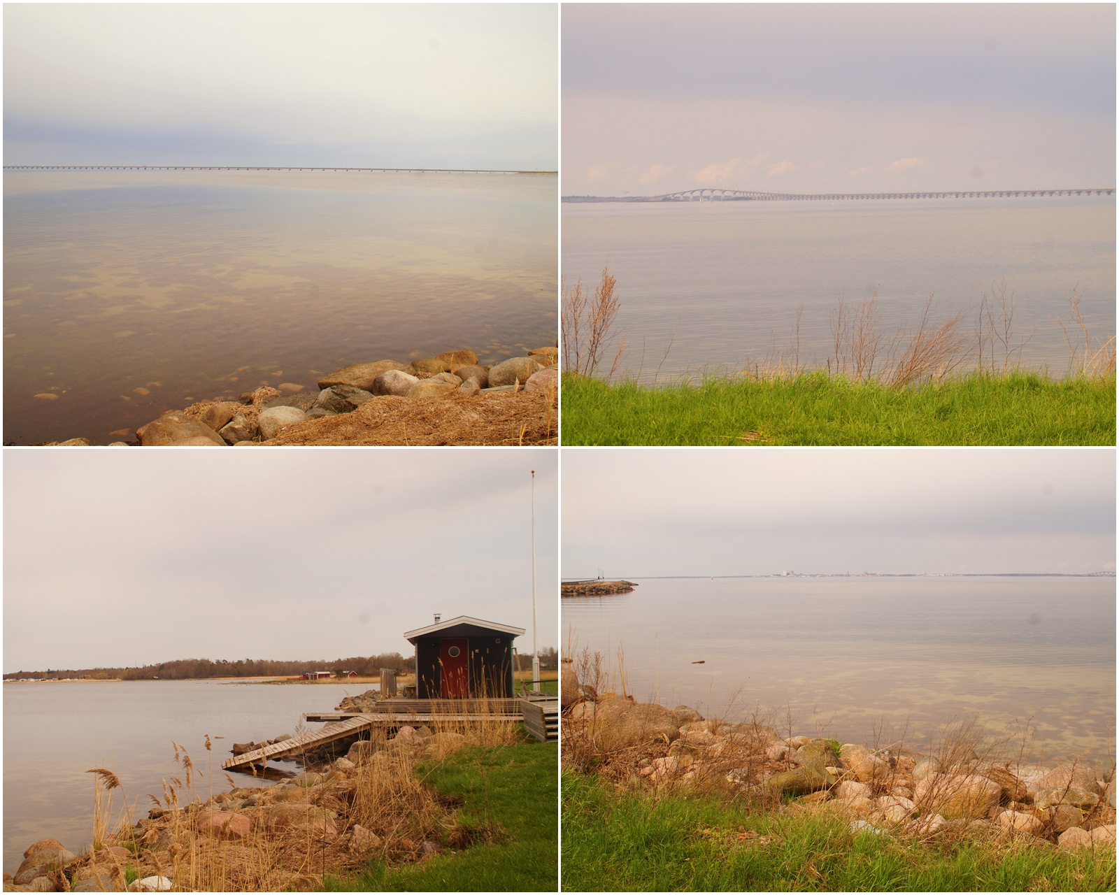
With the radio on loud and me singing along to the music, I headed south along the west coast towards the village of Färjestaden, which is the port to the Swedish mainland. I made a quick stop here by the ocean to look out into the horizon and the bridge that connects Öland with the Swedish mainland. The weather was gorgeous and luckily, it stayed like that all day!
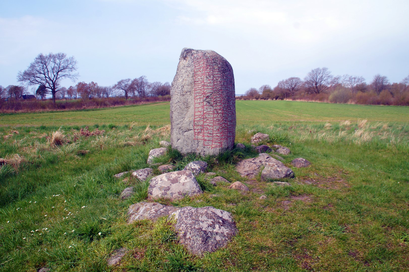
Just south of Färjestaden stands Ölands most famous runic stone from the glorious Viking Age, Karlevistenen.
Karlevistenen is the oldest runic stone in Öland and one of the most spectacular in Sweden. The 130 cm tall stone was raised at that exact spot around 1000 AD, where it has stood since then.
Originally, the stone was located in between two burial mounds, which are not existent anymore due to plowing on the site. According to the inscriptions on the stone, it was raised in memory of Sibbi Góði (Sibbi the Good), who was most probably buried in one of the mounds.
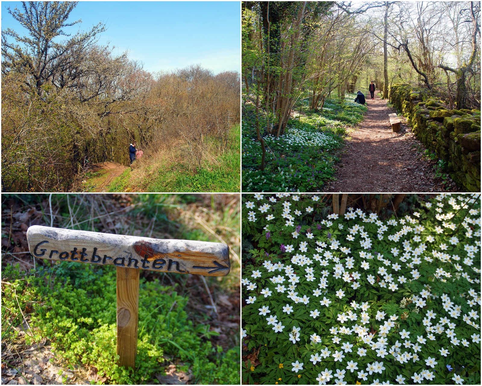
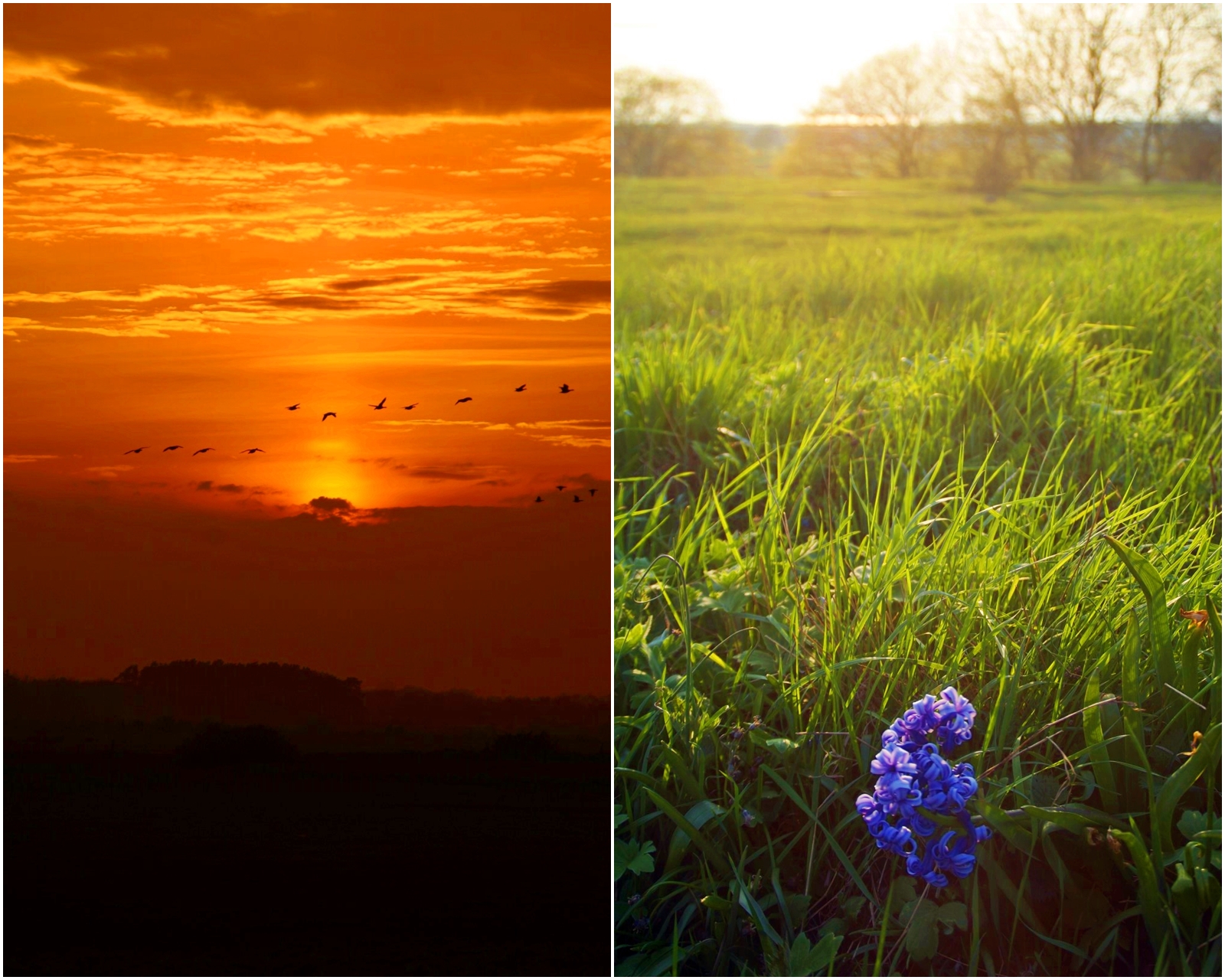
Driving along the southwest coast, I suddenly saw a bunch of cars stopped by the main road in the middle of nowhere. I wondered what was going on, so I decided to follow the people that I saw walking down a steep path into a small woodland, which is seemingly a popular place to take a walk.
I never actually found out why there were so many people there (more people than I’d seen anywhere else on Öland so far!), but I’m guessing it was because the spring flowers had just blossomed. To be honest, there wasn’t that many flowers there, at least not as many as I’m used to in Denmark, but it seems like a big deal on Öland, haha!
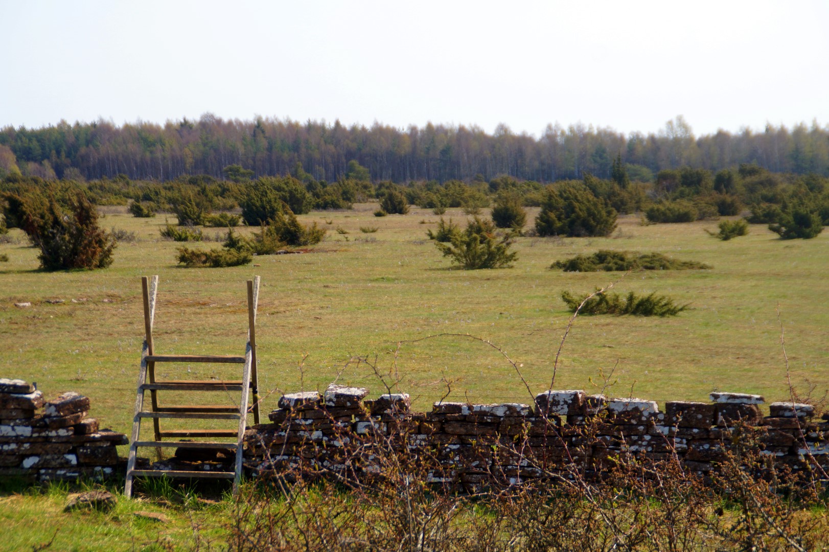
Most of the south part of Öland is a protected UNESCO World Heritage Site. The area is dominated by a vast limestone plateau, where humans have adapted their way of life to the tough constraints of nature for 5000 years. Because of this, the landscape in Southern Öland is unique with evidence of continuous human settlement and agriculture in a relentless landscape for thousands of years.
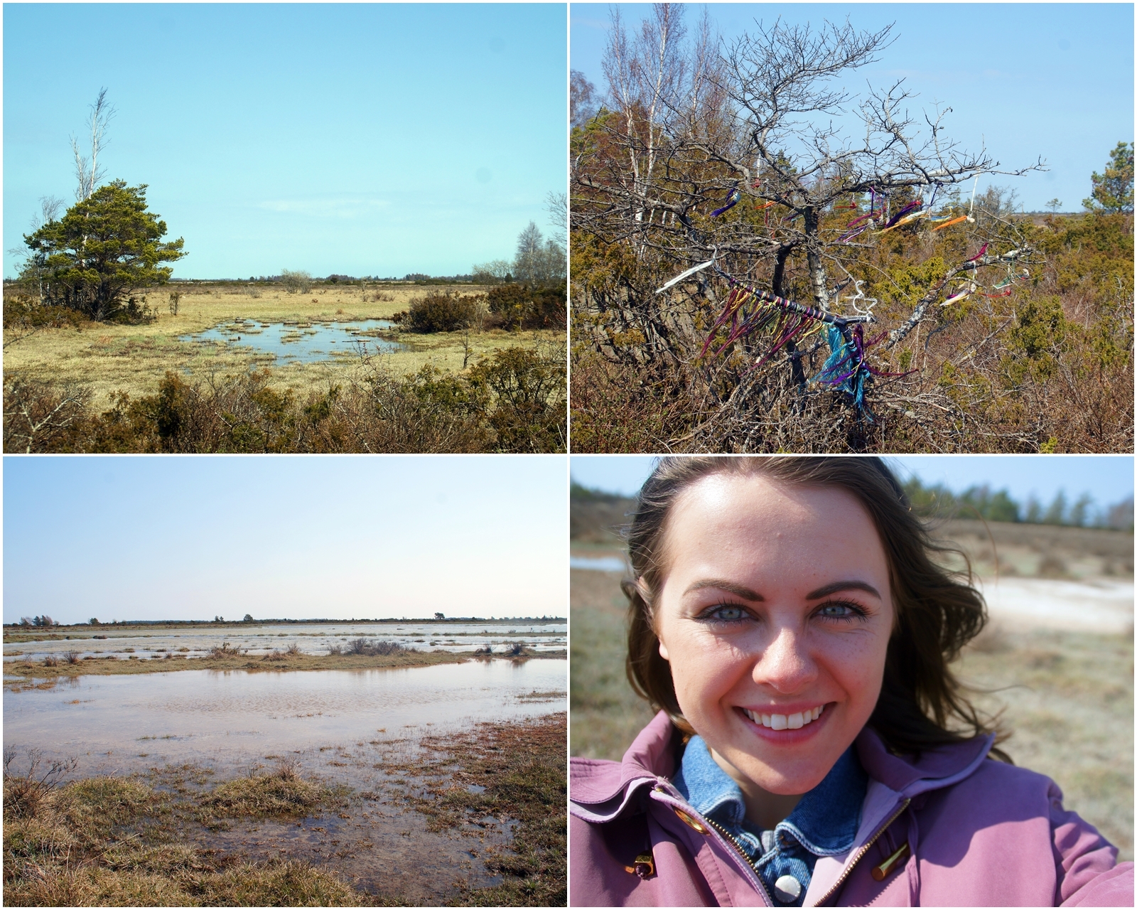
From Karlevi, I drove inland and entered the vast Store Alvaret, a barren limestone terrace which expands almost 260 square kilometers, making it the largest in Europe and comprising one fourth of Öland. The flora in the area is unique with rare species because of the thin soil mantle and high pH levels.
I would’ve loved to have gone for a longer hike in the unique area, but I had too much I wanted to see, so I only went for a short 1 km walk to Möckelmossen, the largest lake in Store Alvaret.
The place really has a special feeling to it – I felt like I was on a safari in Africa only without the enormous animals!
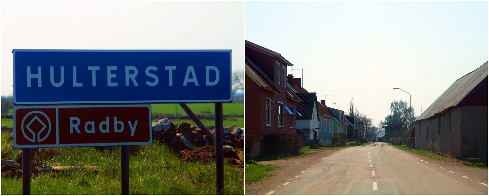
I continued along the road until I got to the southeast coast of the island, where many of Ölands radby-villages are located. All of the radby-villages on Öland were built during the Middle Ages, where the farms were placed close together in a long line along the main road. Unlike the rest of Sweden, the farms on Öland were never moved from the villages, so the radby-villages are extremely well preserved.
According to my guidebook, Hulterstad is the best preserved radby-village, so I decided to go there to have a look. I didn’t stop for long, as the village didn’t really stand out to me, but instead reminded me of most of the villages in Jutland, where I grew up.
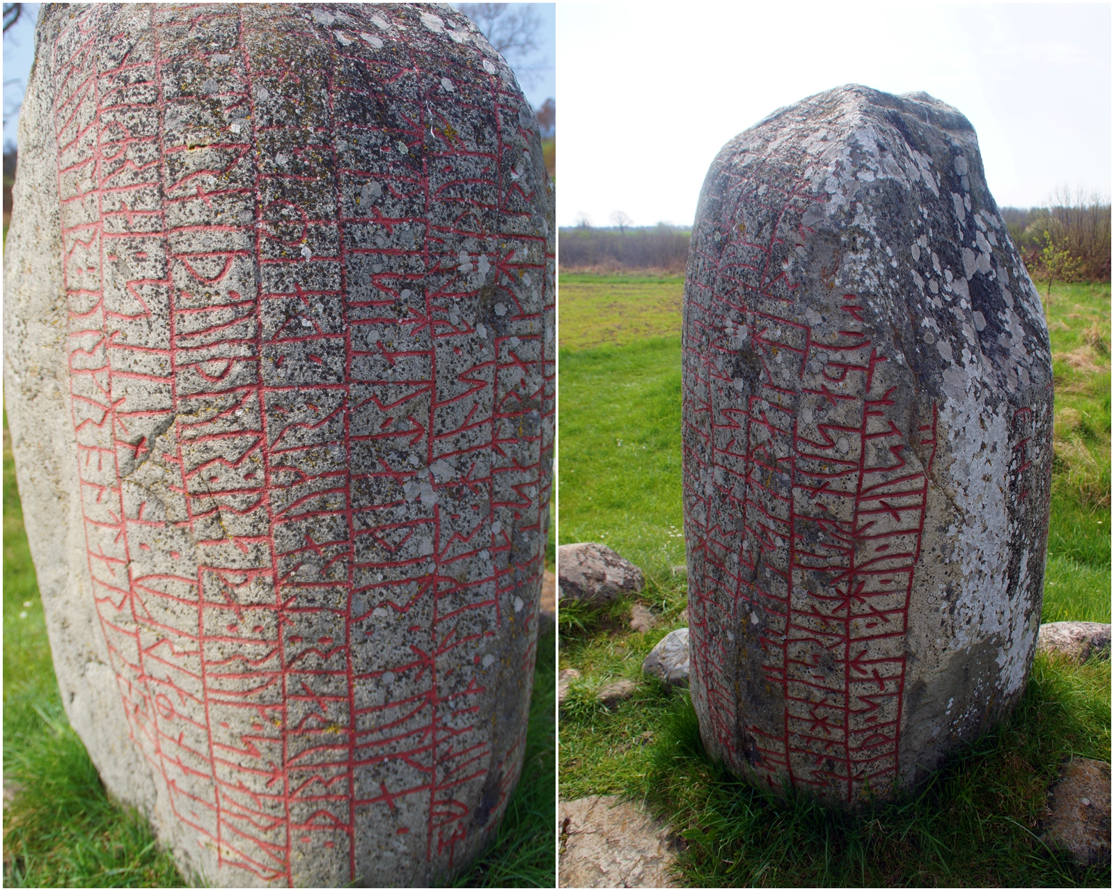
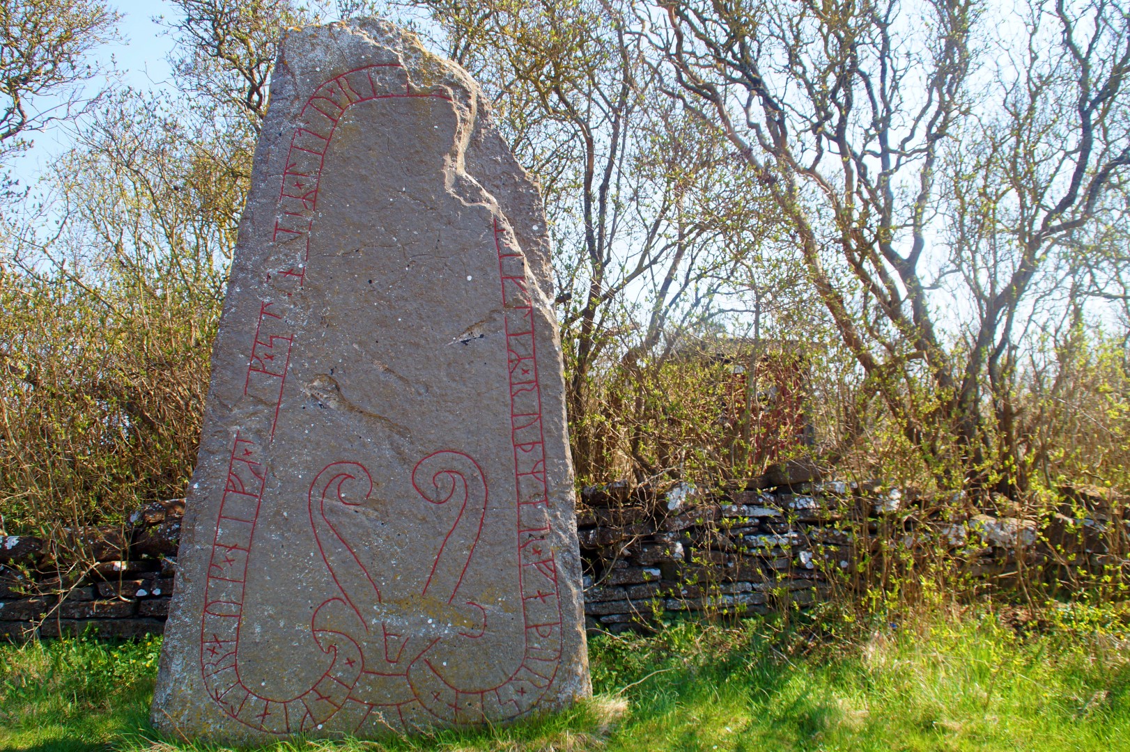
A little further along the road from Hulterstad, I drove past a runic stone that I only spotted by accident out of the corner of my eye. I had to go back to have a look!
This particular runic stone is very beautiful, even more so than Karlevistenen in my opinion, but unfortunately, I haven’t been able to find it’s name or history.
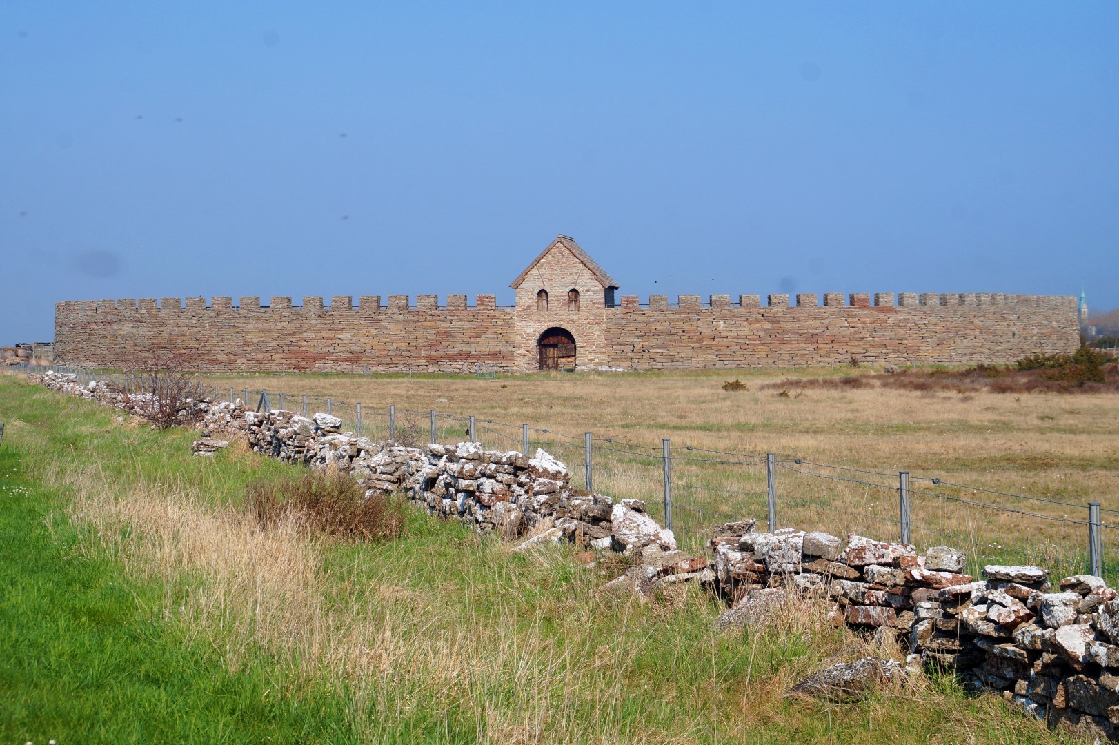
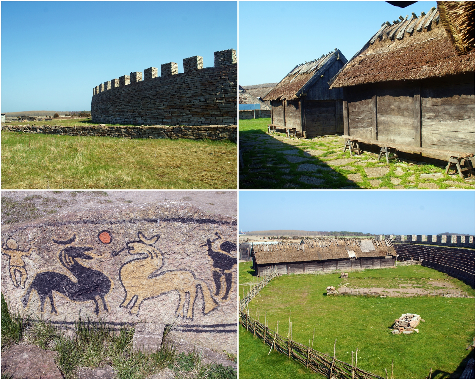
Further south I went and next on the itinerary was the Eketorp Castle, an Iron Age fort which was also used and enlarged during the Middle Ages. The fortification was mysteriously abandoned in the late 600s AD, and it remained so until the early 11th century, where it was reconstructed and enlarged. The stone-built interior was replaced with timber structures and a second outer defensive wall was erected. In the 1970s, the castle was reconstructed once again with houses from both the Iron Age and Middle Ages, and today it serves as an open-air museum.
Eketorp is only one out of 19 known prehistoric fortifications on Öland, but the only one that has been completely excavated with finds of over 24,000 artifacts.
Unfortunately, it was closed when I was there, so there were no activities going on, but I was still able to walk around the fortress and even visit the interior, although the houses were all locked.
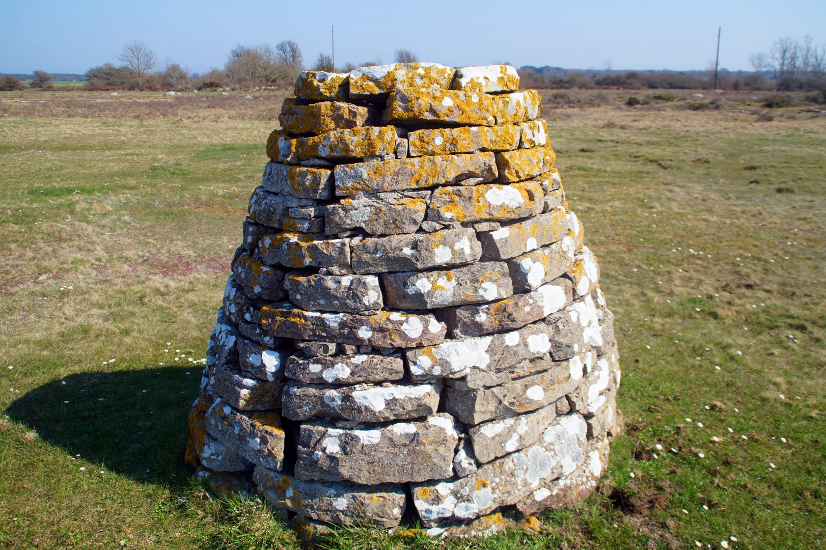
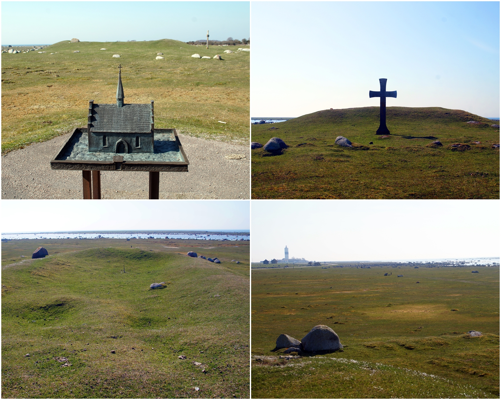
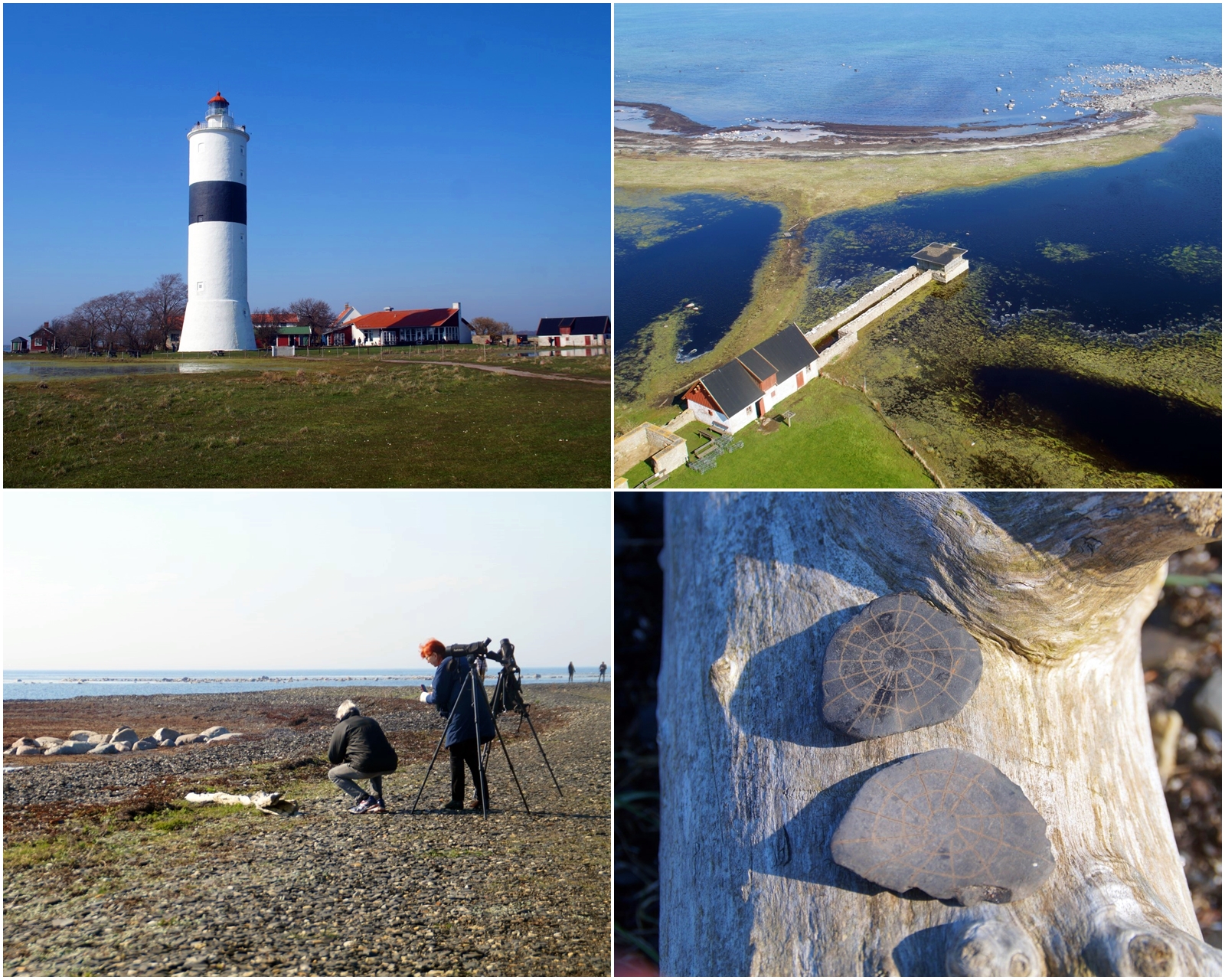
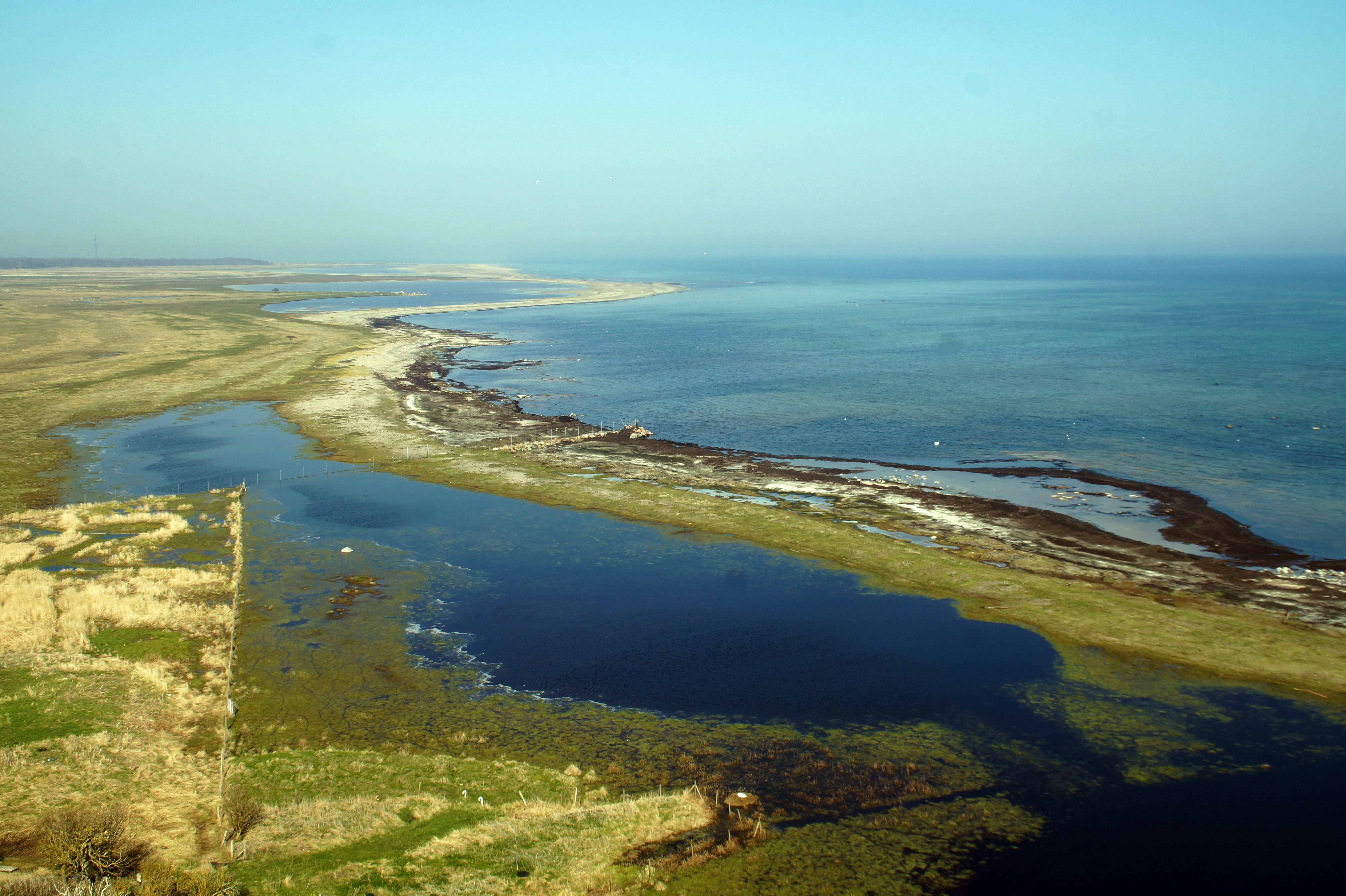
The next part of the drive was a particularly beautiful one. I came to the protected area of Ottenby, which is a nature reserve and one of Sweden’s largest and most famous birdwatching places. I made a stop at the Ottenby Graveyard, one of Ölands largest graveyards with 275 visible graves from the Viking Age, and went for a walk around the mounds and stone graves.
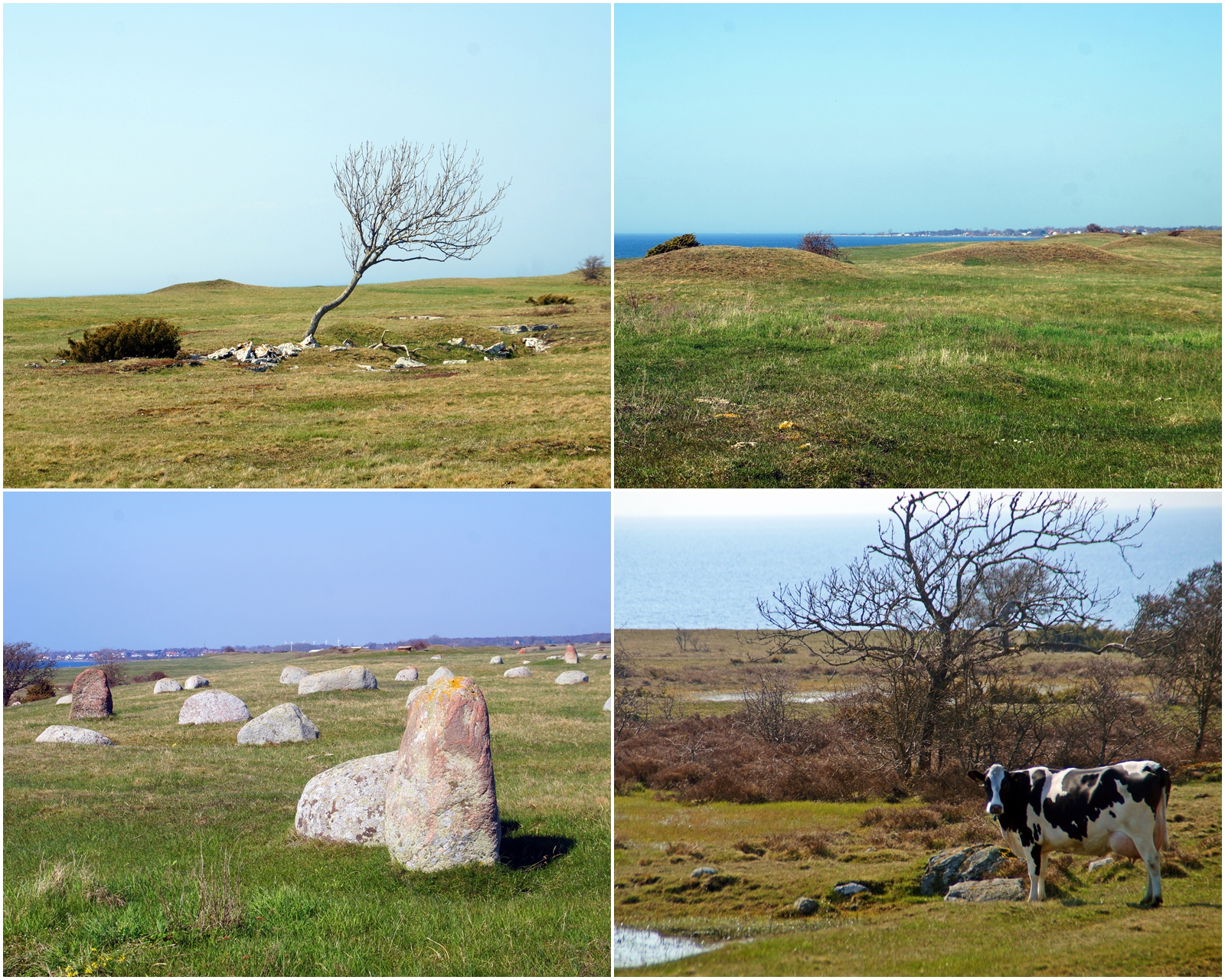
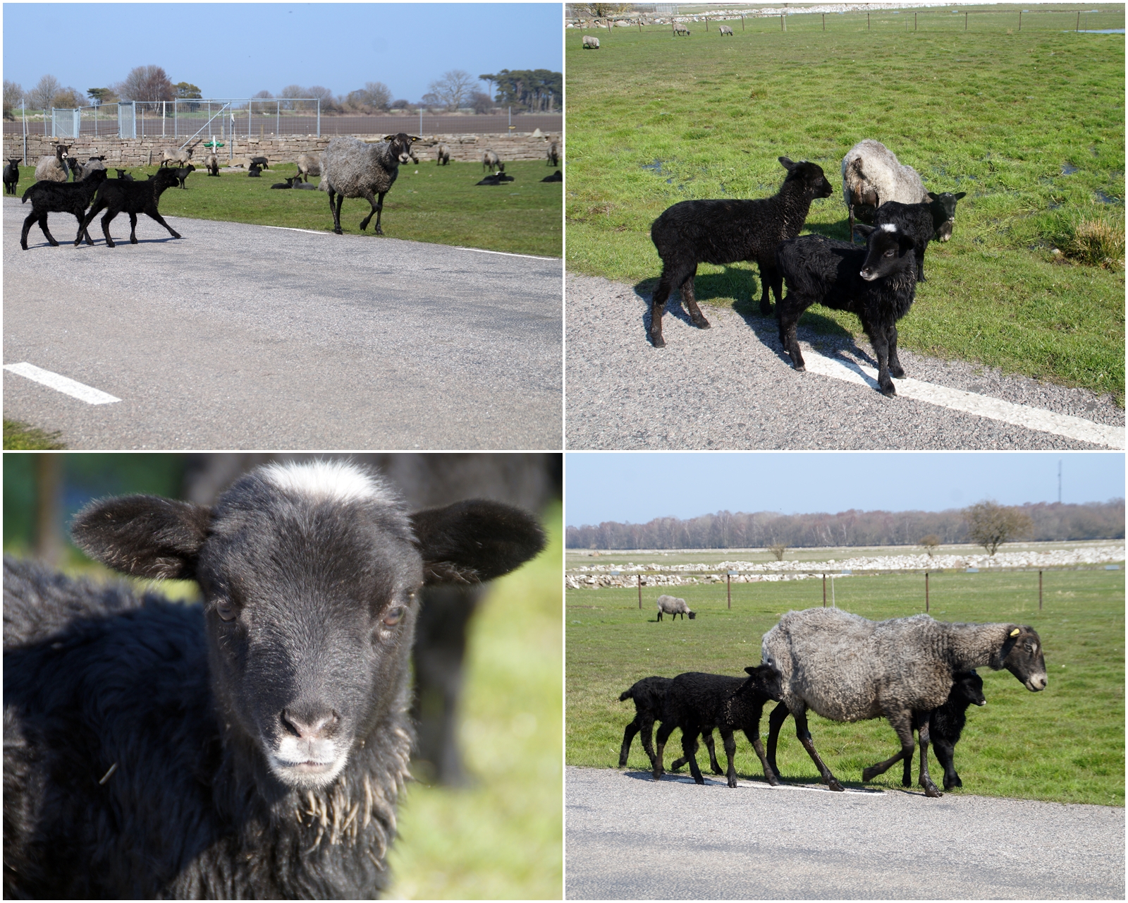
I then headed on into the nature reserve, where I had to drive as slowly as possible as there were sheep and lambs everywhere! It was soooo cute, so I didn’t mind having to stop all the time to let them over the road. Oh, and I also saw two elks before entering the nature reserve – but I couldn’t stop as I was on a highway and had cars behind me…
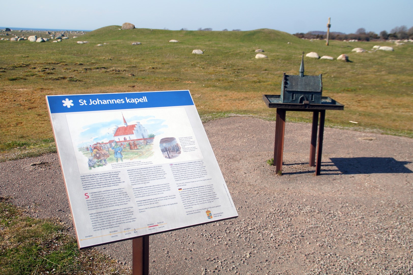
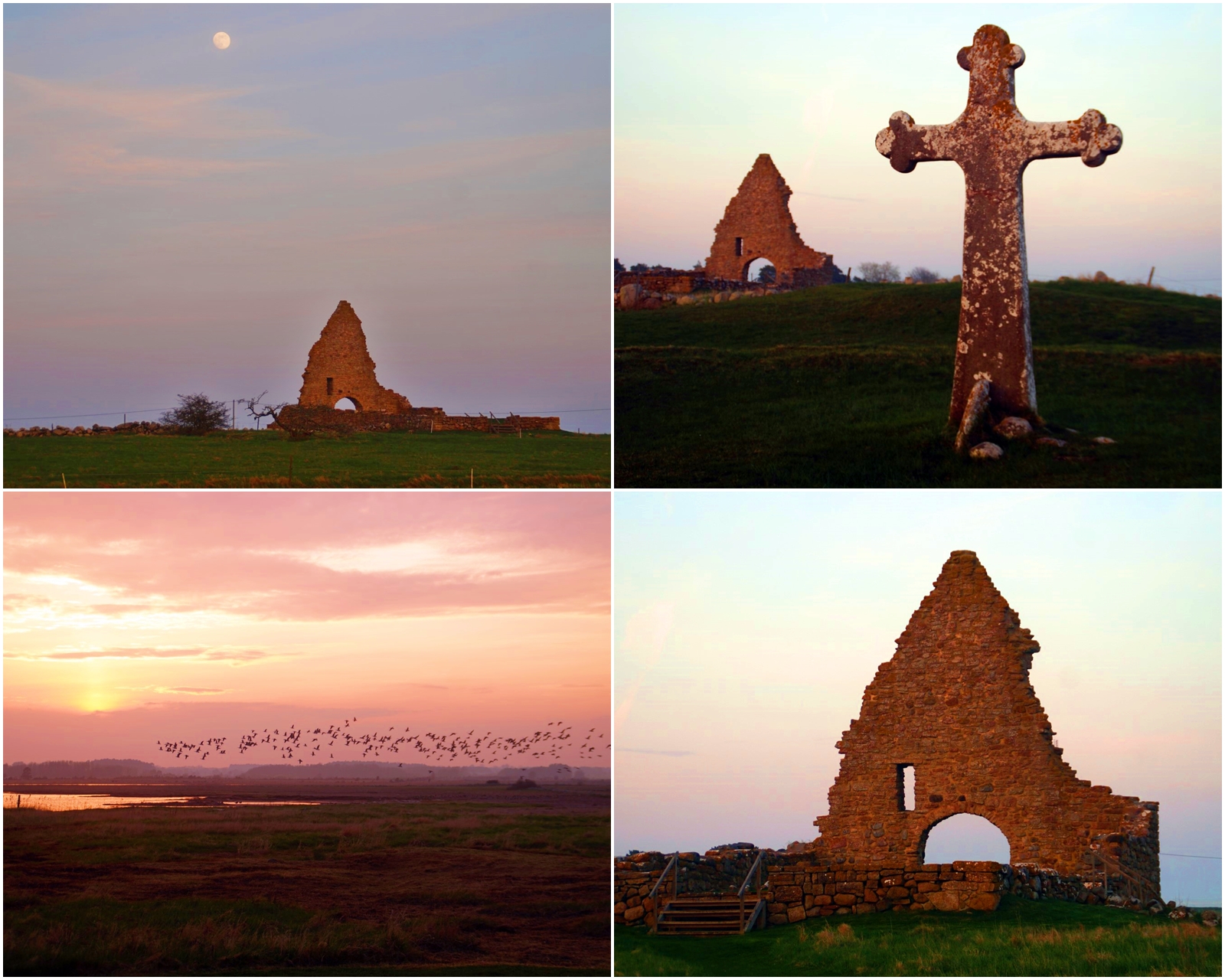
One of the most interesting sights along the road was St. Johannes Kapell, the remains of a medieval chapel located by the medieval fishing village of Kyrkhamn. The chapel was built during the 13th century and remained intact until the 17th century, where it was destroyed. The stones from the chapel were instead used in the construction of the Långe Jan Lighthouse, located on the southernmost point of the island.
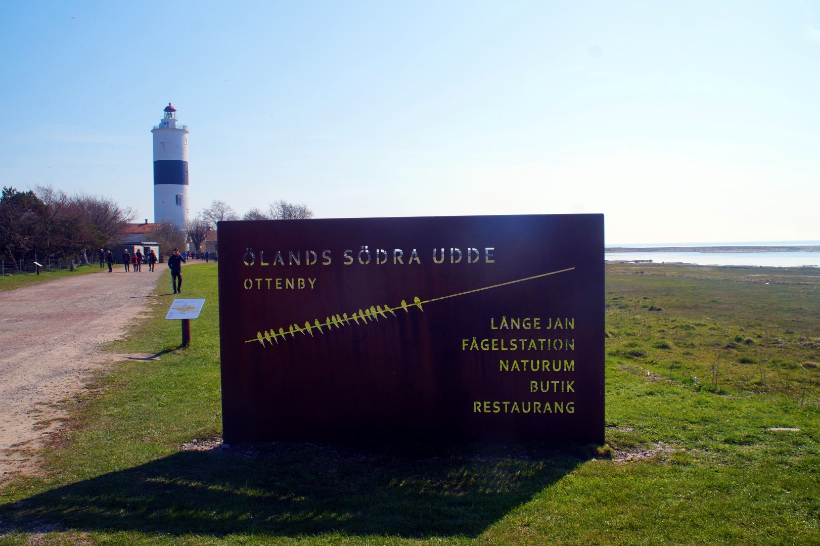
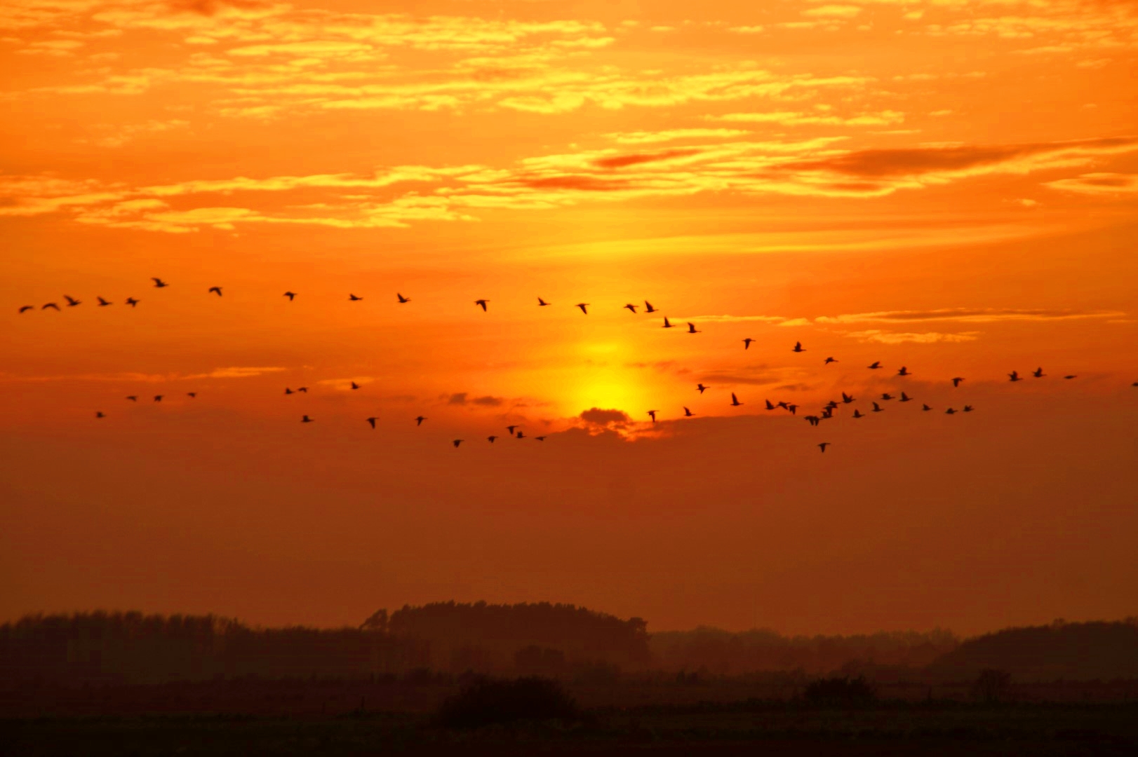
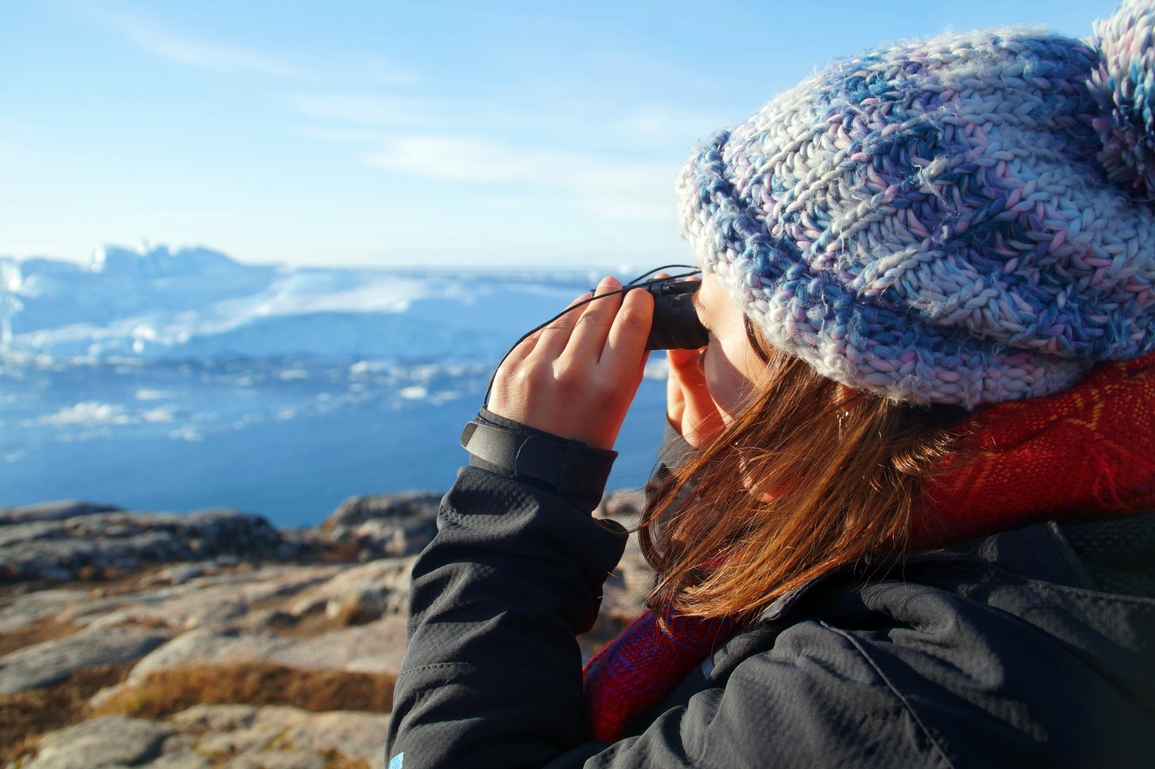
Not long after, I had reached the southernmost point of Öland. I was absolutely shocked to see how packed the place was – it was swarming with tourists! Most of them had binoculars and enormous cameras, so I quickly guessed that almost everyone there were birdwatchers. I love birds too, but I can’t even tell a dove from a pigeon, so birdwatching wasn’t exactly my plan.
Instead, I decided to climb up the Långa Jan lighthouse to see the view of Öland from above (which was amazing!), and then bought myself an icecream and went for a short walk along the stoney beach.
I really do understand why there were so many tourists at this place (especially birdwatchers – there were soooo many birds!), as it’s really spectacular, but the north still has my heart.
It was time to head north again, but before going back to Borgholm, I had a few more places that I wanted to visit.
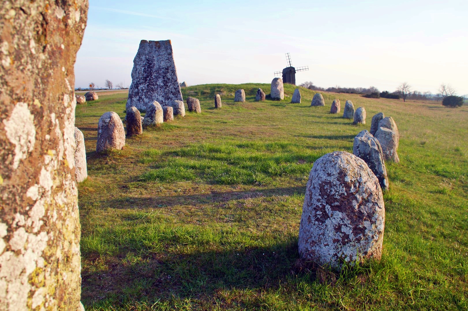
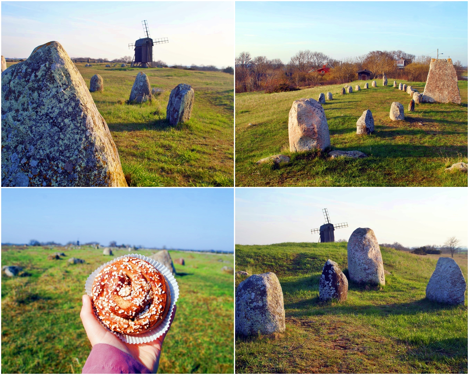
I stopped by the Gettlinge Burial Site located right beside the highway, which is one of the largest graveyards on Öland, and probably the most famous. There are over 250 graves stretching over two kilometers and with a utilization time of over 2000 years from the Bronze Age, Iron Age and Viking Age.
I actually took a longer break here, as I sat in the car and wrote some sections of my written exam while looking out at the graves on the one side and Store Alvaret on the other side (great inspiration for an archaeologist and nature worshipper!).
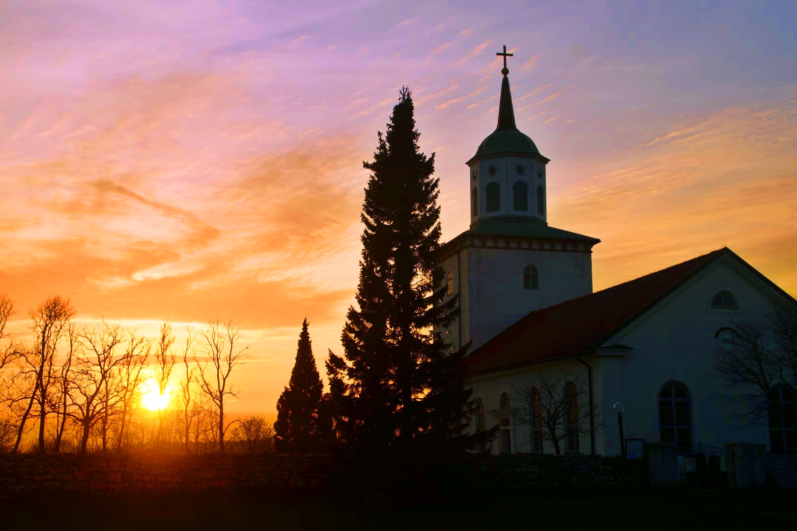
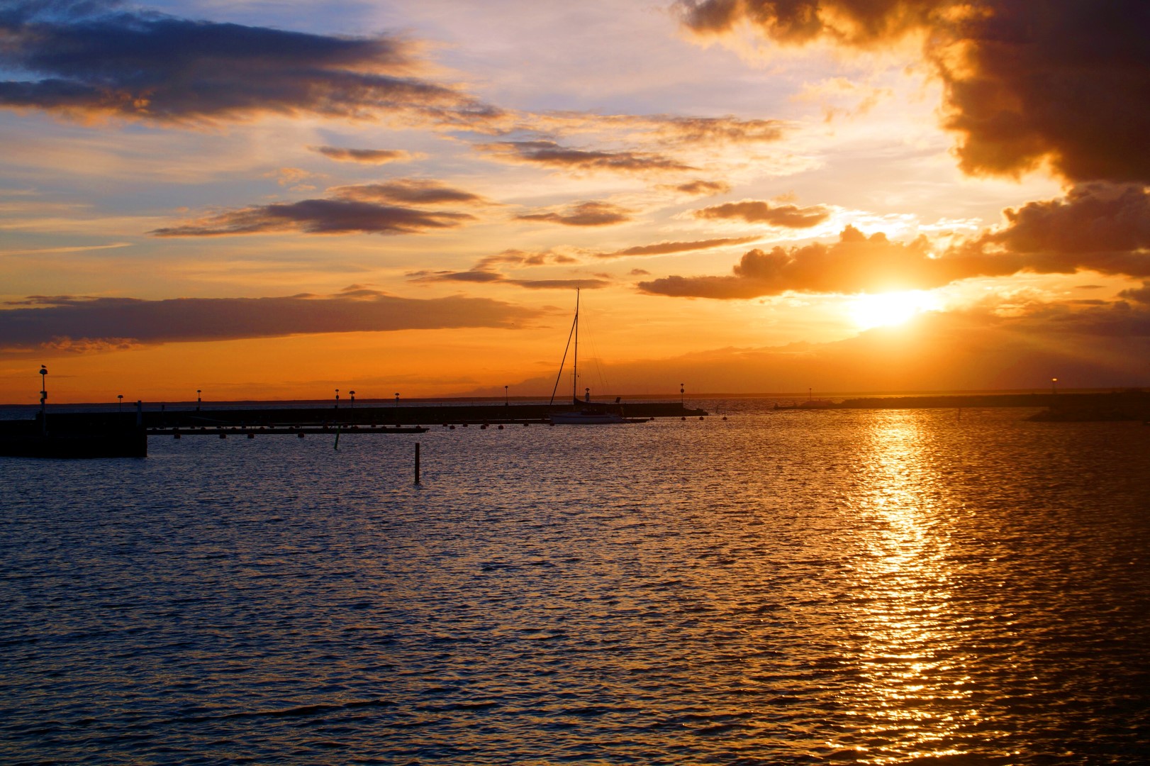
It was 7 PM when I decided it was time to leave, and I headed to my last stop on my roadtrip through Öland. Just before getting to Borgholm, I turned east once again and drove all the way out to the coast to Kapelludden, a wetland area with a rich birdlife and important cultural remains, such as the remains of the Saint Birgitta’s chapel from the 13th century. Today, only the foundation and the eastern wall remains of the chapel after the western wall collapsed during a storm in 1914.
It was the perfect place to end my journey through Öland and also the perfect timing, as I got to see the beautiful sunset from many different locations as I was driving along the inland!
While I definitely enjoyed my roadtrip through the south part of Öland, I was still more impressed by the north, which to me was much more wild and rich in variety. In general though, I really loved Öland (just as much as Gotland, Bornholm and Åland!), and I do hope to come back there someday. Next time, I will do the bike trip that I originally wanted to do, only I’ll allow myself enough time to actually do it. I’m thinking a week or two with biking from south to north and camping in the wilds along the way!
Leave a Comment
Pingback: My July 2018: From Peru to England and the Faroes – Northtrotter on 05/07/2018

3 COMMENTS
Ann
6 years agoHow beautiful this place and your photos! I love it. Sorry that I missed your latest posts, this month is very busy (summer, who would believe), sometimes I am pressed in time! I love your writing, Mel, keep on exploring and inspiring us!☺☺☺☺?
Melissa Cherry
6 years agoHi dear Ann, don’t worry about missing my posts, I understand that we can all be busy. I hope you’re well! 😀 thanks for your lovely words <3