This post contains affiliate links. If you make a purchase through these links, I may earn a commission at no extra cost to you. Thank you!
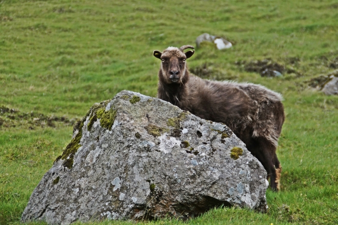
Suðuroy is the southernmost island on Faroe Islands and the fourth-largest. It has a population of 5000 people. Suðuroy is quite different from the rest of the Faroe Islands due to being far away from all the other islands. The atmosphere is more relaxed and the nature is more mild yet raw.
In 1946, Suðuroy got the nickname “Little Denmark”, as it was the only island that voted against independence from Denmark. Everything about Suðuroy seems more Danish than anywhere else in the Faroes; the language, the mild climate and the landscape, although it is nowhere near as flat as Denmark!
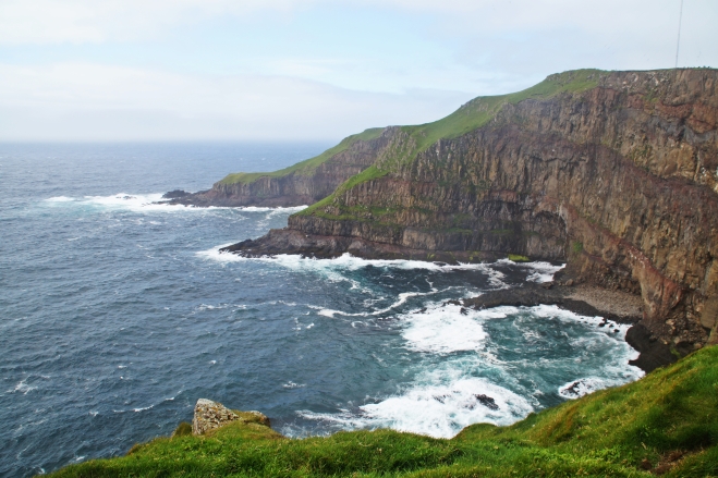
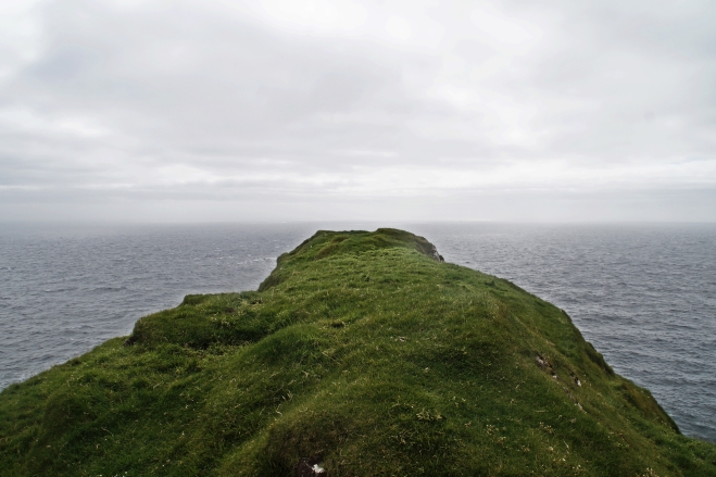
Everywhere you go in Suðuroy, there are beautiful views of the mountains, villages and nearby islands to take in. It’s a spectacular place that deserves more tourism and I hope for the sake of the World that people will start recognizing Suðuroy as a must-see place to visit during a stay on the Faroe Islands!
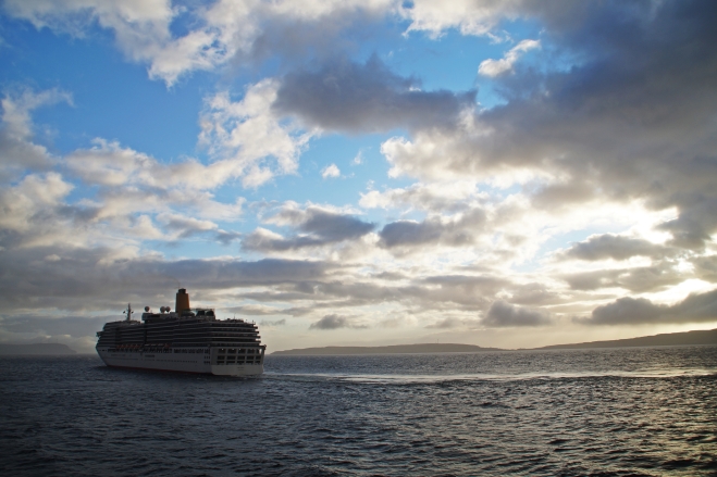
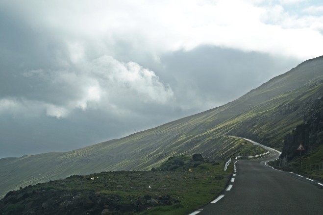
Back in March, I really wanted to visit Suðuroy, but never got the chance to do it, so this time Regin said that he would take me there. We caught the ferry from Tórshavn at 7 AM and spent the entire day driving around the island until the ferry left again at 6.30 PM. On the way to and from the island, the ferry sails by the small islands of Nólsoy, Sandoy, Skúvoy, Stora Dimun and Litla Dimun, so there are plenty of chances to snap some great pictures!
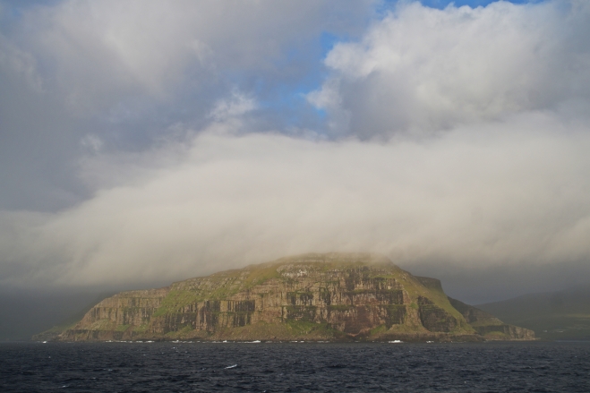
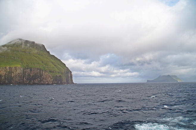
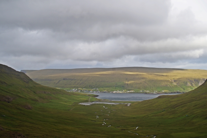
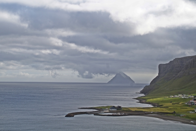
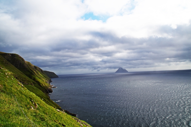
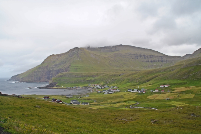
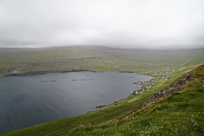
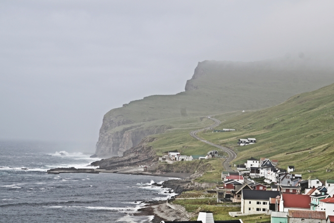
The ferry docked at the village of Tvøroyri at 9 AM and we started the journey by driving around Tvøroyri and the nearby village of Froðba for a bit, before heading North to Sandvík and Hvalba, where we had beautiful views of the small islands of Litla Dimun and Stora Dimun.
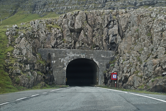
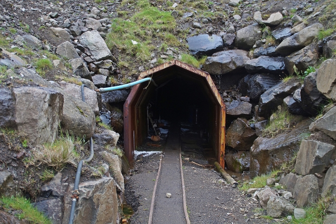
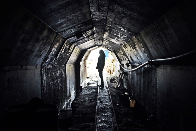
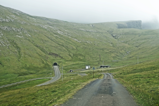
On the way to Hvalba, we passed Hvalbiartunnelen, which is the oldest tunnel on the Faroe Islands, built in 1963. We also passed the coal mine near Hvalba, which was actually closed, but due to our adventurous souls, we chose to walk past the “No entry” sign and enter the mine. We couldn’t get far though, as there was water dripping from the roof, making the path very slippery. We were also worried that it would collaps on us and we weren’t wearing helmets, which is usually obligatory when entering a mine. But it was a great experience nonetheless and definitely worth a visit even if you choose not to go inside.
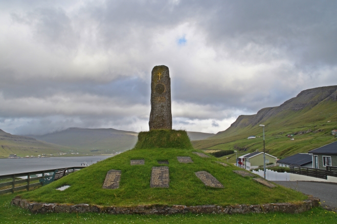
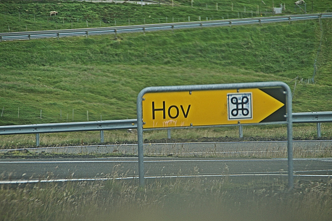
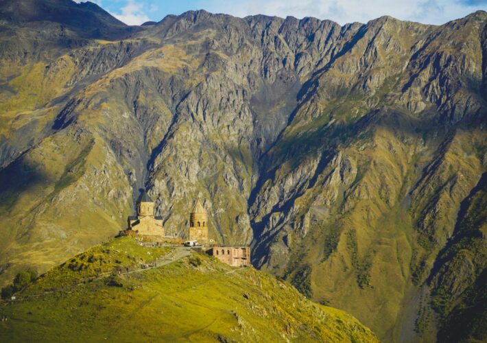
After checking out the mine, we headed South to the villages of Fámjin, Hov, Vágur, Sumba, the abandoned settlement of Vikarbyrgi and the southernmost point on the Faroe Islands, Akraberg.
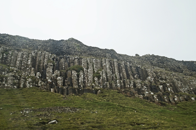
Fámjin and Hov were my two favourite villages on Suðuroy, Fámjin because of its interesting history and attractions and Hov because of its name. I know it’s silly, but I live in a town called Hov in Denmark, so it was amazing for me to visit another town with the same name in a different country! North of Hov it’s possible to see large lava basalt columns that are over 60 million years old and the drive up into the mountains behind Hov is one of the most beautiful on the Faroe Islands.
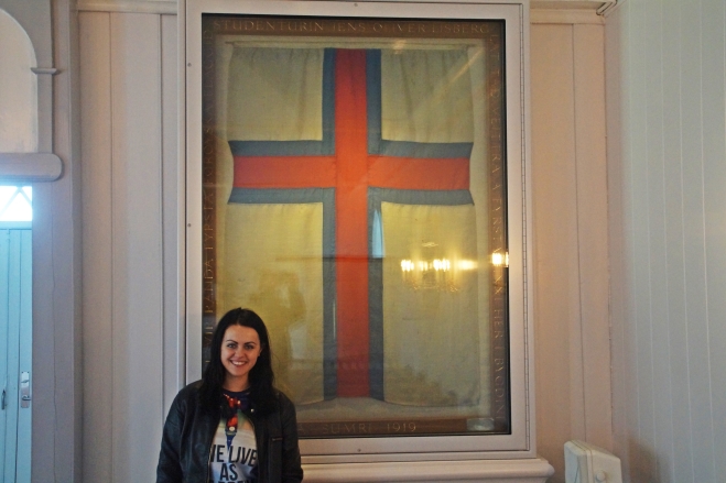
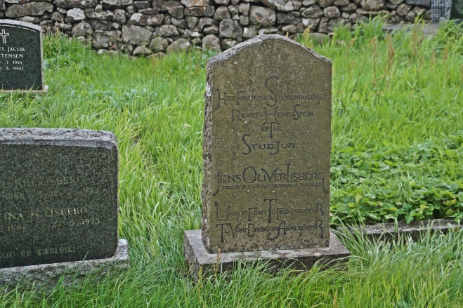
Fámjin is famous for being the birthplace of Jens Oliver Lisberg, who was one of three students that created Merkið, the official flag of Faroe Islands, in Copenhagen in 1919. Inside the old church in Fámjin, which was built in 1875, one can see the original version of the flag, which was hoisted for the first time on June 22nd 1919 in Fámjin. Shortly afterwards, Lisberg died of phneumonia and he was buried just outside the church.
My book about the Faroe Islands told us to call a lovely elderly woman who holds the key to the church and she let us in and told us all about the histroy of Fámjin and Merkið. There is also a small runestone from the 16th century inside the church, which is the youngest of the Faroese runestones.
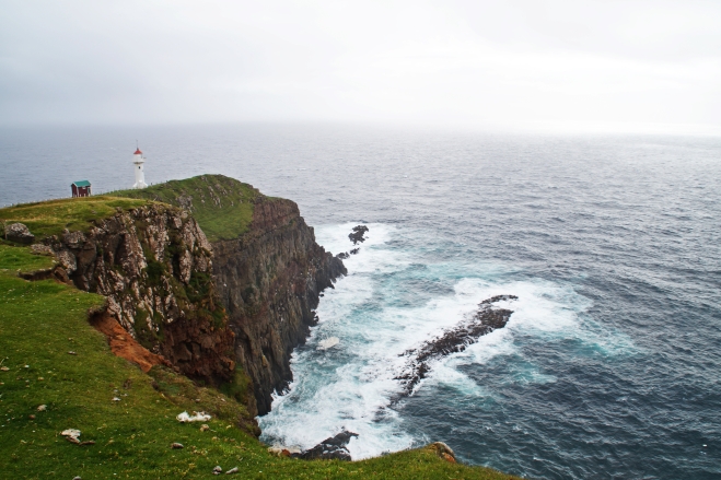
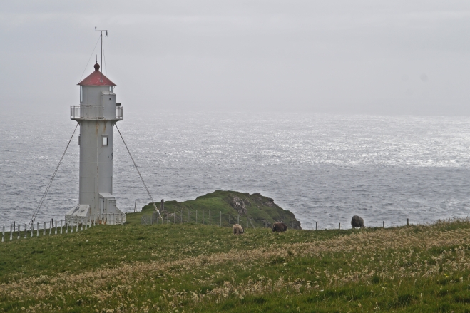
Our next stop was Akraberg, the southernmost point on Faroe Islands – and, in my opinion, the most beautiful place on Suðuroy. A lighthouse was built here in 1909 and although it’s fenced in, tourists are allowed to cross the private field and get right close to the lighthouse, which is definitely worth a visit.
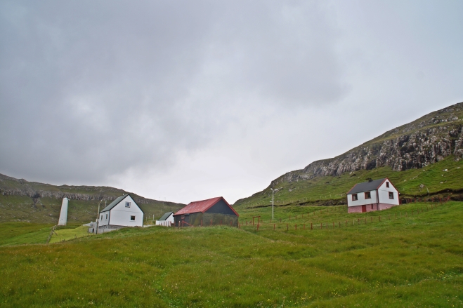
On our way back to the ferry, we made a little detour to Vikarbyrgi, which was supposedly abandoned in the late 1990s, but we saw quite a few people there and lit-up houses, so it wasn’t really what I expected from an abandoned town.
One day is definitely enough to see the entire island, as it isn’t very big, and I saw everything that I wanted to see, which was great. I would love to go back and do some hiking there one day, but until then, I’m settled with the fact that I have driven on almost every road on this island.
Interested in a full-day tour of Suðuroy?
Suðuroy is best explored by car (or hitchhiking!), but if you don’t have a car available or don’t have a driver’s license, you might want to consider a full-day tour of the island, taking you to all the most interesting spots! Click here to read more!

4 COMMENTS
QuentinSymbolful
4 years agoNice travel story on Suðuroy! And Suðuroy sure is a special and beautiful place being distinguished from the other islands of Faroe Island, it even have its own dialect, given the straight-line distance to Tórshavn is only 50KM. And the village Víkarbyrgi, along with Hamrabyrgi, the other village nearby, are now factually abandoned but not fully abandoned. Just like Múli, the village at the northernmost Borðoy, there will some residents come back to stay a few days occasionally. BTW, is that mine you guys visited at the south of Hvalba, near the exit of the tunnel?
Melissa Cherry Villumsen
4 years agoYeah, not many “abandoned” villages in the Faroes are actually abandoned, although a few in the north islands are completely abandoned! Yeah the tunnel was south of Hvalba 🙂
Sigvør Eið Jensen
9 years agoDet billede hvor du har kommeteret “Sandvík and a view of Lítla Dímun” er desværre ikke rigtigt. Det er Nes som hører til Hvalba ✌?️
For at komme til Sandvík skal man køre gennem en anden tunnel.
melissacherry
9 years agoAh damn, jeg kunne ikke huske det helt præcist med det billede, så jeg gættede bare lidt ? men tak Sigvør, jeg retter det lige, når jeg kommer hjem! ?